
by | Jun 20, 2026
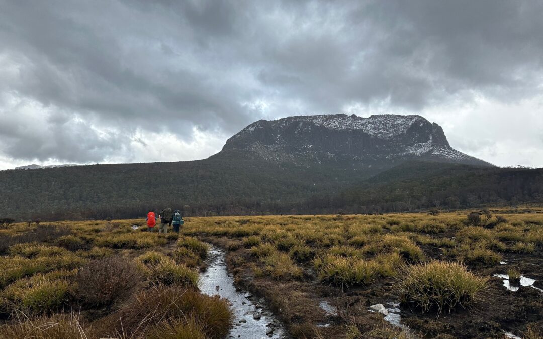
Potentially the two most popular Tasmanian alpine walks, the Overland Track and the Walls of Jerusalem Circuit, sit within 30km of each other so it is quite surprising that linking the two up is somewhat rare. This piqued our interest; surely there was a way and we wanted to do it. Thus, this…
by | Dec 8, 2025
The second New Zealand trip of the club involves a short 4-day multi-day walk through Gillespie Pass, on the east side of Mt Aspiring National Park. These days my interest in road trips has died down and all I’m interested in is venturing into random places, wild camping and disappearing for a few days, which New Zealand is the perfect place for. Preparation for…
by | Nov 8, 2025
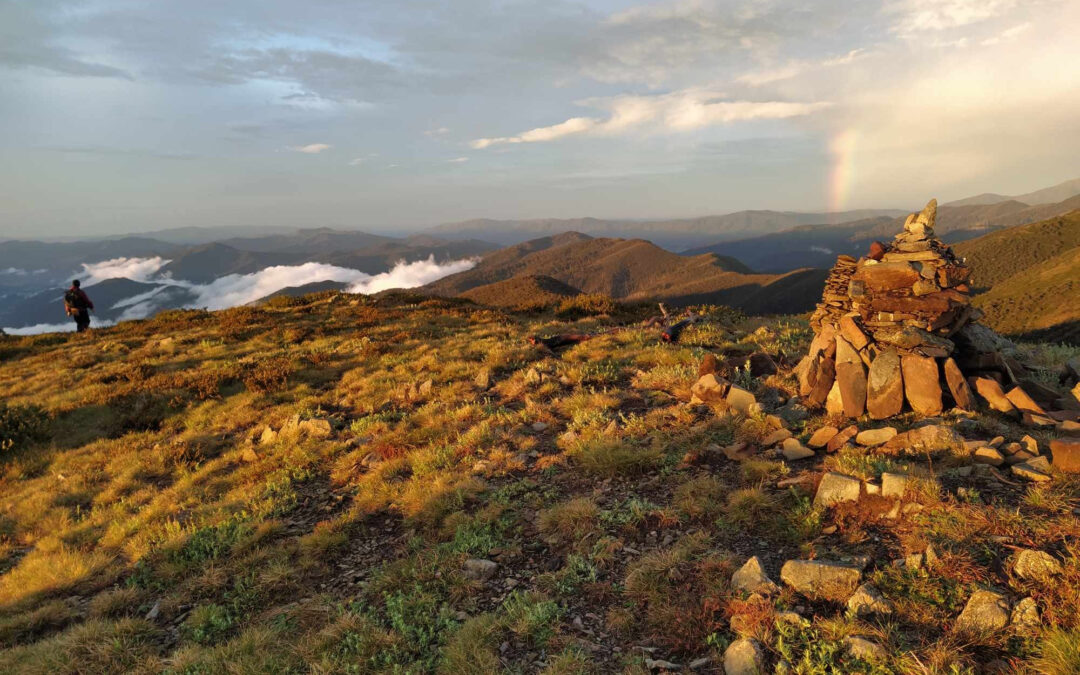
Day 0 – Lake King William Campsite The trip began in Hobart as I picked up a 2WD rental Corolla with 5km on the odometer ready to take it on Tasmania’s finest dirt roads. After an encounter with some methed up Hobartians and the obligatory procurement of a bagnum, we were on our way to Lake King William campsite. Tents were…
by | Sep 18, 2025
The Overland Track is a bit of a “choose your own adventure”. You can stay in huts or camp, catch the ferry at the end or walk the length of the lake, take the many sidetrips atop summits or to pristine alpine lakes. The self-proclaimed “Overland Track Cancelled Gang” left following walkers a bible verse that I think sums up our experience or indeed any Overland Track experience fairly well. “In his…
![The Castle trip [Round 2]](https://www.subw.org.au/wp-content/uploads/2025/05/IMG_7759-1080x675.jpg)
by | May 31, 2025
Round 2 of conquering The Castle finally gained success after a failed round 1, where we were unable to recruit a driver. The date was changed to the weekend right before the National Park’s early closure of the summit track. Being the final weekend in 6 months to access this track summoned large groups of bushwalkers, and even a few commercial tour groups. It’s unfortunate…

by | May 16, 2025
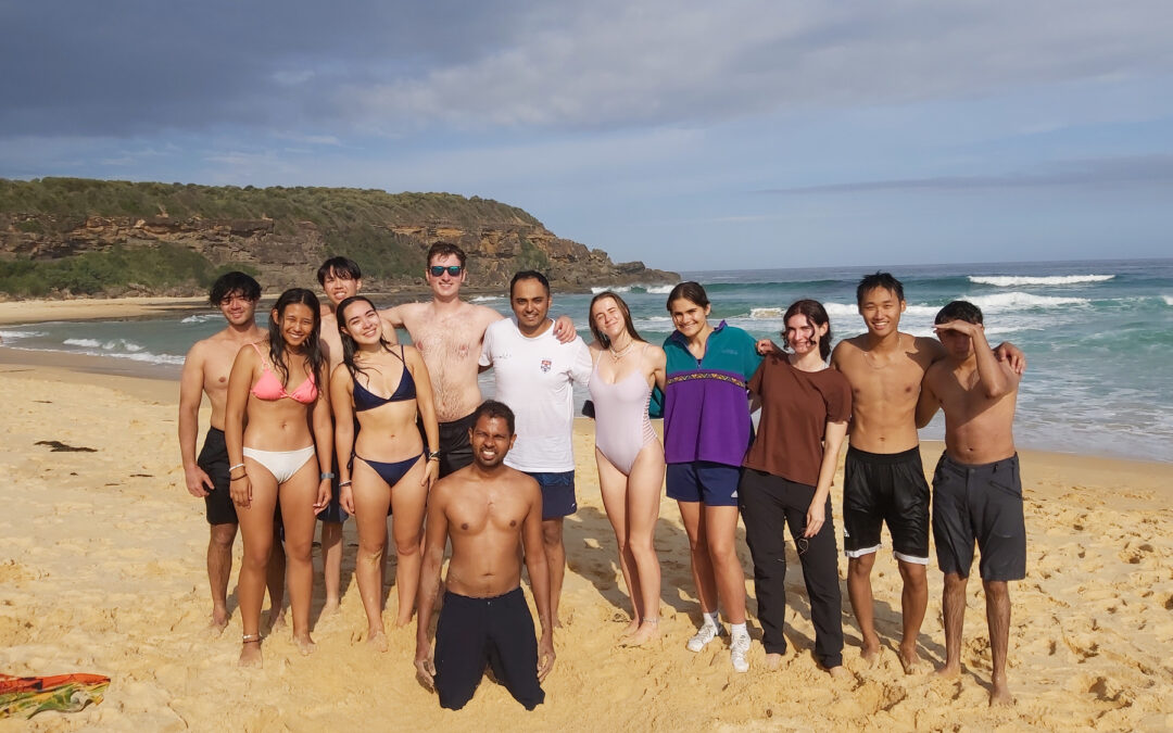
On the 17th March 2025, an email titled “Sydney Uni Bushwalkers Collab??” was sent to our rivals down south, Melbourne University Mountaineering Club (MUMC). The back and forth that ensued manifested in an awesome 3 day walk through Wilsons Promontory down in Victoria that saw 5 from SUBW and 5 from MUMC head through “the prom” down to the southernmost point of mainland Australia. We each…
by | Apr 23, 2025
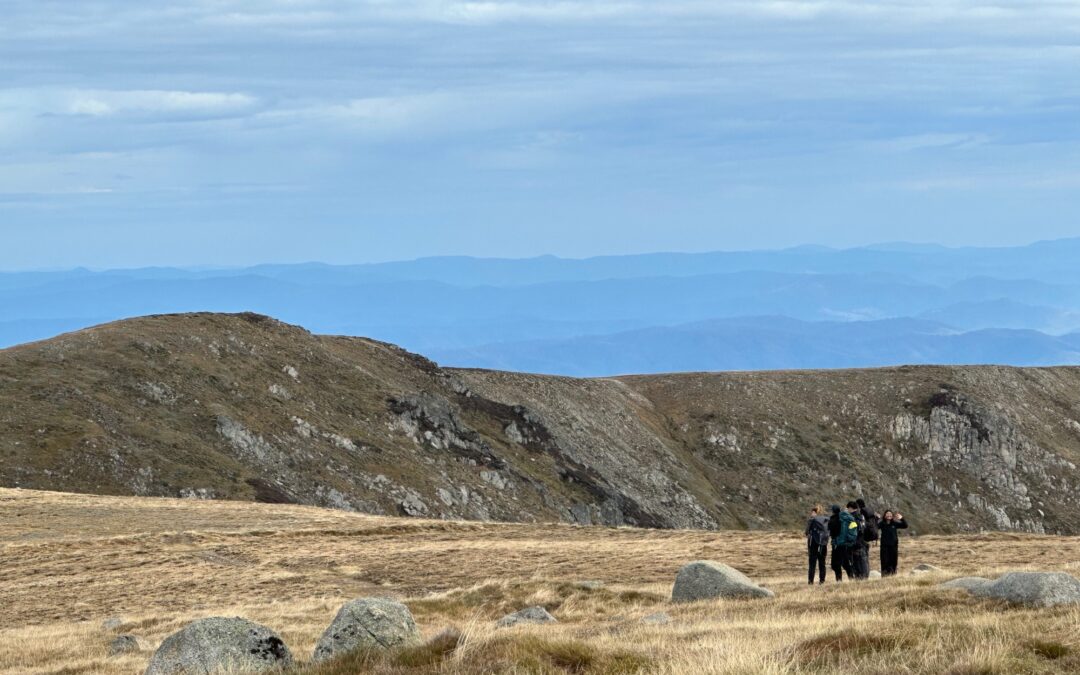
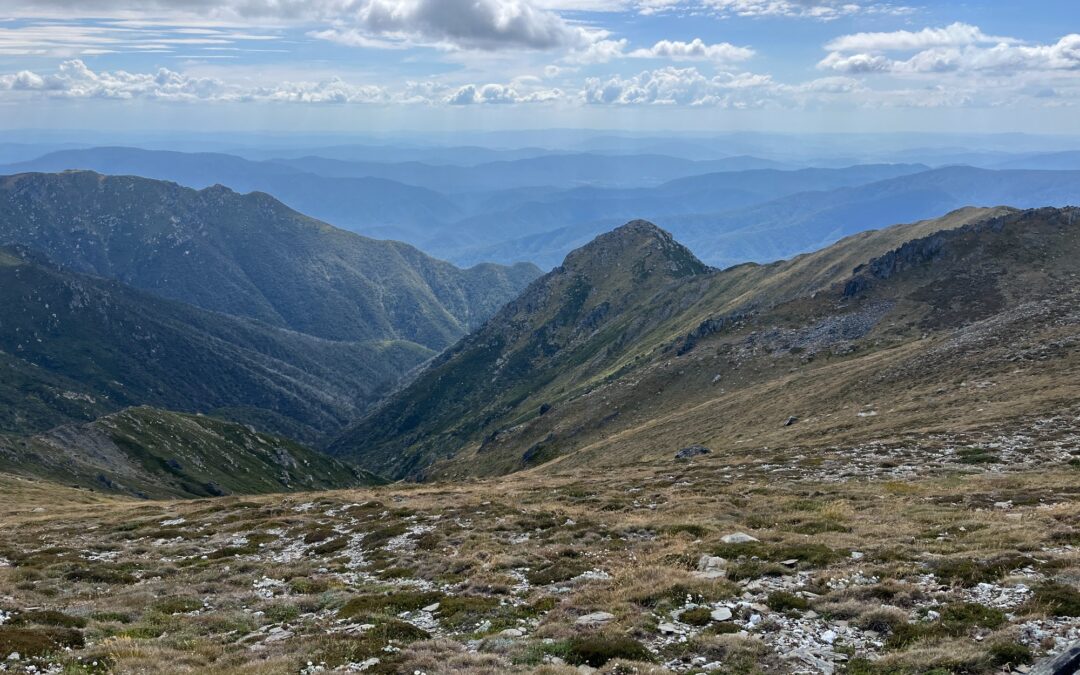
For the first time in nearly 12 months, SUBW returned to Kosciuszko NP to spend our midsem break away from the assignments we should be doing and the lectures we should be catching up on. The initial plan was that we would camp at Mt Twynam on night 1, take a side trip to Mt Sentinel on day 2 and camp at Mt Tate that night, before returning to the cars and camp at Island Bend for night 3. Just about…
by | Apr 18, 2025
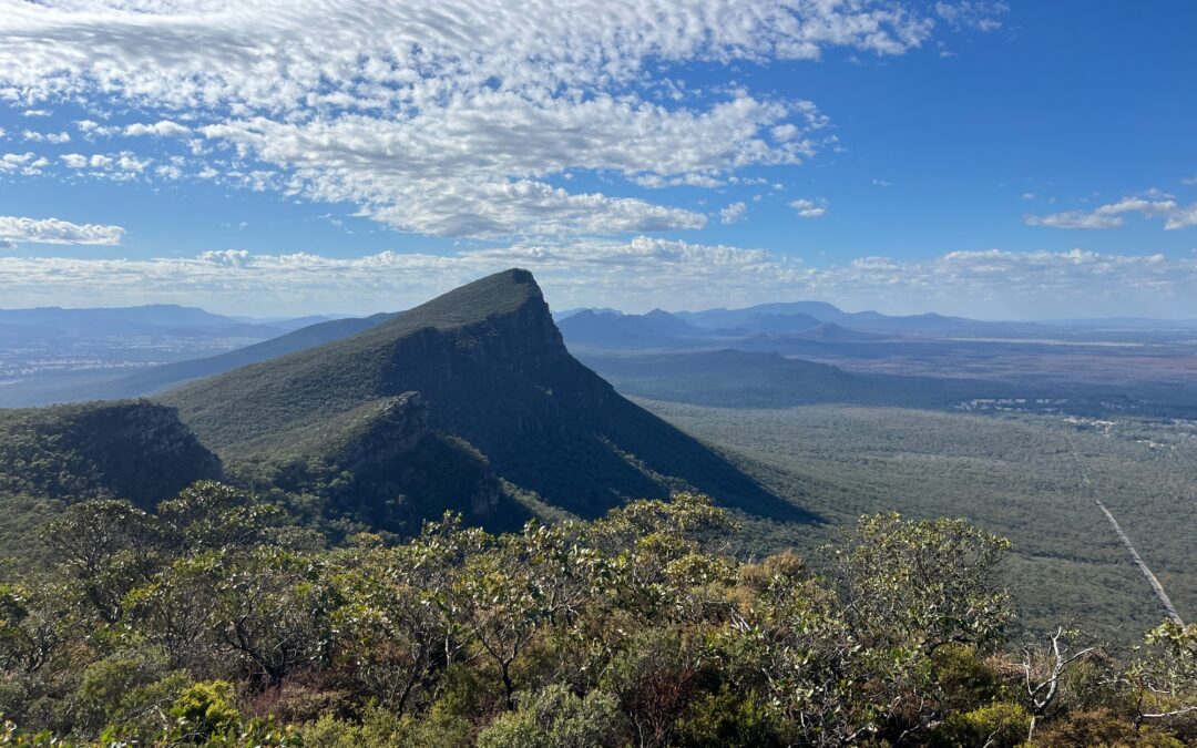
A 4-day, 3-night road trip around Gariwerd (Grampians) National Park in western Victoria, 3 hours west of Melbourne. Gariwerd is the Aboriginal name of the national park, comprising gar meaning nose, and werd meaning shoulder. The group arrived in Melbourne the day before, spending a day exploring the city or doing some remote work, followed by a pre-trip dinner and dessert run. At roughly…
by | Feb 21, 2025
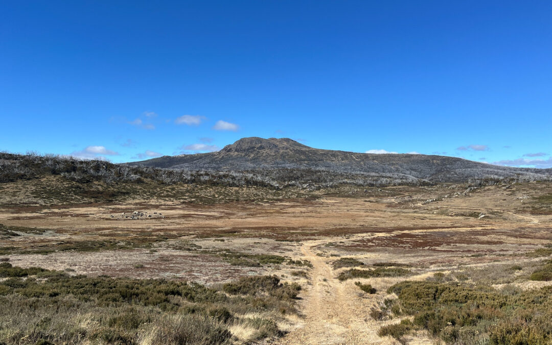
My friend from Schofields really misses Kosciuszko and wants a trip there. While he couldn’t make it at the end I’ve found the perfect long weekend with time to get there and back comfortably. It’s when a clinical placement ends and another one starts- back to back with 3 days to stretch. Inside my…
by | Nov 6, 2024
With just one boring exam at the end of semester it’s the perfect time for interstate trips. A bit of research, finding best prices for flights and rentals, and off we went. Car rental prices have been pricey, pushing for the need for more participants to lower costs (the cost was ~$600 at the end, including flights and all expenses). A trip…
by | May 1, 2024
Jimmy had a few days off from uni and thought it would be a cool idea to do a weekday camping trip. In early May the bushwalking season for Jagungul is edging towards its end, about to step into snowy winter, but forecasts weeks ahead look alright and we’ve decided to give it a go. Also on…
by | Feb 17, 2024
This collaboration with the Sydney University Astronomy Society (SUAS) was the first camping trip that I had led. Jackson, Ashwin, and Ben were the trip leaders from the SUAS side (even though Ben is an SUBW member). Shout out to Chloe who helped massively with the organisation of this trip, and greatly contributed to its eventual success. Originally, this…
by | Nov 20, 2023
We found out that going to Yamba would be too rainy, so instead we went to Mt Hotham to do some of the Australian Alps. Thanks to Nam for coming up with this plan and also thanks to Facebook guy who gave us a suggested route. Day 1 drive to Mt Hotham (8 hours) camp and diamantia hut Day 2 walk to federation hut, walk up Mt Feathertop. Go to…
by | Jan 27, 2023
Video trip report available here: https://www.youtube.com/watch?v=UJJXvzUoLdM Our annual pilgrimage to Tasmania’s Southwest National park started as usual with a Friday night out in Hobart, followed by a 7.30am pick up by Tasmanian Wilderness Experiences. TWE specialises in transporting bushwalkers to and from trackheads and the business is for sale if anyone is looking for a tree-change! Day 1. With breakfast…
by | Sep 24, 2022
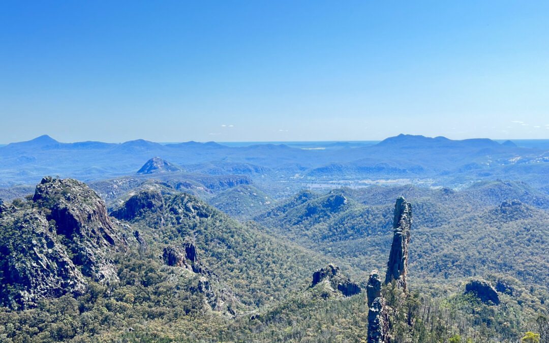
Here’s the long-promised trip report. As photos don’t work on WordPress I’ve put a version with all the photos on my own website instead: https://www.err404notfound.xyz/hiking/warrumbungle-national-park It has been some sort of tradition to do camping trips during mid-semester breaks of uni, as this is when others usually have more free time. This national…
by | Mar 5, 2022
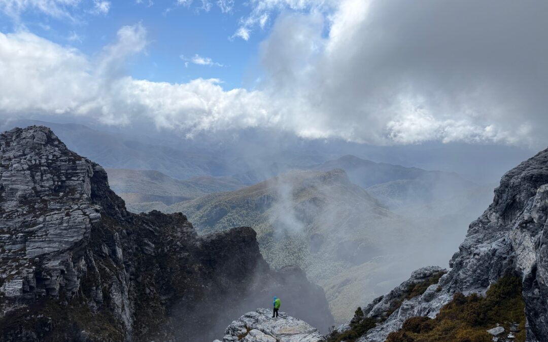
Expeditions to South West Tasmania are a long tradition in SUBW. It’s remote, rugged, beautiful and one of the few places in Australia that offers real mountaineering. Exposed to the ocean storms of the roaring forties the weather can turn dangerous at a moment’s notice even in summer. The most…
by | May 7, 2021
Caption https://www.gaiagps.com/map/?loc=10.3/151.4152/-31.9109&pubLink=Uenp6AWQ9YMf2tQTGXQBsSkD&trackId=e61e3a7c-e4a1-4b13-a335-b5c28783781e
by | Apr 1, 2021
55km, 1500m ascent All pretty straight forward on paths or open plains with the exception of a small stretch following Goodradigbee River at the start. https://www.gaiagps.com/map/?loc=11.6/148.6130/-35.6605&pubLink=HXWoi2Pj0ZMrTfpS4tDKyP0H&trackId=a372ac56ffa4908aa80b0a68d34e564fe0f54dc4 Caption
by | Jan 29, 2021
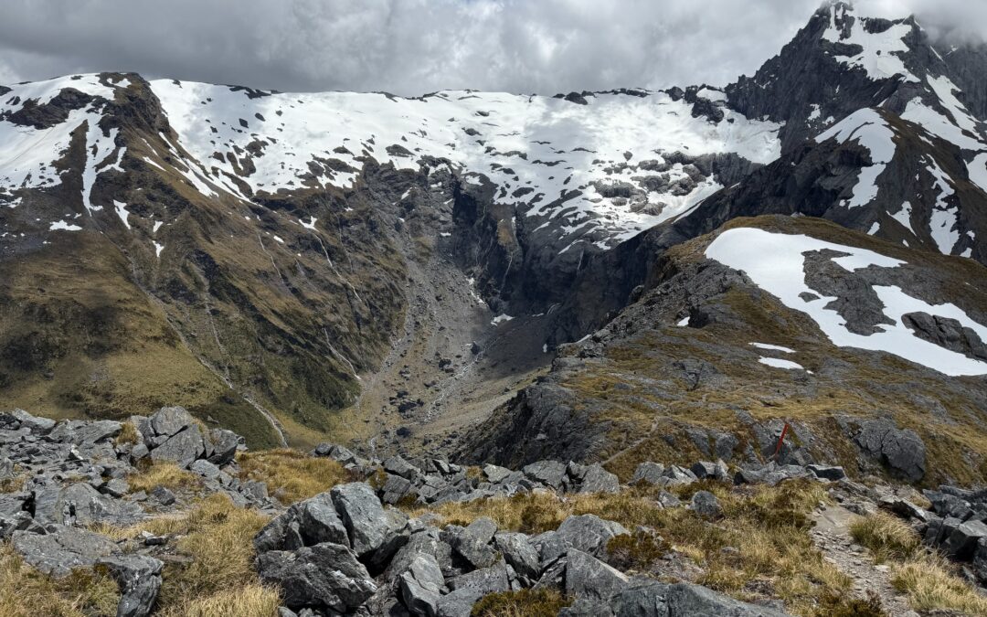
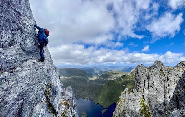
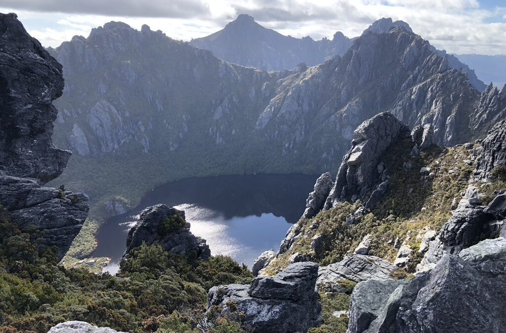
Mud, Bad and Dangerous to Know [1] – The Western Arthurs Traverse The Western Arthurs are an ice-carved range of mountains in southwest Tasmania. Its jagged peaks and spectacular glacial lakes feature in some of the most famous photographs of the Tasmanian wilderness. First traversed…
by | Jan 16, 2021
Caption 30km, 1800m ascent https://www.gaiagps.com/map/?loc=12.7/150.1311/-35.2938&pubLink=kbrMKb2az4h2vKrcGB1opfME&trackId=fe619e42-a7f0-4f7c-864f-844089622f2d Yadboro River whilst slow was relatively easy work. Freeman Creek became too steep and had to divert after encountering a 2nd waterfall Whilst incredibly narrow after re-joining Freeman creek was still accessible but you needed to be quite agile to reach the path.