Date: 27/1-4/2/2023
Trip leader: Paul Griffiths
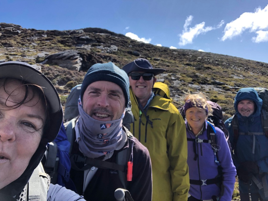
Party: Frances, Geoff, Jennifer, Marty
Photos: by Everyone
Video trip report available here: https://www.youtube.com/watch?v=UJJXvzUoLdM
Our annual pilgrimage to Tasmania’s Southwest National park started as usual with a Friday night out in Hobart, followed by a 7.30am pick up by Tasmanian Wilderness Experiences.
TWE specialises in transporting bushwalkers to and from trackheads and the business is for sale if anyone is looking for a tree-change!
Day 1.
With breakfast in Huonville it was 9.30 before we arrived at the trackhead in Ida Bay. We collected our gas canisters (you can’t fly with gas, so TWE supply it), and weighed the packs – average pack weight was 20Kg including 2 litres of water and 7 days food, so an average base weight of 13kg. You can’t go too light in this area as you need to be prepared for winter weather even in summer. On the way our driver gave us the cheerful information that only 65% of parties who attempt Precipitous Bluff by the inland route succeed in getting there. “Because they are walking into the prevailing winds,” he said – a prescient remark.
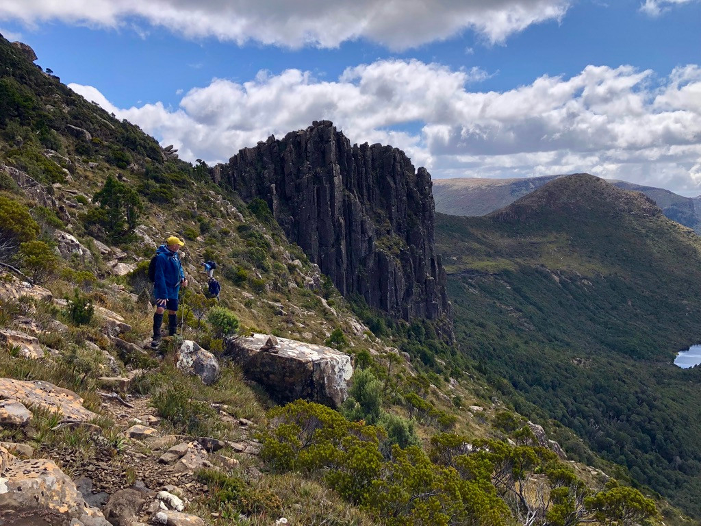
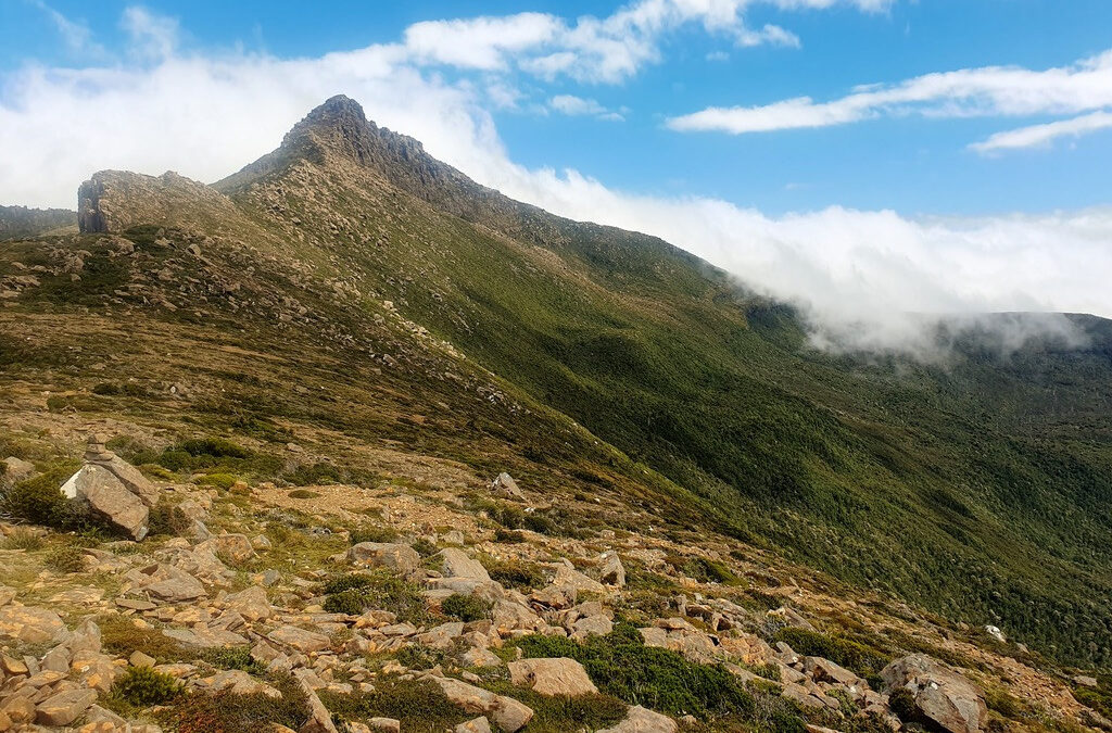
We were off at 10.20 and the first few hours were on a steep track through magnificent forest, ascending 650 vertical metres to reach the open moorland. The forest was full of Lyrebirds and we heard some spectacular concerts. The change when we reached the uplands was instant and dramatic – from enormous trees and barely a sight of the sky to a desolate landscape of tussock grass and the grey skeletons of small trees lost in the bushfires a few years back. The track turned from leaves, moss and fallen timber to a narrow erosion ditch of grey mud braided into chaos where walkers have sought to avoid the deepest sloughs. The best advice to is recognise the inevitable and walk in the mud – better for the landscape and much less exhausting than ‘bridging’ or jumping in and out of the ditch.
The tussock grassland continues past Bullfrog Tarns, where the frogs were calling loudly, and as we started to climb towards Hill One and we hit the first band of scoparia (Dracophyllum persistentifolium) a prickly shrub found only in Tasmania and the dominant scrub in the south west. Every bushwalker knows that scrub-bashing is character building but scoparia is the very sandpaper of the soul. Its stems are strong and elastic, which is great when using them as hand and footholds on climbs, but when they grow across the track you need to shoulder-charge to get through, especially if the track is very steep. That allows the smaller branches a good chance to tear backpacks and inflict stick-bites on any exposed flesh. And the leaves that densely cover every stem are sharp and prickly – the perfect character-building plant!
Once through this scoparia belt and getting close to the 1000m contour we emerged onto real moorland – cushions of brilliant emerald-green moss, expanses of flat rocks and tiny alpine flowers everywhere. It’s very beautiful, and easy walking, but before we had the chance to really appreciate it the wind hit us. The southern ranges route to PB is a series of high ridges running roughly SW. The prevailing NW winds are confronted with the ‘wall’ made by these ridges, which rise steeply from the surrounding valleys often as much as 400m. As the moving air is forced up over the ridge it can reach fantastic speeds. The underlying windspeed on this afternoon was probably around 30kmh but on the ridge it was a matter of leaning into it to move and feeling it suck the heat out of you even through a good shell. The next day we met a professional guide who had abandoned his (personal) trip when his tent poles broke in the wind and was heading back to Ida Bay.
After about eight hours walking we decided to stop at the next available campsite. There are very few places you can pitch a tent and find water along Moonlight Ridge and the next point was the saddle between Hill One and Hill Two. We got there around 6.00 feeling cold and battered (the sound of the wind on my hood was giving me a headache!). The obvious place to camp is right in the saddle, where spare timber from previous track work has been laid out to lift tents out of the mud. But rather than pitch tents in the teeth of the wind we dropped a few metres down on the lee side and behind some patches of scoparia. It wasn’t flat, but by putting my boots in the biggest hole under the tent I managed to get my sleeping mat into a manageable Z shape – head up, bum down, knees up, feet down! After a quick dinner we crawled into our sleeping bags and waited for morning.
Day 2.
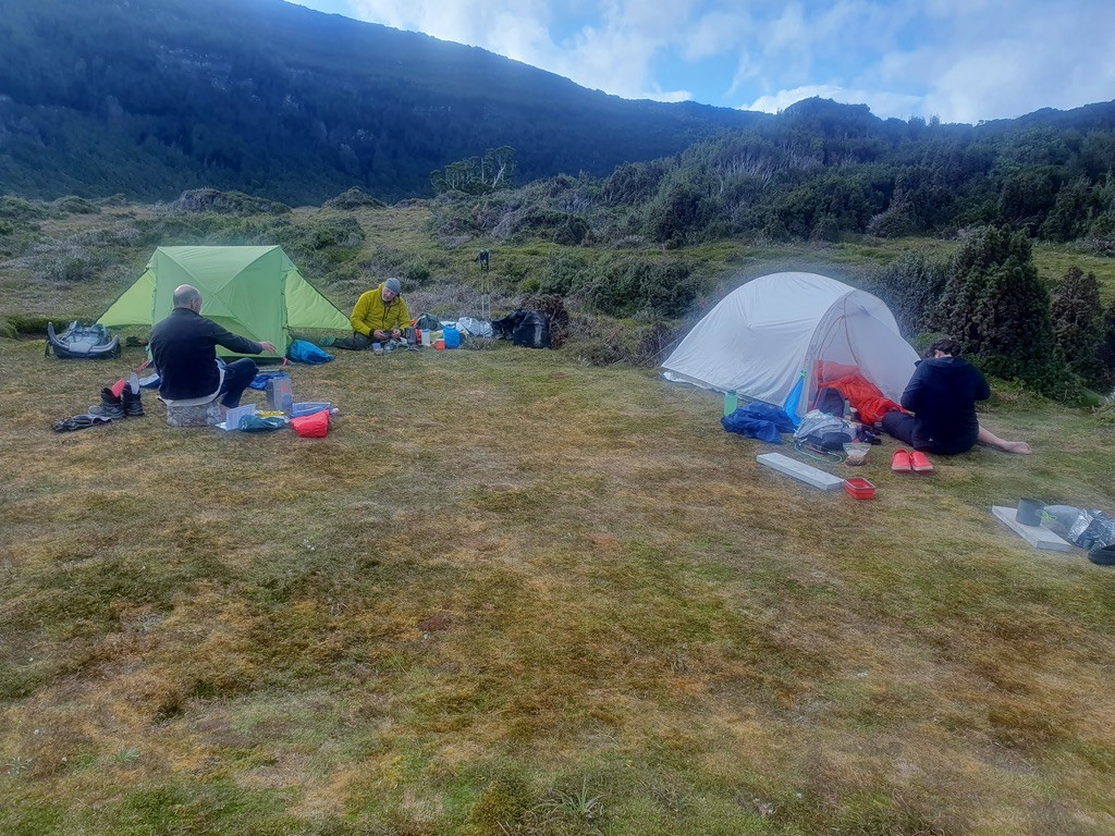
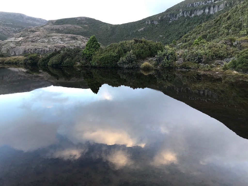
Sunday morning dawned bright and clear and with lighter winds. The Moonlight Ridge track mixes moorland with patches of scrub and expanses of open rock as it climbs over and around Hills Two, Three and Four. Jenny met her first snake of the trip, probably a White-lipped Snake. Moonlight Ridge ends with a steady descent to Pigsty Ponds and Reservoir Lakes, the only truly sheltered campsites on this route. The misnamed Pigsty Ponds is a beautiful alpine meadow of soft, green moss and wombat-cropped grass surrounded on all sides by mountains. A tiny creek winds through the moss in a deep, narrow trench full of crystal clear water, connecting two small lakes. We set up our tents on perfectly flat, soft ground and lay around eating lunch and discussing what to do from here. Having failed to reach the Ponds on Day 1 it was unlikely we would reach PB and when we got a weather update (using a Garmin inReach satellite pager) it suggested steady rain from Wednesday. During the morning we had met a party on their way out, who had been camping at the Ponds and climbing the nearby peaks, so we decided to change our plan and do the same, beginning with Mt La Perouse, which is an easy half-day from the Ponds.
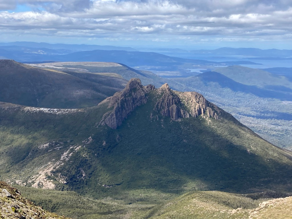
A couple of hours after lunch we were on top of Mt La Perouse, 1158m high, 350m above our campsite and an easy walk over rocky slopes. The top of the mountain is a plateau about 500m in diameters made up of flat rocks like paving slabs. There is almost no vegetation. The view of the south coast and the surrounding peaks and glacial lakes are magnificent and on a sunny afternoon with light winds it was a delightful place to be. At the centre of the summit plateau is a three metre cube of carefully arranged rocks. This is a trigonometric station erected by surveyor James Sprent around 1850. As the peak is still two days walk from a road the idea of getting there in his day – presumably on horseback – carrying a giant theodolite and other surveying equipment before building this cairn blows the mind. Sprent was the first European to spot and remark on Federation Peak and we had wonderful, blue distant views of Fed Peak and the rest of the Eastern Arthurs from most of the high points on our trip.
As we made our way back down the mountain we spotted a solo walker setting up camp at the Ponds. Later we discovered they had been on a nine-day trip to PB and the South Coast Track, but the wind last night had snapped their tent poles at Ooze Lake, causing them to abandon the trip.
This far south sunset was not until nearly nine in the evening, so we had a long, relaxed dinner lying on the soft moss and planning next day’s walk. Towards dusk wombats came out and grazed on the far side of the meadow.
Day 3.
We awoke to a heavy fog. Our plan today was to climb Pindars Peak, a pyramid of bare rock that we had been observing from afar most of the previous day. At 1230m it is the highest point on the whole route. Although it is a mere 6km map distance, we allowed twelve hours for the trip and were on the track by 07.00. Jenny decided to stay in camp and spend the day exploring Reservoir Lakes. It felt like a day off for the rest of us too, because we only had to carry day packs!
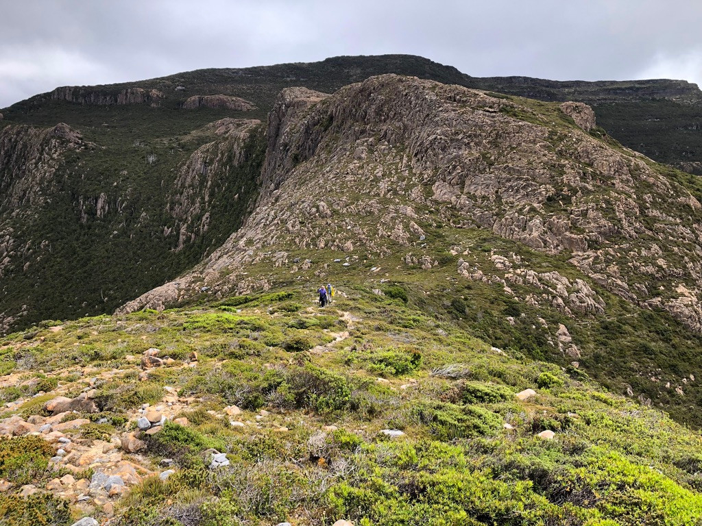
On the rocky slopes above the Ponds is three-headed arrow of piled up rocks, marking the split between the track to La Perouse and the track to Pindars Peak and beyond. After about a hour we were on top of Maxwell Ridge, a kilometre or so of bare rocky summit along which we made good time in the cold mist. That was useful, as the track down to King Billy Saddle is more representative of the south west. It’s a heavily eroded ditch through scorparia scrub on a steep slope. Mostly a series of metre-deep erosion holes that you climb down using the scrub as hand holds. Only Geoff had decided to bring gardening gloves for scrub-bashing, which we all envied. By the time we reached the saddle the fog was starting to break up, with patches of blue sky and occasional views of the surf on the south coast through ‘windows’ in the mist.
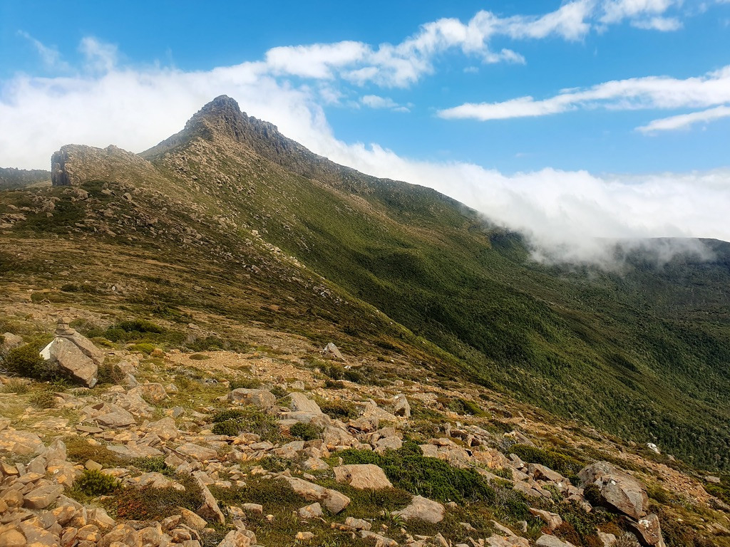
From the saddle the track traverses through heavy scrub to reach Ooze Lake, which is actually a very pretty glacial hanging lake. This was mostly head-high scorparia, but with a nice break in the middle that we christened the ‘magic pandanus forest’ where the tea tree gets high enough to suppress the scrub and the dark interior is a jungle-gym of Pandanus stems as the plants grow long and thin to reach the light. Picking up water at Ooze Lake we were only about 2km from the peak and started a steady climb up the slopes of Lake Mountain through open moorland. The wind picked up on the ridge between Lake Mtn and Pindars and we were glad when the track dropped down on the leeward side of the ridge and worked its way around behind the peak.
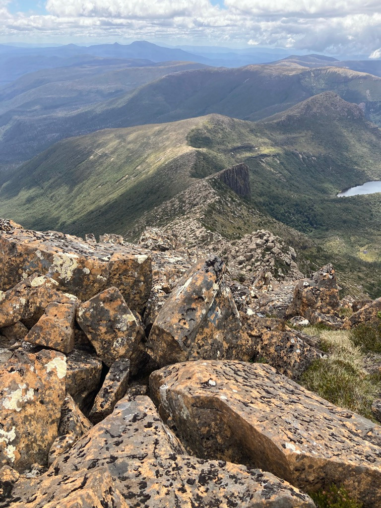
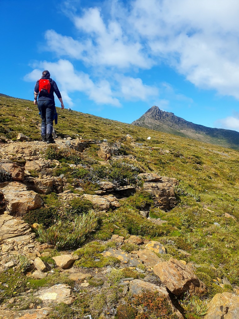
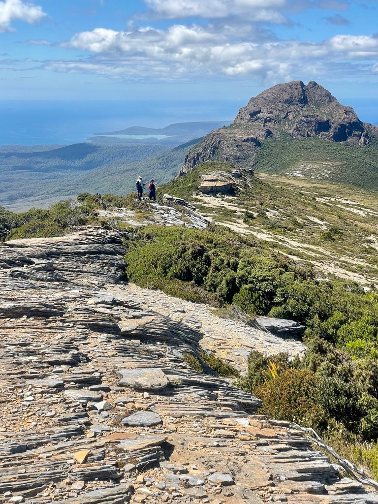
By the time we reached the saddle next to Pindars Peak the sky had cleared to a gloriously blue, the wind had dropped, and to cap it off a Wedge-tailed Eagle was soaring around the summit. The peak itself is a chaos of large dolerite boulders, dappled grey and ochre. It was a fun scramble to the top, which we reached at 12.00, five hours from camp. From here we had an extraordinary panorama of the south coast with its long, surf-fringed beaches, our route back over the ridges to the east, Mt Wyllie and PB away to the west, and to the north the Eastern Arthurs, with Federation Peak sticking up like a knife, and behind them the distant, blue summits of the Western Arthurs.
Over lunch we discussed the remainder of the trip. It was clear from here how much remaining distance there was between us and PB, and there is not supposed to be much of a track beyond this point, so clearly we had not allowed enough days for the trip. Given the weather we decided to finish a day early and made use of the phone reception on the peak to call TWE and arrange an earlier pick-up. We would have one more day to climb the Hippo and be in a campsite off the ridge by the time the rain hit on the following day.
In the afternoon we retraced our steps, stopping for a swim in Ooze lake, and reaching camp at 6.00. From the top of Maxwell Ridge we could see the tents and gave a mighty collective shout of “MAKE TEA” to Jenny, although it would be an hour before we were down there so she wisely ignored us.
Day 4.
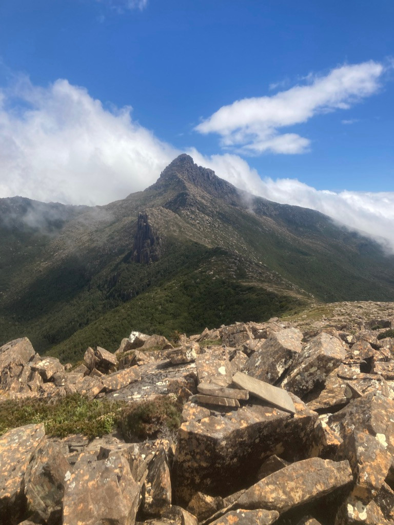
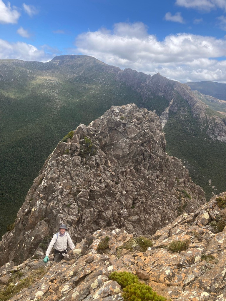
We had a slower start this morning and started climbing back onto Moonlight Ridge at 09.00. The wind was up again, but much less of an issue on our backs than when walking into it on Day 1. We stopped for morning tea just below the summit of Hill Three and, were struck again by the difference between the wild, windswept track and the sunny, sheltered slopes a few meters down the leeward side of the ridge. Here we dropped out big packs and set off with day packs to climb The Hippo, a spectacular rocky peak connected to Hill Three by a long, bare ridge.
The walk down the ridge was open and easy but as we approached the Hippo it became obvious how steep it is on this side – basically a wall of dolerite columns and scree. However, a Z shape of scree and greenery running up the face seemed the obvious route, so when we reached the bottom we started scrambling on the edge of a scree chute. As expected, this led to another chute, and a final chute ending between the twin peaks (the Hippo’s ‘ears’). From this tiny saddle it was an easy climb to the left-hand ‘ear’, the true summit, which we reached at 1.00. So a pretty easy climb in the end, but enough to be interesting and give a sense of achievement.
Once again we had magnificent views, this time of Mt La Perouse, the Coxcomb – a series of massive dolerite pinnacle connected to that mountain – and the cascades of Arndell Falls, as well as the remainder of the Hippo stretching down towards the south coast.
It was close to 4.00 before we were back over Hill Three and on the track. On the rock platforms here I was struck by the ‘horizontal trees’ – shrubs growing completely flat to the rock with their trunk facing NW into the wind and the branches and leaves spreading out to the SW, just like a two-dimensional picture of a three. Other shrubs were growing on the SW side of a rock, precisely trimmed to the profile of the sheltering rock as if the wind had cut them with a hedge trimmer.
We had afternoon tea – with real hot tea this time as we were getting tired – at our old campsite between Hills One and Two and then bashed through the scrub as we came down from the ridge to reach our next campsite in the headwaters of Mystery Creek at 7.00 – an 11 hour day.
This must have been a magical campsite before the bushfires, a sheltered patch of forest around a stream. But after the big fires of 2019 it felt more like camping in a communication trench on the western front in 1917. Grey mud surrounded by the grey, shattered remains of trees and the tussock and grey dead shrubs stretching far away. The creek has much less capacity to retain water now, and although it had been running freely when we passed it on the way in, three days without rain had reduced it to a series of unappetising puddles. But we had a cheerful dinner before stowing everything away for the predicted rain.
Day 5.
The rain arrived perfectly on schedule just after dawn, and quite heavy. It was predicted to reduce by mid-morning and be reasonably dry that afternoon so we stayed in our tents until 10.00 before getting up for breakfast and packing in our wet-weather gear. By the time we hit the edge of the forest the sky was clearing and we had lunch at the very pretty- but waterless – camping area just inside the forest boundary. After lunch we had a lovely encounter with an echidna. From here it was a steep and pretty forest walk back to the trackhead, which we reached with time to explore the massive cave into which Mystery Creek disappears and which is what brings most tourists to Ida Bay.
Day 6.
Rain was predicted again for the afternoon, but the morning was only cold and overcast, so we spent it discussing lessons learnt, eating an oversize breakfast and organising our gear ready for the return to Hobart. Sure enough, just after TWE arrive to collect us the skies opened and we drove back to Hobart in the rain.
While we did not reach PB this was a great introduction to the Southern Ranges track. It is in many ways easier than either the Western Arthurs or Federation peak, our previous two trips, as the track is better and there is much less climbing involved. But I have rarely felt so much at the mercy of the weather – the ridges would be quite dangerous in high wind and rain and there are very few sheltered campsites. We’ll be back!