Date: 14+15/9/2019
Trip leader: Bruce Stafford
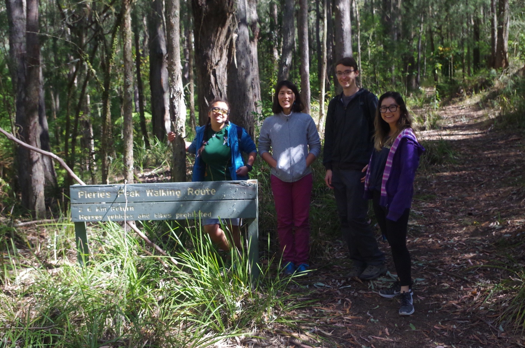
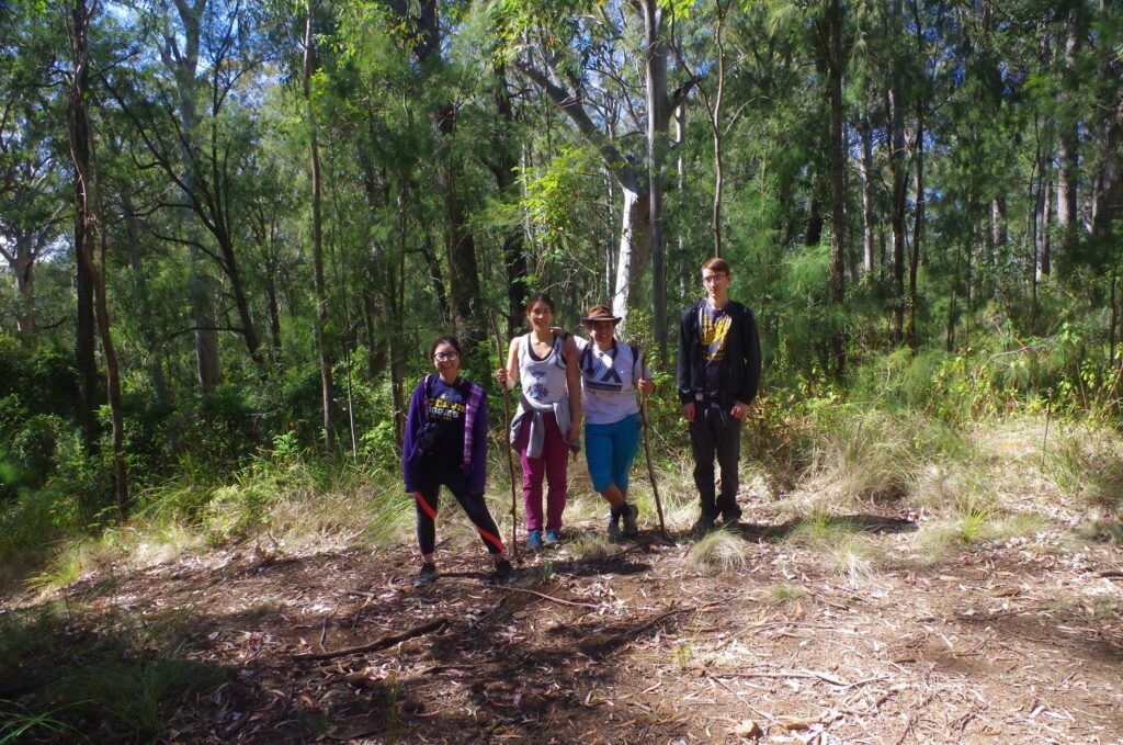
Party: Bruce (leading), Meri (Meritxell), Ailsa, Sally (Hui Jung), Kai.
Photos: by Bruce
Quite a long report but I think you will find it interesting.
This trip was originally planned for Coolah Tops but that park put on a local fire ban on the weekend intended for the walk, so that would mean no camp fire.
So instead I decided to do Mount Royal National Park instead, as there was no park fire ban there, so a camp fire was allowed in their campfire sites (but not elsewhere). It also meant that a Saturday morning departure was possible instead of Friday night.
I met up with Meri, Ailsa, Sally and Kai off the train at Tascott Station, which made it so much easier to carry their gear to the car, rather than toting it up and down stairs at Woy Woy. We managed to everything in the car – just, as there were also 5 large chookfood bags full of firewood in the boot as well. Then we settled in for the 90 minute drive to Singleton. At Singleton we stopped for a coffee break, and petrol, then continued on the final 50km drive to Mount Royal National Park. This park is actually a part of the Barrington Tops Wilderness Area, and in fact Mt Royal itself lies within Barrington Tops National Park. Along the way we encountered participants in a bicycle charity ride headed to nearby Lake St Clair, which provided interesting moments getting round them on this winding road.
On arrival at Youngville Campground, there was just one other car there, and those people were there for a day walk and not staying, so we ended up with the campsite for ourselves for the night.

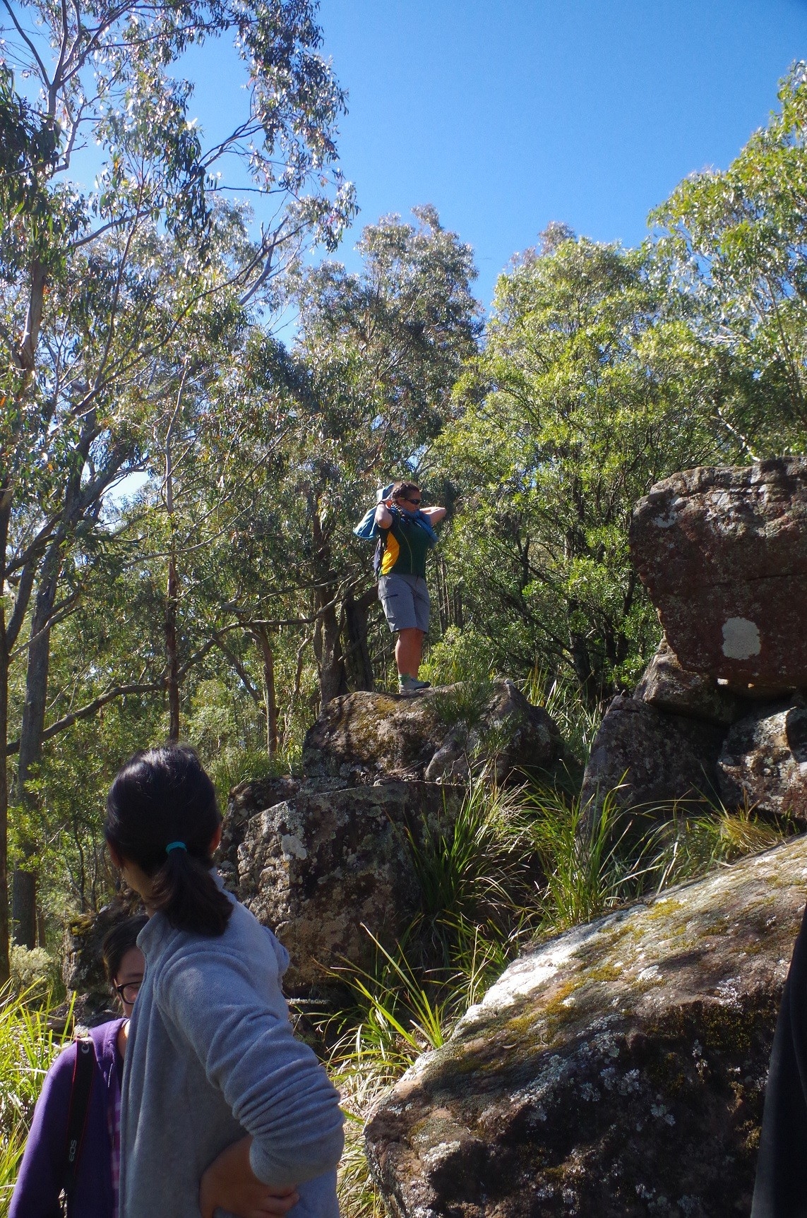
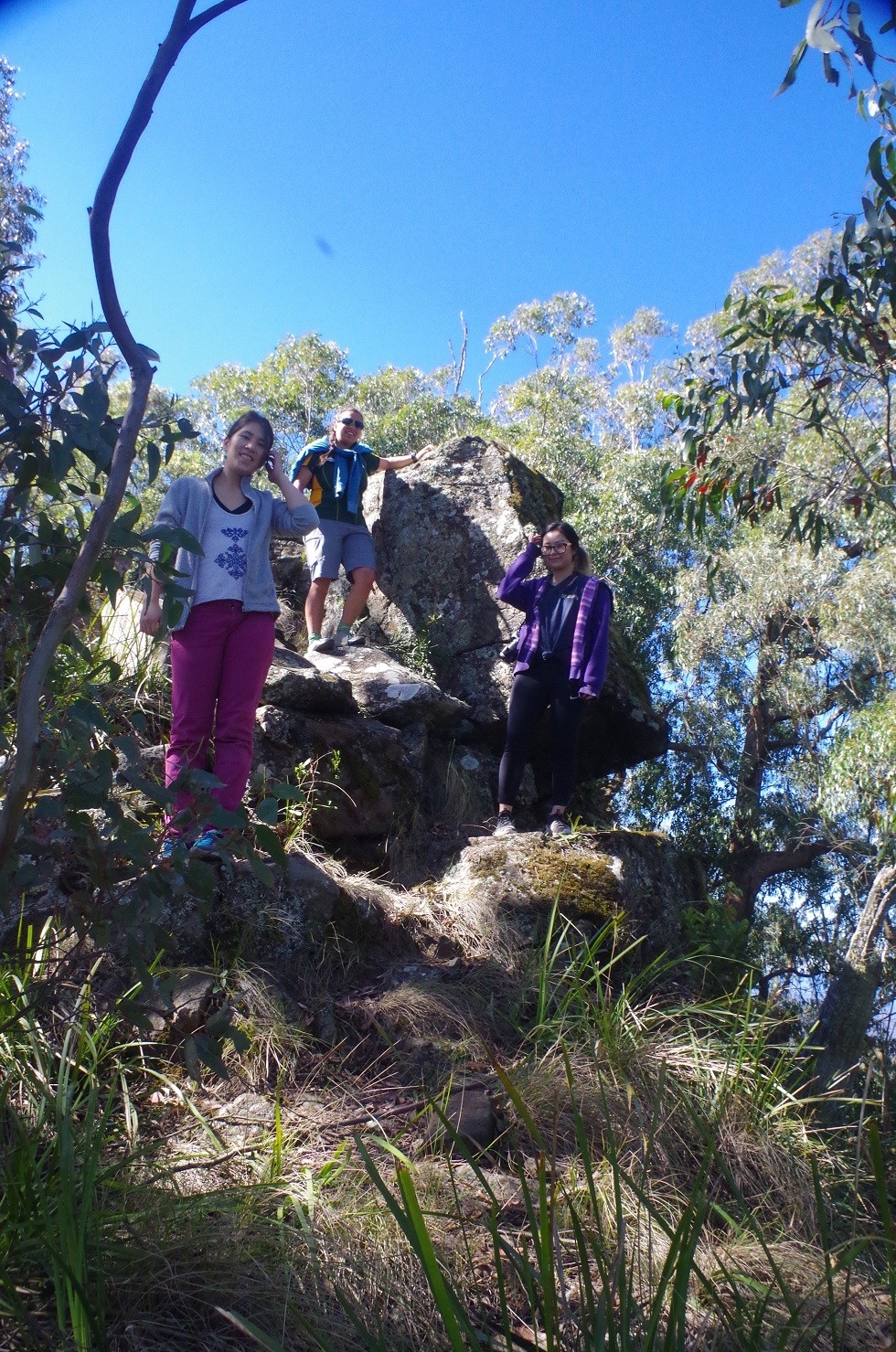
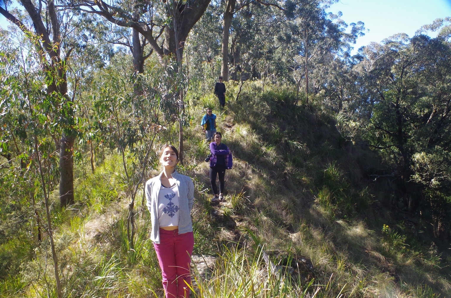
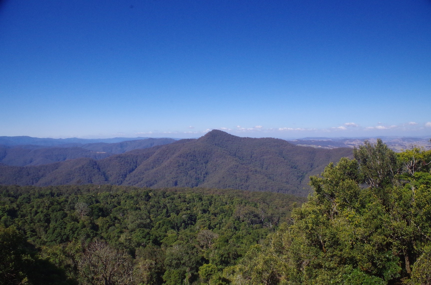
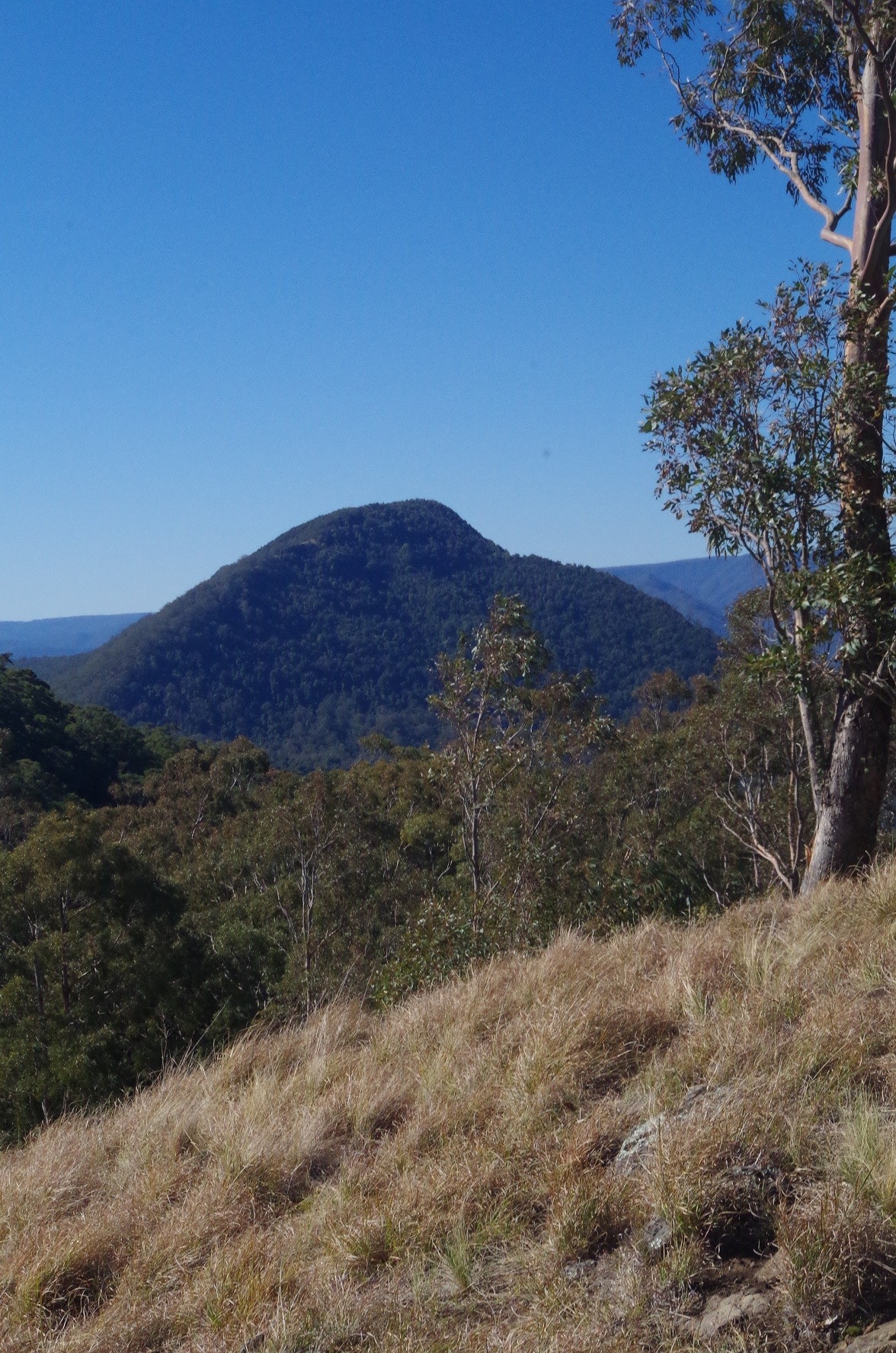
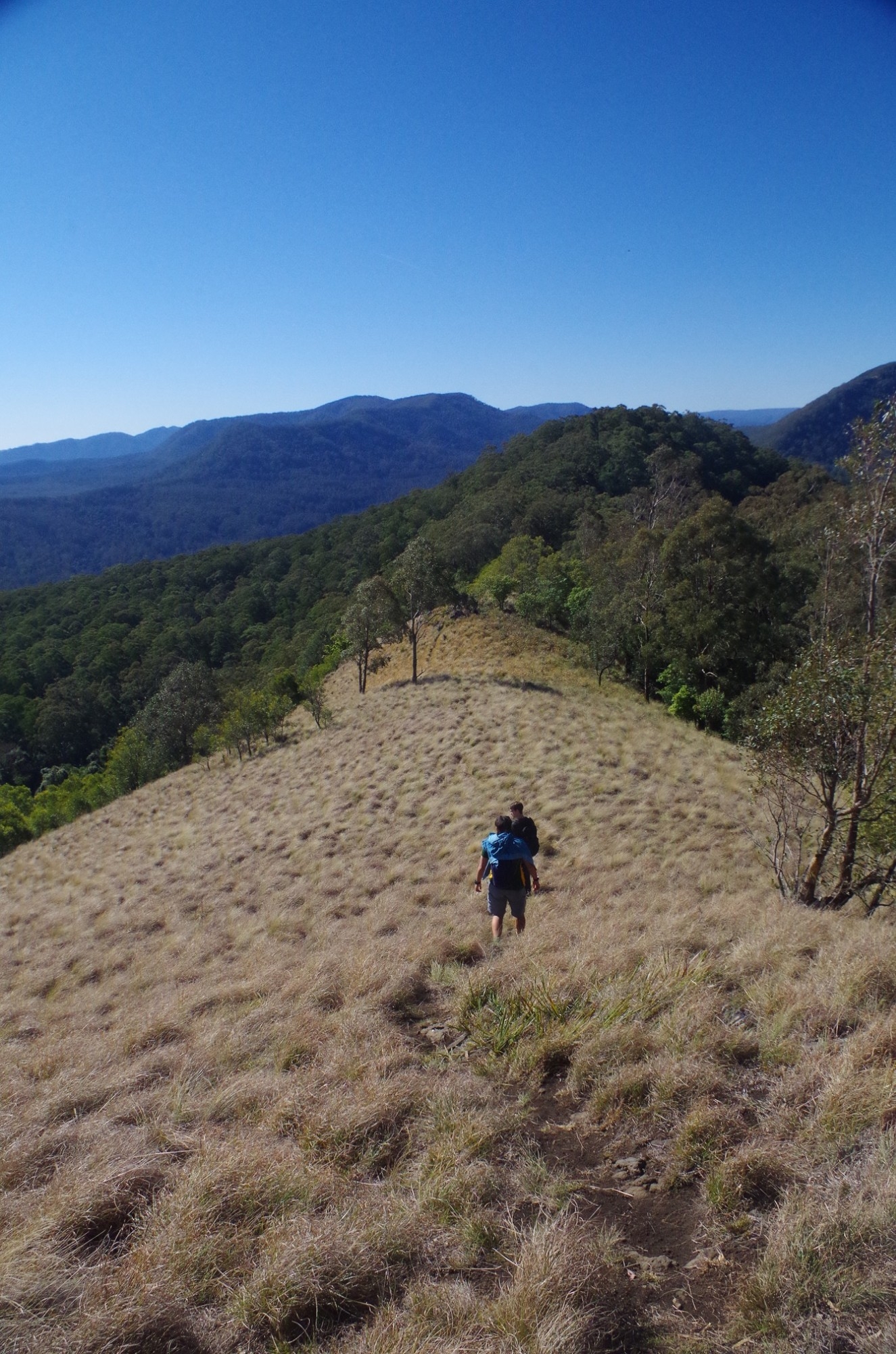
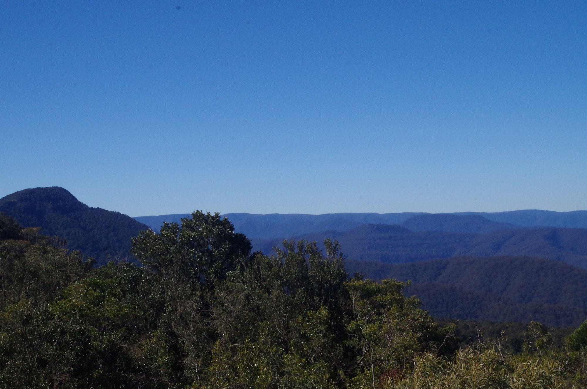
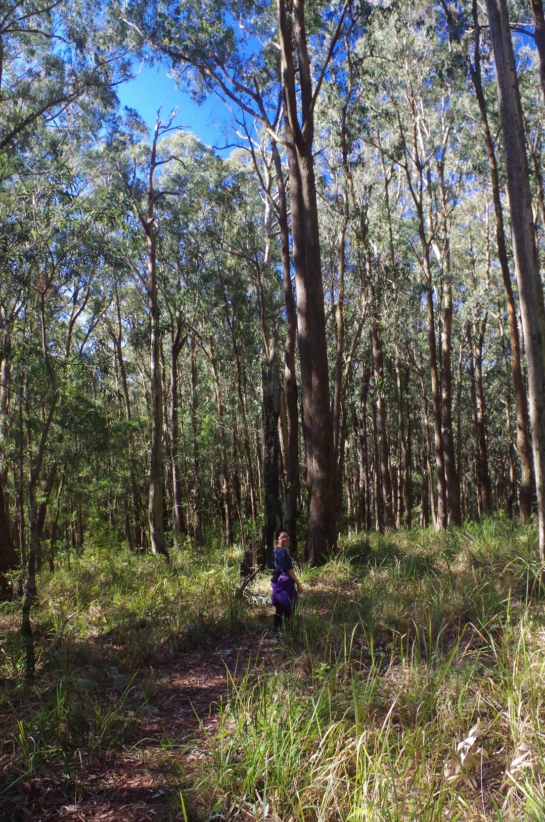
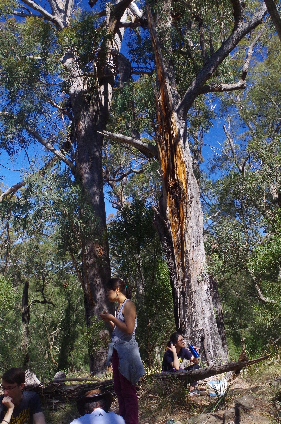
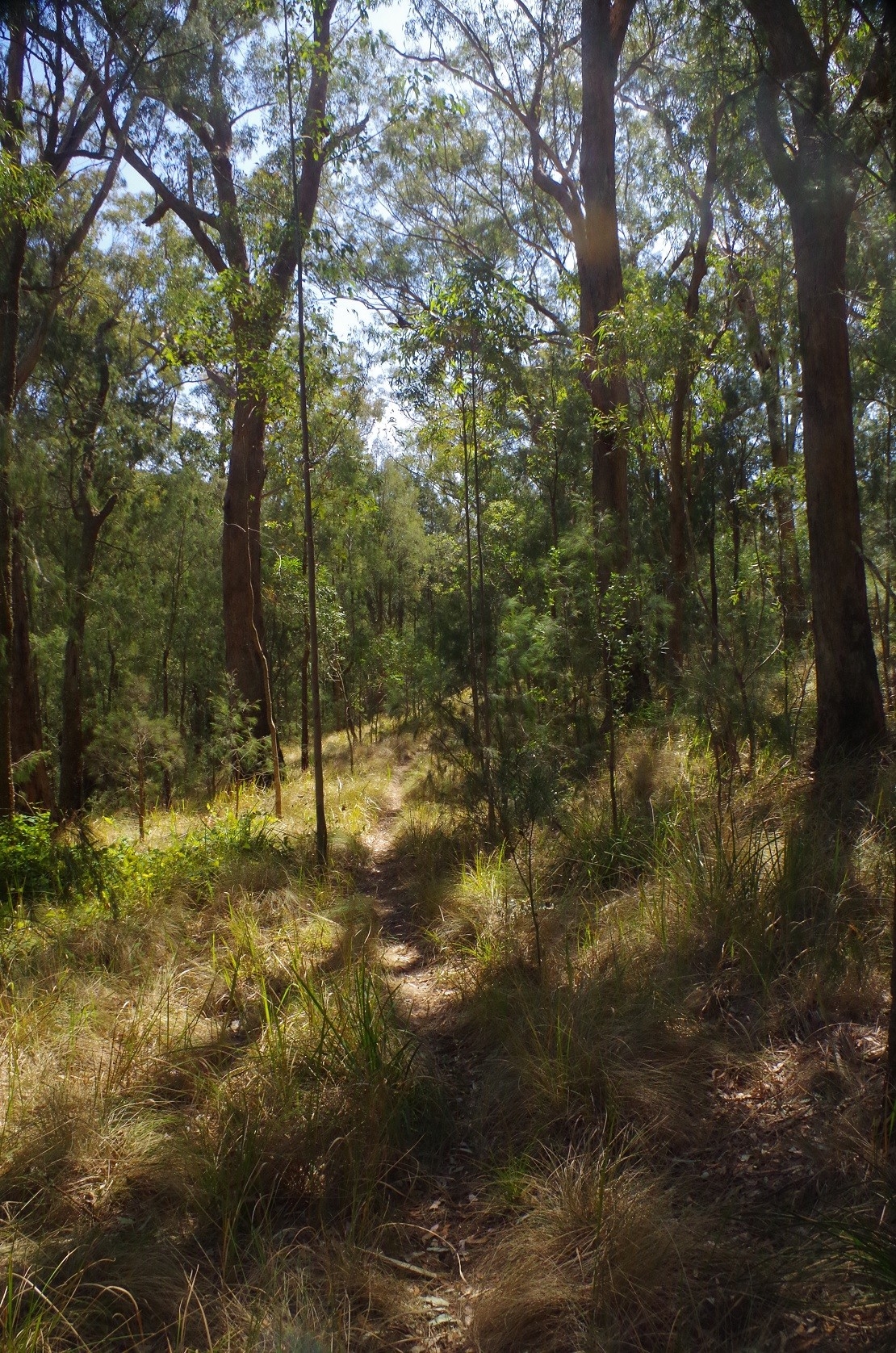
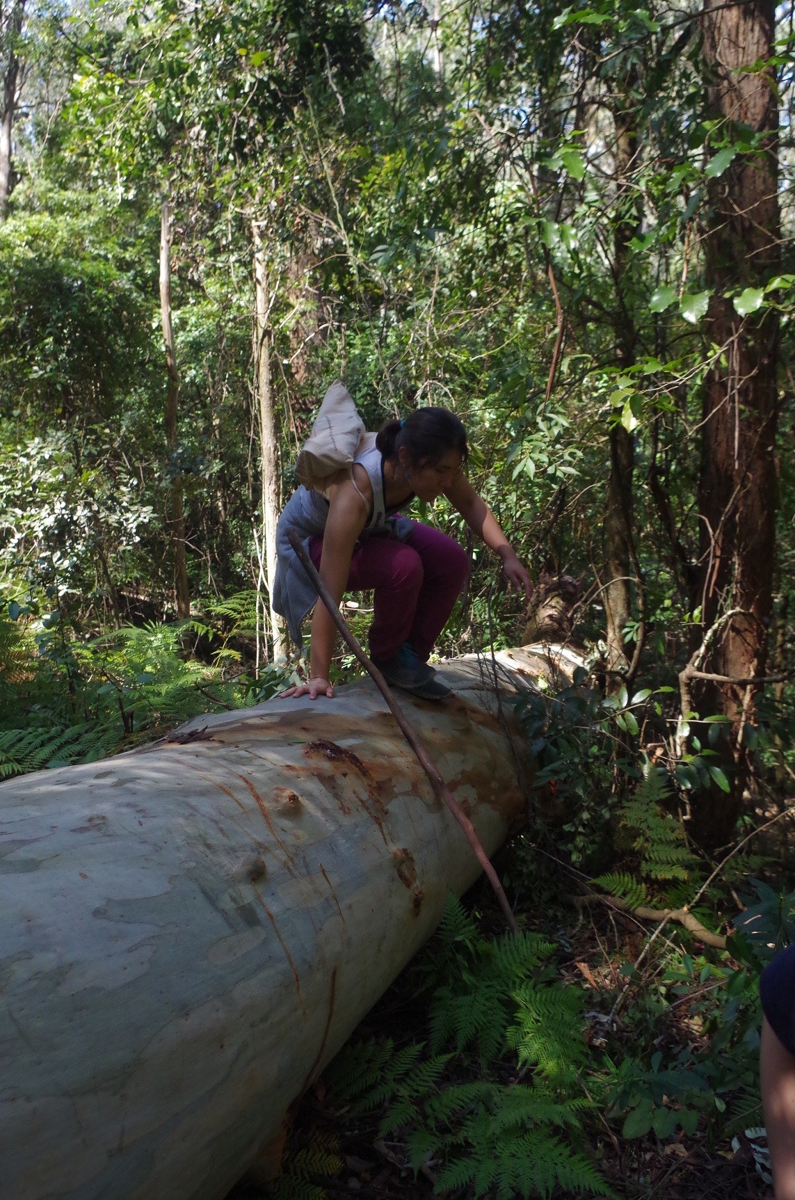
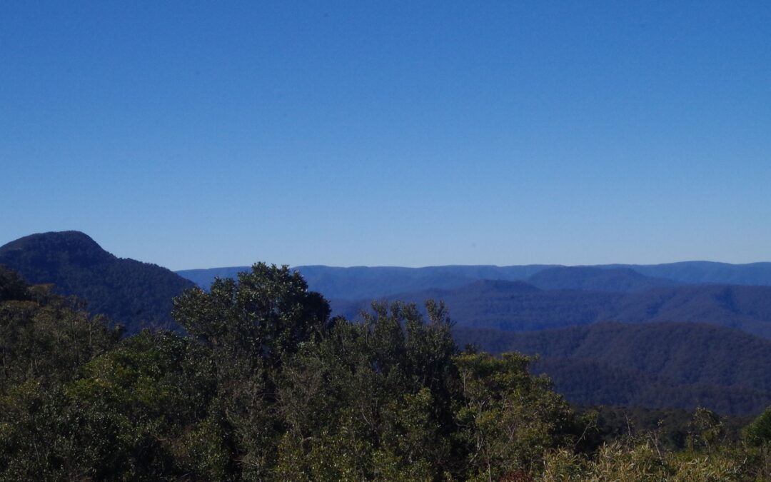
We set off on a walk to Pieries Peak about 2km away which gives the best views of all the peaks. This walk starts off in open woodland although I missed the start of the track by going up a dead end short trail. After getting on the right track we continued along until it comes to a rather narrow section, with clambering over some volcanic rocks needed. Then it continues on a steady climb along an open ridge covered with tussock grass. It is a well known feature of the area. Once at its highest point it gives views in all directions. Mt Royal can be seen looming to the north, and north-west are the almost 1600 metre peaks of Barrington Tops. To the south though the cooling towers of Bayswater Power Station near Muswellbrook can be seen. After taking in the view we returned the way we came back to YoungVille Campground, then proceeded along a loop track to Carrow Brook. This track descends almost continuously and gets rather steep in places. It is evident it sees little use nowadays despite having some wooden steps in some places. It is getting somewhat overgrown and covered with undisturbed leaf litter,and some time was spent avoiding vines which reach out with thorns trying to ensnare you. We also had to clamber over (or under) several fallen trees. We eventually came to and crossed Mulgowrie Creek (a tributary of Carrow Brook) but it was completely dry. The long run of dry weather is taking its toll. A bit further on the track got a bit more open and eventually came to the junction with its return leg up to Youngville campground. That is not the track’s end however, as it continues a short distance further down to Carrow Brook. This brook was still running but the water level was low. Also, this areas is noted for its abundance of leeches, but this time there was no sign of any, which shows just how dry the ground was.
So we returned back up the return track to the campground, and this time the track was less overgrown and seems to see more use. Even so, care has to be taken to avoid brushing against the Stinging Tree saplings, several of which are growing beside the path. The leaves of these trees are covered with tiny barbs which can give a burning sensation on the skin for days, and the most effective relief to get rid of the barbs from your skin is using Brasilian Waxing!!
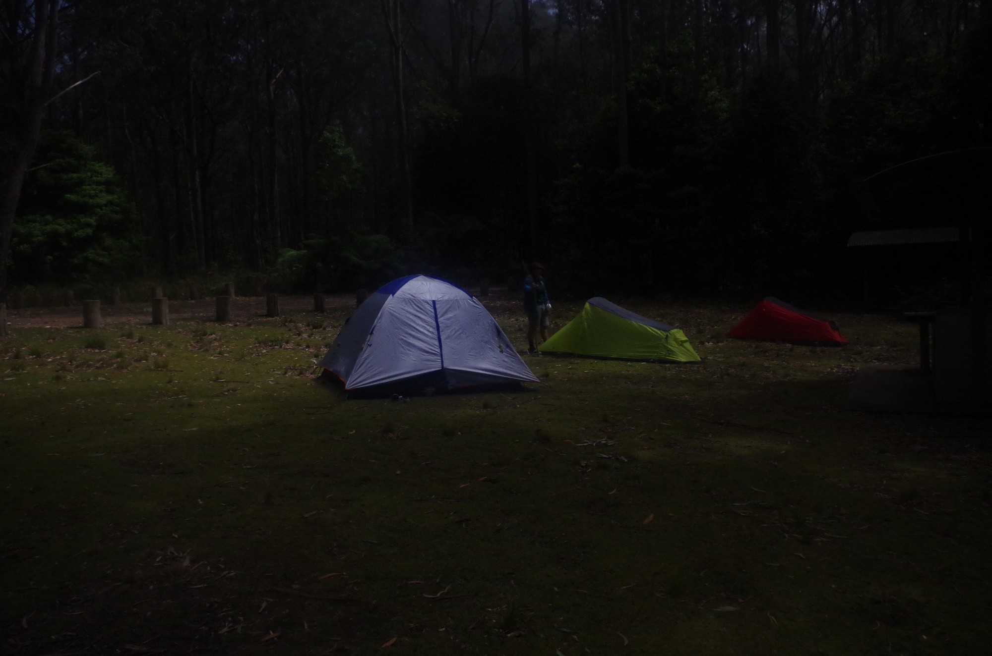
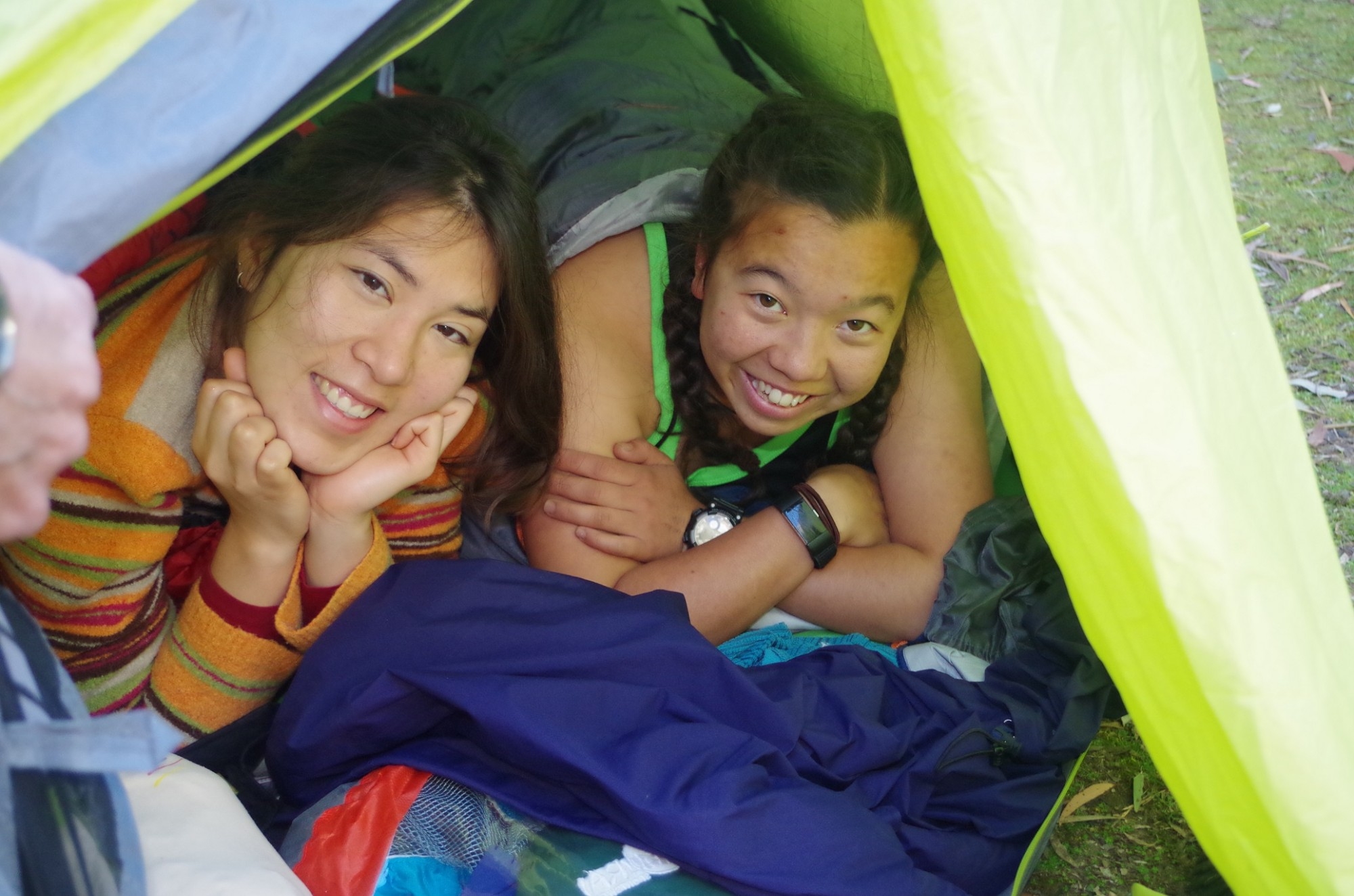
It was somewhat after 5pm when we got back to the campground, and so we got up our tents before dark, which would be about 6.30pm (one thing which often catches out students from the Northern Hemisphere is our short twilights). So tents were set up, and Meri discovered that her tent appeared to be a one-person tent, even though she intended to share with Ailsa that night (it was an SUBW loan tent and may have been mis-labelled). At least they weren’t going to worry about getting cold!
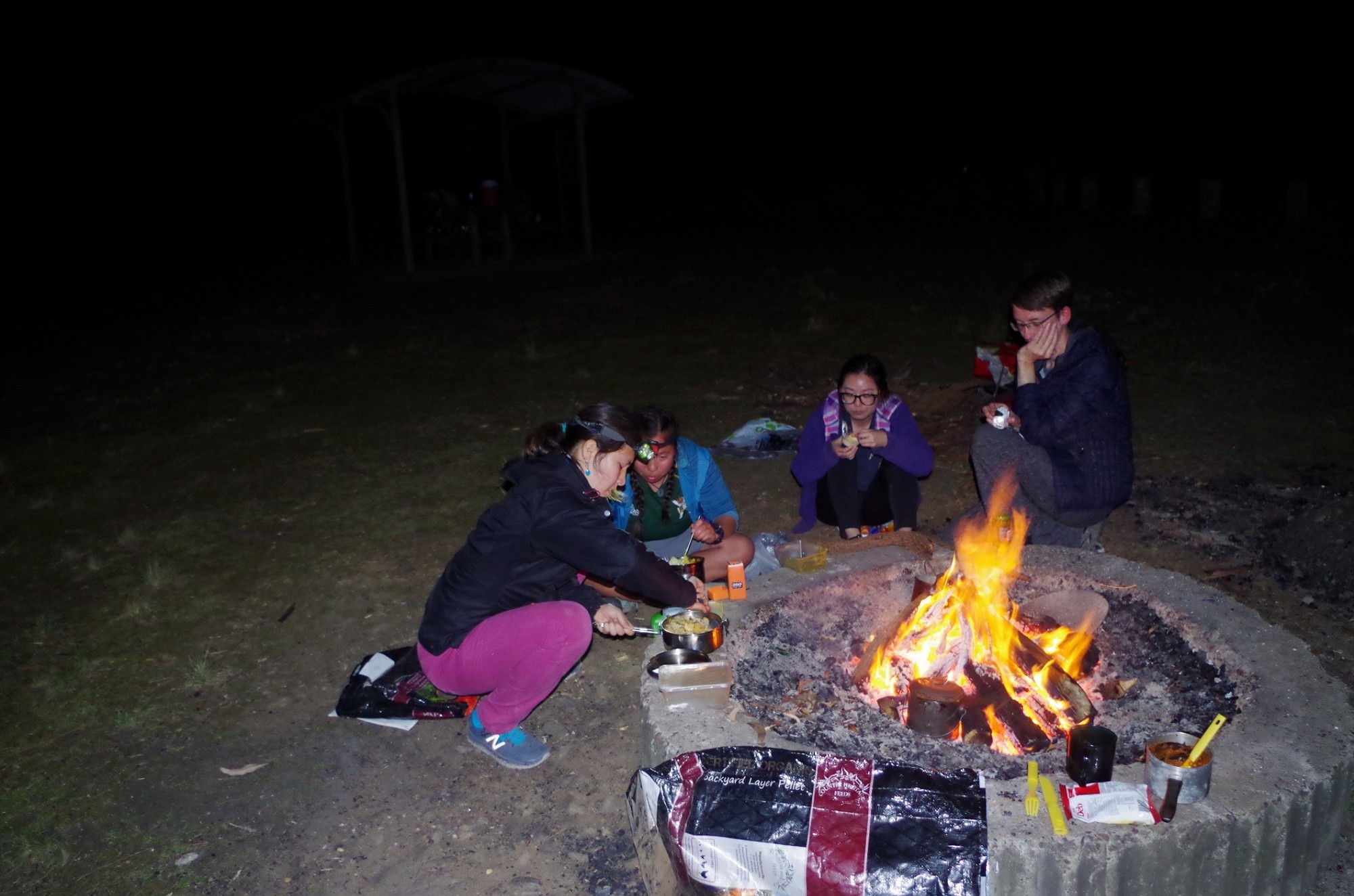
Then came setting up the fire. The fireplace there had a lot of ash in it up to the level of the concrete surround, and so we set about shovelling excess ash out of it so that the fire would be below the top of the concrete. The shovel we used was an old one of mine with a broken handle, and the only way to remove the wood inside the shovel’s shaft to enable its repair was to burn it out. And of course the shovel was able to double as a tool. The wood for the fire came as I mentioned from 5 chookfood bags of wood from home. We upended these and built up our fire. The dry wood made for an almost spark and smoke-free fire, and thus we also did our bit for the environment by not using local wood (which the National Parks try to discourage). Mt Royal is basically a BYO firewood park.

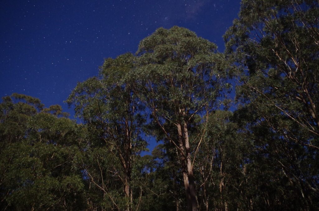
So we did our cooking and found that despite the fire not being very big, it was cooking food and boiling water in 5 minutes as well as keeping us warm (seems there is a lesson in that; a bigger fire is not always better). Then Meri, Aila, Kai and Sally settled in to play card games including a Spanish one called Uno. Meanwhile I tried to get photos of the night sky despite the full moon drowning out most stars, and was surprised that a lot still came out in the photos anyway. Even a part of the Milky Way came out in the photos.I also went looking for scorpions using an ultra-violet torch, but the only objects fluorescing were scraps of paper thrown away by other visitors. A possum looked down on us from the pine trees, with it’s eyes shining in the torchlights. The full moon was also bathing the campground in quite bright moonlight. Later on, a fog started coming up from the valley of Carrow Brook. which made the trees look eerie. A dew was also depositing on our tents, which made me wonder if they would need a good drying out the next day.
So went went to “bed” such as it was, and during the night I could hear the call of a Tawny Frogmouth close by. This bird repeated a very soft “Mmmmm, mmmm, mmmm, mmmm, mmmm, mmmm…” at regular intervals, and it went on for some time.
The next morning there was not a drop of moisture on top of our tents, which I thought was odd given the heavy deposit the previous night. It is usually a sign of impending rain, but none at all was forecast; indeed a check of the fire conditions showed that the Greater Hunter Region was upgraded to “Very high fire danger” but no total fire ban. Top temperature in Muswellbrook was forecast to be 30 degrees C. The fire had gone out although the ashes were just a bit warm, so the remaining 10 litres of water in the jerrycan was put onto the fireplace to make sure. (And that reminds me; the water tank that used to be at Youngville Campground has now been removed, so it’s also BYO water as well as BYO firewood).
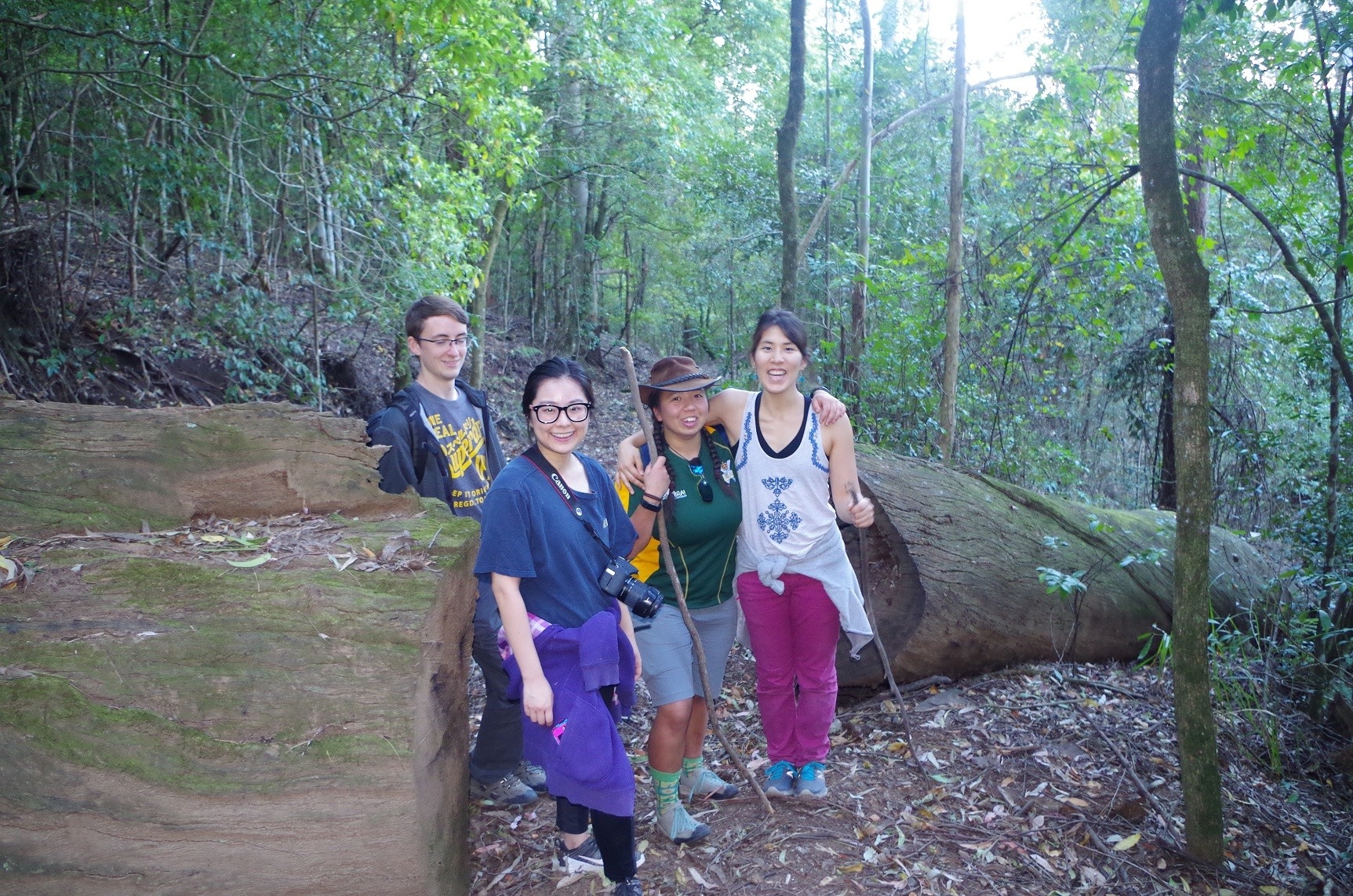
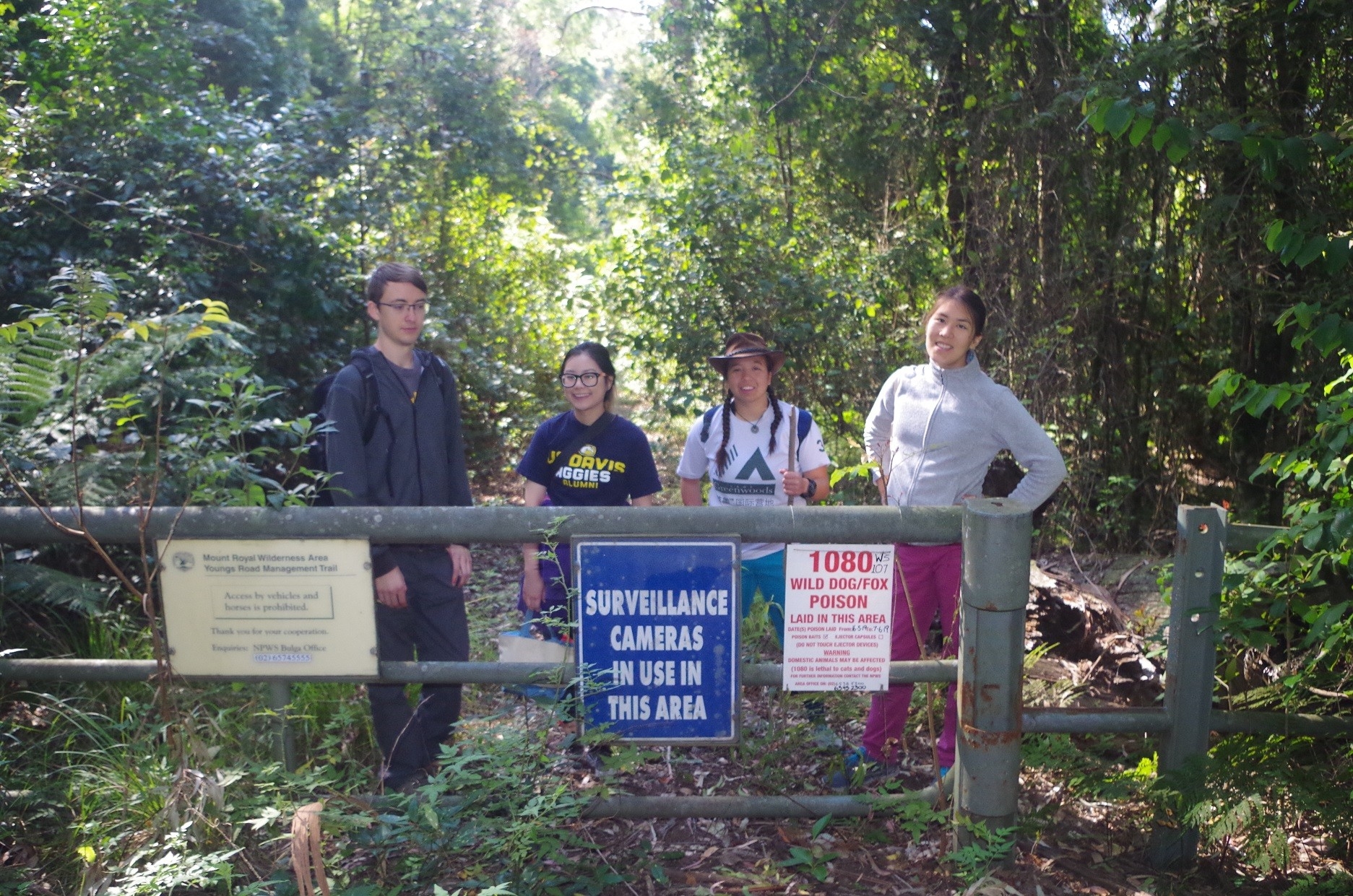
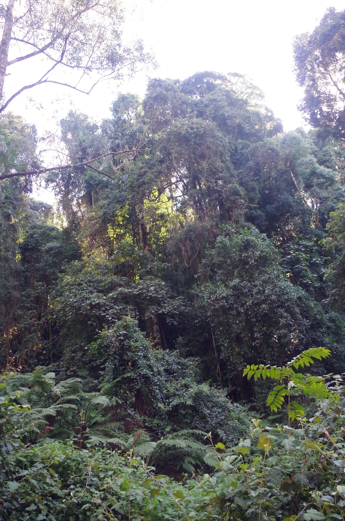
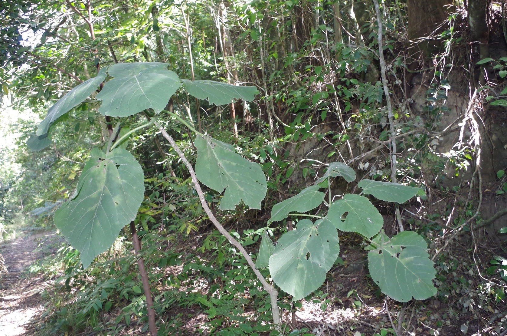
After breakfast we packed up – with a lot more room in the car now that all the firewood was gone – and drove the 2km north to the base of Mount Royal, spotting some kangaroos along the way. Here is also the start of the Youngs Road Trail. “Trail” is an overstatement as it is actually heavily overgrown and a single line track for about 2km until it clears the shadow of Mt Royal. It is also literally half in Barrington Tops National Park, and half in Mt Royal National Park. The track itself is the boundary between the two parks. Being in the shadow of Mt Royal means that the ground can retain more moisture as it gets less direct sun, and so the undergrowth is very thick. The track descends at a reasonable gradient before levelling out and heading north. Before it does that, it is surrounded by thickets of vines with clinging thorns, stinging nettles and the occasional Stinging Tree. Vines festoon almost every tree. There are also several Red Cedar saplings growing, a remnant of the once great groves of these valuable trees that were seen by explorer Ludwig Leichhardt when he came here in 1843, which I will mention later on. Red Cedars were plundered throughout Northern NSW for their beautiful red timber, and are now very uncommon in the wild. At one point we came to a detour past a washaway of the old loggers road, showing that nature is starting to reclaim the track. Further on there was a tiny creek where bees were getting water, so we hurried past that spot. Then we came to a formidable obstacle being a very large and long tree that had fallen across the track; not an obstacle for determined buishwalkers, but a barrier to a particular pest found in many national parks, which I will mention a bit later. After the log it was not far to go to the junction of the tracks to Mount Carrow (going south) and Boonabilla Creek (going north and then east). That creek was our intended destination, and after a water break we continued down it. At first it is a gentle descent, but suddenly it becomes quite steep; the first section drops 100 metres in just 250 metres of track, and the rest is at a gradient of 1 in 4 down to the creek. From the creek the track continues uphill to Mt Cabre Bald. The problem was though that the steep downhill section has been badly degraded by motorised trail bikes – being that pest found in national parks I had alluded to earlier. This made the top fine shale layer of the track topped with very fine dirt and dust as well as creating ruts. This made it very difficult to maintain a foothold on the crumbling surface of the slope. I then decided that it wouldn’t be really safe to use the track, so we returned back to the track junction. It is a pity as Bonabilla Creek is very pretty and in normal lines runs well over a bed of cobblestones, and is a likely place to find Platypuses. Using motorised trail bikes in this area is totally illegal (hence the warning earlier on about surveillance cameras being in use). With the staff shortages experienced by the NPWS in NSW thanks to Liberal-National Party government indifference, it’s difficult to have proper policing of the rules. (The Climate-Change-denying boofheads in the National Party would probably like to see all national parks changed to mining and grazing leases). On past walks here, cows have been observed in the area, having come up from local farms further downstream. The cows were responsible for creating the track to the base of Mt Carrow. No cows nowadays (or cowpats) but it is evident that the trail bikes have been coming along for a short distance along this track.
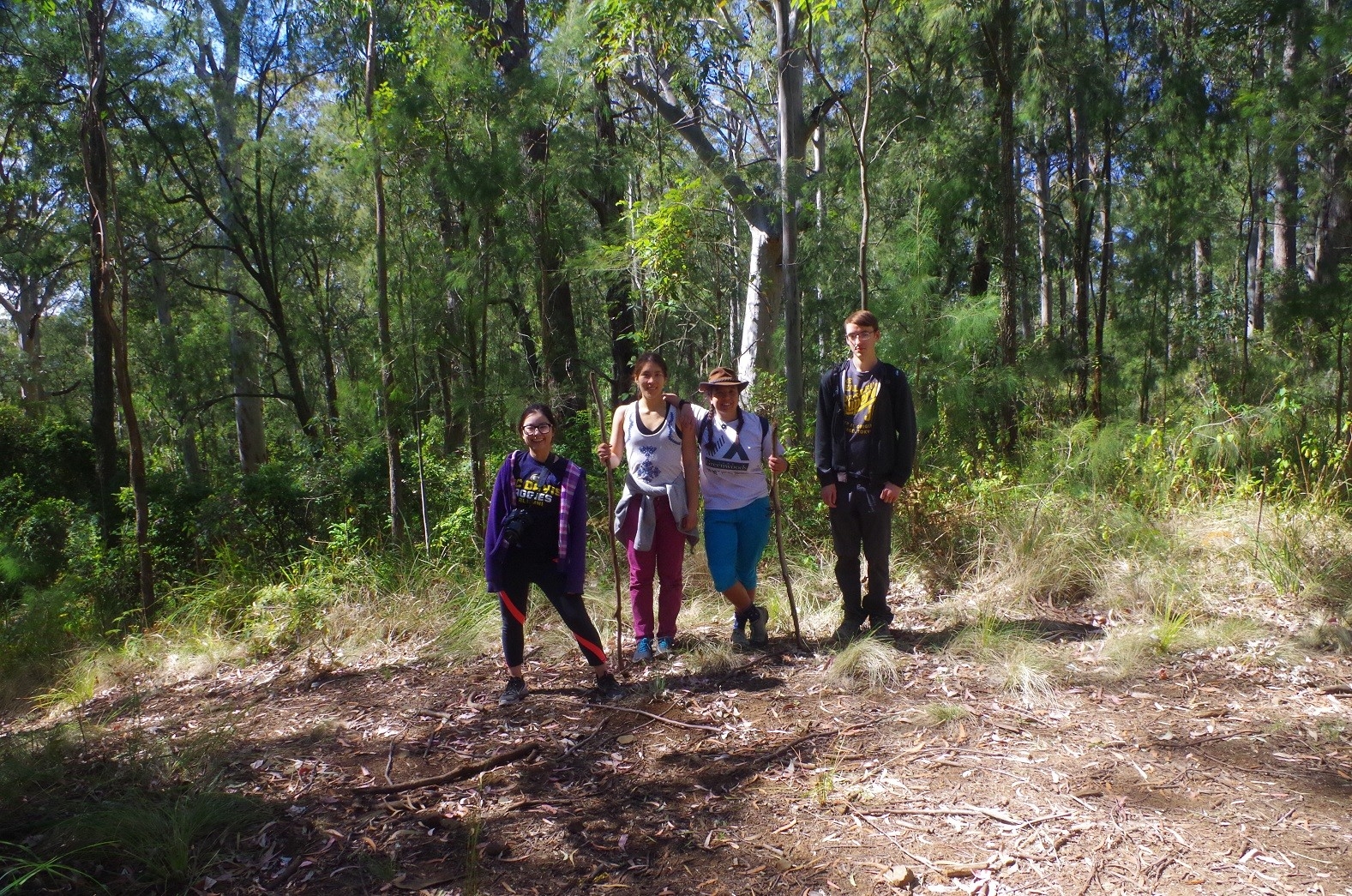
After our defeat at getting down to Boonabilla Creek, the destination now decided on was to go along the Mt Carrow track as far as we could safely go. I had to keep in mind that as the track gets close to Mt Carrow it gets more overgrown, and so is a handy hiding place for snakes. This track goes along for about 5km to Mt Carrow, although we stopped at the last hill 1km before that mount, to have lunch. There wasn’t much of a view at our lunch spot, but it was pleasant enough being in open woodland with a Whipbird calling nearby. During lunch I discovered that other pest to be found here and which Leichhardt reported as well: ticks. I spotted one walking along my firearm and quickly dispatched it. That was a warning not to hang round here for too long. I also noted that the tree under which Sally was sitting appeared to have been struck by lightning at some time, with its entire side neatly sheared off.
After lunch we returned back to the base of Mt Royal and the car, again negotiating the thick undergrowth and the huge tree across the track, which would be an effective trail bike deterrent. I hope the NPWS takes its time removing it!
Then it was a matter of driving back to the Central Coast to get my four passengers on a train home to Sydney. North of Singleton we spotted what at first looked like a small wallaby beside the road, but was actually a large Hare. These rabbit-like animals are not native but unlike rabbits are uncommon and not a pest. They are very elusive and rarely seen.
I stopped at a service station at Morisset for the final petrol, and started encountering busy traffic on the M1 before the Wyong exit. I worked out that it was likely better for the group to get the train from Tuggerah Station instead of Woy Woy or Tascott, as the traffic ahead could be unpredictable and they could miss trains. It was a 30 minute wait for an express train at Tuggerah but at least they would be guaranteed seats together than they would by getting on further down the line. After sorting out petrol money, we said our goodbyes and I saw the other 4 off on the train. They all appeared to have a good time on their first camping experience in Australia.
Now if you have read this far, you might like to read about Ludwig Leichhardt’s experiences at Mount Royal in 1843. When he was there it was 34 degrees C in Singleton in mid summer [normal] and in a drought (but not as bad as the 2019-2020 one). He complained about ticks and flies (we didn’t get flies – much) and also mentioned the great stands of tall Red Cedars which subsequently were all cut down. An article incorporating his observations can be found here: https://www.abc.net.au/radionational/programs/offtrack/mt-royal3a-in-the-footsteps-of-ludwig-leichhardt/4518870 The map was sketched by Leichhardt with his comments not only in German but also the German script of the period (can any German speaking SUBW members decipher it?). The steep slopes drawn by Leichhardt are no exaggeration at all!
And his own glowing description of Mount Royal from this article: (Copy and paste into Google) Mount Royal: Leichhardt’s Liebe – A Leichhardt love affair – Martin Fallding (Queensland Museum):
“Die Nächte waren kühl, der Himmel herrlich gesternt. Wie ich am Morgen mich erhob und der frische Wind mich umwehte, fühlte ich mich so froh, so reich, so zufrieden, dass ich oft meine Hände gefaltet zum Himmel streckte und freudebebend ausrief: O Gott ich danke dir! Ebenso wenig konnte ich mich meiner Gefühle bemeistern als ich auf dem Mt Royal eine so herrliche Aussicht genoss. [The nights were cool, the sky magnificently starry. As I arose in the morning and the fresh wind blew over me, I felt so happy, so rich and so satisfied that I often stretched my clasped hands to the sky and trembling with joy cried out: Oh God I thank you! I could master my feelings just as little when I enjoyed such a magnificent view on Mt Royal.].
One final reference: https://www.rbgsyd.nsw.gov.au/getmedia/ba22f2d0-6d86-4e48-b409-913b4319c148/cun131fall305.pdf.aspx “Adventures, hardship and a scientific legacy: Ludwig Leichhardt’s 1843 journey to Mt Royal in the Hunter Valley, NSW” [Martin Fallding and Doug Benson].
So there you go – a recommendation of Mt Royal from a great early explorer of Australia!