Date: 5-12/3/2022
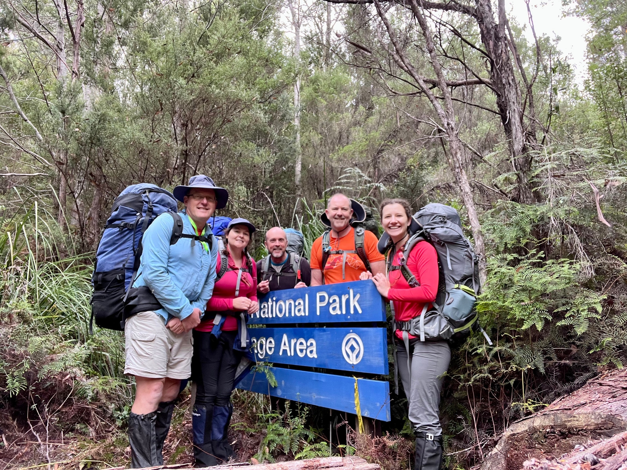
Trip leader: Paul Griffiths
Party: Frances, Geoff, Marty, Samantha
Photos: by Video here
Expeditions to South West Tasmania are a long tradition in SUBW. It’s remote, rugged, beautiful and one of the few places in Australia that offers real mountaineering. Exposed to the ocean storms of the roaring forties the weather can turn dangerous at a moment’s notice even in summer. The most stable weather is in February-March and the beginning of the university year is a good time for an expedition.
We flew into Hobart on Saturday afternoon and caught the bus into town, then walked up to picturesque Battery Point, where we had booked a bunk room at the excellent Montacute Backpackers. We walked down to Sandy Bay to buy fresh food for the trip and noticed a promising looking restaurant, which turned out to be the oldest continuously operating restaurant in Hobart – Don Camillo – highly recommended!
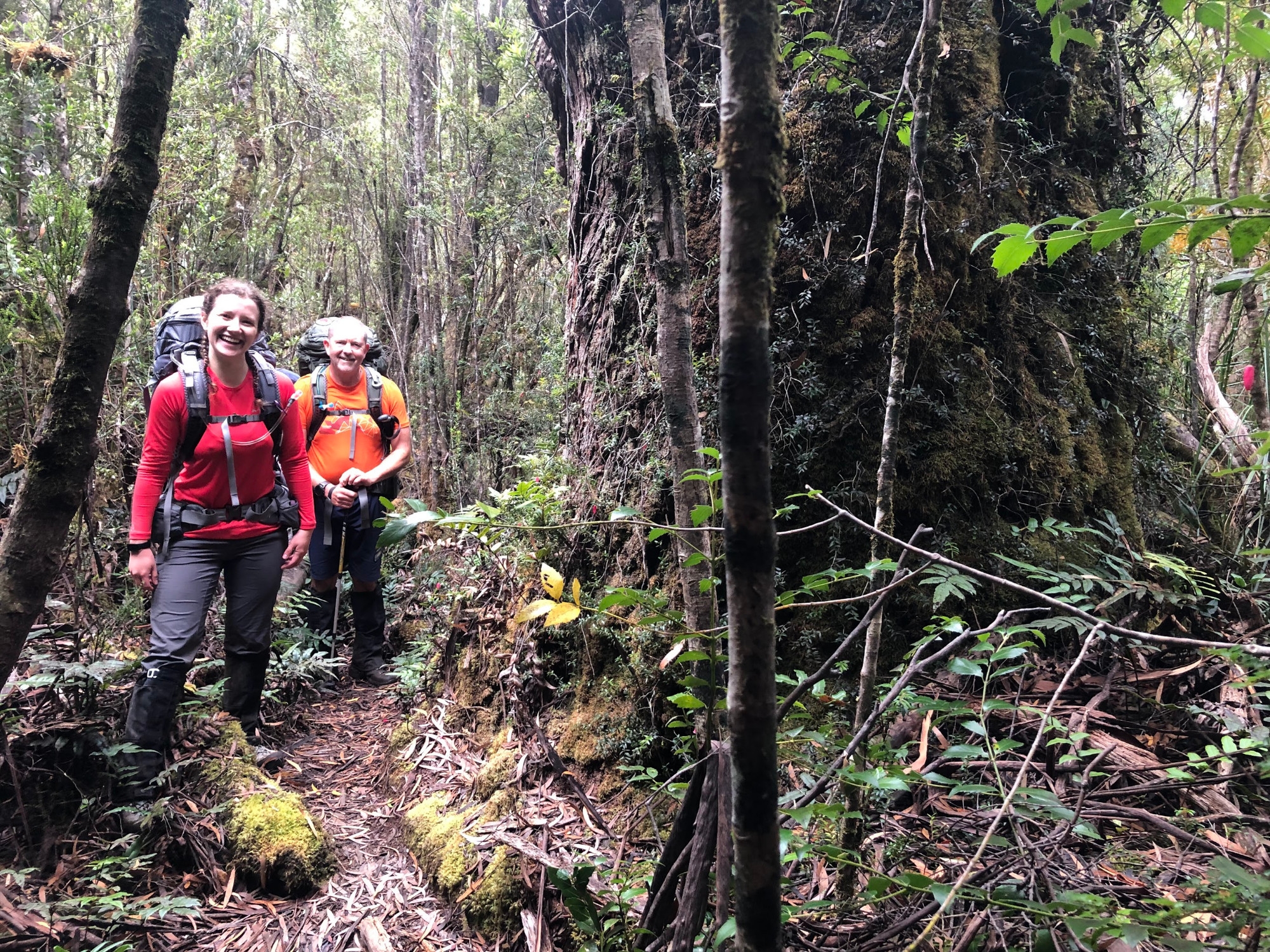
Nest morning we were up at dawn and outside the famous Jackman and McRoss patisserie when it opened. We had time for a slap-up breakfast before our pick up by Tasmanian Wilderness Adventures. Three hours later, and after second breakfast in Huonville, we emerged from the van at Farmhouse Creek. Some of us were were feeling slightly queasy from the combination of massive breakfast and a wild ride along the dirt roads. Nothing daunted, we shouldered our packs, disinfected our boots at the cleaning station, signed the logbook, and set off.

Our packs weighed around 18kg, with one example being 18.5kg, including two litres/kg of water and 4.5kg of food, so a base weight of 12kg. Food was for five days plus one day reserve, so 750g per day including packaging, which is pretty good given that there was a bit of fresh food in there not just dried stuff. The one outlier pack was 22Kg, but it contained some amazing curries, lots of nan bread, and a bottle of chocolate rum, which is a pretty good excuse.
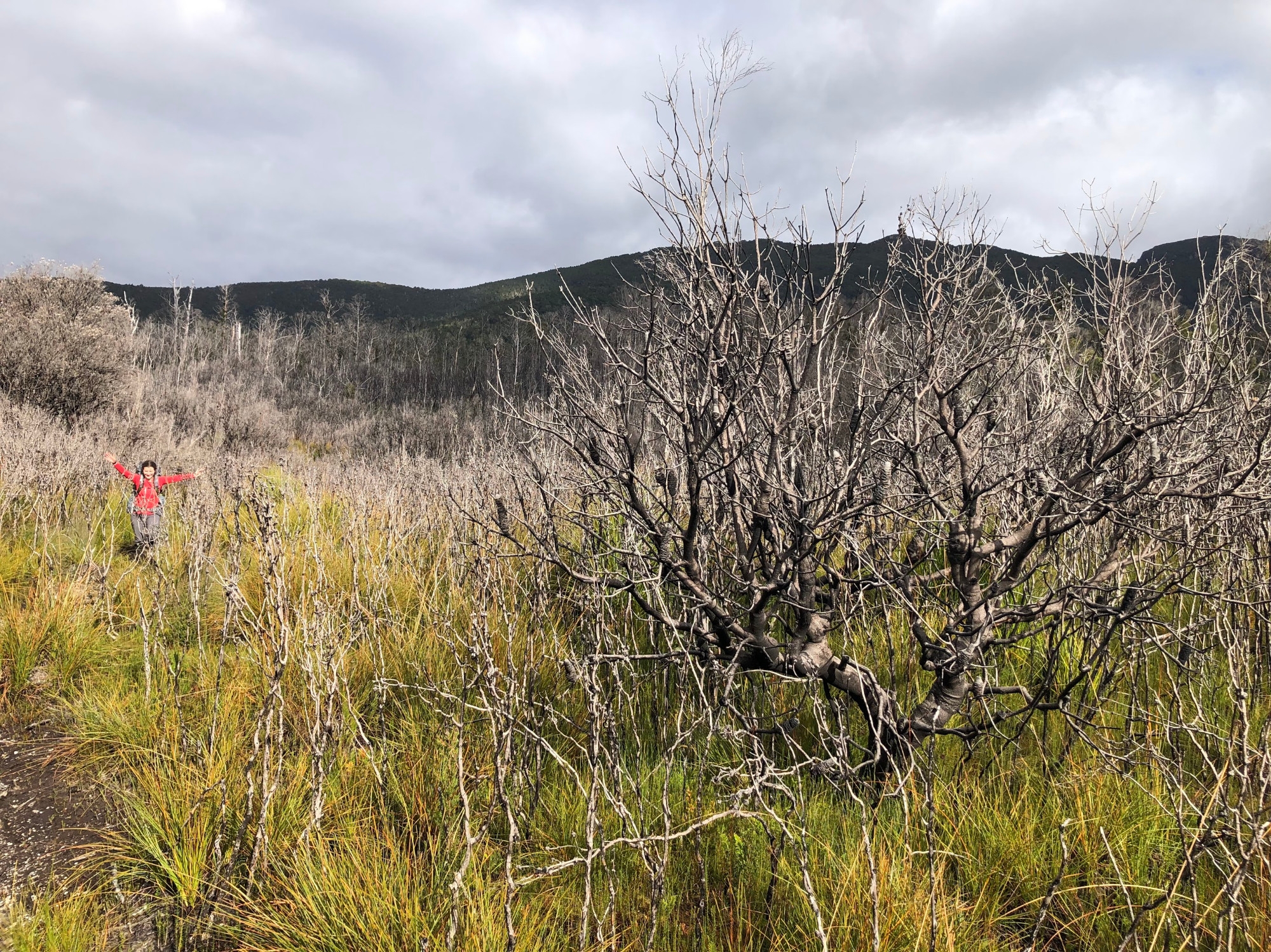
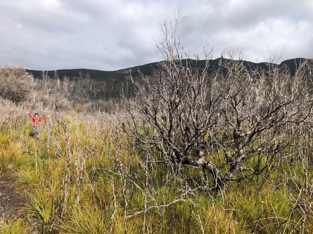
An easy half-day took us up over South Picton Saddle and across the button grass plains to the South Cracroft River campsite. Being the SW there was plenty of moss-covered fallen timber to climb over and sloughs of liquid mud to negotiate, but there has been a lot of track work here and its a nice walk. We took frequent stops for Sam to photograph the extraordinary range of fungi in the forest, bright red buttons and pink and orange many-branched coral fungi being the highlights.
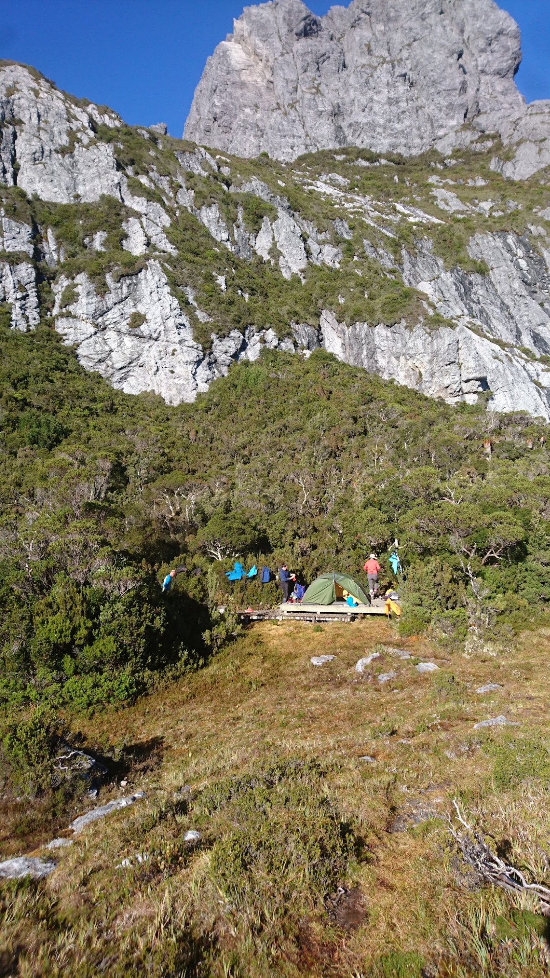
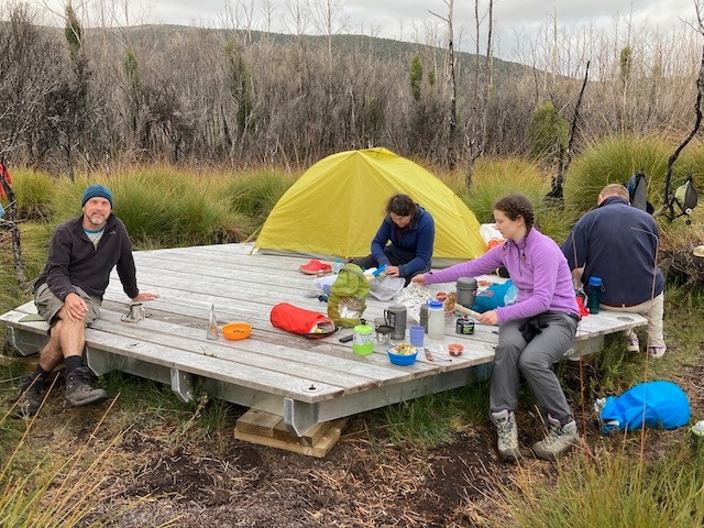
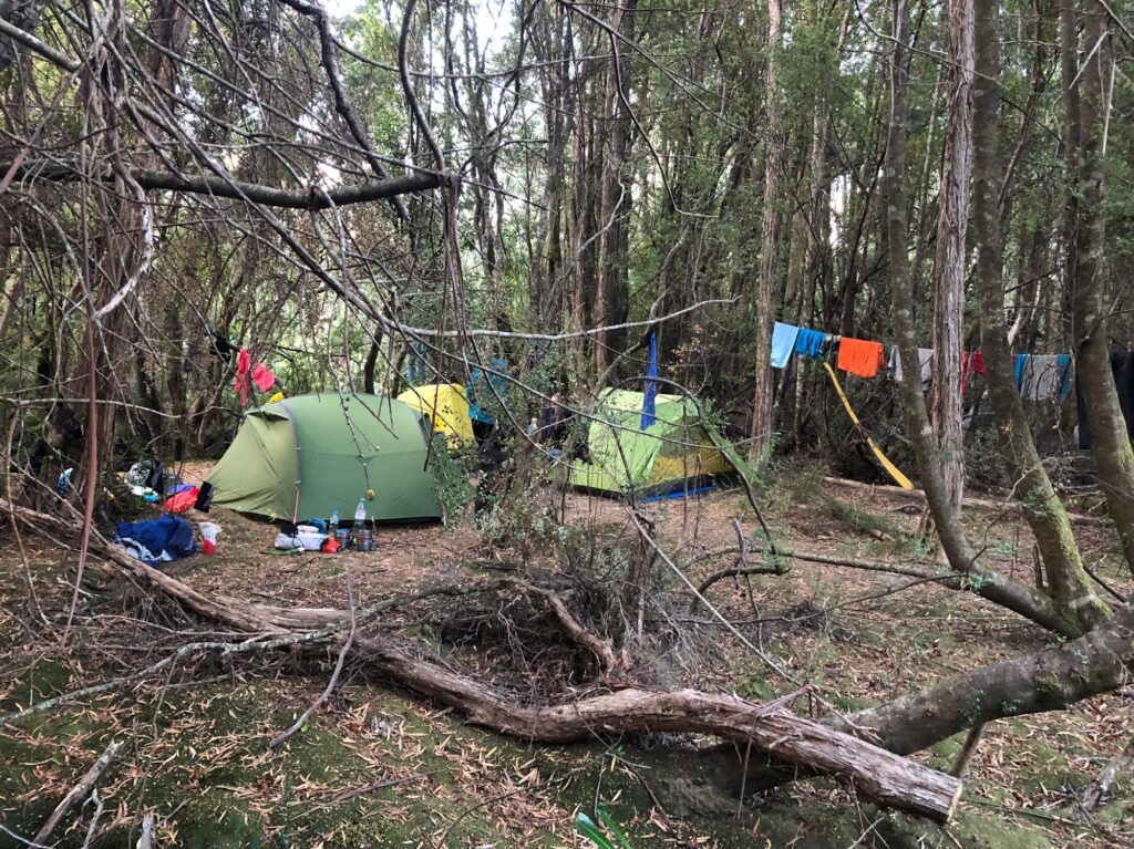
Two of the three wooden camping platforms were free, so we fitted two tents on one platform and used the other for one tent and a cooking area. It was nice to have a long, relaxing first evening, chatting and getting into expedition mode, but in reality we would have done better to push on to Crest Camp.
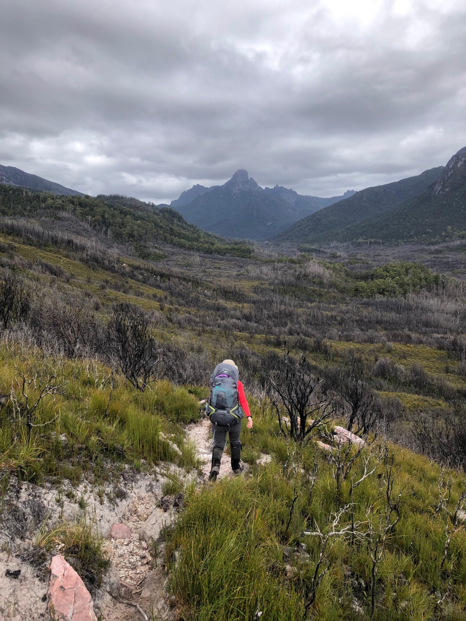
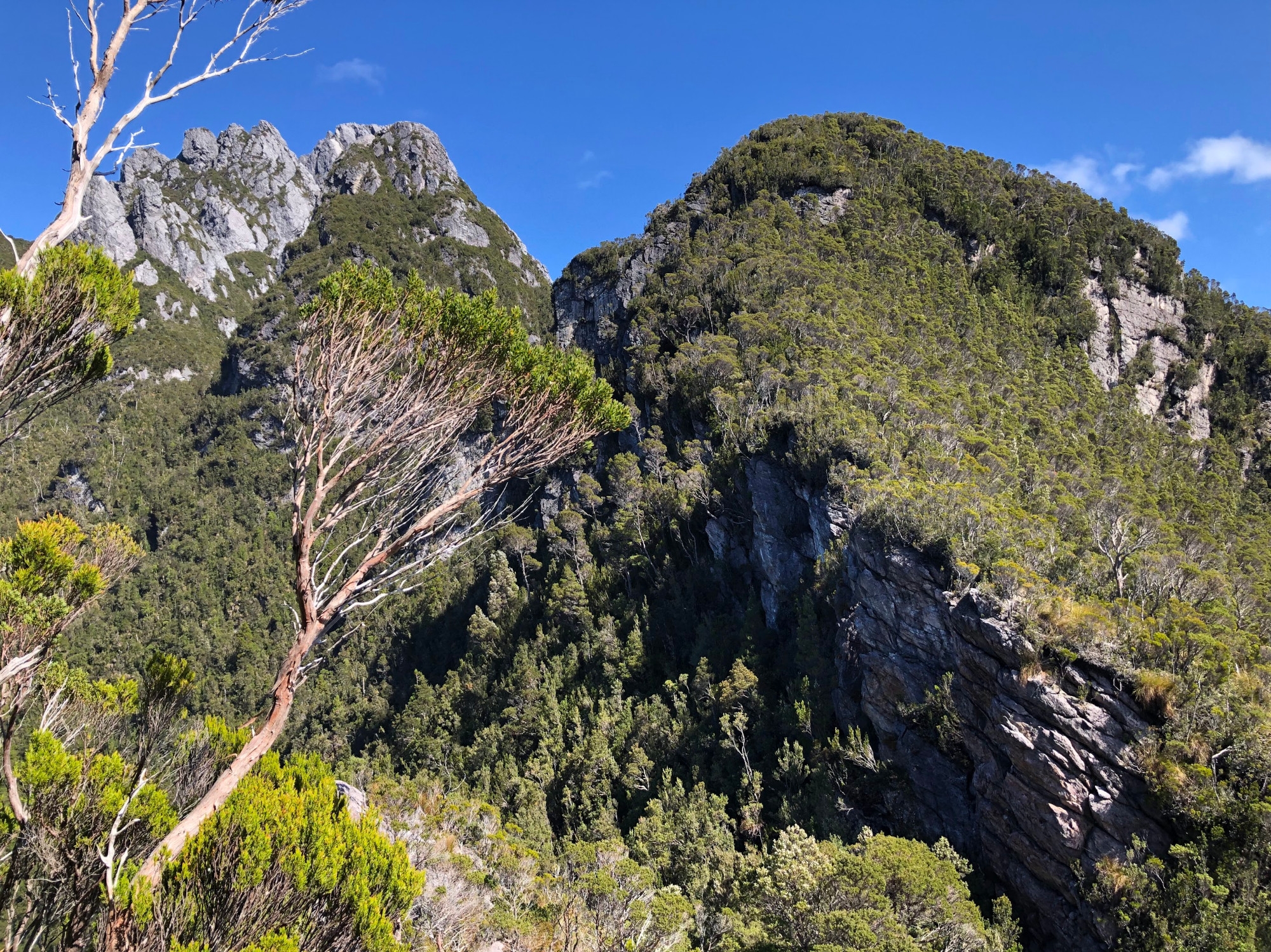
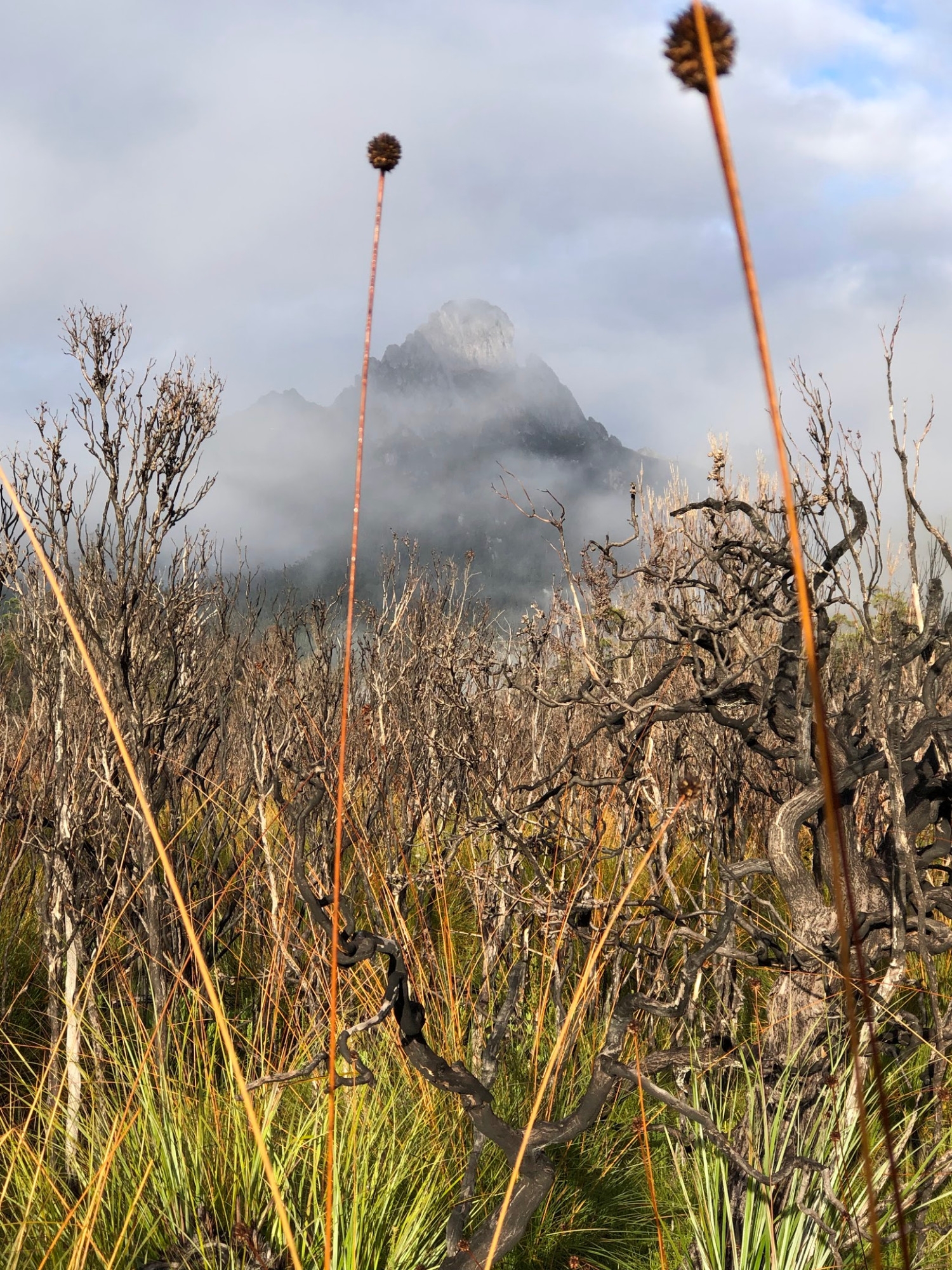
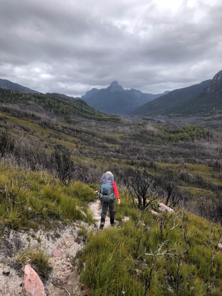
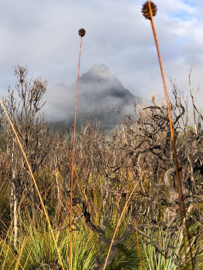
Next morning we set off across the plains and up onto a moraine ridge. On the other side of the ridge we got our first real view of Federation peak, a vast rocky triangle at the head of the valley – the classic view on an approach to a mountain. We soon reached Crest Camp, which would have been a wonderful place to wake up, nestled in the trees at the edge of the forest with panoramic views of the mountain from the nearby watering spot – a fast mountain stream with crystal clear water.
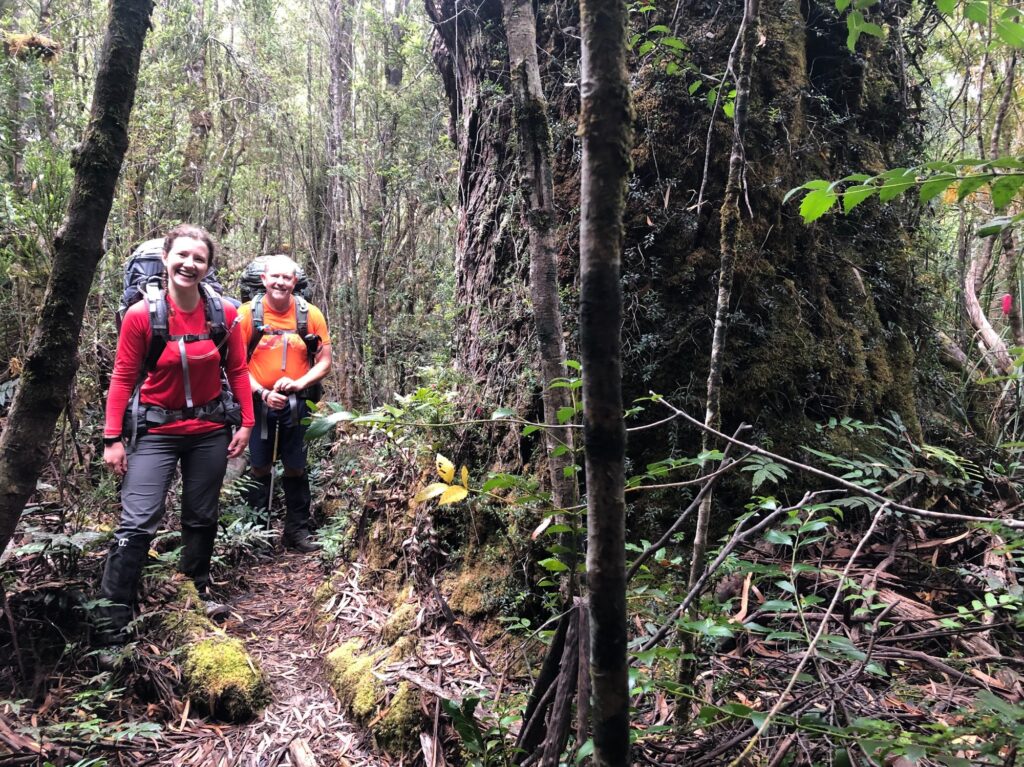
For the next few hours the track follows the valley floor, switching back and forth between the dark, moss-covered forest along the river and the button grass plains. The track is rougher and there’s more mud, but in this dry year it was still easy going by SW Tassie standards. There are a number of attractive riverside campsites before the track turns up a side-creek to reach Cutting Camp, where we had lunch. We had walked 7km and only had 3km to go, but that 3km is….Moss Ridge!

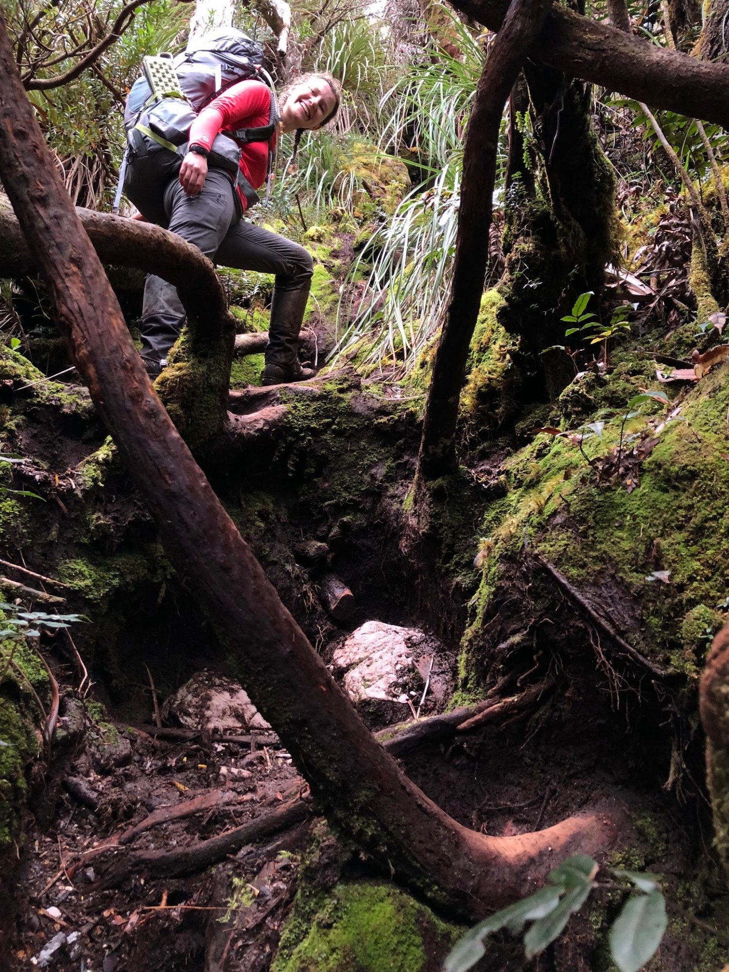
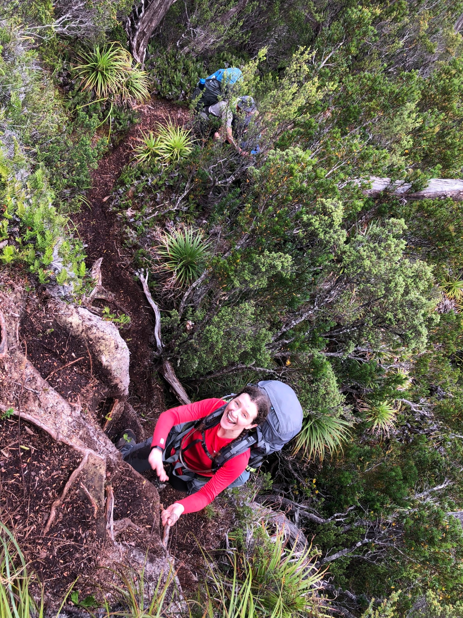
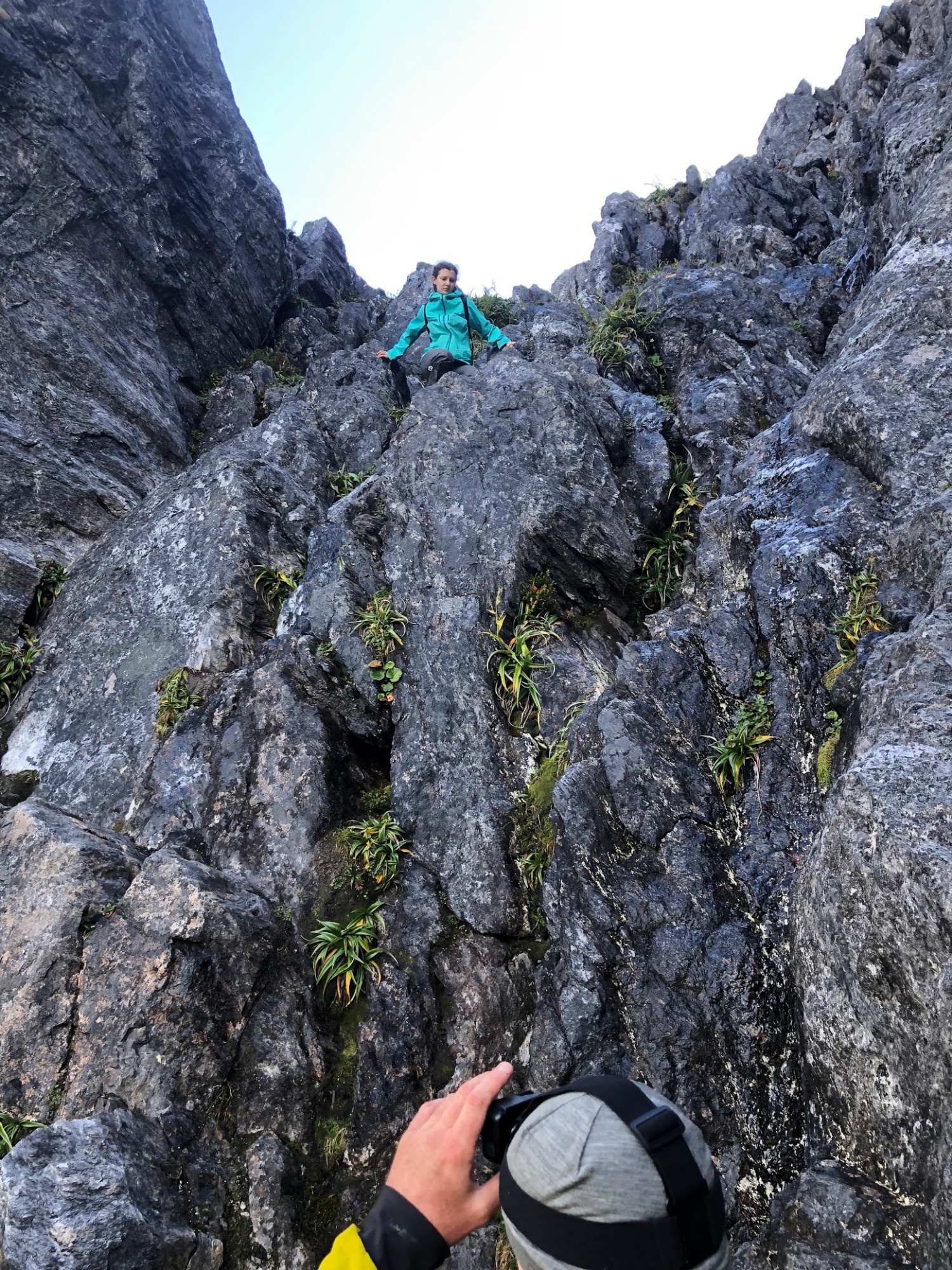
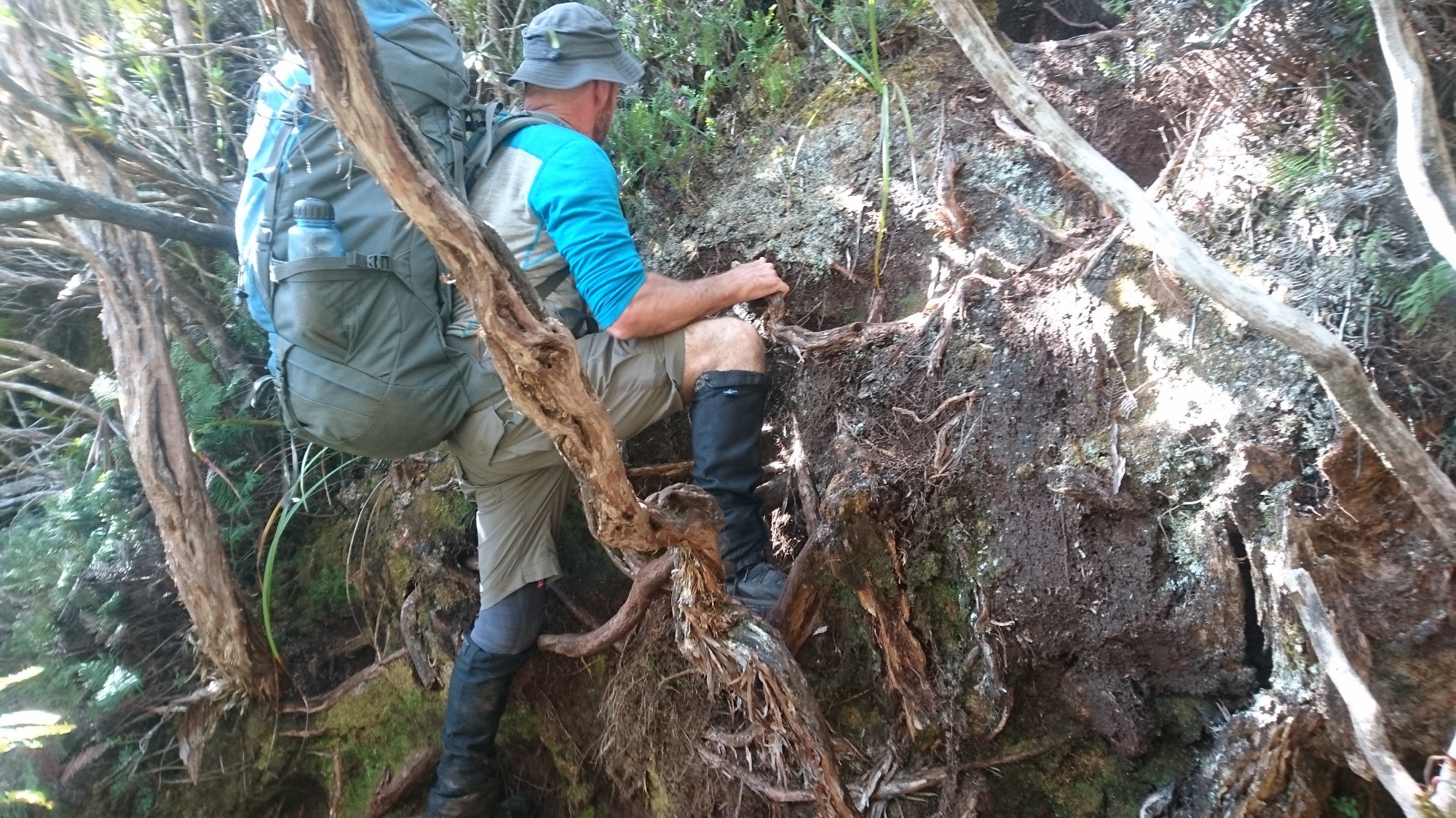
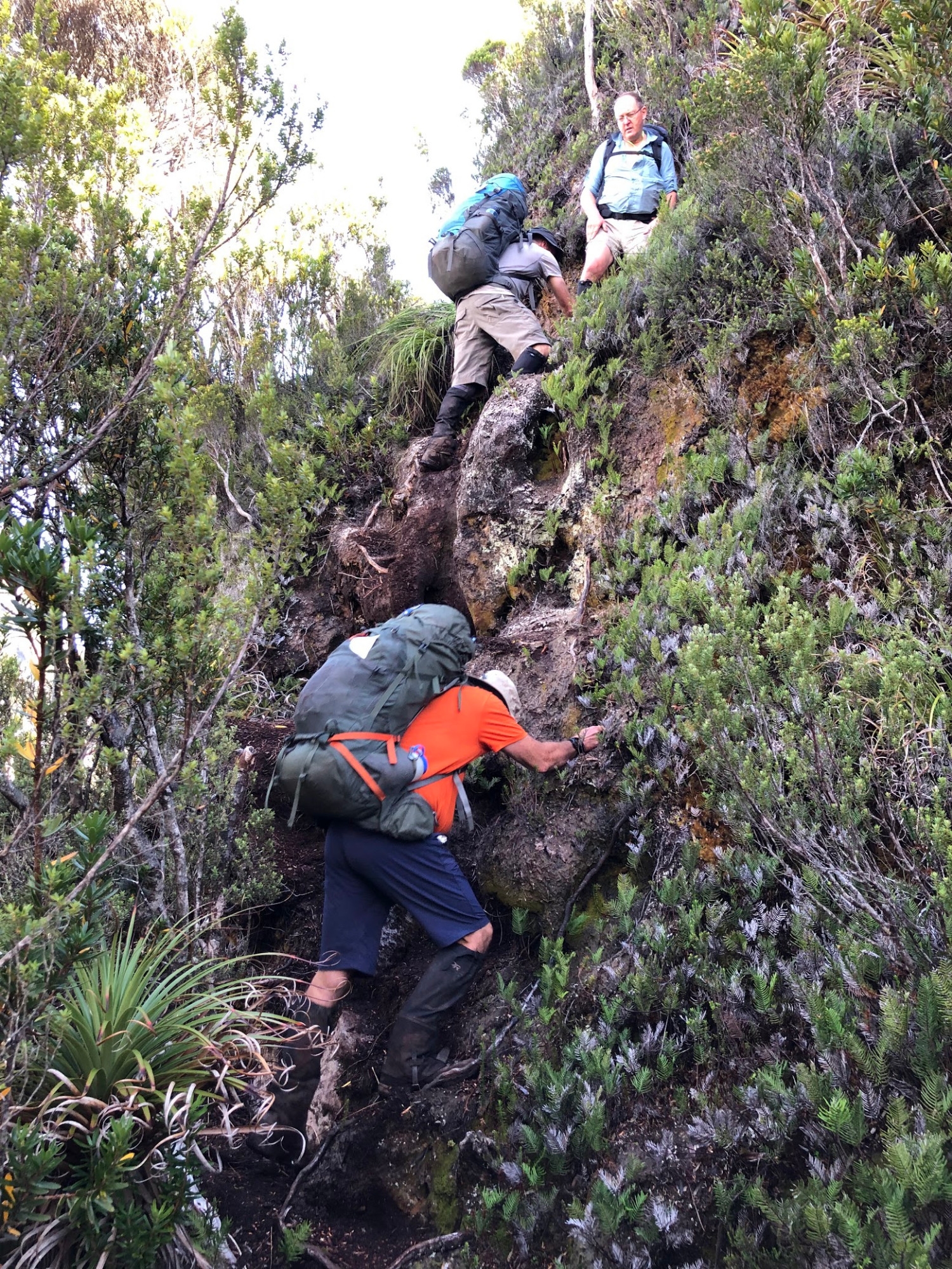
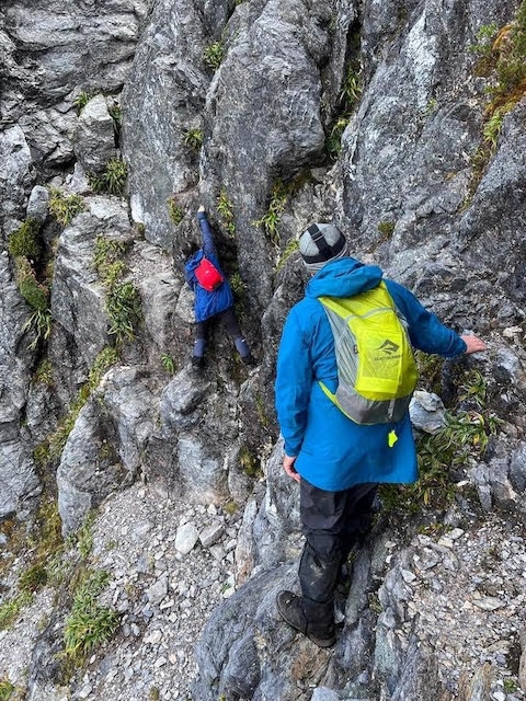
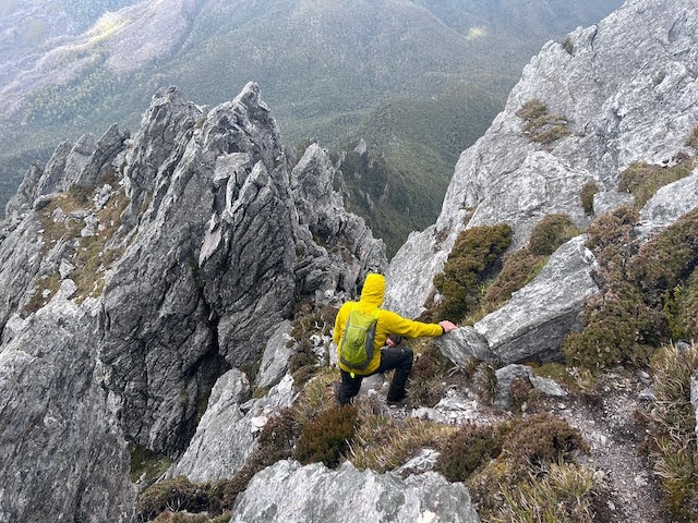
Moss Ridge is a spur of Federation Peak that climbs about 600m to the Bechervaise Plateau, one to two campsites on the shoulder of the mountain from which you can attempt the summit. The first half of the ridge is straightforward. It’s a steady, steep climb through a jungle gym of tangled roots and fallen trees. Heaps of fun, especially if it’s not too wet, but slow going. The second half is a series of rocky knolls, like the Beggary Bumps in the Western Arthurs. The track climbs up and down a series of rock pinnacles, mostly covered in scoparia scrub. It goes seventy metres up forty metres down, and so forth. But at the same time the track goes continually up and down on a smaller scale – two metres up, six metres down, three up, five down and so on for hour after hour. A few of these scrambles are on rock, but most are ‘mud ladders’ where footholds have been kicked into the mass of soil and roots and you use the incredibly tough roots of the scoparia shrubs as handholds. Also fun, but very slow – in this kind of country it takes about an hour to cover 500m on the map. At long last we reached the steep slope of scoparia scrub that leads up onto the plateau. The walk from South Cracraft river to Bechervaise Plateau had taken us 11 hours.

The light was fading as we put the tents up and it was eight o’clock by the time we remembered to send our daily ‘all going to plan’ message and map reference to our families. We used a Garmin InReach Mini satellite pager as there is, of course, no phone coverage out here. Its main purpose was to get real-time weather forecasts, the value of which we had realised in the Western Arthurs next year. Should I stay in my tent today, or is this rain going to ease off? Is this a good morning to attempt the climb, or is a weather system coming in? Really useful. You can also use it to send an SOS to the emergency services, but a PLB (Personal Locator Beacon) is probably more reliable. We had Geoff’s PLB with us as a back-up. SUBW has two PLBs in the Gear Locker.
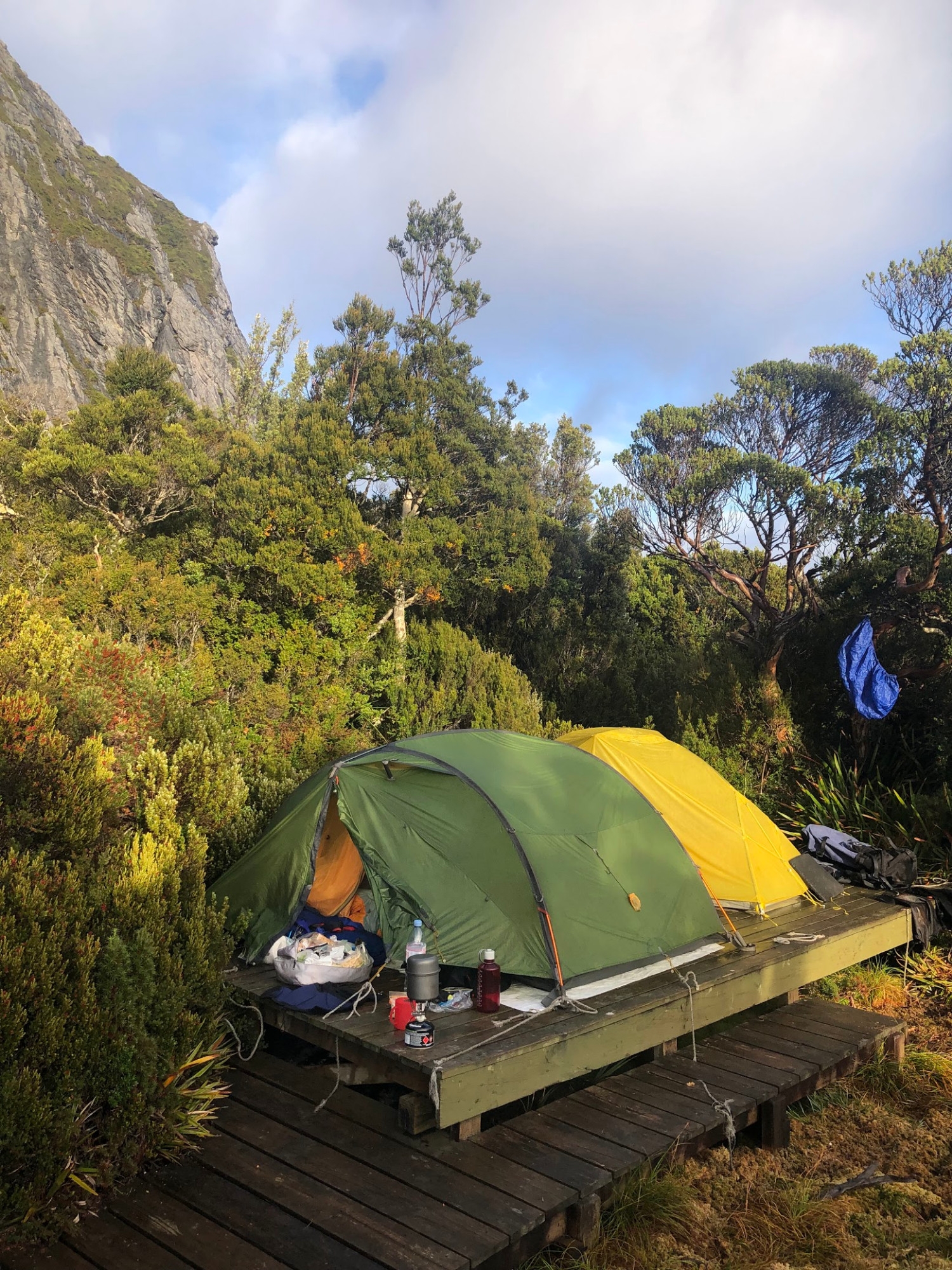
Only six people are supposed to camp on the platforms at Bechervaise at one time, and not for more than two consecutive nights. Fortunately, no-one was there and the platforms comfortably accommodated the five of us. A boardwalk has been installed to protect the delicate alpine vegetation and connect the campsite to the little swamp where you can collect water. We religiously followed the instructions about toileting downstream of the water source, and cutting and replacing a square of vegetation to leave no trace. But it still did not feel right, and if we came again we would bring a poo-tube and pack our waste out.
As soon as the tents were up it started to rain – perfect timing. We cooked dinner in the tents and went to bed. As well as requesting weather from Garmin, on the advice of a park ranger we asked a friend to text us the forecast from the YR website, which is said to be more accurate. Both services predicted the rain would clear in the morning, so we went to sleep feeling optimistic about the summit.

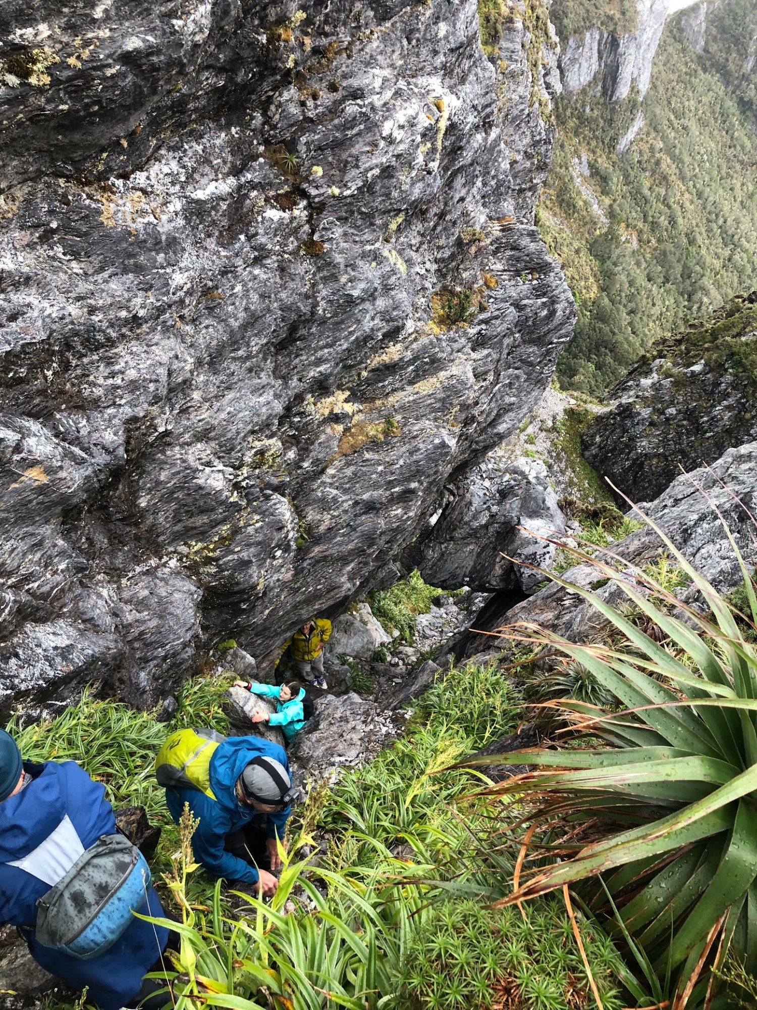
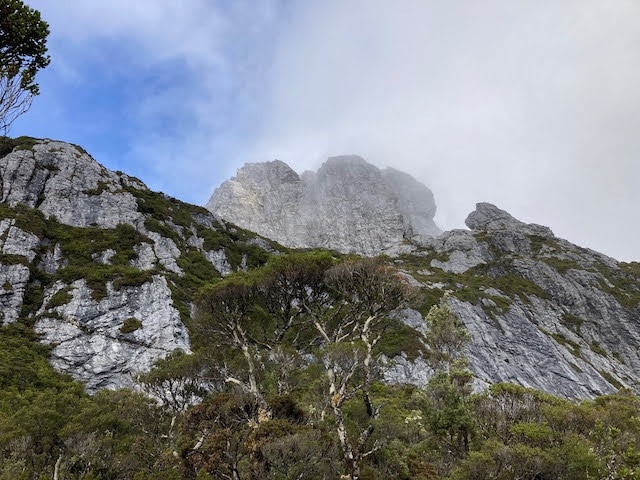
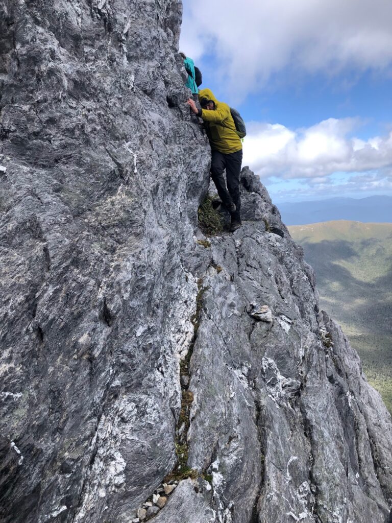
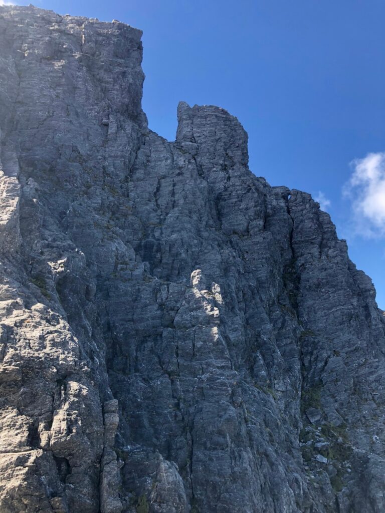
Next morning, Day three of the trip, the rain had eased to occasional drizzle and the peak was visible high above us, with clouds drifting around it. We loaded essentials into our little daypacks and followed the track to the start of the Southern Traverse. This route connects the Bechervaise Plateau to Thwaite’s Plateau, the campsite on the other side of the mountain. Halfway along it is the Direct Ascent route to the summit. Direct Ascent is also known as the ‘Bushwalkers Route’ as it is the only route to the summit that does not need ropes, but it is still a real climb. The Southern Traverse begins by ascending a near-vertical fifty metre cliff on little ledges of scoparia root and mud, connected by mud ladders. Its probably one of the more dangerous parts of the trip! At the top you are looking directly up 300m of rock to the summit.
The track then plunges down a near-vertical gully, with several small downclimbs, at the end of which you can traverse to ascend Chockstone Gully, climbing up underneath the eponymous boulder wedged between the rocky walls.
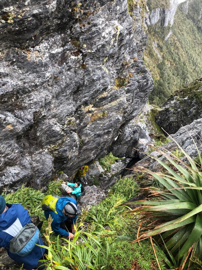
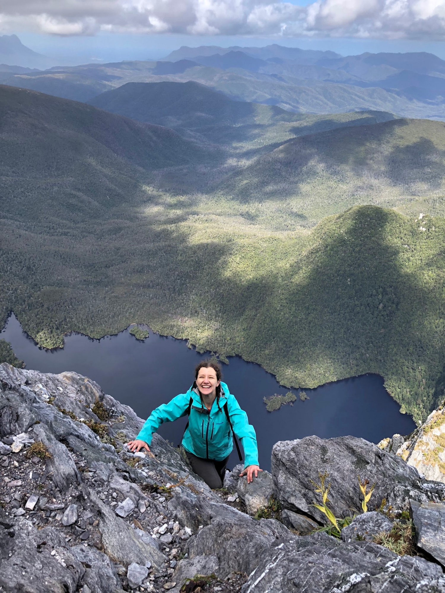
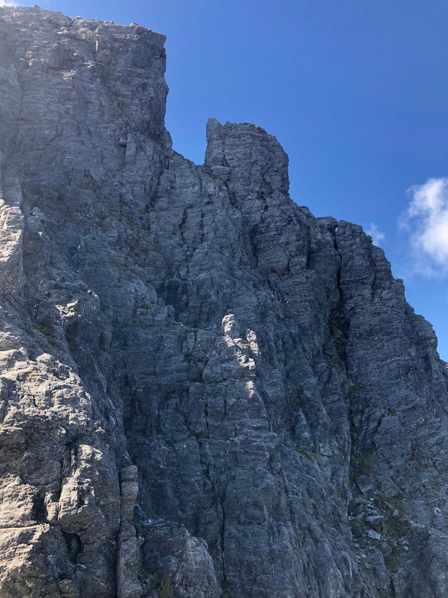
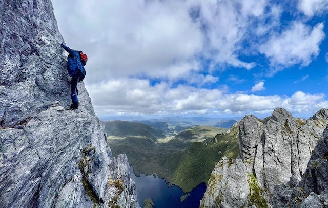
Soon we were below southwest cliffs of Federation Peak, admiring the spectacular pinnacles of rock that surround the main peak and Lake Geeves gleaming in the sun hundreds of meters below. The drizzle stopped and the clouds cleared – a perfect opportunity to summit. We started to climb. At the first traverse Geoff and Marty decided that discretion was the better part of valour, and they would not continue. Everyone fully endorsed this decision – its about the journey – and Fran led just Sam and Paul onwards and upwards. The second traverse leads into a gully where you don’t feel exposed so this part of the climb was not scary at all. But eventually we found ourselves at the section where “sheer rocky walls bar the way” as Chapman writes. Looking down we could see the tiny figures of Geoff and Marty in a patch of sunlight between two massive rock pinnacles from where they were watching the climb.
Chapman’s notes suggest climbing the left corner of the wall, but there was a cairn a few metres out to the right on a ledge, and investigation showed that a small arête at this point provided access to the ledge above. This is where the climb gets scary, as you swing out to climb the arête above what feels like a sheer drop of 600m to Lake Geeves. In reality you would hit the talus slope and bounce, eventually coming to a rest in the scrub somewhere below, although that’s not really better.
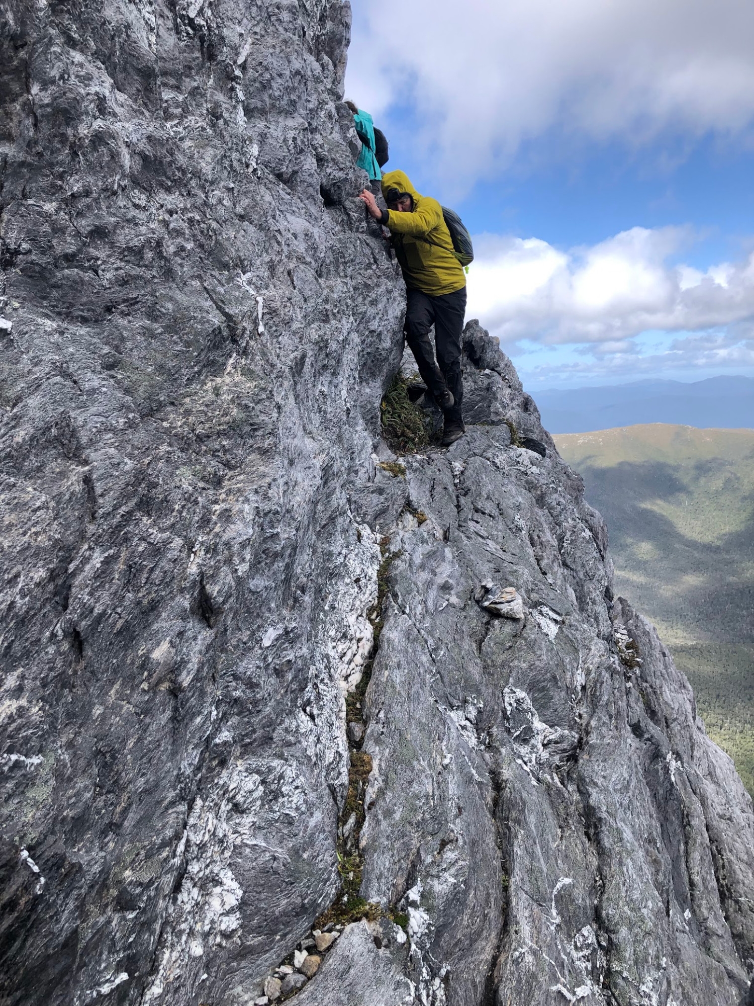
Now the three of us found ourselves standing on the famous ledge. The rockface is near-vertical at this point, but there is a decent ledge to stand on. The ledge narrows until it becomes a mere crack in the rock. But that crack that provides good footholds, and has good handholds above it. So you can traverse right until you reach a crack you can climb up to the next level. It’s not a technically demanding climb – rated a mere 5 on the Eubanks scale – but the exposure is terrific. We had discussed bringing ropes, but the consensus is that that they are of little use on this difficult section and complete overkill on the rest of the climb. And for that you have to carry ropes, harnesses and gear the whole way. Having done the climb we agree with the consensus.
Fran led us out along the ledge and up to the next level. I went last, and as I eased myself up over the edge I could see Sam and Fran sitting on a rock on a moderate slope – lovely! It was easy scrambling from here to the summit. On the summit platform we whooped and cracked massive smiles at one another. Time for film, photographs and lunch.
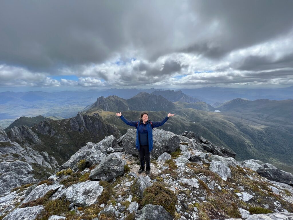
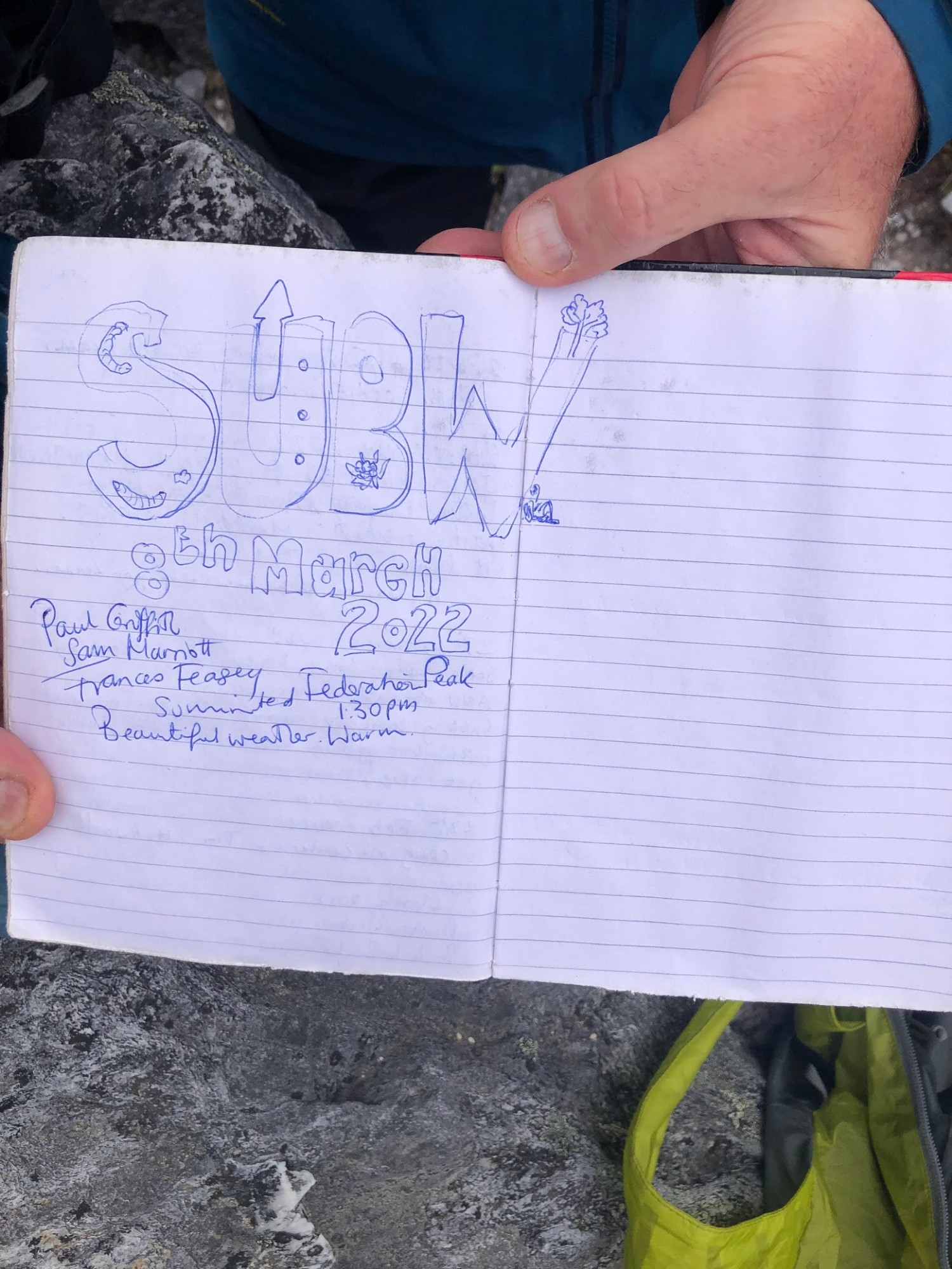
We found the log book in its metal storm case lodged in a cairn and weighted down with rocks. Fran drew the SUBW logo, as tradition demands, and we added our names. We flicked back through the book to find some friends who had summited earlier this summer.

After half an hour it was time to descend. Easy enough until the route simply drops off a cliff. But having come up, we knew that if you ease yourself over the edge there is a foothold, and then a handhold, and then another foothold, and so forth until you are safely back on the ledge. Then we repeated the process on the little arête and then the climbing became easier.

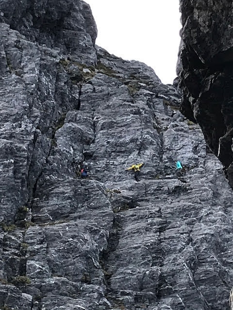
After perhaps forty-five minutes we were back on the southern traverse and high-fiving Geoff and Marty. They showed us some film of our tiny figures on the ledge, which was as scary as actually being there.
We went slowly back along the Southern Traverse, taking in the landscape on a gorgeous sunny afternoon. In the far distance we could see Precipitous Bluff and a tiny patch of white – the surf on the south coast below the Bluff. This, we decided, should be our goal in 2023. Back at camp we had a cup of tea and then a relaxed evening chatting, cooking and taking sunset photos.
In the morning there was frost on the tents and the camping platform, but the sun was up and quite intense, so we took the opportunity to hang sleeping bags and tent flys out to dry. The mountain above us was spectacular in the bright morning light.

We set off down Moss Ridge. Unfortunately, early in the day Marty fell into a hole on the track and hurt his ribs. The track is basically a boulder field covered in scrub, so this is an easy thing to do. Climbing and jungle-gym-ing through the vegetation with a cracked rib was excruciatingly painful, but he soldiered on and we stopped for morning tea on top of the highest knoll, where we had some of the finest view of the whole trip.


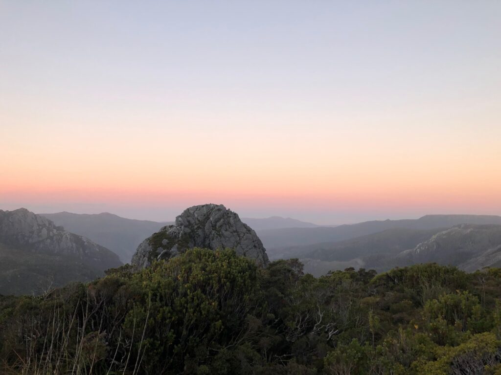
After a late lunch at Cutting Camp we decided to head for a nice flat site we had seen along the river. This meant we could have our first proper wash on the trip (no soap or detergent, of course!). The water was freezing but you always feel great afterwards and sleep much better for a wash. That evening the weather closed back in and Sam took some great time-lapse footage of the peak, towering at the head of the valley with veils of cloud passing across it.
Our plan the next day was to make a side-trip to Lake Sydney. In the SW it is always best to allow extra days so you can wait it out if bad weather comes in. So had allowed two days at the Bechervaise plateau and had a day in hand. However, although we were now on a decent track there was still plenty to climb over and around, and that’s pretty tough with a cracked rib. So when we got to the Lake Sydney track, we decided to give it a miss. Our decision was reinforced by the fact that the first few hundred metres of that track was deep mud through a mass of head-height cutting grass! Instead, we pressed on to a delightful campsite alongside Farmhouse Creek. We had another lovely wash, and after dinner got through all the extra chocolate and the last of the rum.
These riverside campsites did suffer from clouds of mosquitoes, but Marty had brought the terrifying 80% DEET Bushmans and with long sleeves, rainpants and Bushmans smeared on everything else we had hardly any bites. We had two leeches and one bee sting, so overall a pretty good trip as far as insects are concerned. The rats were not bad either, compared to previous trips. We were trying to hang everything containing food in the trees, but Fran left some sweets in a side pocket of her backpack one night and a rat chewed through it to get to them. But we had no damage to the tents.
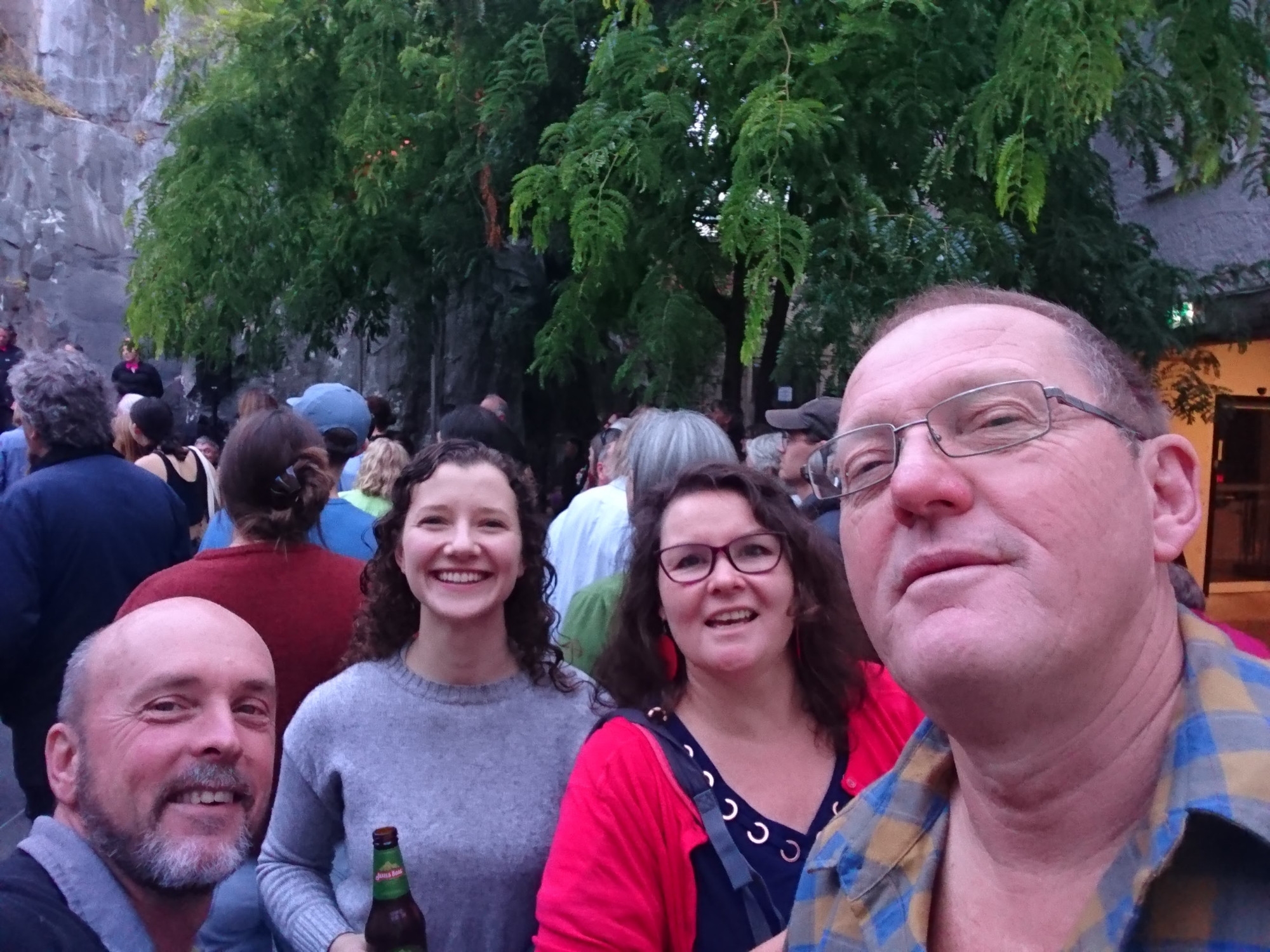
The next morning we had just a couple of hours to walk to our pick-up point. That left us with a few hours by the river drinking tea, reading and sleeping. Sam impressed everyone by floating in a freezing pool until she turned blue – cold immersion is supposed to have all sorts of health benefits and she certainly seemed to enjoy it. Eventually Tasmanian Wilderness Adventures arrived to drive us back to Hobart, where we rushed through our showers in order to catch the Friday night outdoor music at Rektango, something we were put onto a few years ago by then SUBW President Nanakie!

Federation Peak certainly lived up to its reputation for us. It’s an amazing trip, but not one to be undertaken lightly, and always remembering that if the weather closes in or some other problem arises, the mountain will still be there next year.