Date: 29/10/2023
Trip leader: Bruce Stafford
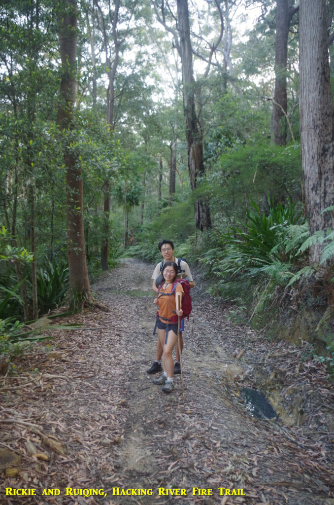
Party: Ben, Ruiqi(Rickie), Ruiqing, Sherry, Trevor, Yang.
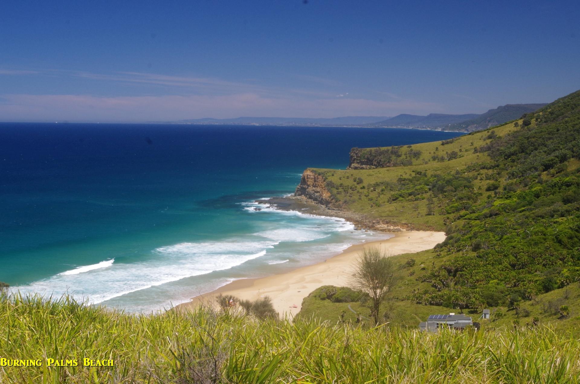
Otford to Burning Palms Beach/Figure 8 Pool, then Helensburgh, Sunday 29/10/23.
This day was chosen because it supplied a combination of good swimming weather, and a very low tide in the mid afternoon. This would make a trip to Figure 8 Pool fairly safe. There was however a moderate 1.7 metre sea swell forecast, which meant that we would still have to be careful there.
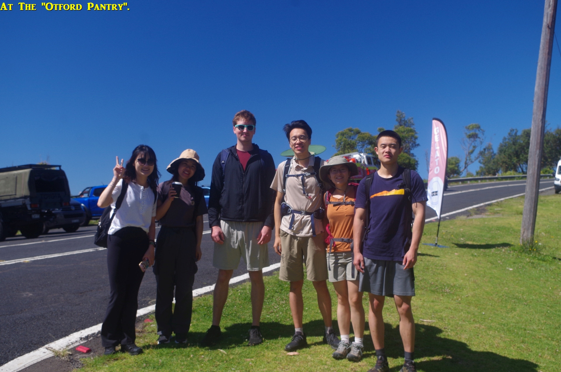
With people getting on at various stations along the way, we didn’t all completely meet up until we arrived at Otford Station. Immediately someone asked if this station has a “bathroom” (it hasn’t, nor does it have a toilet); (more about that later). My advice was, we will be at the “Otford Pantry” shop in about 20 minutes and they have a toilet. Otford Station does have a tap though on platform 1, so I suppose you could say it has a very basic “bathroom”!
Anyway, instead of going straight up the very steep Beaumont Road and its loose gravel underfoot, I led the group immediately right to follow the railway fence for about 200 metres along a dirt path under shady vegetation and onto Station Road and then left to go up the fairly steep Domville Road to reach the “Otford Pantry” shop. This way is 500 metres longer than going straight up Beaumont Road but is less steep and also very shady much of the way. And because the walk had started fairly early, we were not pressed for time – yet.

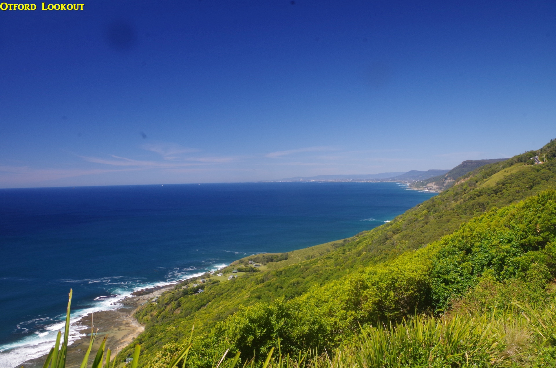
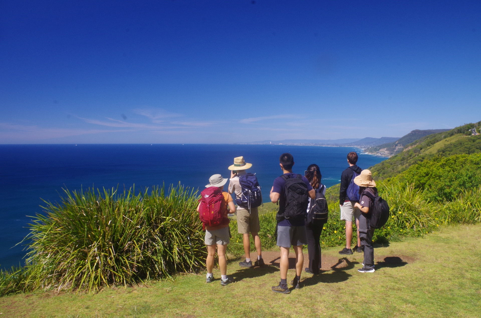
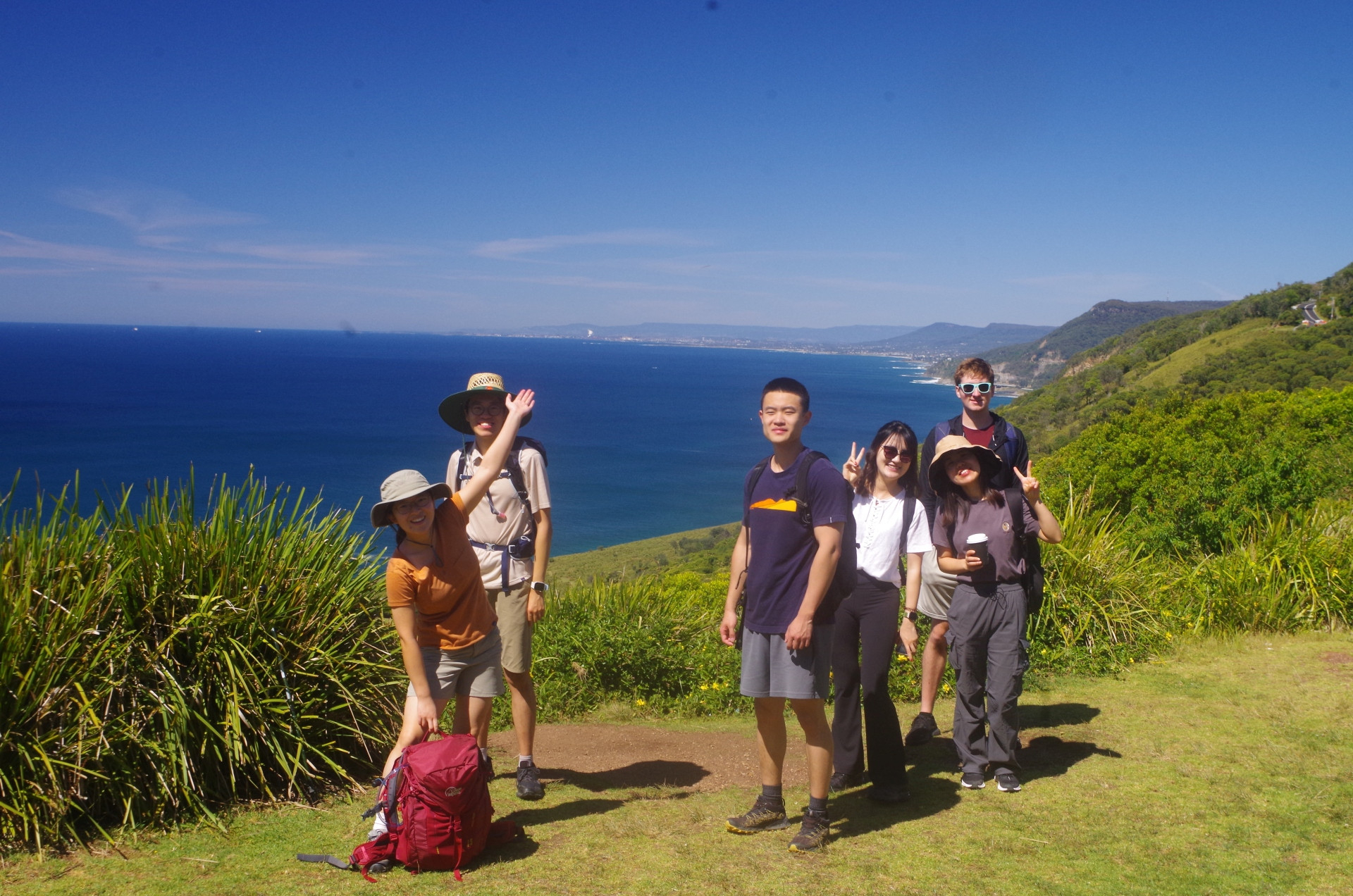
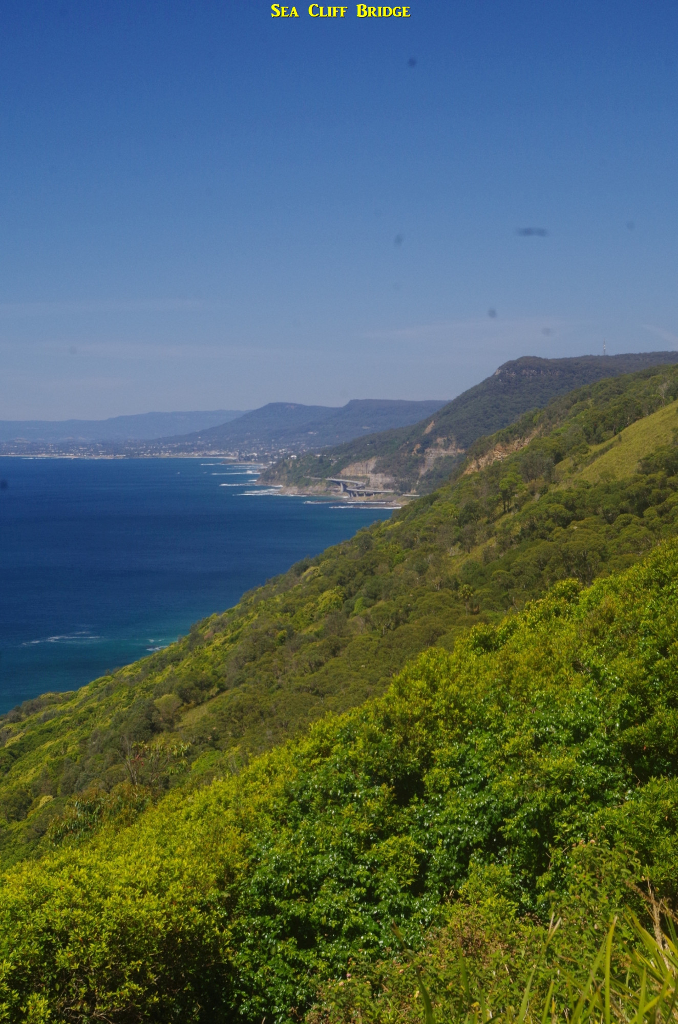
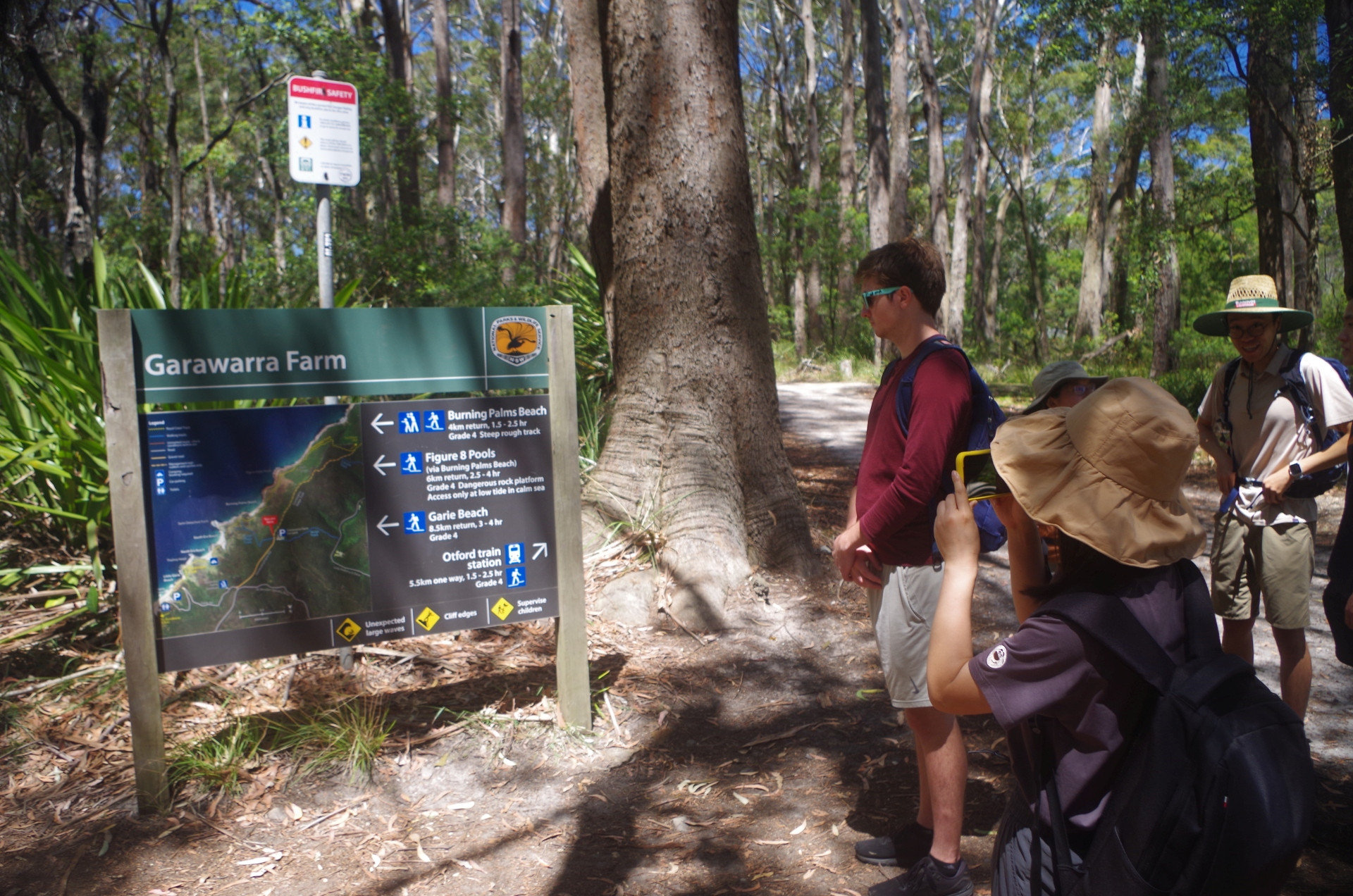
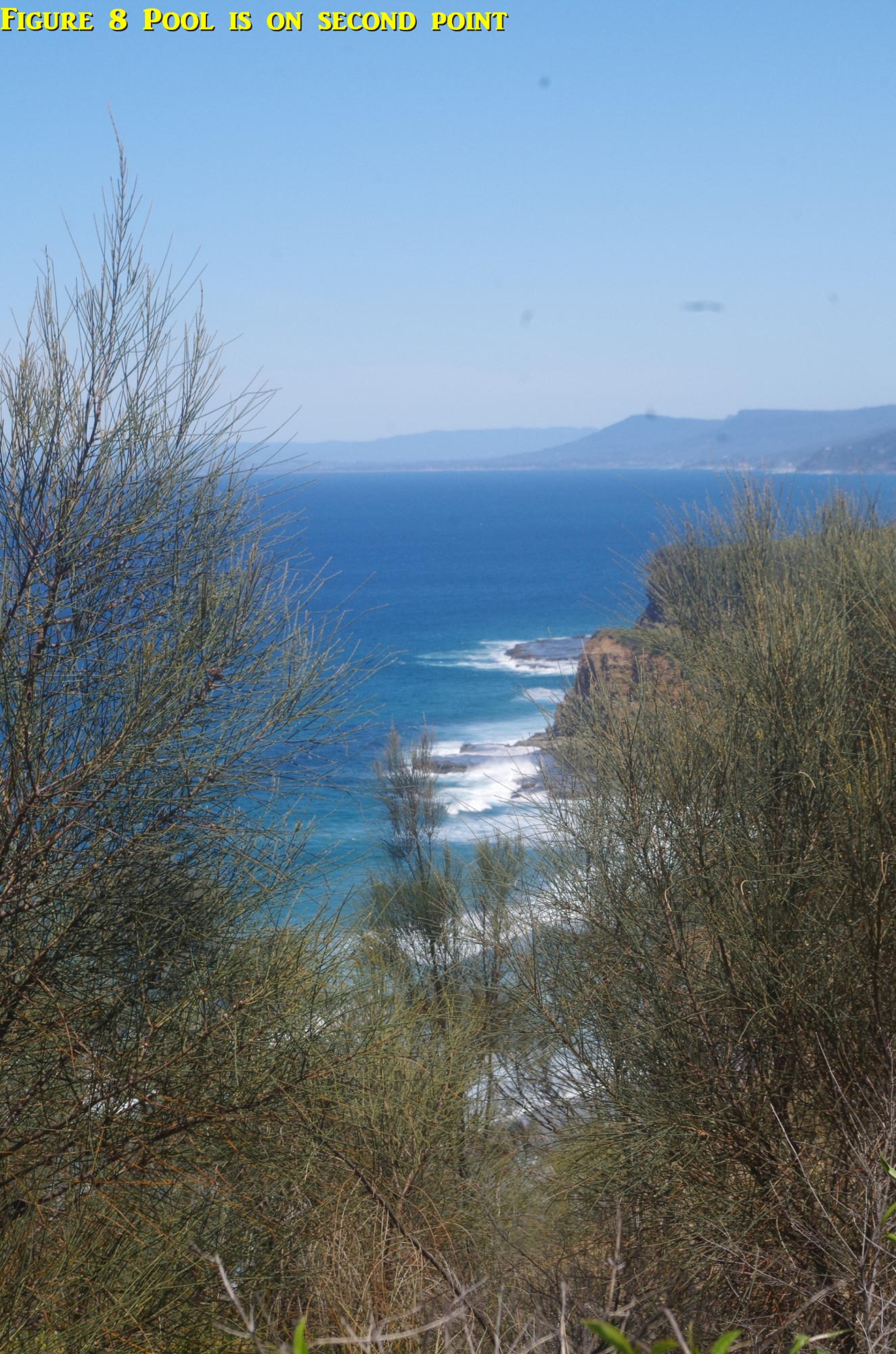
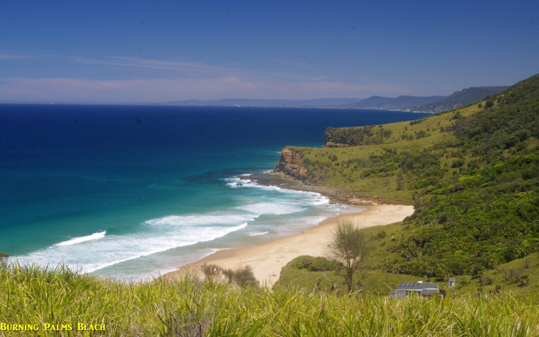
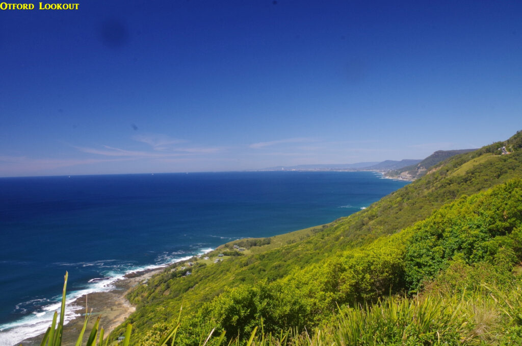
So after a break at “Otford Pantry” for coffee, and a toilet stop for a few, we set off along the unavoidable road bash along Lady Wakehurst Drive to Otford Lookout. It was a very clear day and so the view south extended a considerable way past Wollongong; the occasional puffs of steam from the Port Kembla steelworks could be seen, and also the much closer Sea Cliff Bridge at Clifton, south of Coalcliff. After a photostop there we came to the start of the Coast Track there, and immediately saw that track work is proceeding on a deviation of the Track to take it further away from the cliff edge. The original section along the cliff edge has been plagued with frequent closures over the last couple of years because of land slips, so it seems that the new deviation will avoid that problem. It also means that after Otford Lookout, there are no more coastal views until reaching Werrong Lookout another 2km further along (and at present needing a deviation off the Cliiftop track because the Coast Track via Palm Jungle is closed from that lookout on). And speaking of that closure, it means that the walk to Figure 8 Pool takes, at present, and extra 45 minutes from Otford as the route is via the Clifftop track (called “The Squeezeway” for some reason by “Wildwalks” website) to Garawarra Farm car park, then down the Burgh Track to Burning Palms Beach, then along the whole length of the beach to access the rock platfrom to get to Figure 8 Pool. When the Palm Jungle section is reopened (probably 1st July next year), the south end of the beach is much more easily and quickly accessible.
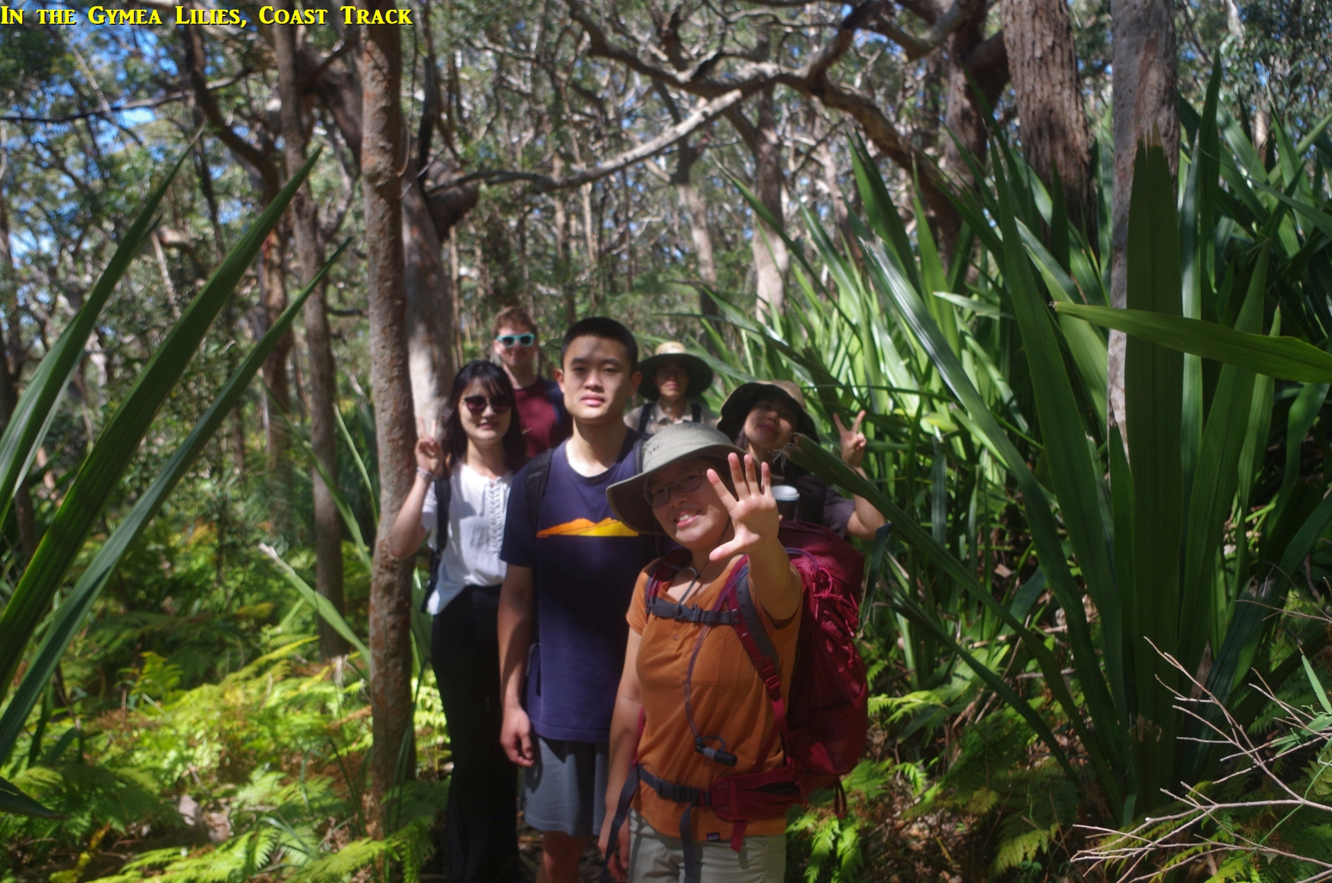
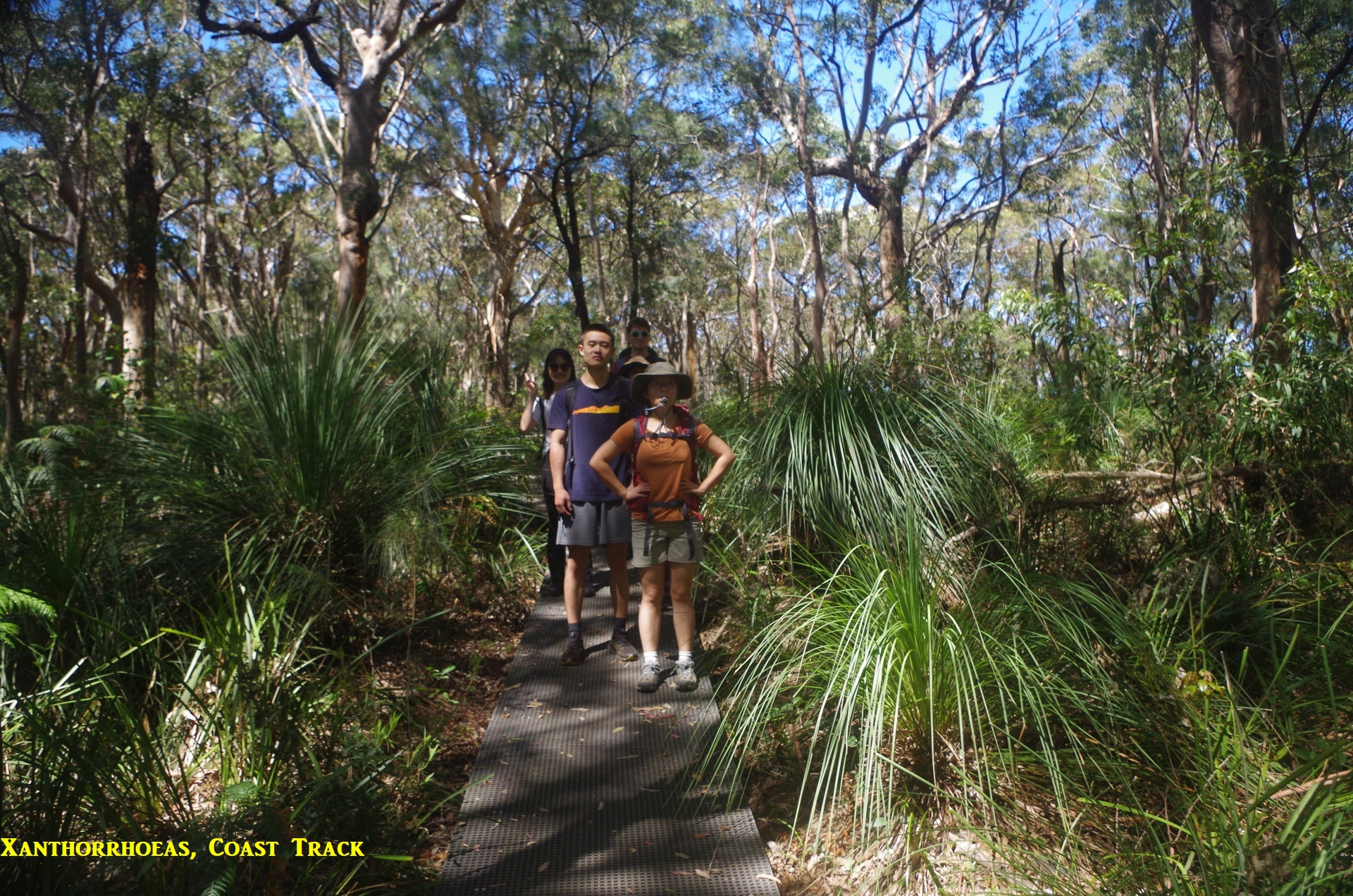
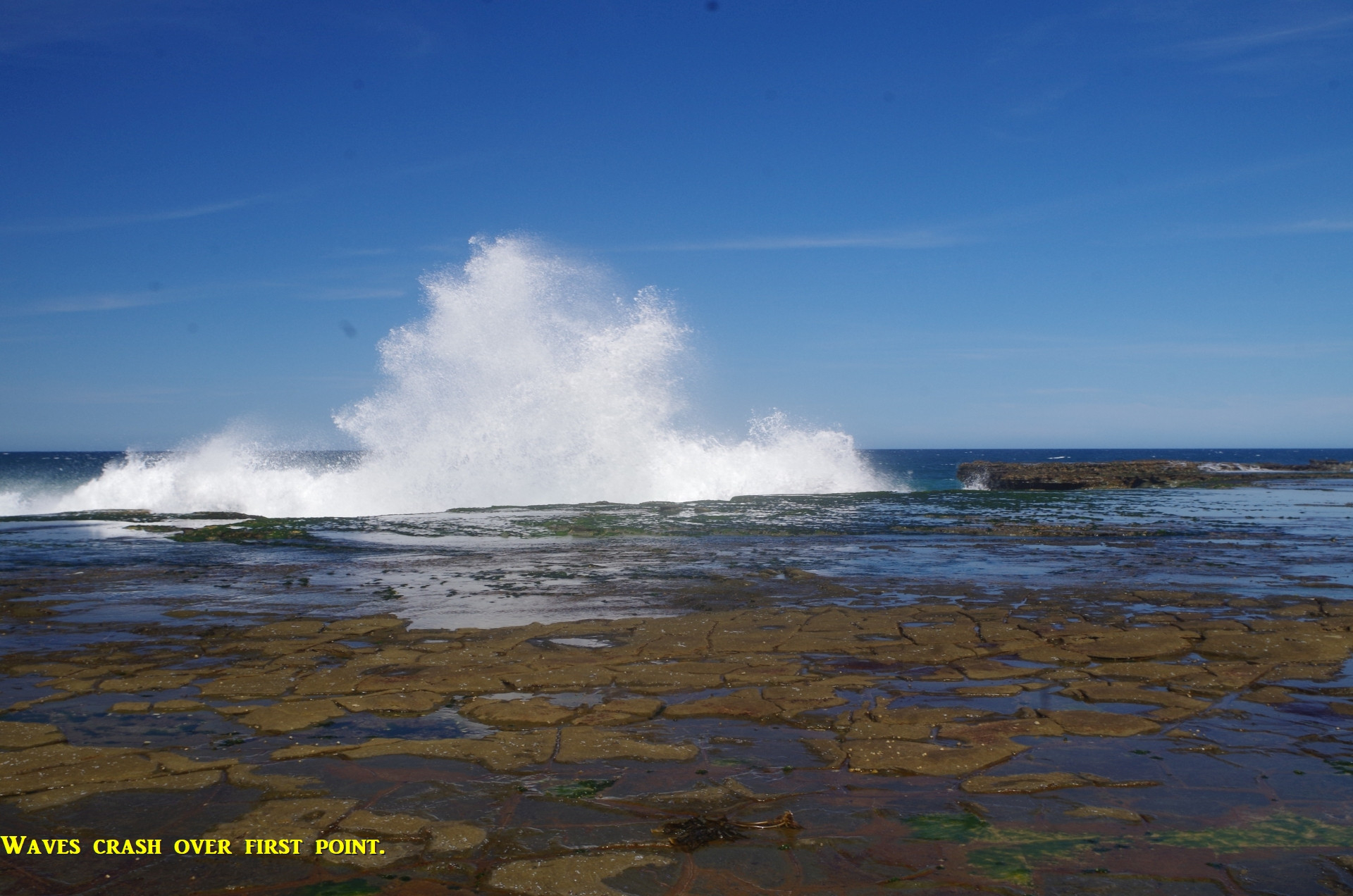
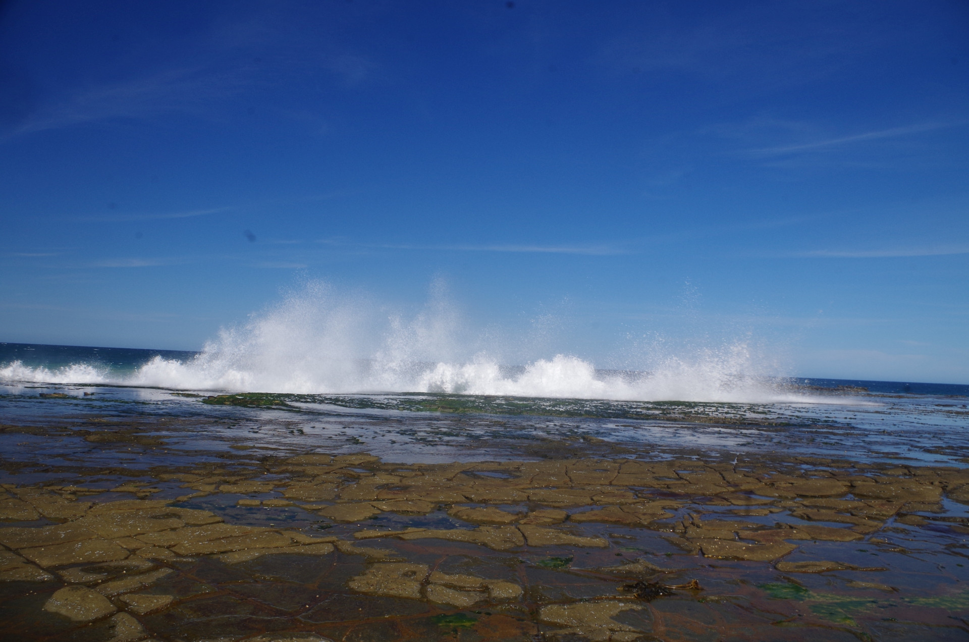
So we went along the Clifftop track to Garawarra Farm car park; the track was quite shady for most of the way, an advantage of using it mid morning and not the middle of the day. Near the Lilyvale Track junction (with its signpost gone) we saw a small dragon, a Jacky Lizard, but it was too quick to hide for us to get a photo http://reptilesofaustralia.com/lizards/agamids/amuricat.htm At Garawarra car park there was another toilet stop and break, and then we proceeded along the Burgh Track down to Burning Pams Beach. There are good view points along the lower part of the track, and it was pleasing to see that the annoying and difficult to cross boulder field that was in the middle of the beach on my last trip here in September last year, was now covered by sand. The significant sand erosion caused by frequent storms in 2021-22 had been repaired by nature. It could also be seen however that waves were crashing over the rock platform on which Figure 8 Pool is located (below the second headland past the beach). Low tide though was still three and a half hours away though so it wasn’t a complete surprise, but it indicated that the sea swell might have been bigger than the predicted 1.7 metres.
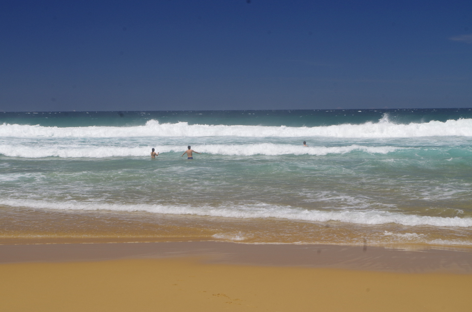
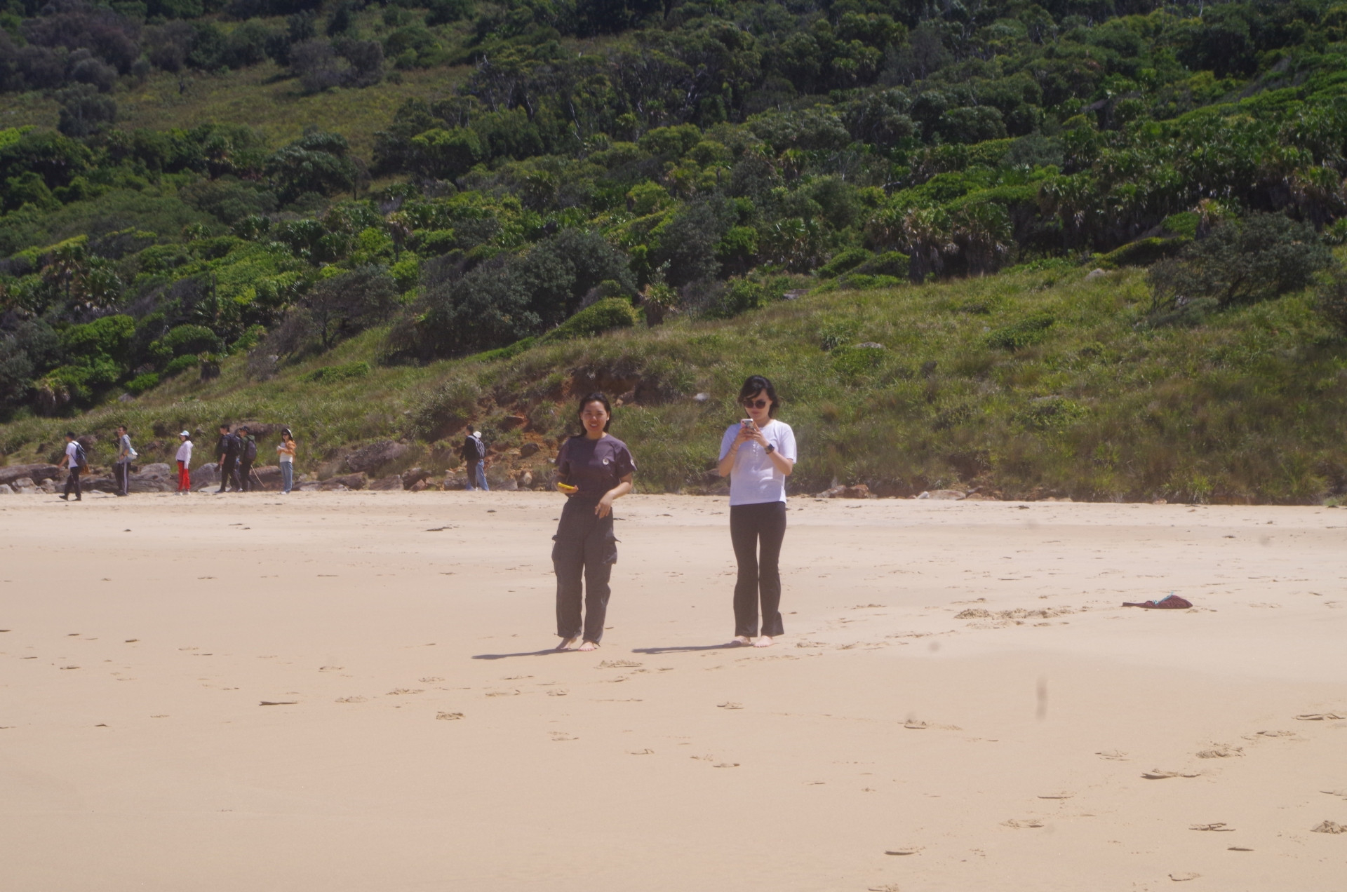
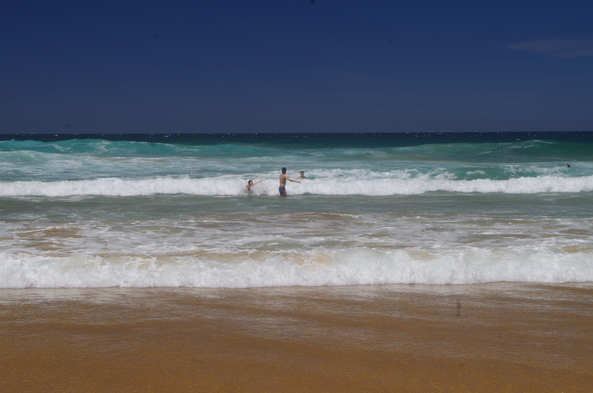
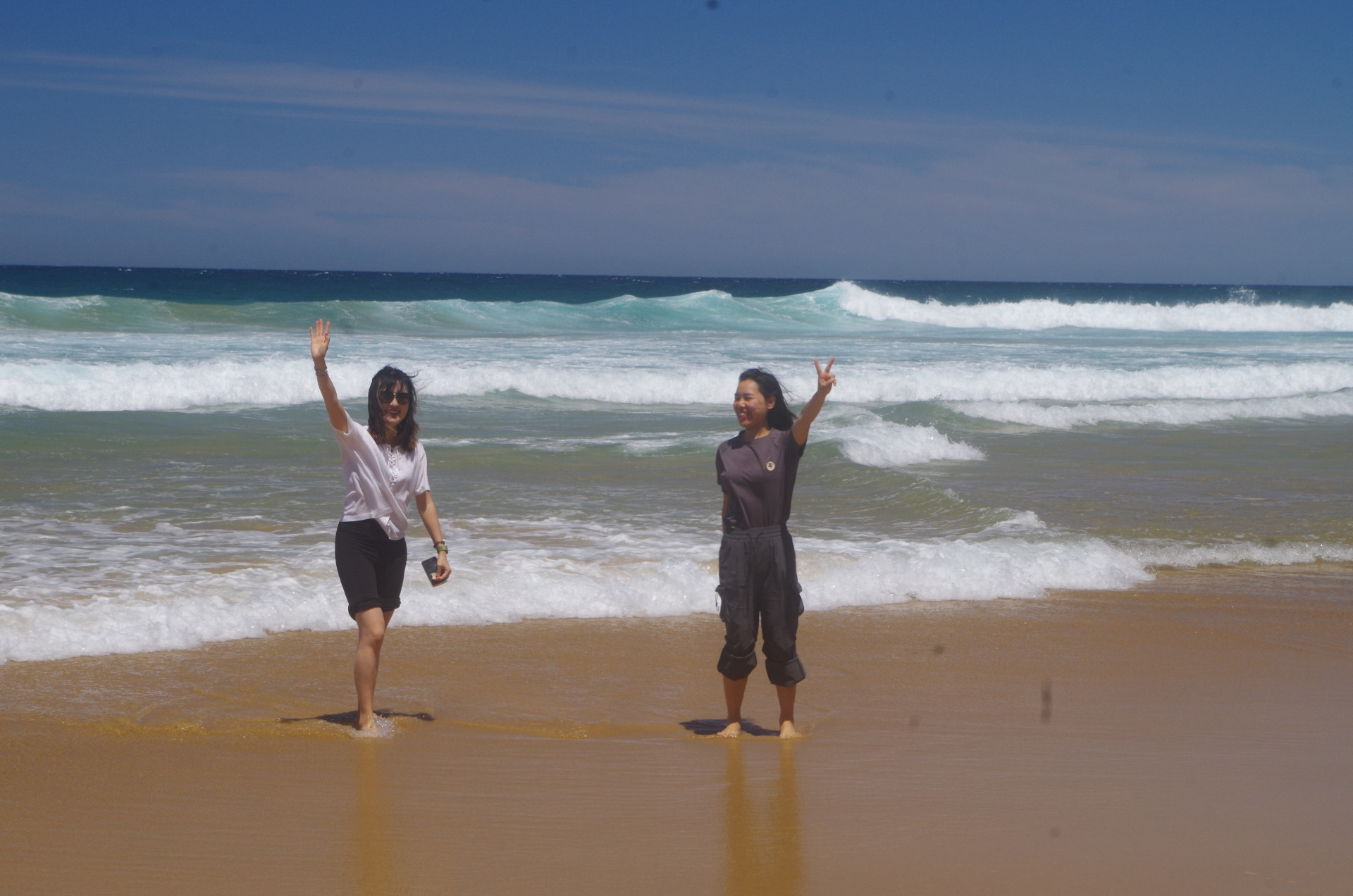
On reaching Burning Palms Beach we found a spot on some rocks which provided some shade, then Rickie, Ruiqing, Trevor and myself went into the surf for a swim (the local Surf Lifesavers were on patrol nearby). The waves were not too bad buit the water felt quite cold on first getting in! Sherry and Yang just had a paddle at the surf edge. Then it was lunch time.

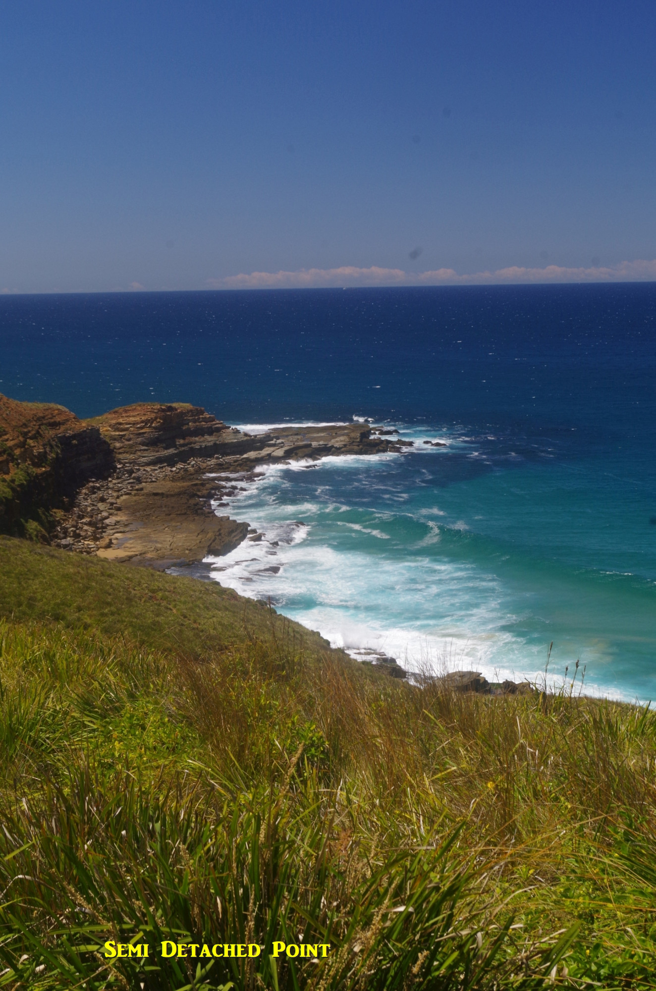
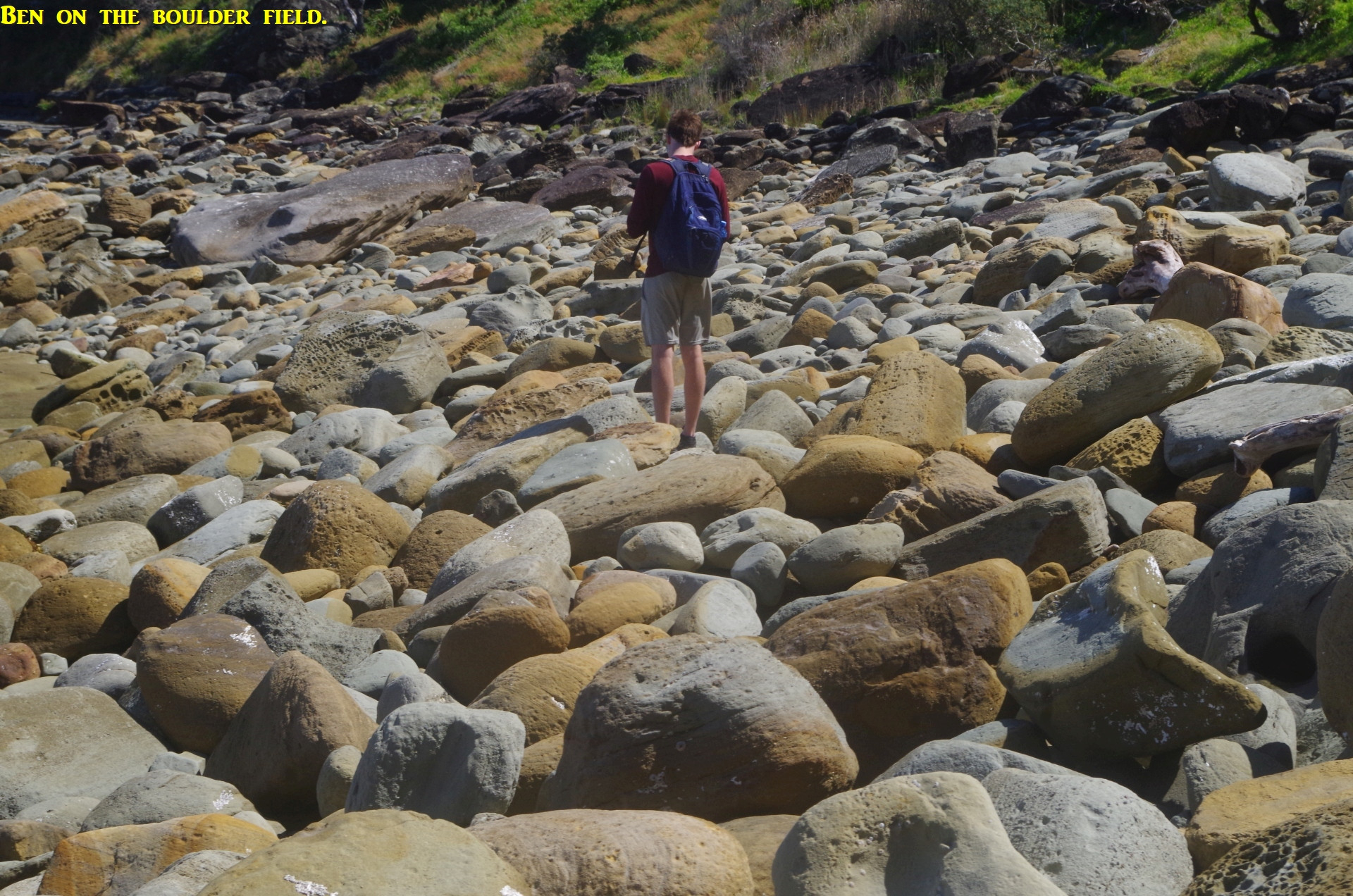
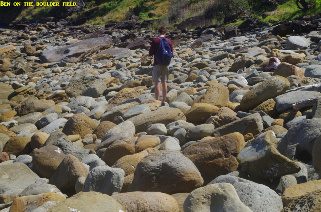
After lunch we set off along the length of the Beach to reach the first rock platform near the base of the first headland. The tide still had an hour to fall to its lowest, so there were waves breaking over the rock platform because of the moderate sea swell. This meant that to avoid clambering over rocks there, walking through the quite shallow water and not minding if your shoes got a bit wet was the easiest way (but still stay well clear of the sea’s edge!). The sea swell made the “walk” around the base of the first headland rather dicey (although another way is possible closer to the cliff side but is somewhat nore difficult). We were lucky that the “path” underfoot was fairly dry, but this section always needs special care. Once past that, there is a fairly easy section along a rock ledge, then the rough boulder field between first and second head which can be time consuming. The photo of Ben on this boulder field shows how rough it can be.
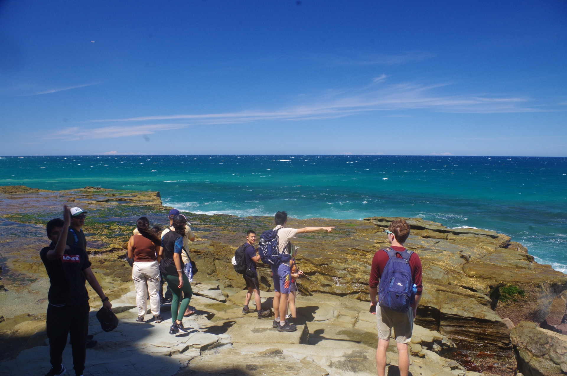
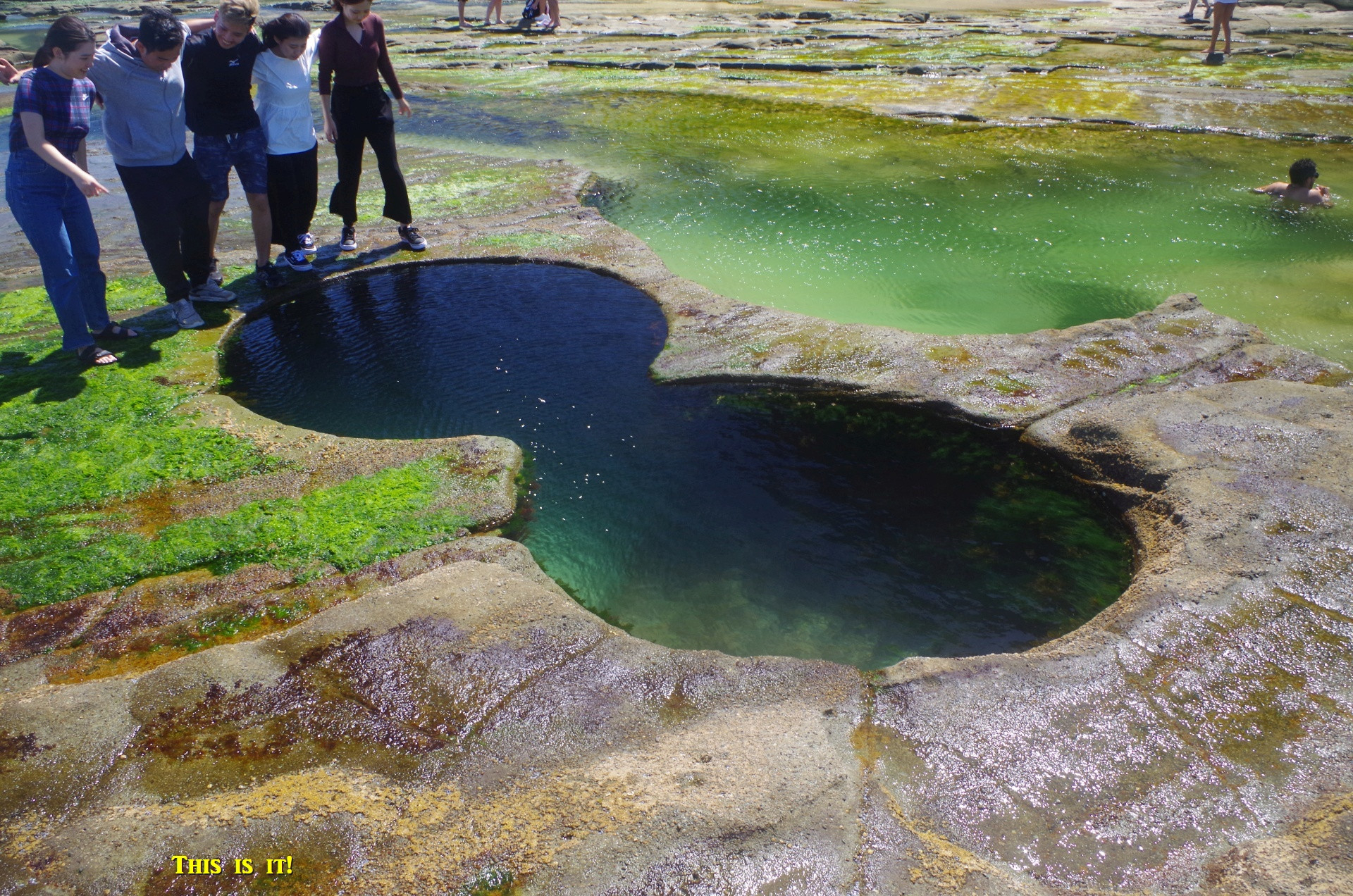
Once past that there is another rock platform which is easy to cross, as long as – as on this day – you don’t mind your shoes getting a bit wet. On reaching Figure 8 Pool, some were a bit disappointed at its small size, expecting something a lot bigger; indeed on one walk, some people who were a bit ahead couldn’t find what they thought would be an olympic-sized pool and just kept going! A lot of us locals can’t really understand the hype about what is a quite small rock pool, but I suppose some people think it will bring them luck. It’s been known about since the 19th Century, but it’s only in recent years that it has become so popular.

While there taking our photos, a larger wave washed over the edge of the rock platform and nearly swamped us, despite the still falling very low tide. This proves that you can never trust the sea not to play tricks on you no matter how safe it might look or how low the tide is. Ben asked me how high can the tide get, and I pointed out some Blue Periwinkles (a tiny sea snail) attached to rocks above his head. And that brings me to another important point that some people who have come here have not understood: a very low tide is always followed by a fast rising very high tide! They cannot understand why it’s not possible to stay here for hours, but that’s the reason.
Soon it was time to return to the beach and take advantage of the fact that the tide was about to reach its lowest point, making it safer to pass around the tricky ledge below the first headland (unfortunately I didn’t get any photos of that section as we have to concentrate of getting round it safely, not taking snaps). Then it was safely back on the beach, and then the walk along it to the start of the Burgh track up the hill to Garawarra Farm car park. That track is quite steep and challenging, although it levels out a bit about the third of the way along. It required some frequent stops for short rests and water breaks. To lighten my load (which includes some important heavier itmes like a First Aid kit), we did some pack swaps. On the climb up the steep section through the open woodland (thankfully shaded) we heard, and then saw, a couple of Lyrebirds. After a welcome rest at the car park, it became apparent that we would be pushing it to get the 6.23pm train at Helensburgh. This was due to our arrival and departure times from Figure 8 Pool being dictated by the tide; “Time and tide wait for no man” as the saying goes. The tides determine what train you will eventually get. We would easily get the 7.15pm train from Otford, but then, why do the same track twice when a different track to Helensburgh for the same train (at 7.23pm) was on offer (and originally planned)? So we set off along the Burgh Track on its much less used 2km section to the Hacking River, with a warning to keep an eye out for snakes as this track does not see much use. All the way to Helensburgh we did not see a single other person. The walking was very pleasant at this time of the afternoon.
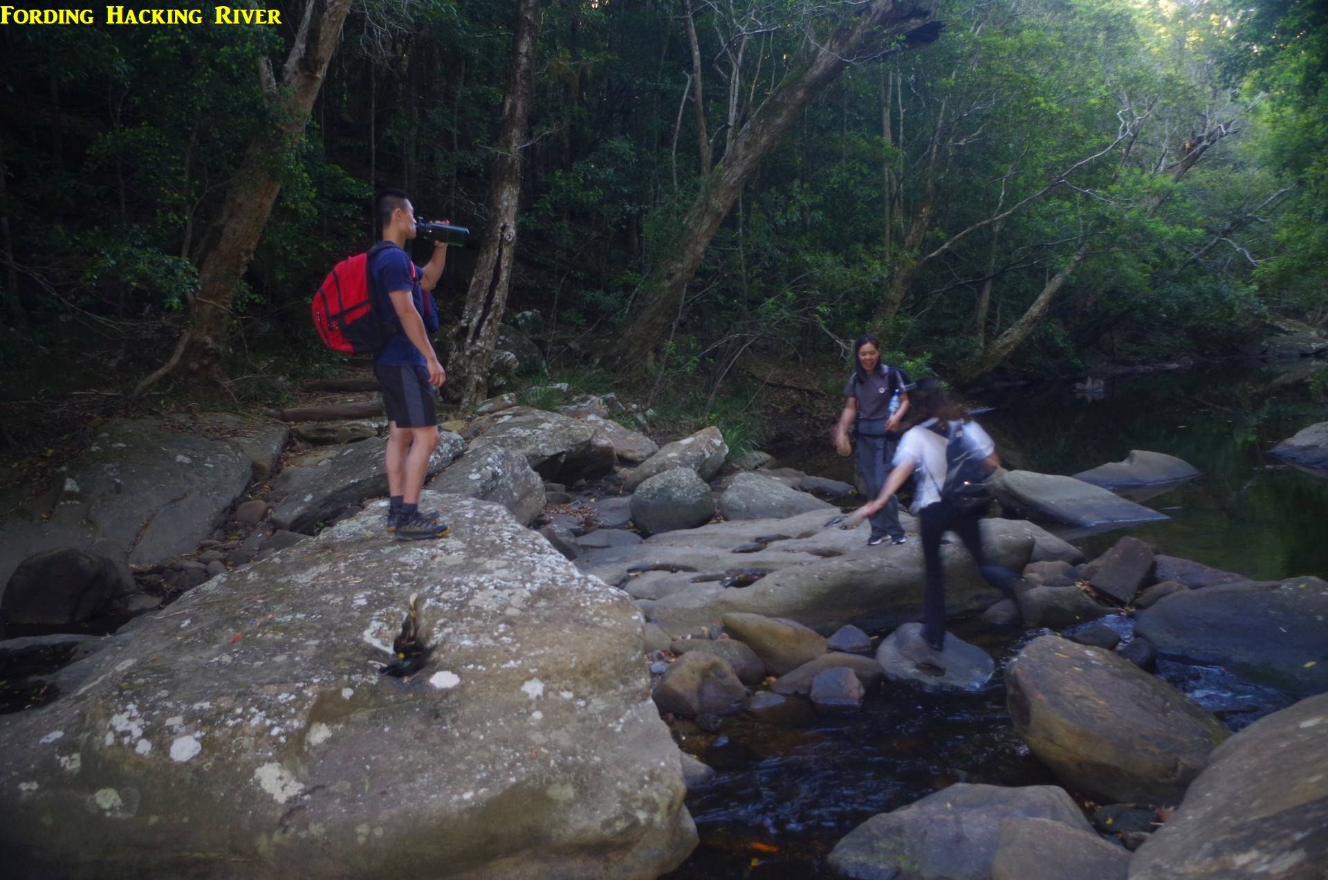
This track is gently unduklating for quite a while before starting to drop down fairly steeply to the valley of the Hacking River. It passes through open shaded woodland at this point until reaching Lady Wakehurst Drive, and then another 100 metres to the ford at Hacking River. On reaching that road, I noticed that Rickie and Ruiqing had fallen behind. Some minutes later they appeared,and Rickie reported having some issues with her knee coming down the fairly steep path. Then we all forded the Hacking River; the water was very low, so crossing it without getting feet wet was very easy this time (hasn’t always been as easy as this). Then the track goes up some wooden steps to reach a point where it is very vague because of fallen leaves and its infrequent use. Shortly a sign pointing to Helensburgh was found, and the track becomes clearer as it climbs on a moderate grade to reach the Hacking River Fire Trail. After a short rest here we set off again along this trail which stays level for a while before starting a series of rather steep climbs. Being a fire trail it is wide enough for vehicles, although a new formidable gate where it joind Lady Wakehurst Drive a km further on seems to have deterred casual 4WDs from using it. It is still accessible by trail bikes although there were no recent tracks by any that I could see.

The steep sections were not only slowing me down but also Rickie. The distance from the Hacking River ford to the old Helensburgh tip is about 4km, and it does become tiring after all the walking we had already done. Rickie’s knee was still giving her trouble. Close to where the trail finally levels out and about 1km near its end, Rickie and Ruiqing had a break while I went on ahead to see if I could catch up to the others who should have stopped on the edge of the old tip fence. When I got there I was dismayed to find that they had not stopped there, and obviously had just continued on. Because the track splits here with the foot track going right to follow the tip fence for 500 metres, and the left track (still on the fire trail) veering left to follow a much longer route around the horse yards, I did not know on which one they might have gone. My note pad with the list of names and phone numbers was in a pack I had given to someone else, but fortunately I had my mobile phone with me (luckily I had taken it out of my pack much earlier before we did pack swaps), I opened the SUBW website, logged in and started calling the others. I got three “please leave a message” answers from others before I was able to contact Sherry. She said that they were “near a gate” but didn’t know exactly where. She handed the phone to Ben who said that he could now see Helensburgh Station in the distance; that put them on the service trail behind Gardiner Place and only 600 metres ahead of me and Ricke and Ruiqing. I asked Ben why didn’t they wait for us further back, and he said he just followed the GPS directions to Helensburgh Station. I reminded him that GPS is not your trip leader! He apologised about that. I explained also that I had thought about sending someone back to help Rickie with Ruiqing but I couldn’t do that if I did not know where the others were. As it turned out, Rickie and Ruiqing had by now caught up with me and she was able to manage OK on the flat sections now.
So the three of us set off on the final section of the walk to Helensburgh Station (less than 1km away now), along a rough track which skirts the wire fence of the old tip and passing through undergrowth which includes Lantana and some Blackberries (but no berries on them). Then it came to a point where this path gives a choice between turning left to follow the fence to the tip gate on NIxon Place (which I assume were the gates that Sherry mentioned), or veering slightly right down a wider path to reach Gardiner Place and the service trail which runs behind the houses on that street, we took the latter, then the service trail, then another rough track that local school students use as a short cut to the Station. It follows the fence beside the railway before a final quite steep drop at Wilson’s Creek Road, then straight across the road to the steps down to the station car park.
Having had enough of steps, we three took the lifts to the platform to find the others there, and we were surprised that they had only been there for about 5 minutes. They had at one stage been more than 15 minutes ahead of Rickie Ruiqing and me, so this meant that they mustn’t have followed the same track that we did. This was confirmed by Ben saying that they had walked along the fire trail around the horse yards. This had added over 1km and 15 minutes to their walk, thanks to following GPS directions. Now, we had reached Helensburgh Station a good 20 minutes before the train was due, so there was no rush to get there. If, however, they were cutting it fine to get the train, that extra 15 minutes lost because of following GPS directions could have resulted in a train being missed and an hour’s wait until the next one.
We got on the train which came on time and had an uneventful trip back home. And no one reported getting any leeches.
There’s a few takeaways from this trip:
– DO NOT use GPS or Google as your trip guide, they are not your trip leader! When in doubt, contact the trip leader by phone. If you do find yourself well ahead, stop and wait for the others to catch up. Using GPS or Google as your guide has caused a LOT of problems in the past. Look at the last third of this trip report to see how things can go badly wrong when someone decides that his GPS is his trip leader: https://www.subw.org.au/2017/09/17/helensburgh-burning-palms-otford-2/
Allied to this are people who have got too far ahead of the main group asking strangers for directions instead of phoning the trip leader (happened on a walk to Ruined Castle).
– Until the Coast Track through Palm Jungle reopens in July next year, any walks to Burning Palms and Figure 8 will take at least 45 minutes longer than stated on some walks websites.
– And intercity and outer suburban trains have toilets on board; on past walks we have had people travelling about 2 hours on one of these trains, and then on arrival at the destination station, ask for the location of the “bathroom” (often closed or non-existent at the station)! I know that the toilets on the Blue Mountains V sets aren’t great, but those on the OSCAR sets are usually good, and so will be the toilets on the new “modern dynamic” D sets soon in service, the only thing good about these awful trains (what a monumental stuff-up those trains have been; and they will have the non-reversible seats that NSW passengers hate on long journeys). “Modern, dynamic” is Transport for NSW’s description of these trains, not mine.
Bruce Stafford