Date: 25/4/2023
Trip leader: Bruce Stafford
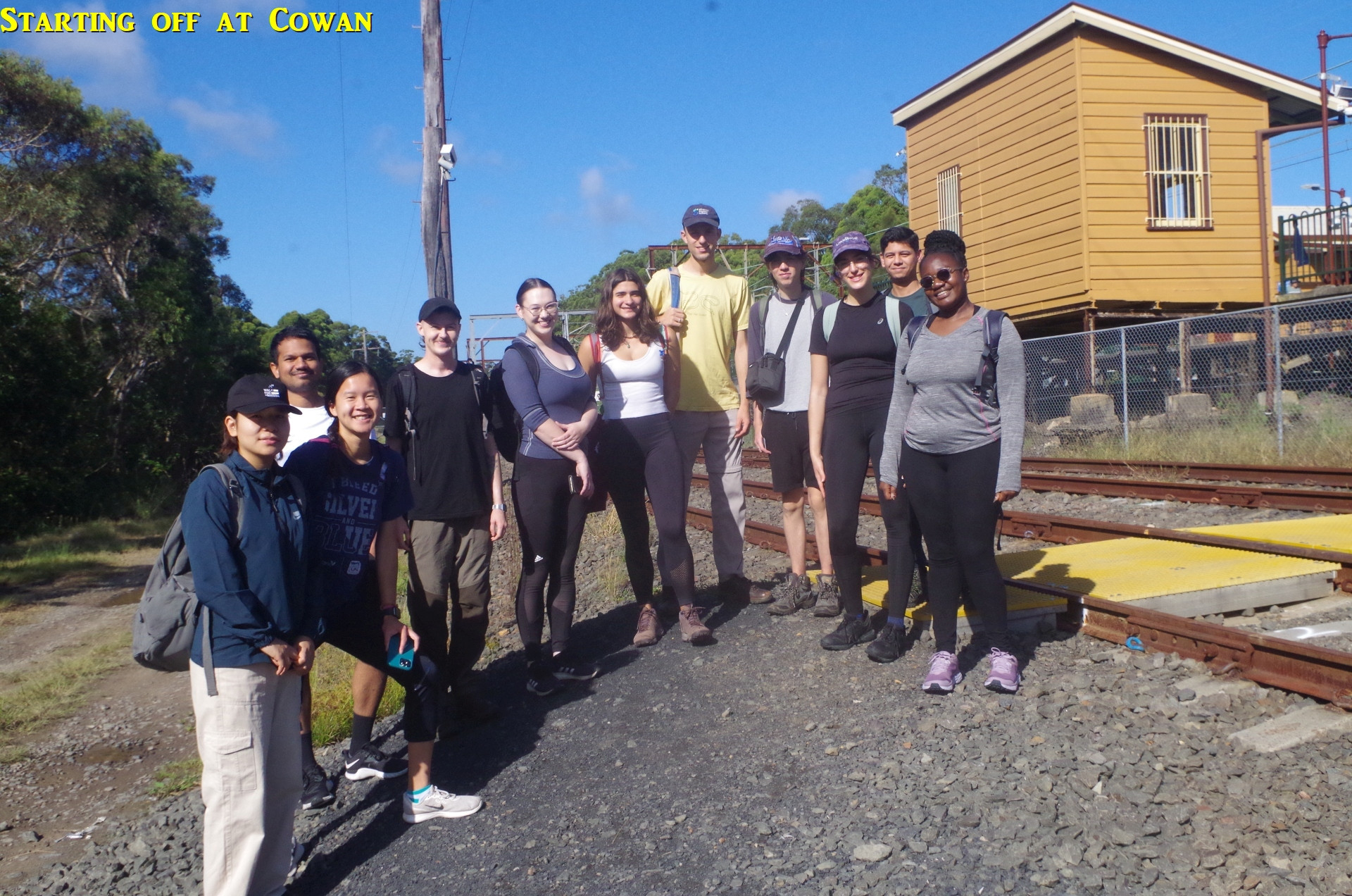
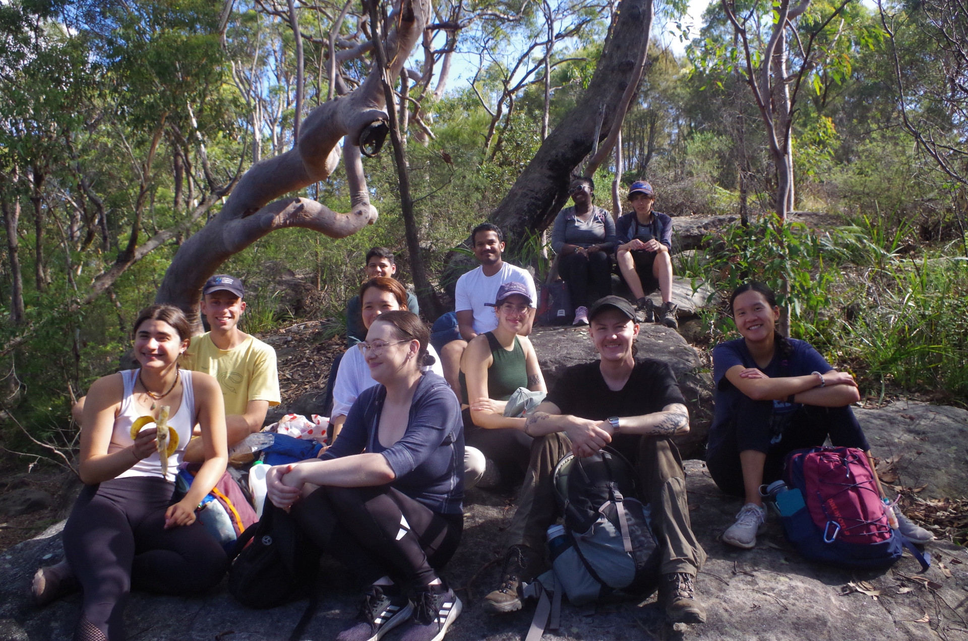
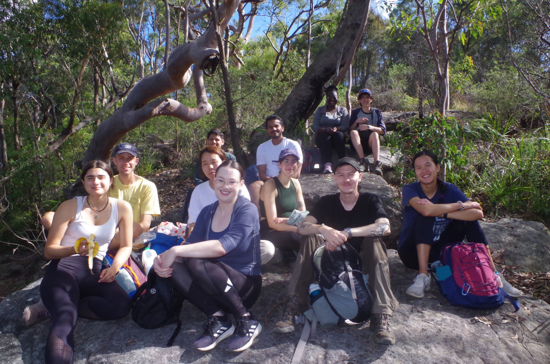
Party: Akash, Racheal, Ben Leo, Devin, Jimmy, Julián, Lauren, Leen, Mackenzie, Yanjee, Yasmin.
Cowan to Brooklyn Walk ANZAC Day 2023.
With earlier worries that adverse weather might cause the walk to be shortened to just around Brooklyn (like last year’s) the weather turned out almost perfect on this ANZAC Day, not too hot and no rain at all.
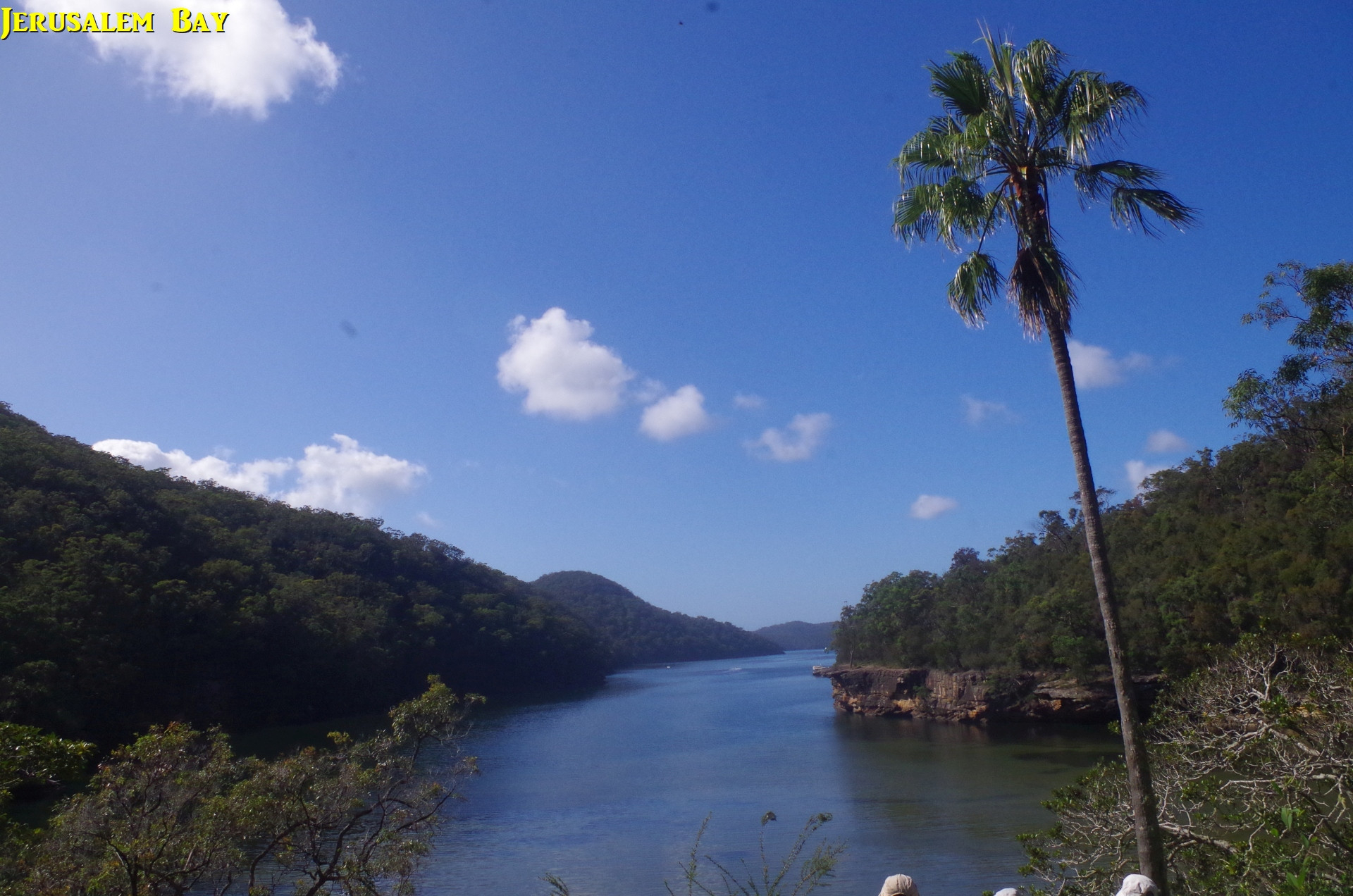
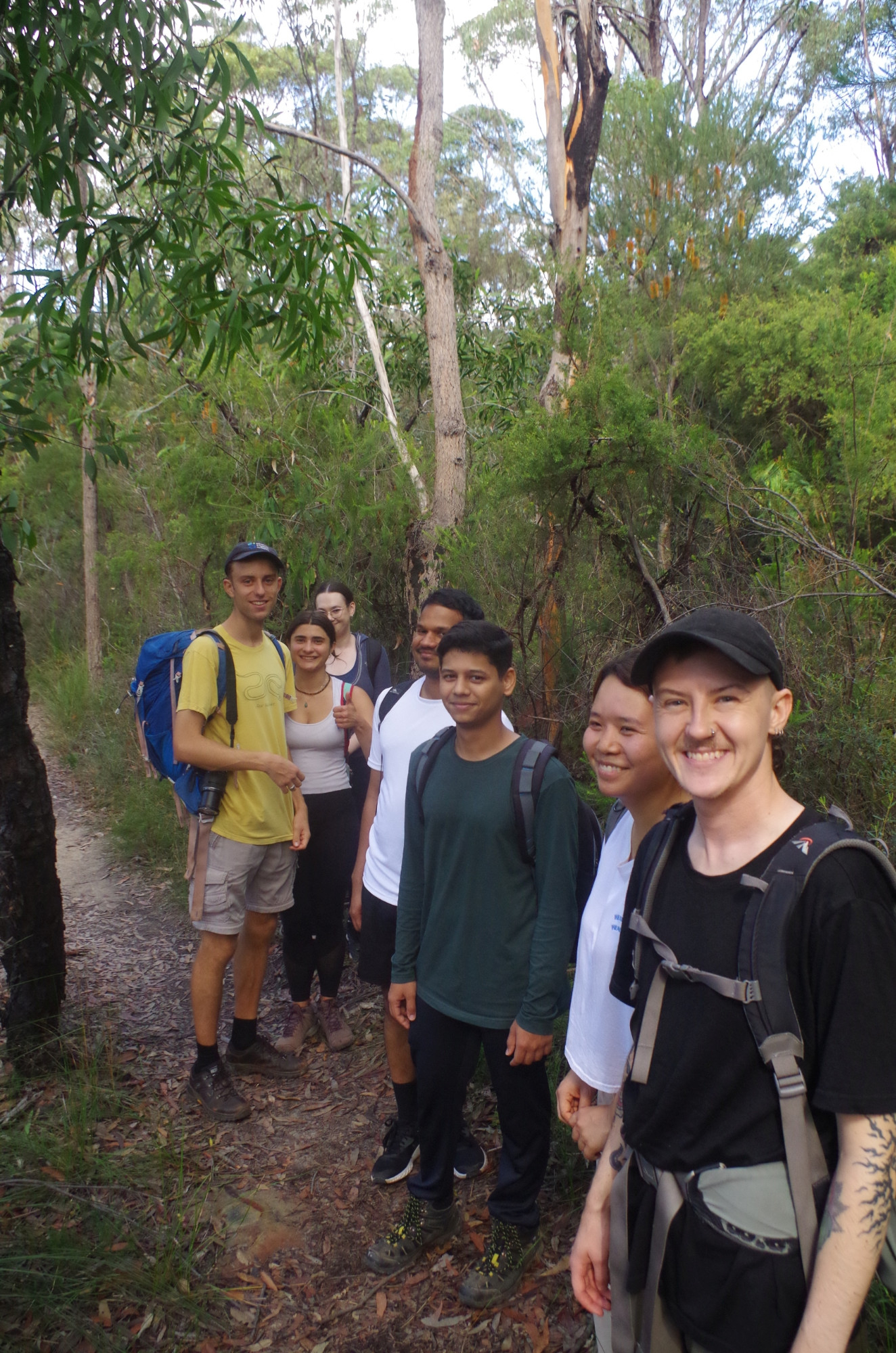
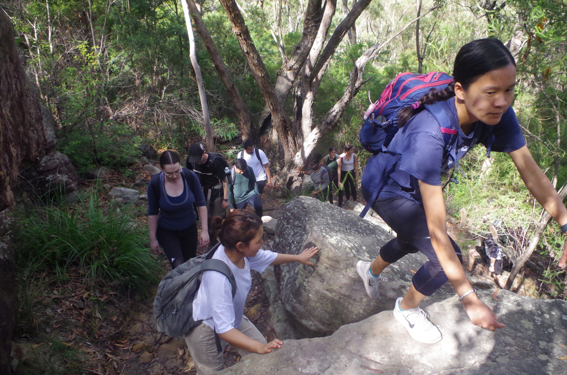
A dozen members arrived at Cowan Station and off we set for the walk to Brooklyn along this section of the Great North Walk (GNW). Some people think that the GNW is a pushover, but it is not, especially on this section. After crossing the M1 (F3) Highway the track immediately becomes rough, dropping down into the walley of Yatala Creek which it follows. Along this section we were “serenaded” by lots of birds, but we did not actually see any of them. As the track neared Jerusalem Bay it levels out and becomes less rough, and eventually it arrives at the view spot with its now iconic lone Palm Tree. We had a short break here, and also came across other groups of walkers doing the same. A few had arrived from Brooklyn doing the walk in the other direction.
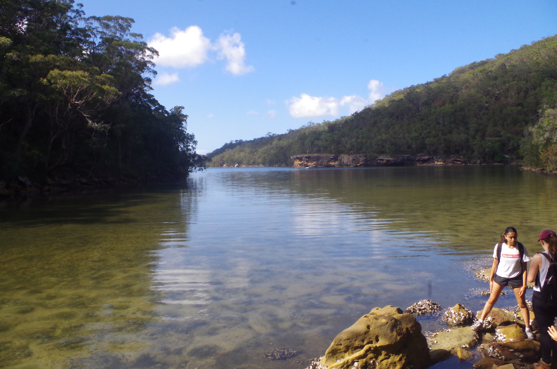
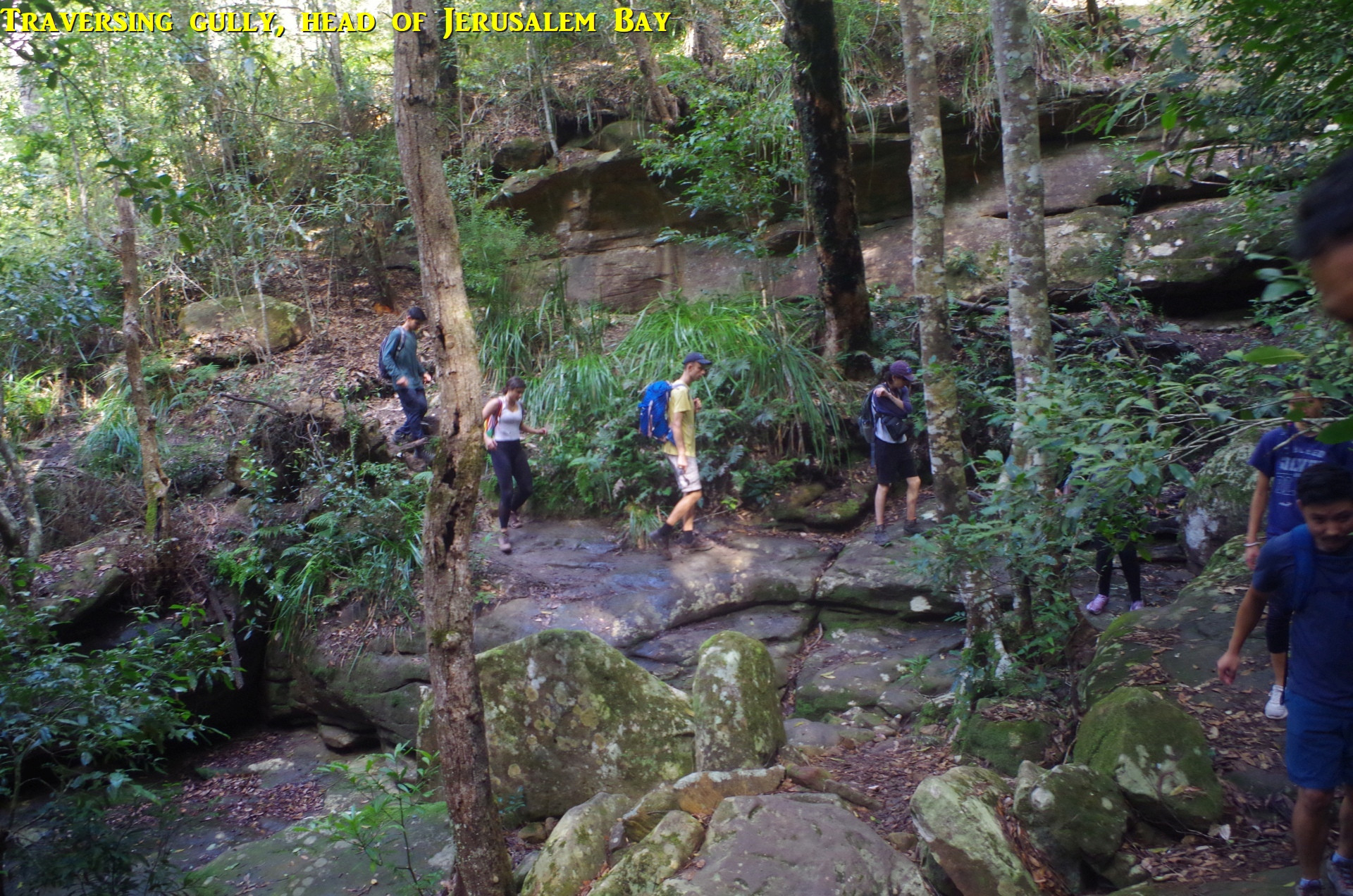
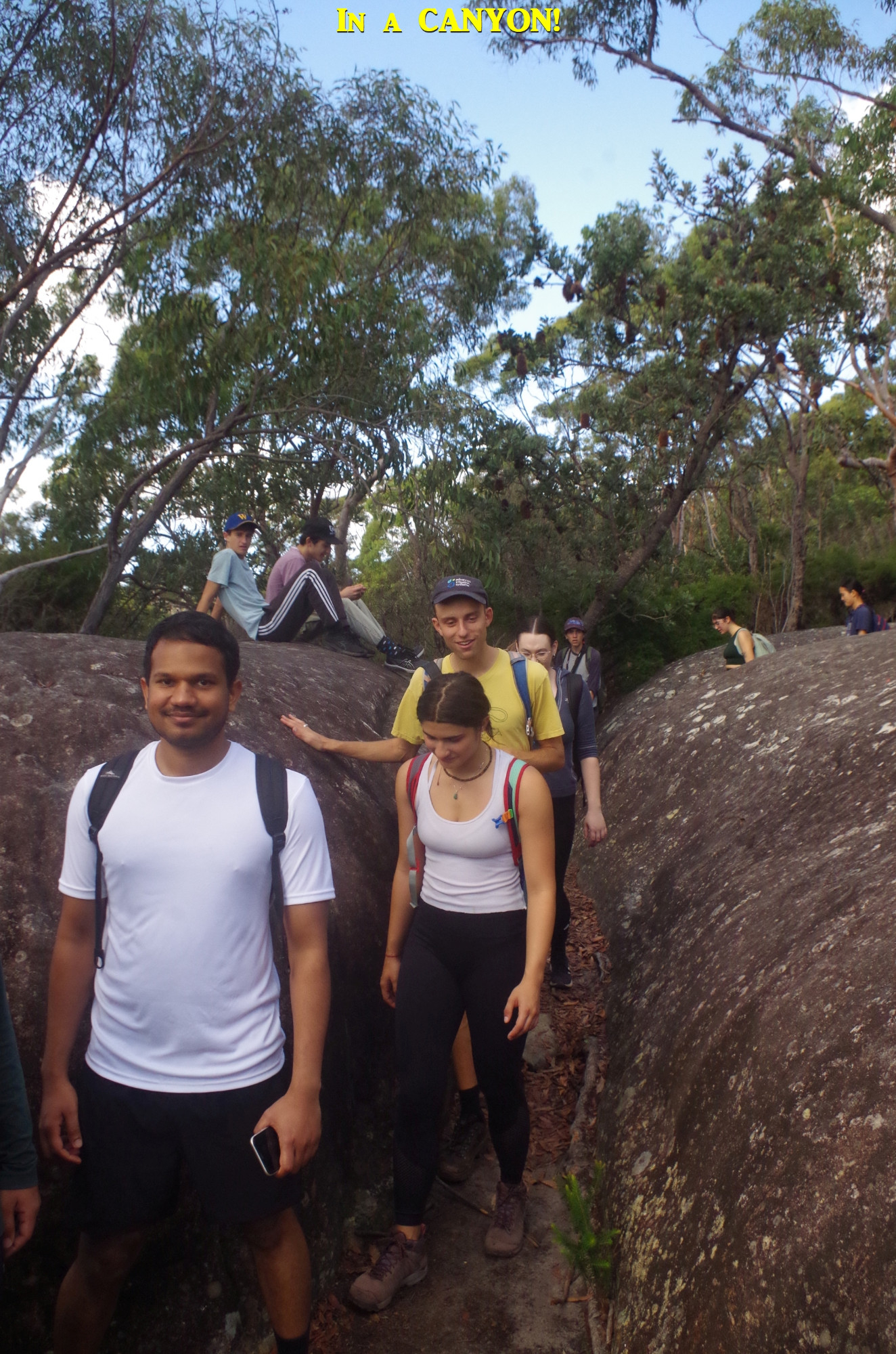
After the break we set off following the edge of Jerusalem Bay and we found that, because of a quite low tide, we were able to take a slightly easier path along the waterside rocks for a while, before reaching the shady gully at the head of the Bay. We crossed this to start the main climb to the top of the ridge overlooking the opposite side of the Bay. This is the steepest and hardest part of the whole walk, although there are also some steep but much shorter climbs later on. There is a rest spot about two thirds of the way up (and some fools appear to have knocked over the seat located there – NPWS to note). We had a break here and Jimmy passed around some Lamingtons, and I passed around some ANZAC biscuits (anyone who calls them “Anzac cookies” will be court-martialled! Indeed, it is illegal for shops to sell them as “Anzac cookies”, seriously). I will discuss the origin of ANZAC biscuits later on.
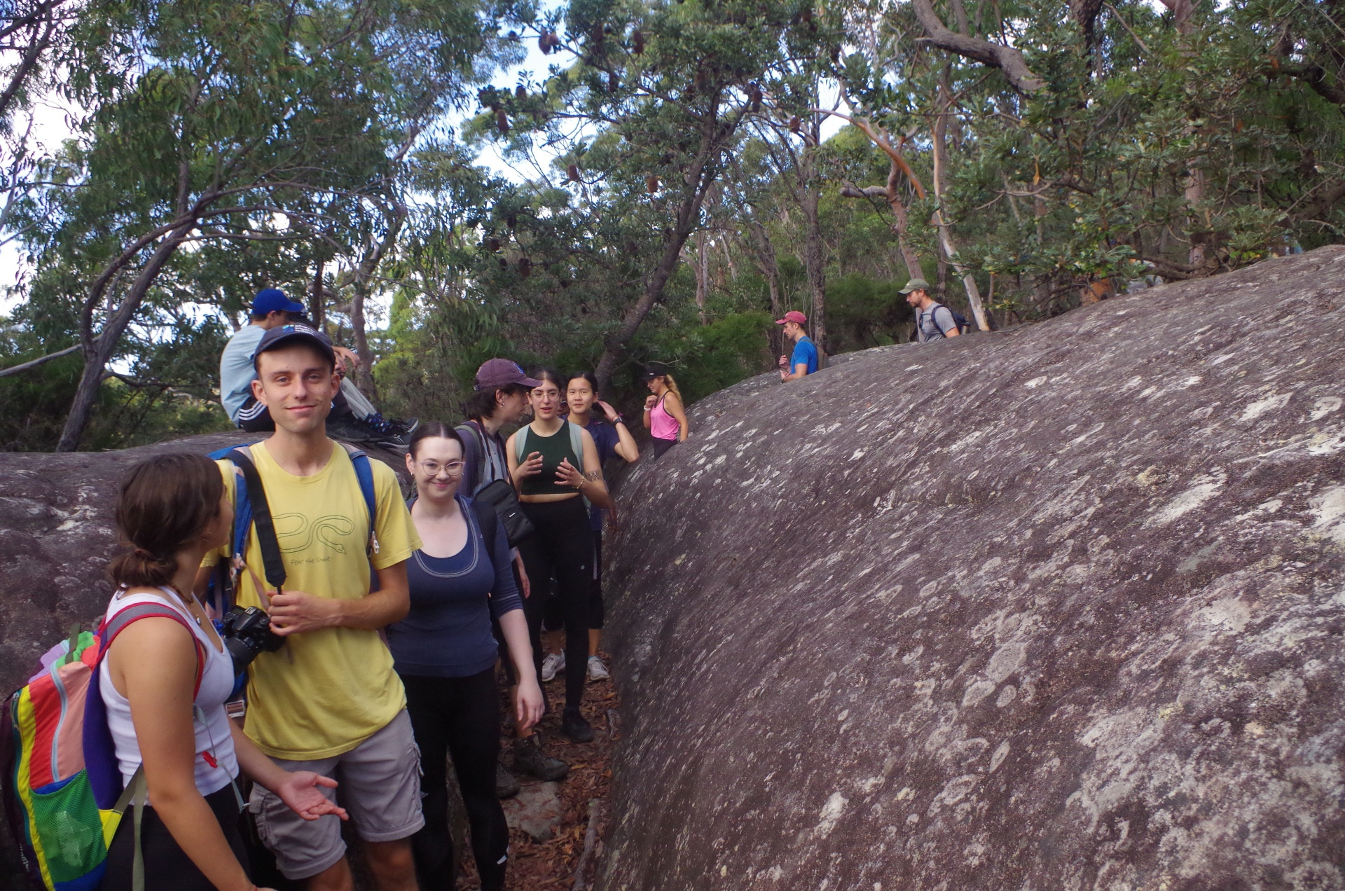
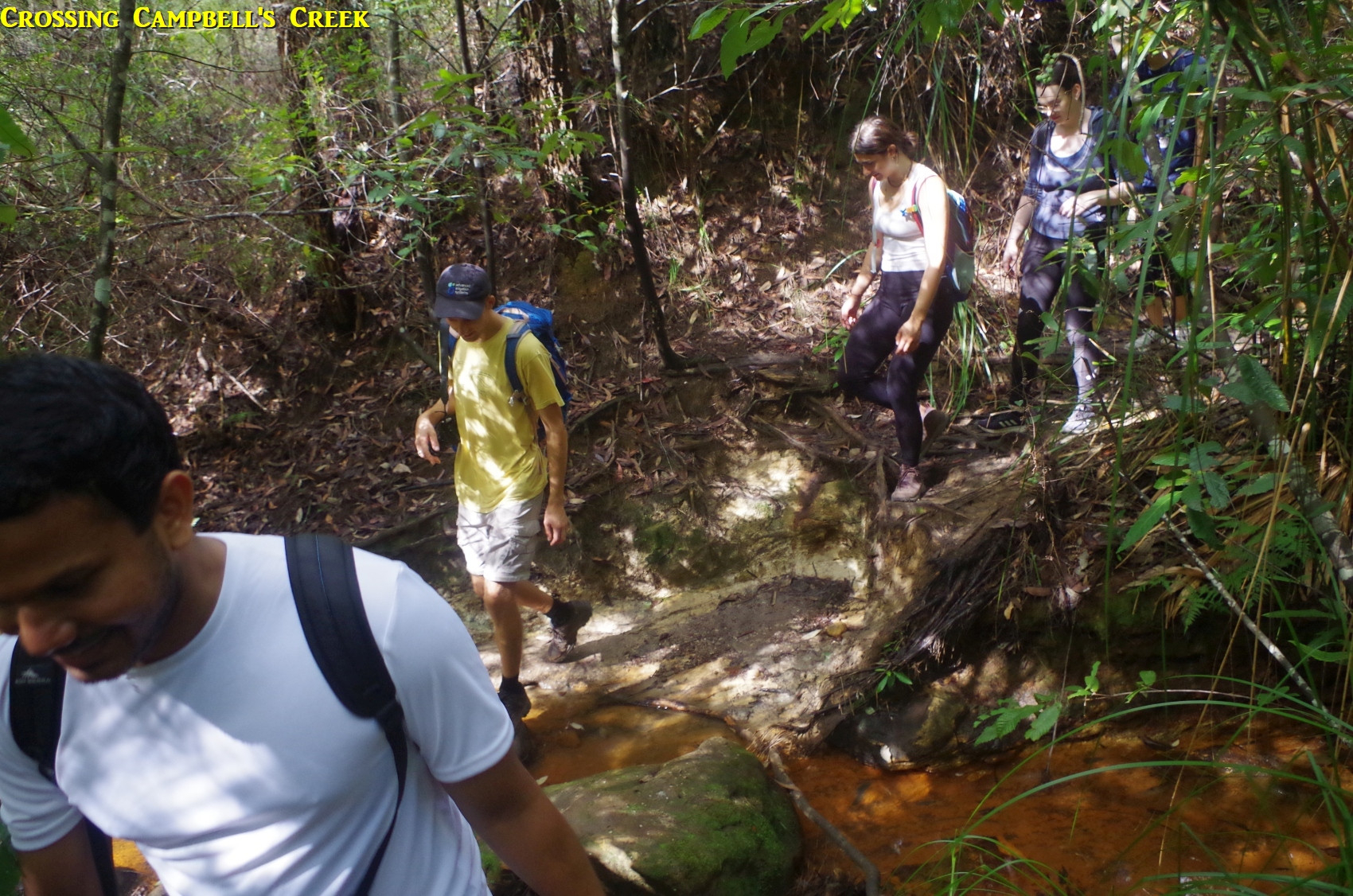
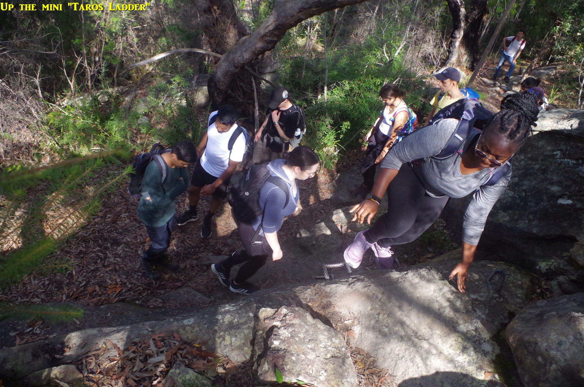
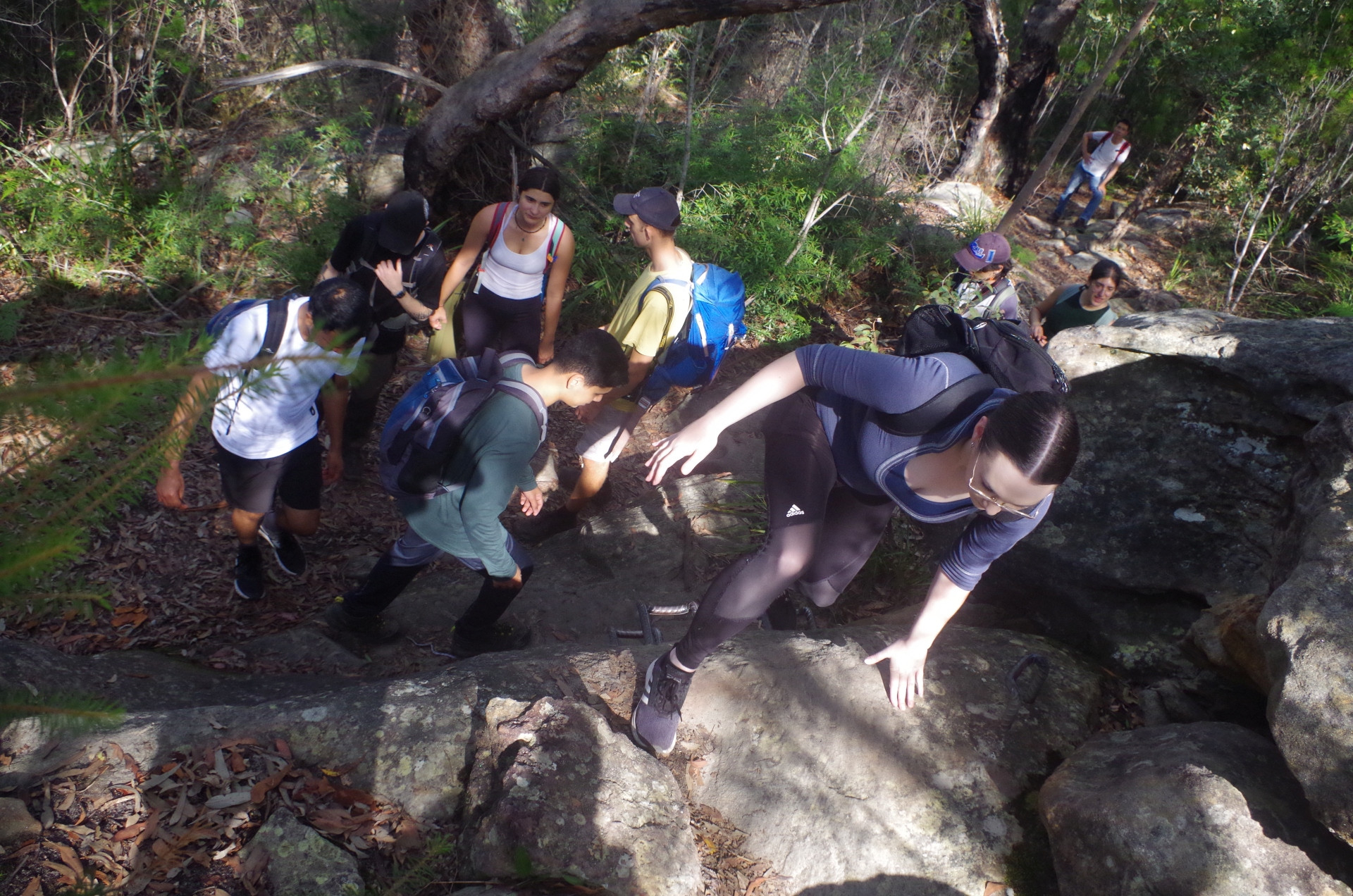
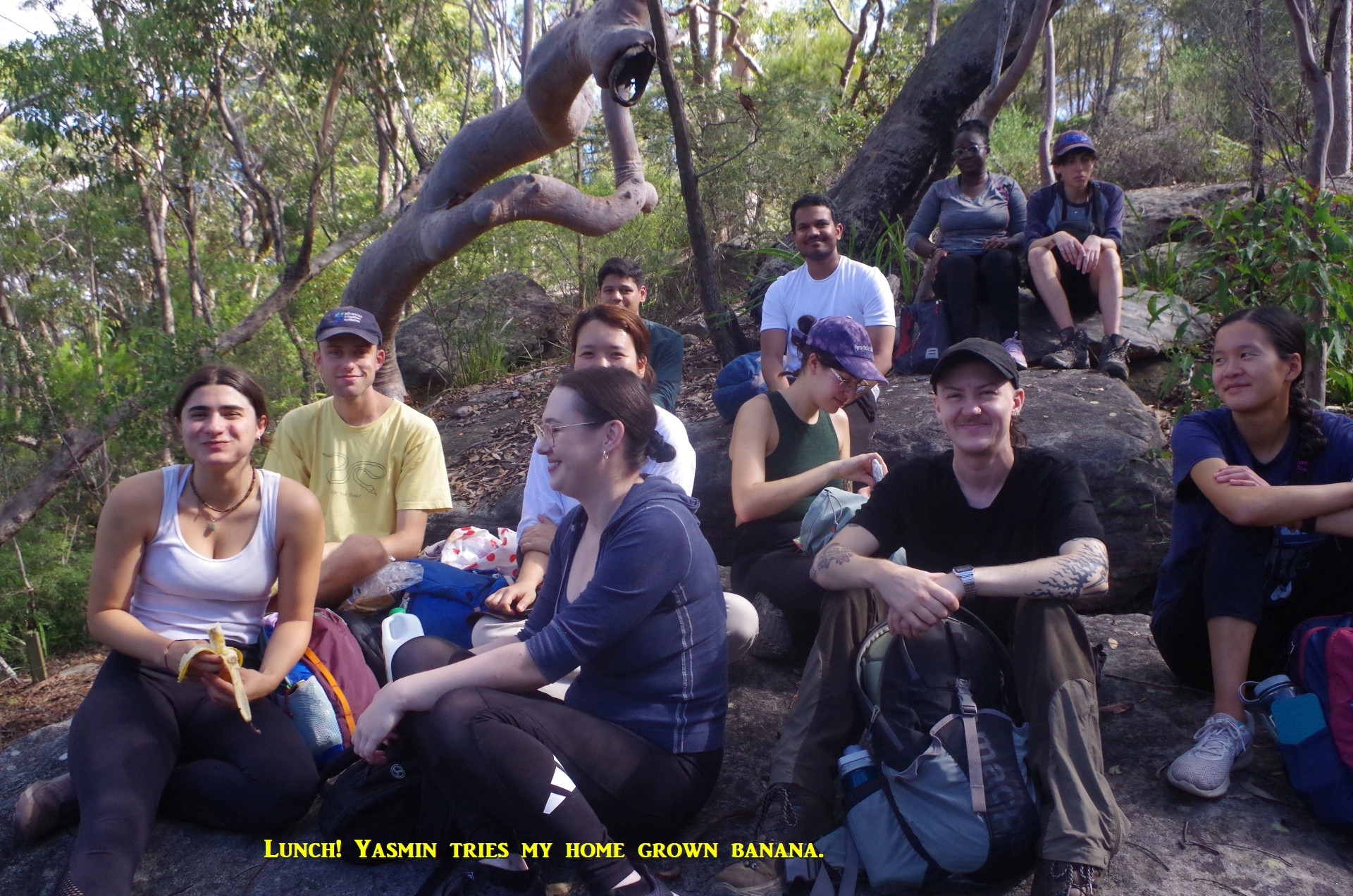
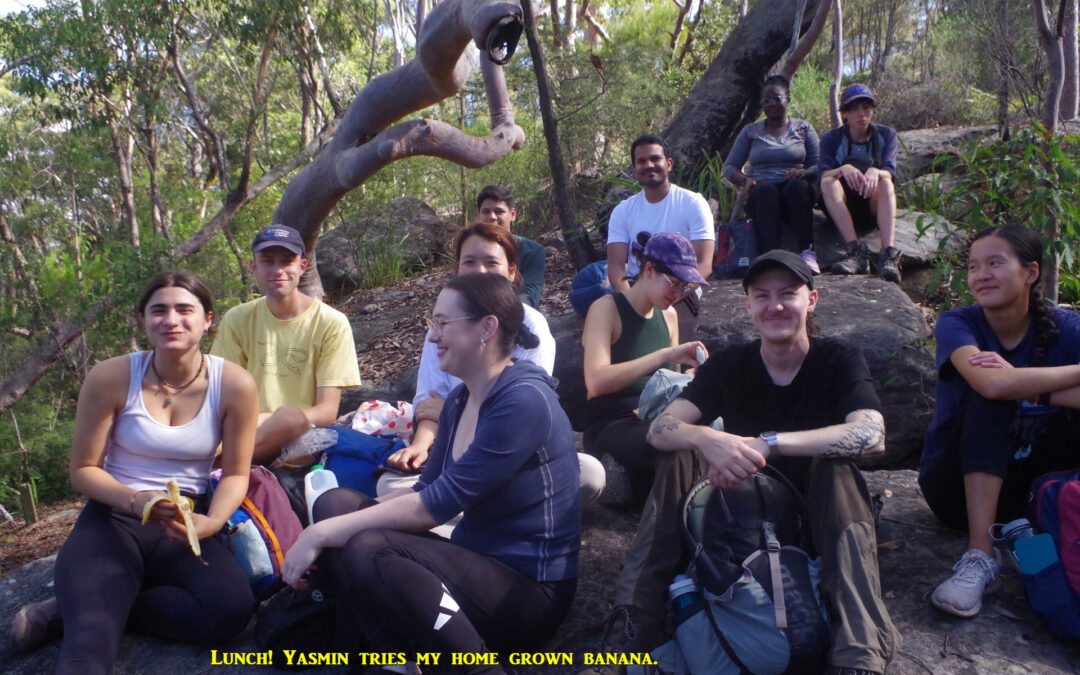
After being reinforced with climb-aiding food and a water break, we set off on the last stretch of this climb, thankfully not quite as steep as the bit we had just done, and I came across a couple of groups also taking a break from the climbing effort. The track levels out at the top of the ridge, and after a while starts to descend again on a rough track to Campbell’s Creek. There is quite a steep muddy step down to cross the creek but everyone managed it OK. From there on the track starts to climb again fairly gently but soon becomes steeper, then levels out again before reaching a long rock platform with an overhang under which another group were having lunch. This reminded me to look out for a lunch spot before we reached the railway access trail. Again the track levelled off before coming to the final climb which is aided by a set of metal steps set into the face of the short cliff face. and which I call a “mini Taros Ladder”. Very shortly afterwards we arrived at the NPWS log book (which now has a new weatherproof container) which we signed. Then we arrived at the railway access road, at which junction there is a passable lunch spot, but spoiled by the constant sound coming from the highway not far below. So, I back tracked about 100m to find a nice spot on rocks with dappled shade, and we settled in.
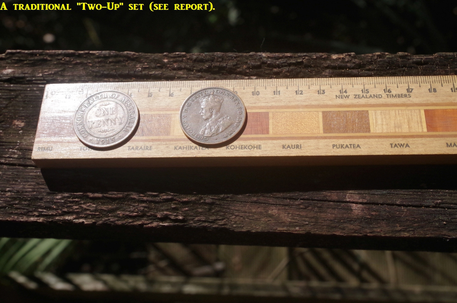
At lunch I offered the group some of my home grown bananas and I had two takers who found them delicious. At lunch we had a variety of discussions ranging from bananas; the game of “Two-Up” (see the last photo); in which U.S. territory do people drive on the left (American Samoa); that Australia Pacific territories including New Guinea had four concurrent currencies in 1914-15 (Australian and U.K. Pounds, and German and Australian Marks, although German coins were the currency for denominations below 5 Marks). Warning: Economics exam question: Australia printed off tens of thousands of Marks in that period but it did not cause inflation. Why not?
As for “Two-Up” I will explain that a bit later on. Oh, and I asked how many of the group know what a chook is, and only Lauren knew the answer although Ben guessed it because he had heard some use of it in his native Leicestershire (a chook is Australian English for a “chicken”).
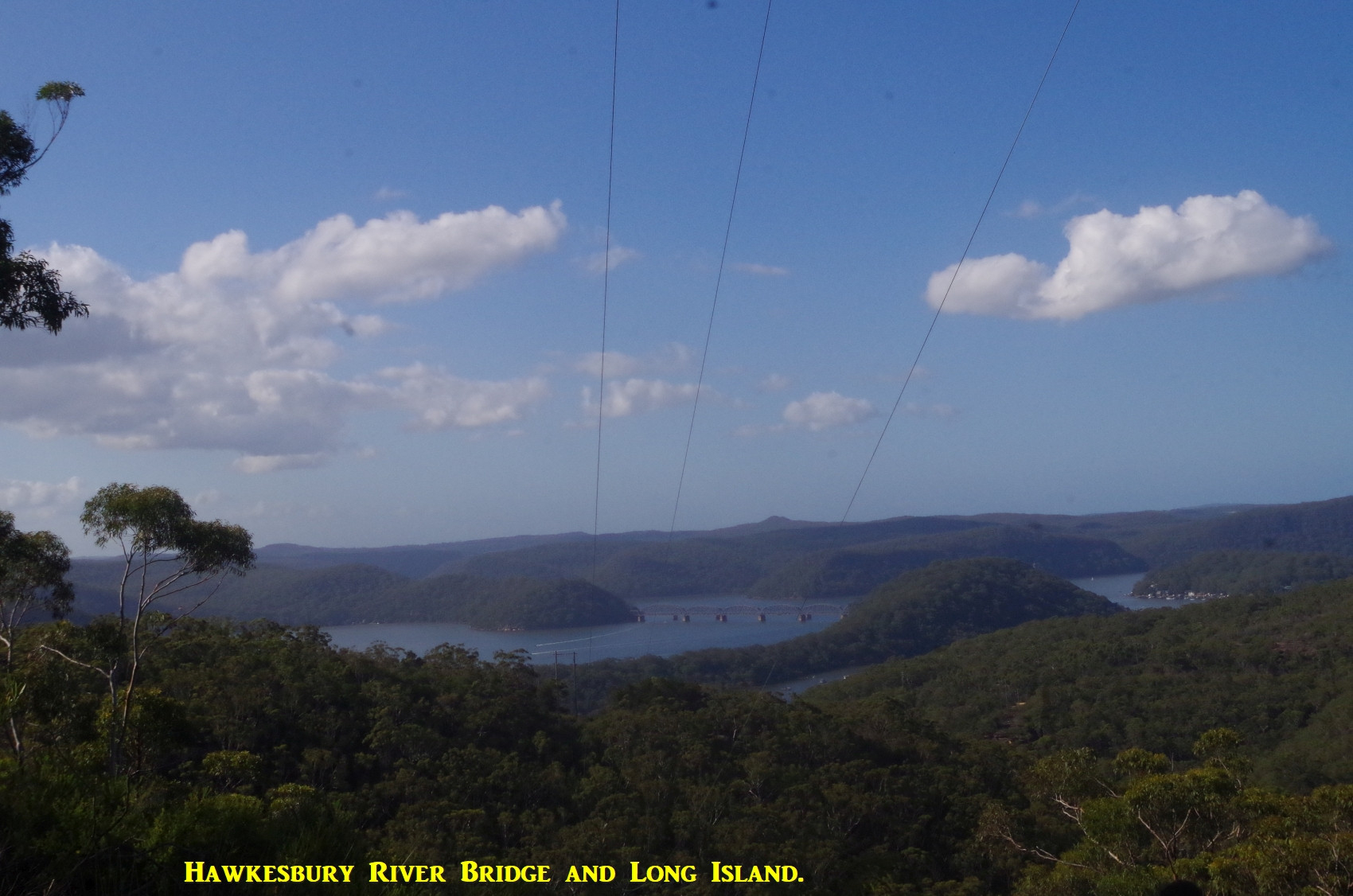
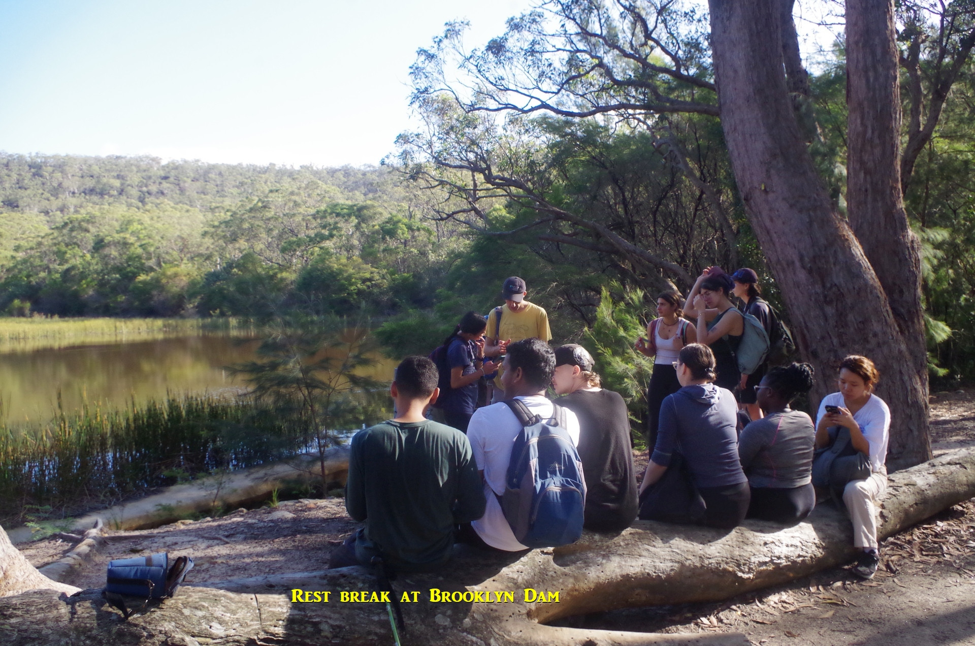
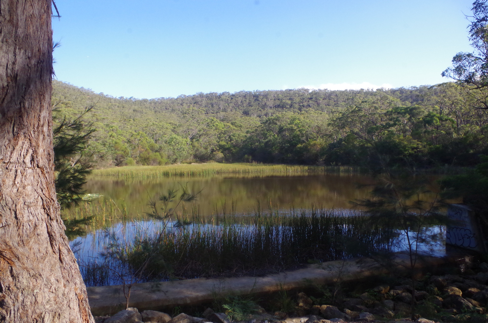
After a pleasant lunch break, we resumed our bushwalk, which now had become almost a “hike” as it was now on a wide railway access trail for some distance. It meandered a bit, with short side tracks with views over the Brooklyn road bridge (and the Motorway), and further on over the Hawkesbury River and Long Island, with Mount Wondabyne being seen in the far distance. After a while it started to drop down until levelling out again and I started looking for the vague side track which can be used as a short cut to access the trail near Brooklyn Dam. It cuts out 1.3km of walking along the main trail which is a not very exciting walk and is actually a bitumen road for 200m. I found the side track and we continued down this “track” which got rougher and rougher as it went down on its 350m length, and somewhat overgrown too. There are slippery spots where underlying slippery clay has been exposed by the recent rains. (Incidentally, “Google Maps” shows it as being part of the GNW – it is not). Thankfully the track arrived at the trail surrounding Brooklyn Dam, which trail IS part of the GNW. We turned left for about 100 metres to find the entry to Brooklyn campground on the right. We walked through the campground, then over a set of stepping stones to reach the rest area at Brooklyn Dam. This dam was built to provide water to steam trains, not drinking water, and its quality is questionable.
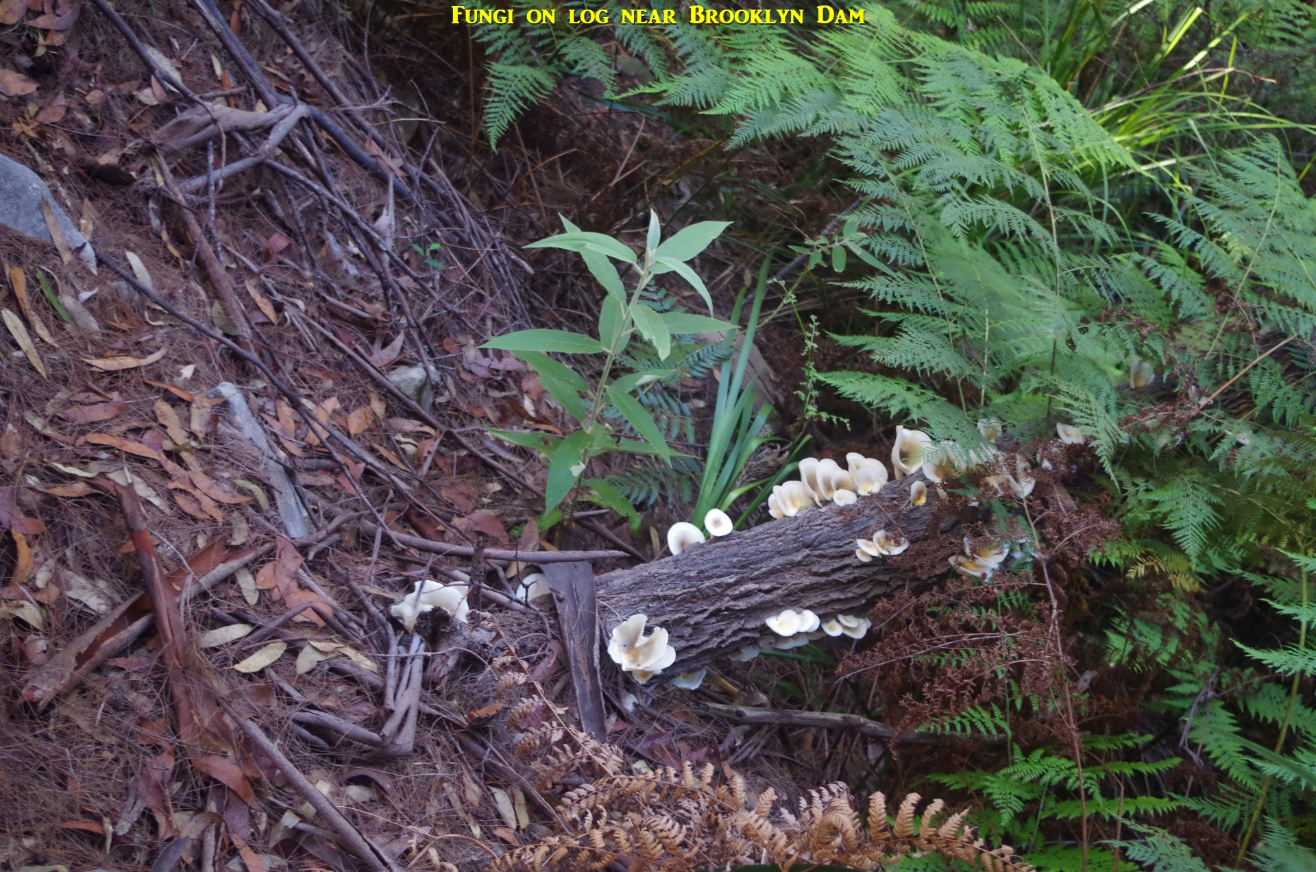
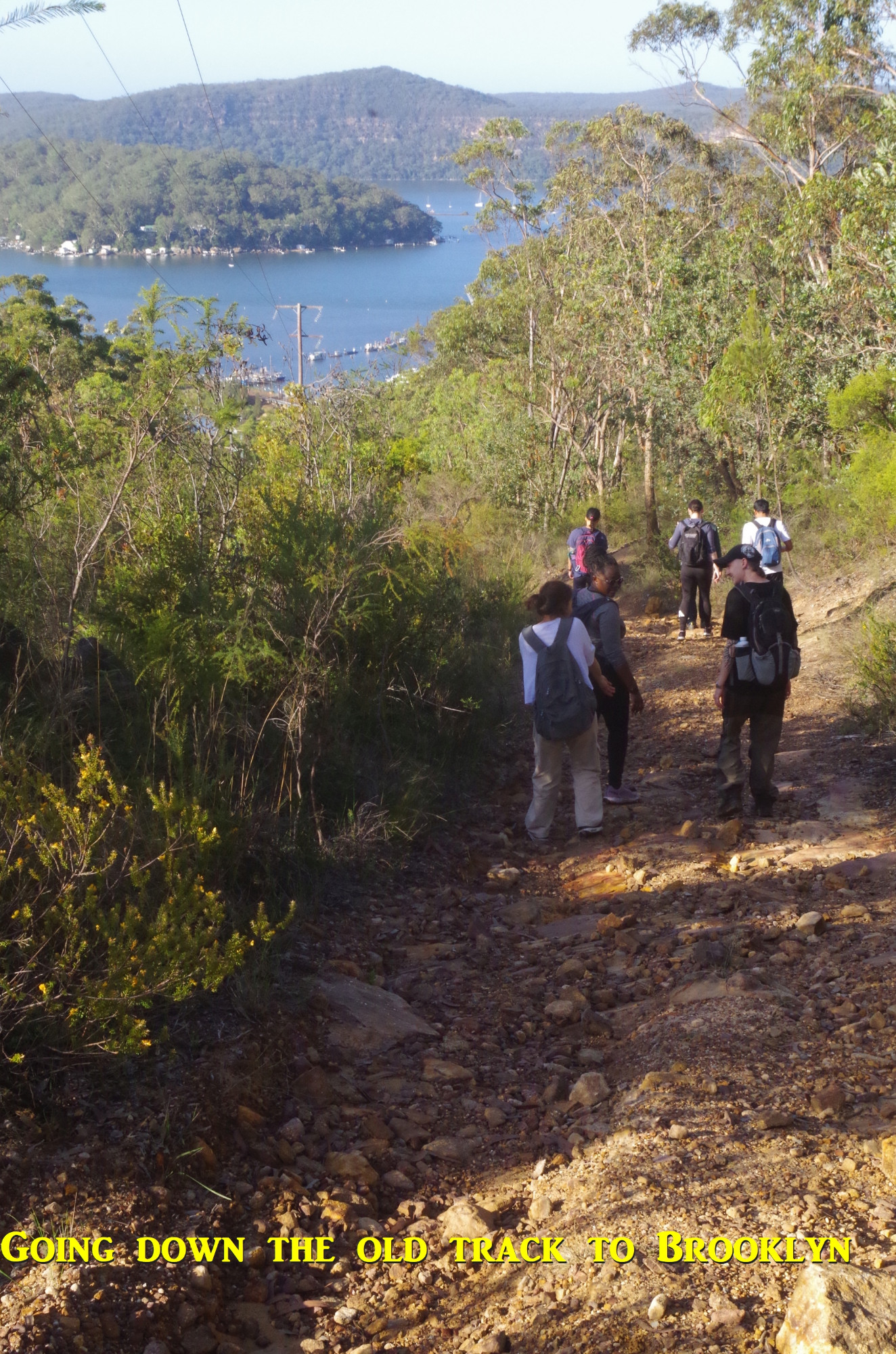
I noted that a new Dunny (bush toilet) has now been built by NPWS at Brooklyn Dam rest area. We saw several small birds flitting around the surface of the dam, drinking water on the fly or catching insects. This prompted four of our group to stay there longer (the way to Brooklyn is easy to follow from here) and eight of us continued on. From here on until Brooklyn the walk is along a wide railway access trail (except, for us, one part which I will mention shortly). It is quite straightforward, largely following high tension wires (its actual purpose). After a while it reaches a sign stating “Brooklyn Station 1.3km” (which is actually the distance to the pub; the station is another 150m on). The “official” GNW track goes straight ahead from here, but the old original track branches off downhill from here. It can save about 600m of walking and also mean the difference between catching the hourly train at Hawkesbury River, or missing it (although we were not in that situation). It also avoids the quite steep concrete Railcorp road at the end which can be slippery with we tleaves and twigs after weat weather (as on this occasion).
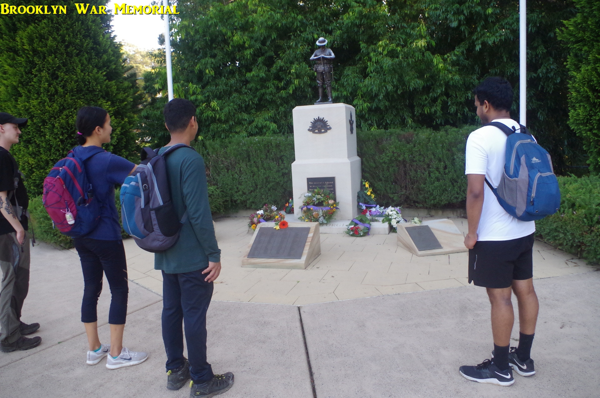
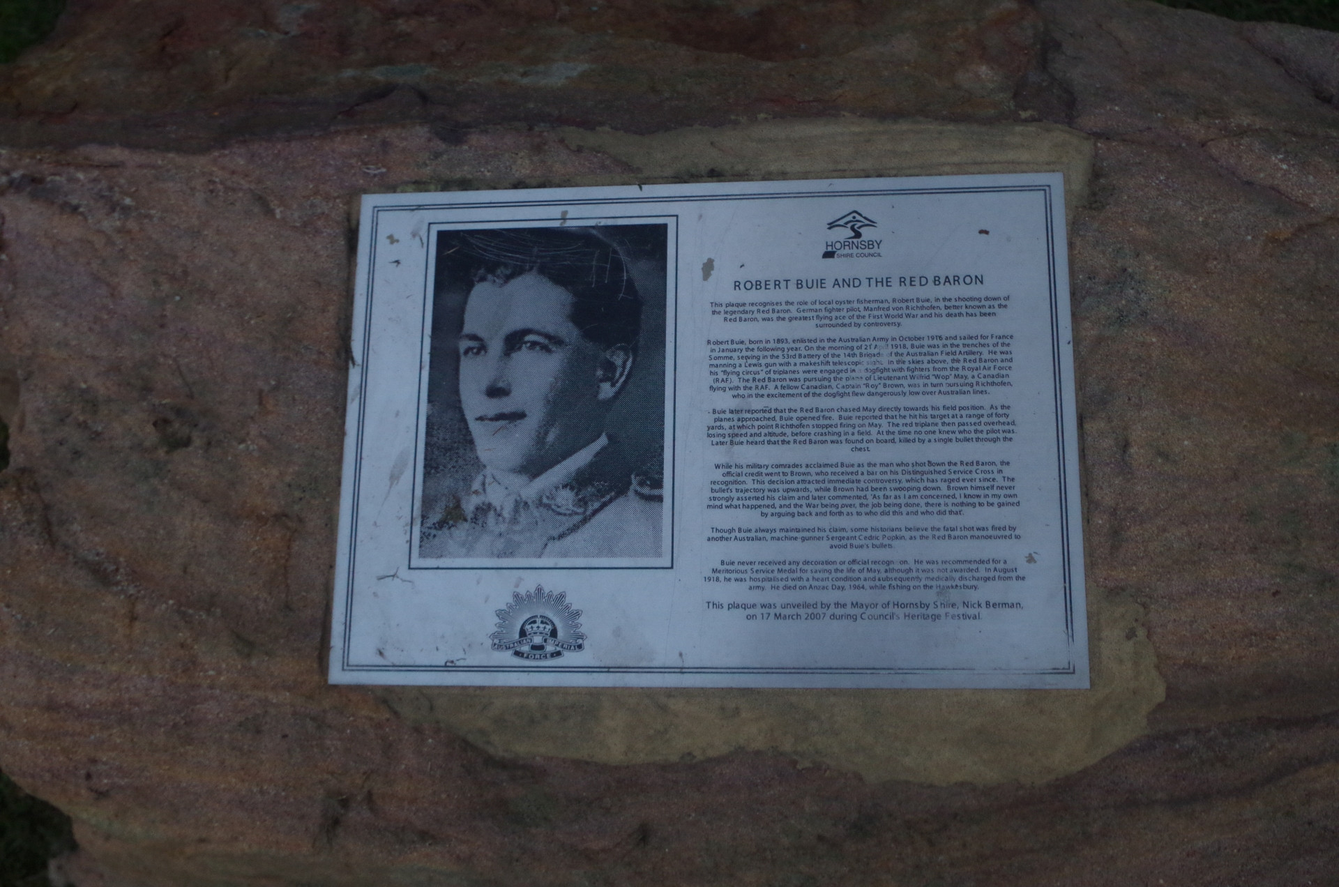
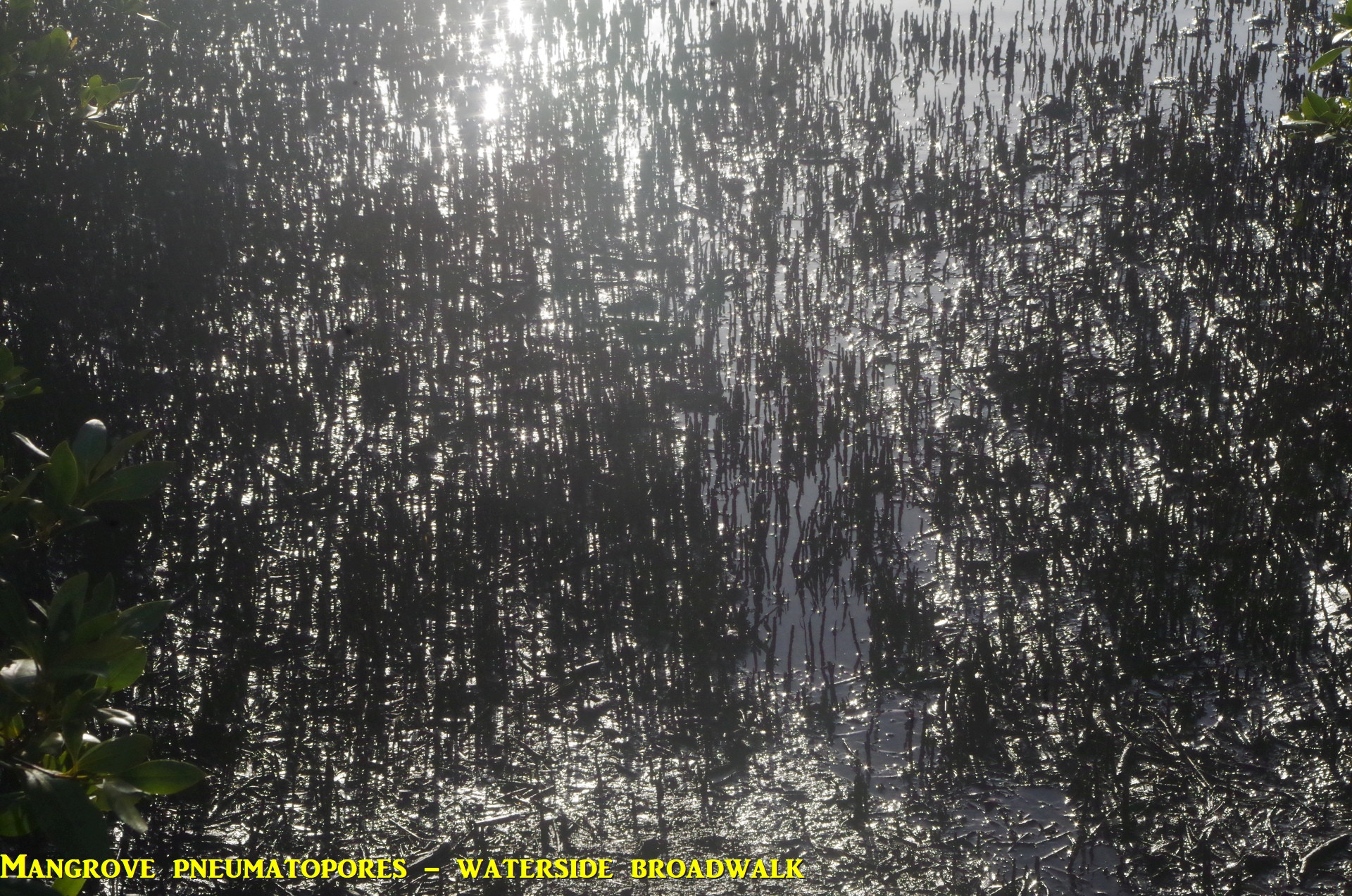
So I led the group down this track (which is just a branch of the main rail access road to follow more directly the high tension wires). There are some steep rough sections but generally it is wide and easy to follow, as long as dead-end side tracks are avoided. After a while the track comes to a decaying signpost near an obvious overhang which we visited on ANZAC Day last year; see that report: https://www.subw.org.au/2022/04/25/brooklyn-area-walk-hawkesbury-river/ A rather vague track branches off left here and winds its way down to Brooklyn Town to come out on Brooklyn Road near the bridge over the railway line. This track is becoming overgrown as only locals and a few bushwalkers still use it. At this point, Lauren, Racheal and Yangee decided to head to the Brooklyn waterfront and then to the station to get the next train due in 20 minutes; the remaining five (myself, Mackenzie, Akash, Devin and Jimmy), then headed to the Brooklyn Oval and the War Memorial about 900m west down Brooklyn Road. We stopped to look at the War Memorial and the Red Baron memorial (see photo and I will explain more further on). Then it was on to the waterside boardwalk, and as it was low tide, lots of little crabs could be seen scavenging in the mud. The pneumatophores of the Mangroves silhouetted against the afternoon sun looked like a city of tiny skyscrapers.
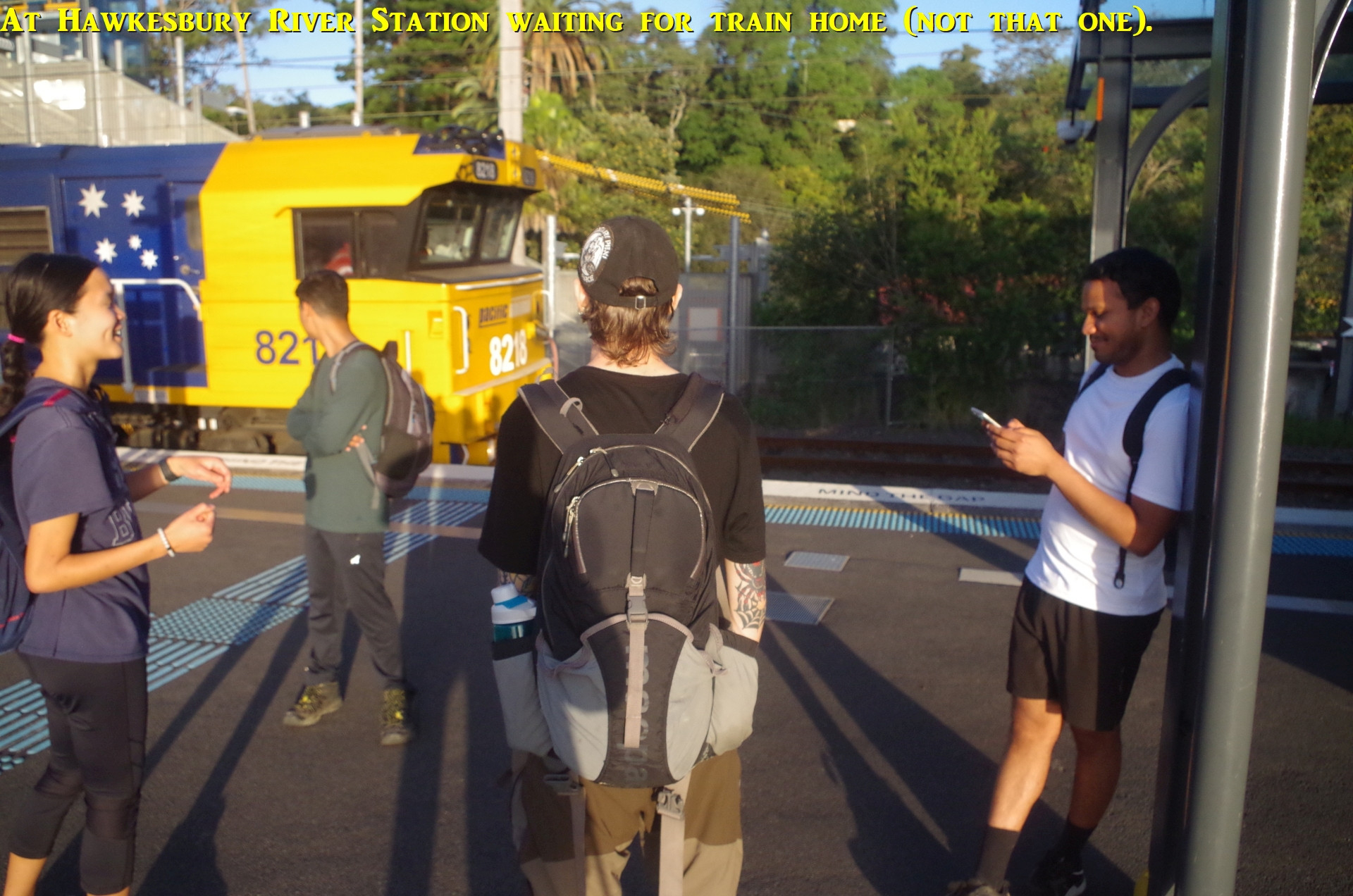
After that, we returned to Hawkesbury River Station to await the next trains. Mackenzie commented about the names Brooklyn and Long Island and said it was like a mini New York. The association is not a coincidence; The Union Bridge Company of New York built the first rail bridge in 1889 but it was replaced by the present rail bridge in 1946. My train arrived first and I said goodbye to the other four.
A couple of promised explanations:1. “Two-Up”. This gambling game was popular with Australian troopsin both world wars, and was constructed simply out of two pennies on a wooden ruler, like in my last photo. In NSW it is legal to play this game only on ANZAC Day. You often see “Two-Up sets” for sale in sovenir shops in The Rocks and Circular Quay, but you can make your own much cheaply with a dollar ruler and two vintage pennies from a coin shop for a couple of dollars.
2. The Red Baron was Manfred von Richtofen, a famous German WW1 “ace” pilot whio had survived 4 years of war on the Western Front in France when many pilots only lasted one week. Fate eventually caught up with him when he flew too low over Australian lines and got shot down on 21st April 1918. Just why such an experienced pilot flew so dangerously low was never explained, but the stress of four years of war would have gotten to anyone and resulted in errors of judgement. The British military establishment also refused for 100 years to acknowledge an Australian had shot von Richtofen down, instead wanting their own Royal Air Corps to get the credit. My photo of the memorial plaque should be clear enough to read the history of that fatal day.
3. ANZAC biscuits. The origin of these is obsure but the practice of baking these and sending them to Australian troops overseas likely started around 1916. The rolled oats and Golden Syrup combination in butter meant that they lasted the several weeks’ sea voyage to their destination.
There was one person who missed the train and attempted to get to Cowan by driving there, but she sent me an email instead of a text asking if we could dely our departure from Cowan by 5 minutes so she could catch up with us. Unfortunately due to the vagaries of Bigpond Outlook and the patchy mobile phone reception around Jerusalem Bay, her email didn’t get to me until about 2pm, far too late. That’s why I always ask people to send ne texts and not emails on the morning of the walk if they enounter problems. There were, however, two outright “no shows” who have made no contact with me.
Bruce Stafford.