Date: 10/9/2022
Trip leader: Bruce Stafford
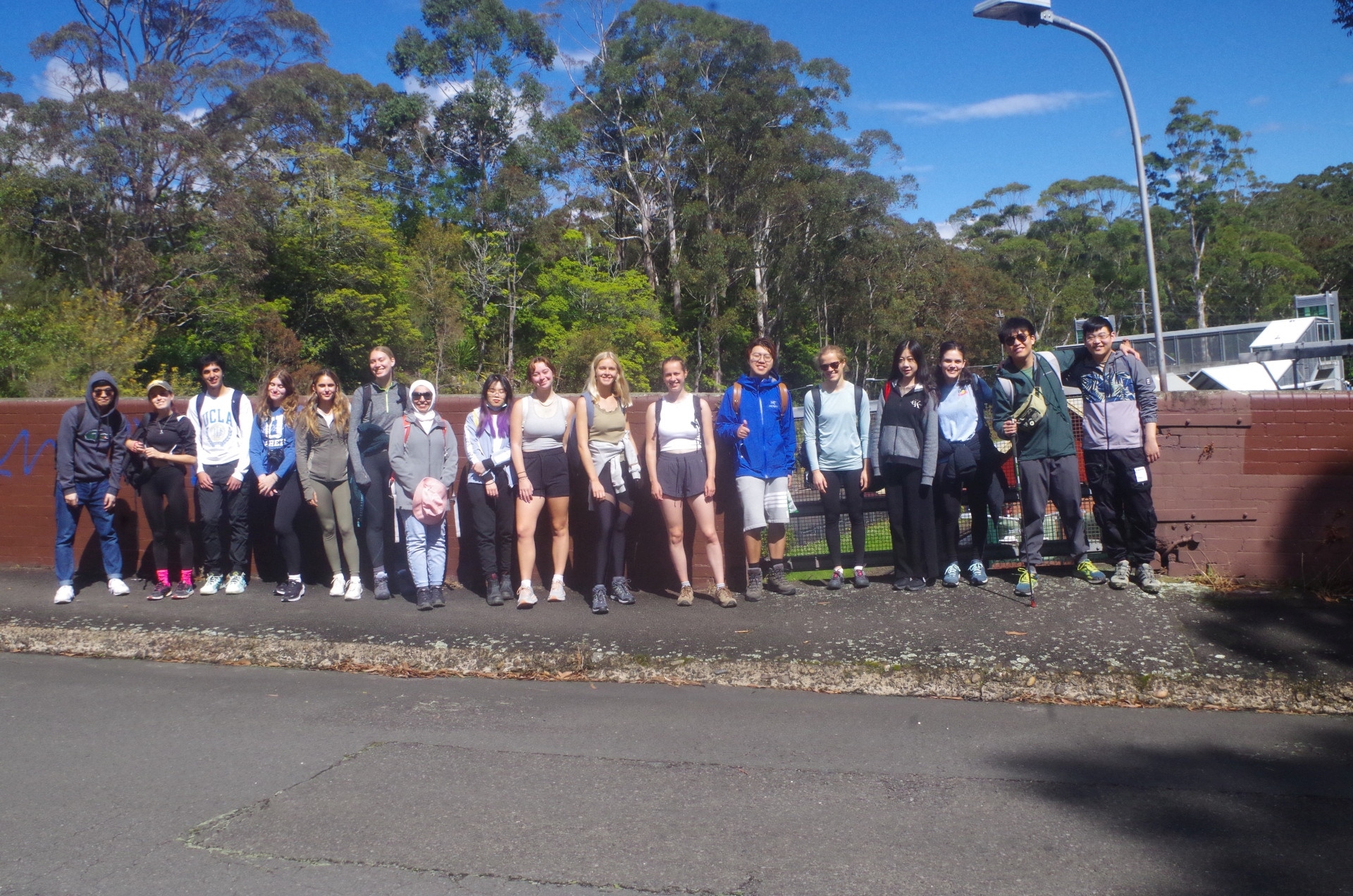
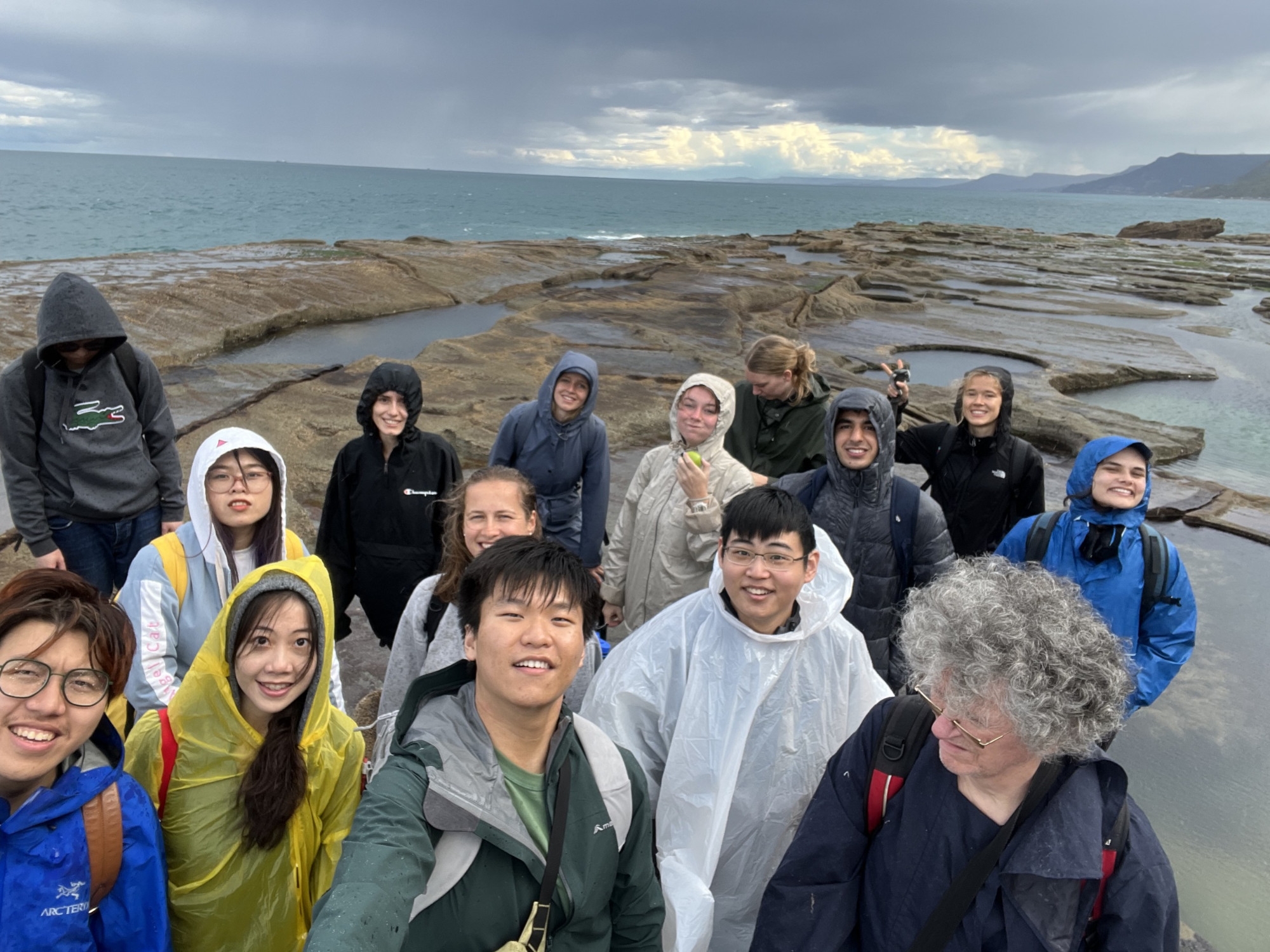
Party: Aaron, Armaan, Badour, Boren, Hongyu, Julie, Lilli, Mia, Olivia, Paige, Paula Lina, Rebeca, Samara, Signe, Tran Uyen Nhi, Yi-ming, Yifan.
Helensburgh to Burning Palms & Figure 8 Pool and then Otford.
With the earlier weather forecast looking like a fine day, it changed just 24 hours prior to being “partly cloudy with 40% chance of showers”. The following day’s forecast had changed from showers to sunny. That’s the luck of the draw, especially given the rainy weather pattern we have had for the past several months. Still, I decided to take our chances on not getting too many showers. As it turned out, the showers that did come lasted only a couple of minutes and were sunshowers (except the last one which was a bit longer and heavier). Unfortunately it put paid to our chances of seeing the Full Moon rise over the sea, to greet the Chinese Autumn Moon (Spring Moon here)..
One change was made to the walk when I found that the Coast Track near Otford appeared to be open again, as the track closure advice was no longer on the Royal National Park’s website. That meant that the walk could continue to Otford instead of back to Helensburgh after Burning Palms, although with a later finish. The group were agreeable to this change.
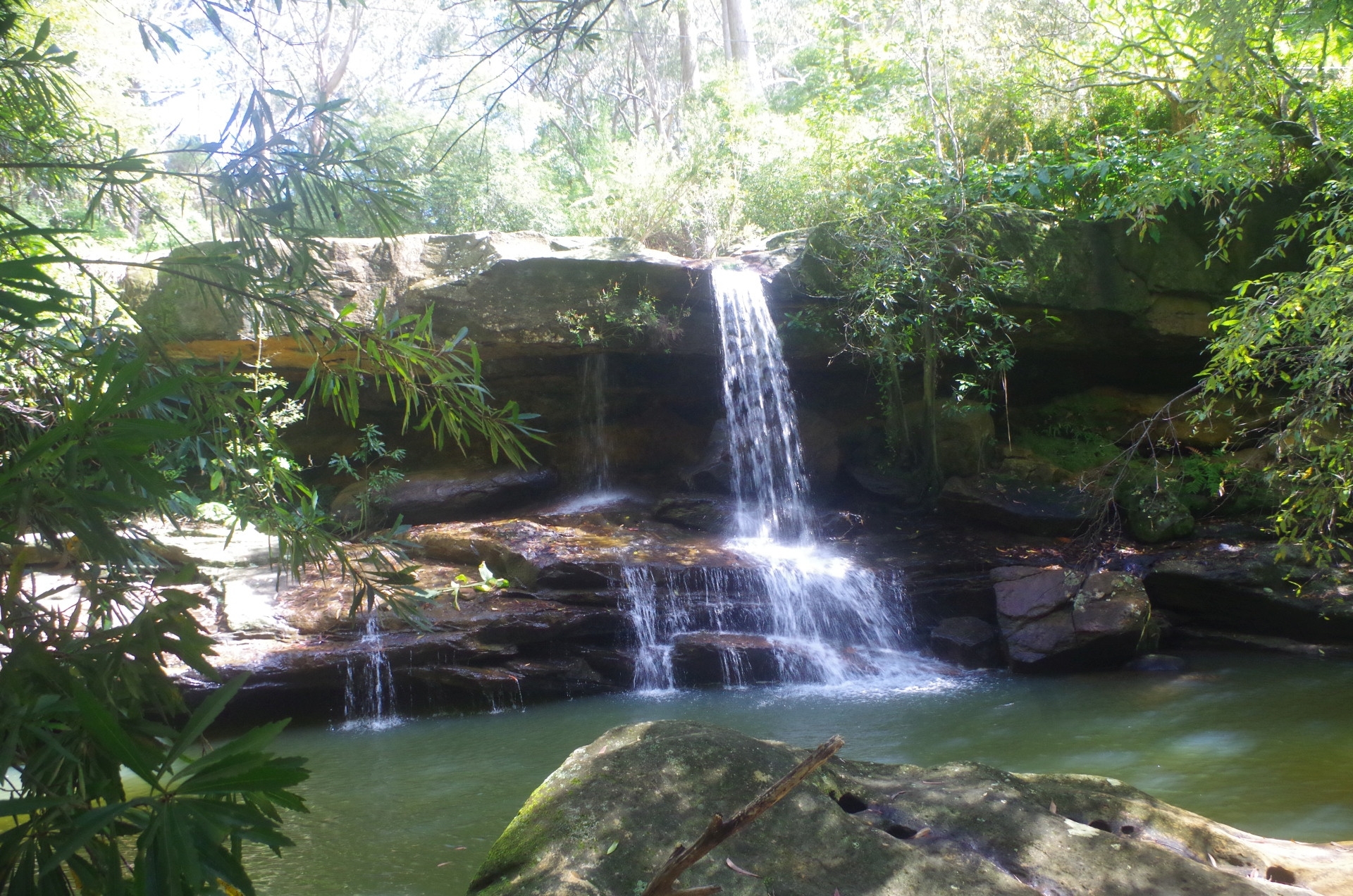
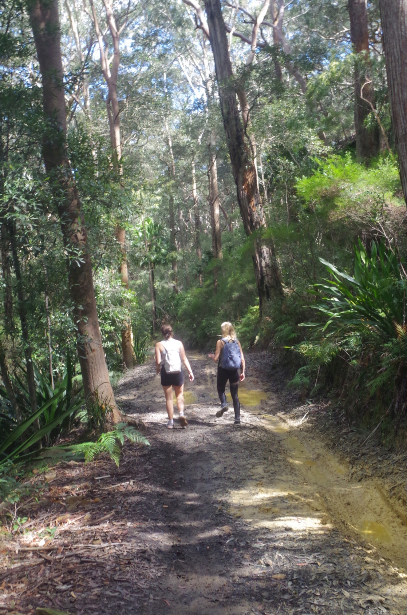
Most of us met up at Central Station with a few getting on at Redfern, and arrived at Helensburgh a bit over an hour later. After the compulsory toilet (not “bathroom”) break we set off for the 150 metres or so down to Wilson’s Creek waterfall. I also had another motive for going there apart from seeing the falls; the rate of flow gives a clue to how high will be the Hacking River crossing when we reached it in about 75 minutes’ time on the Burgh Track. The water was flowing moderately which was a good sign.
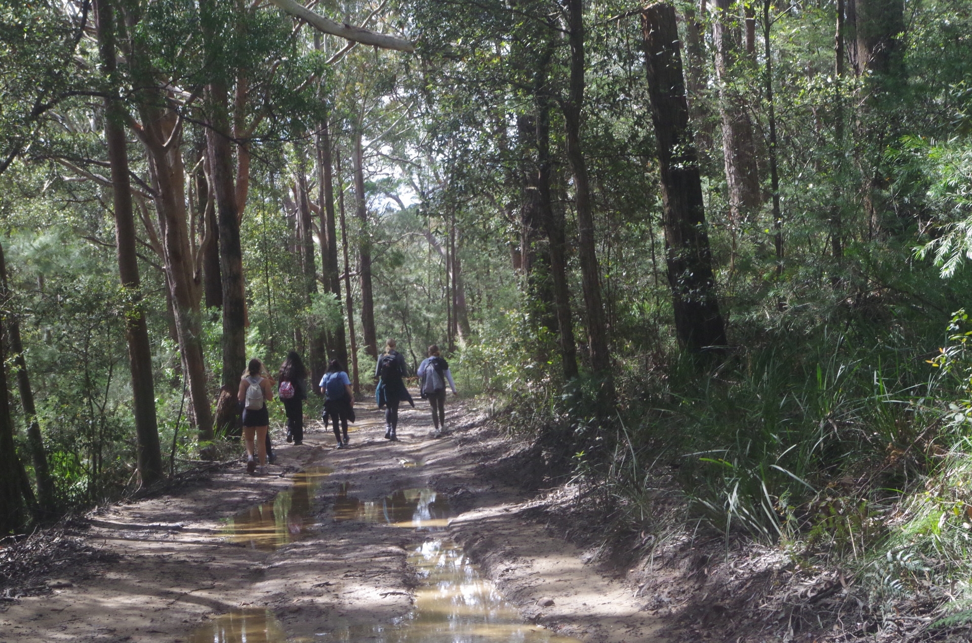
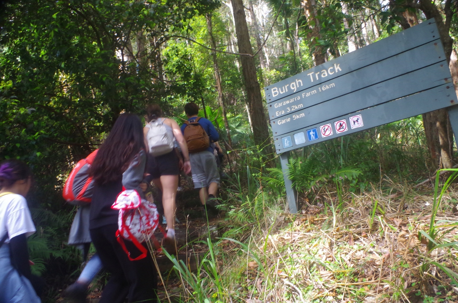
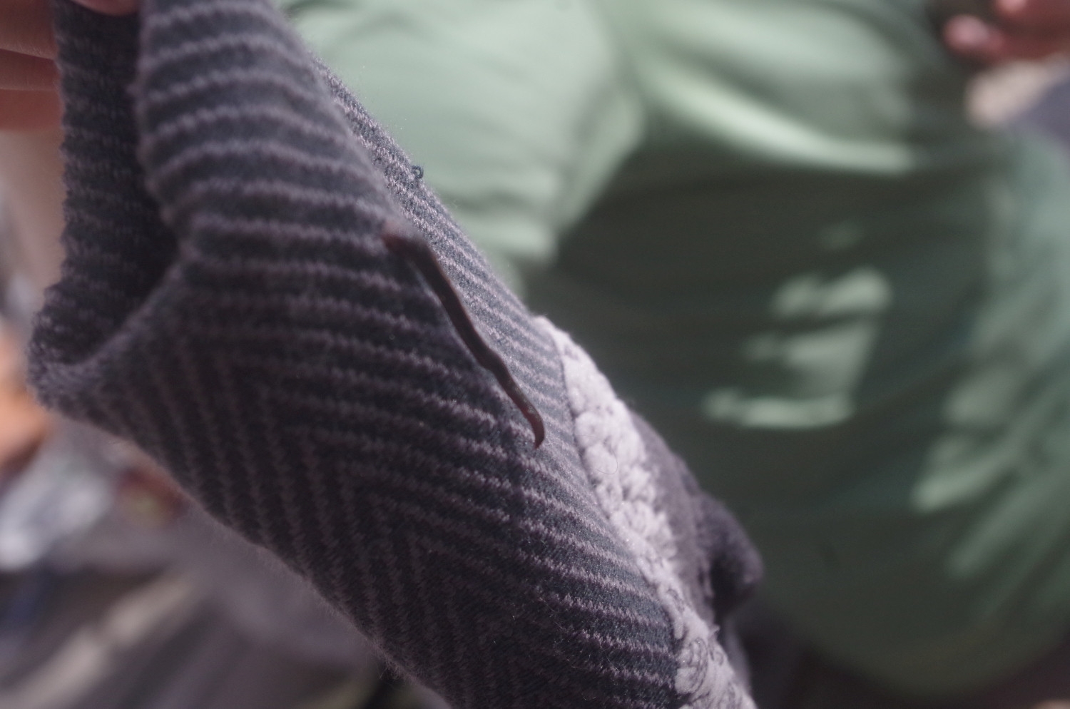
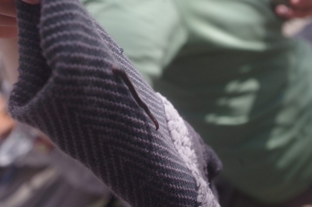
After the waterfall, we set off along the track which initially follows the railway fence just over the road bridge near the station which is also the local school students’ short cut to the station. It rises quite steeply initially until levelling out to pass behind houses on Gardiner place. Then it goes through a rough track which continues to follow the fence of the old Helensburgh Tip for a while until reaching the Hacking River Fire Trail. It was here we had a short stop while I warned people not to stop once we set off on The Burgh Track between its turnoff from the fire trail and the river, if they didn’t want to pick up leeches.
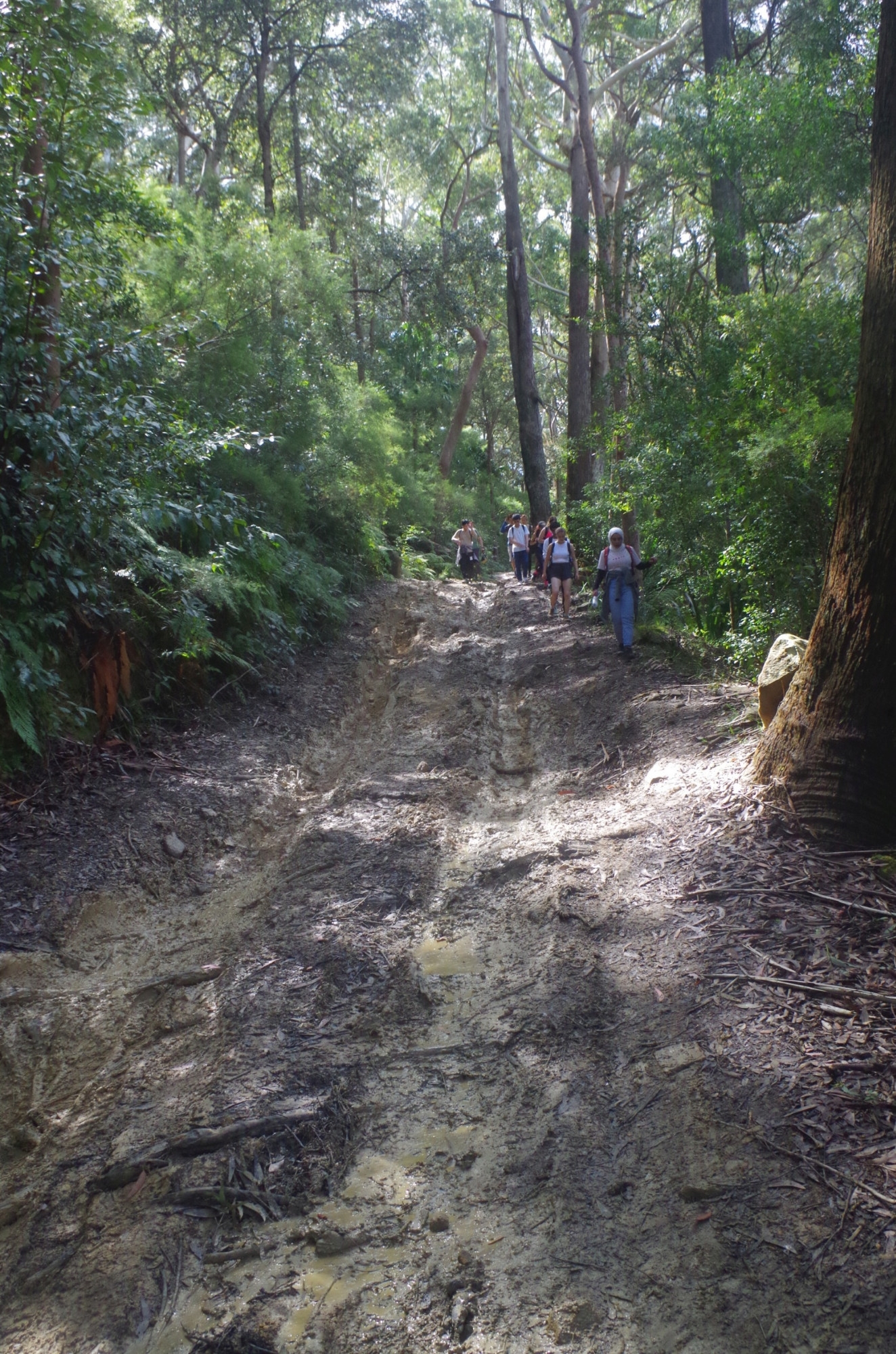
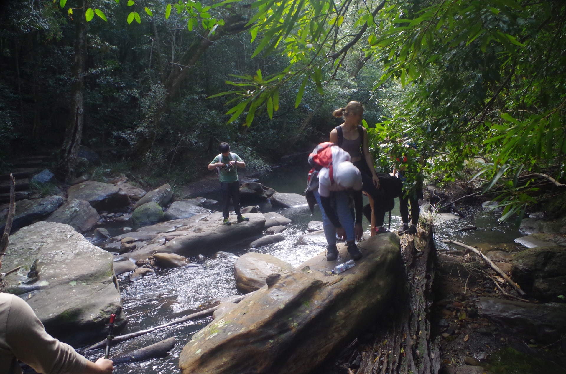
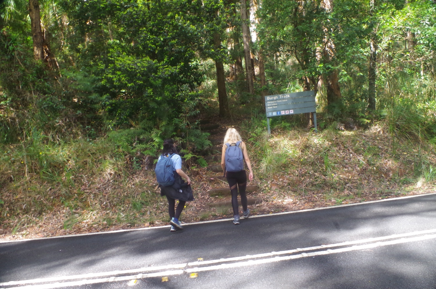
The Fire Trail goes on level for quite a while until starting its downhill descent into the valley of the Hacking River, passing through groves of Cabbage Tree palms and rainforest vegetation. Unfortunately it appears that some 4WDs had been along it recently (or maybe hopefully just National park vehicles) as some very deep wheel ruts had been made in the track surface, churning up mud too, making walking along it not easy (any 4WDs would get an unpleasant surprise at the locked gate at the main road exit – Lady Wakehurst Drive!). Eventually we arrived at the start of the Burgh Track, which is marked by just a post and an arrow, which a few in the lead overshot until called back. I repeated the warning about not stopping until reaching the river and along it we went. The river crossing looked OK this time, and most got across OK although care still has to be taken on the slippery rocks.

From there it is only a short distance to Lady Wakehurst Drive which we crossed to continue along the track which rises rather steeply from here for quite a while until the ridgetop. About two-thirds of the way I called a halt for a water break and also passed round Lamingtons (an Australian cake made from squares of sponge cake coated in an outer layer of chocolate sauce and rolled in desiccated coconut). This was a new experience for our overseas students. After the break we continued on until coming out at the Garawarra Farm car park, which had more toilets (not “bathrooms”), and also some picnic tables which we decided to use for lunch instead of lunch at the beach (a wise choice as it turned out as within an hour very short light showers had arrived, which would have hit us on the beach). Meanwhile I found a very small leech trying to get on my shoe, and Aaron found one on his sock! A couple of others found a leech each, but overall the leech “harvest” was very light. I gave Aaron’s leech a political name that I best not mention here.
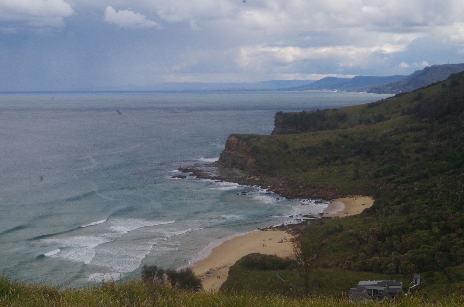
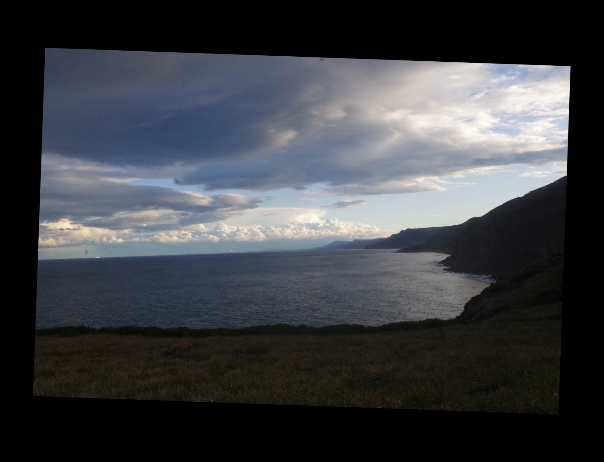
After lunch we continued down the Burgh Track on its final stretch to Burning Palms Beach and its junction with The Coast Track. There are lookouts along the way to view Burning Palms Beach and Figure 8 Pool, which is below the second headland you see, not the first headland. The sea looked calm and no waves were breaking over the rock platform which contains Figure 8 Pool. At the track junction we turned right along the Coast Track which drops down again along a track which thankfully has been greatly repaired by National Parks and much easier to negotiate than the former rutted and eroded track. On reaching the huts, the Coast Track is abruptly blocked by a “no entry” sign which directs walkers onto the beach to bypass a section there which is being upgraded with a board walk. Down along the beach we go, needing to cross a boulder field in the middle of the beach which can be hard going (it can be bypassed at a very low tide at the seaward side, but not this day). In fact, this mid-beach boulder field only exists because of sand erosion during the several storms and East Coast Lows we have experienced over the past 18 months. Check out my photo of this Beach here https://www.subw.org.au/2021/01/30/helensburgh-burning-palms-beach-otford-royal-national-park/ . You will see that the boulder field is hardly visible. I expect that when the sand is eventually returned, the boulders will again be covered, and the beach walk much easier.
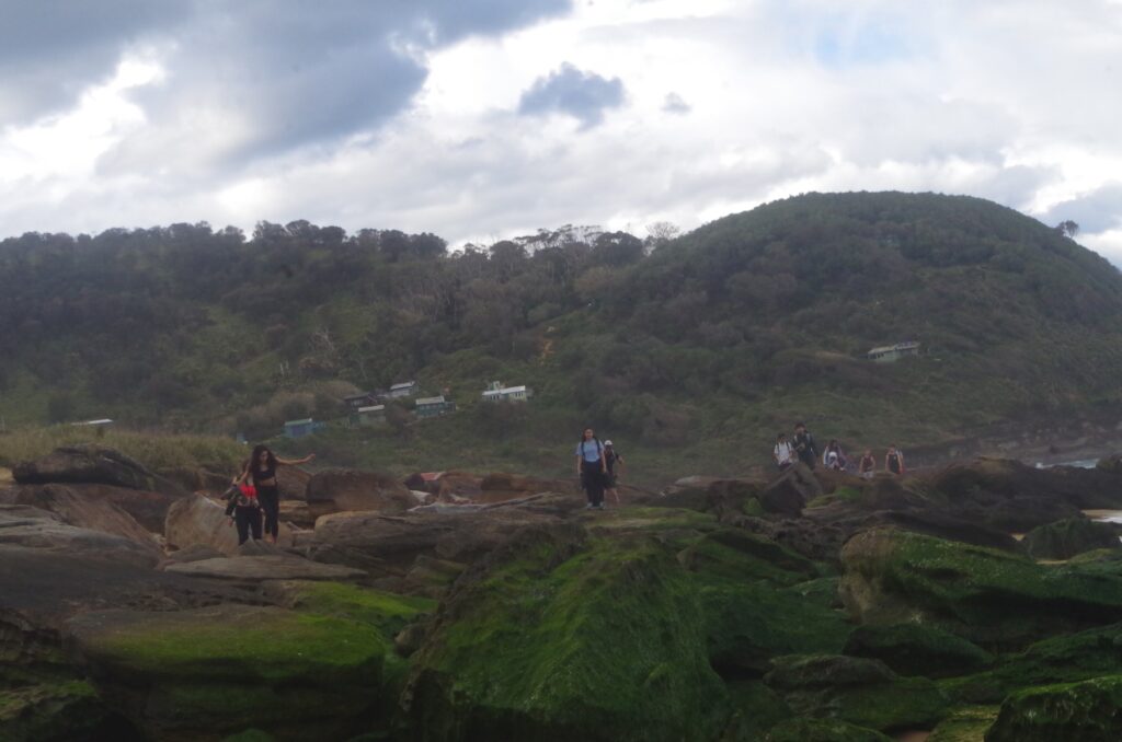
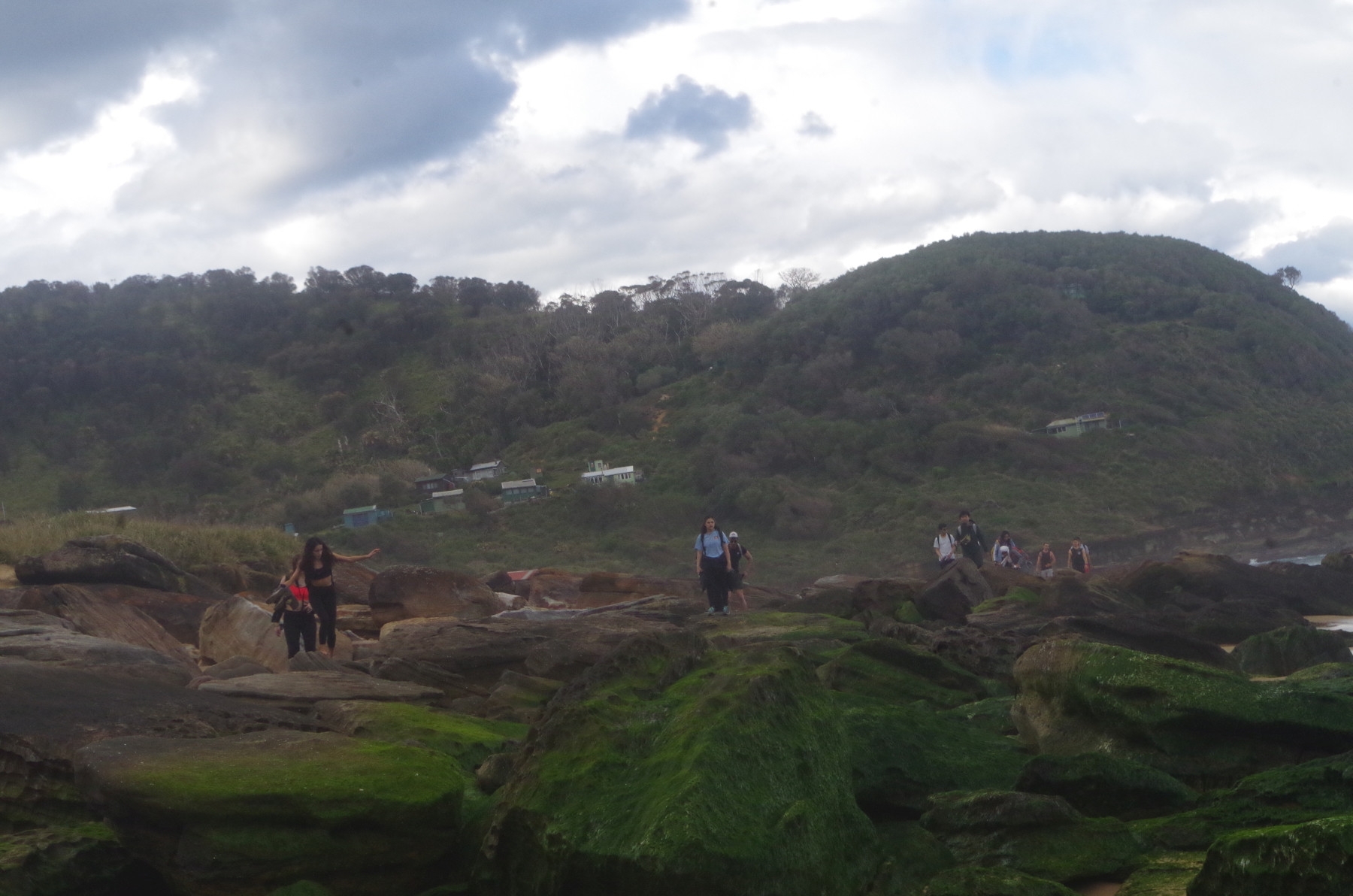
From the south end of the beach, another boulder field starts which has to be negotiated to reach the first rock platform before the First Headland. This boulder field is also normally partly covered with sand and can be partially by-passed via a grassy track higher up. Once on the rock platform it was easy going until reaching the base of the First Headland. this is a potentially dangerous spot, with rocks that might look dry but can be very slippery. Care has to be taken rounding this on the seaward edge although a somewhat more difficult pass closer to the cliff edge can be used if the sea gets too high. I did warn people not to jump from one rock level to a lower level as it’s just too easy to slip and end up in the sea with disastrous consequences. I will mention more about this later.
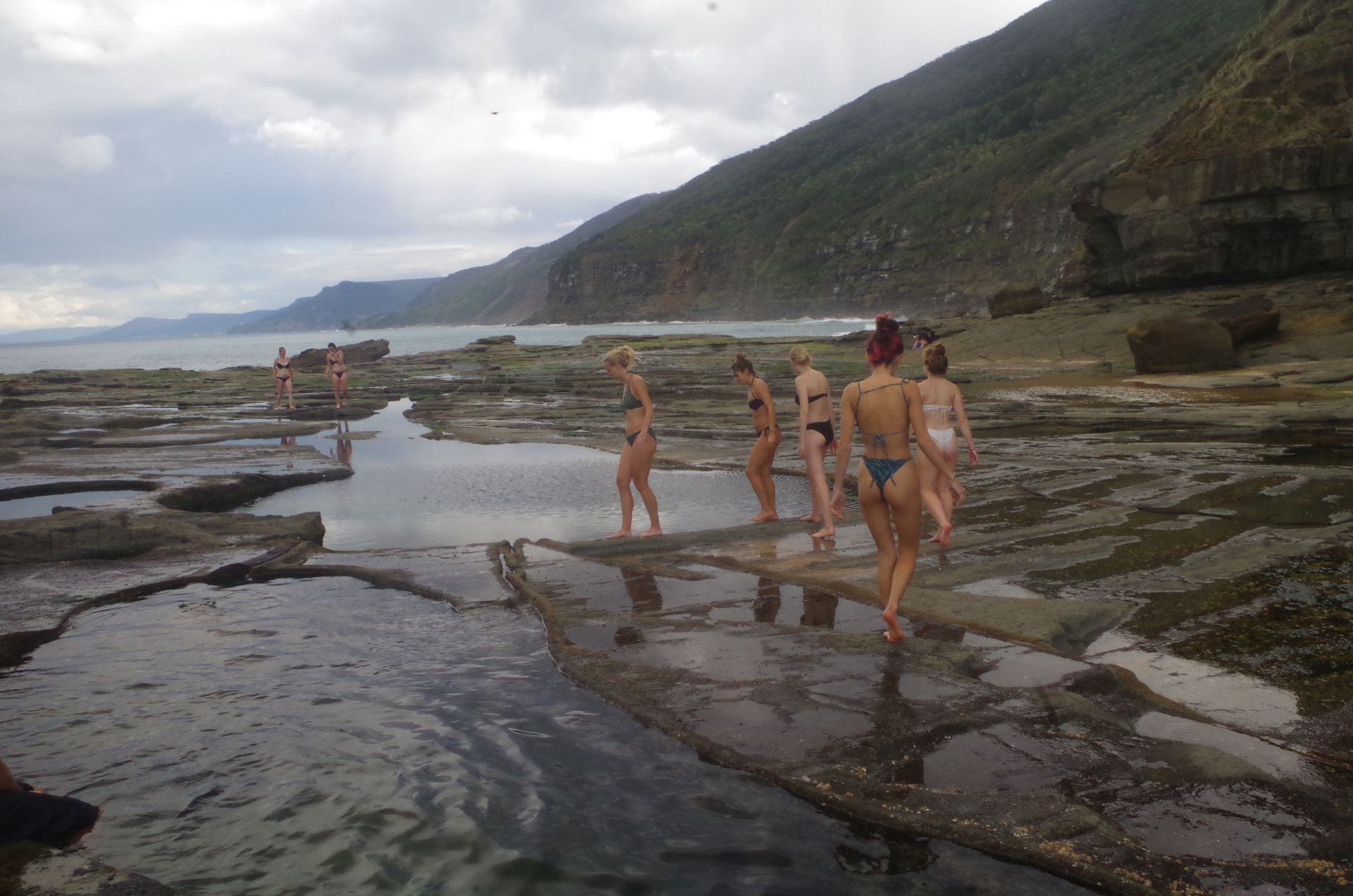
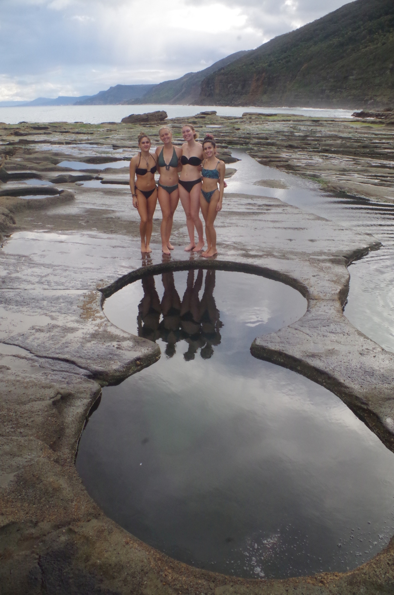
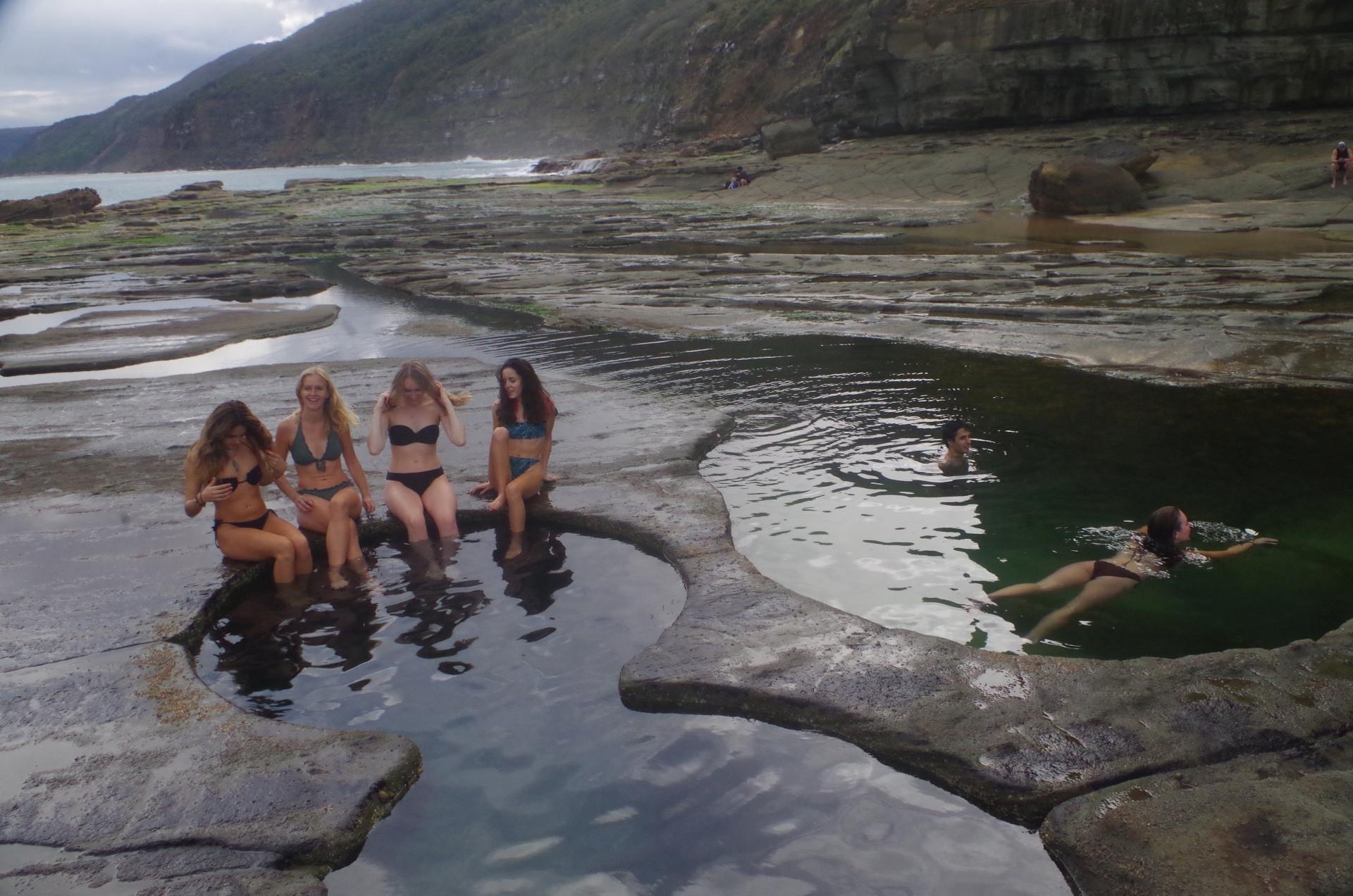
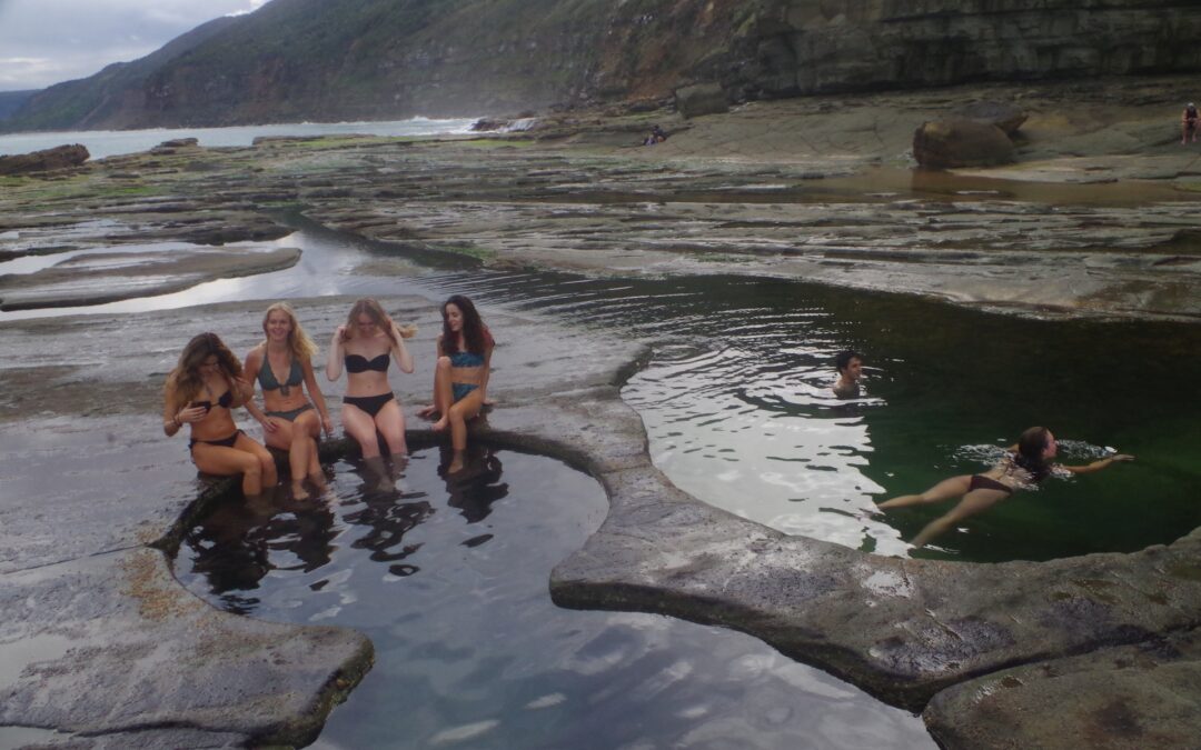
From here the “path”, such as it is, to the second headland and Figure 8 Pool has to cross another boulder field which can be hard going. Once past that the rock platform is easy to cross until reaching The Pool itself. I should mention that Figure 8 Pool is not actually very big at all; some walkers on past trips there had expected an olympic-sized pool, and on not seeing one, simply kept going!
The weather was too cold for swimming by Australian standards,and noboby was swiomming at Burning Palms beach, I noticed. Still, it was good enough for the overseas students from colder places, so in they went into Figure 8 Pool for a dip. There were few tourists there at the time, which also made the visit more pleasant. there was one person flying a drone around the location, which is illegal in this National park, likely due to its being below the flight path of aircraft coming to and from Mascot airport.
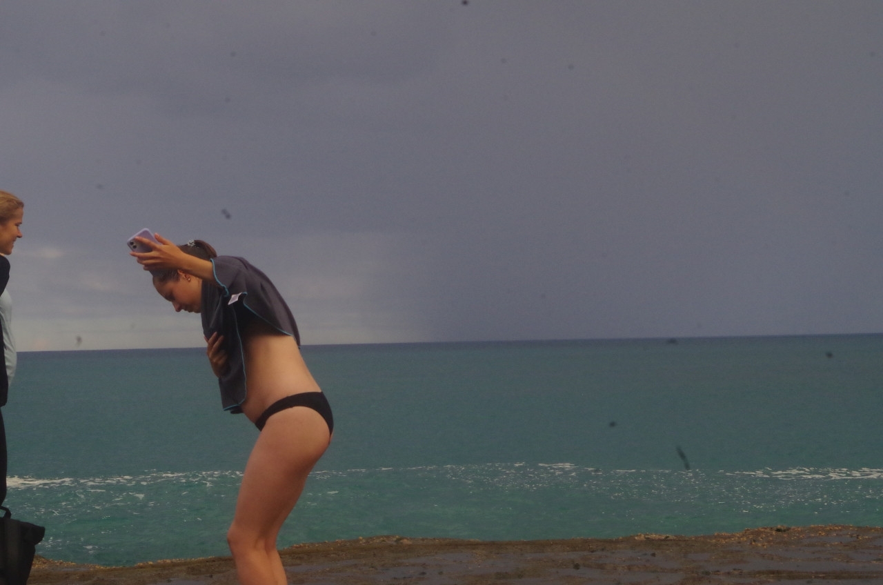
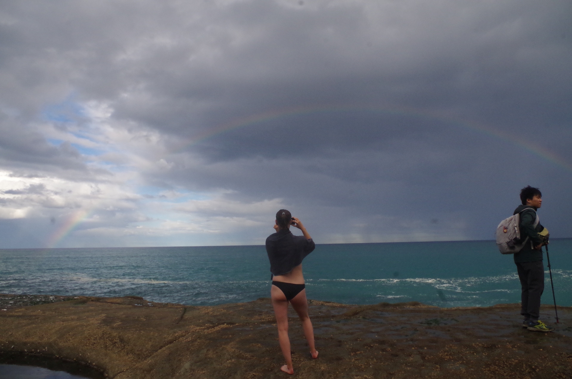
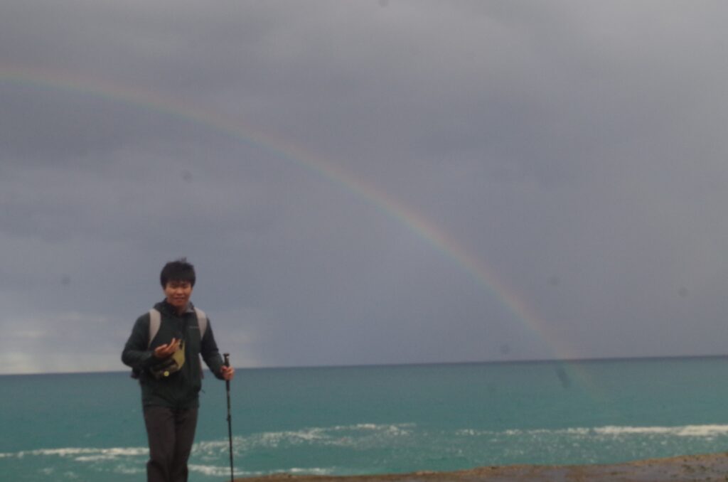
We did get our longest and “heaviest” rain shower here, but it was still fairly light rain and only lasted 5 minutes. It did create a rainbow over the sea which was exciting for many.
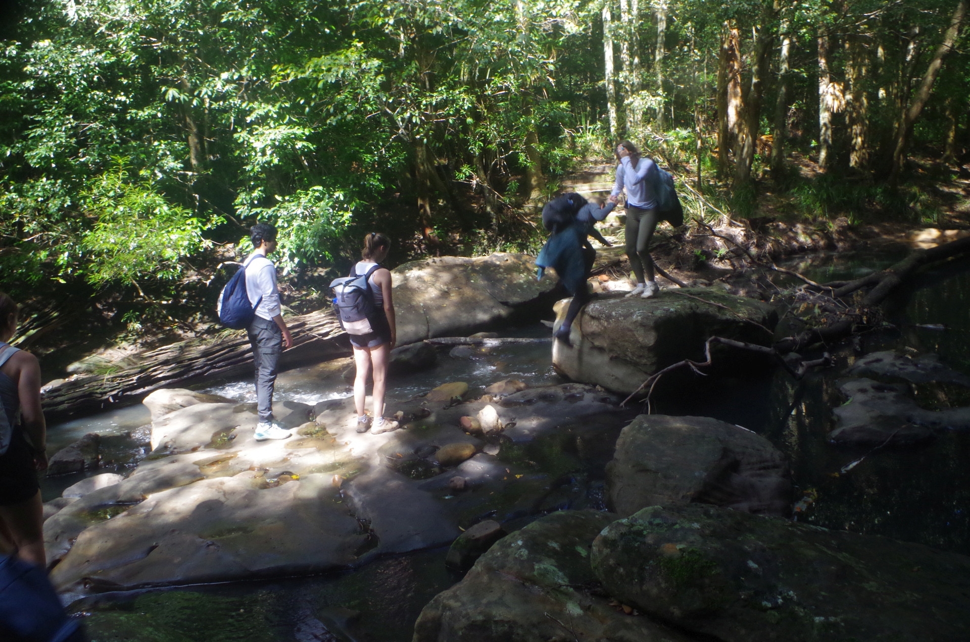
After a while it was time to return back to the beach, being aware that the tide was coming back in again. (That is something some people on past walks haven’t understood; at high tide Figure 8 Pool is hidden, sometimes by a metre of water with waves breaking over it. That is why we can’t spend hours there). Also, we don’t want to get caught by the rising tide causing waves to break over the passage past the First Headland, which I mentioned earlier. So off we went again over the boulder field, and taking more care passing round the risky first headland section, and I made sure everyone got around it OK before continuing on. On reaching the beach after crossing the last boulder field, I found there was only 6 people there including me, and I couldn’t figure out where the others had gone. Badour then said that a few minutes ago, she had seen them just disappearing over the mid-beach boulder field. She then ran forward to catch up with them to tell them to come back. This was disappointing as until then the group had always waited at various places to ensure that anyone at the tail end of the group had caught up. I was in the tail group here as I wanted to make sure everyone got off the rocks OK (we have had injuries [cuts, sprained ankles] on this section in the past). This was the one spot where the people in the lead really needed to wait, but didn’t, because we were going back to Otford, as I had mentioned at the walk start. The Coast Track detour was also here (but not signposted – something overlooked by National Parks) and it was a rough track beside, and partially in the bed of, Robin Rill to reach the Coast track from the beach. During periods of rain, Robin Rill becomes a gushing stream, and you have to actually walk through the water, like we did on the wet March 26 walk here. (Earlier on the way to Figure 8 a couple asked me how to get to Otford as the way to the Coast Track off the beach was not obvious, and I gave them directions).
The effect was that we lost almost 15 minutes off the walk back to Otford, leaving just over two and a quarter hours left to get there. It was possible, but it meant not stopping at lookouts and not having a more relaxed walk back to the station. (“Wildwalks” website quotes 2 and a half hours from here to Otford Station, but that’s downhill in the reverse direction, and also during daylight. We would be walking in the dark for almost half the distance, and uphill on a badly eroded track (more on that shortly).. So I was not happy.
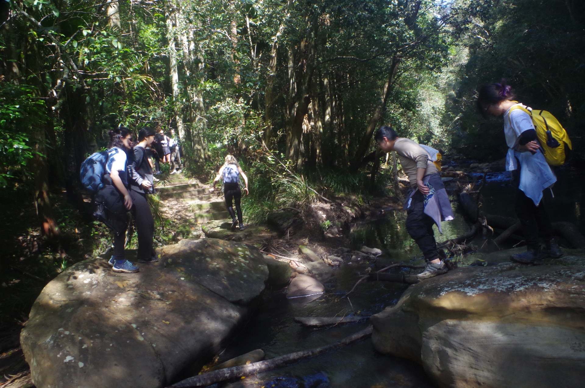
Anyway, we set off along The Coast Track as it wound its way gradually upwards through the Lomandra grass and levels out eventually just before it enters Palm Jungle. We had a brief water break here as a steady climb was coming up. Into Palm Jungle we went, and the track for some distance wasn’t too bad, not nearly as muddy as after the rainy season earlier this year when it was mostly under water. I noticed equipment stored here suggesting that this section of track will soon be undergoing track repairs, and not before time. After Palm Jungle, the track continues to rise and unfortunately the hordes of tourists visiting Figure 8 Pool in summer has caused considerable erosion making progress slower, and what’s more we were now walking in the dim light of dusk. There are exposed tree roots and random rocks to trip you, and the track gets more eroded at each heavy rain season (and we haven’t seen the last of these with another La Nina event forecast for late Spring). Track repair work does seem imminent which will make the going much better and reduce the damage to the environment and the tree roots. At present it reminds me of walking on railway sleepers on rail lines: sleepers are laid too far apart for comfortable walking but too close together for comfortable running. That’s what the obstacles on the track here are like now.
After another water break we continued on until evertually reaching the stone steps of the original Lilyvale Track which once connected this section to the old Lilyvale Station (closed by transport bean counters in 1983). That’s when I knew with some relief we were nearly at the top. A sort time later we came to the boardwalk which brought us to the Coast track’s junction with the Ridgetop Trail (called “Squeezeway” by Wildwalks for some reason). By this time darkness had set in and although I could see my way on the track up to now, I turned on my torch now (my night vision is still quite good!). Thus we continued under torchlight (the full Moon had only just risen and not showing enough light yet, and the sky was cloudy as well). At the end of this trail, the way continues on another boardwalk which is where I got a brief cramp in my left leg (for some reason if I do get a cramp on this walk it always happens at this point). It only lasted a minute and we continued on to where the track is close to the cliff top and from there starts to drop down via a series of stone steps.
I and a couple of others reached Otford Lookout at 7.02pm, although the lead group had continued on to the station. On checking the train times I found to our luck that the train from Otford was running 7 minutes late. That meant that we had just enough time to make it (actually with a couple of minutes to spare). “Wildwalks” quotes 24 minutes from here to Otford Station, but it takes less than that (we did it in 17 minutes and in darkness). So we were fortunate in making it to the train OK (the alternative was the 7.30pm train to Thirroul and changing there for an express train back to Sydney, but it would still be an hour later getting back to Central). Just before I reached the station Aaron was on the phone checking where I was; I told him I could hear the same passing freight train that he could hear so we were very close to the Station, with some relief.
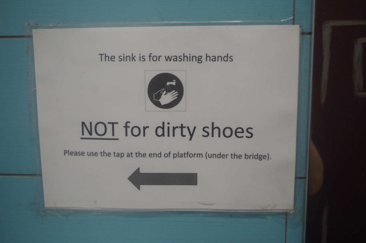
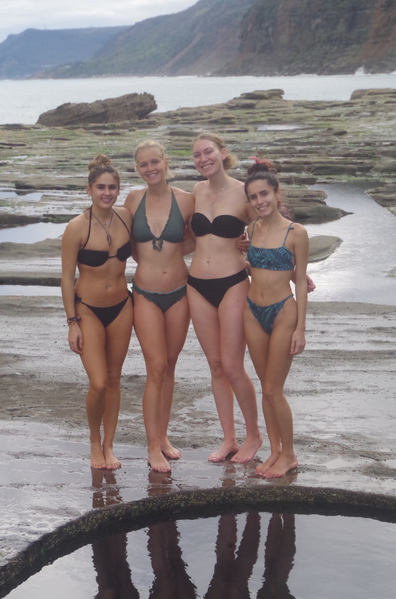
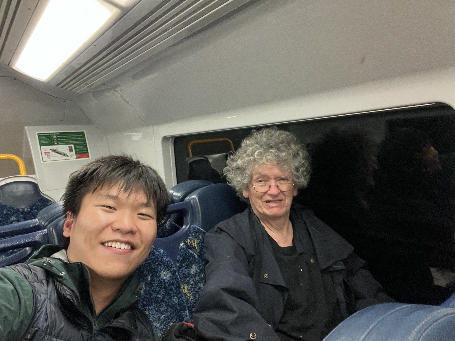
The train itself continued being delayed, arriving at Central 15 minutes late. Several of the group got off at Redfern so I didn’t see them once we left Otford as I was in a different train carriage to them. Aaron said that whenever he reads my trip reports, he hardly ever sees me in them (because I’m taking the photos). Therefore he used his selfie stick to take the whole group at Figure 8, and also one of me in the train going home. (My hairdresser is off sick; Covid?? I don’t know. So I am still waiting for a haircut as you can see). Another photo is of a sign in the toilets of Helensburgh Station; looks like people visiting muddy locations like Metropolitan Tunnel have been washing boots in the sinks there! The final one is of the full Moon with Saturn just below it, taken the next day showing what we missed seeing on the walk because of clouds.
There are a couple of take-aways to be learned from this particular walk. (1) Figure 8 Pool has a deadline which can’t be ignored: the tide. Get caught by a rising tide and you can be in big trouble! (2) Extra care must be taken when walking on seashore rocks. Some can be very slippery even if they look dry; if they look black they can be slippery as the black is caused by algae. Slip on one, and you can find yourself in the sea being cut by the razor-sharp barnacles clinging to rocks at the waterline. (3) You must keep aware of your surroundings on walks. Some people get so engrossed in chatting that they miss things, and some of those things can be snakes. Many Australian snakes are HIGHLY VENOMOUS, and the World’s second and fourth most venomous land snakes can be found around Sydney (Common or Eastern Brown, and Tiger snakes). Overseas students are sometimes told silly stories about “drop bears”, but snake stories are no joke; they are very serious. (4) When in a group keep together as much as possible. If you are in front and find you can no longer see the rear of the group, you must stop to wait until they catch up (the walk leader does this too) Some people are slower walkers and that needs to be taken into account. Failing to do that has caused delays on walks in the past. It;s also a safety issue; everyone needs to keep a lookout to ensure everyone else is safe. (5), On recent walks, (but not this one), people have arrived with what they think is the route already downloaded by them from apps like “Alltrails“. That route might not be what the walk leader might use. The tracks I use to get from Helensburgh Station to link to The Hacking River Fire Trail will not be found on any apps. Remember, apps and Google are not your walk leader!
If anyone reading this knows any staff of NPWS, ask them to put up a sign at the south end of Burning Palms Beach showing how to get back onto the Coast Track and Otford after the detour. If there had been a sign there the lead people in my group might have stopped there instead of continuing on.
The group was quite a large one, and in fact more than that had signed up. One person pulled out late the night before after my weather email, because he didn’t have any sort of rain cover, and it is unwise to go on any walks without one. It can be unhealthy to be going home wearing wet clothes. Another emailed me at 9.15pm to say that “something had come up”, after I had sent a circular email advising people of the weather forecast the next day. I do suspect that if not for my weather email, he would have just been a “no show” the next morning. In fact there were two outright “no shows”, including someone who missed my Heathcote walk because of “sleeping in”, and one other. I have heard nothing from either of them yet.
Someone was asking about a Wondabyne walk. The wildfloers are out now, so I will see when one can be done, and post it.
Bruce Stafford.