Date: 8-13/12/2025
Trip leader: Terry
Party: Adam, Aidan P, Katya, Tim, Chloe
The second New Zealand trip of the club involves a short 4-day multi-day walk through Gillespie Pass, on the east side of Mt Aspiring National Park. These days my interest in road trips has died down and all I’m interested in is venturing into random places, wild camping and disappearing for a few days, which New Zealand is the perfect place for.

Preparation for the trip was straightforward with a group of 6, all having previous multi-day camping experiences. Weather conditions in that area are relatively stable compared to Southwest Tasmania, as the tall mountains along the Alps shield off most of the rain coming from the Tasman Sea. This leaves the West Coast humid and wet, while the East is relatively dry. Still, alpine trips come with alpine conditions, which can be unpredictable. Everyone is prepared with rain and puffer jackets, quick-drying outfits and warm sleeping bags. Conditions were pretty temperate with weather similar to winter in Blue Mountains, and most of the extra layers I took ended up unused.
The walk is well established and the tracks are well paved, crossing through sections of forests, alpine valleys, alpine crossings and back to river valleys. It’s a nice mix of different trail conditions, even though nothing is challenging. There’s no snow except for a short section near the bit with the highest elevation, but the snow is powdery and there’s nothing of concern. It’s also far away from the crowds in those Great Walks, and we spent a good chunk of our time being the only ones on the track.
A 4-day walk is also at the point where you’re transitioning from being able to pack fresh ingredients for every meal to having to rely on lightweight freeze-dried meals. Almost all of us took freeze-dried meals as meal prep in a foreign country isn’t the most pleasant thing to do. New Zealand is where most of the freeze-dried meals are produced in this part of the planet, and they can be found at affordable prices at PakNSave. Over multiple Tasmanian trips, we’ve gathered a few tips on how to choose tasty freeze-dried meals. The main thing is to avoid anything Asian, eg. Beef teriyaki, Honey soy chicken, as most of them taste horrendous and special fried rice is probably the best way to describe their taste. We have a personal Backcountry Cuisine’s nice list and mostly stuck to it in our preparation:
Moroccan lamb
Beef curry (even though it tastes more like beef stock+jerky+rice)
Lamb Fettuccine
Thai Chicken Curry
Chicken Tikka Masala (if we disregard authenticity and treat it as a creative interpretation of indian cuisine)
Spaghetti Bolognese (more like a safe choice. It’s a bit bland, and bringing some salt and pepper will help)
I’ve also found RealMeal’s wilderness stew to be really nice. It’s a nicely seasoned mix of potatoes, carrots, and solid chunks of beef. That has given me confidence in that brand and I’ll probably try their other meals in future.
The group of 6 was mostly finalised a month before the trip, roughly after Adam’s Frenchman’s Cap trip. Some have been to New Zealand before, and some, like me, have grown tired of touristy road-tripping itineraries and overcrowded spots filled with wealthy tourists. Aoraki/Mt Cook village in my previous trip was a prime example. Hooker Valley track, the extremely touristy walk, was more crowded than Strathfield Station at 7 am. Tourists equipped with fancy Arcteryx shell jackets worth thousands of dollars, all to flex their wealth on this one single walk, when a $60 one would’ve been good enough.
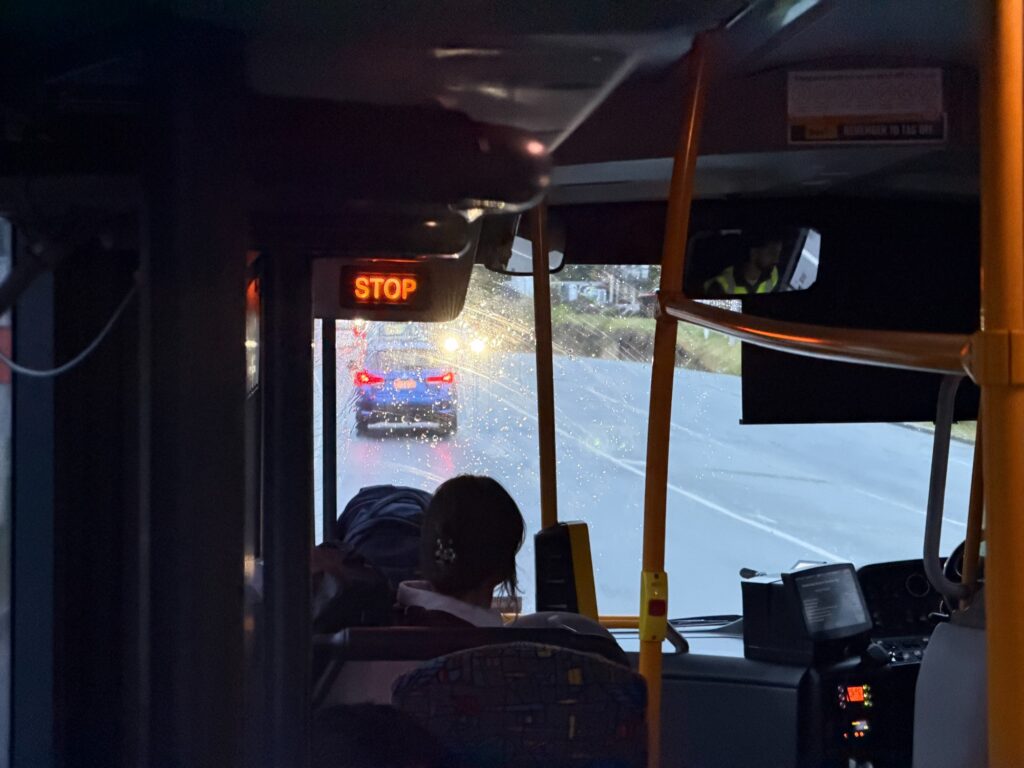
First day in Queenstown was rainy and cold. Fortunately, the rainfall was fairly contained to Queenstown area and Wanaka area still had great weather. Nothing is guaranteed in alpine areas, but at least nothing overly extreme is happening and it’s all within our range of tolerance. Going through immigration, declaring my tents and hiking shoes and all that didn’t take long. Getting on the bus was a challenge by itself. I have a Bee card from my previous trips and paying for public transport is a breeze. Not so much for other tourists who have no clue how to pay for public transport, wouldn’t listen to a word of what the bus driver said and kept trying the card reader with Apple Pay (which obviously doesn’t work- it’s not an eftpos machine). Reminds me of catching a bus in Hong Kong, where tourists clog up passageways while they struggle with their payment QR codes, then proceed to complain when they’re the ones slowing everyone down. Public transport in Queenstown is really nice- the main bus route runs every 15 mins, and the transport app uses crowdsourcing to help with bus tracking.
I’ve spent a few extra days around Queenstown before everyone else arrived. The city feels very much like Disneyland. Everything in town is catered to tourists, with an abundance of AirBnBs pricing out renters. Most of my time was spent walking by the lake and enjoying an office with a view. A few shopping trips to Four Squares, breakfast in the Instagrammable Fergburger, visits to Cookie Time, patronising the southernmost Gong Cha, and a short half-day guided canyon. The guide likes his “ooh la la”, but that sounds a bit old these days- I think “6 7” is a better alternative.
A short conversation with the guide followed as I’m interested in the canyoning equipment scene in NZ. Similar to Australia, outdoor equipment is fairly overpriced and most people would import their equipment during their European trips, or retailers such as Olinuid. There’s more CE4Y gear (a Swiss brand) popping out in our gear scene, with one of their wetsuits costing close to $600. While being overpriced compared to other wetsuits, the guide strongly attests to its quality, where it’s capable of keeping him warm even when canyoning in Swiss winter, where everything is snowy and icy.

A few others were arriving in Queenstown the same day. There’s strong wind and gusts in the area and those on the Jetstar flight were unfortunately diverted to Christchurch. Then comes the flight replacement bus- an 8-hour bus ride from Christchurch back to Queenstown. Not the most pleasant experience but fortunately, that was arranged by Jetstar with no out-of-pocket cost from them. We stayed in youth hostels the nights before the trip, and car camping near the start the night before.
Soon it’s the day before our first day on the walk. We have almost an entire day in Queenstown before Adam and Tim, the drivers, fly in. Katya did a walk to Queenstown Hill while I explored the DOC office, which featured some interesting exhibitions and lots of info on how to prepare for a walk. We took the bus to the airport to join up with others, endured a bit of routine traffic jam, and got into our rental cars. First stop: Pak’n Save, the cheapest place to get freeze-dried camping food. We spent some time packing and saving, stocking up on snacks and a few other things as well.
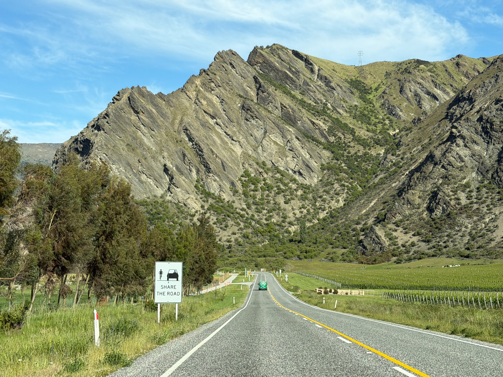
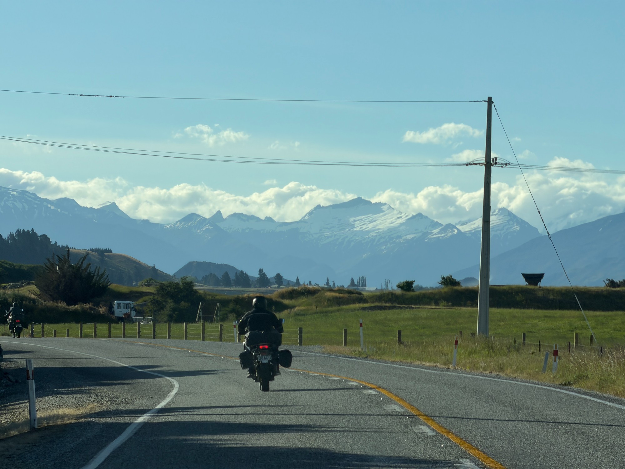
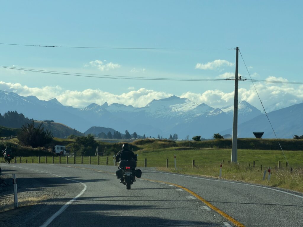
Having our meals sorted we continued east towards Wanaka. Adam took Crown Range Rd while Tim and I followed State Highway(SH) 6. A few tight twists around Gibbston Valley, we passed the bridge known for the first commercially operated bungee jump in the world. Soon we got to Cromwell, where the road branches off- SH6 towards West Coast and SH8 towards Christchurch. There are a few plantations on the outskirts of the town, and Jones Fruit Stall- my favourite rest stop on my previous trip to NZ on public transport. With buses, a shuttle from Wanaka would pick up passengers towards Cromwell, where they would change into a bus service to Christchurch.

Distant snow-capped peaks emerged as we cruised through straight sections of the highway. The plan was to meet at the Wanaka Tree, an Instagrammable landmark by the lake. Adam arrived roughly 30 minutes ahead of us and had already completed the walk to the tree by the time we got there – it’s quite underwhelming anyway. Tim and I wanted to avoid miserable camping food for as long as possible, so we ate out at a pub by the lake, enjoying some Monday specials.
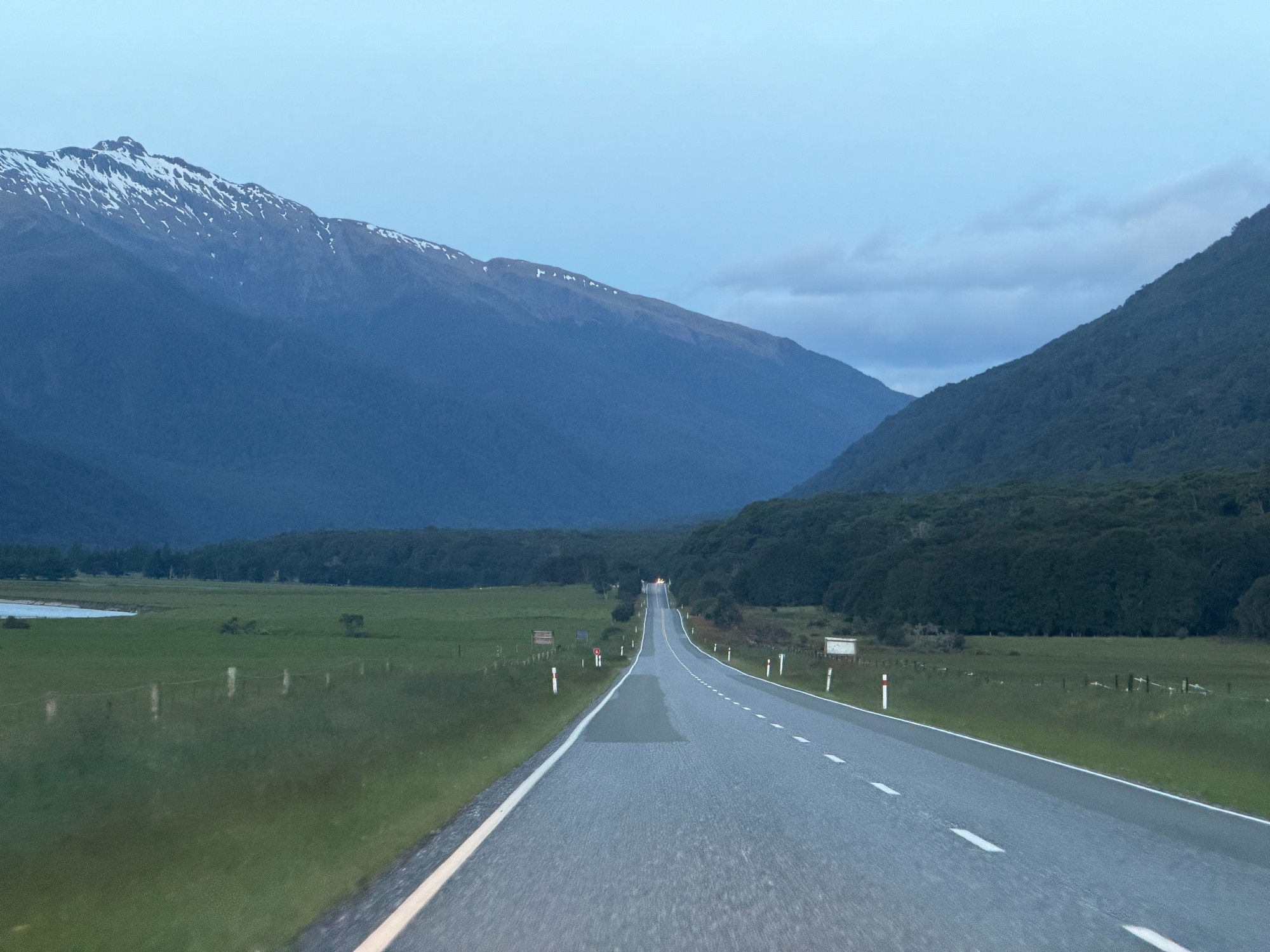
After dinner, we continued up SH6 for roughly 2 hours to our campsite. The lakes by the road were extremely scenic- first Lake Hawea, then Lake Wanaka. We had a few ideas of car camping next to these lakes, but settled on somewhere closer to the start of our next day.
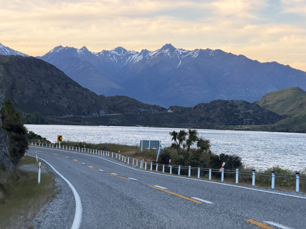
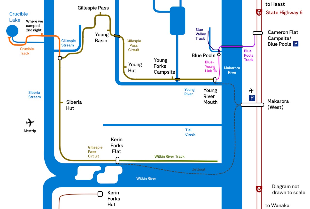
Lake Wanaka soon turns into a wide river, and we enjoyed some straight highway sections on the open river flat. That’s the Makarora River, where Mt Aspiring Nat. Park is just on the other side of the river. Up the valley we passed Makarora Township, a bit of forest and arrived at our campsite next to Blue Pools Carpark. We’ve settled somewhere in this crowded car camping spot full of caravans and campervans, set up our tents and gone to bed for the night.

Day 1: Young River Mouth to Young Basin
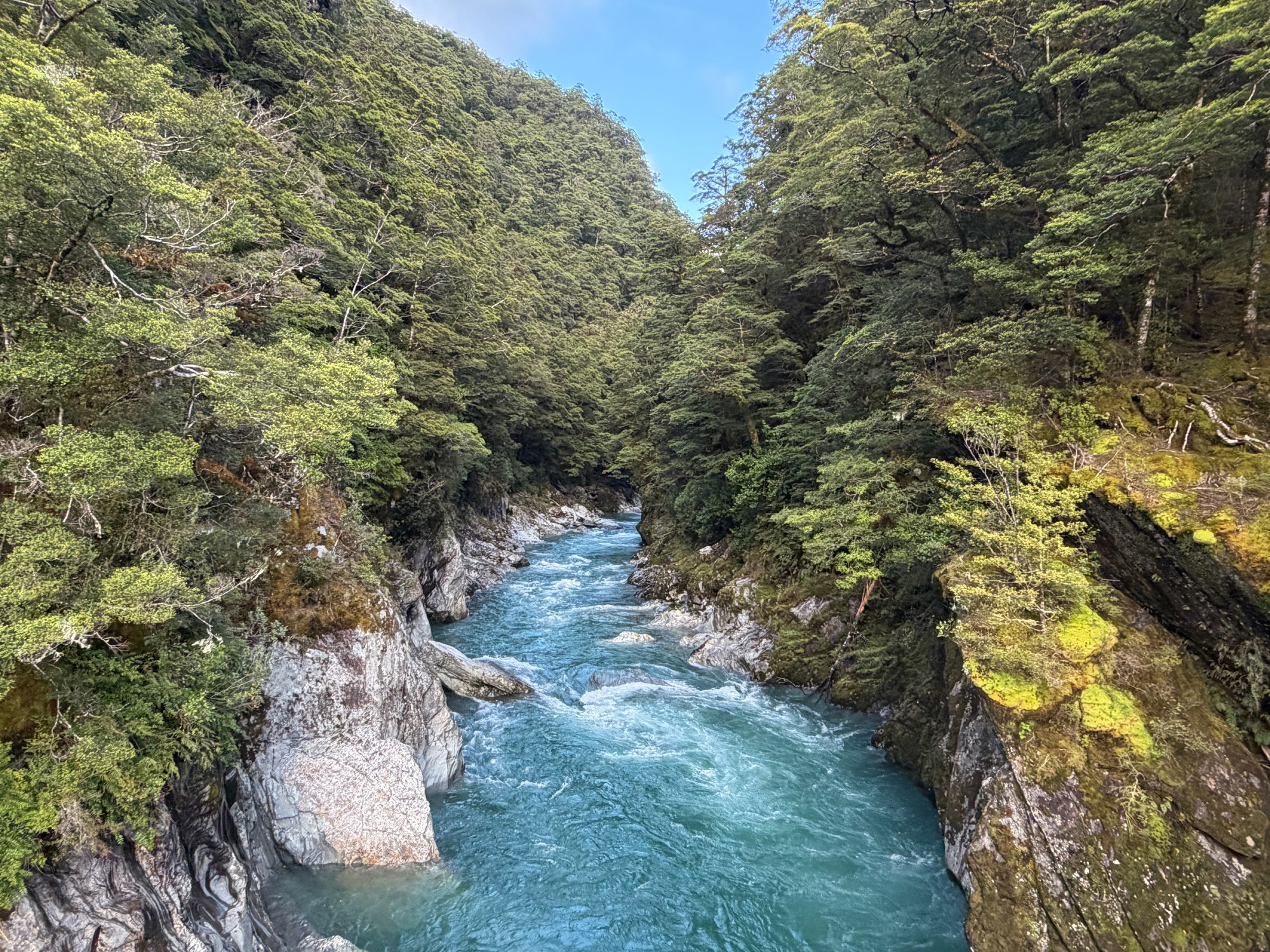
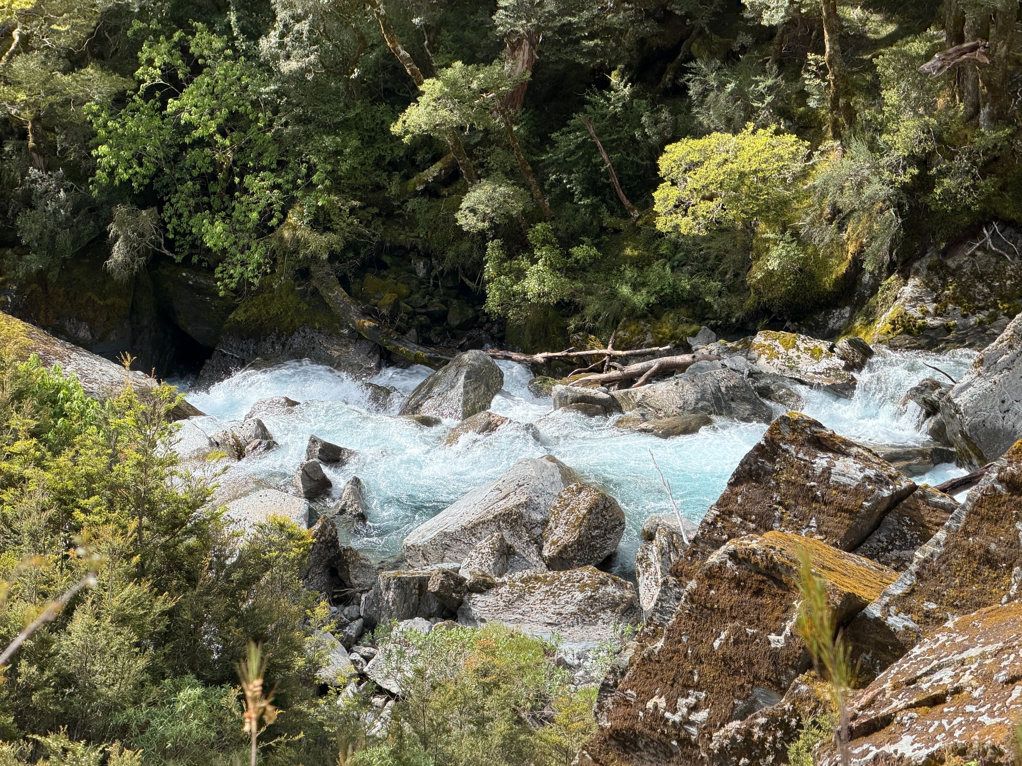
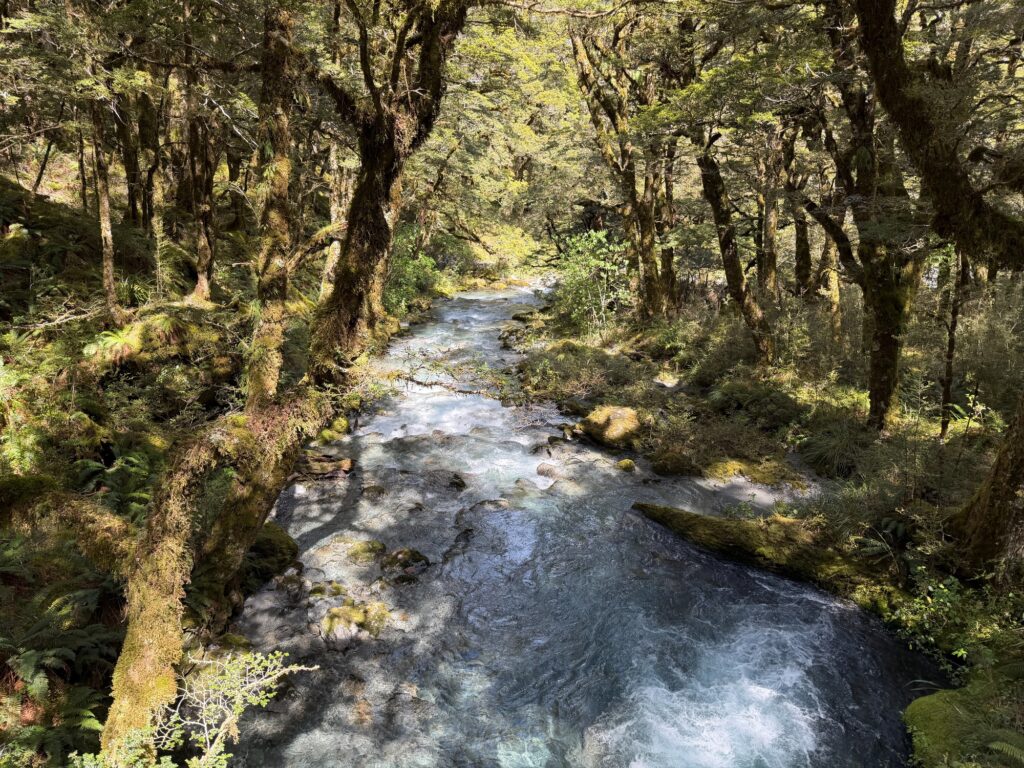
I woke up really early and went for a morning jog to Blue Pools while others were still mostly asleep. Blue Pools is a bit boring- most of the river on the walk is more blue than these supposedly blue pools. It’s quite nice crossing the Makarora River on the suspension bridges, though- it’s the only bridged crossing of this big river in the area.

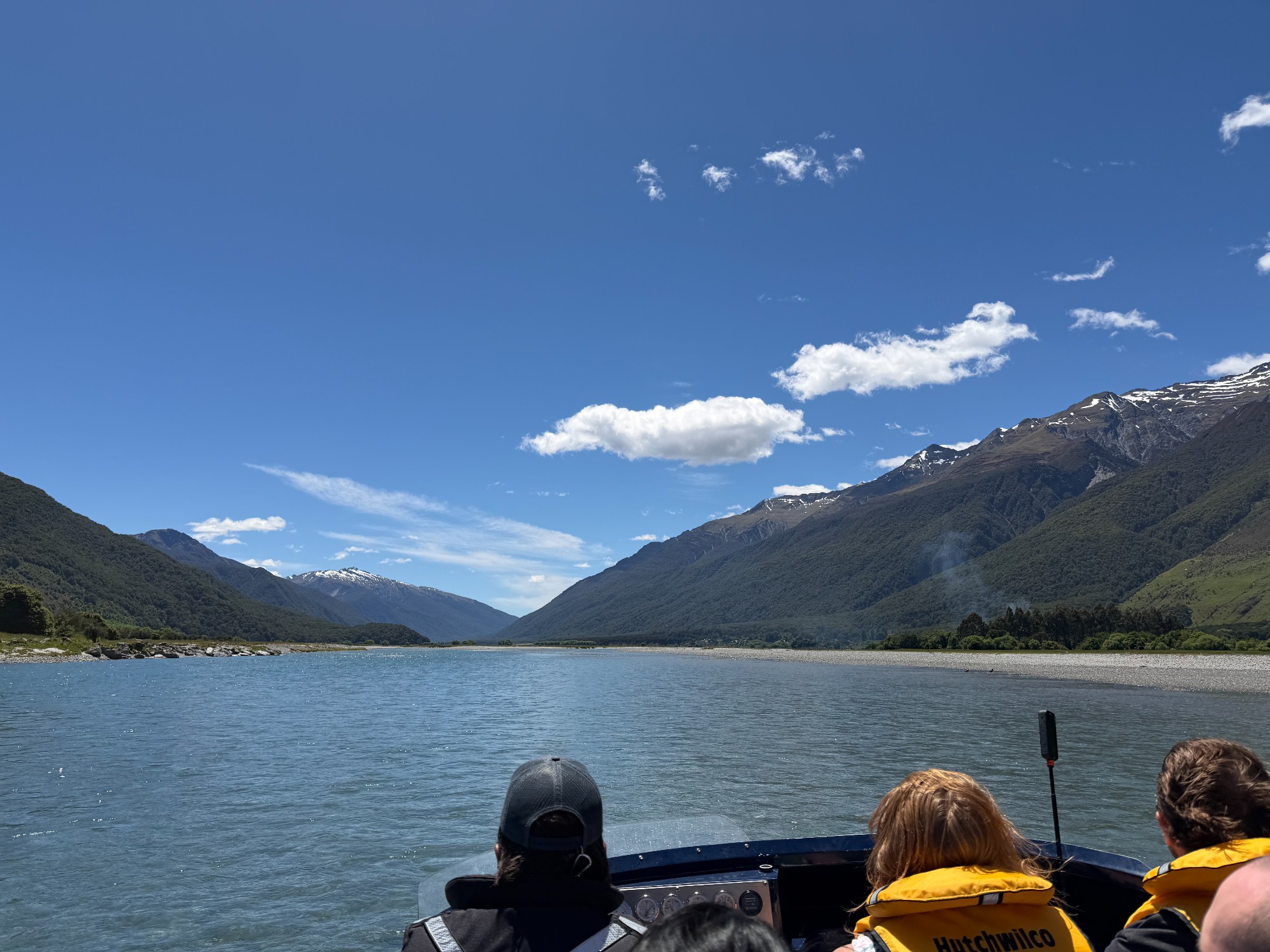
We started the walk with a short, 5-minute jetboat shuttle to Young River Mouth. Wilkin River Jets operates these transport for trampers/bushwalkers, along with a mix of itineraries for tourists going on scenic flights and hut stays. We’ve got a taste of what jetboating feels like and what to expect on our final day’s longer jetboat ride, before pulling into a rocky bank marked by a handline. Not quite what we were expecting a pier to look like, as the driver jokingly said that if we can’t get out of the pier, we probably shouldn’t be doing the walk. A few of us in the front row got off first, forming a human chain passing packs off the boat.

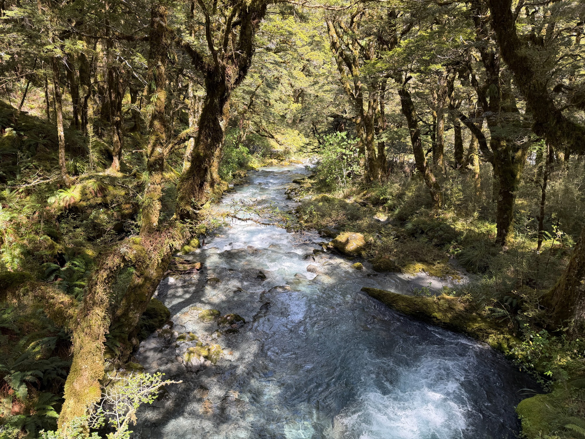
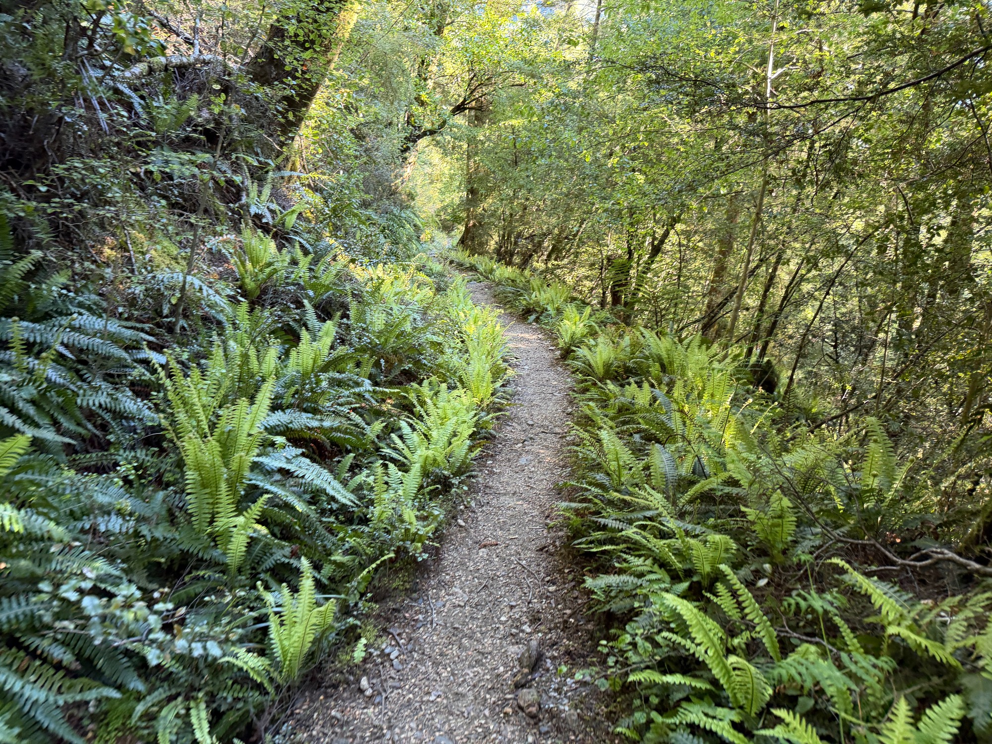
That’s where the walk starts- a pleasant dirt track right by the river. Few minutes later, we found a nice beach by the Young River to fill up our water bottles and have a bit of morning tea. This is also where I’ve reiterated the rules of my walks. Similar to our Frenchman’s Cap trip, we’ve introduced a social credit system, where you would gain points for stepping over mud and lose points for going off-track to avoid mud. Essentially, stepping on the fringes of the track to go around mud would, over time, widen the track and erode the vegetation that surrounds it. Everyone’s social credit points would be in the negatives regardless, as it’s always easy to think of ways to lose social credit points, but hard to brainstorm methods to gain points.
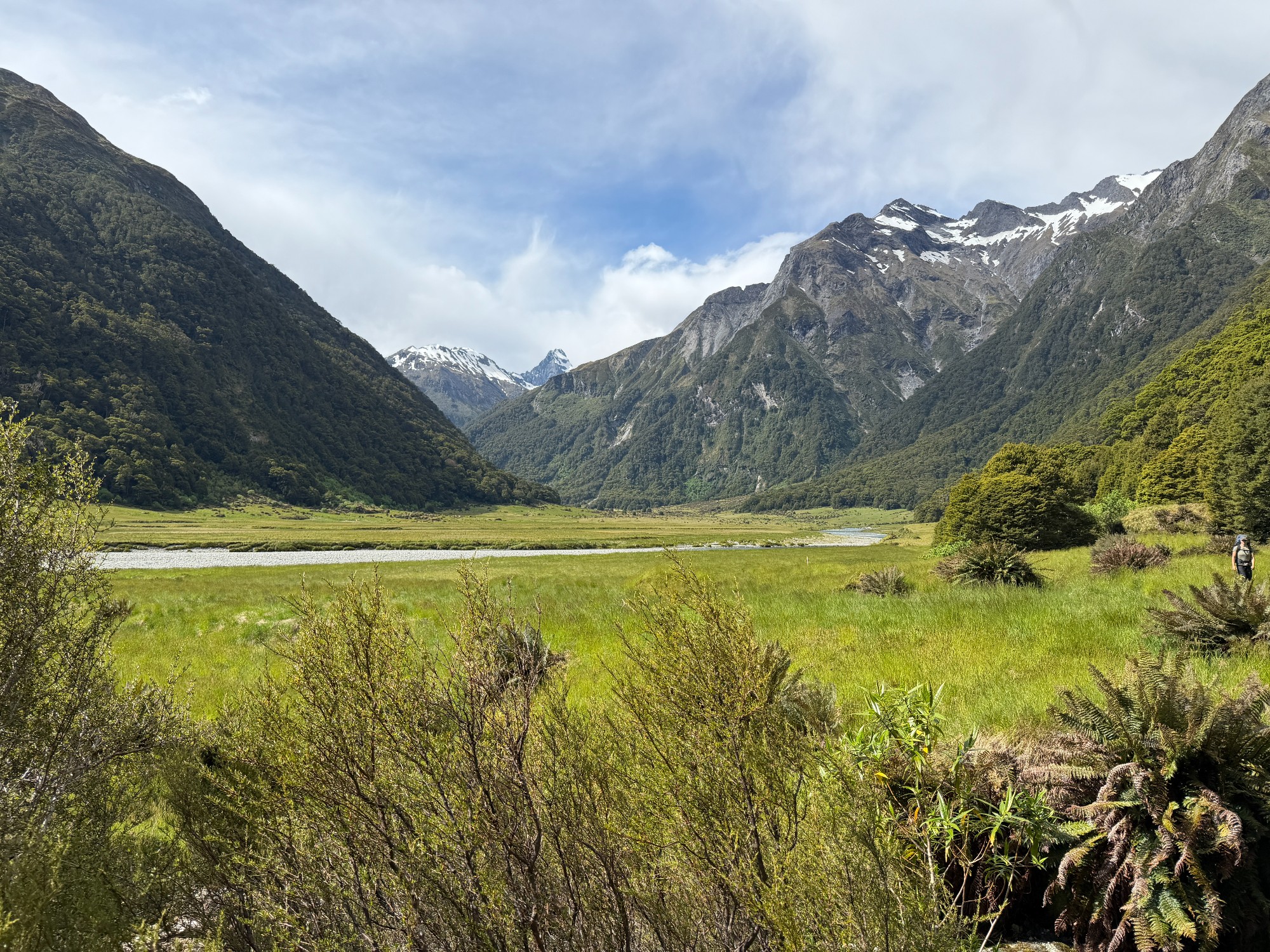
The valley then opens up as the track travels along its riverbank. Lots of photo opportunities and for most of us, a first taste of what walking in NZ feels like. A bit of easy walk along flat terrain, mixed with some easy creek crossings and we’ve reached Young Forks Campsite for lunch. First taste of freeze-dried meals for me, and Adam made wraps with cheese, chorizo and spinach- things that last for weeks with no issue.

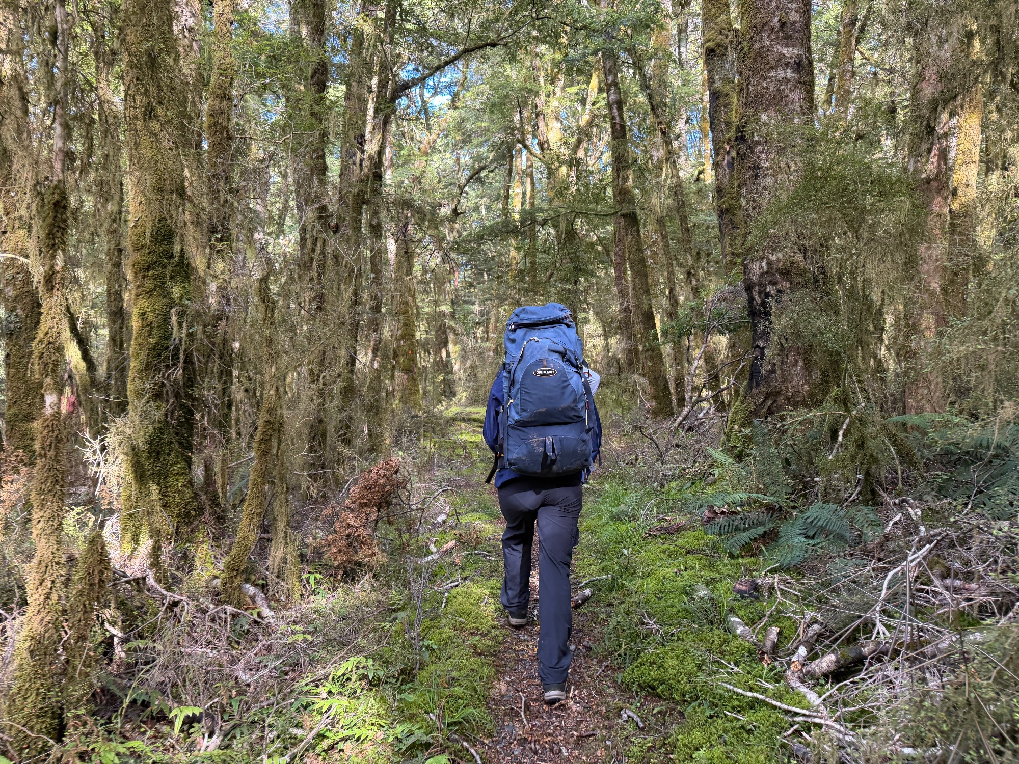
A fast-flowing river has accompanied us for most of the afternoon, as we gradually gained elevation up towards the valley. The track is fairly rugged with lots of tree roots and rocks, not the easiest for beginners, yet a lot easier compared to Frenchman’s Cap. At least the tree roots are dry, saving us lots of time from navigating through tripping hazards.
Going uphill also meant we were going at different paces, where Adam and Tim led the way while I was at the back. The 200m elevation gain from the lunch spot to Young Hut through all this uneven terrain was quite demanding for the less experienced members of the group. We had a small regroup 2km from the lunch spot, right after a suspension bridge. The creek looks quite pretty, but not much time to enjoy it. Quick look at the time, it was about 4 pm- we were walking at a pace of 1km per hour, which is pretty concerning. With a sunset time of 10 pm it still feels like midday, but with about 3.5km and 400m of elevation to go, we probably needed to double our walking pace.
With every water break comes a round of Cookie Monster- distribution of my bag of Cookie Time choc-chip cookies, with a really cute monster printed on its bag. It’s got great value, a big bag of cookies for just $5NZD. Many people online would recommend cutting down on snacks to save weight, but that’s often not the case- in fact, they are essential for an energy boost for the most demanding parts of a walk. Carbs are what we need to power through an uphill, and it’s never worthwhile to try and save weight.
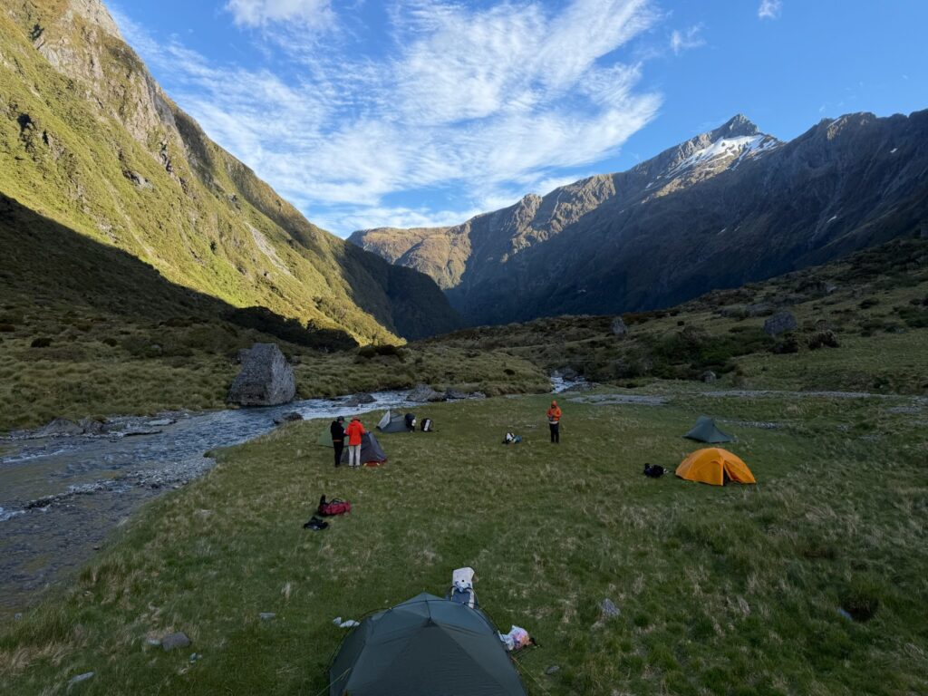
We took a few things off the slowest person and that has sped things up on our final stretch from Young Hut, with a 300m climb to the basin where we’ll camp. They weren’t bad at scrambling, but perhaps the pace just needs to be doubled and they would need to be a bit more confident with the terrain.

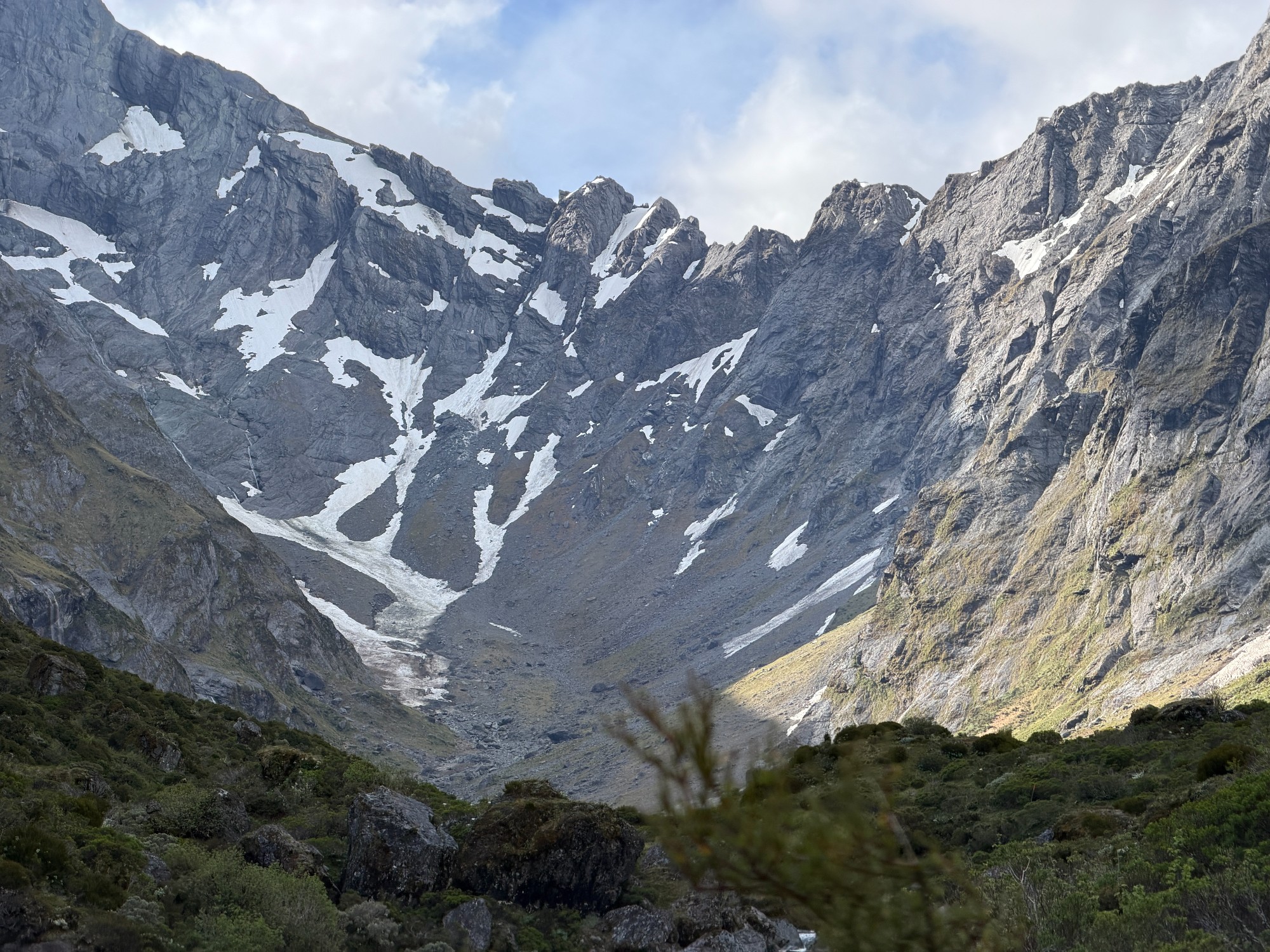
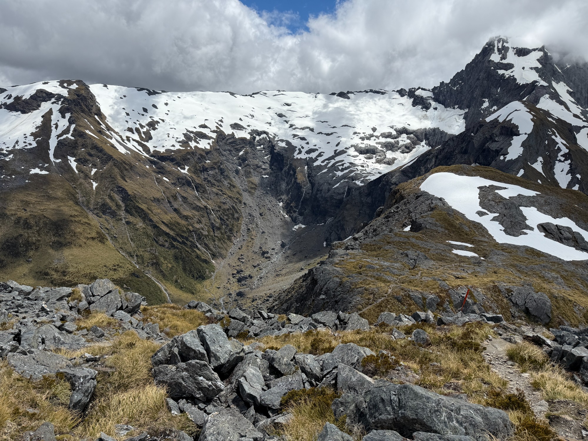
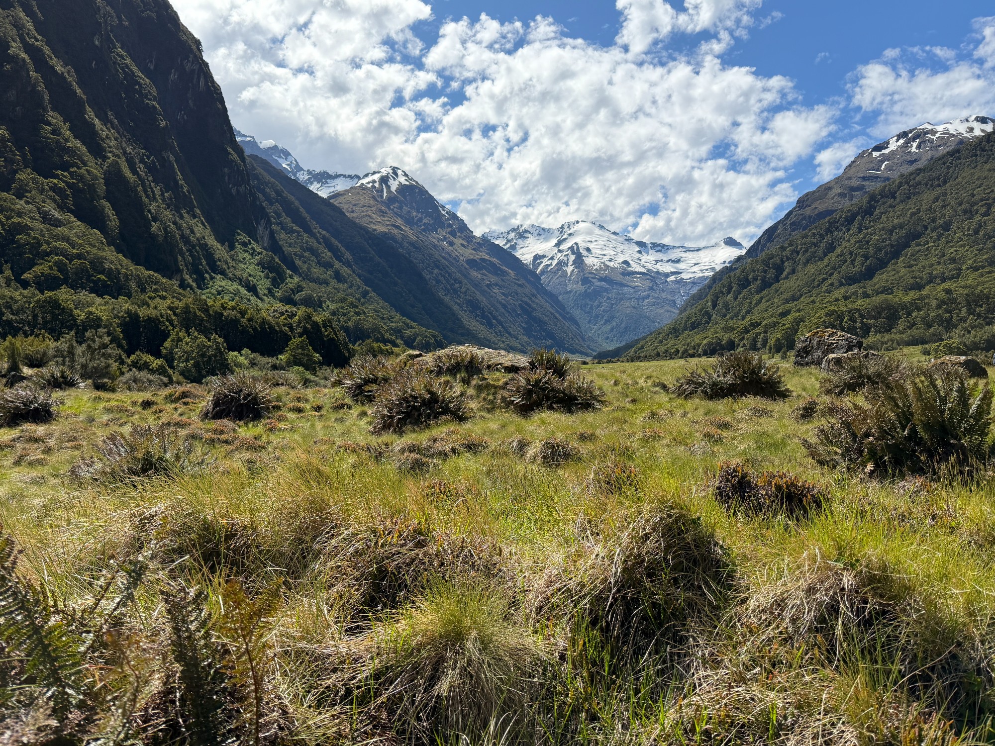
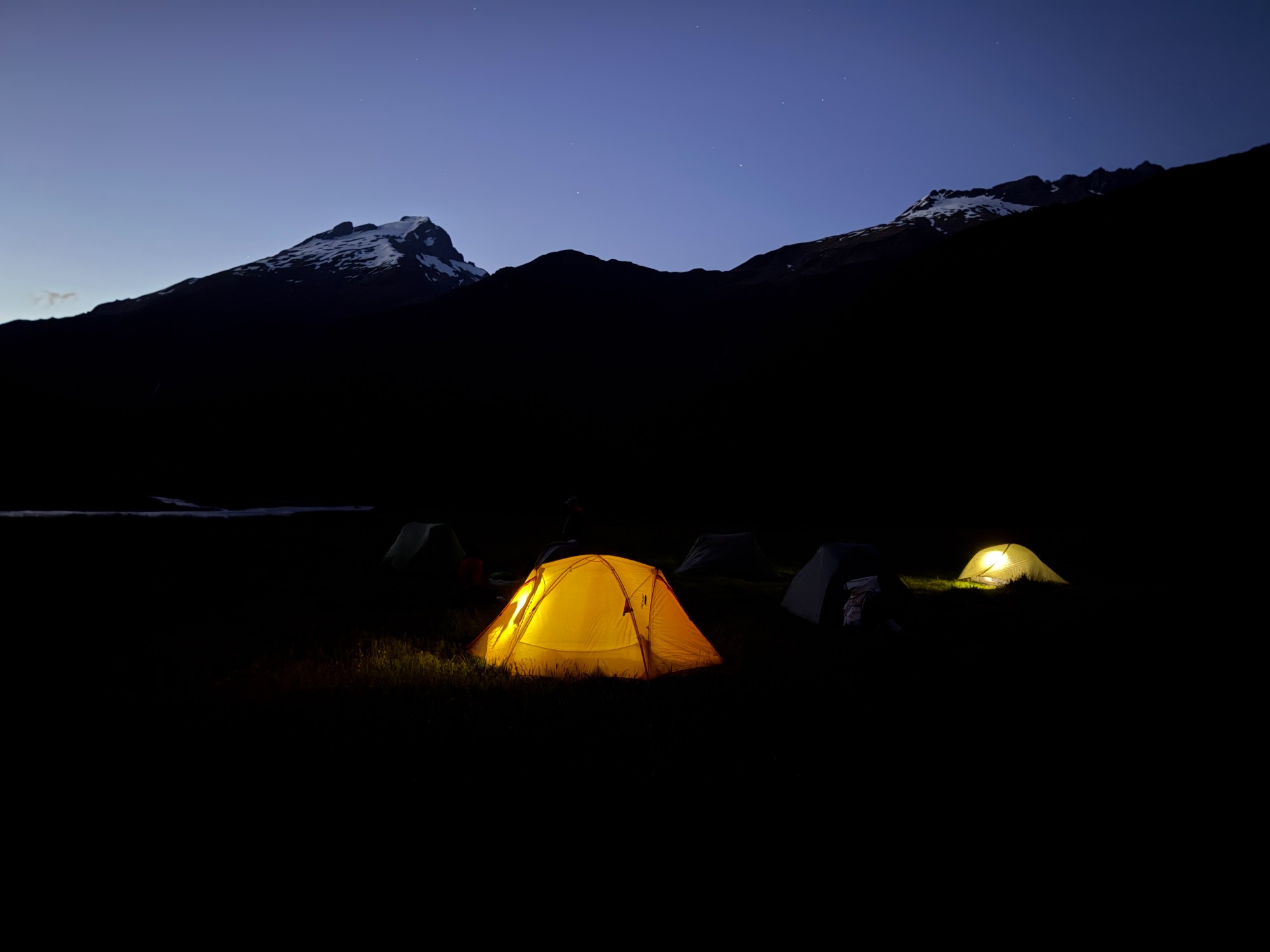
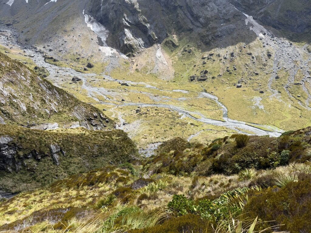
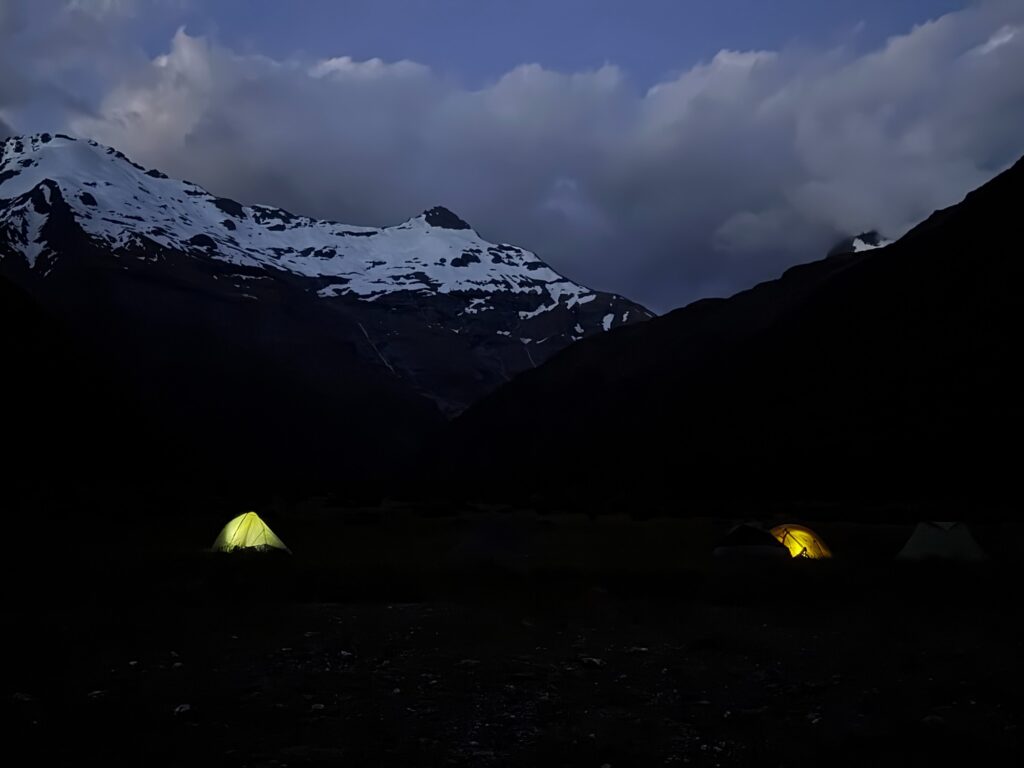
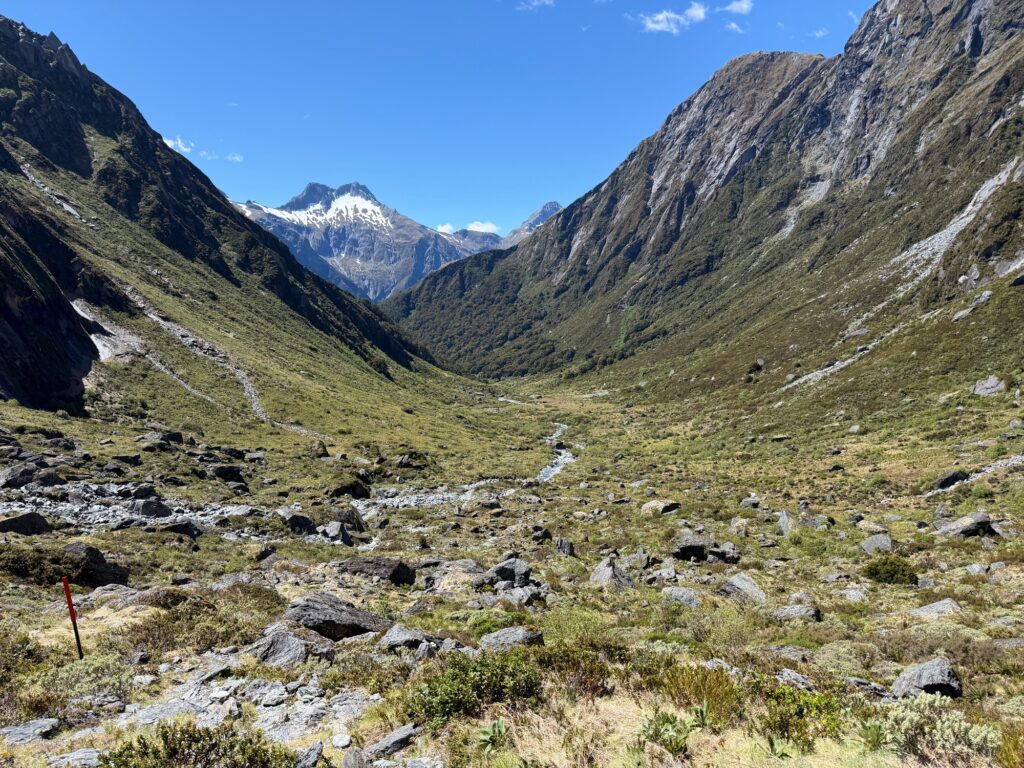
On the basin, we found a nice flat and set up our camp for the night. A full day of scrambles and we’re rewarded with a view of an open alpine valley, lined with towering cliffs, waterfalls and the world-renowned mountain of Mt Awful.
Day 2: Gillespie Pass and Siberia Valley
Strong gusts had accompanied us the entire night, camping in an exposed alpine valley. Everyone’s tents stood the challenge except mine- the poles dislocated from the toggle and my tent converted itself into a bivvy, with the fly crashing straight on my face. My poles were slightly bent but no serious damage was incurred- just an uncomfortable night’s sleep. Adam’s tent, which had a bad record of not withstanding alpine conditions, stood well with the addition of trekking pole reinforcement. There are two slots for trekking poles to be inserted, strengthening its structure in addition to the carbon fibre frame.
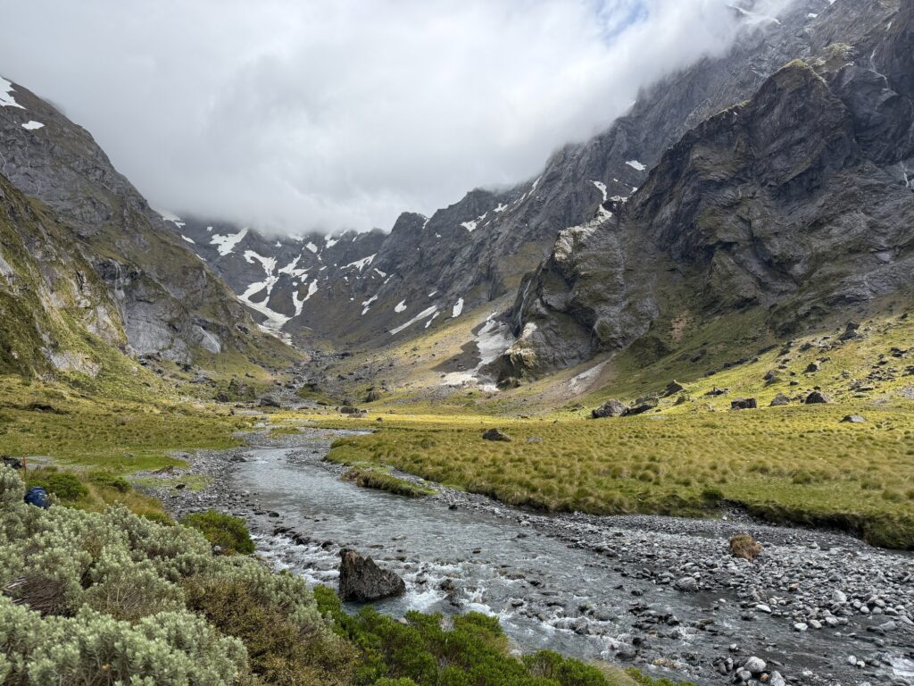
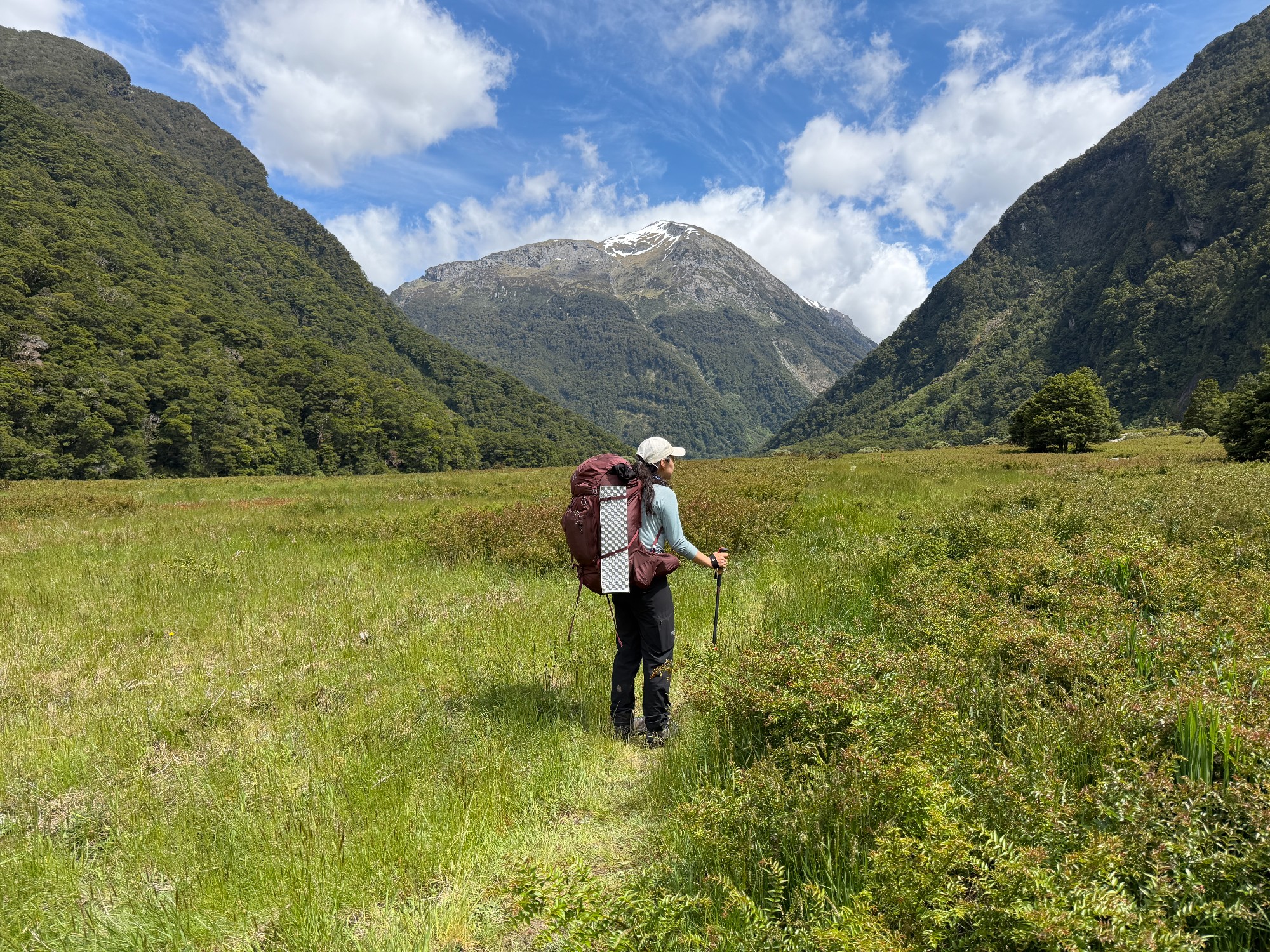
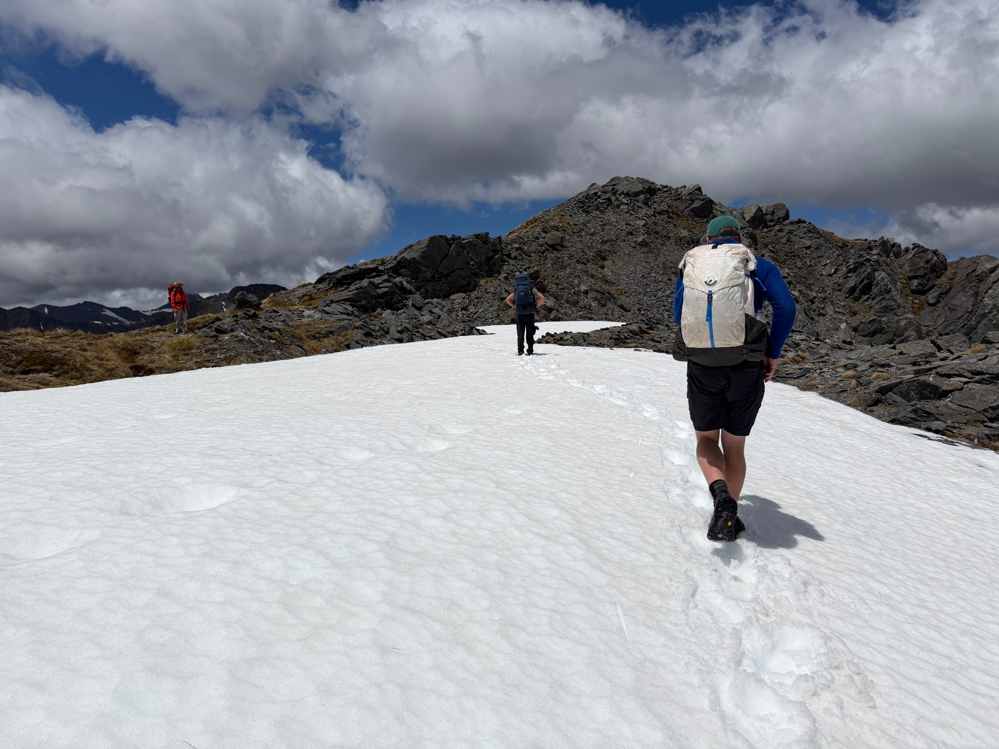
The second day is a similar day elevation-wise, but distance-wise, a much shorter day. All we have planned is to cross Gillespie Pass and camp in the other valley. Our day started with slightly cloudy conditions as we walked down the basin and started the uphill walk.
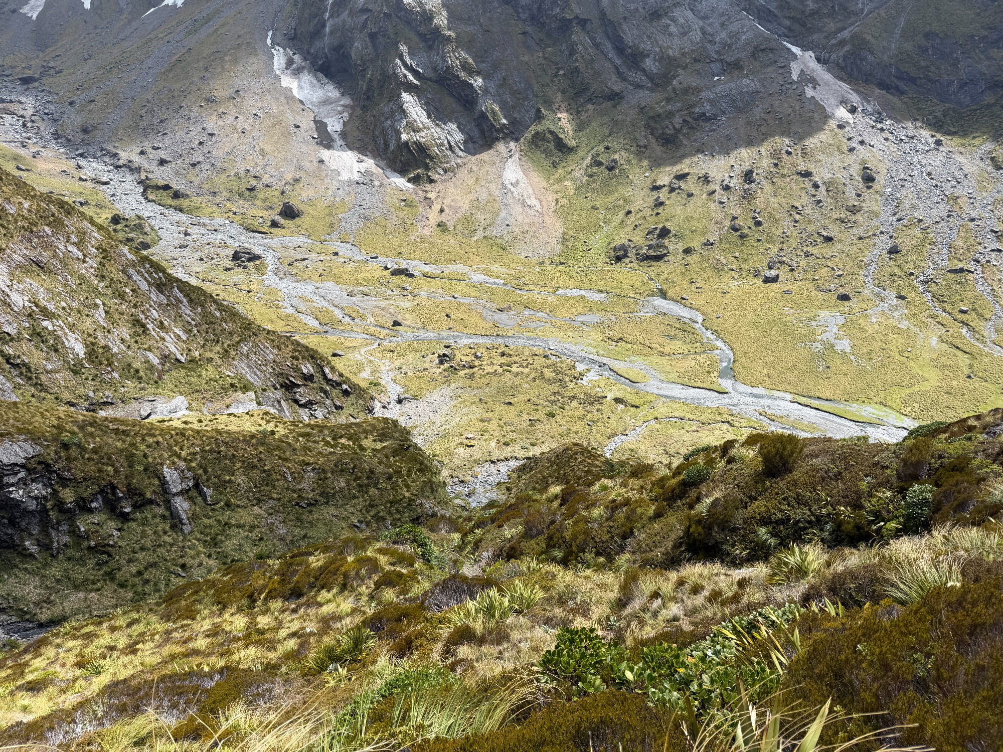
From the end of Young Basin, it’s a gradual ~500m climb towards Gillespie Pass. We started to gain more of a bird’s-eye view of the valley as we gained elevation. What’s great about alpine areas is that we’re seeing nature in its purest form- river basins branching and merging without human interference. In big cities, many of our rivers are rerouted or have some sort of reclamation taken place, and the shoreline we see today is often far from how it would be without all the development. In fact, natural shorelines are more of a scarcity, and it’s always very pleasing to see what it would’ve looked like in the wilderness.
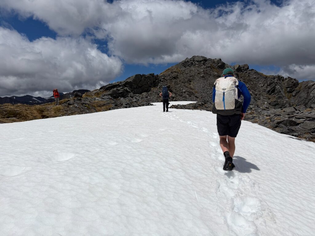
For me, another objective of this trip is to share as much about planning remote trips as possible, such that next time someone else would be leading it. It’s quite unfortunate that not a lot of people are capable of leading remote trips in the club these days, but it’s also these outback and snow trips that make our club interesting. I squeezed in a few discussions on snow safety and assessing safety when choosing camping spots. Was about to demonstrate how to quickly traverse scree slopes as well but our slope ended up being covered by snow- something for another time I guess.
Around lunchtime, we’ve reached Gillespie Pass, 1574m above sea level. Worries of not having enough water to make lunch eased as we discovered a massive snow patch right on top. That’s the water source we need, as I collected some of the freshly melted water for my freeze-dried meal. Adam kindly shared his honey-roasted peanuts while I restocked Cookie Monster with more cookies, this time it’s ginger-flavoured. I’ve continued my Tasmanian tradition, hydrating myself by chucking snow straight into my mouth. It’s also a good dessert idea with an infinite supply of shaved ice. Add a bit of coconut/condensed milk, sugary syrup, grass jelly and red bean, and that’s a nice dessert similar to Ais kacang in Malaysian restaurants.
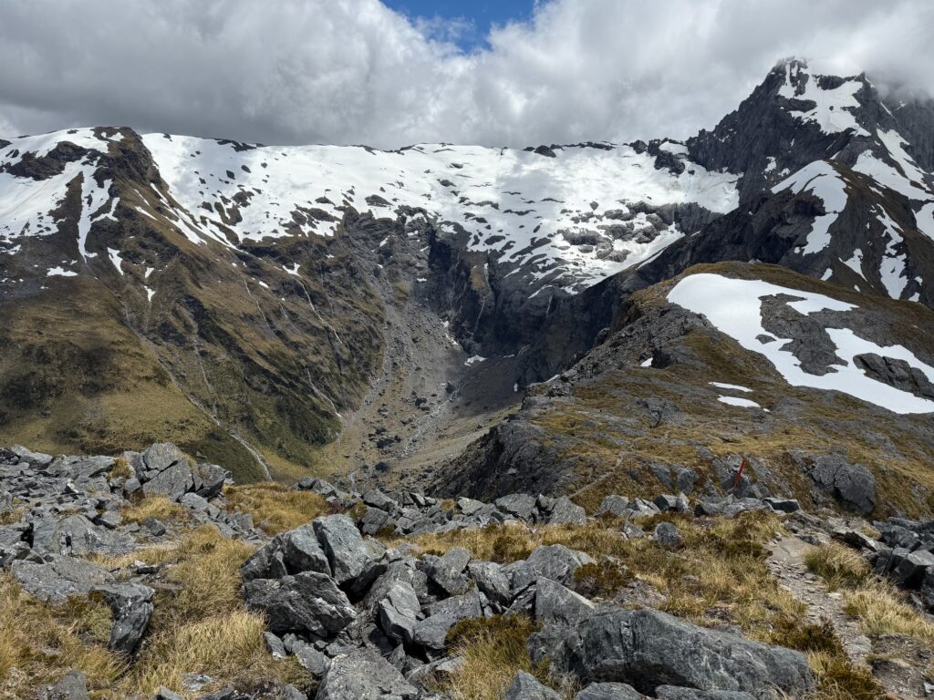
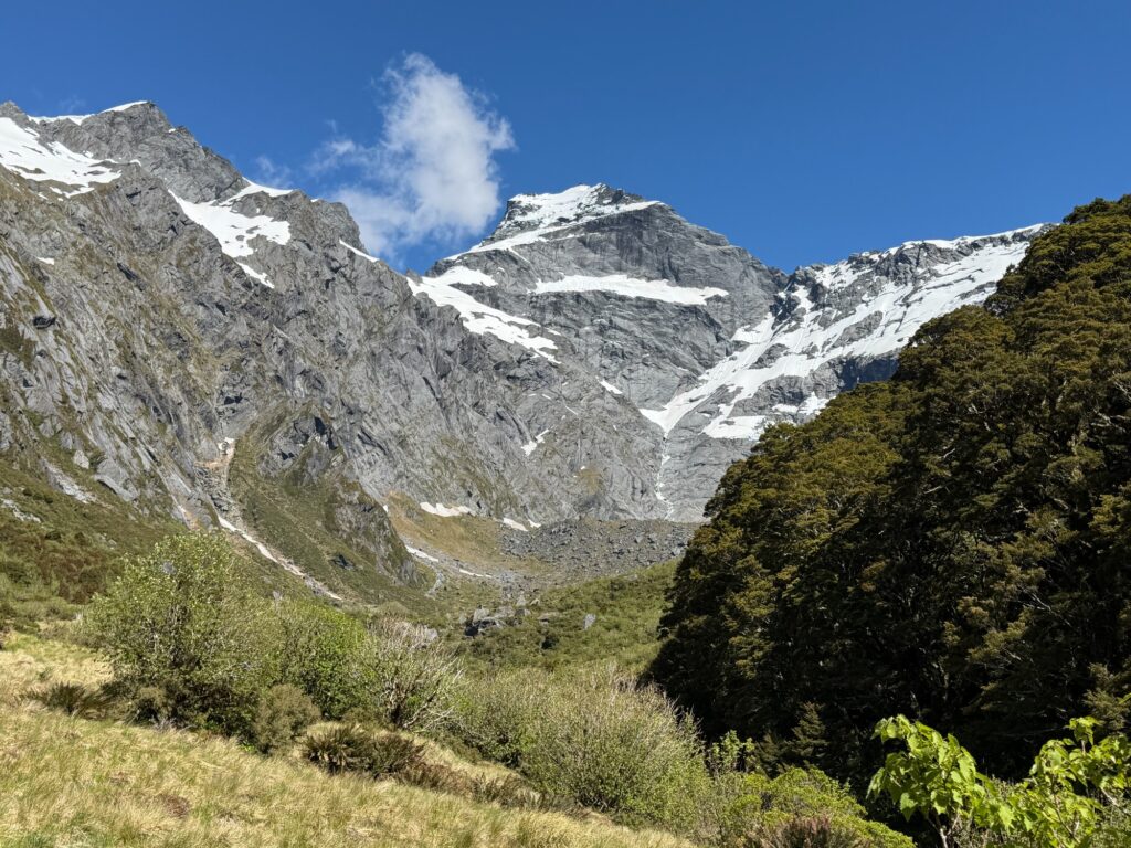
Right in front of us is the inappropriately named Mt Awful. It looks quite cute, and I guess that’s why it’s called Mt Awwww…ful. We’ve got a peek of the valley on the other side while meeting a few fellow walkers- the first humans we’ve seen since we started the walk.
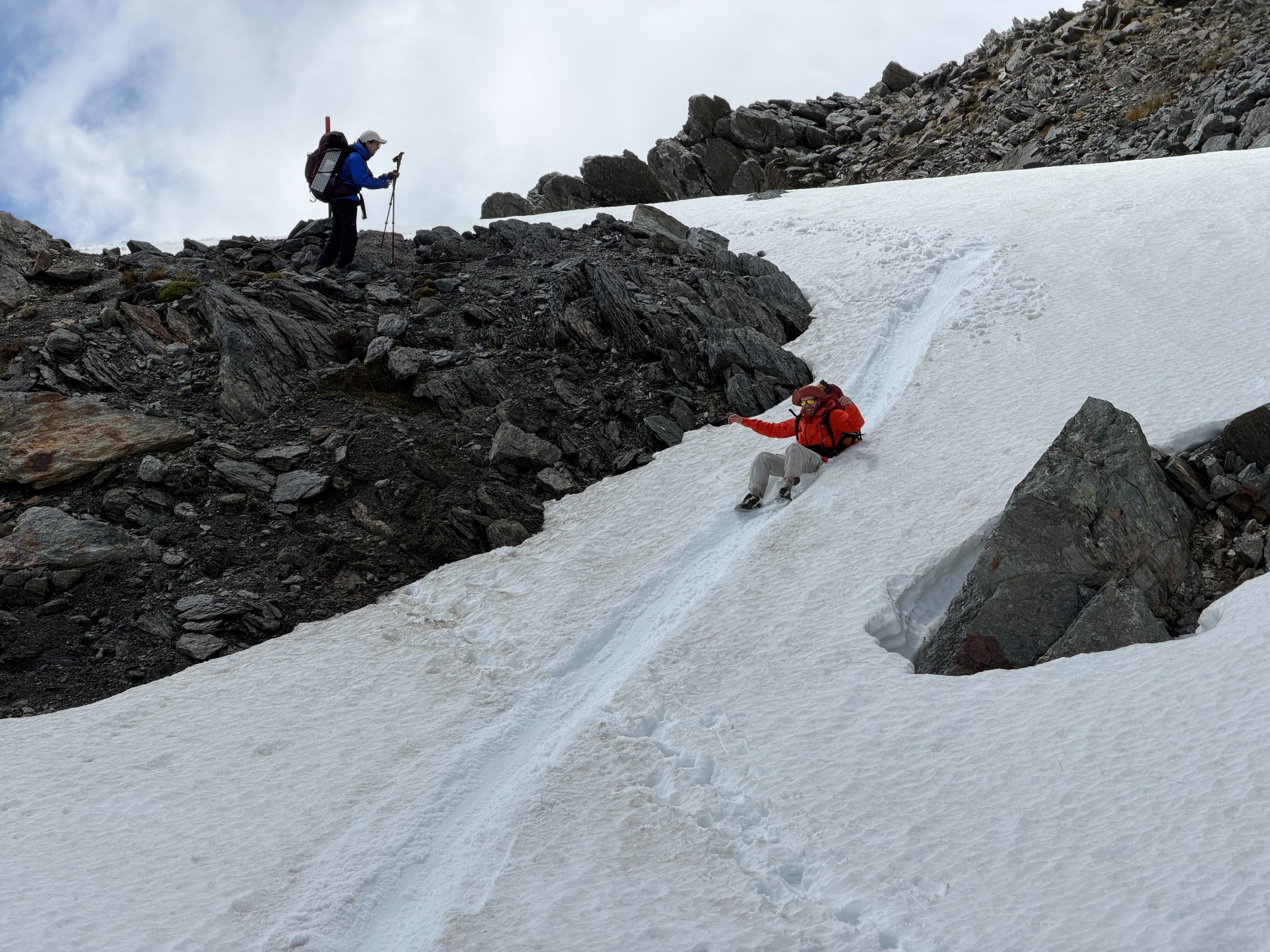
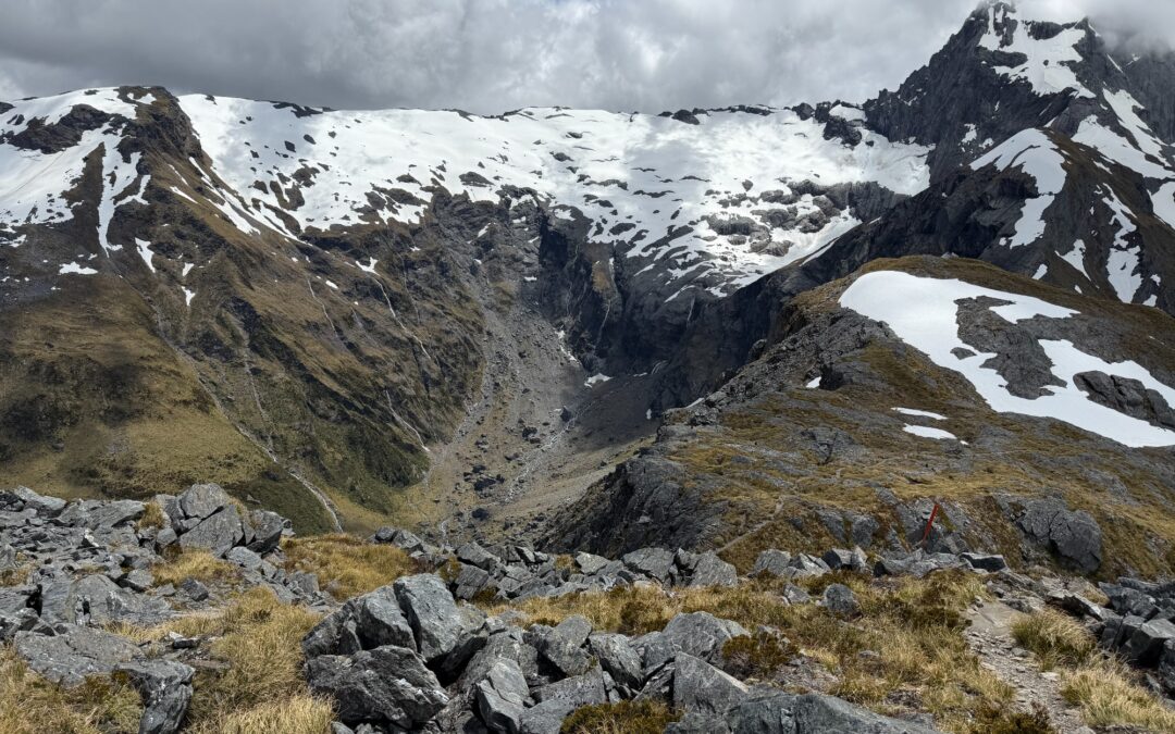
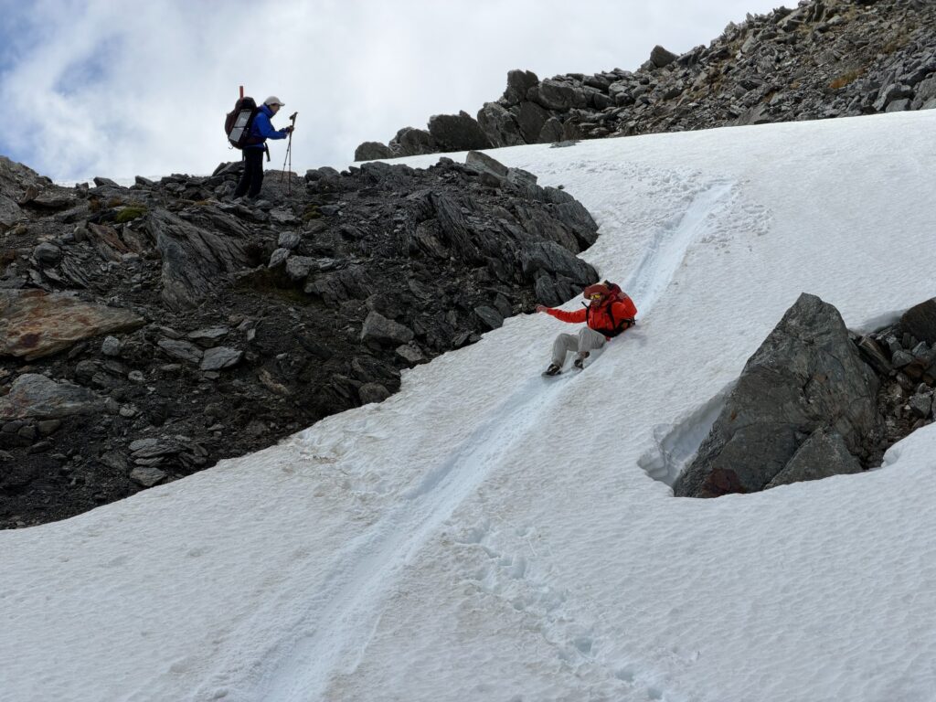
After a short scramble we’ve reached the highest point of the walk at 1629m. From here it’s all downhill- normally a scree slope, but when we got there it was snow-covered. The snow was powdery and the perfect condition for glissading, sliding down the snow on our bum.
A few glances to make sure there’s enough runoff, and off we went! We’ve managed to get about 3-4 slides down the slope until the track resumes.
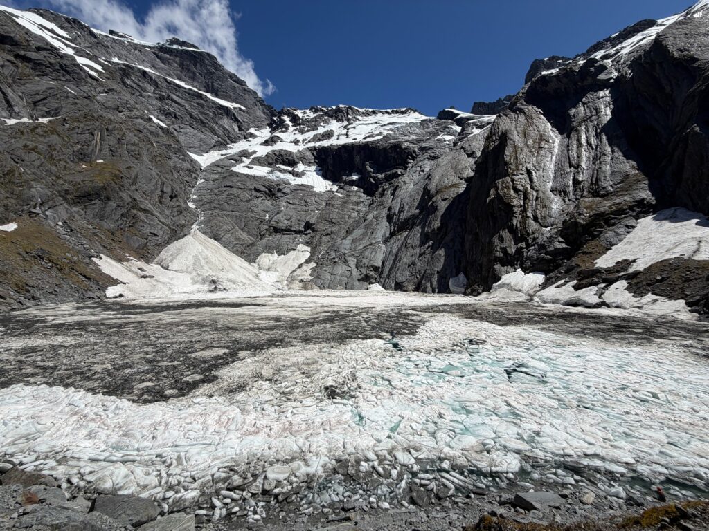
And the rest of the walk is just downhill, running alongside Gillespie Stream. The track became a bit more rugged as we dived back into the tree line with all the tree roots crisscrossing the track. Aidan led the way, followed by Adam and Tim, and me sticking around the back of the group. At the back, we were going at an extremely slow pace of 0.5-1 km/h with the less experienced member, and there’s roughly a 2-hour gap between Aidan in front and me at the back. Gillespie Stream drops into Siberia Stream with a steep waterfall, which the track bypasses by wrapping around the slope with lots of uphills, downhills and scrambles. Would’ve been great to have a rope and some canyoning equipment, as it’d probably be way quicker to lower the slowest member down the waterfall than to work our way along the track.

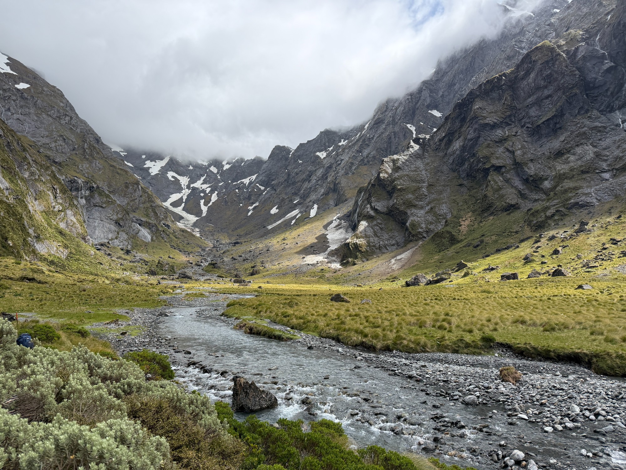
At about 5pm we’ve entered the flats at Siberia Stream with no one in sight and only a few blue ducks accompanying us. We’ve communicated beforehand that we’ll be camping at the start of the track to Lake Crucible, but with this large river valley, there’s no guarantee that everyone will be at the right spot. I did a quick stroll around the river and spotted a faint orange mark somewhere distant. Using my iPhone camera’s 40x zoom as improvised binoculars, I saw two tents with Adam and Tim set up on the other side of the stream, roughly 800m away from us.
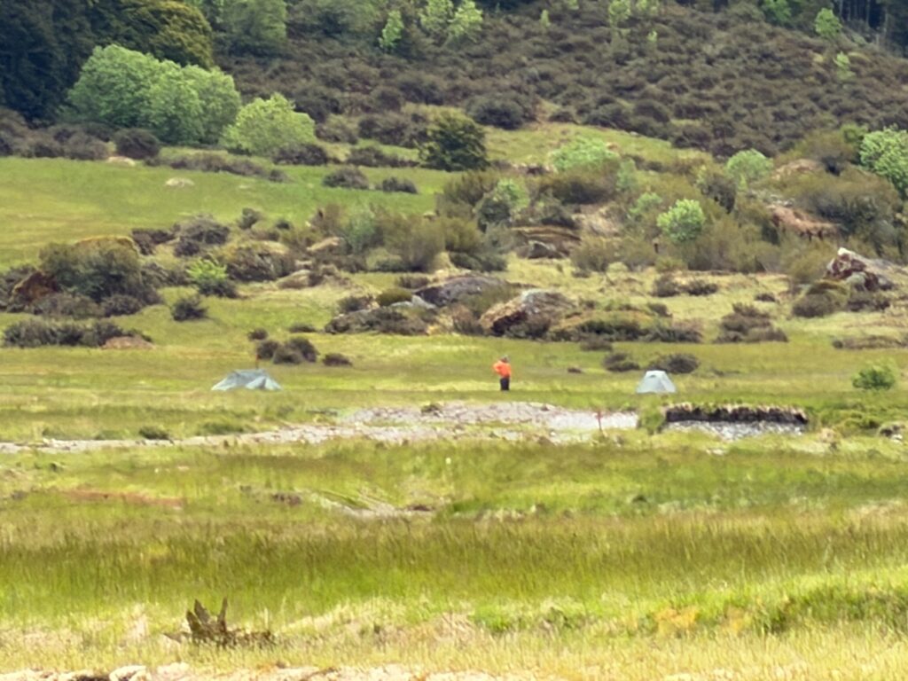
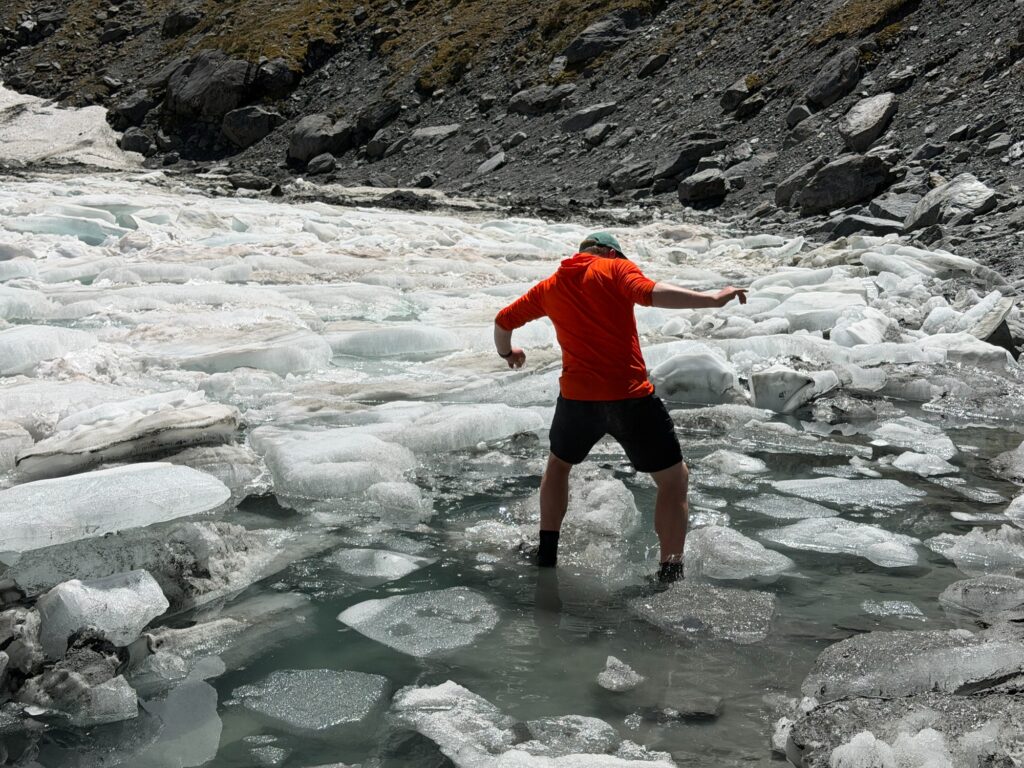
Being a bit exhausted, three of us took the most direct route, cutting straight across instead of following the track. Getting there involved two river crossings, and dipping our feet in ice-cold water was quite unpleasant. One of us took the free slippers supplied in hotels, and as she was crossing, one of them slipped off her foot and went downstream with the water. No point racing down the river to try and retrieve it, I thought. It’s probably good that we didn’t follow the track, as the crossing points on the track weren’t the best places to cross. We went slightly upstream, crossing the wide Siberia Stream, before meeting Adam at the tents.
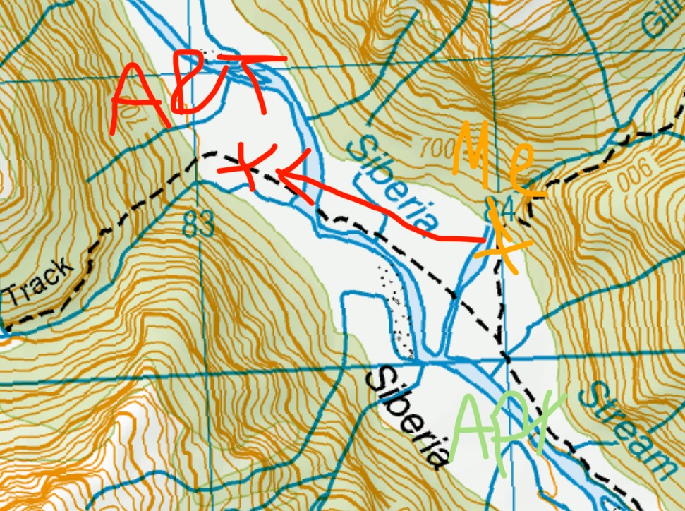
Seeing Adam, the first thing he asked was “Where’s Aidan?” Oopsie, looks like someone’s missing. Adam and I decided to follow the track and see if we could spot Aidan down the track, as he might have taken the wrong turn towards Siberia Hut. We left all our camping stuff, took a few layers with us and redid the river crossings. We’ve got to the T intersection where there’s a sign put up by DOC denoting directions. Luckily, Aidan was spotted about 50-100m away, ending the mystery of where Aidan is. Turns out he has probably misread the DOC sign and taken a left turn instead of the right. He spent some time relaxing by the river, visited Siberia Hut and saw no one there, and decided to head back to where the track branched off, where we saw him. Nothing bad happened except that he walked an extra 4km.
From that point it was another 2 river crossings back to camp. The sun was about to set and I had gotten quite cold with multiple river crossings. Guess that’s why the recommendation is to put on dry layers and check for signs for hypothermia after river crossings- the water can be really cold and those signs can be hard to spot if you don’t look for them specifically. It’s also much better to cross with shoes on instead of crocs or sandals, as they’re good at keeping your feet warm.
We made dinner right by the creek flowing down Lake Crucible just as the sun set. At just 300m above sea level, conditions were a lot more pleasant down here- no strong gusts, no cold wind. Setting up my tent at night comes with the privilege of not having to deal with sandflies, as they are not as active at night.
Day 3: Lake Crucible day walk
We left our tent where we camped and went up Lake Crucible, a short, out-and-back, half-day walk. We’ve got the slowest member of our party to stay back at the tents and get a bit more rest, and head uphill with just a bit of snacks in our pack. The 2km, 500m elevation walk took us about 2 hours one way and 4 hours return.
The first half of the walk was fairly steep with lots of tree roots to scramble through. Now we’re walking at our normal pace, doing 200m of elevation in 20mins, and by the time we’ve gone halfway it was most of the elevation completed. Crossing another icy creek we found ourselves once again above tree line, having all the mountains clearly in sight.
The final bit of the walk was really pleasant- just some grassy slopes before we reached the lake. The lake was nicely covered in ice, still quite a lot of ice being fairly early in the season. It probably would’ve looked better if the ice had melted a bit more, similar to online pictures with icebergs floating in the middle. We spent some time having a bit of snacks, taking some pictures and trying to balance ourselves on the ice. Aidan went in for a dip and reported the water to be fairly warm.
A few minutes in we’ve gotten a bit cold and decided to head down. Crossing the creek once again, scrambling down the tree roots until our tents were back in sight. At the tents, we had lunch before continuing down the valley towards Siberia Hut.
From our tents it’s a mostly flat walk towards Siberia Hut along the valley. There’s a lot more people on this track compared to the first few days, being a lot more accessible with jetboats, helicopters and planes. The area near Siberia Hut and the airstrip is a no-camping area, and hence, we had to walk a bit further beyond the hut for a spot to camp. I went into the hut, had a glance and signed the logbook. The hut looks really crowded, possibly in full occupancy. Mattresses are supplied, and the hut etiquette is also to have shoes off outside the hut, quite unlike those in Tasmania.

Adam and I had quite a bad impression of the hut, as most of the people weren’t walkers, but merely tourists who paid to fly in on a plane. As we gathered outside the hut, Tim wondered if the hut had a warden, and the American tourists next to him immediately went “Yes!” It became so awkward with the tourists giving vibes similar to the kids when I taught in primary schools, where when I asked a question, a few kids would go “me me me me me!!” trying to be the first one to answer. The hut felt like it was full of people who paid $600 for the plane ride, and because I’ve spent $600 the nature is now my possession, here to serve my personal enjoyment.

Abandoning the cringe vibes, we’ve continued down the river towards Kerin Forks where we can camp. From the hut it’s the airstrip where there’s no camping, then the track dives into a forest which is certainly not good for camping, until we get to the other river flats where there’ll be some nice spots. There are some nice valleys but it wasn’t as scenic as the section from Lake Crucible down to the hut. The airstrip on the other side of the river is essentially a grass field where propeller planes can somehow land.
The track down to Kerin Forks was really well paved- essentially a stroll in the park. There’s a bit of uphill and then it’s all a walk by the river.

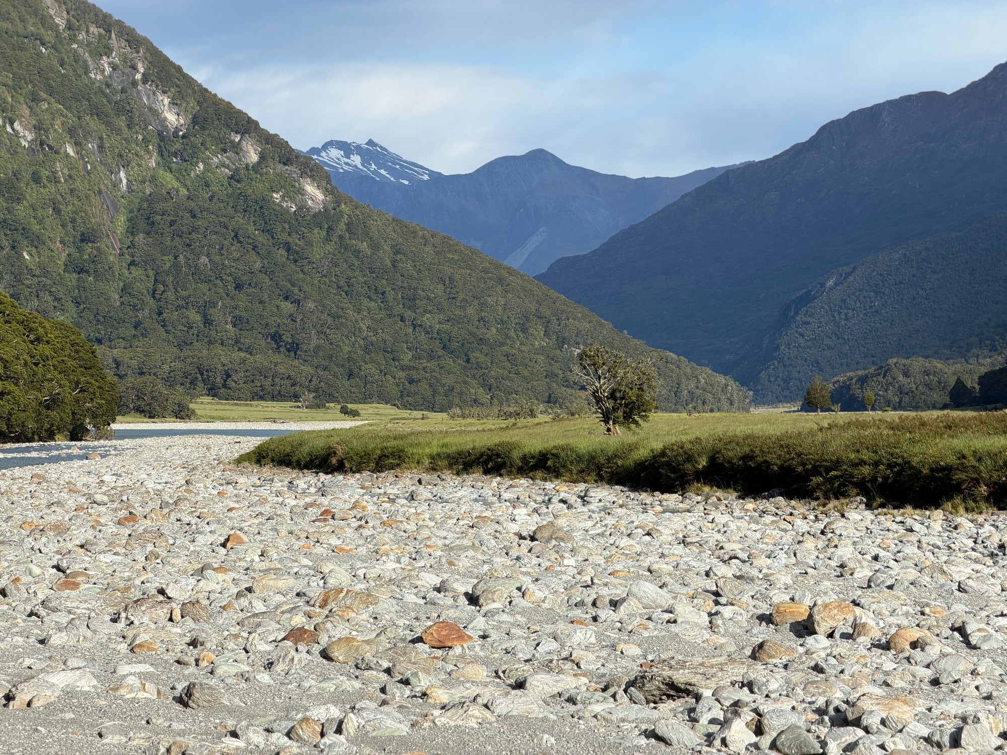
By the river we started looking for a place to camp. On the topo map we can see 2 big islands, with the jetboat pickup on the last day located near Big island no. 2. We first had a look at the first island, which is a really big grass flat. Getting to Big island no. 1 was pretty easy with some rock hopping. I got Adam, who’s on that island already, to go over to the other side of the island and see how the river crossing looks like. We could potentially camp near Kerin Forks Hut on the other side of the river and it’d be somewhere nice to check out. The river was crossable with mutual support method, but it’s probably not a good one to cross just for fun. Continuing down the track, the forest opens up with a nice river flat just outside Big island no. 2. We picked somewhere slightly more inland with shorter grass and settled for the night.

Day 4: Jetboat to the car
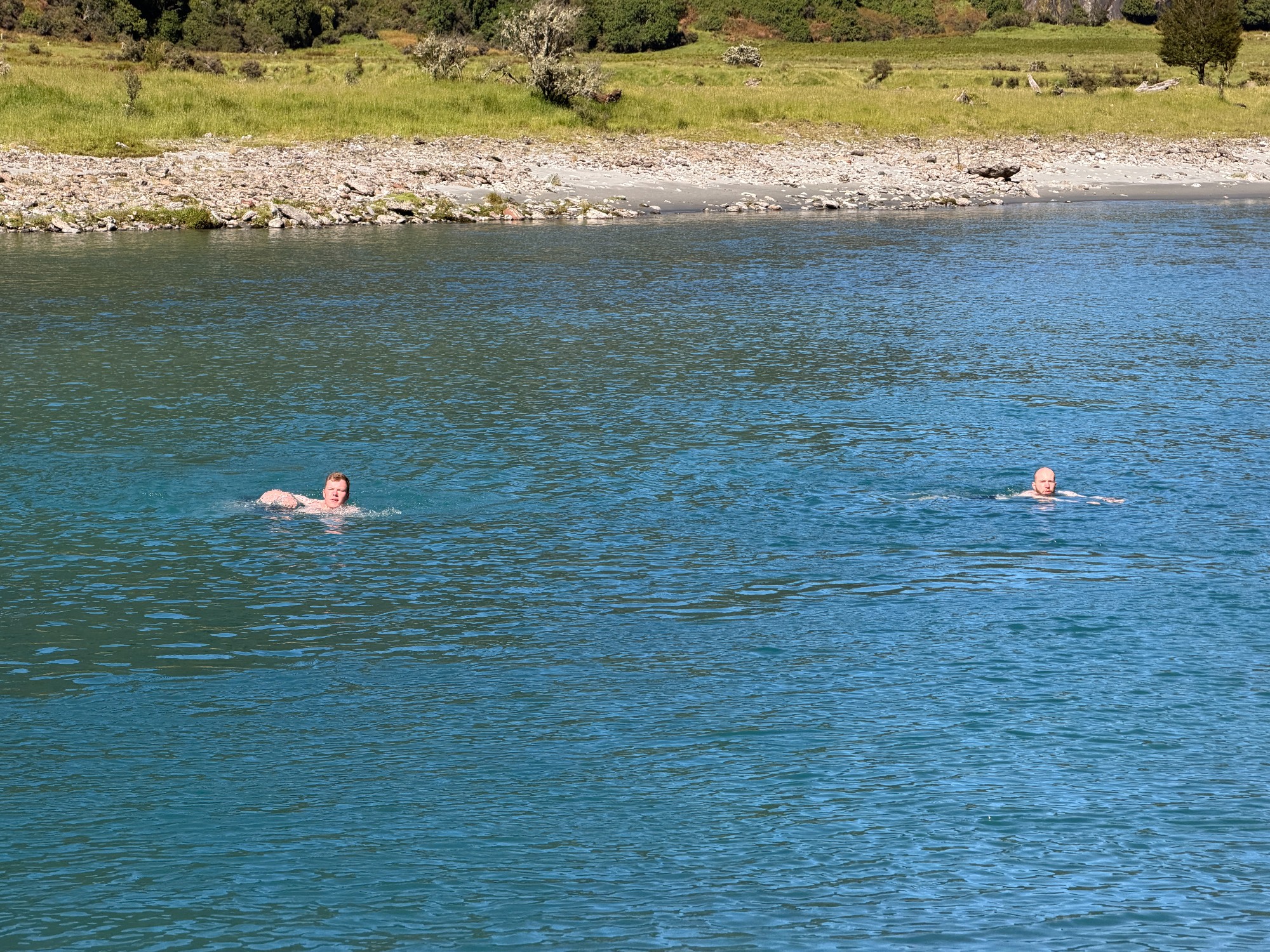
As usual we had the entire spot to ourselves and enjoyed some peaceful times by the river. The place we camped was 20 seconds away from the jetboat pickup, which means lots of time to spare in the morning before the scheduled pickup around midday. Adam, Aidan and I went for a morning swim in the river, making a ~50m crossing to Big island no. 2. It was an exhausting swim with the river current working hard against us, and icy water which Aidan describes as way colder than swimming in the ocean. We made our crossing, took a few pictures, and went a bit upstream before starting our swim back, just so the current would bring us back to where we started.


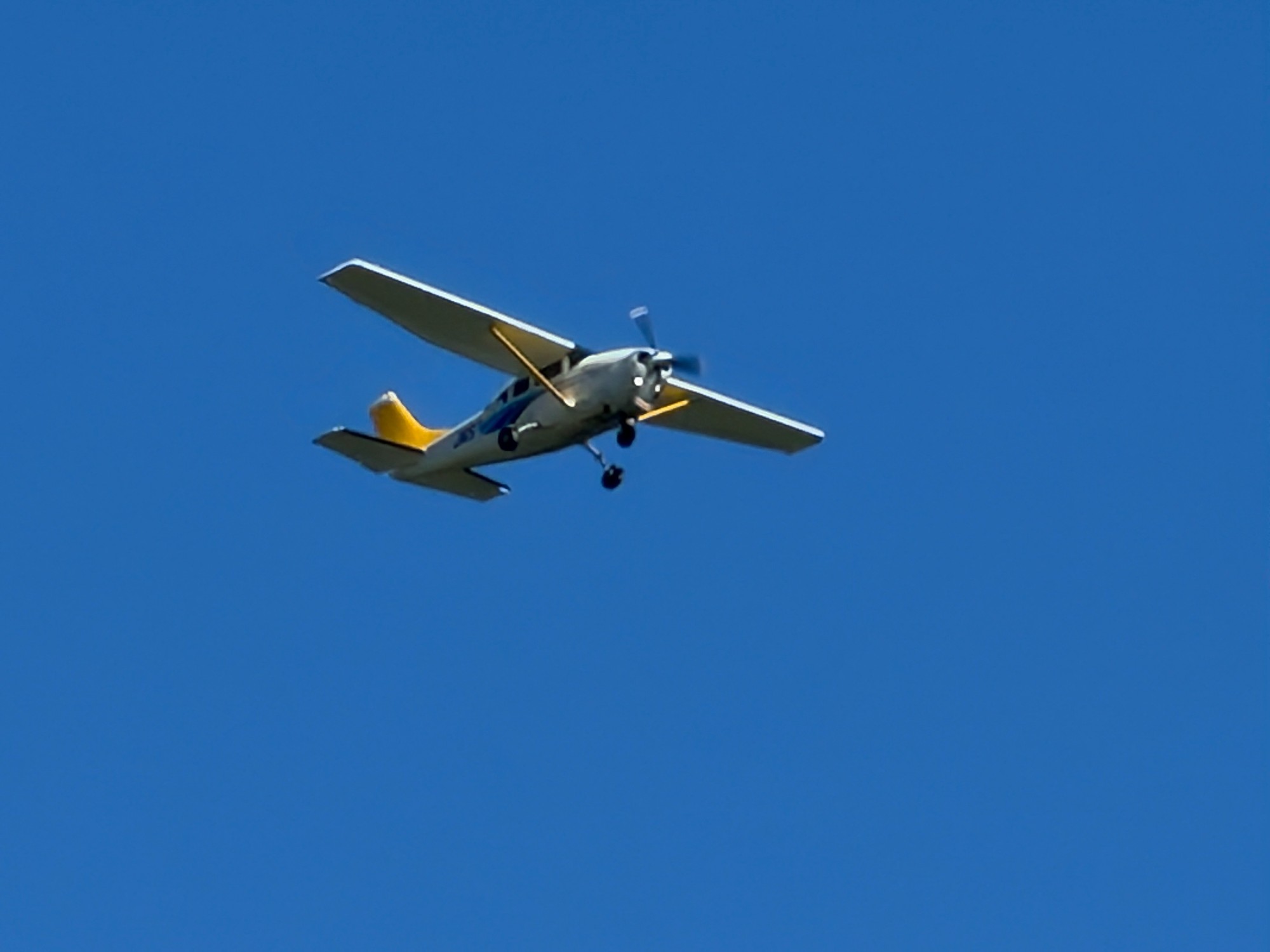
Back on shore we’ve all gotten quite cold, putting on our puffer jackets on a warm 25-degree day. Luckily, a bit of warm coffee fixed all the problems. The rest of the morning was spent watching another group crossing the river from Kerin Forks Hut, and spotting the many propeller planes flying over the valley towards the airstrip at Siberia Stream. Quite a busy day for the company I suppose.
We’ve been procrastinating with packing up our tents throughout the entire morning until roughly 30mins before our pickup. Something for the tourists on the planes to spot, I suppose. A few minutes before the pickup time, an American couple joined us for the jetboat ride. What they did was a package from the company where they’d fly into the airstrip, walk 2-3 hours to the jetboat and take the jetboat out, something that would set them off roughly $700. We surely didn’t tell them, but the section of the walk they did was the most boring part out of the 4 days in Gillespie Pass.

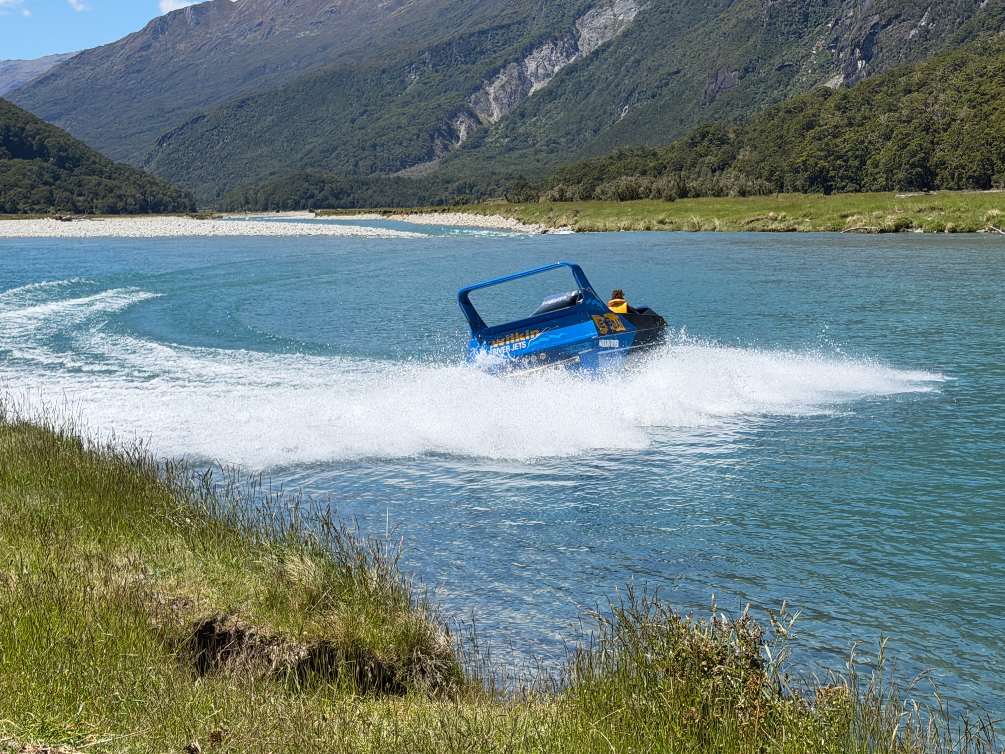
Few minutes later our jetboat arrived and we’ve got everything loaded. Some of the more interesting forms of public transport I guess, capable of going through really shallow water. We had a routine safety briefing followed by a quick round of how many spins we want on the jetboat. It went a bit like:
Driver: How many spins do you want? Some people prefer one, some kids are like I want 100 spins…
Adam: Maybe about 6 or 7?
Us at the back: 6 7!!
We had about 4 spins at the end which was fun. Some of us were getting nauseous towards the end and it’s probably better to not have a cleaning bill from the company. The ride was mostly a mix of bumping down shallow water and spins in the deep water, coupled with a few photo stops. Soon the boat entered the wide Makarora River before finishing at where we started.

Back in our car we made a stop at Wanaka for a late lunch, before heading back to Queenstown and returning our car at the airport. Dinner at a pizza place, sharing a few beers by the lake, and calling it an end for our club’s 2nd NZ trip of the year.