Date: 7/11/2020
Trip leader: Dean Smith
Party: Samantha Waldon, Kip Xu, Suhail Samad, Aidan Irrgang, William Jorgensen, Yonghan Wang, Briony Moore, Jeffrey Chiang, Dean Smith (leader)
Photos: by Dean, Suhail,William,Kip,Samantha
With an uncharacteristic forecast of low temperatures in November, it seemed a good opportunity to do a walk in the Wild Dogs which would normally be less than ideal at this time of year. With a couple of weeks notice everyone signed up quite early and that was it. Only one pulled out due to an injury.
The plan was reasonably ambitious: head down Carlon Creek and up Cattle Dog Ridge to Knights Deck, across the ridge to Mobbs Swamp then to Warrigal Gap, along Wombat Parade past Mount Warrigal, ascending the mountain if we could find the way through the cliffs, then across Blackhorse Mountain and Mount Mouin, and back to Breakfast and Carlon Creeks via Blackhorse Ridge.
With that in mind it the instruction was to “bring a head torch” and it was planned to meet at Blackheath by 8:00 at the latest then head down Megalong to Dunphys for a reasonable start time. Despite being on time for the first pick up, some delays including a fuel stop meant a later start and we managed to start walking by about 9:30 – a little after originally hoped.
Heading down Carlon Creek meant someone wanted the obligatory photo crossing the stile; the others however walked straight past where the now non-existent fence used to be. The firetrail down to Carlon Creek, as well as much of the creek and surrounds has become quite overgrown with weeds after the fires; thankfully though very little of it was stinging nettles. Soon we were at Breakfast Creek and it was interesting to see how much more water there was with the wetter weather, with the creek needing to be crossed more than a couple of times. The gate just before Cattle Dog Ridge now lies on the ground further down the creek and looks to have been washed there by a flooded creek. Soon we left the track and headed up Cattle Dog Ridge, my shortcut up the side of the ridge proper meant climbing up a steep and overgrown face to only save fifty metres or so of walking. We then began the steep climb up Cattle Dog Ridge, where some needed a couple of rest breaks on the way up, and no-one complained about the extra stops!
Finally we reached the top of the ridge and the cliffline, and whilst it was tempting to skirt around the right hand side to explore a different route, we followed the usual route around the left due to having a long way still to go. Once up on the top, the effects of the fires were quite obvious with an abundance of grassy regrowth and most of the lower understorey and scrub burnt out. We backtracked to the top of the cliffs to have a break for morning tea where we lingered for a while, putting up with lots of ants wherever we sought to sit.
We then headed off towards Mobbs Swamp, deciding the detour to Knights deck wasn’t feasible given our time constraints, and followed the ridge and then the saddle to meet the track heading to Mobbs Swamp from Blackhorse Ridge. It all looked very different to normal with grassy growth everywhere, some places having a distinct track and others needing navigation where there is no sign of any track. On the way we bumped into a small party from SBW who seemed amused by our barefoot bushwalker. Once at Mobbs Swamp we decided to stop for lunch and found a nice clearing, chatting to a couple of guys heading, from memory, to Splendour Rock.
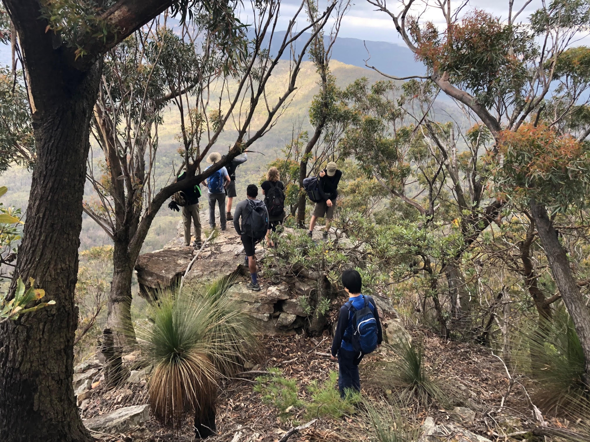
Upon leaving I made a navigational error by simply following one branch of a fork in the track and assuming it led up to Warrigal Gap, but soon we were heading across the western base of Mount Merrimerrigal and had to backtrack steeply up to the saddle to gain the Gap. Once there we continued along Wombat Parade on the eastern side of Mount Warrigal, looking for a way up through the cliffs. I had read of a route mentioned by Paul Ma on mntviews.blogspot but the grid reference seemed to be out. We tried a couple of places but they didn’t go without serious climbing so continued along. Soon however the spot was recognised from the photo I had seen and up we went. It was a little exposed to begin with but not particularly difficult and after a bit of a scramble we were on the top of the mountain. Soon we were puzzling over our discovery of a crowbar and a shovel rusting on the ground – odd things to take to the top of a mountain. Heading south along the top we reached a cliff top at the end with superb views over the rest of Wild Dogs and down to Kanangra Walls. Climbing back down and continuing along, the weather had become quite cold with a cloudy sky and a breeze blowing. There are some moist green places along the eastern side which contrast with the usual dry and rocky terrain of much of the Wild Dogs, with water dripping out in many places after permeating through the cliffs. We passed a couple of parties heading the opposite direction along this section, meeting yet another as we looked for the way down into Blackhorse Gap – a scramble down a slot in the rocks.
We had decided to head across to Mount Mouin via Blackhorse Mountain then return via the firetrail; given it was getting late in the day it was thought the knee-jarring descent down to Breakfast Creek and up Carlons would be more difficult due to the fading light and the added darkness of the valley. Heading across a bit of a saddle we soon climbed up the ‘unremarkable’ Blackhorse Mountain, according to one description online, but found the steep slope to the northwest gave amazing views especially with the fading light and clouds lit by the sun. Following the rocky ridge along and past the balancing rock we dropped through a saddle and climbed up to Mount Mouin, continuing past the summit to the Eastern end where a rocky outcrop has great views of the end of Narrowneck and the back of Mount Solitary. We stayed here for a while seeking to work out the various landmarks, with some interesting suggestions to begin with. We soon needed to continue, so headed back past the summit and down a gully to the north-west. I had come up this way a couple of years ago, however going in the reverse direction meant we had to spend some time before we found the way down through the minor cliff line. Once down, we contoured around the mountain to meet up with the old four wheel drive track leading down to the fire trail. Once at Medlow Gap the realisation of a 9km firetrail bash was met with varying levels of enthusiasm by the group but we managed to entertain ourselves for the next couple of hours walking back, arriving back at Dunphy’s just before dark at 7:50pm. It had been a long but rewarding day, achieving almost all we had set out to see. Not surprisingly, some headed straight home whilst the rest of us went in search of dinner, finally finding somewhere open in Katoomba at almost 10pm.