Date: 16/8/2025
Trip leader: Bruce Stafford
Party: Chloe, Chuncheng, Fredo, Hemu, Jinmin, Leesa, Lei, Nicholas, Xiaofan, Xiaotian, Yessentay, Yiran, Yun Liny, Zhiqi
Mt Victoria-Mt York & historic roads; Saturday 16th August 2025.
The weekend of this walk was the first dry weekend for many weeks, enabling a chance at last to get out in the bush. I’m sure that the international students are wondering what is going on; it’s not “sunny New South wales”, it’s “saturated New South Wales”. And August is normally Sydney’s driest month!
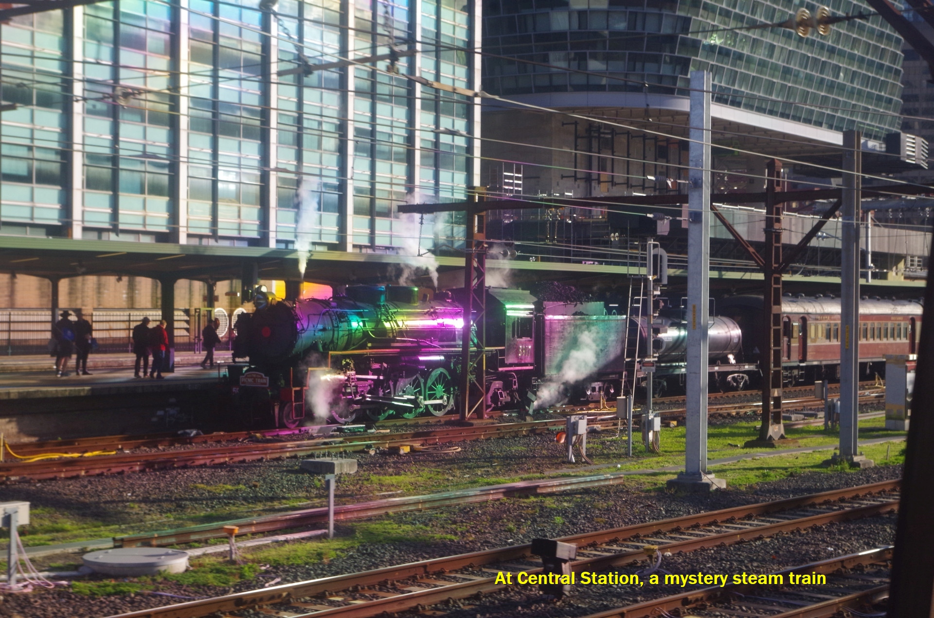
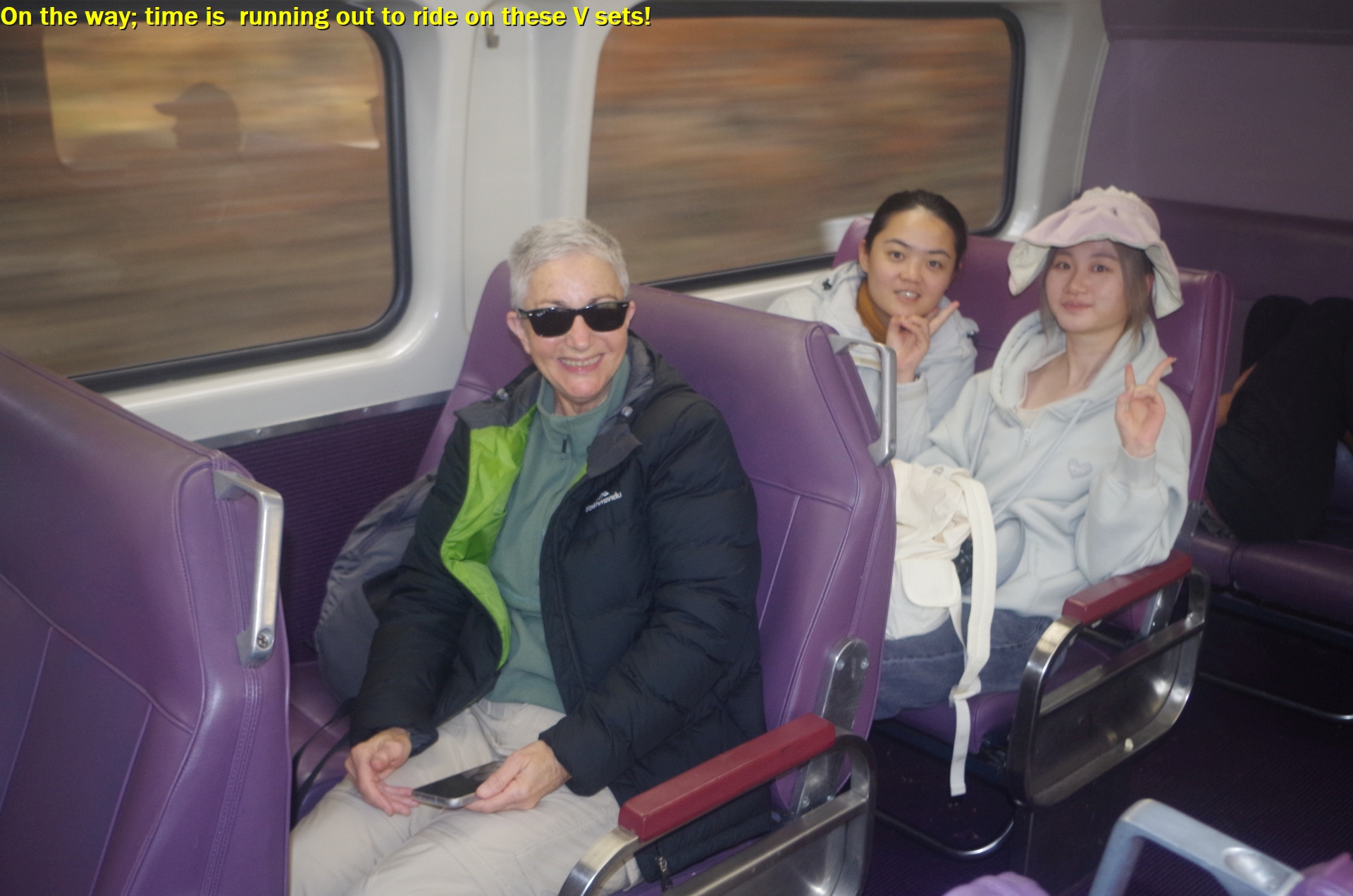
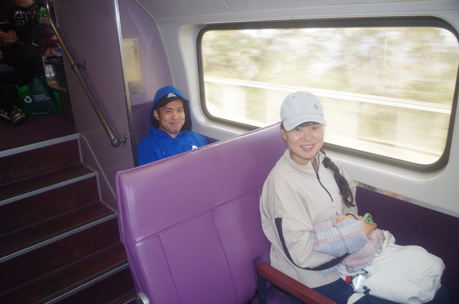
Anyway, most of us met up at Central Station for the train to Mount Victoria (with Yessentay driving up as that was more convenient for him). As I arrived at Central there was a steam tour train on another platform which I assumed was going to the South Coast despite that line having replacement buses this weekend. So maybe just no electric trains to there. We travelled up on a 4 car “V-Set” train, keeping in mind that time is running out to travel on these trains with their confortable reversible seats. By December they will start to be replaced by the “new” D sets with their unpopular non-reversible seats. On the way up we saw a lot of kangaroos in the grounds of Western Sydney Uni near Kingswood, taking advantage of the first sunny morning for quite a while.
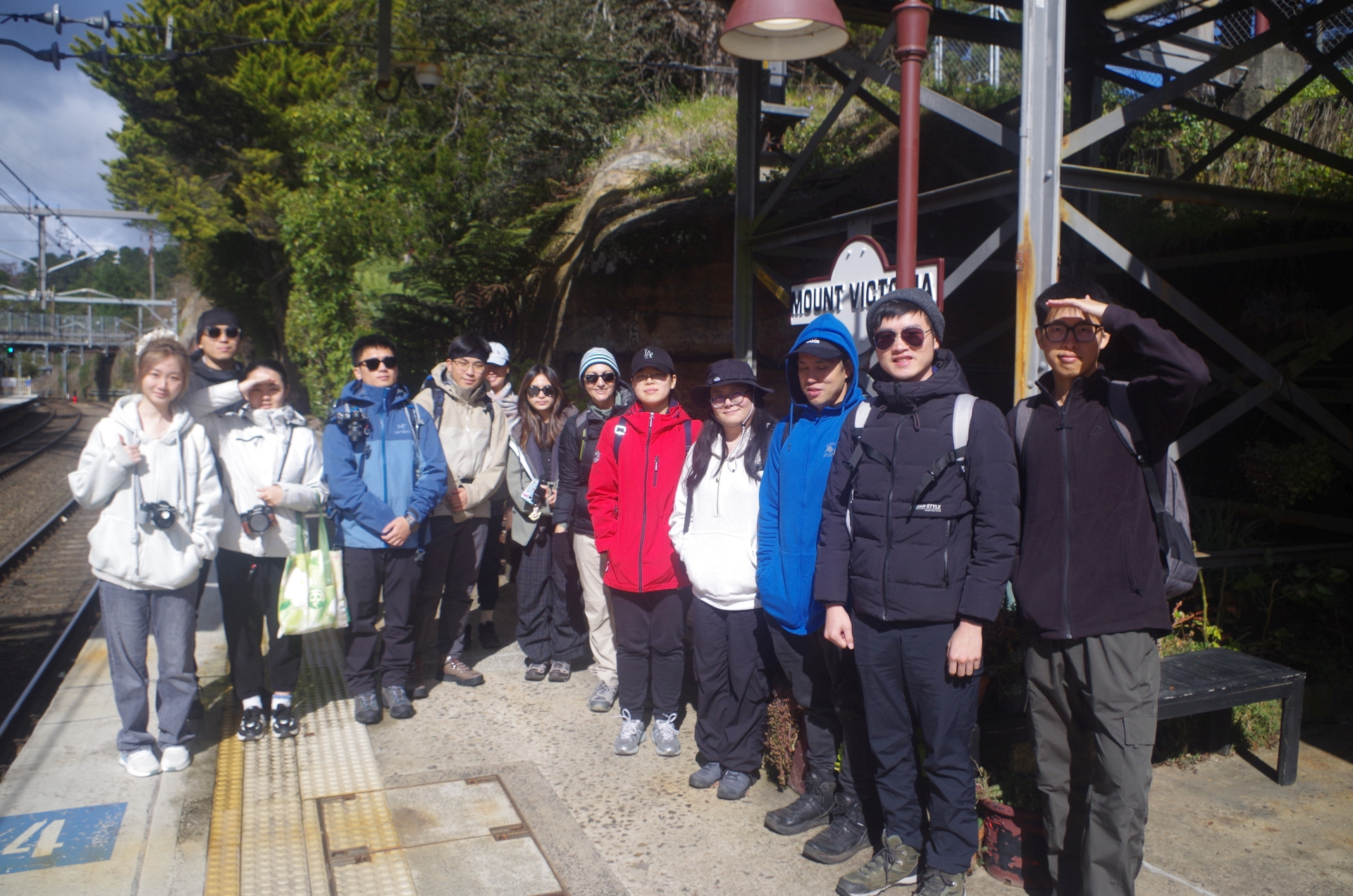
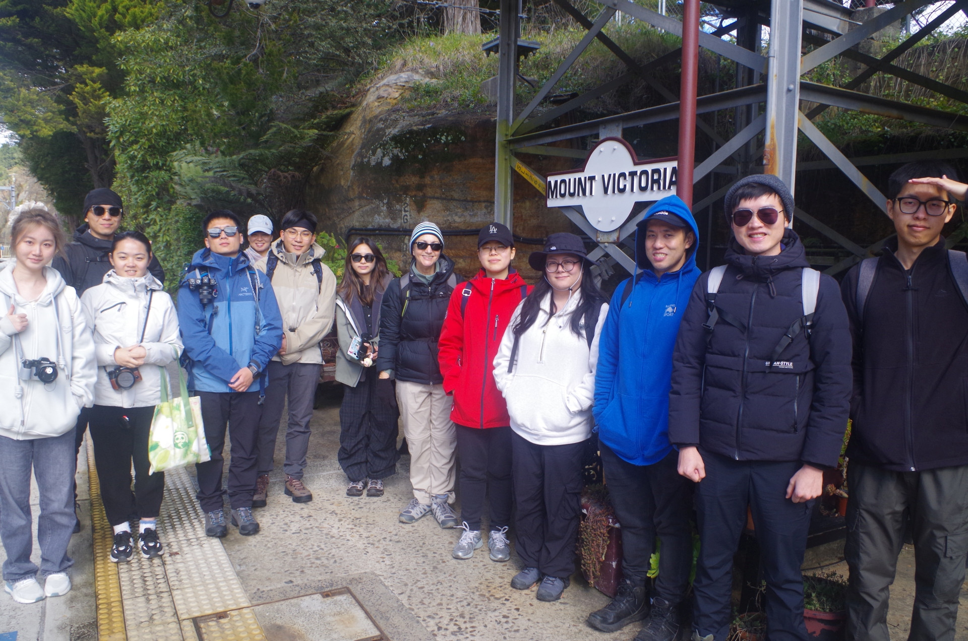
Two hours and 20 minutes later we arrived at Mount Victoria Station where Yessentay was waiting for us. The temperature was just 6 Degrees C with a very cold wind blowing. I noted that the Station had some bags of pool salt in store, to use on the stairs and platforms when there is snow and ice there. The Station Master did in fact think that it could snow later that day, and the dark clouds in the sky suggested that.

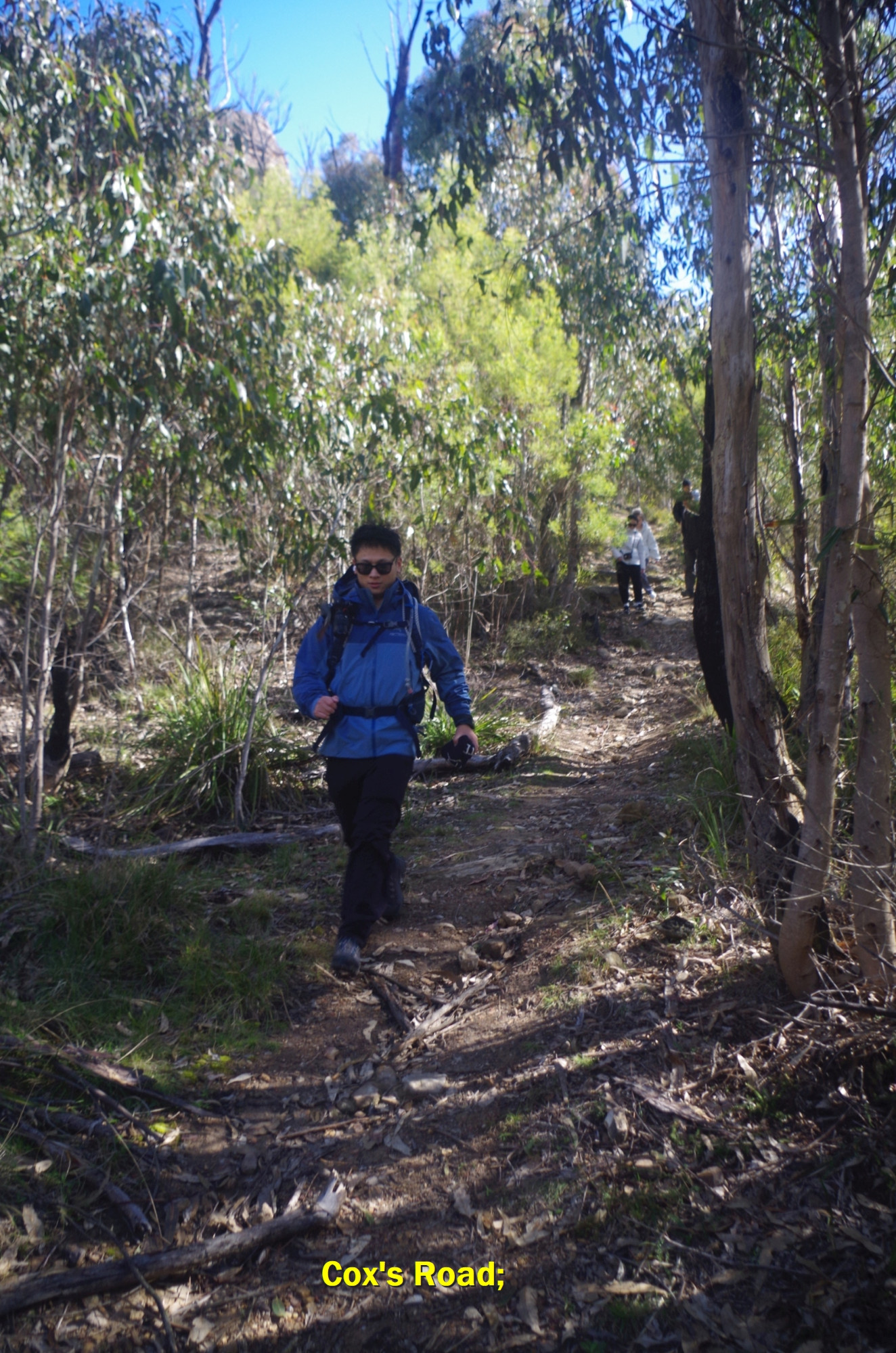
So we set off on the 2.5 km walk to the top of “Lawson’s Long Alley” track head. To do that we walked along the Great Western Highway, onto Mount York Road, then into Closeburn Drive to reach Berghofer’s Drive. Closeburn Drive has an unfortunate name as several houses along that road were burnt in the 2013 bushfires and wisely never rebuilt (as the 2019-2020 fires again impacted the same area and also affected part of our walk, as will be seen further on). Berghofer’s Drive is itself part of the 5th and final attempt at a road down the mountainside here, but never adopted as Victoria Pass (the present highway) proved to be better. Berghofer’s Track is also closed from the other side of Mt York Road because of landslips.
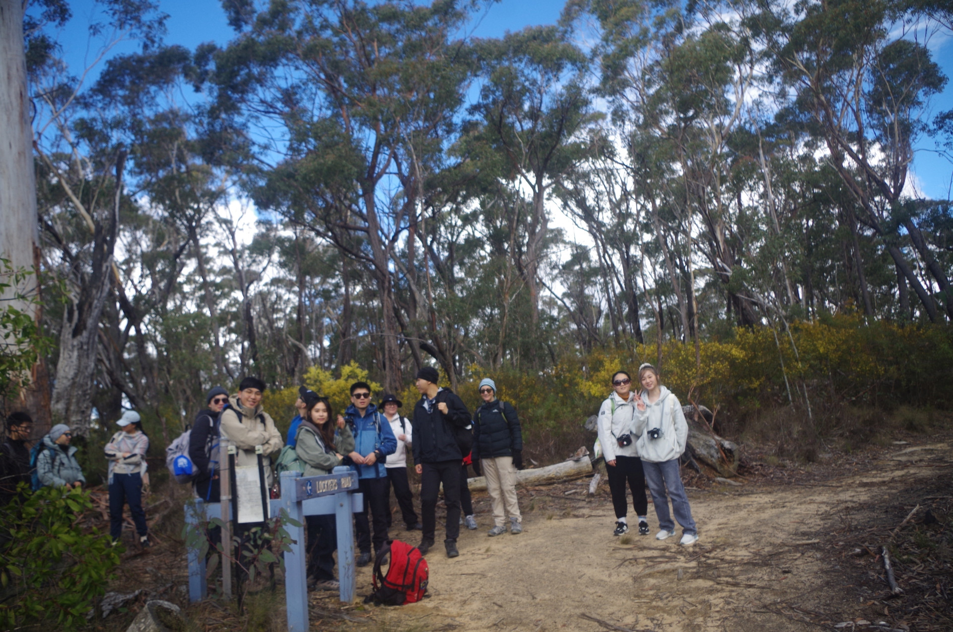
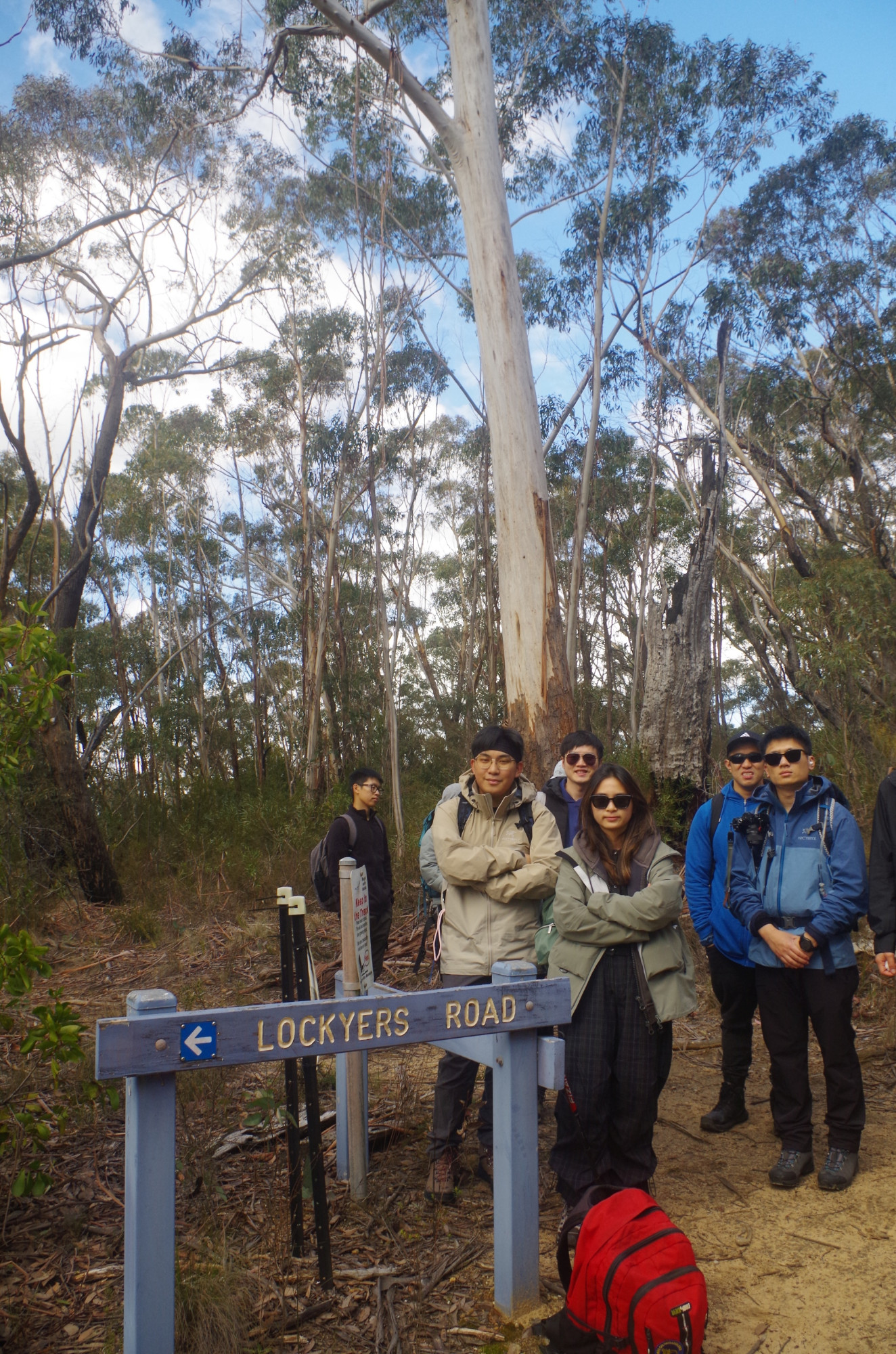
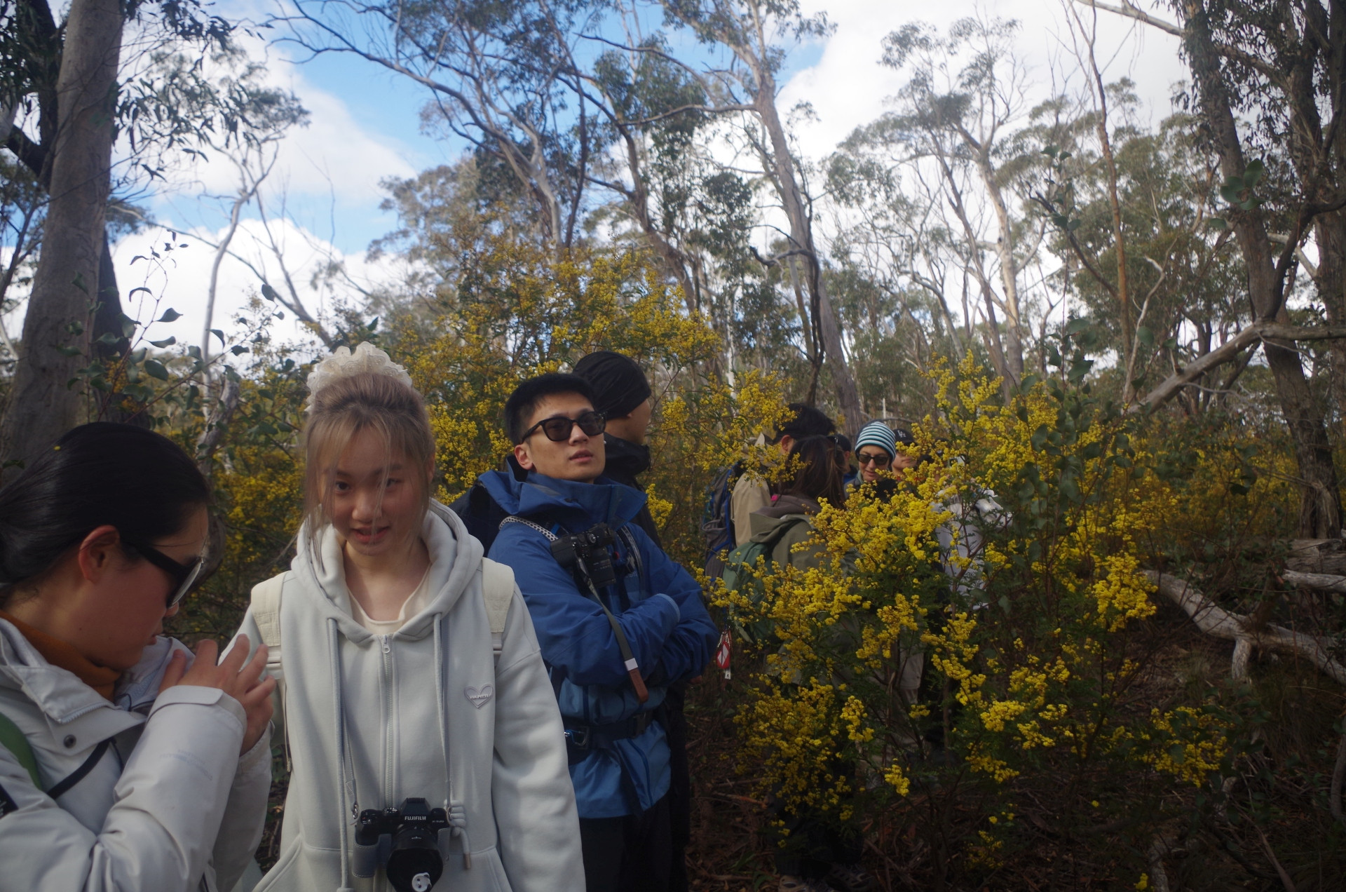
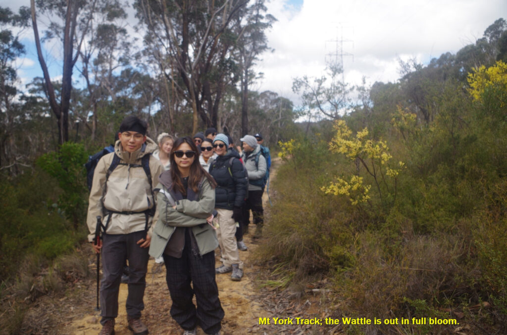
Often, walks here start by going down either Lawson’s Long Alley or nearby Lockyer’s Pass and back up via Cox’s Road, but I decided to do the reverse of that, as Cox’s Road is a rough steep track (definitely not a “road” anymore) and better to go down that. From its start it loses 100 metres of altitude over just 300 metres approx of track so is quite steep. Lawsons Long alley also gains 200 metres elevation from the valley floor but is very gradual for the first 100 metres gain and the last 100 metres gain is made over the final 600 metres, so less steep. It is also a much better track, and for much of the way is a dirt road. So we continued on along the Mount York track and passed through a lot of Wattle in bloom (August is Wattle month).
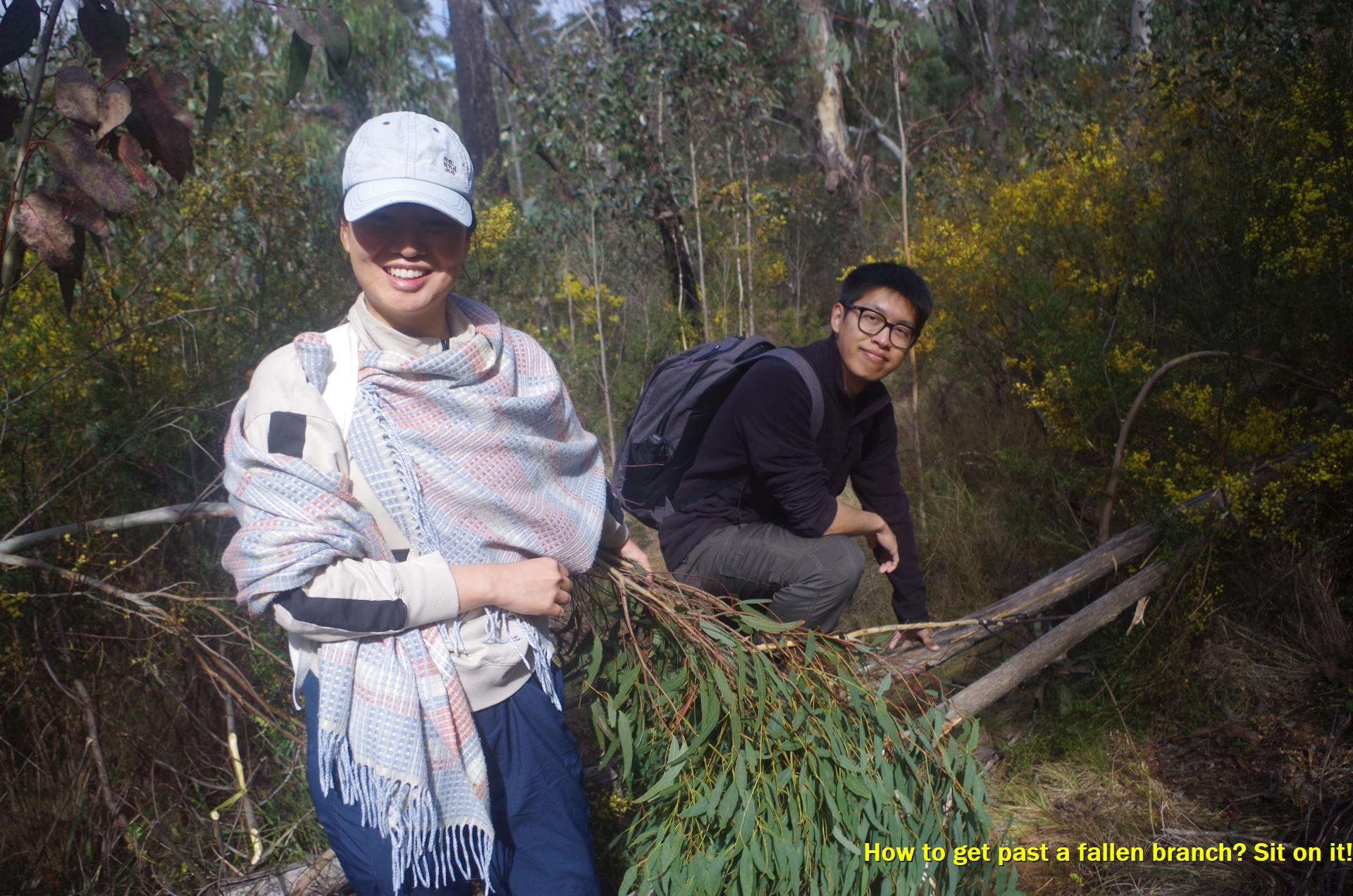
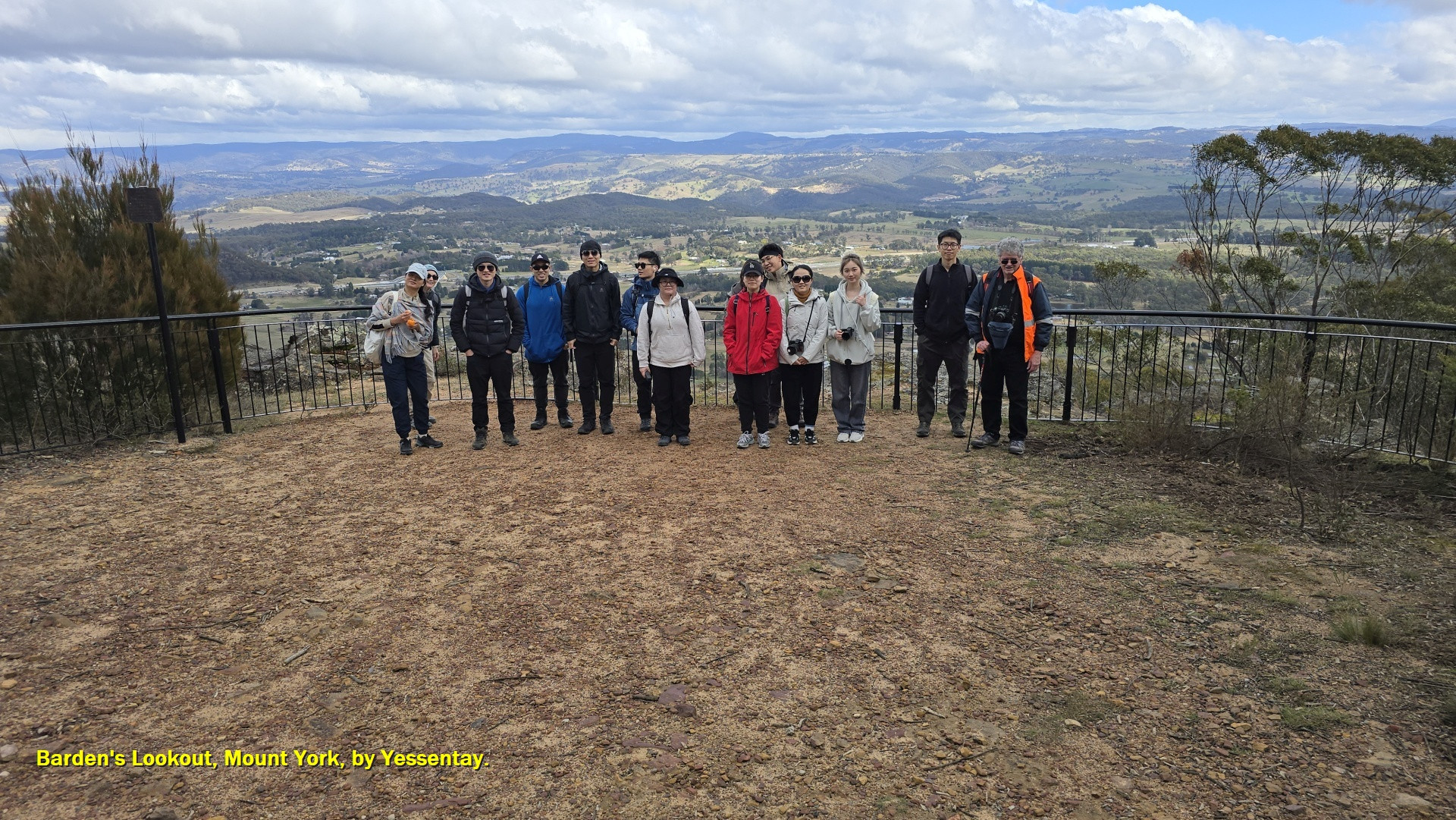
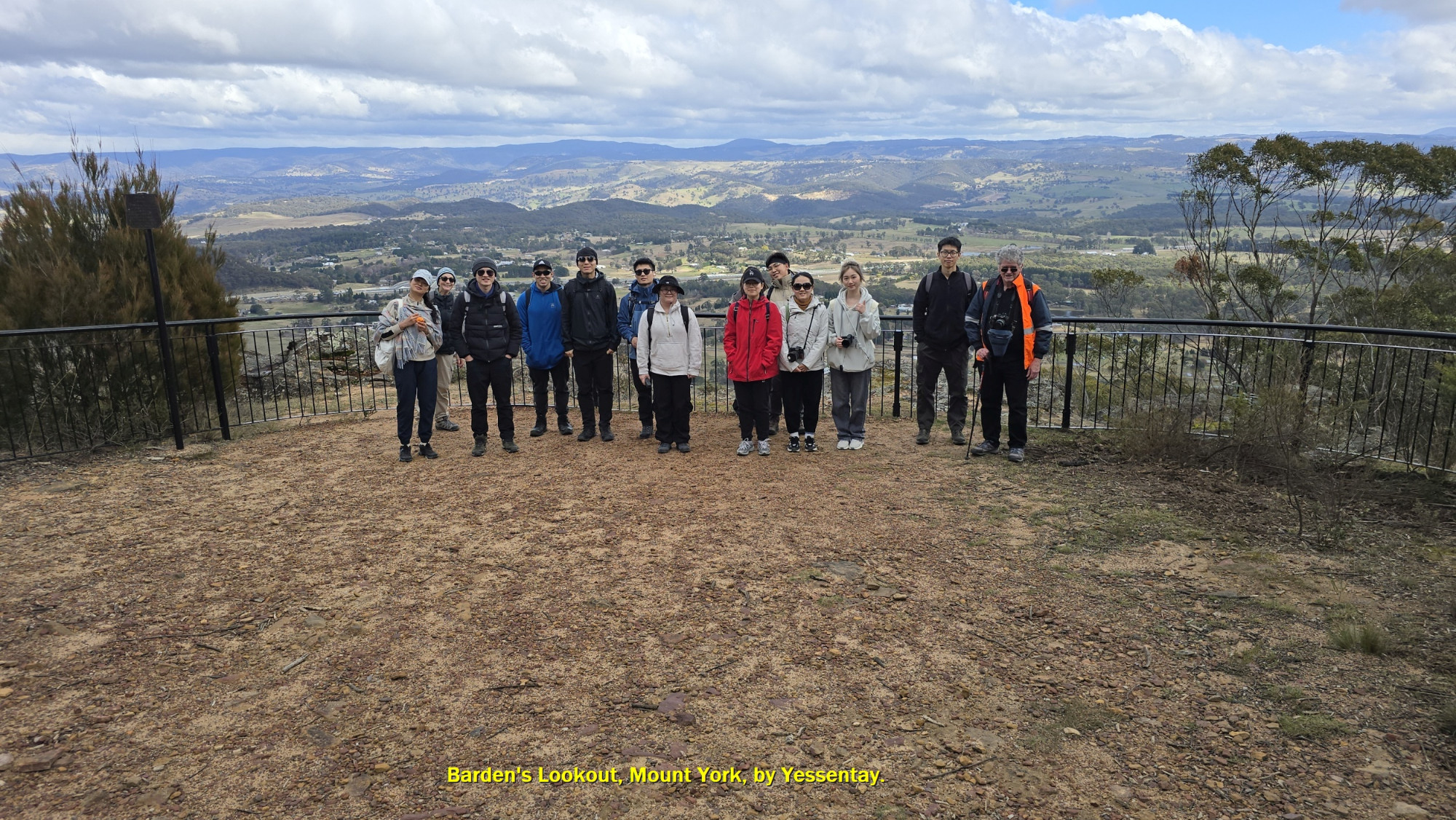
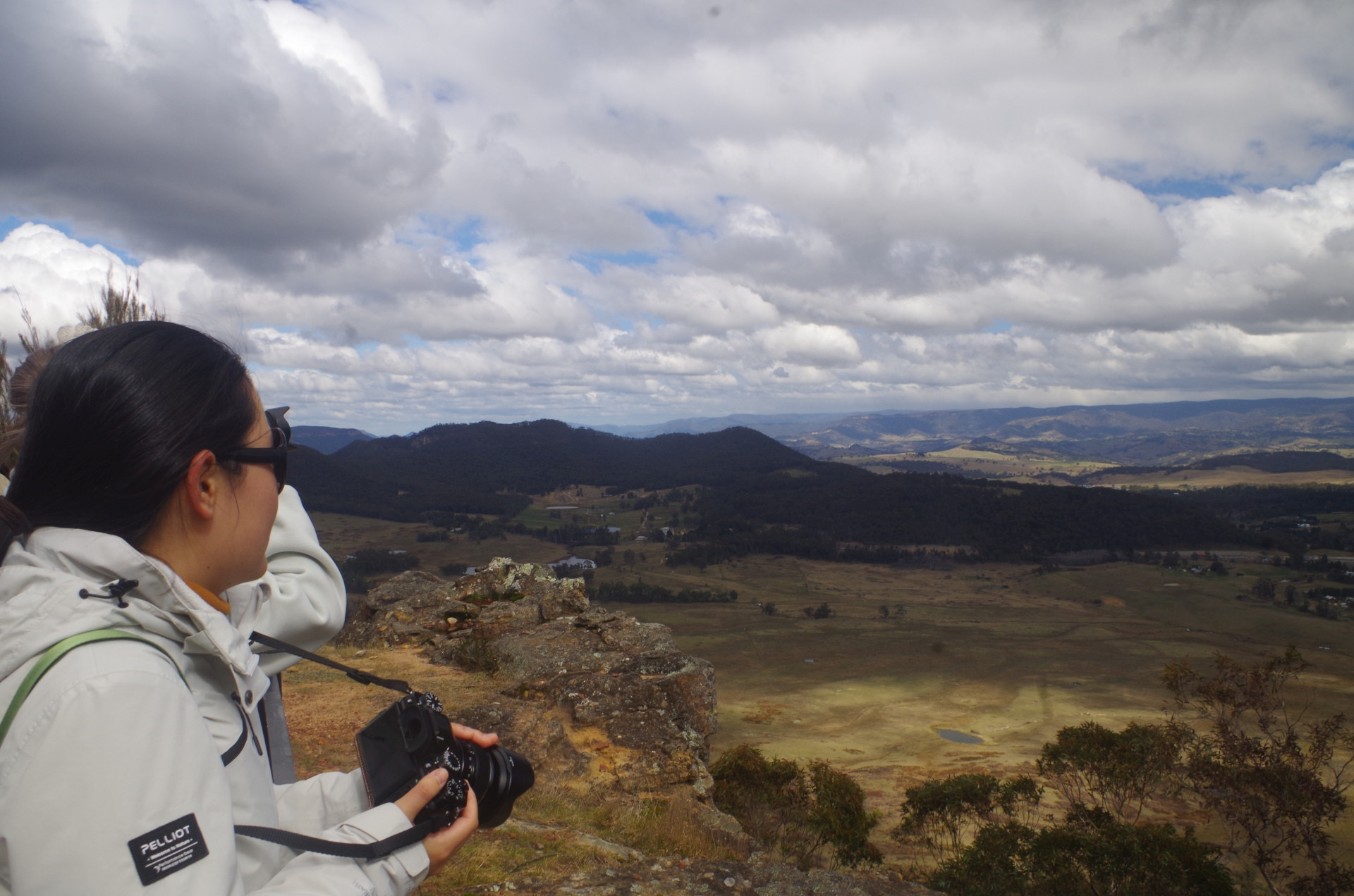
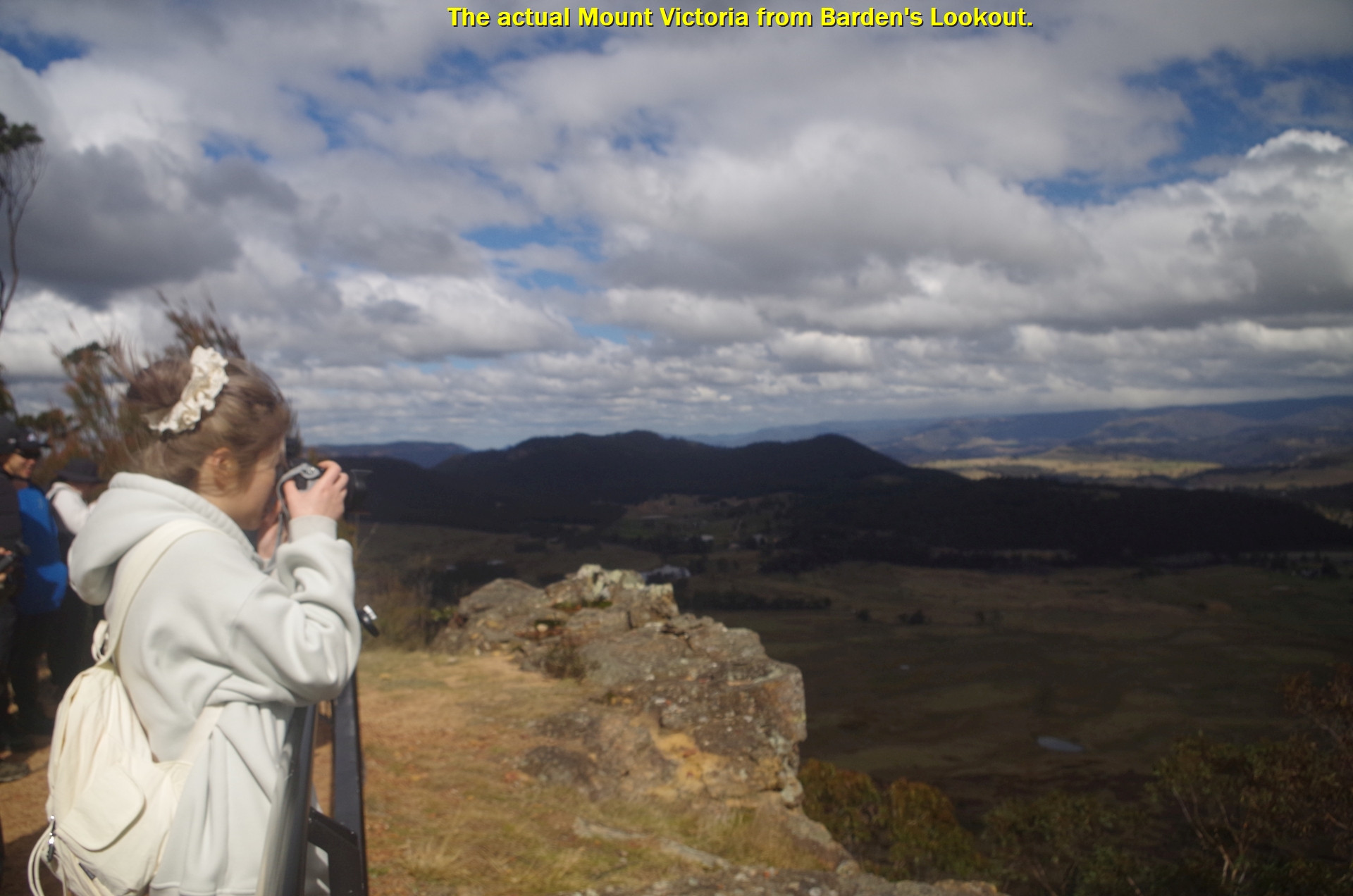
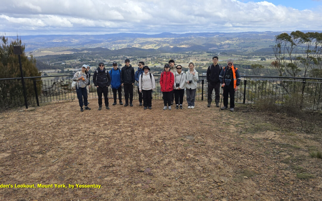
At one point there was a bough across the track and I found that if I sat on it , it could be depressed enough so the group could easily step over it, so that is what I did! Then we arrived at Lockyer’s Track head for a break, and then on to Barden Lookout where there are great views across Kanimbla Valley to Hampton on the Jenowlan Caves Road. The “Oldies” (Three Peaks) Ranges were in the far distance. The actual peak which is also called “Mount Victoria” can be seen from here also.
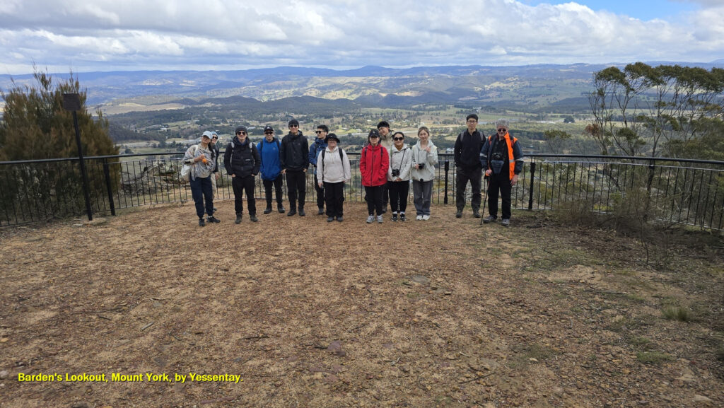
After a photostop at Barden’s Lookout we continued on to Mount York for lunch, finding a spot which was mostly (but not completely) out of the cold wind. Noticed a few people camping there, and there are toilets. No water taps that I could see though.
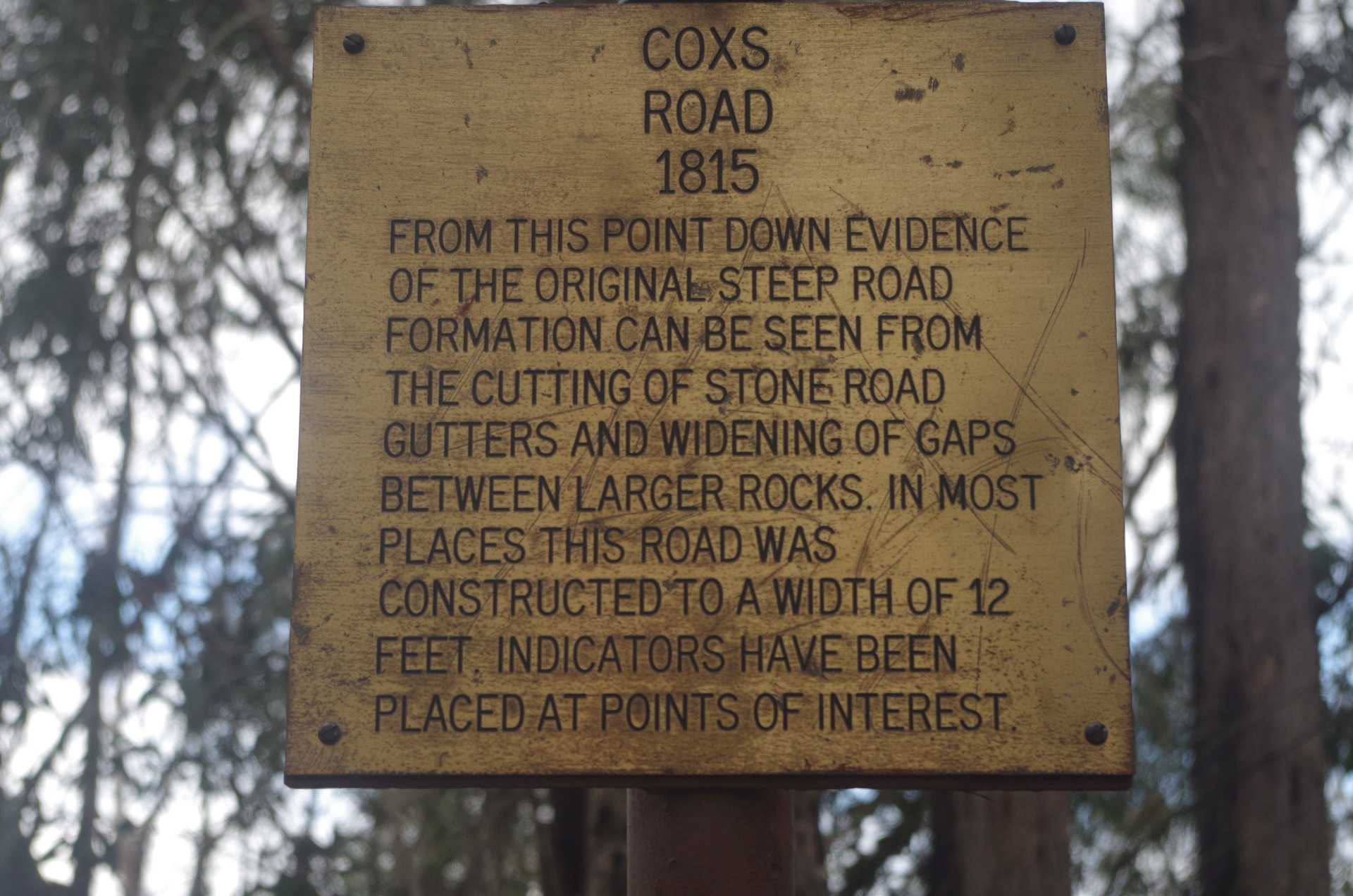
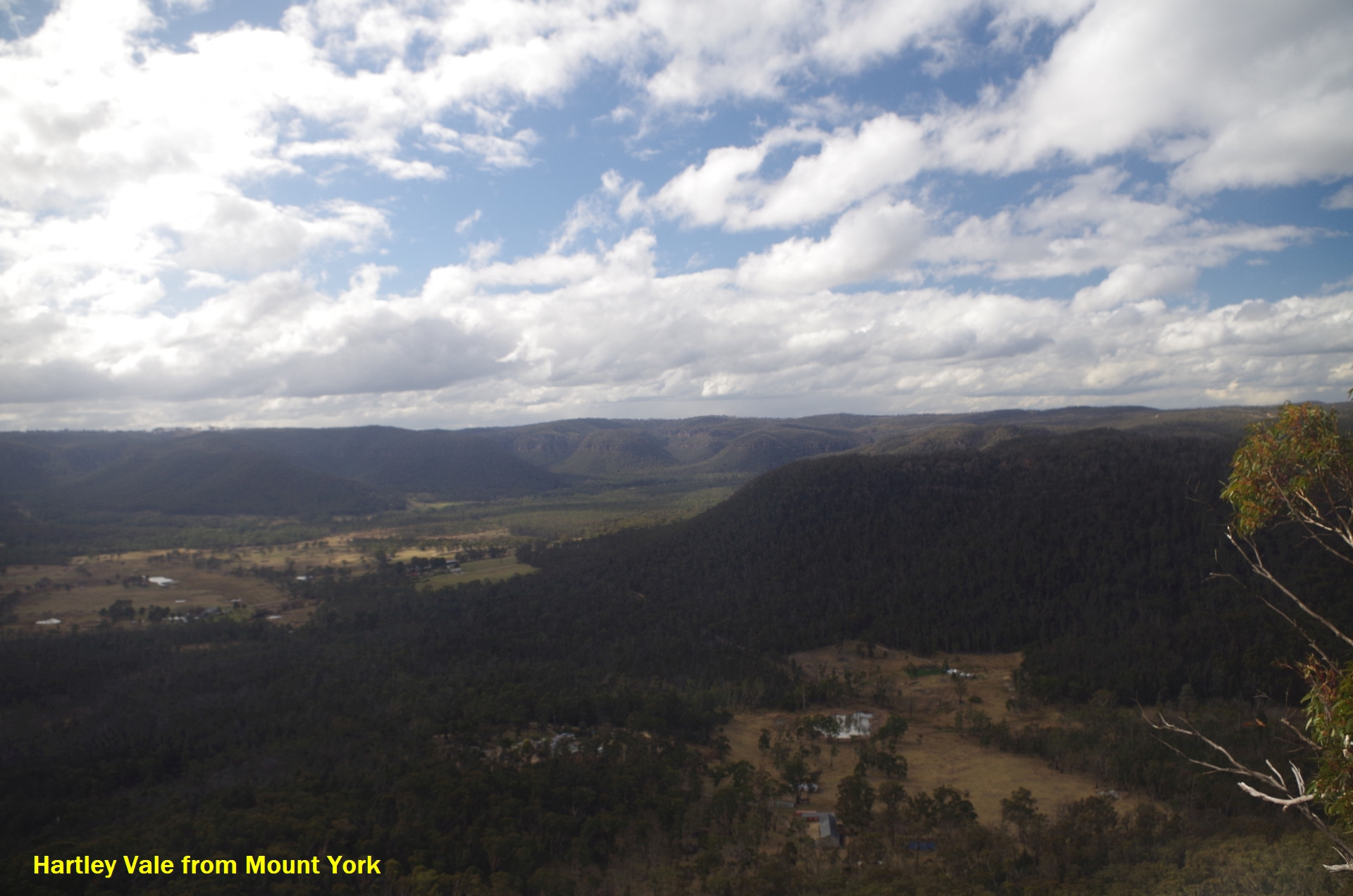
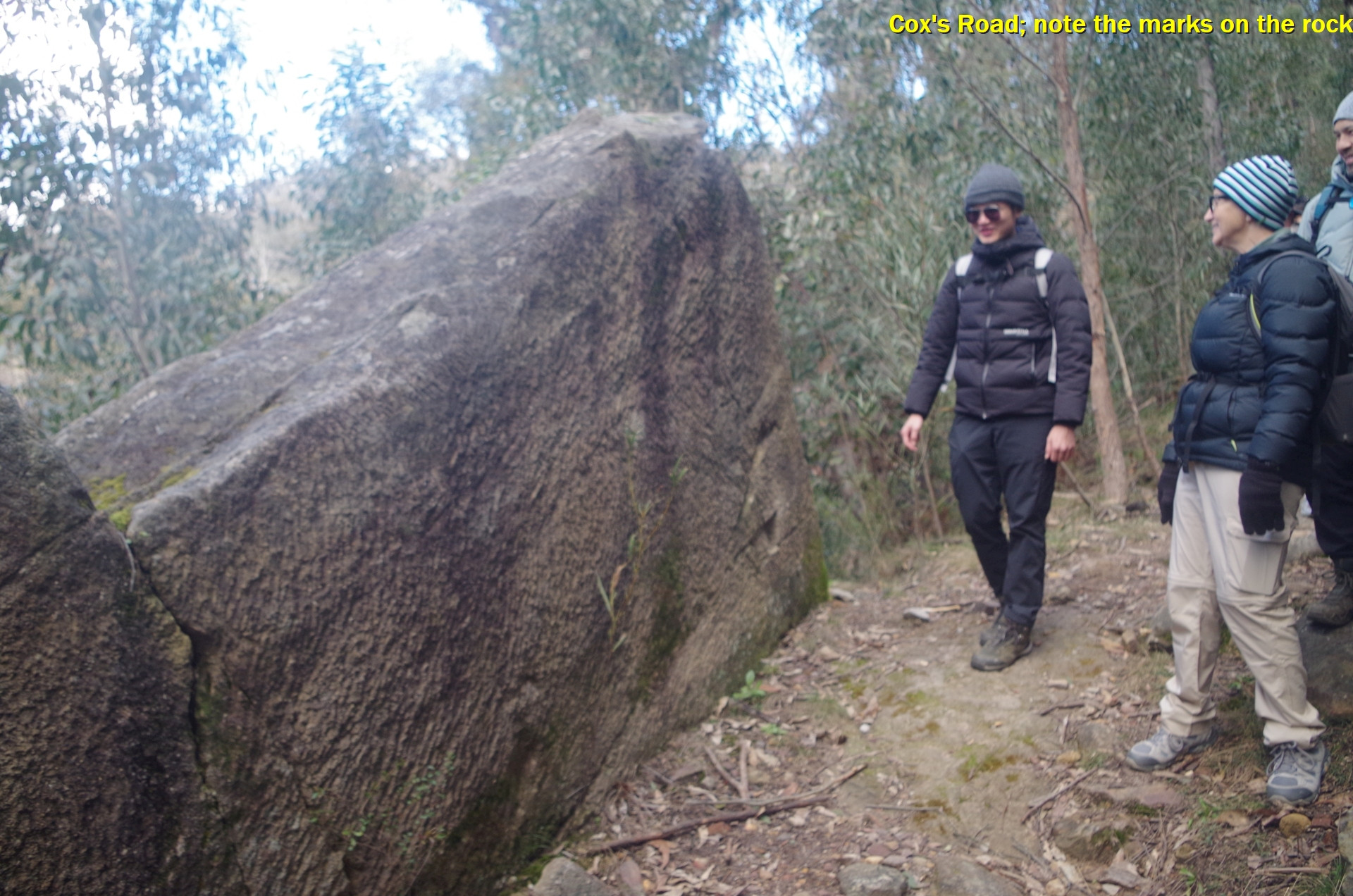
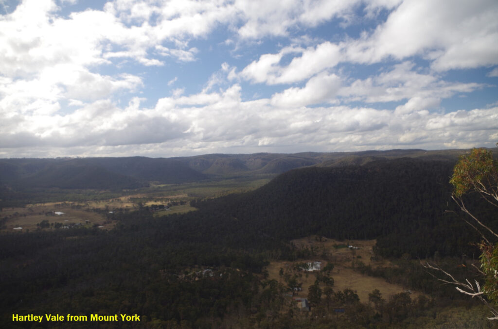
After lunch we started off down Cox’s Road, made in 1815 and which was the first attempt at a road over the Blue Mountains here. It is so steep it would really have been hard work for horses and carts going down and especially up it in 1815, so it’s no wonder it was soon replaced by Lockyer’s Pass in 1828. At its start there is a view point over Hartley Vale towards Lithgow and is unfenced so care must be taken as there is a sheer drop over the edge. It is used by climbers as a base.
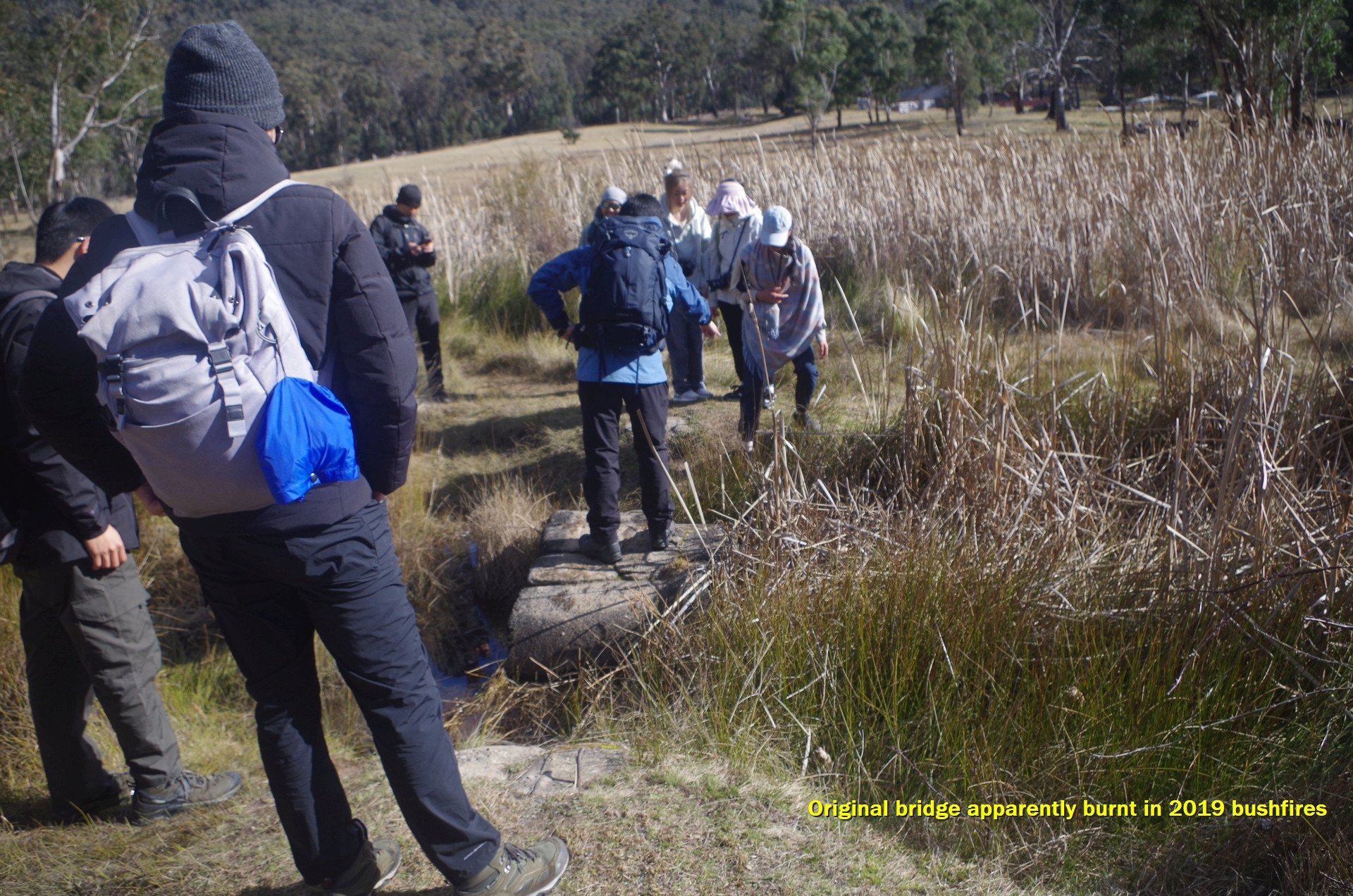
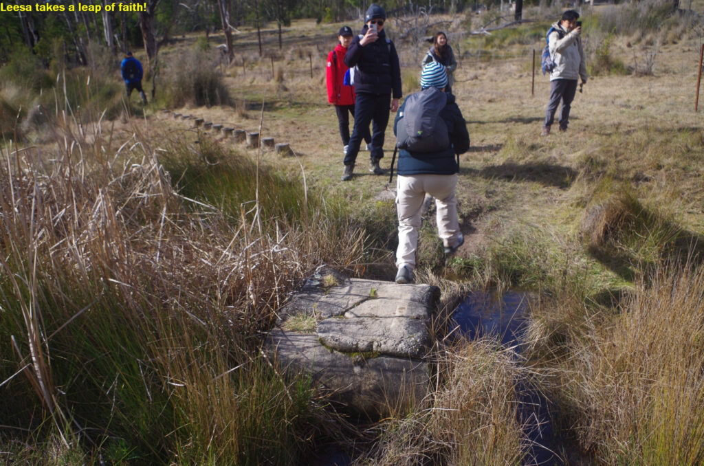
As we went down we saw where there must have been a wooden bridge (long gone with rough-hewn stop abutments), and a bit further on evidence of hand tools being used to cut away at a rock face. Anyway we eventually reached the valley floor where there is farmland and the track crosses some swampy land and a couple of creeks. The last time this walk was done, there were little wooden bridges across the creeks made of railway sleepers, but this time there was nothing, requiring a leap across the abutments or in one case stepping into the (thankfully shallow) stream. It is likely that the wooden bridges were burnt out in the 2019 severe bushfires and have not been replaced. In the swampy sections there are wooden “stepping stones” but because of all the recent rain they were almost under water as well. We were thankful to eventually reach the dry fire trail which led us to a rest spot near Hartley Vale, Here we had a well earned brief rest (and there’s a pit toilet here as well).
Afterv this break we walked beside Hartley Vale Road beside some historic old buildings such as the old school (1878), “the Comet Inn”, and some kangaroos were sighted in the adjacent paddocks which excited some of our group. Then we arrived at what I assumed was the start of Lawson’s Long Alley, to find a couple of cars parked across the gateway and about 5 people standing around. When I started to go through the gate a woman said that is was private property. So I asked her where the start of Lawson’s Long Alley was and she pointed down the road to another side track. So we went down there and found that it was nothing more than a long driveway to someone’s property. I decided to try and get some advice from the residents there but found that there appeared to be no one at home. So I led the group back to where the cars had been and they were now gone, and noticed that their cars had been parked hiding the direction sign making it clear that indeed it was Lawson’s Long Alley entrance. From Hartley Vale Road Leesa spotted an information sign about 100 metres down that “private” road which we could not see earlier. So we entered and proceeded along that road.
In fact that part of Lawson’s Long Alley does pass through private property but is also a Public Right of Way. These are fairly common in rural areas and indeed a part of the earlier Cox’s Road is also one. Landholders generally respect the right of travellers to use these roads (as is their legal right), so why did this woman want to deny us the use of this road?. Worse though is her directing us to the other landholder’s driveway entrance. Unless, that is, she meant for us to continue walking along Hartley Vale Road to where it climbs up to meet the Darling Causeway between Mount Victoria and Bell. That road is dangerous for walkers as it is a narrow winding road with no footpath, and then to walk along Darling Causeway to Mount Victoria is much worse, as it is a fairly busy main road with 80km/hour speed limit and also no footpath. It is simply not a realistic alternative. Bad Karma will eventually come to those people, I’m sure. I assure our overseas students that this behaviour is not typical of most rural people who are usually willing to help you. A couple of other locals passed us in their cars on that road and just smiled at us. I did consider reporting this to the NSW Environment Minister, but this area is managed by Blue Mountains City Council, not the NSW Government. The sign on the gate: “Private Land – please keep gate closed” can be too easily used to convince walkers that they can’t use the road. Perhaps the Council should put a sign on that gate to make it clear that it is a public right of way, but to keep on the road. If anyone reading this has contacts in Blue Mountains City Council, you could let me know.
The ten minutes wasted while sorting this out had implications at the end of the walk.
Anyway we continued along the road which is part of the Lawson’s Long Alley walk and it gradually rose over a distance of about 3km, passing by a few more Kangaroos in nearby paddocks. Some parts are fenced off with “Private property, no entry” signs, which in some places was just as well as the ground there is contaminated with heavy metals like Cadmium and Arsenic from when it treated the oil shale which was mined there until 1921. The walk reaches a point where it diverts away from the road – which at this point really does become a private road for local landholders – then undulates (again through some muddy sections) to go back down to near the road again briefly. We found ourselves outside a very fancy new set of gates at which man was standing, and said that we can’t come in there. Leesa replied that we were not going in there.
At this point I found myself needing a break as my legs were getting fatigued, and so we made arrangements to share the contents of my pack to lighten my load for the approaching climb. From there the track wasn’t too bad (but with more muddy sections again) and there’s a new foot bridge over Kerosene Creek. Even so as we started the final fairly steep climb I started to find it difficult and had to stop a few times to catch my breath. About half a dozen people stayed with me with the rest going ahead to stop at Berghofer’s Drive when they reached it. When it became apparent that it was best for them to go ahead to Mount Victoria Station instead of staying there, Leesa discussed it with me by mobile phone and they went ahead. Meanwhile we ended up about 10 minutes behind them. As soon as we in the rear group reached the level part of Closeburn Drive, I was able to increase my speed as it was mostly level or down hill from then on to the Railway. Unfortunately the train left two minutes early, My Opal tap-on records it as being at the time the train should have been about to leave, yet it was already some distance gone by that time (I will mention more about that later). Whatb is more, had not 10 minutes been wasted because of that woman trying to stop us from using Lawson’s Long Allay, we all would have made the train in time (notwithstanding my own slow progress up the hill.).
So what was going on with me? One thing was that I had under-estimated the length of the walk. Walk descriptions on line state that it is 15km but that excludes the 5.5km return walk to the track head from Mount Victoria station. Thus the walk turned out to be just over 20km long (confirmed by Yessentay). So yes, my legs were getting fatiged by the 15km mark which was at the start of the final climb up Lawson’s Long Alley. There’s more: thanks to the long period of poor weather over recent months the only long walk I did was the La Perouse walk on July 4th (before that it was the Katoomba to Leura walk on May 4th). So I had got out of condition due to the lack of practice. Last year I led a walk which went up the new Bald Hill track at Stanwell Park which also gains 100 metres of altitude in an even shorter distance (although on a well made path) and it was done easily. Goes to show how quickly you can get out of condition without practice. By the way, you do use additional muscles when climbing stairs etc than walking on kevel ground.
Unfortunately, having missed the train, there was a 55 minute wait until the next one (fortunately Mount Victoria Station has a heated waiting room). My apologies to those who stayed with me for the final climb and I am very thankful to them for their assistance. Overall everyone on this walk showed a high degree of cooperation, which is something we like to see on all walks. Also, Yessentay offered to drive some of us back to Tallawong Metro Station (unfortunatley he could not fit all of us in his car) and Fredo and myself took up his kind offer. We went along a strangely empty Bell’s Line of Road, and noticed that as we left Mt Victoria there were a few tiny spots of rain (or was it snow?). Anyway this enable me to get an earlier connection at Chatswood for my Central Coast Line train.
I will mention that there is no use complaining to Transport bureaucrats about the early-departing train. They have a rule that you must be at a train or bus stop five minutes before departure. That rule dates back to 1865 when there were good reasons for that; station staff had to stop selling tickets 5 minutes before train departure as they had a lot of work to do in that 5 minutes before a train arrived. For example they had to close level crossing or foot crossing gates, unlock the water column for the steam loco, and set the signals etc for the next section. And lots more stuff. None of that happens nowadays of course, but Transport for NSW still hides behind that 1865 rule as an excuse when trains (or buses) leave early.
Still, despite these setbacks, everyone seemed to think that it was a good walk.
I did mention at one point earlier to the group that although it is nice to chat on walks, you also need to be watching where you are going and not be too distracted with chatting. This will become VERY important when the weather warms up in a few weeks and snakes come out of hibernation. The Sydney area has some of the WORLD’S MOST VENOMOUS LAND SNAKES such as the Common or Eastern Brown Snake, and the Tiger Snake. You do not want to be bitten by them, so be alert when doing walks.
i did consider anothert Blue Mountains walk this coming weekend (30/8 and 31/8) but trackwork means THREE changes of transport modes are needed, impossible to organise with a sizable group. So a Blue Mountains walk will have to wait a while yet.
Congratulations if you read it this far! See you on future walks.
Bruce Stafford.