Date: 18-21/4/2025
Trip leader: Terry
Party: Chenghan, Vyom, Jeff, Paul & Calvin (Jeff’s friends)
A 4-day, 3-night road trip around Gariwerd (Grampians) National Park in western Victoria, 3 hours west of Melbourne. Gariwerd is the Aboriginal name of the national park, comprising gar meaning nose, and werd meaning shoulder. The group arrived in Melbourne the day before, spending a day exploring the city or doing some remote work, followed by a pre-trip dinner and dessert run.
At roughly 7 am a southern XPT train pulls onto the platforms of Southern Cross. The train arrived 2 minutes late, an impressive feat for a train service with a horrendous punctuality and reliability record. It’s not uncommon for this train to be 2-3 hours late, sometimes even getting last-minute rail replacements, hence the happy announcements from the train crew not having to do overtime. Walking off the train we quickly mixed with busy Melbourne morning commuters, getting off their regional V/line services and waiting at the intersection for a tram across the city. Landing in Melbourne always feels like being in another country, with vastly different acoustics that are pleasant to hear. Tram bell sounds just as they turn across the intersection, while the occasional cyclist speeds past down to the city. We took a 10-minute tram ride to Jeff’s place in Melbourne, just down the free tram zone at the newly developed Docklands. With camping packs dropped off we could explore the city with a lot less weight on our back. Vyom and I went to the Instagram-famous croissant place at Russell St which now has a branch in Sydney, down for some Instagram-famous shots. We explored the free museum in Old Treasury Building which reminded me of my trip to Tasmania, where I had a conversation on the Ballarat Uprising in a campground with some random campers. Quick ride to Springvale for some Vietnamese food that’s better than those in Cabramatta, only to discover that there’s no vegetarian option for Vietnamese pho.
A few of us headed out to Southern Cross Station to pick up Calvin who was on the day train, arriving into Melbourne at night. The train was running on time, but just as it was about to terminate it was stuck around Sunshine, roughly 10km from its terminus. Turns out there’s a points failure where train tracks couldn’t switch, and this brought the entire Victorian regional network to a halt. Trains from Southern Cross couldn’t depart and in evening peak there are hundreds of people waiting for their train back to Geelong or Ballarat. The train eventually arrived 30-40 minutes late, which is unfortunately a common occurrence in Victoria’s crumbling rail network.
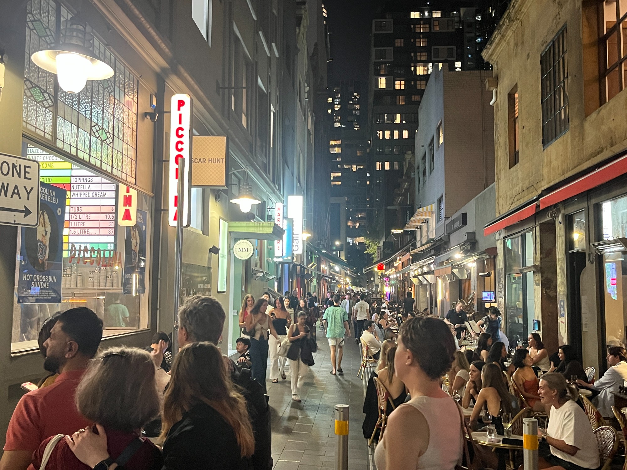
Everyone met up at night for dinner at a Taiwanese place near Southern Cross. Paul insisted on Hong Kong cafe but as HongKongers, Jeff and I are confident they’re not as genuine. We walked around the city for extra rounds of food, first stopping near Korean town for some Cantonese rice rolls. The authentic taste of steamed rice rolls matches that in Hong Kong, where high schoolers gather around food stalls for a quick after-school snack. It’s an interesting new texture unseen elsewhere for those who’ve never tried. A gelato crawl followed as we wandered around Hardware Lane precinct for dessert places. We started at Bing Chilling, sounding like the one single Chinese speech everyone knows. The shaved ice place looks fancy, but sadly I’m not a big fan of bing chilling. There are a few gelato places in the area but all have long queues on a busy Thursday night, including Piccolina which now has branches all across the CBD. We settled with a souffle place at a carpark on the south side of Hardware Lane, where Vyom did the obligatory Instagram-style souffle pull-out. It’s a city with endless alleyways to explore, and restaurants superior to those 900km up north.

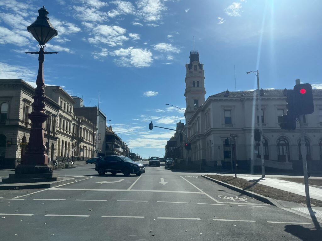
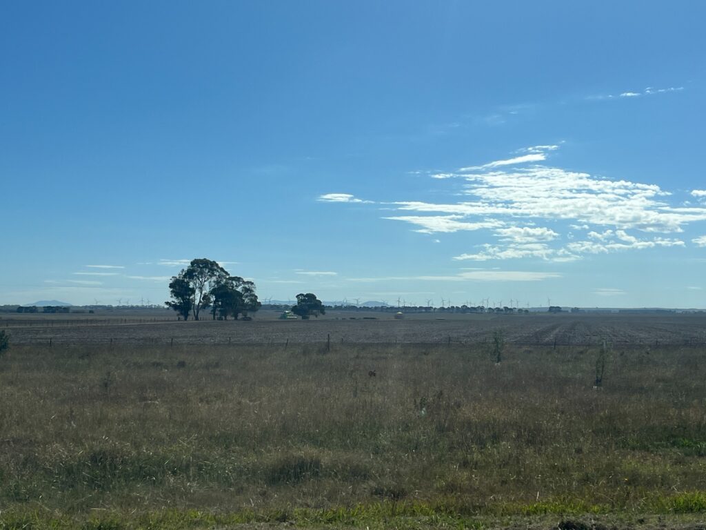
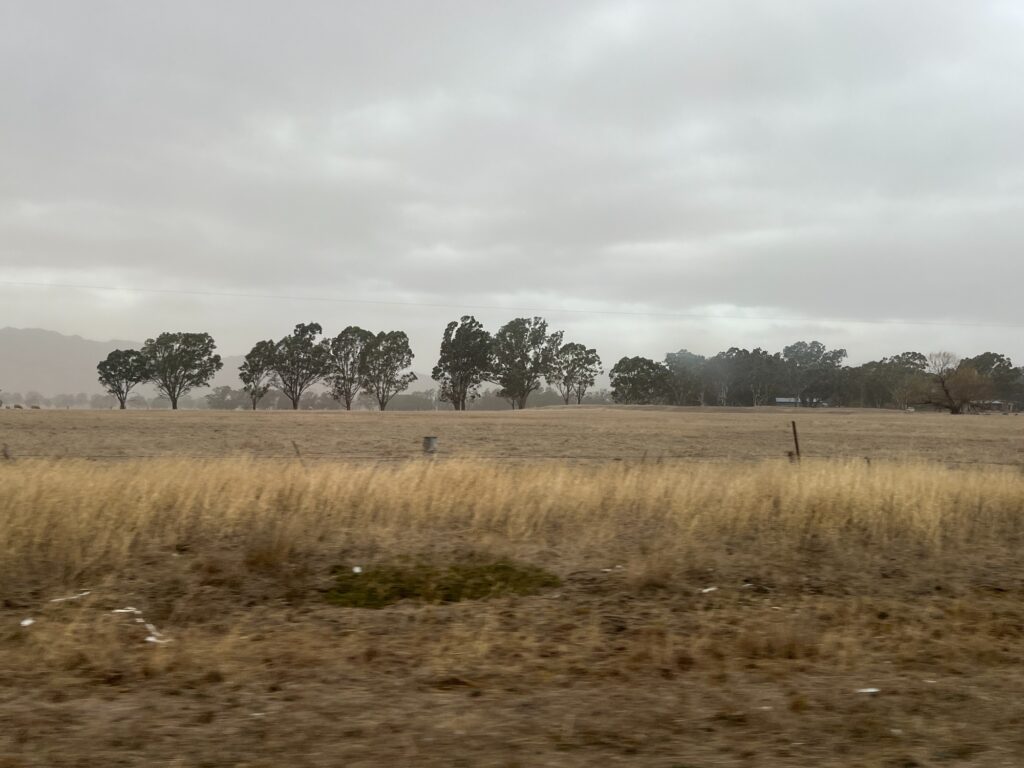
Next day we picked up our GoGet rental and drove out of Melbourne. Motorways in Melbourne run through the CBD and it didn’t take long to merge onto the motorway out of the city towards Ballarat. It was Good Friday and nothing in Ballarat is open except a few cafes. The city is quiet and the streets are empty, quite an oddity with the shiny buildings of a former gold mining town. Sydneysiders are constantly amused by how regional Victorian towns have bike lanes. We got out of the city onto Gleneig Hwy running southwest towards Hamilton. A few small settlements along the way with interesting names- Pittong, Skipton, Glenthompson, all sounding like names of homesick British people. All these settlements have only one street, a few shops, main pub full of motorcyclists and a general store/post office. Windmills scatter along the slopes of the fields harvesting energy from the windy region. We made a stop at Lake Bolac which has a lake with questionable water quality. It’s a hot day and being in the treeless farmlands under the scorching heat feels depressing. Drivers stopped for a picture of sheep as we continued down to Dunkeld where the Grampians are, stopping for a bakery before entering the national park. The mountain range emerges out with its highly irregular shape looking more like a lumpy dump.

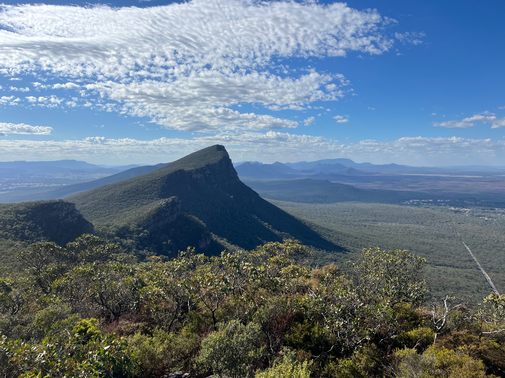
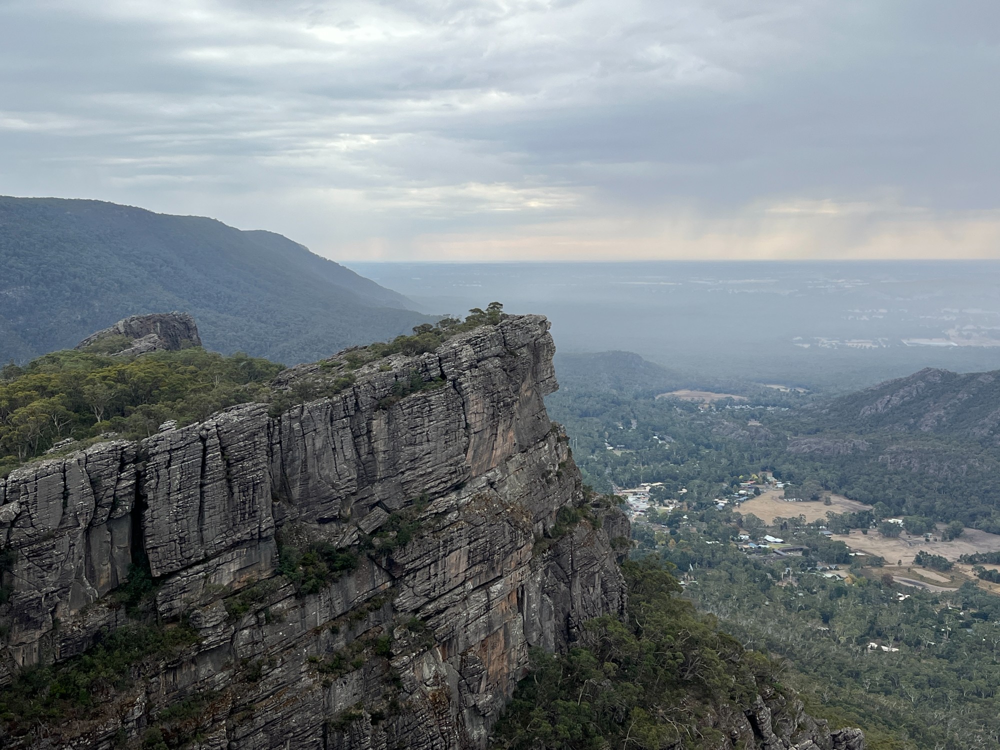
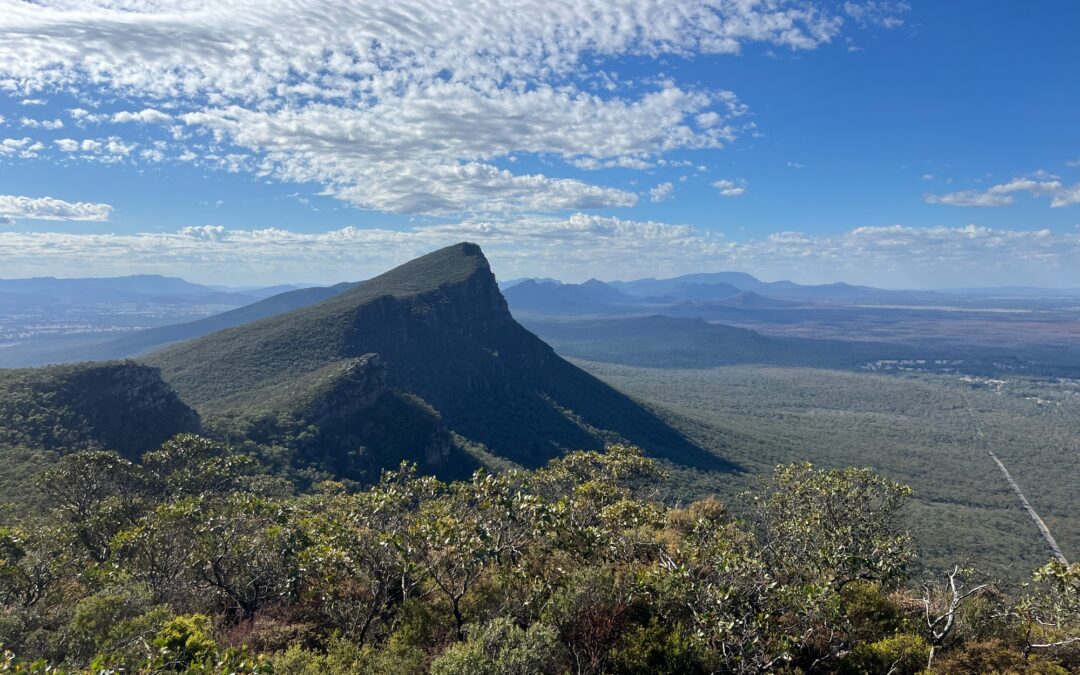
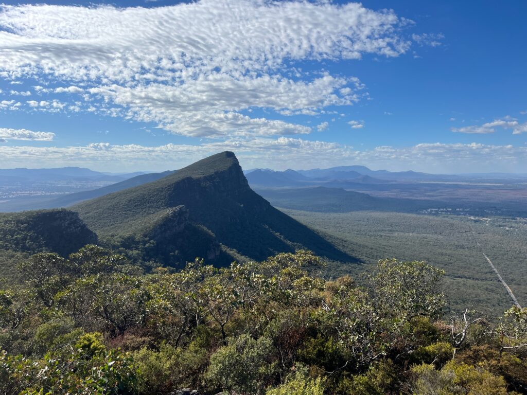
Heading up Grampians Rd we did an afternoon walk towards Mt Abrupt (Mud-dadjug). It’s Aboriginal name (spoken Mur-da-joog) means a blunt or useless arm, likely referring to the peak’s summit with a slanted rock shelf and a steep ridge on its south face. The dry climate has brought vegetation looking more like Central West NSW, with the likes of Warrumbungle or Mt Kaputar. Paul the Blue Mountains resident is excited to finally escape the same old forests as his home, but unfortunately they aren’t that much different. We had a short discussion on the geology composition of the area, and while some areas of the Grampians have volcanic features, this is very likely to be sedimentary with rocks being sandstone. Tectonic plate movement forced these rocks up creating mountains like how most of Great Dividing Range is formed. Folding of the rock layer is still very visible today with the rocky plateau of the summit all slanted to one side, giving a slight hint of how this all happened. It’s much unlike Blue Mountains where the valleys and canyons are carved out by erosion.
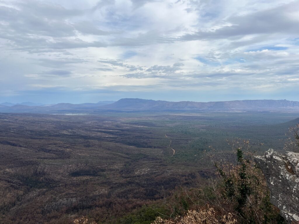
The summit of Mt Abrupt gave clear views over the southern side of the ranges, surrounded by some unreal scenery. All the mountains form a line stretching all the way north, perhaps also explaining the popularity of Grampians Peak Trail, a multi-day hike traversing through the national park. The woodlands comprising eucalyptus and grass trees become shrubs towards the windy summit. Endless farmlands spread towards the flat plains on the southern and eastern ends of the summit.
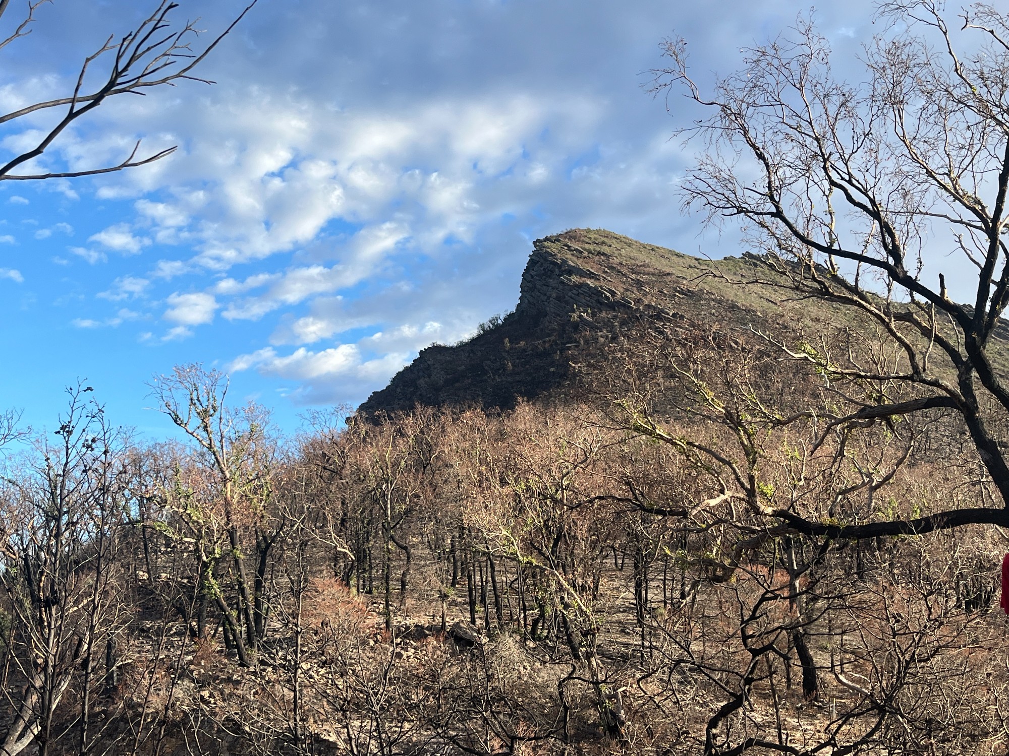
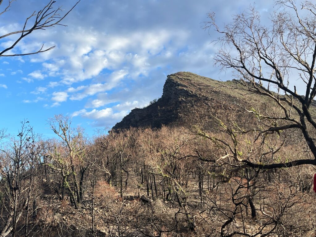
Continuing up the road we crossed the southern section of the park, which is heavily affected by the bushfire early this year. Much of the vegetation is burnt and reduced to ashes. This section of the park is still closed partly due to concerns of falling branches and partly to facilitate regeneration. We turned off the road for a lookout through the valley giving an idea of the scale of this bushfire.
The bench on the lookout was burnt and so is the bush surrounding it. Trees are all covered with charcoal and the ground is nothing but ashes. The irregularly shaped mountains all look really scenic but are unfortunately affected by the fire. While this freshly burnt bush looks empty and easy to traverse, it’s certain that within a few years, the regrowth of shrubs will render it too dense to traverse. While the density of the shrubs depends on the weather and Grampians being much dryer might not receive the tremendous rainfall that has led to Kanangra’s overgrowth, it’ll certainly take years, if not decades, for the regrowth to stabilise. The bushwalking tracks that we still see might become overgrown in a few years time and until this regrowth stabilises it’ll be hard to traverse.
On Saturday we headed down to Halls Gap to stock up on groceries. Paul woke up with a dream of using NSW Trainlink’s Discovery Pass for a free ferry across the sea to Auckland. We stopped by Lake Bellfield which is a dammed reservoir and for some reason is where V/Line coach services from Stawell (pronounced stall) terminate. Some Victorian place names are tricky to pronounce, like Nhill- nil, Moe- mo-ee, Nyah- na-yah just to name a few. I got a book from Halls Gap Newsagency- A History and Field Guide of The Grampians (Gariwerd) by David M. Welch which has been a valuable source of information, and Calvin got a paper map of the national park as a souvenir.
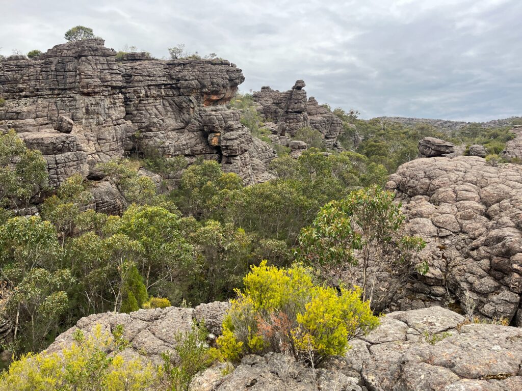
Quick drive up from Halls Gap to Wonderland carpark eliminated a bit of walking. Being in easter long weekend the carpark was very crowded and cars parked along the road down the hill, similar to Charlotte Pass during the day. The walk was very crowded heading up Grand Canyon and towards Pinnacle Lookout. We scrambled on and off the track seeing if certain rocks give us better views. The vibe feels largely similar to Valley of the Dinosaurs in Mugii Murum-ban near Mt Genowlan, or the rocky pagodas at Gardens of Stone. Lots of families and kids on the track forming lines of queues up to the summit, reminding me of my travels to China except with much more civilised tourists.
Walking up the track Paul and I had a chat on our bushwalking mishaps. Paul mentions his Kanangra camping trips where his mates were scared of leeches and few were keen for adventurous walks. Unfortunately, that’s the case for most people if they haven’t been vetted for experience before going on a trip, and even for people on camping trips, it’s increasingly common to encounter. Not everyone has to be hardcore and super adventurous, but it does get frustrating when this mismatch happens on a trip, where some want to discover more and some simply prefer heading home. Some people put in what they call bulletproof trip screening questions, asking a long list of questions like a job interview on whether they’re keen for a challenge and how they solve problems. Most of nature’s best happen off the beaten path, and nature rewards whoever is willing to take the plunge, unlike the overcrowded mess in the well-paved tourist track.
International exchange students are also often blamed for the loss of adventurous spirit. Most exchange students do follow the same pattern- arrive in Sydney, spend weekends flying to Cairns, Darwin, Uluru, getting all the first-time experiences and leave Australia. It’s fair that many wouldn’t find a lot of time to contribute or even absorb what the country has to offer, but there are certainly ways for them to become key parts of the community. A French student doing an exchange in Hong Kong sat next to me once, on a flight back to Hong Kong after a short trip to China. The city has gone deeply into her heart after a full year of exchange, feeling a strong connection in culture, people and the future of the territory. It’s always great to see this identity-building process, where common values and shared experiences transcend nationalities. While it’ll be unrealistic to expect exchange students to deliver big changes, these positive influences certainly pass beyond borders, where those interactions and experiences shape new ideas.
A while ago I met up with my Hong Kong friend in Sydney, who’s just been back from volunteering near Brisbane. In South East Queensland on Border Ranges houses an education centre, where a group of Hong Kong uni students went for a volunteering project. Their first bushbashing adventure came a bit unprepared, unlike SUBW mandating experiences. Running around the slope, identifying invasive plant species and removing them, all sounding a bit boring until one of the teammates comes down with huge piles of plants strapped around him, cheering everyone up showing what’s possible. Pure positive vibes influence each other, just like being on any other bushwalk. To him, a lifestyle of living and appreciating nature feels unheard of, but it’s perhaps one way to belong to a place.
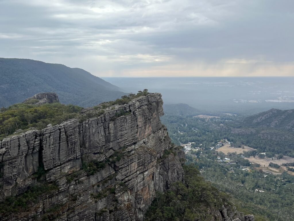
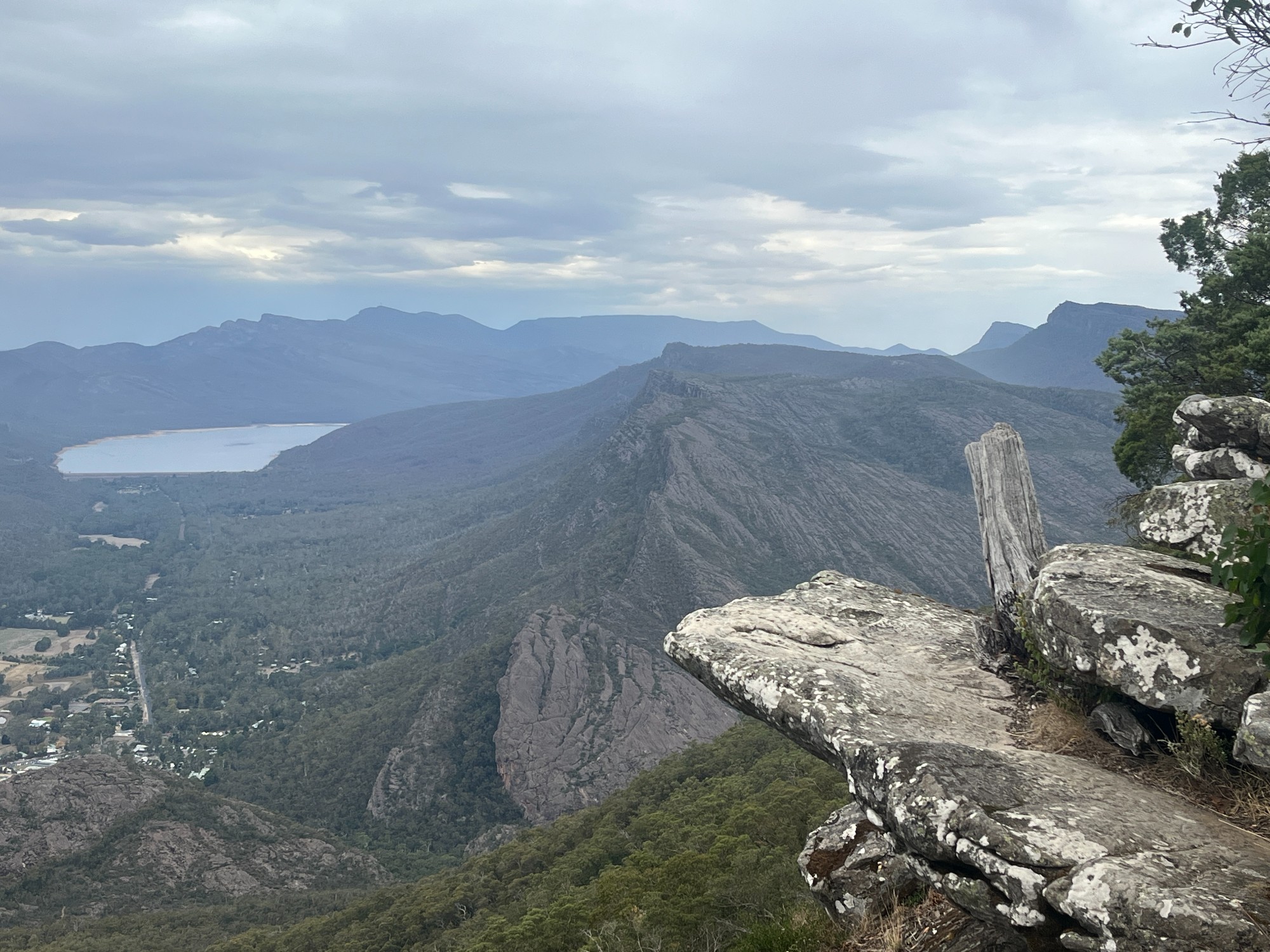
We stopped by Boroka Lookout which is a short drive away, with another view of Halls Gap. Many of the attractions in that area are closed due to bushfires. We headed to The Balconies, one of the few areas still open. The short walk from the carpark was as expected fairly crowded, running through freshly burnt bush. It’s always funny to see how these tracks allow for ill-equipped hikers wearing luxury brands and expensive shoes on a bushwalk. The Balconies is a C-shaped rock looking like a cave, where the floor dangles off to the cliff allowing bushwalkers to sit on the edge like a balcony. The view there was stunning and it took me a few minutes to comprehend what was in front. Paul and I walked along the cliff, not towards the balcony but another rocky outcrop just to sit and watch the scenery. The bushfire impact here is really clear and it all looked freshly burnt. The gullies look slightly better but that’s also because there’s more vegetation around waterways.
Here’s where all the high school biology comes back, where you learn about primary, secondary succession. Secondary succession refers to the process by which an ecosystem reestablishes itself after a bushfire. We can see the regrowth of grass, which will be covered with more small bushes and shrubs in a few years. Over time, trees grow and shrubs are reduced, and the ecosystem reaches a steady state. In high school, they call this a climax community, where boys in our biology class always get excited hearing the word climax. There’s no real climax community as there’s no way to tell if it has been reached, but that’s a concept sufficient for short responses in exams. Aboriginal people carry out cultural burns as a traditional practice, which is a burn with way less heat than a hazard reduction burn. By burning through the shrubs with low heat, this returns nutrients back for taller trees to grow, helping ecosystems to stabilise. It also reduces fuel, prevents bushfires, and people have long advocated for widespread use of this practice.
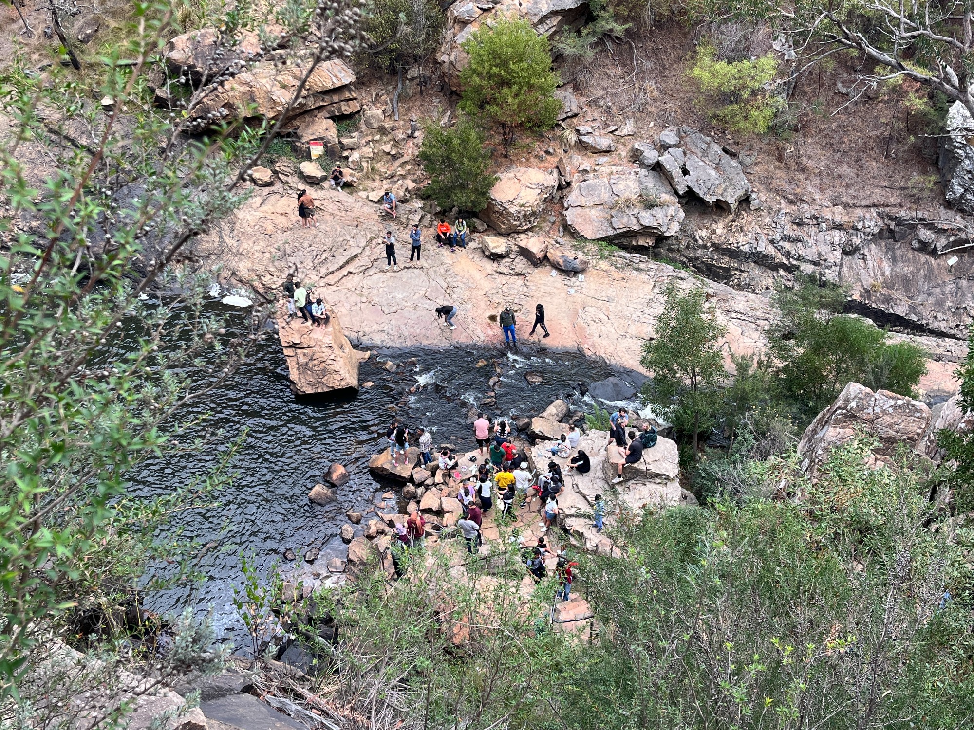
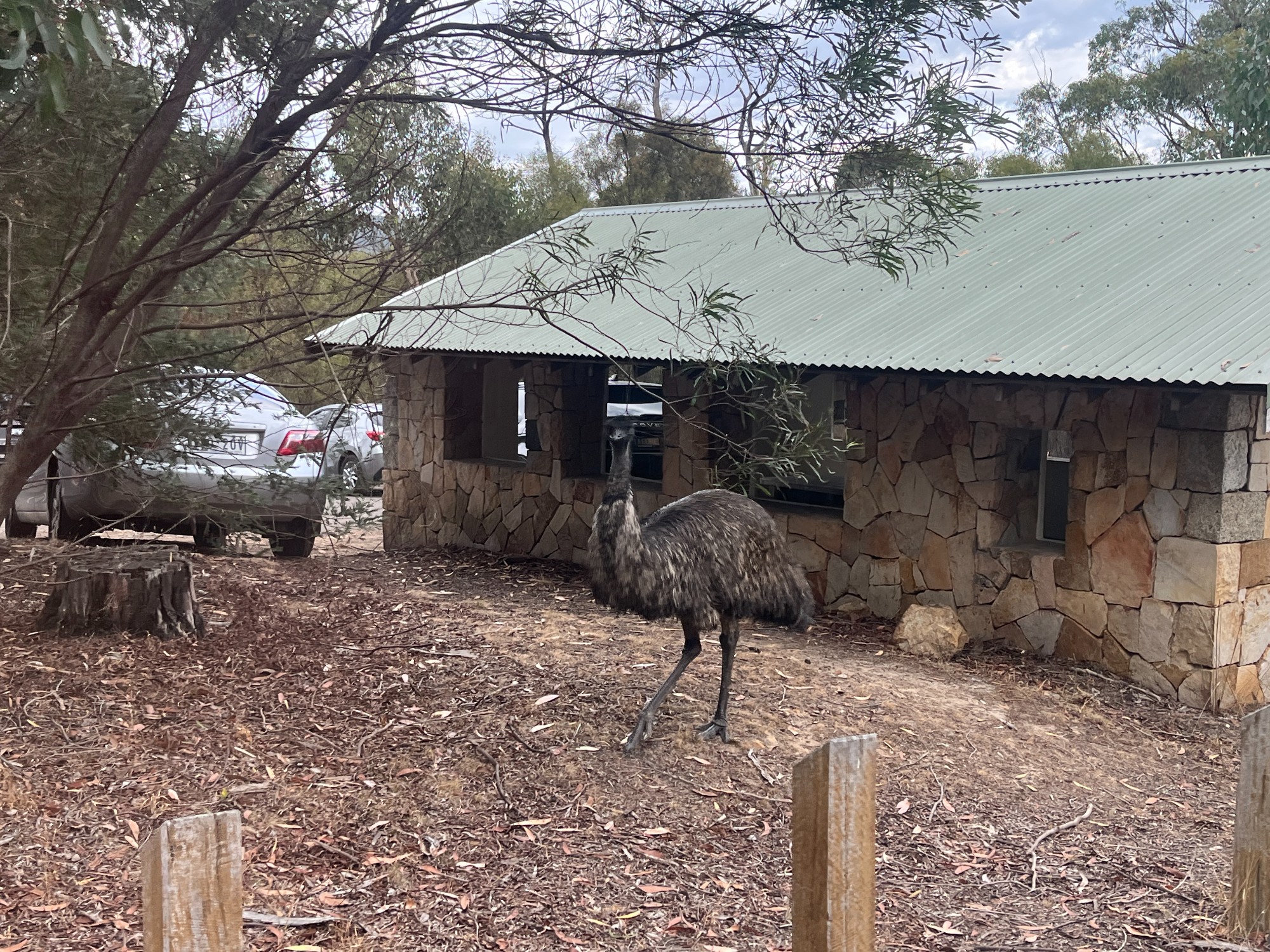
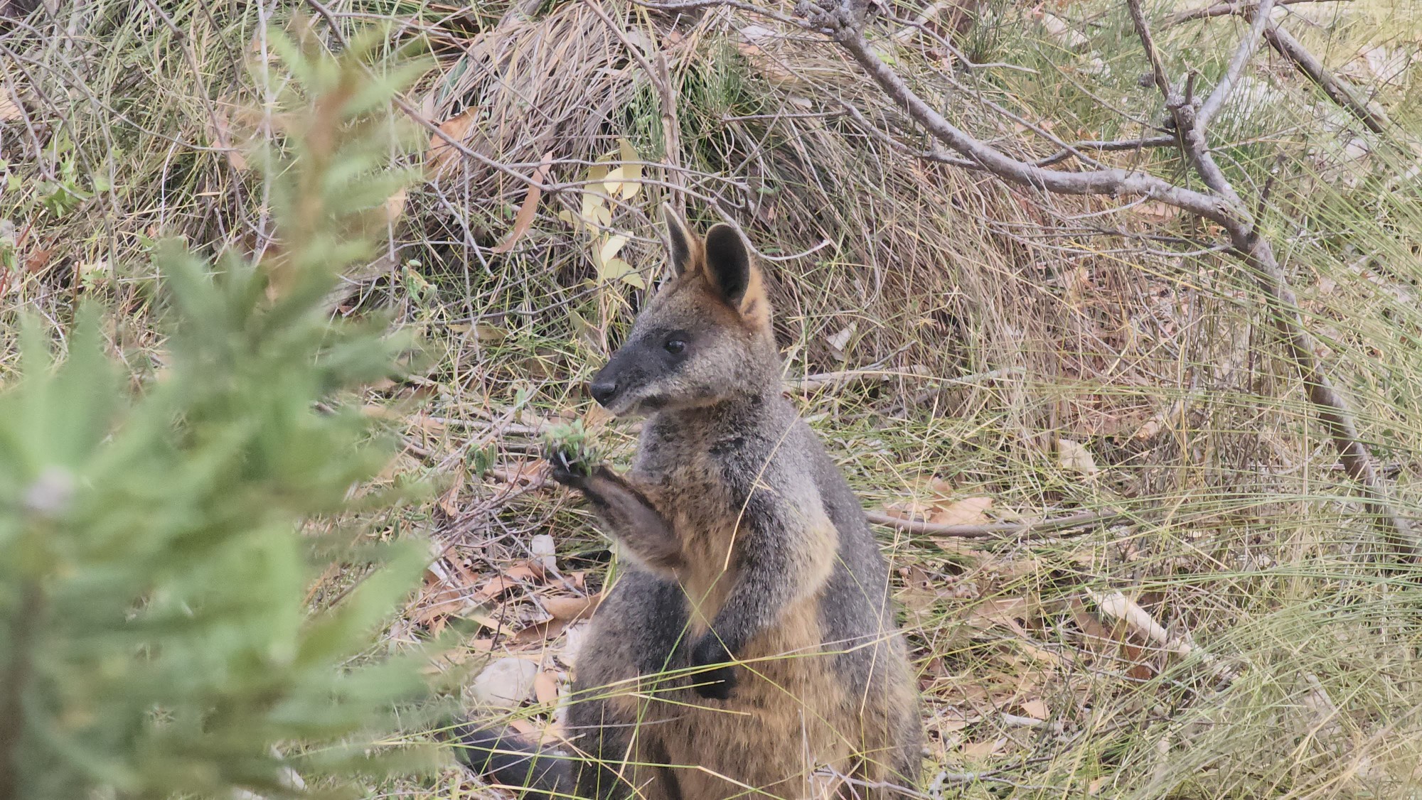
Down the road is MacKenzie Falls, the tallest waterfall in Victoria. National parks claim this to be a strenuous walk which perhaps is the case for most people. We went down halfway through the track with long lines of people and turned back after seeing a crowd of roughly 30 people at the base of the waterfall. We’ve all never seen that many people in a national park and there’s certainly no point in adding to that overcrowding. The tracks to nearby lookouts are fairly quiet where we saw a few swamp wallabies, with orange fur around their ears and near their belly. There was also a small emu at the carpark, a common sight in this area.


Escaping the crowds we drove into Zumstein to check out a picnic area, a potential camping site for the night. This is the night where we couldn’t secure a campsite and therefore we were enlisting a few picnic areas to potentially camp in. Deciding it’s too obvious for some stealth camping we thought it’d be good to have a look at the historical site, even though we’re not historical enough. It’s essentially a summer resort built by a man profiting from public land. There were a few cabins and some nationally significant trees.
Right before the sun sets we headed down to a nearby state forest and decided to settle there for the night. We drove into a clear spot, set up tents while avoiding falling branches of red gums, unaware that this would turn out to be a mistake. As night falls, a nearby family camped out with full car camping setup- gazebos etc turned up their loudspeaker and started playing music, blasting through the entire area. Two of us went to remind them of the music volume, and as they approached that family the mother picked up a kitchen knife, pointed at us and told us to get away from them. Attempts to negotiate this peacefully failed as the mother turned aggressive and the kids on the sides giggling as if they were endorsing this behaviour. We retreated back to our tents as they continued with their music, occasionally revving their chainsaw over the night just to create more noise. The music continued till 2am when they decided to sleep. We woke up at 4am, packed up everything, gave them a honk on the way out and headed back to the national park.
Perhaps this reminds us not to camp in state forests where there are no rules and no one to enforce anything as they are private lands. One of my friends has camped outside of town in Mildura once and almost got robbed by a few people wandering around the vicinity. Most of the time camping in regional places is very safe and they offer some of the best spots to camp, but there’s just a bit of risk that skilled travellers will need to know how to mitigate. Staying away from population centres (eg. towns) and roadside places, camping in national parks or caravan parks where there’s heaps of other people, helps with avoiding these instances. These regional towns towards the northwest side of Victoria are probably fairly rough places as well without much economic opportunity and entertainment. One of my classmates did a placement in Dubbo and while elderly patients are very nice, the younger patients aren’t the kindest. It’s a complex issue that’s important to acknowledge on a trip, but not much we can do other than to stay kind.
Outback trips are still fun- Broken Hill is where I had my very first beer when I turned 18. Sitting at a pub, enjoying the vibes while chatting with an Aboriginal man about Japanese anime. Jamie Maslin’s The Long Hitch Home is a really good book to read if this is something that intrigues you. It’s a travel writing on a hitchhike from Hobart to London, but half of the book describes hitchhiking across outback Australia and the stories are highly reflective of what the places are like.
Paul runs a book club and working with environmental science he’s always intrigued with ecosystems and plants. It’s common to find field guides on flowers and trees you might find in an area, but for many people, you only understand how great and biodiverse an area is when investigating on a broader scale. When asked what books are good, he recommended Ecological Communities of NSW and ACT, a hardcover book found in random libraries. There’s also Ocean Shores to Desert Dunes, describing native vegetation of NSW and Scitech Library has a few copies. Scitech Library is a sort of hidden treasure for urban planners and enthusiasts alike with collections of old maps, directories and books. It’s only when one looks into the ecosystems and biomes will they appreciate the scale and wonder of nature. Modern-day books are increasingly feeling like Wikipedia copypasta as a big reason for us to buy a book is the time and effort spent in original research.
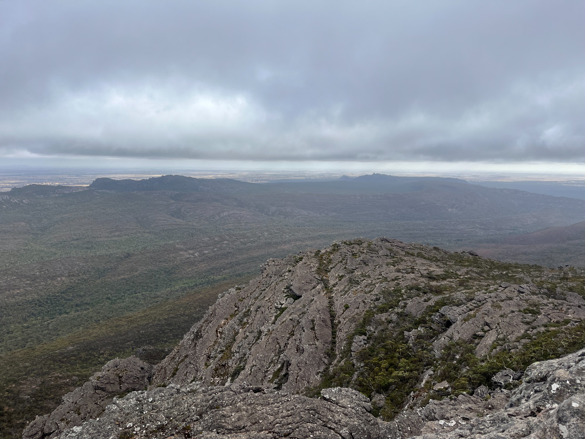
After all the bogan drama we headed back to the national park at Roses Gap for a day walk to Mt Difficult / Gar. We walked to Beehive Falls realising it’s not a waterfall, it’s water-fell. The creeks were all dry and there was no water for us to collect from. A few of us headed back to the trailhead where there’s a bore water tank. Up the summit track all the vegetation looked very alpine-like (they’re not alpine plants), perhaps due to the constant strong winds.
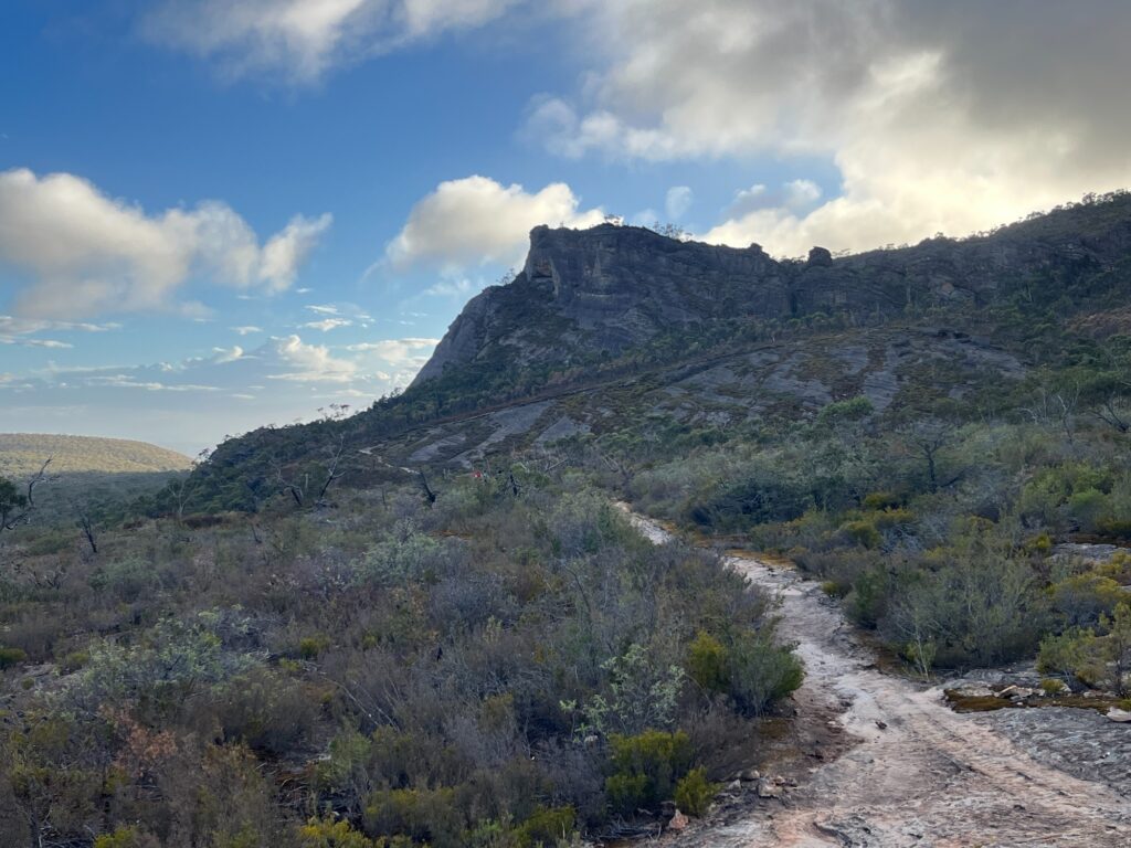
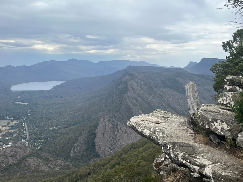
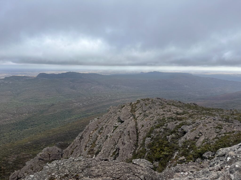
Up the summit track the wind grew stronger and weather turned more cloudy. The track is still clearly signposted but instead of a dirt track it’s mostly traversing over rock surfaces, giving Tasmanian vibes. Passing through Gar hike-in campground with a few campers on the wooden platform we reached the summit, marked by a trigonometric station.
The rocky summit was windy as it was barely shielded by plants. There’s clear views to the northern side of the range, the fields extending northwards to Horsham, and Lake Wartook to the south. On the way back we stopped by the hike-in campground where there’s a nice indoor shelter with solar-powered mobile chargers and a logbook. I picked up the pen and wrote with the handwriting of a 5-year-old on my freezing hands. As usual I made an entry on behalf of SUBW, marking our interstate adventures:
“A group of Sydneysiders + Sydney Uni Bushwalkers (SUBW) delegates have visited the People’s republic of Victoria. Good vibes on the rocky shelves towards Gar summit. Finally something slightly different from boring Blue Mtns. Be sure to ask us Sydneysiders about the purple feather!”
Over these couple days I’ve been educating everyone with campfire stories, purple feather being the most important one. Poor Vyom have heard them too many times and starts to get annoyed, but at least most people enjoyed them. Luckily the logbook had its share of interesting entries and we didn’t have to kill time with 30-min extended version of Purple Feather. People do the walk as part of duke of Ed, as part of school, or even getting engaged. It’s always fun to dig through a logbook and see how emotions come to play when being in nature.
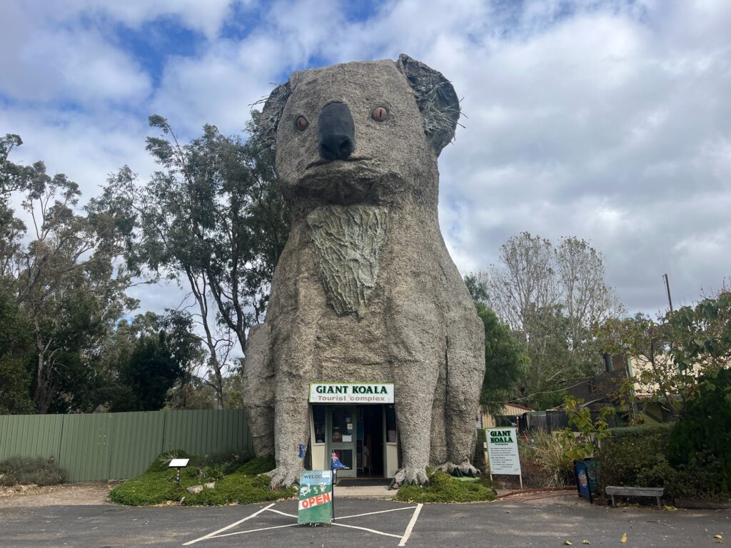
From Roses Gap it’s a short 10min drive out to A8 Western Hwy where we stopped at Dadswell bridge. This small, much unheard of place has a very well-known attraction- the Giant Koala! Australian regional towns love their big things where tourists stop by and take pictures. There’s big banana in Coffs Hbr, big pineapple in Sunny Coast, and big bogan in Nyngan (slightly northwest of Dubbo). The shop was unfortunately a bit rundown and the souvenirs aren’t of the best quality. I got a burger from the restaurant which is fairly decent on the scale of regional servo burgers. The other time I had a burger was in a Chinese takeaway in Balranald, NSW (in the Riverina region). They’re certainly not the best in Sydney standards but at least better than Chiko rolls (a bastardised spring roll common in regional towns that tastes horrendous).
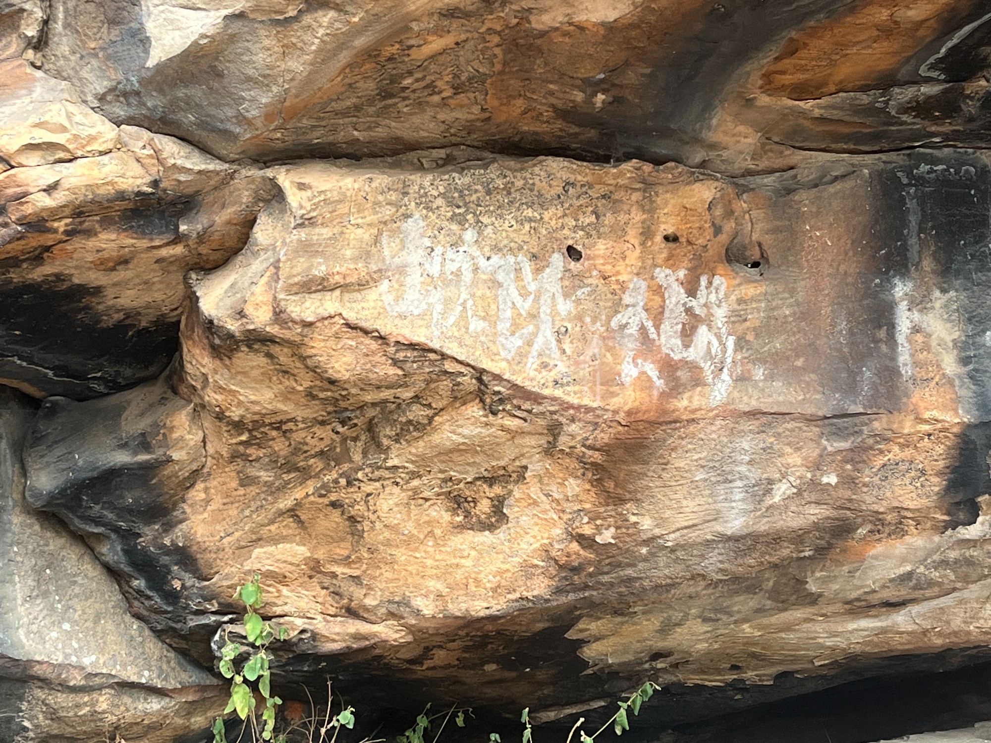
We visited 2 Aboriginal sites as Jeff has never been to any. First is Gulgurn Munja, pronounced Gool-gorn Mun-ya and means hands of young people. A short walk from Hollow Mtn (Wudjub-Guyan) carpark leads to the site which has a collection of hand prints. Next is Ngamadjidj, pronounced Nar-mar-jeej and means white person. The human stick-like figures are drawn in white clay. Much of the meaning is unknown as the people were killed before anything could be documented, and we can now only guess from the limited sources we have on hand.

From there we continued down A200 Henty Hwy towards Hamilton where we continued towards Great Ocean Road. It was very windy along the paddocks on Henty Hwy as wind blasts through empty fields unobstructed. Much of Northwestern Victoria all the way up to the Mallee Desert is in the same fate. Large chunks of eucalyptus forests were chopped down to make way for agriculture, and this has altered the ecosystem so much that sandstorms and strong crosswinds are a common occurrence. Wind continued as the highway crossed through Grampians National Park through bushfire-impacted areas. The bushes on both sides of the road are reduced to ashes and all the shrubs look black in colour.
Jeff did a Melbourne to Adelaide bike ride, and the same strong winds struck around the Mallee region, forcing him to give up just past Mildura at Renmark, SA. There’s a town named Manangatang which I’ve been through once and always made fun of as it sounds like Malatang, and apparently the only store in town is an Asian grocer run by some Filipinos.
Weather cleared off as we approached Hamilton. Midway we passed through a town named Cavendish, and funny enough this tiny settlement has been awarded A Tidy Town! The town is very tidy indeed with a few desolate houses and barely any people. Hamilton is a decently sized city serving as the hub of nearby agricultural heartlands. The town has a lot of asian restaurants- Noodle & Sushi, Wok’s & Dumpling, Thai Town, all on one street. As an Asian myself I always have a rule of thumb which is to never eat asian in regional places. Seeing those Chinese restaurants reminds me of the joke of diarrhoea dragon in Broken Hill from SUBW, which still stuck in my head.
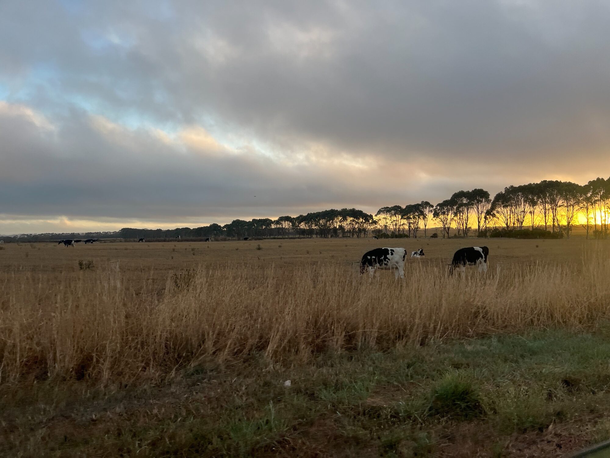
Stocked up in Woolworths we went to a pub for dinner, before driving off to a campground. We camped at Lake Elingamite, a volunteer-maintained campground which is very pleasant to camp in. Waking up, we were greeted with milk cows, some lining up to be milked at a warehouse. The area near Great Ocean Road is probably a milk production hub with a lot of cattle farms along the road.

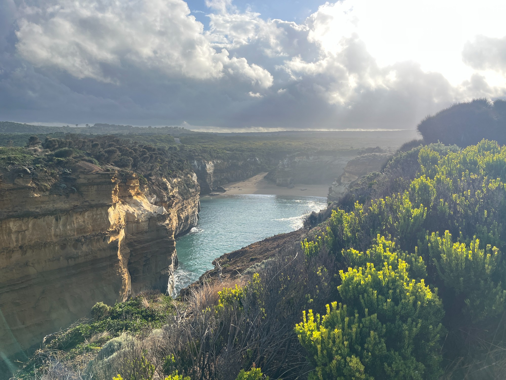
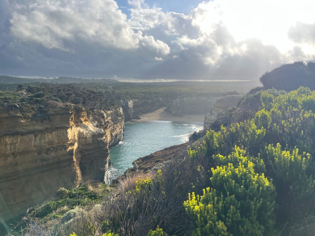
Coming from the western end of B100 Great Ocean Road we stopped at a few spots- Bay of Islands, Bay of Matyrs, London Bridge, before crossing Port Campbell towards Loch Ard Gorge. The walkway down the the beach of Loch Ard Gorge was closed and we could only see it from above. The coastline is essentially a plateau with a steep drop to the ocean over a cliff. Geographical composition of this part of the coast still confuses us- it looked like sandstone but the signs say it’s limestone.
A bit more coastal plateau driving we got to Twelve Apostles, the super popular tourist lookout that looks more like Disneyland. They’ve constructed a new lookout which looks boring and questionable use of taxpayers’ money. Surprisingly these coastal lookouts are all well served by several V/Line coach services per day, which made us wonder whether it’s feasible to do the Great Ocean Rd tour purely on public transport. Some say they do 15-minute stops which is plenty of time to explore lookouts, but V/Line is a public transport service after all not a tourist shuttle.
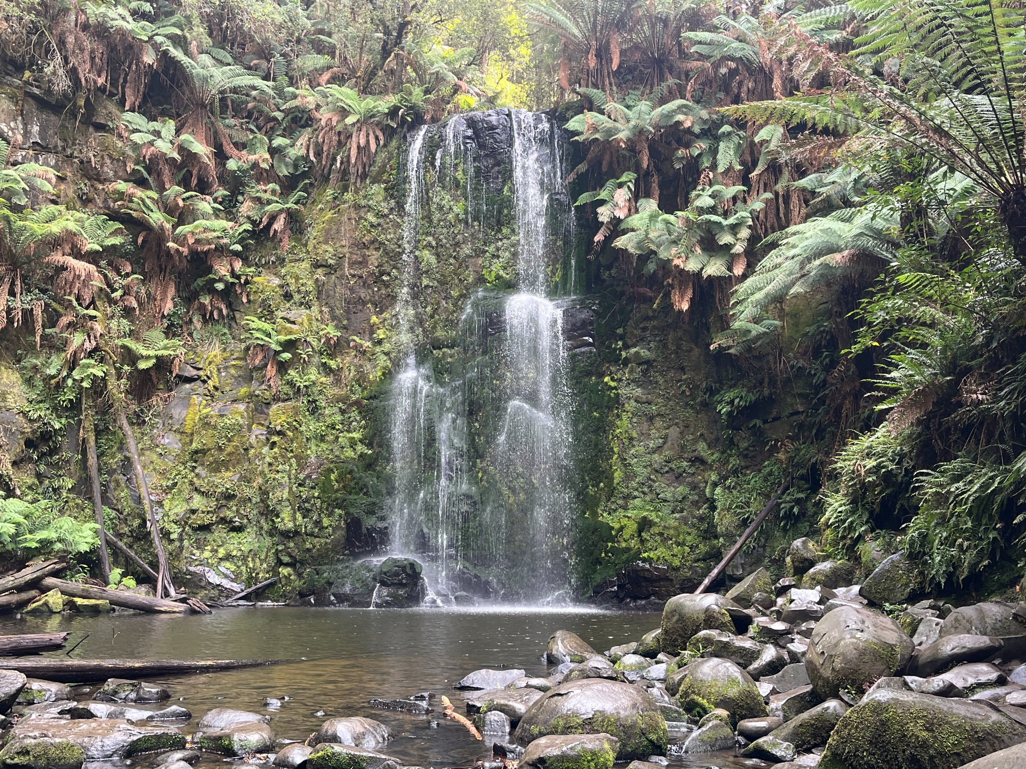
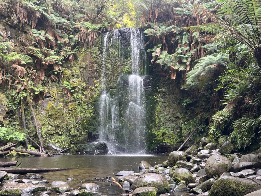
After Twelve Apostles the road travels inland and we branched off the main road towards the Otway rainforest, stopping at Beauchamp Falls. The walk to the waterfall travels through magnificent rainforest. Paul and I were walking at the back and the ecosystem always amuses us. Rainforests are everywhere- from the tropics of Queensland down to Barrington Tops, Jamison Rainforest in Blue Mtns and Otways to the south. It almost looks like anything can be a rainforest regardless of climate except there’s one thing in common- rainforests have no grass. It’s an advanced ecosystem where there aren’t nutrients for grass to grow, leaving just ferns and trees with their canopies. Looking up the canopies cover most of the ground, except that they don’t actually touch or overlap between trees which is interesting to see. It’s a mix of trees along the way including Mountain Ash and beech trees.
We jumped into Beauchamp Falls for a quick swim/shower. The water was really cold but it’s surely a refreshing experience.
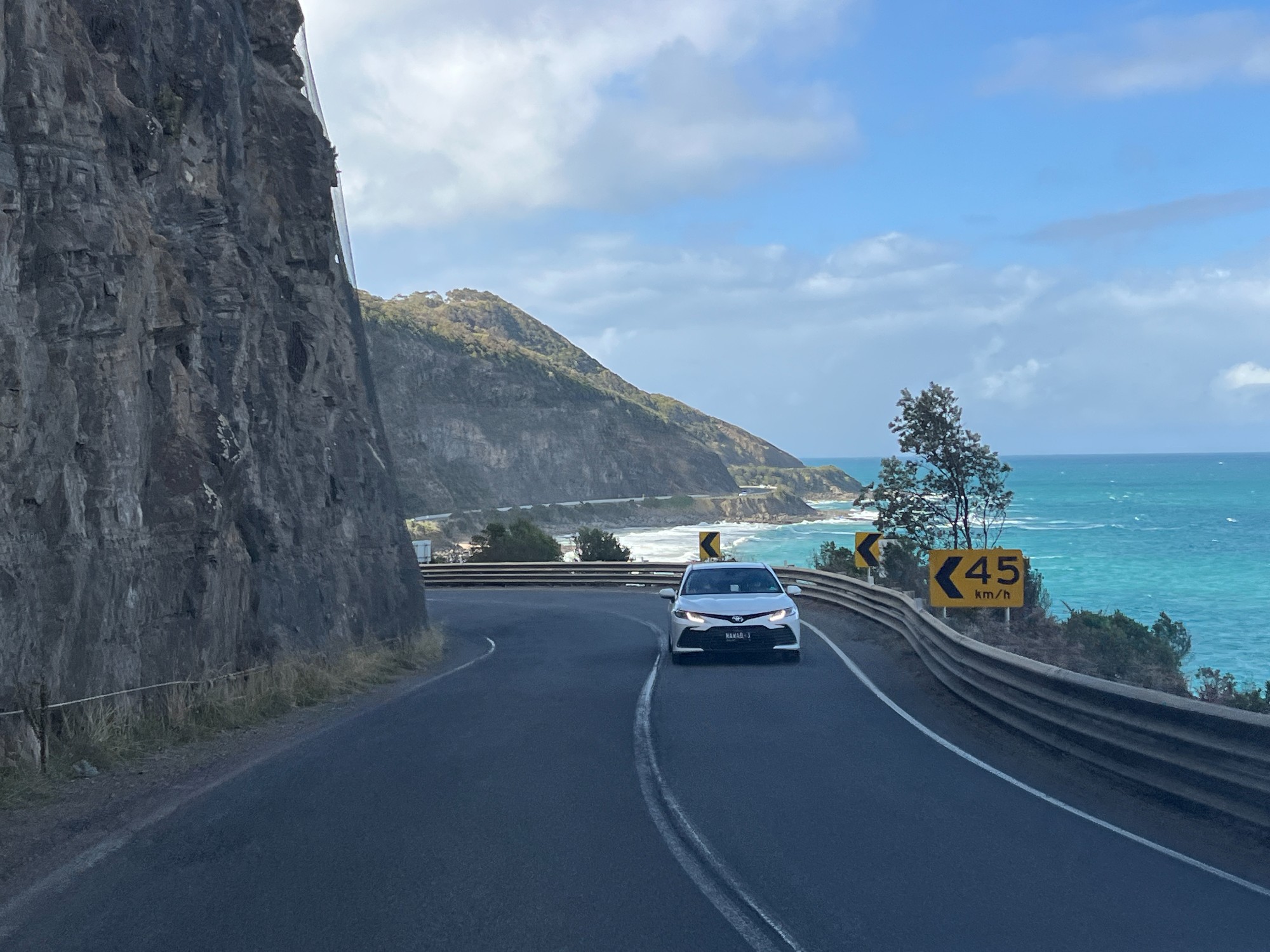
Back to the Gt Ocean Rd the road was really windy through foggy rainforests. A few kilometres of constant turns the road emerges out to the ocean, joining the famous road trip route of Gt Ocean Rd. The road is very scenic being close to the ocean, but it’s certainly not as world-famous as many claim to be. It’s not significant in engineering accomplishment on a global scale, and perhaps just an extended version of Wollongong’s Sea Cliff Bridge. At Kennett River, we visited the one spot where all the tour groups stop for international tourists to take pictures of a koala. Great Ocean Rd’s established tour group industry means they can be as cheap as $60 with Chinese-speaking tours in Chinatown. The tour guides aren’t that good anyway and $60 is a fair price using it as public transport. All the tourists looked at the one single koala as I started sharing about drop bears. In some SUBW walks, international students do believe in my drop bear story which is great assurance to my storytelling. Looking down there’s a Chinese sign with a massive line of English romanisation/pinyin saying don’t feed the birds.

A stop at Lorne we got our lunch before heading down Great Ocean Road towards Geelong, and joining M1 Princes Fwy just before Geelong at Waurn Ponds. Nice sunset over You Yangs on the way to Melbourne as the road trip finally comes to an end. A final dinner and most of the group took the night XPT back to Sydney the same day.
References
Welch, D. (2021). A history and Field guide to the Grampians (Gariwerd), western Victoria.