Date: 3/3/2024
Trip leader: Weiting Li
Party: Andres, Briony, David, Eric, Ivan
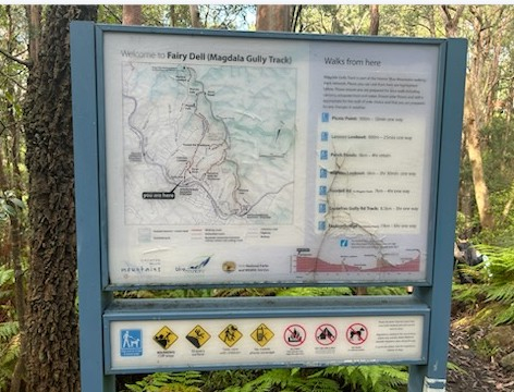
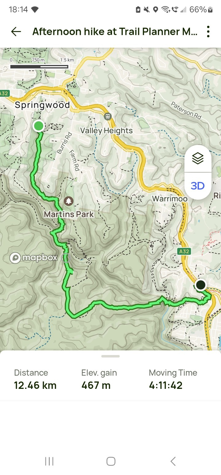
At 9am we met and set off from springwood station. Unfortunately, I received a message from eric that he might be 30 or 40 minutes late due to traffic. I told him about another option. Park at martins park and then we could probably meet at shark’s head cave or lost world.
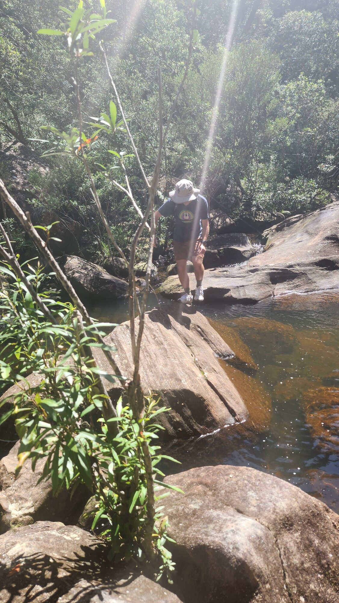
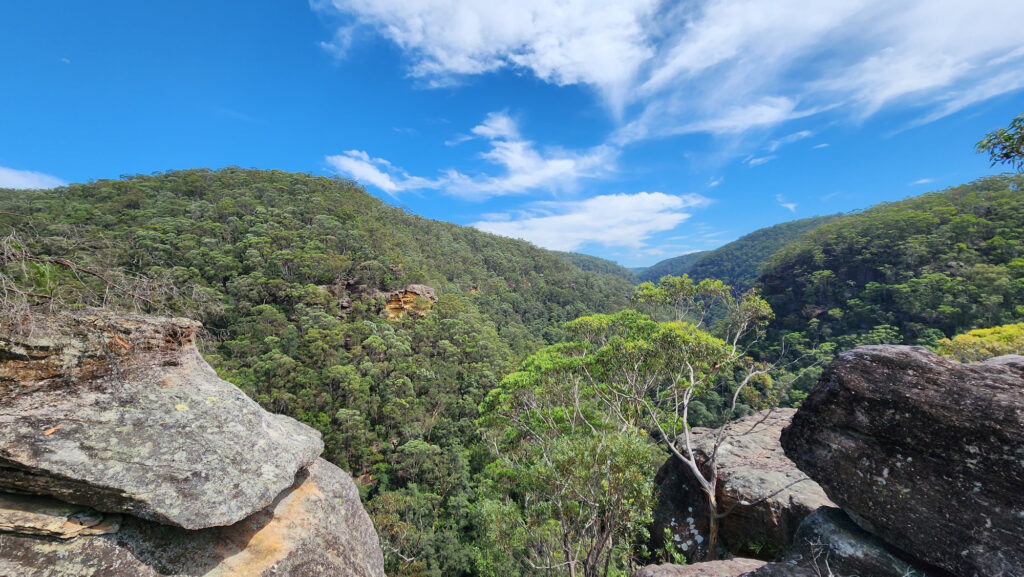
The five of us then proceeded to set off walking along Magdala Creek, which was little wet and muddy in places along the river due to the recent rain, but not as bad as I thought it would be. We didn’t get too far along the trail before we got a little off trail at a fork, but luckily it didn’t take us long to find the right trail.
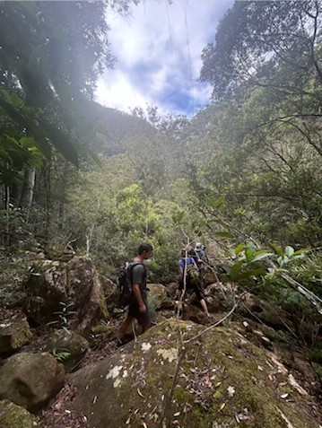
We followed the trail back and forth across Magdala Creek and Ivan found a crayfish in a pool of water next to a creek. We passed by Magdala Falls and Martins Fall, both small waterfalls.
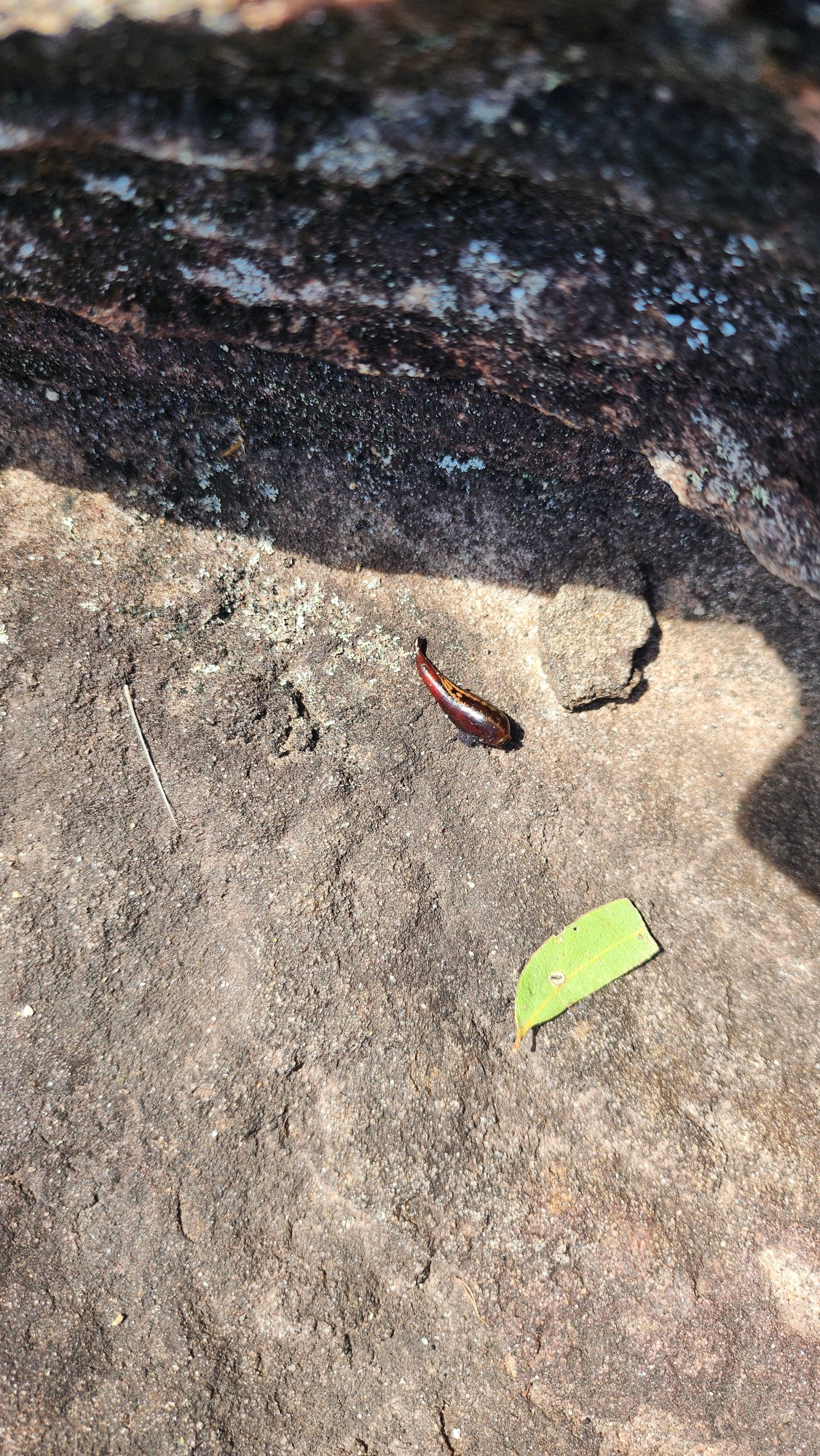
Of course with all the rain and humidity there was the inevitable problem of leeches, David and Andres found some little leeches trying to get into their shoes. Bri also pulled some small leeches off her feet.
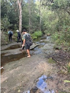
After that we arrived at Perch Ponds and I made a few misdirections while we were switching over to the victory track. But it didn’t take long for me to realize that we had gotten it backwards. When we switched and crossed Magdala Creek for the last time, it took us some time to find the trail, but luckily we found the right trail after the first try.
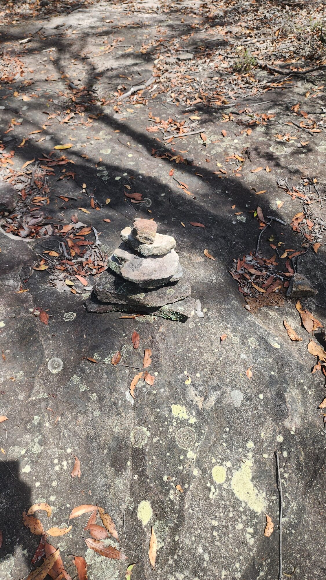
We then headed down Glenbrook Creek and arrived near sharks head Cave. We decided to cross Glenbrook Creek, although we could see some cairns nearby to help us guide our way, we had to be careful as the riverbanks were slippery due to the recent rain. Luckily we all made it to the other side of the creek without anyone getting wet.
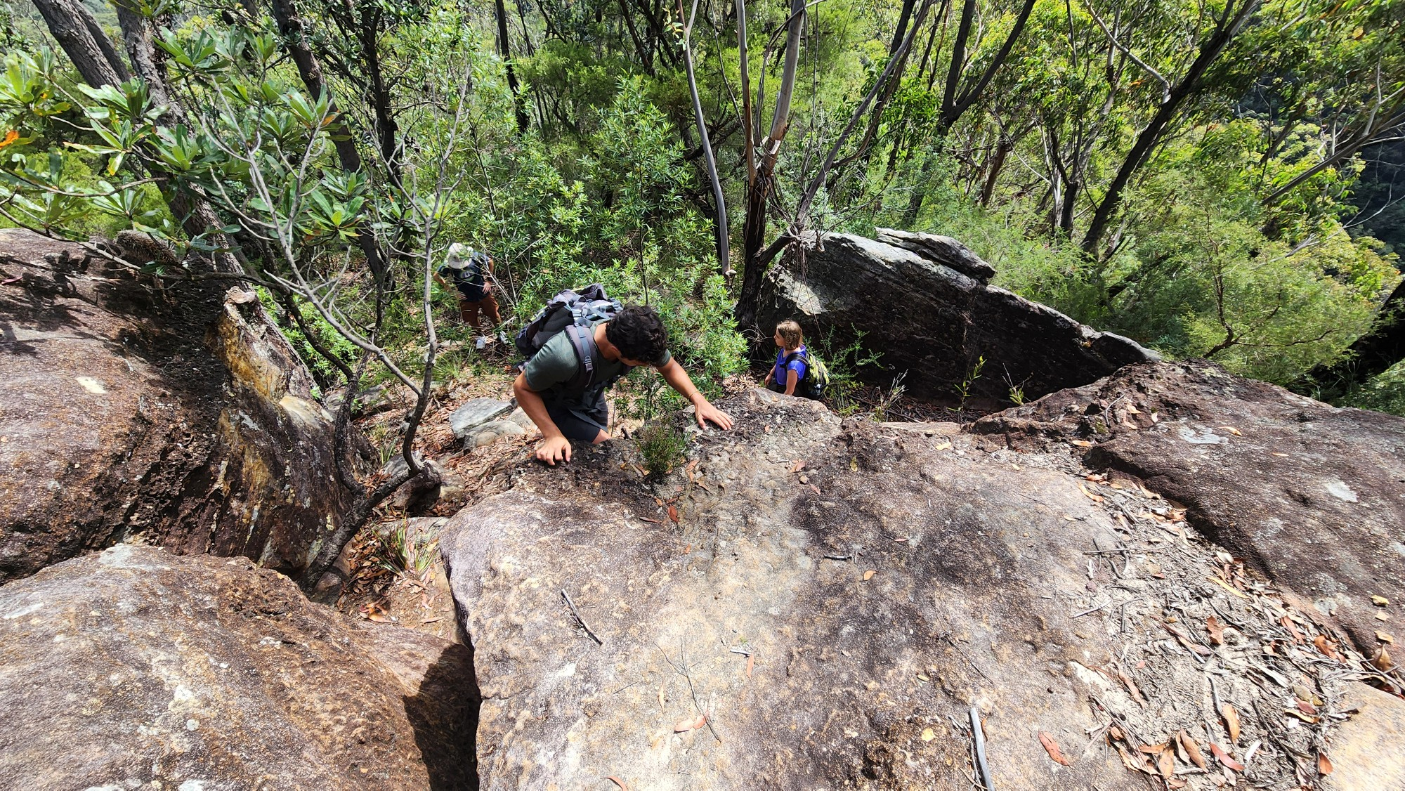
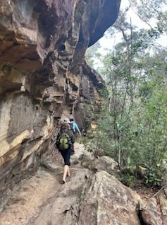
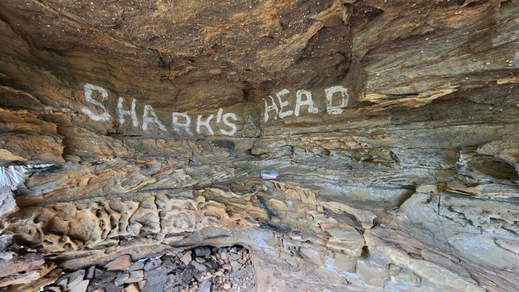
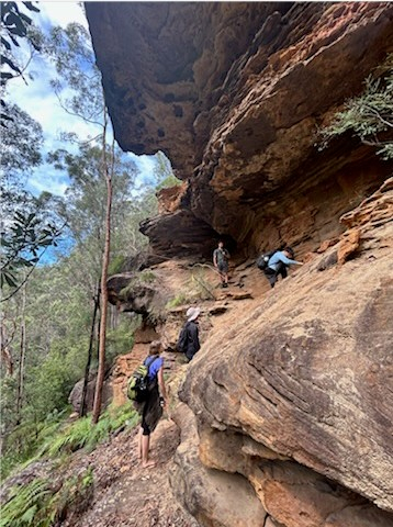
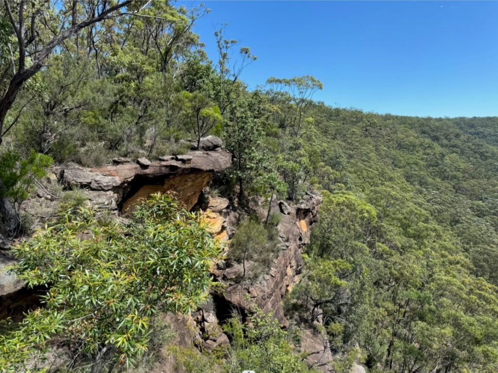
On the other side of the creek there was some fine sand on the ground, and through some footprints in the sand we continued on our way up. We first reached a small cave and went up to rest for a while. After that we continued upwards and after some simple scrambling we saw a triangular boulder like a shark’s head.
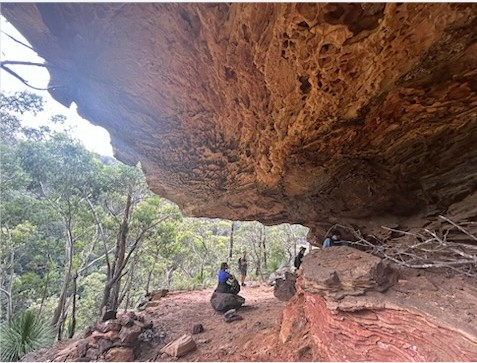
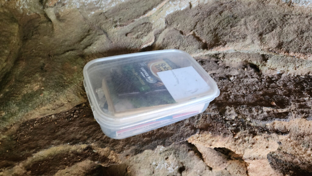
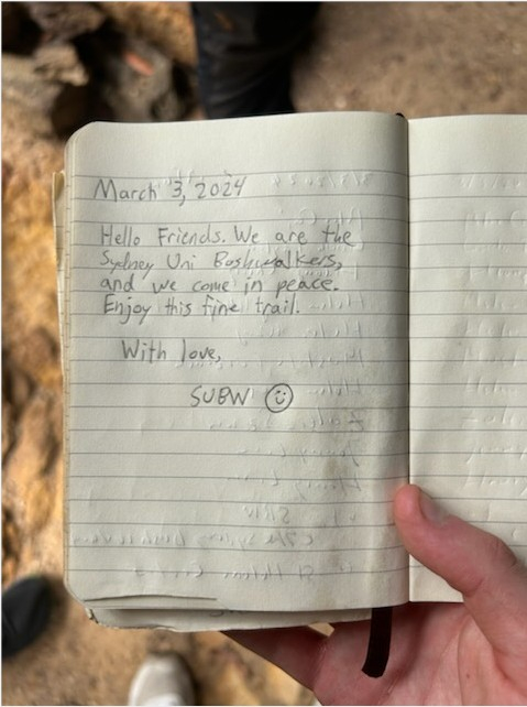
Below that boulder was shark’s head cave and we arrived at the cave to find some hand towels stored in a waterproof bag. Inside the cave we found a small box with some tea and coffee left by others and some postcards from spring wood bushwalker club, we also found two notebooks, one of which recorded the arrival of bushwalkers in the cave since 2005 and we left each of our signatures on it. On the other note David also left a message. We also heard some sounds below us in the cave that we both thought might have been from eric, but unfortunately there was no signal in most places on the route and I did not receive a text message from eric.
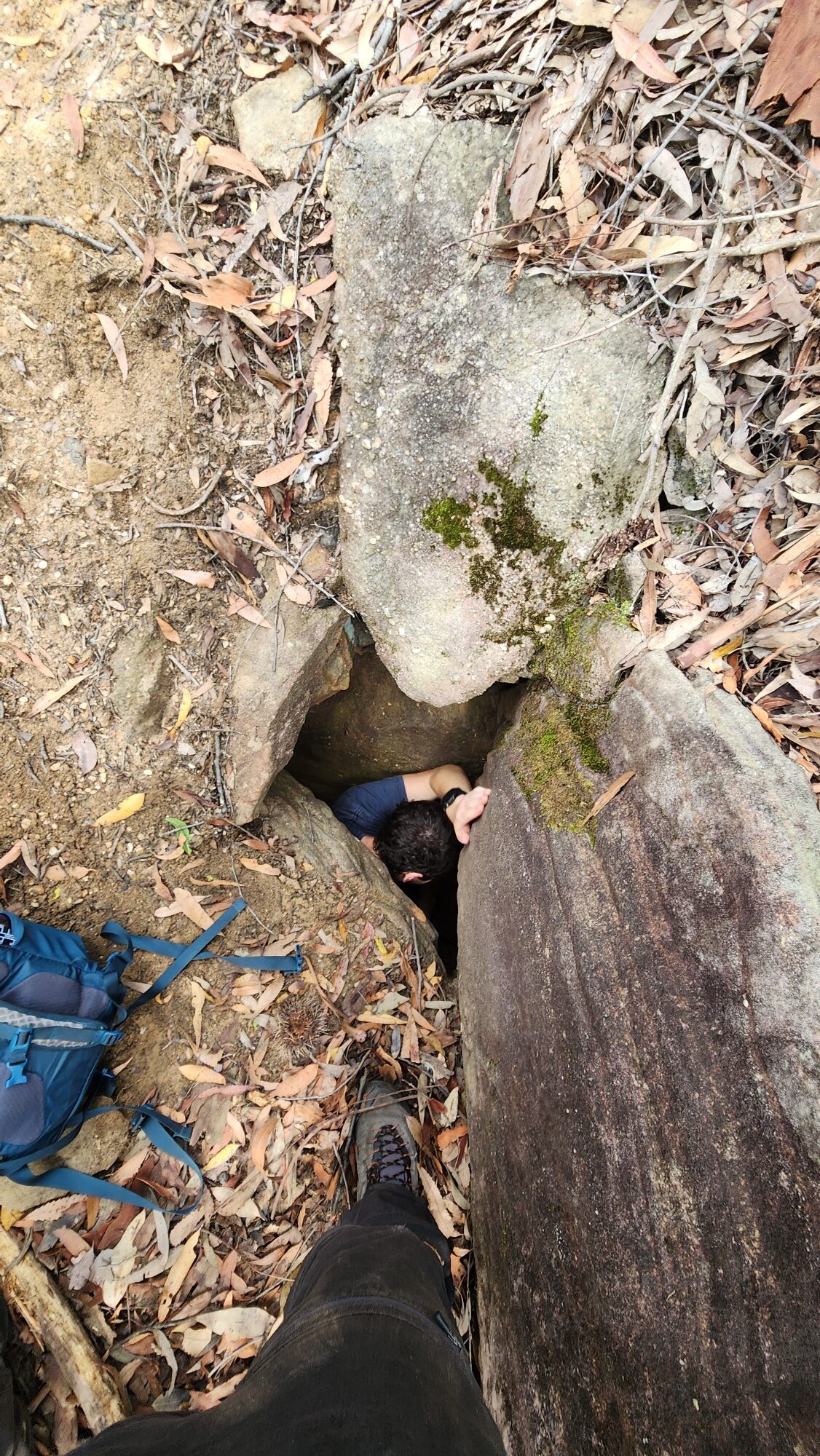
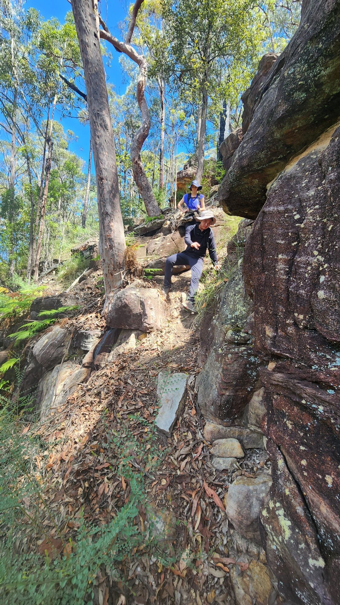
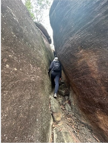
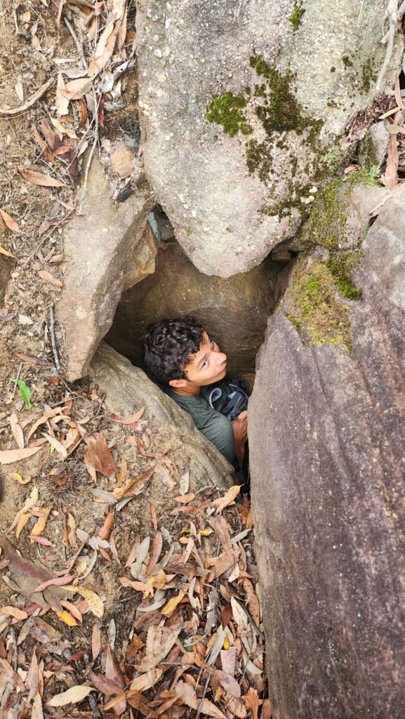
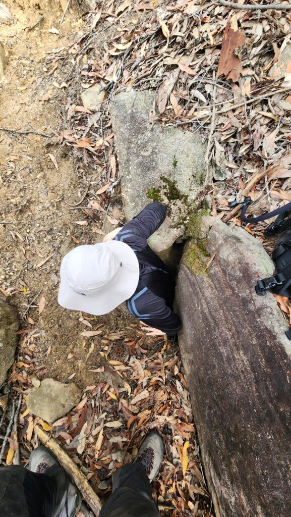
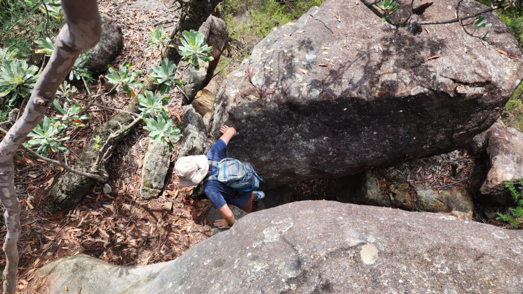
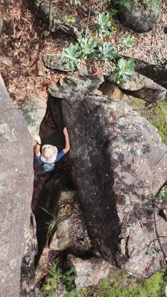
Rounding the left side of the cave and continuing up, we walked for a while before we saw a small cairn on the rock wall to our right prompting us to go up. Once we were up there, I noticed a small narrow rock crevice going up not far ahead. We went through the rock crevice, which was very narrow, and at the very top of the crevice there was a small opening that would only allow one person to pass through without a backpack. I left my pack behind and went through first. Thank goodness I didn’t get stuck in that opening and there were no snakes near that opening. After that each of us went through that hole in turn and remarked on that hole that it was really narrow. We took some fascinating pictures there too.

After resting for a while, I wanted to take a picture of that narrow rock crevice with my cell phone, but as soon as I put it down to enter the cave, I realized that there was another bushwalker there coming upwards. We helped her with her backpack and went on our way. We had some fun scrambling experiences after that.

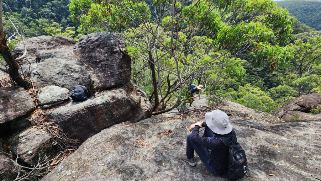

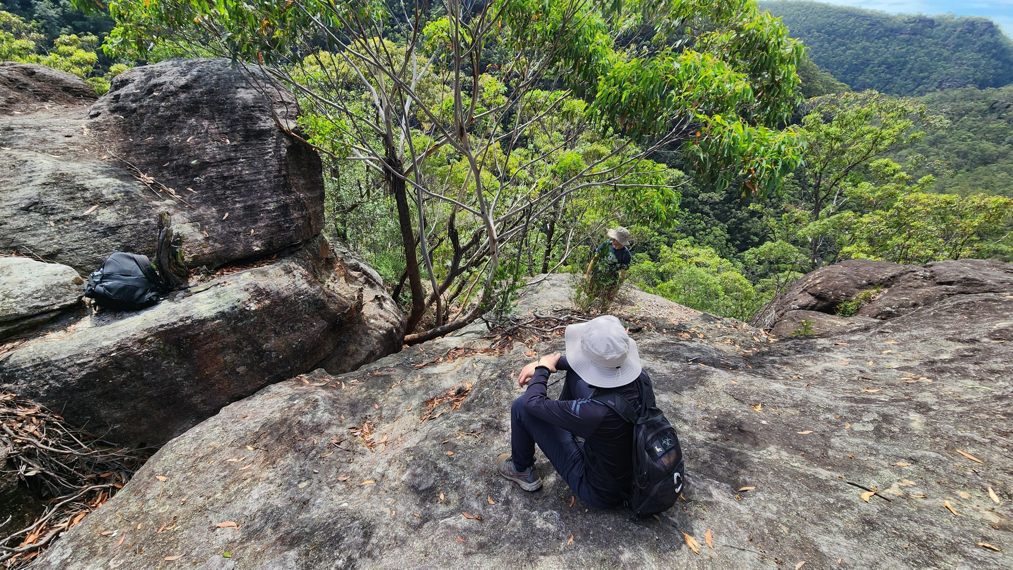
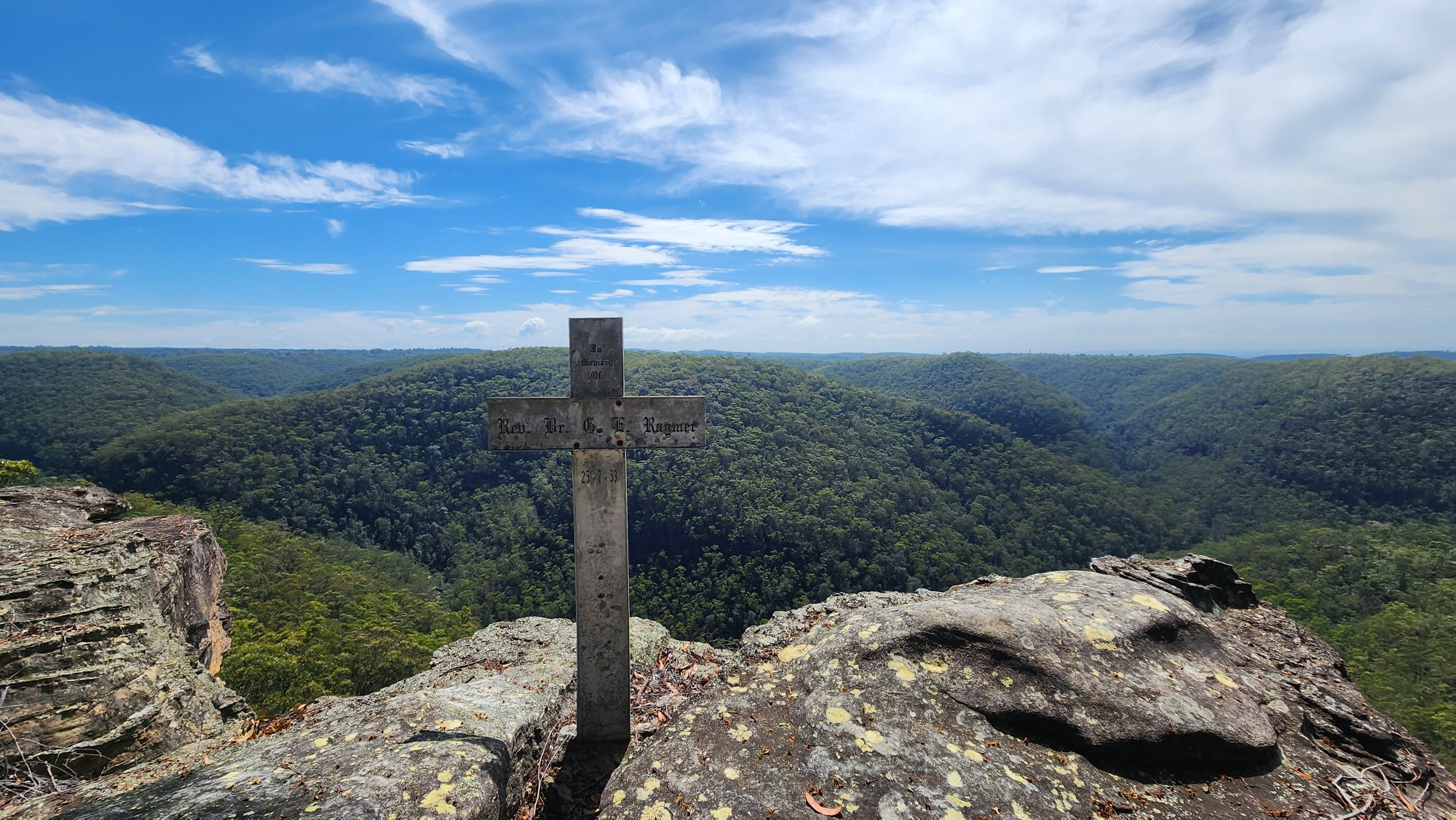
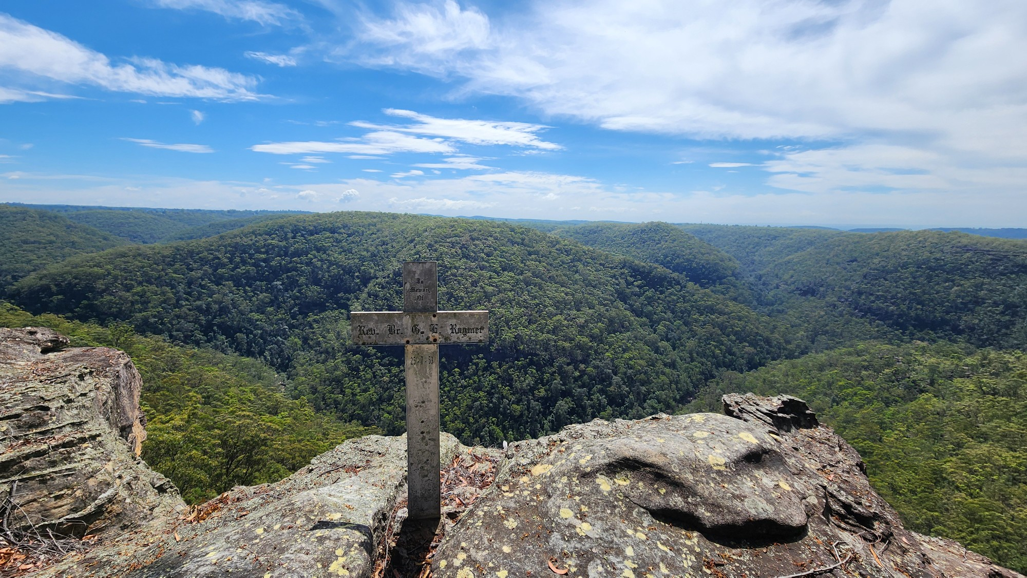
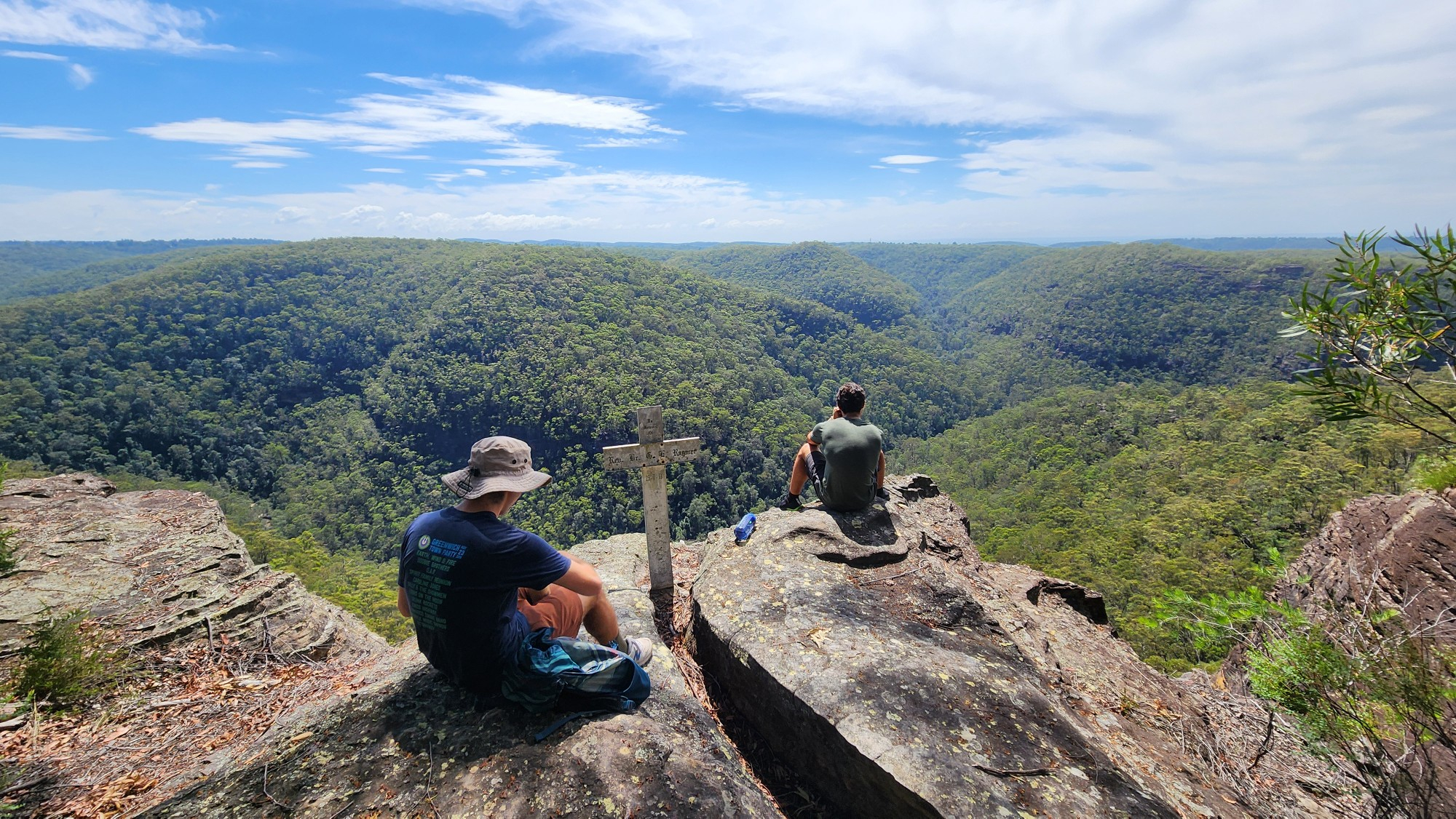
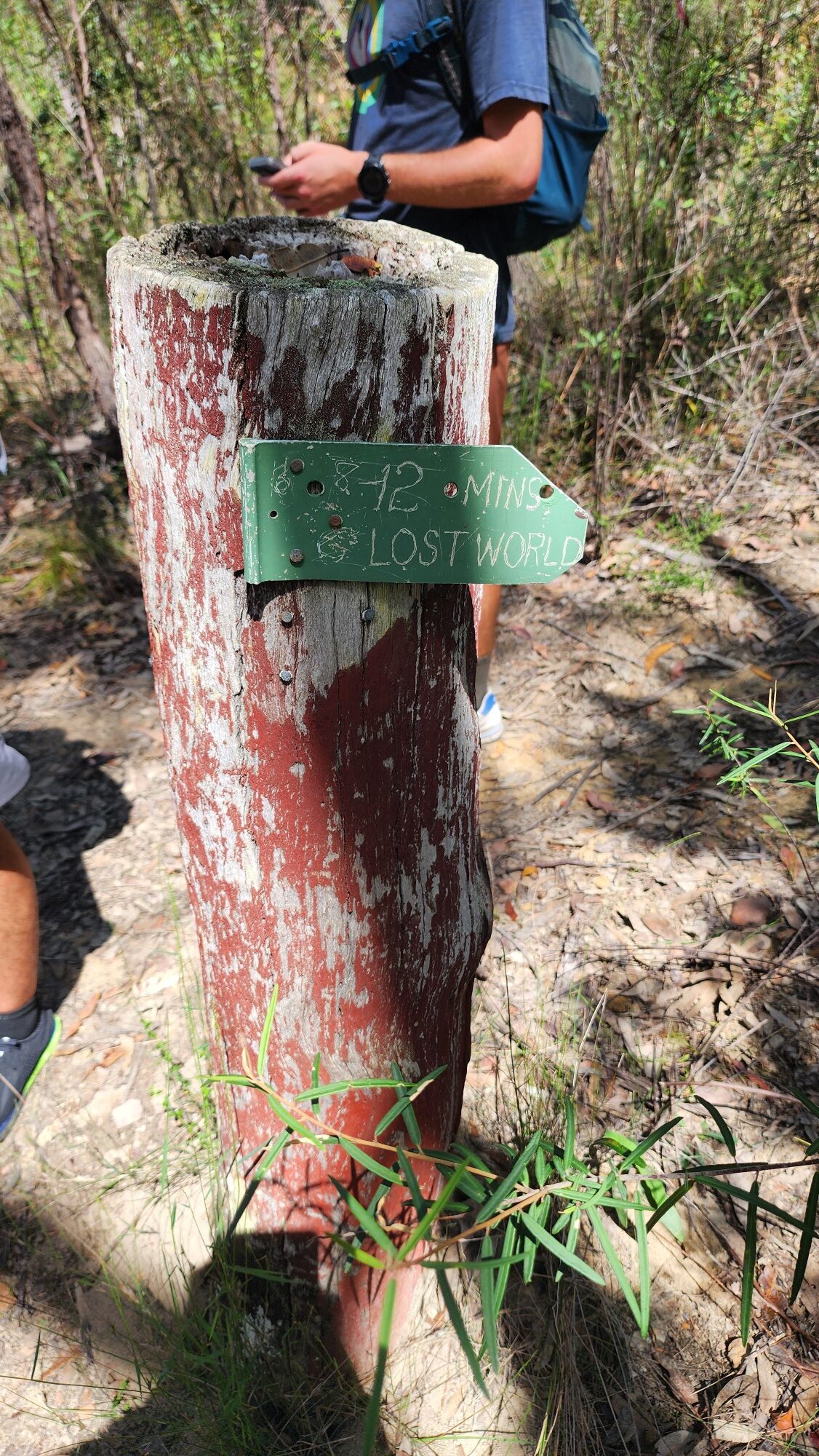
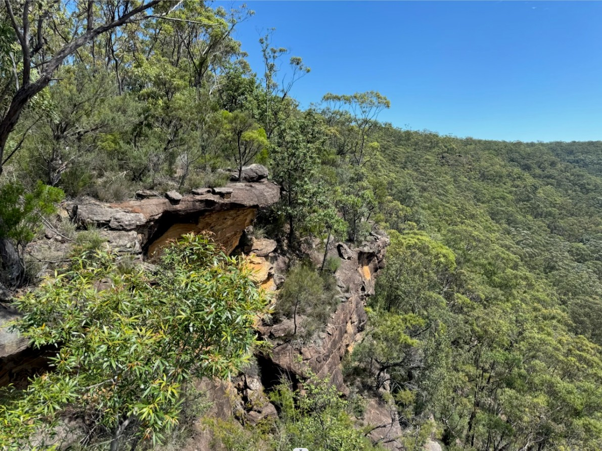
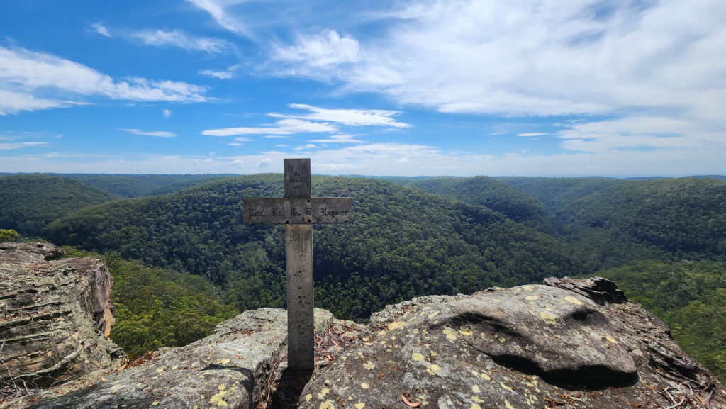
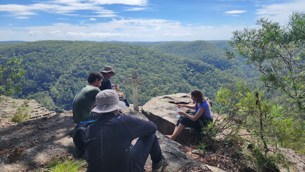
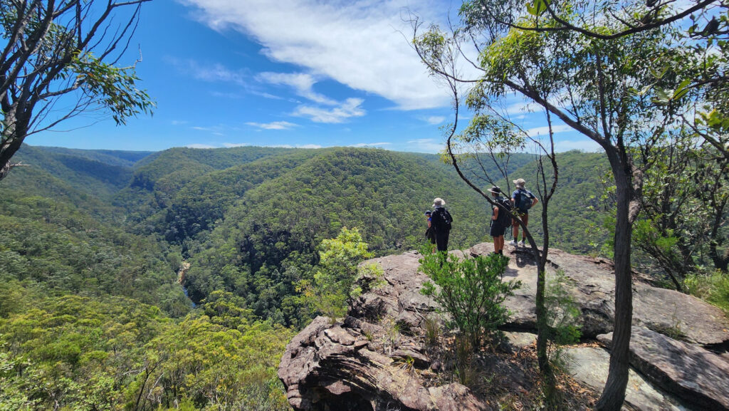
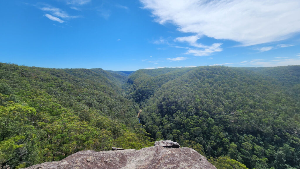
After walking through a bunch of bushes we eventually arrived at lost world lookout at 12:00 p.m. By the time we arrived it was starting to get pretty hot. We met another group of hikers there, I think they were coming from the direction of martins lookout. We also met up with the same hiker again, I took a photo of her at lost world, but it didn’t turn out too good due to the position of the sun, we said goodbye to each other. After resting for a while, I still hadn’t gotten a text from eric and hadn’t seen him, I tried to call him but there was only voicemail. We waited for a while and decided to continue our journey.

After leaving lostworld we had some off track at first but luckily we got back on top of the trail after a turn according to the gps. We walked on the bunyan lookout trail for a while before switching to The Bullant Track at a fork in the road, after a while we reached a junction and I saw a brown snake charging at me, it scared me but it went straight into the bushes, I think it might have been an Eastern brown snake.
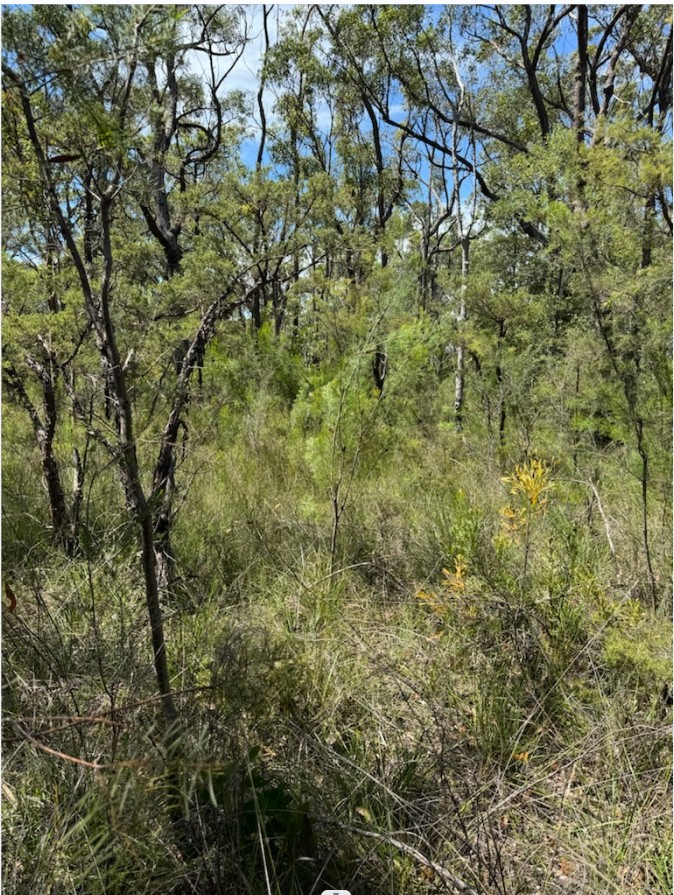
The Bullant Track is one of the more boring walks on the ridge, we met a couple of bushwalkers and we asked them what the route to blaxland was like. They replied that the route on the ridge was very flat and the last section back to blaxland was very steep, after thanking them we continued on.The Bullant Track was not too difficult to walk on, the path was very obvious, there was some overgrown vegetation on both sides but it was not at all as scary as other reviews on the internet portrayed it to be. There were a few bushes with some thorns. Overall this part went well.
After 1 hour or so of boring and hot trail walking we arrived at the end of The Bullant Track, The Bullant Lookout.
We decided to take a break there, and it was there that I finally heard from Eric, probably because he had arrived in an area with a better signal. He stated that he was doing fine, and he also sent a picture of a baby brown snake he had seen on the road (maybe a relative of the one I had almost stepped on earlier).
After getting the news that Eric was still all right, we decided to move on, but before we did, I decided to give myself a leech check. After seeing blood pouring out of my right leg pants, I knew I hadn’t avoided it after all. After removing my pant leg and doing some simple disinfecting, I saw the leech lying next to my shoe that looked like a small chili pepper after sucking its fill.

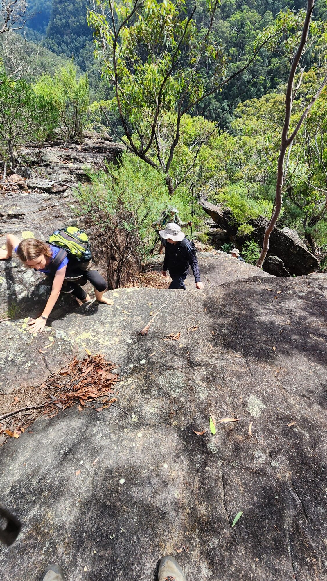
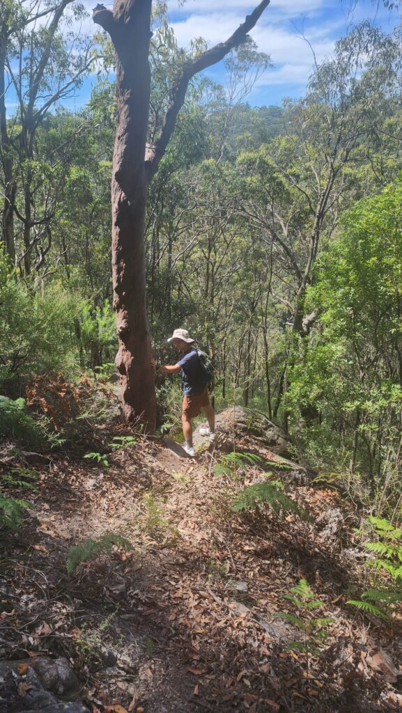
After that we descended from the ridge. The way down was a bit hard to find and steep, and since we were a bit off course at first, we had to stabilize our center of gravity by grabbing onto some tree trunks. The dirt on the hillside was very soft and many of the small rocks were unstable. It was good to get back on the correct route after we had descended a bit. But the descent was still hard and STEEP. after a while we reached Glenbrook Creek. it’s hard to imagine how hard it would have been to find this part of the trail uphill from Blaxland. At this point we understood why some of the online reviews were exaggerated.

We crossed Glenbrook Creek for the last time, where the rocks had been very dry and easy to pass through due to the sun. The last section back to blaxland was a bit more STEEP and required some scrambling. the temps were already over 30 degrees and I had to remove my pant legs to get cooler.

Shortly after we arrived in blaxland, Ivan drove home and the rest of us went to the nearby IGA to get some cold drinks and fruits before getting on the 3:30 train back to sydney. the train was so crowded that we had to find somewhere and stand there until the strathfield crowd thinned out. bri got off from strathfield, and the rest of us ended our journey in central.

All in all, this route is the most interesting one I’ve done since I came to Sydney, but maybe it’s because I’m the leader and I’m always looking for the way. There was a lot of fun scrambling, the scenery was good, and a lot of it was more off track but not to the extent of bush bashing.
I would recommend that bush walkers with some hiking and scrambling experience try this route, suggesting starting at springwood and following the magdala gully track to perch ponds, then switching to the victory track, crossing glenbrook creek to shark Then follow the cairns left by the other bushwalkers up to lost world, then follow the bunyan look trail for a short distance, switching to the bullants track at the fork, and finally back to the blaxland. If you want to try this route and have any other questions you can email or text me.