Date: 10/9/2023
Trip leader: Bruce Stafford
Party: Anna, Catherine, Devin, Duoduo, Lishan, Mackenzie, Ming Suet, Raphael, Tiantian, Yulong (George).
Newcastle – Fernleigh Track and Glenrock Conservation Area, Sunday 10/9/2023.
Most people got on the train at Central, and a couple at Hornsby, to settle in to the two and a half hours train trip to Adamstown. Tiantian only just made it because of a late running bus, yet another example of the unreliable Inner West bus service post privatisation. I got on the train at Gosford.
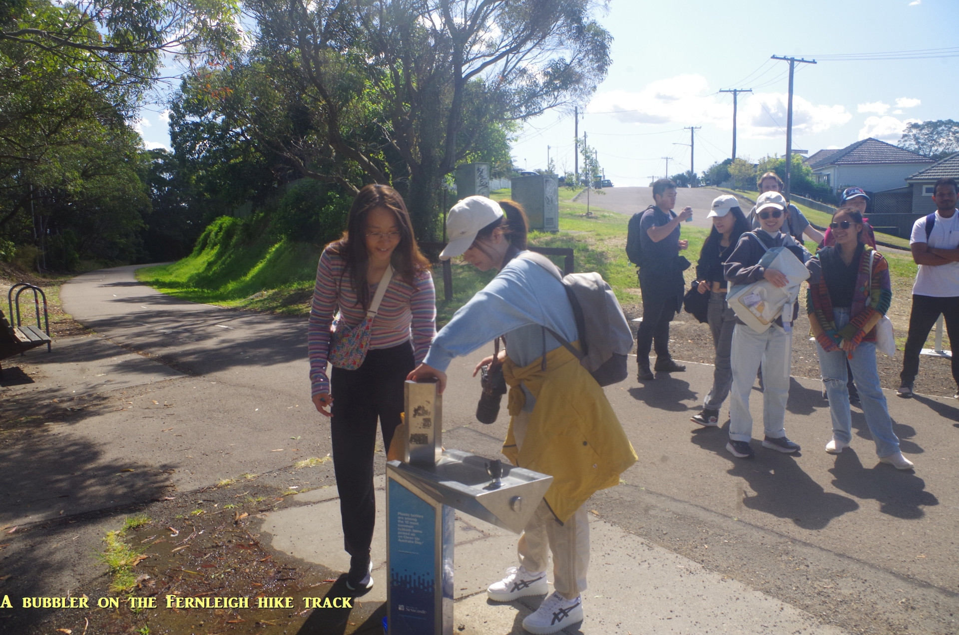
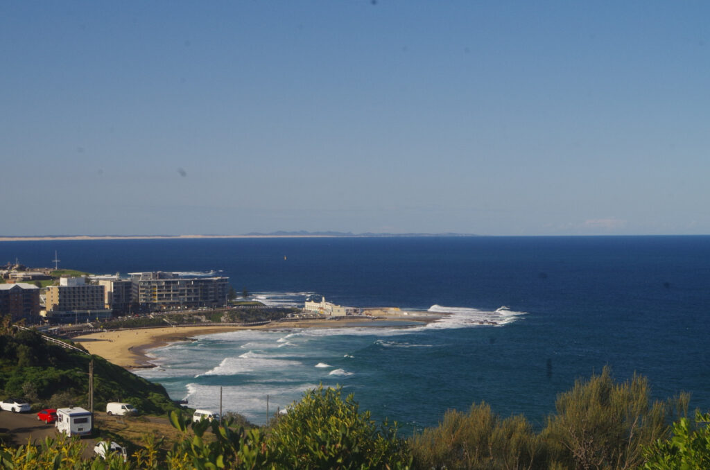
At Adamstown I gathered everyone together and we set off for the “HIKE” section of this walk along the Fernleigh Trail to Burwood Road at Kahibah. It’s the “hike” section as it is a paved rail trail shared by walkers and bicycles which rises on a steady 1 in 40 gradient as far as Kahibah. It has bubblers along the way, and also a cafe at Adamstown Heights, halfway towards Burwood Road. And it was at this cafe where four of our members stopped for a needed toilet break and a couple of us got coffee or a cake.
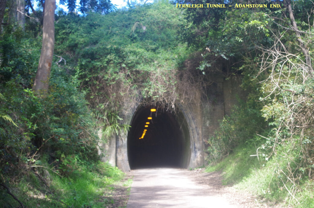
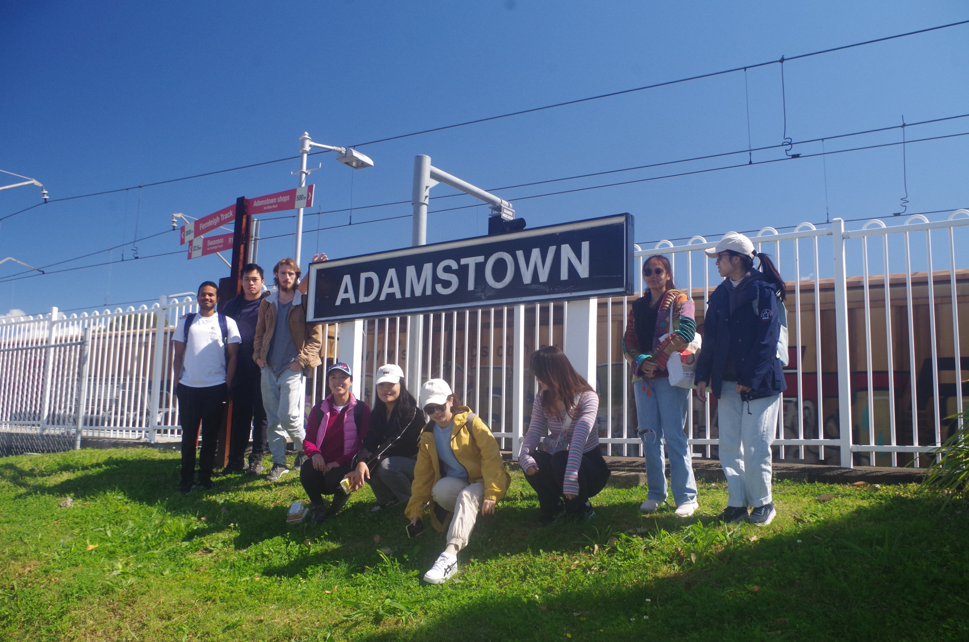
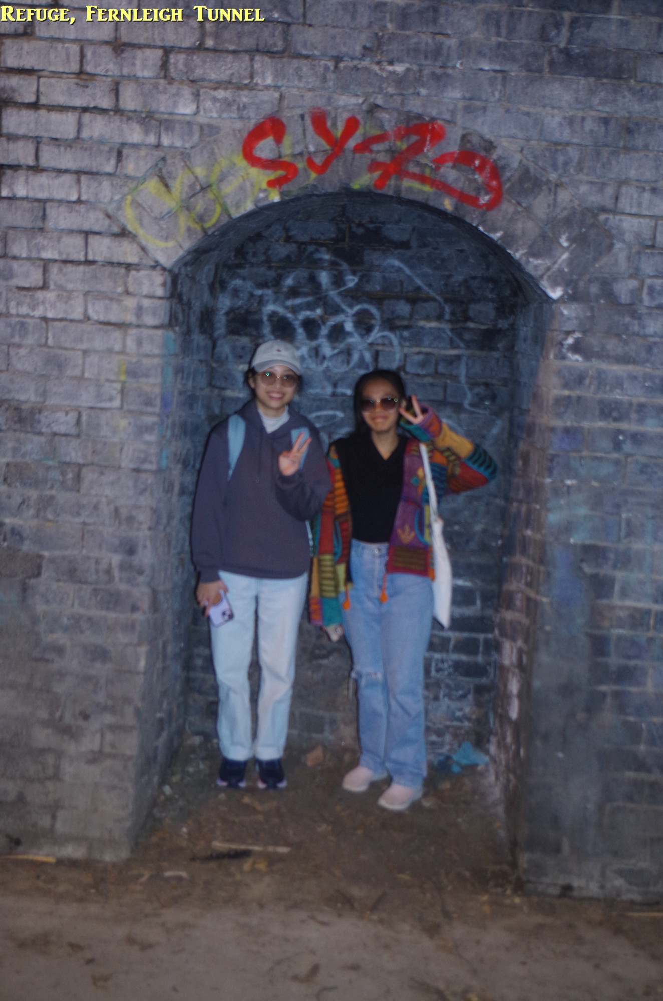
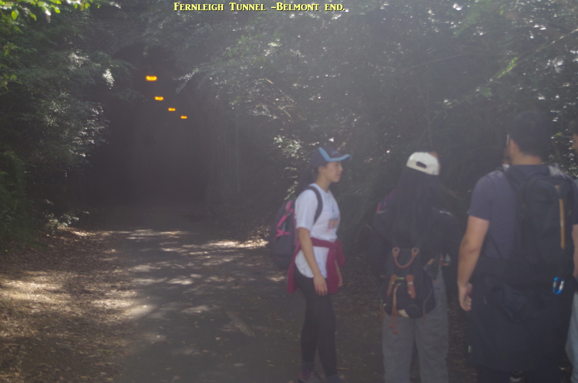
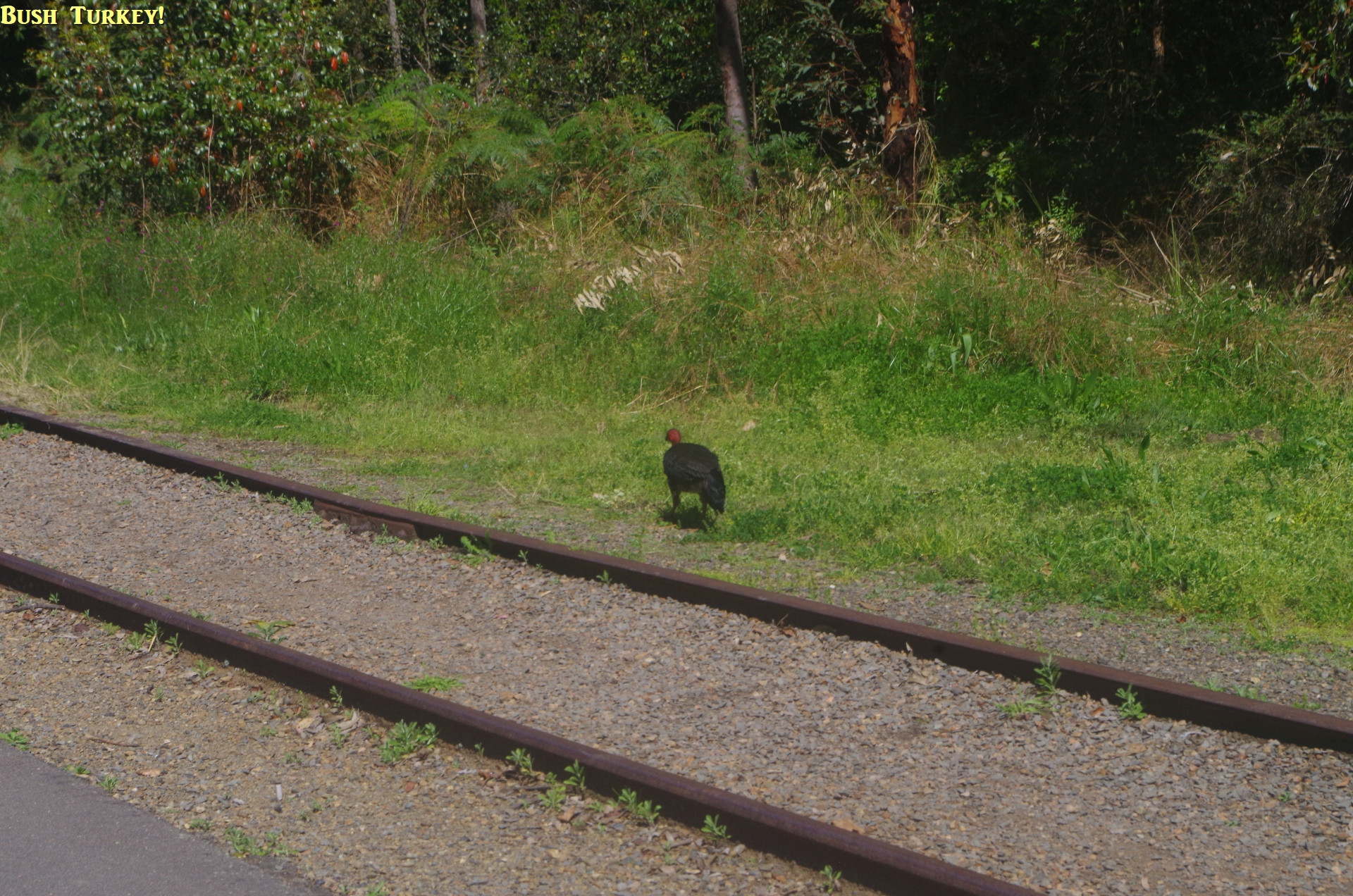
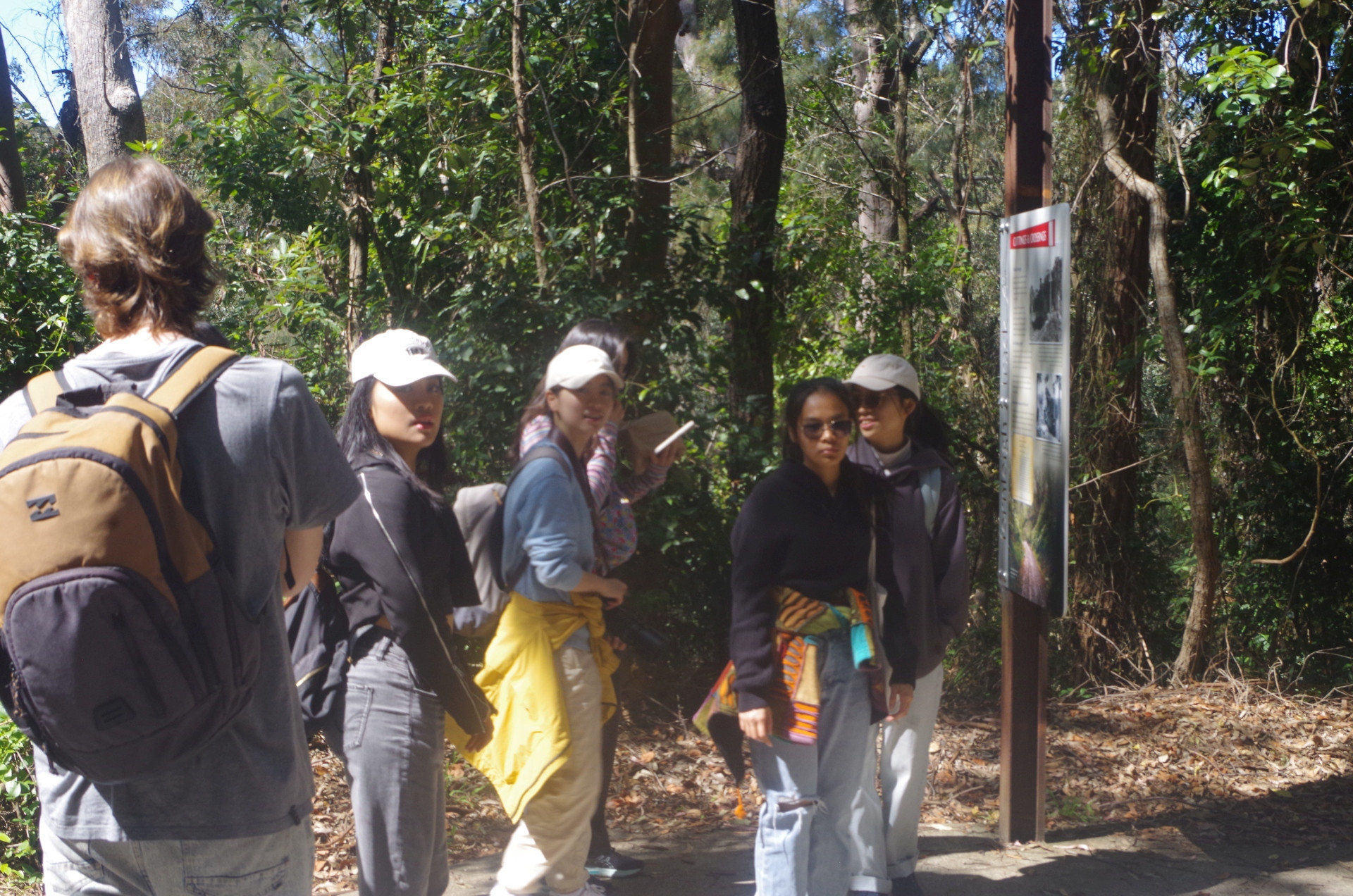
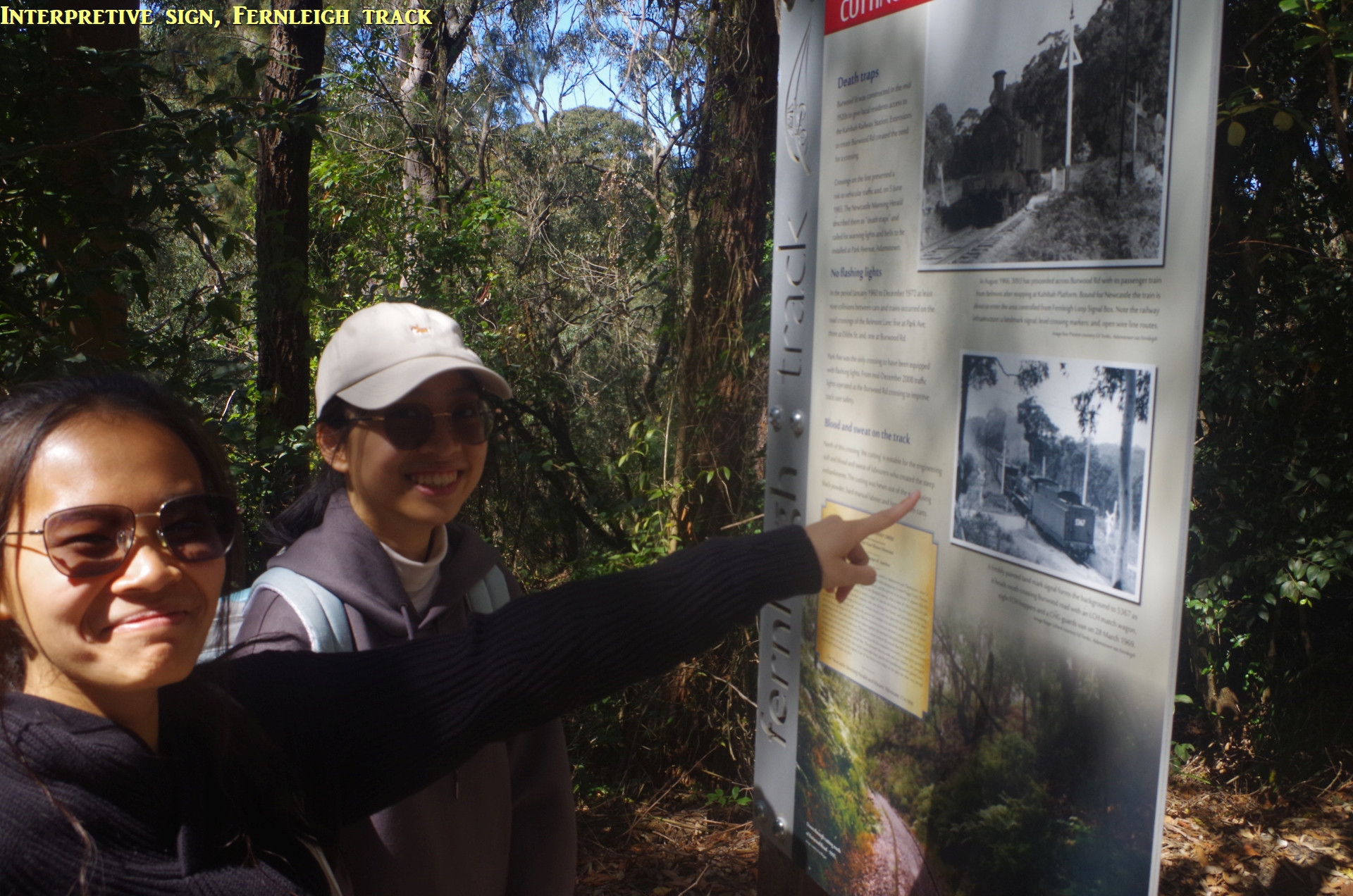
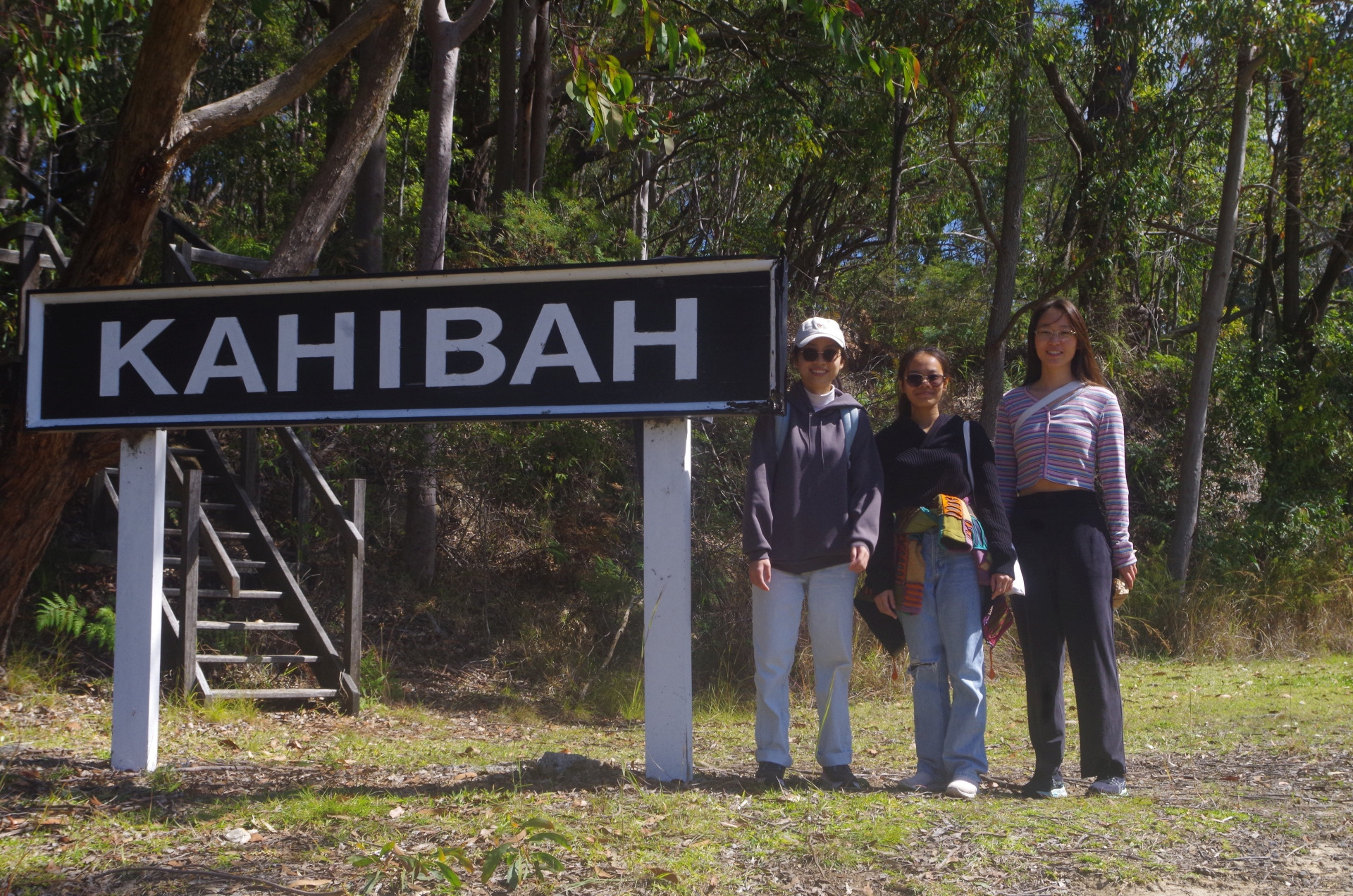
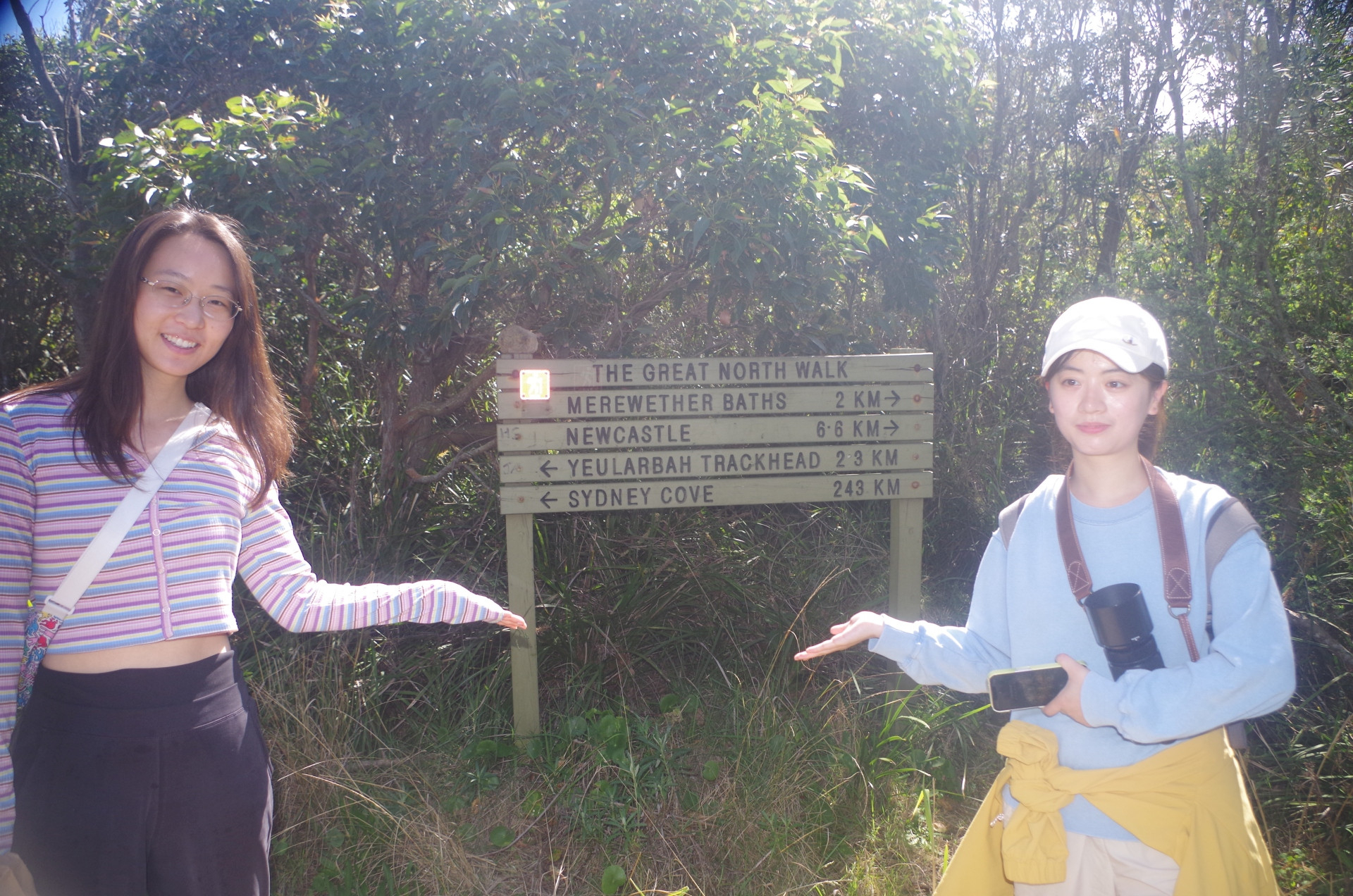
About 2/3rd of the way along we came to the 181 metre long Fernleigh Tunnel, which was a surprise to a couple of people who apparently hadn’t read the walk description properly. Anyway we passed through it with a couple posing in one of the tunnel refuges (these are found every 50 metres along tunnels for people to shelter in if a train comes). After the tunnel we saw a native Bush Turkey (see also note later on) and then came to the interpretive sign showing that the rail trail was the former private colliery railway, to Belmont which closed in 1991. The remaining sections of track still in place show what it was like. Shortly after we came to Burwood Road where I got some people to pose under the “Kahibah” sign. The rail trail continues from here all the way to Belmont, 11km further on, but we turned left onto Burwood Road for about 150m to get to the car park of Yuelarbah walking track within Glenrock State Conservation Area. This is where the “HIKE” ended and the BUSHWALK started. It was here also that we temporarily gained a twelfth walker, a young woman from Argentina who had moved from there to Adamstown only a week ago and was looking around the area. She stayed with us as far as Burwood Beach.
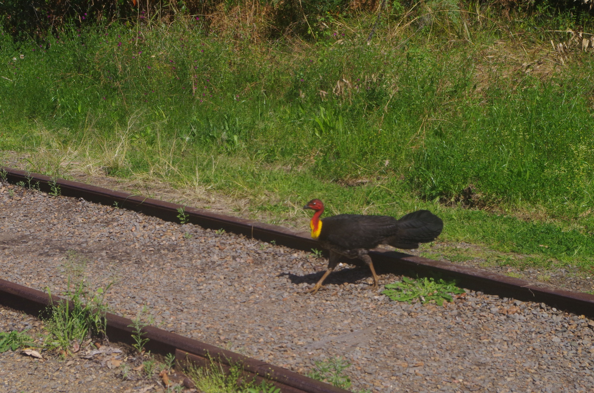
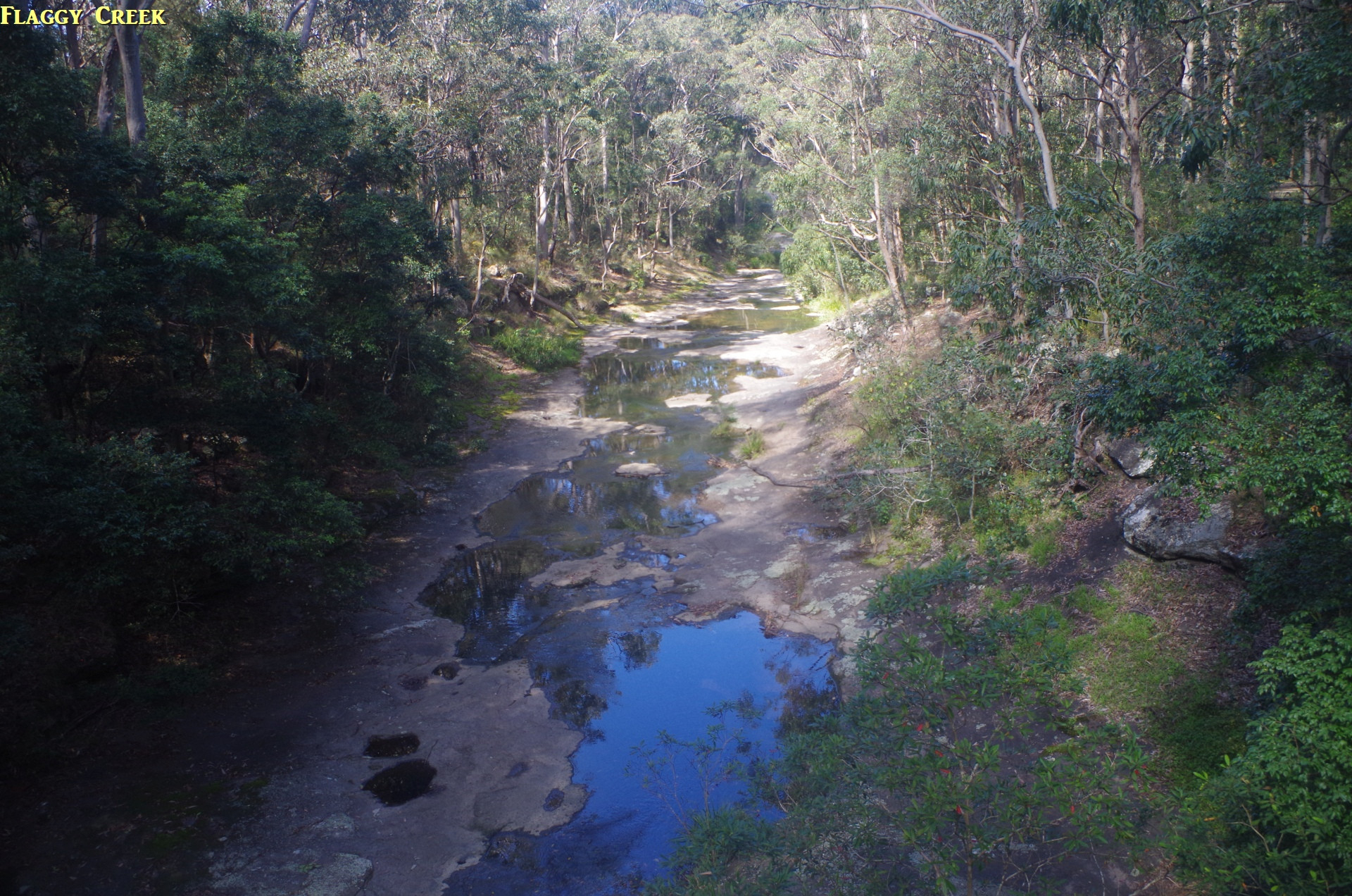
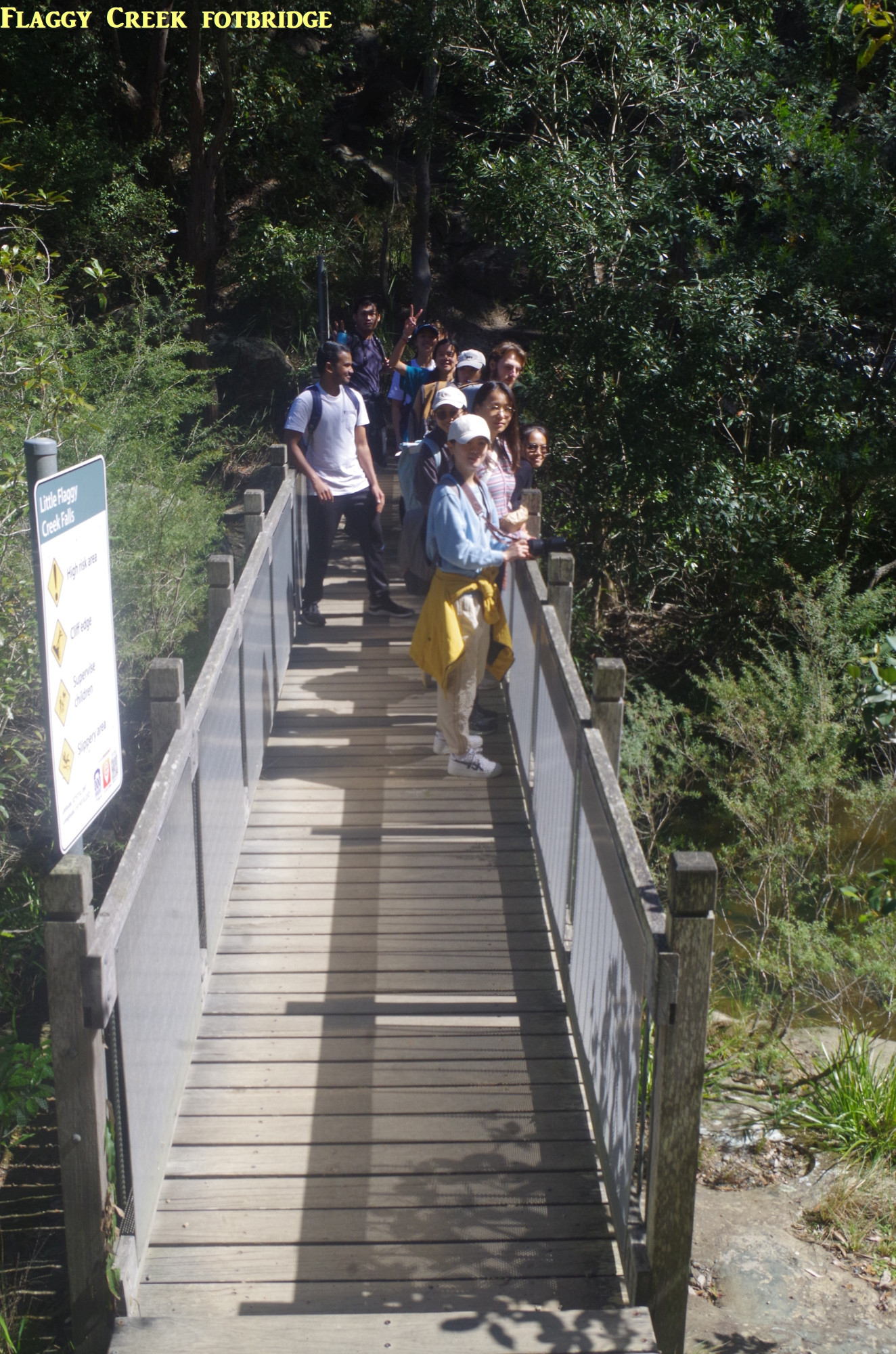
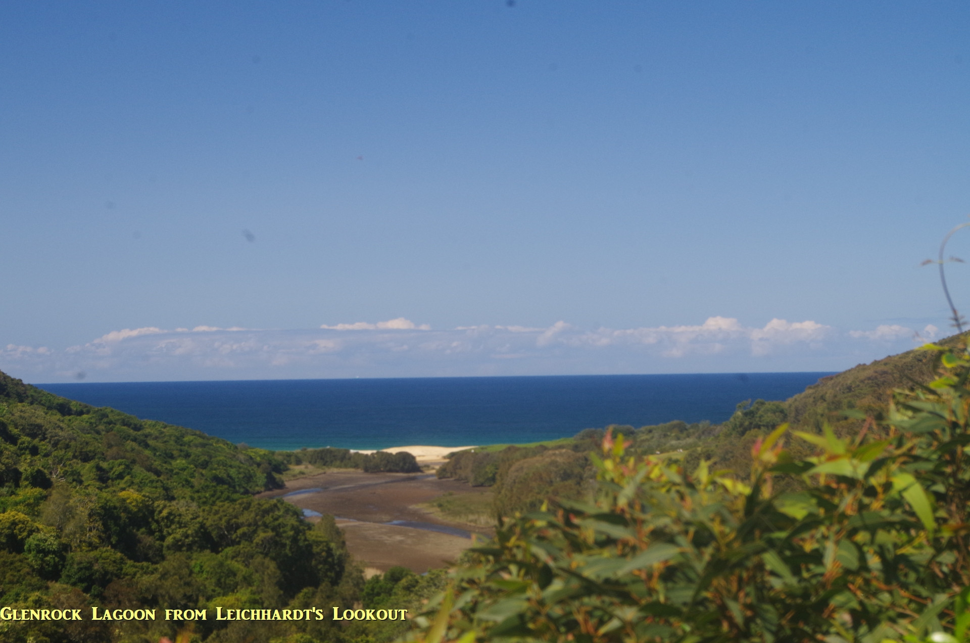
Rather than use the wheelchair accessible boardwalk pathway to Flaggy Creek, I led the group along the dirt track management trail to where it started to steeply descend to a point above the Flaggy Creek footbridge when a side track links the manangement trail to the boardwalk below. We crossed the Flaggy Creek Bridge and then proceeded along the track to Leichhardt’s Lookout, where we could see the sea and Glenrock Lagoon. From Leichhardt’s Lookout the track continued, getting a bit rougher and going down some stairways into thick undergrowth where we saw another Bush Turkey, this time a female without the large yellow wattles that the male has under his beak. The track here has a slightly subtropical feel about it, not surprising as we were in the subtropics at this location.
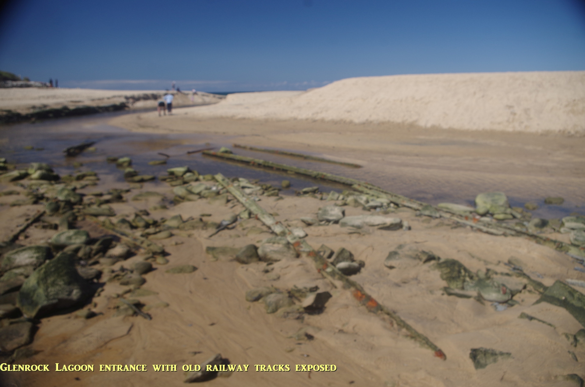
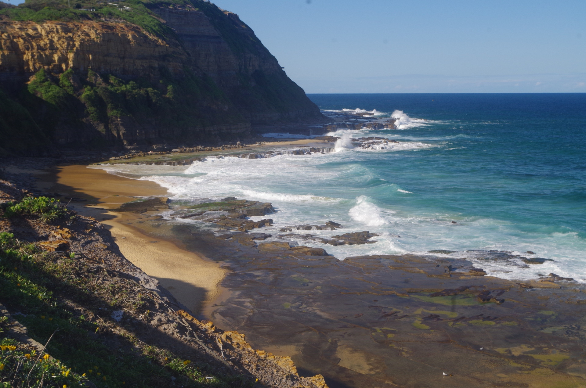
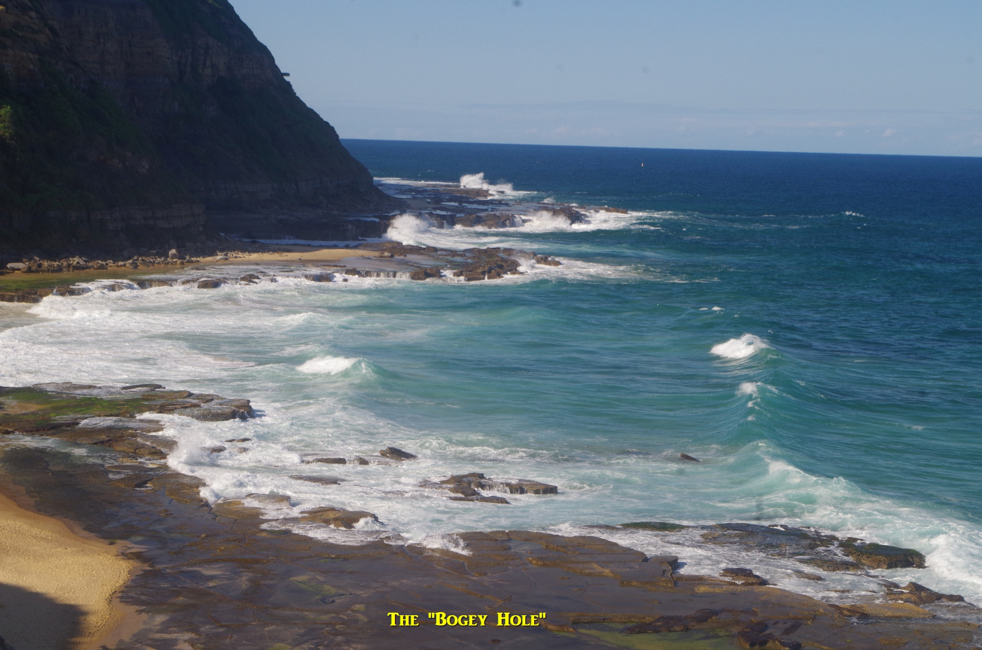
So we eventually emerged from the undergrowth at the entrance of Glenrock Lagoon and the south end of Burwood Beach. The water level in the lagoon entrance was unusually low, meaning that it was possible to easily cross it without getting much wet at all. Noted also the remains of rails of the old Glenrock colliery railway lying in the water. Very often the lagoon entrance can be impassable at a very high tide and after rain has filled the lagoon. This is also where I became aware that my camera was still on manual focus after my last planet photos, and wouldn’t focus on anything that was distant. Fortunately nearly all photos I had taken so far were in focus, or nearly so. Having changed then to auto-focus, photos from here on are all OK.

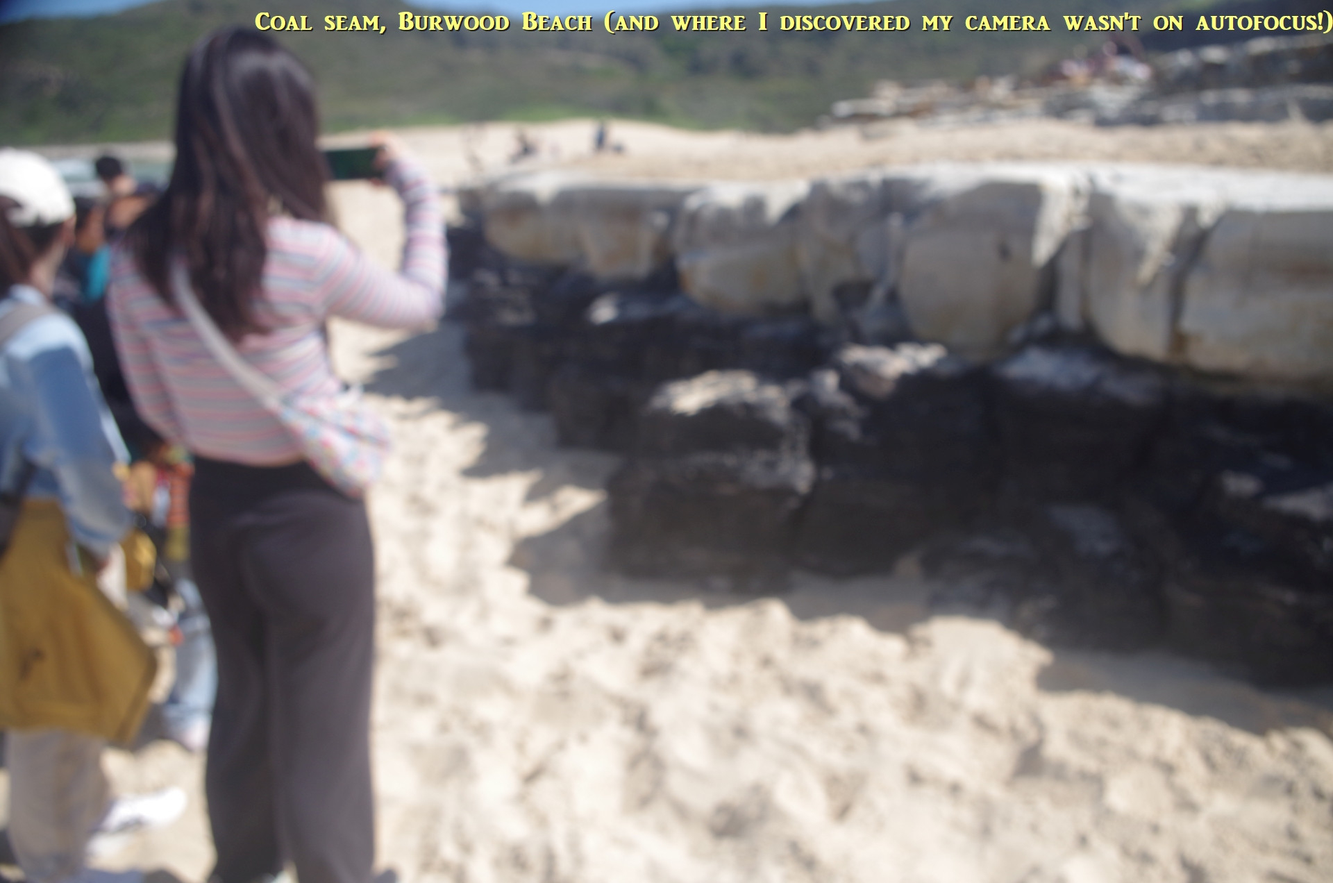
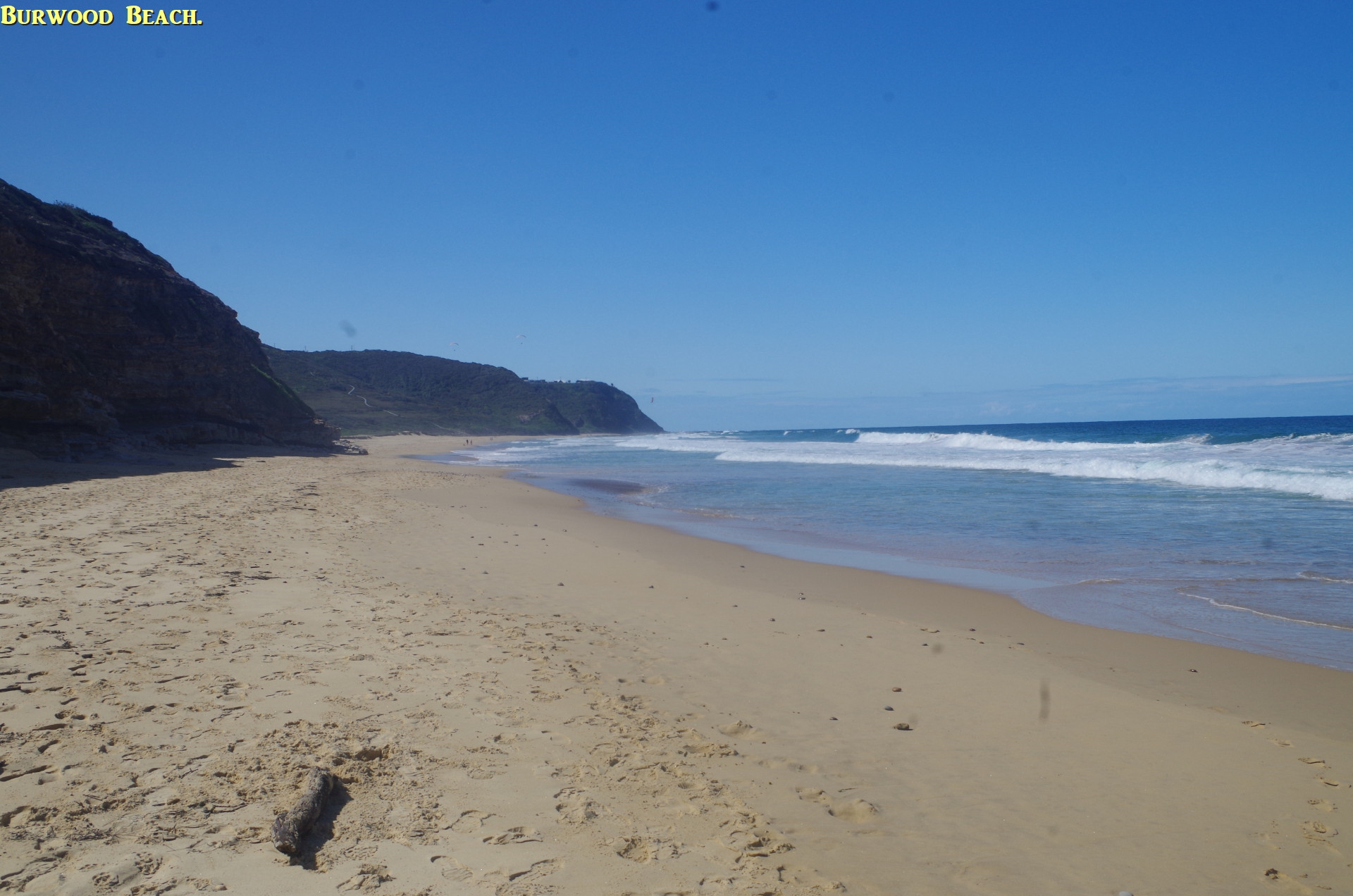
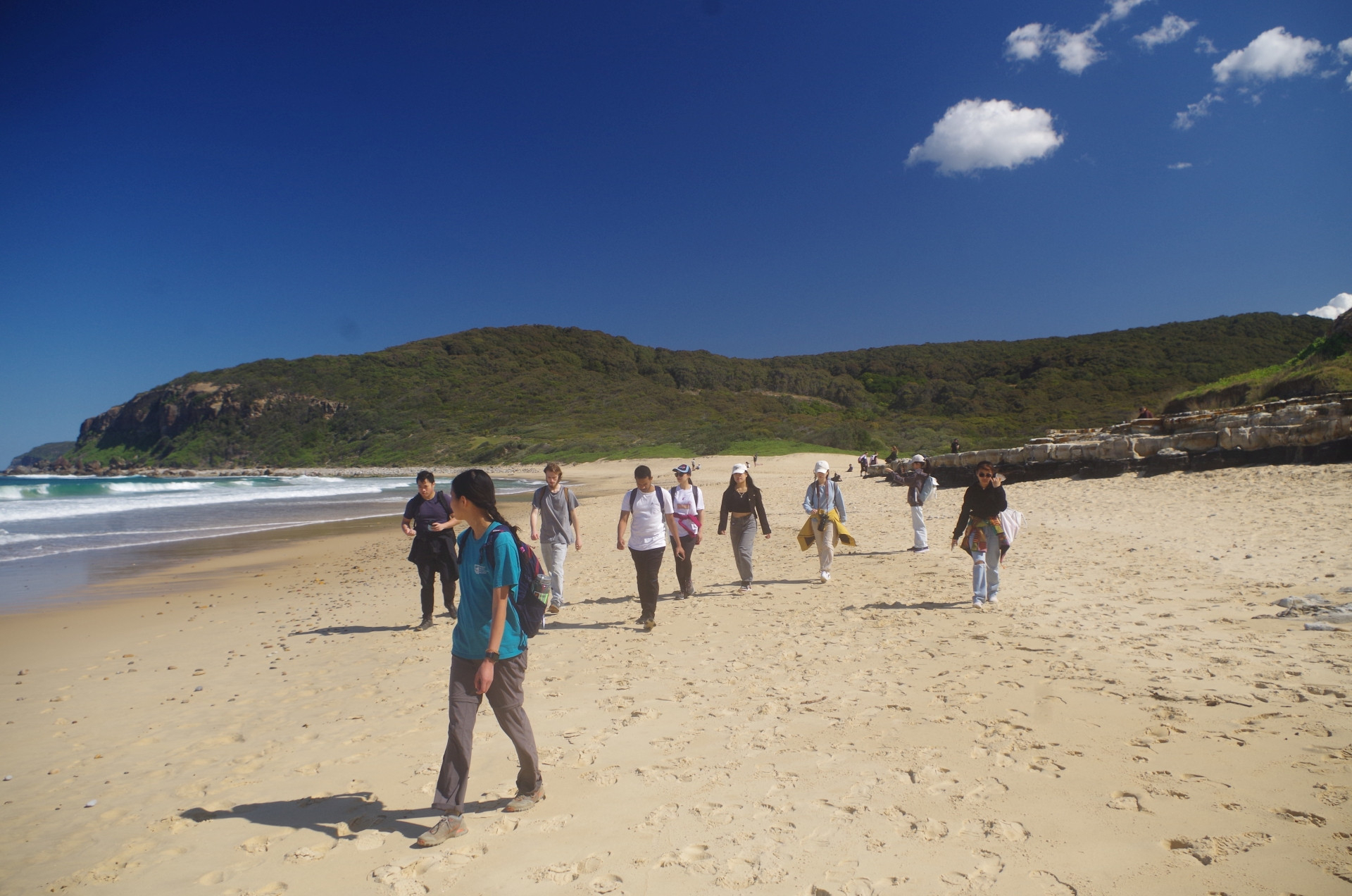
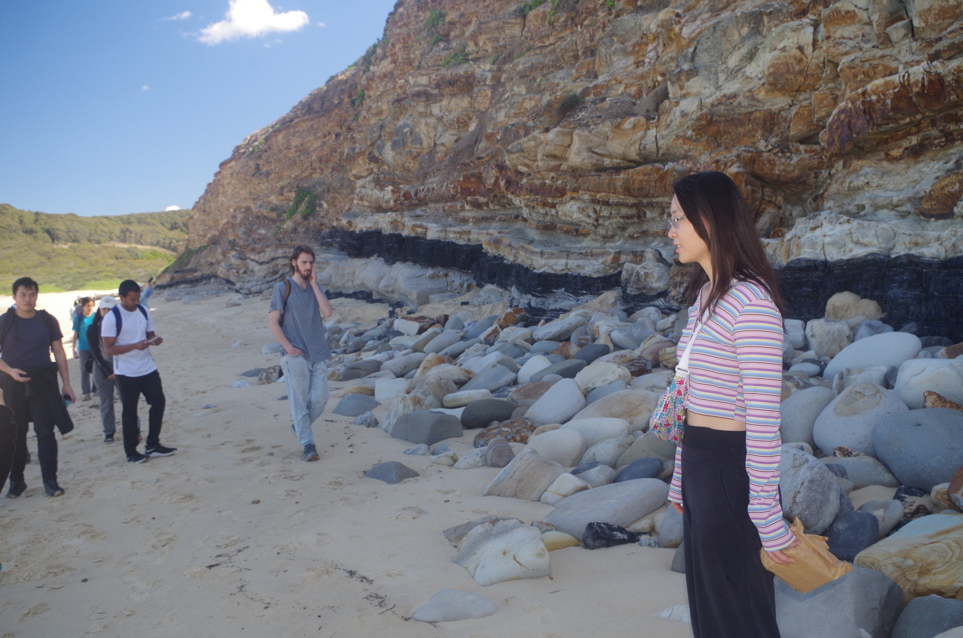
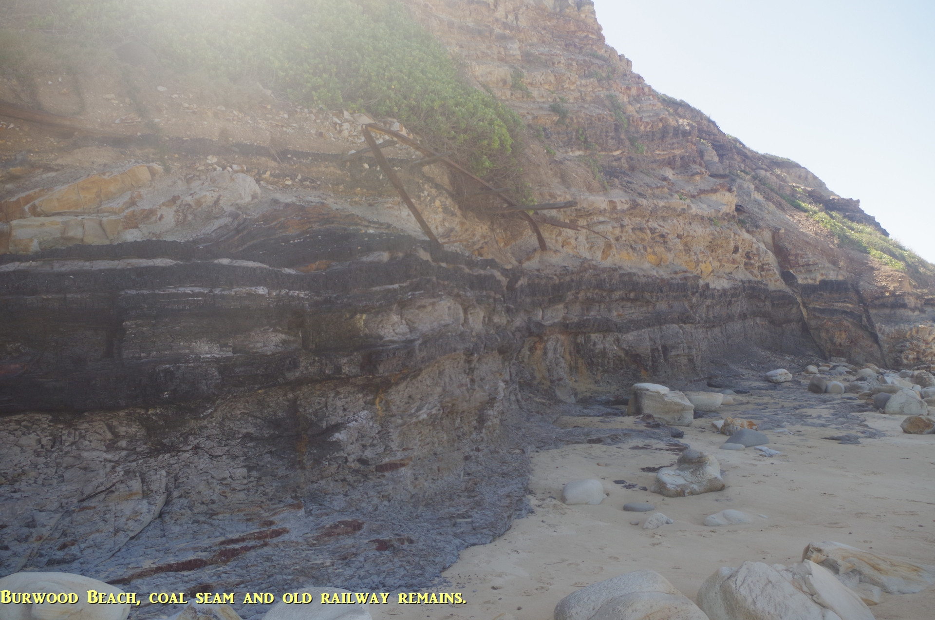
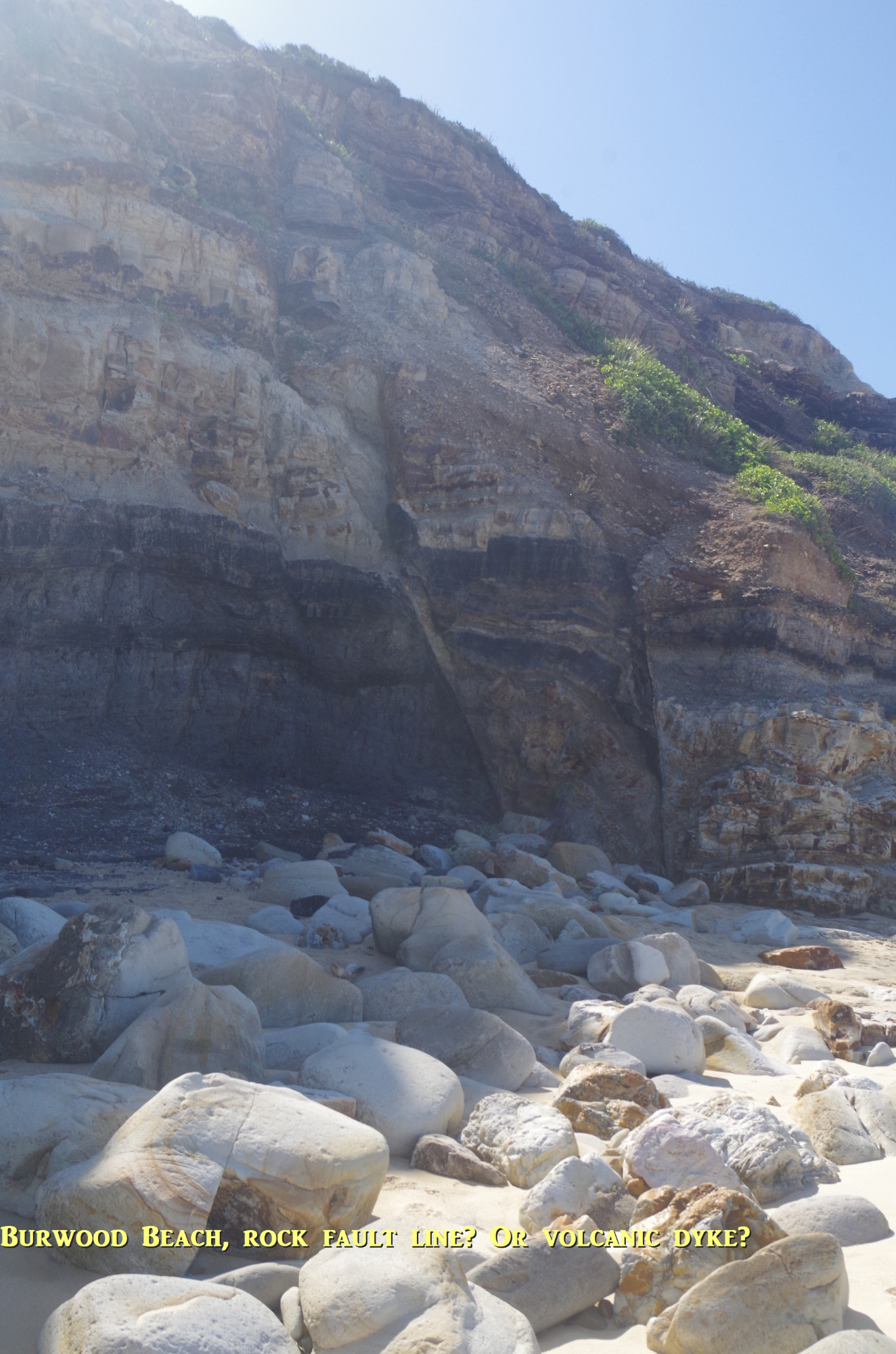
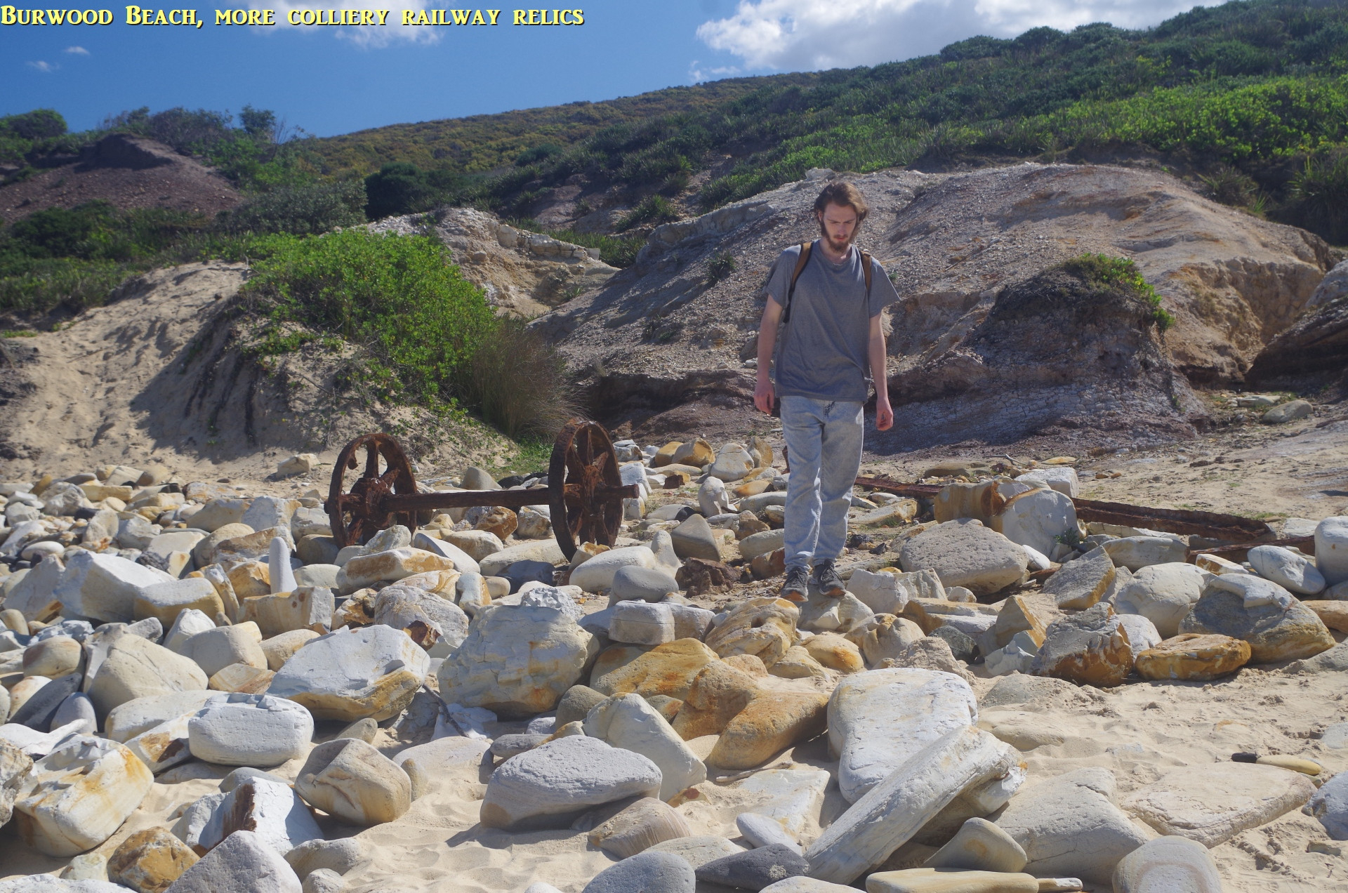
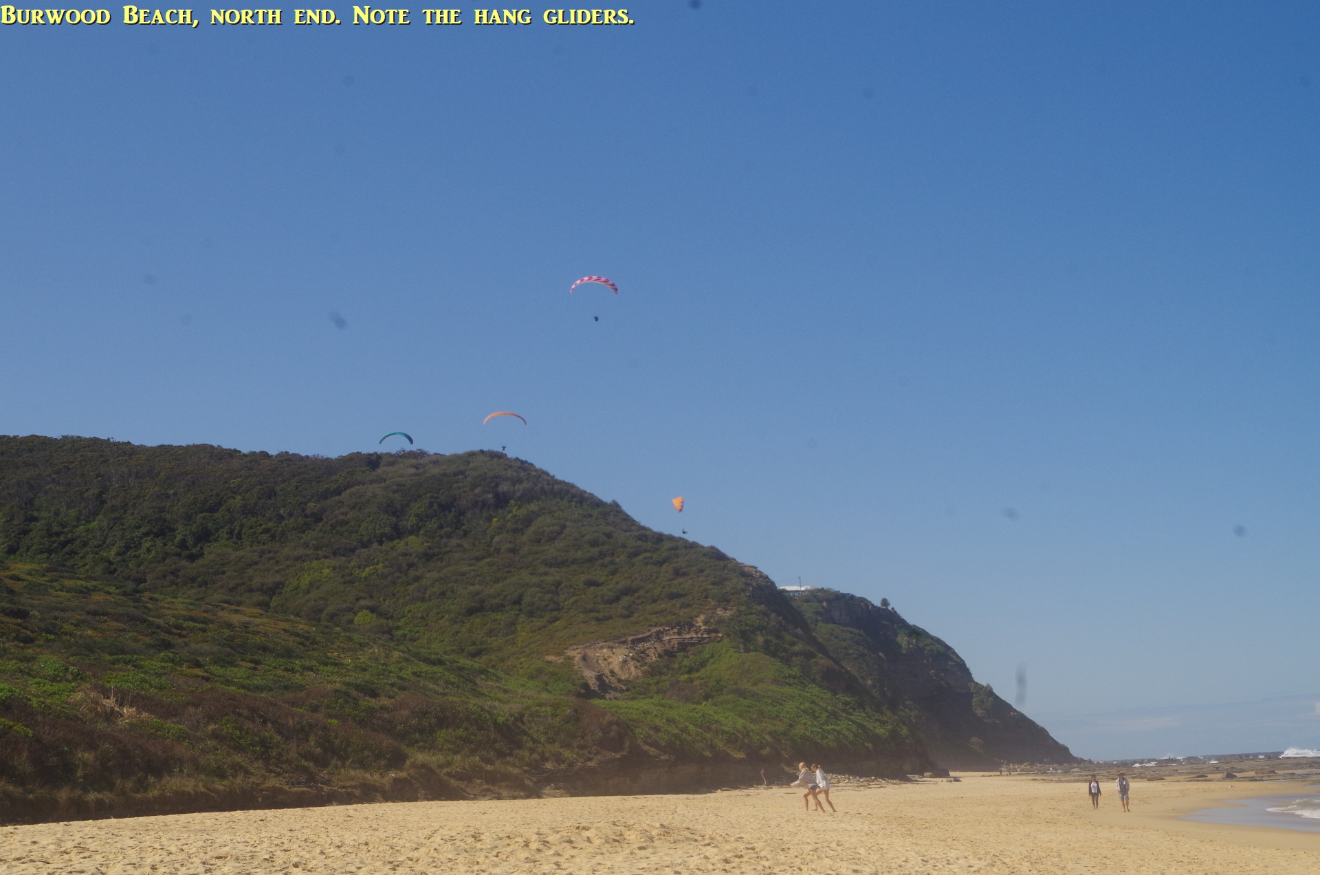
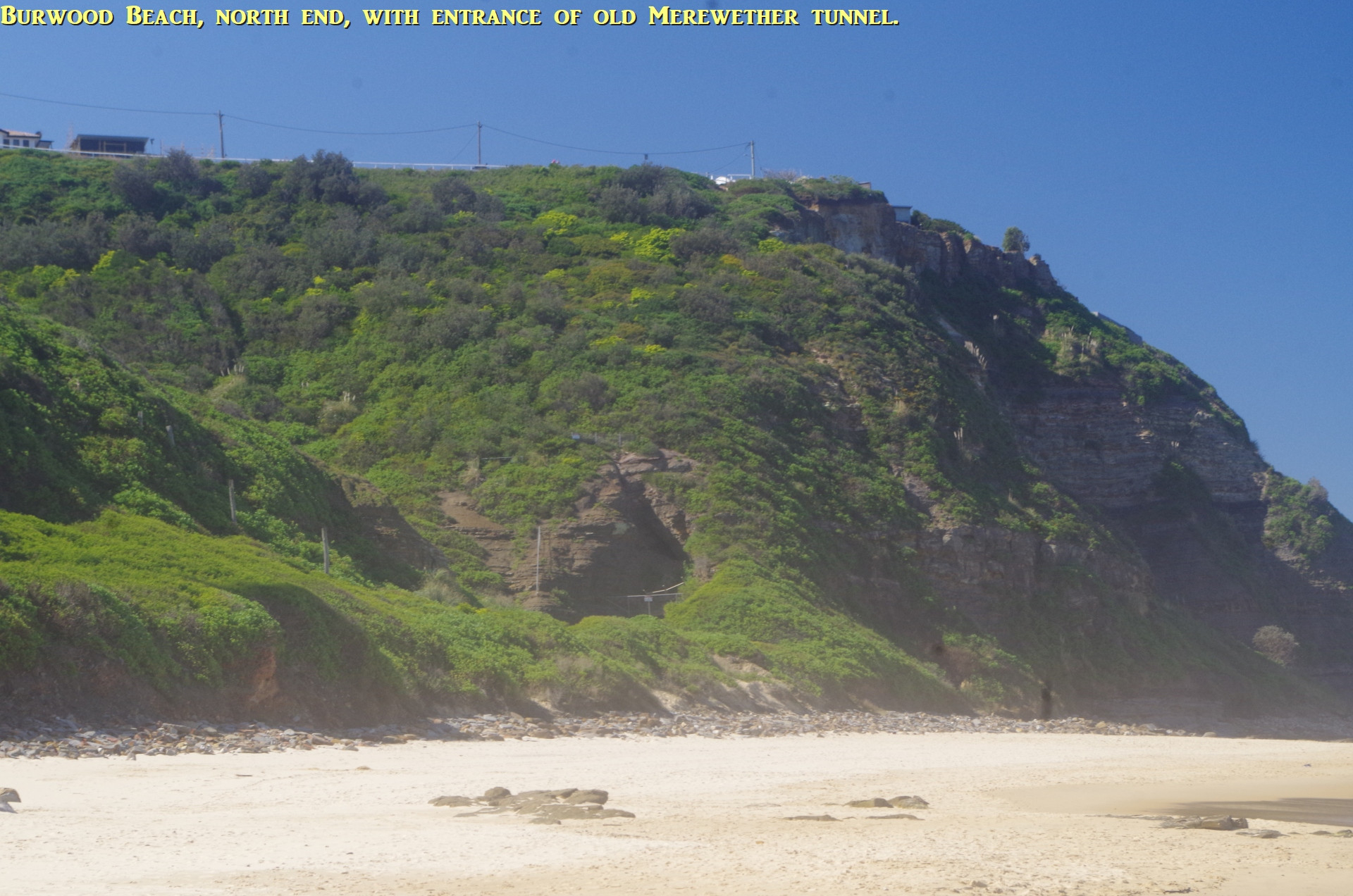
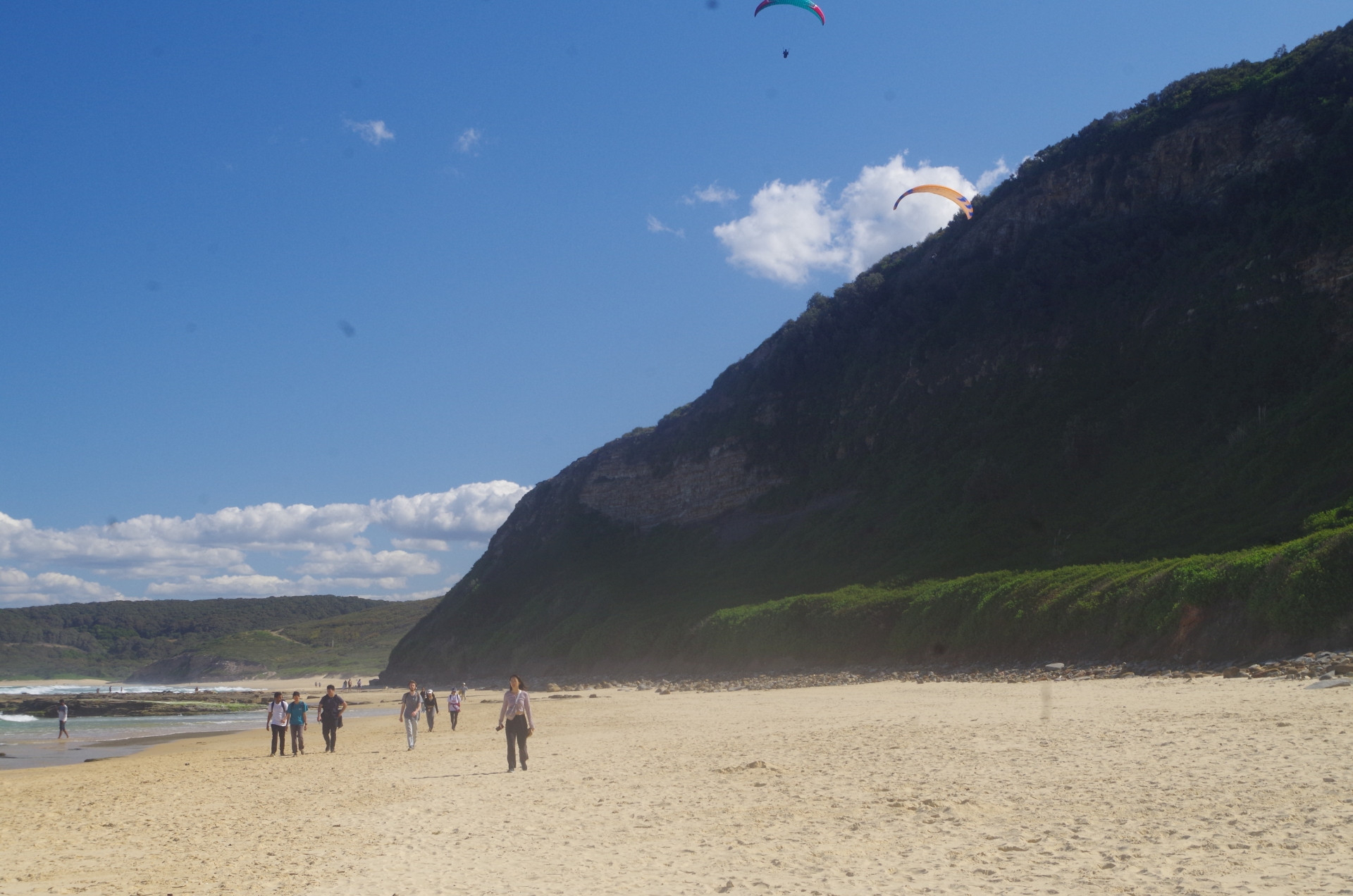
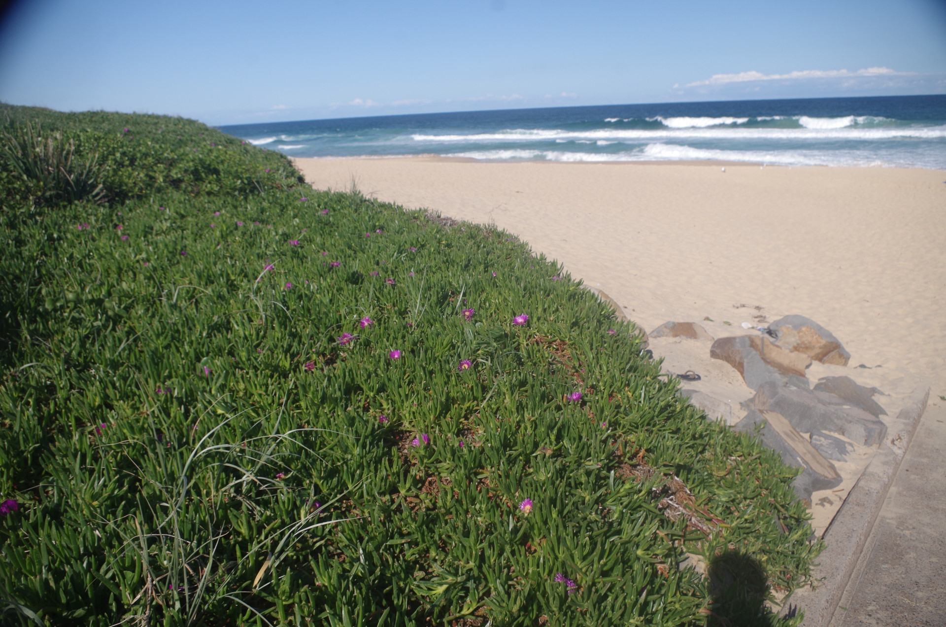
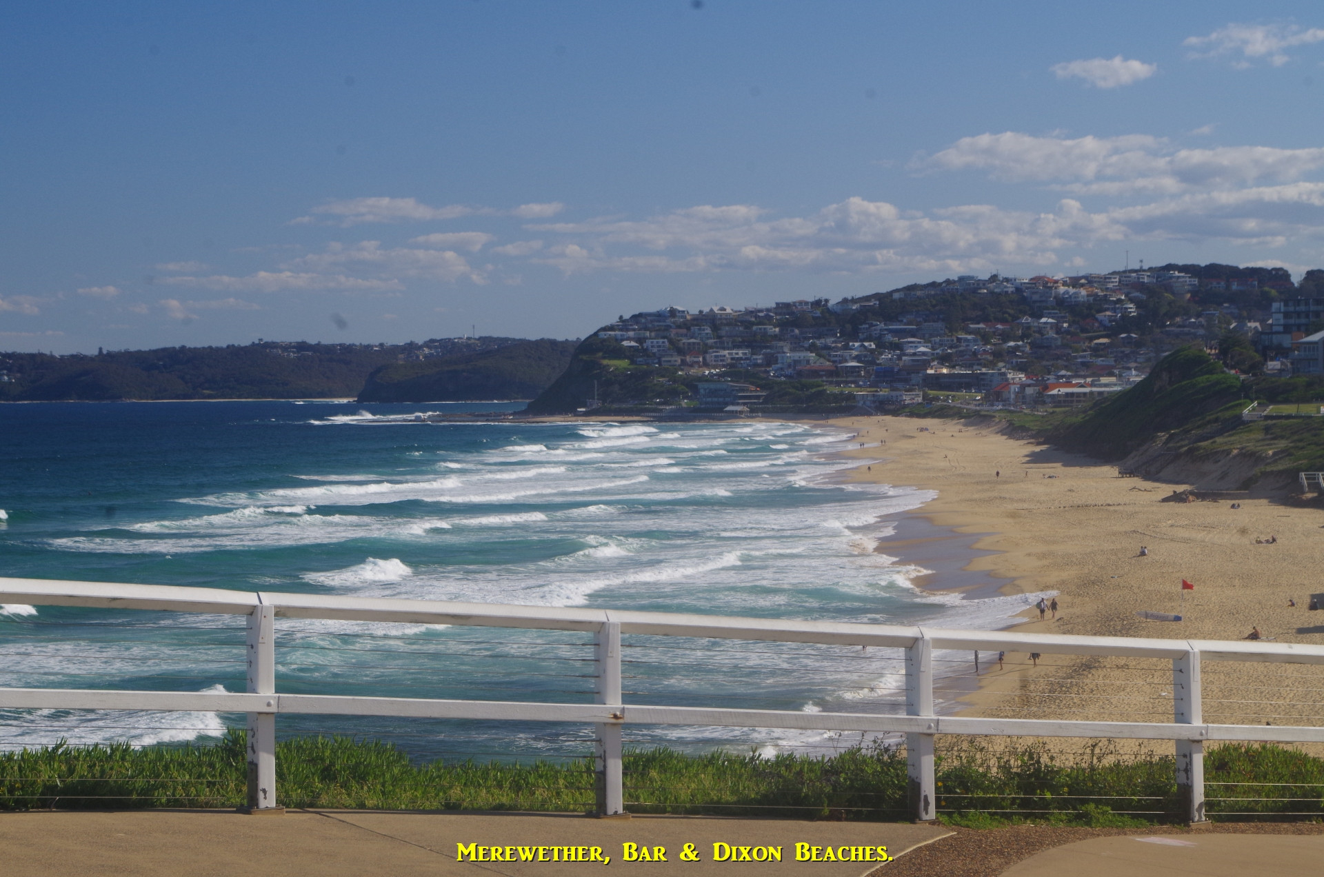
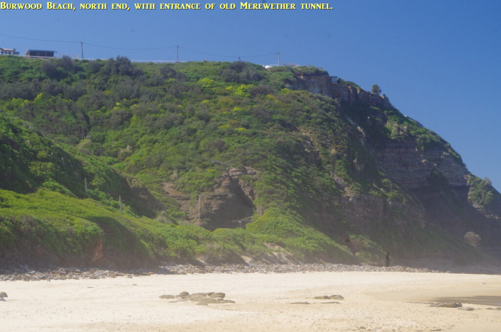
On reaching Burwood Beach I said goodbye to our temporary walker from Argentina. I pointed out to the group the thick coal seams in the cliff face along the beach, and as it was still a slight swell with a low tide (but with an incoming tide) there was no risk of getting wet like happened here in the past at high tide and rough seas. So we set off along the 1.7km length of Burwood Beach. Because of past mining activity here, the whole area has been spared from development. It is also a dangerous beach with several rips and is never patrolled, so swimming here is out of the question. Evidence of the former colliery railway can still be seen in various places along the beach, including, as we got near Merewether Head, the blown down entrance of Merewether Tunnel through which the coal trains once ran (see photo). Several hang-gliders took advantage of the thermals rising above.
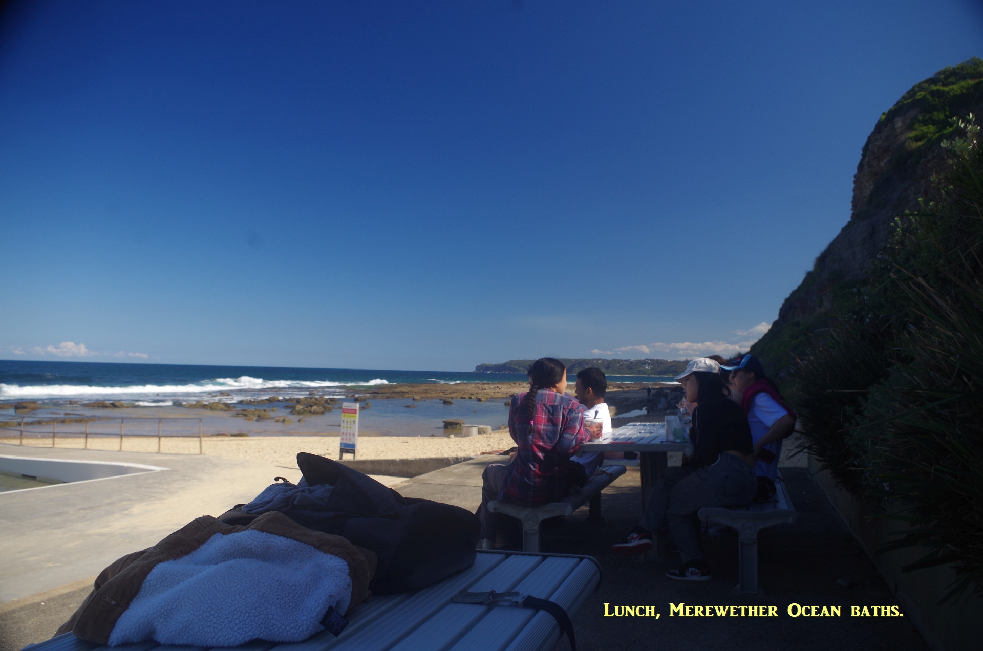
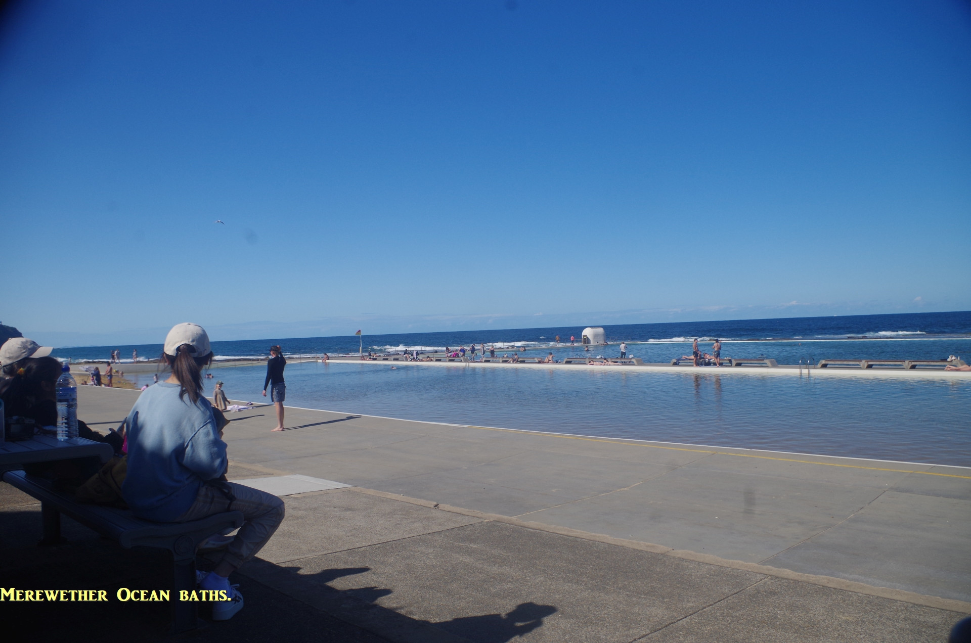
Burwood Beach though could be a good place for lunch, but the rising tide meant that we couldn’t delay crossing the rock platform between Burwood and Merewether beaches. One of my concerns was a forecast earlier in the week that there could be rough seas affecting the rock platform . If the rock platform (which forms part of the Yeulanbah Track) was not passable, the alternate path is a climb up the hill to Merewether Heights and a suburban road bash down the other side to Merewether. Fortunately, the sea swell was only slight, and although the tide was coming in the prediction was for a slow rising tide, so it was safe to cross the rock platform there. Even so, waves were just starting to splash at the edge of the rock platform, so we had to get a move on. We made it OK to Merewether Ocean Baths where we had a late lunch. Raphael was the only one who chose to have a swim; the weather was 21 degrees C by then and not really beach weather by Australian standards.
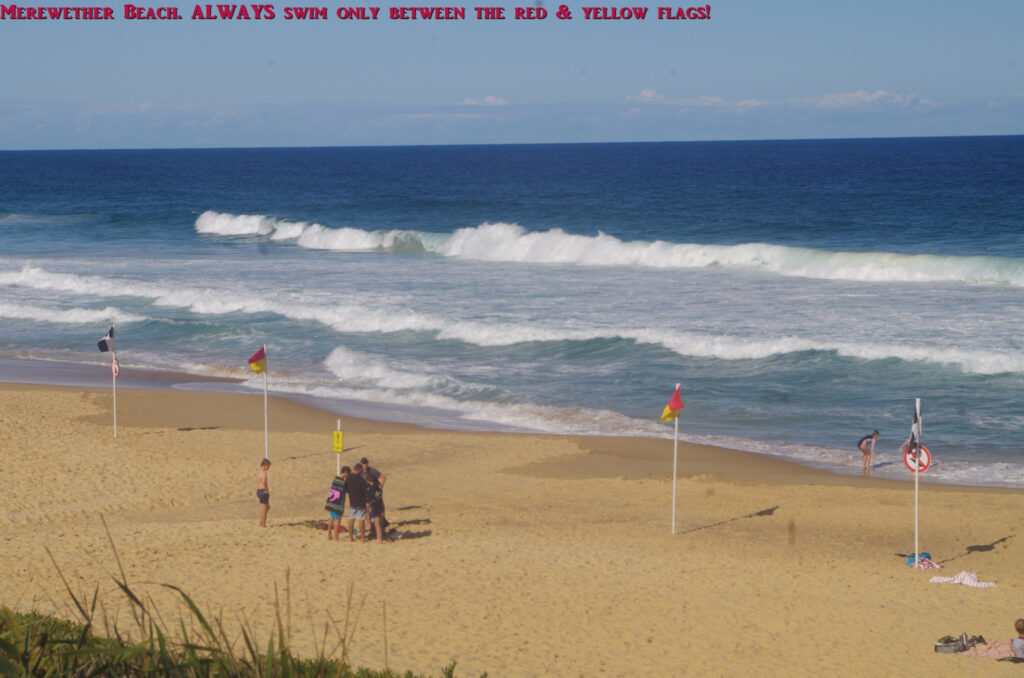
After lunch, we set off along the footpath along the beachfronts of Merewether, Dixon, and Bar beaches, so the walk became a “hike” again. The exception was when we went down to the beach to bypass the hill between Merewether and Dixon beaches (why climb a hill when you don’t have to!). I pointed out the red and yellow flags at Merewether Beach, and asked the overseas students if they knew what they are for. It is concerning that none knew, and learning about them should be part of the orientation for overseas students on arrival for their studies. The flags denote the area where you MUST swim for safety.
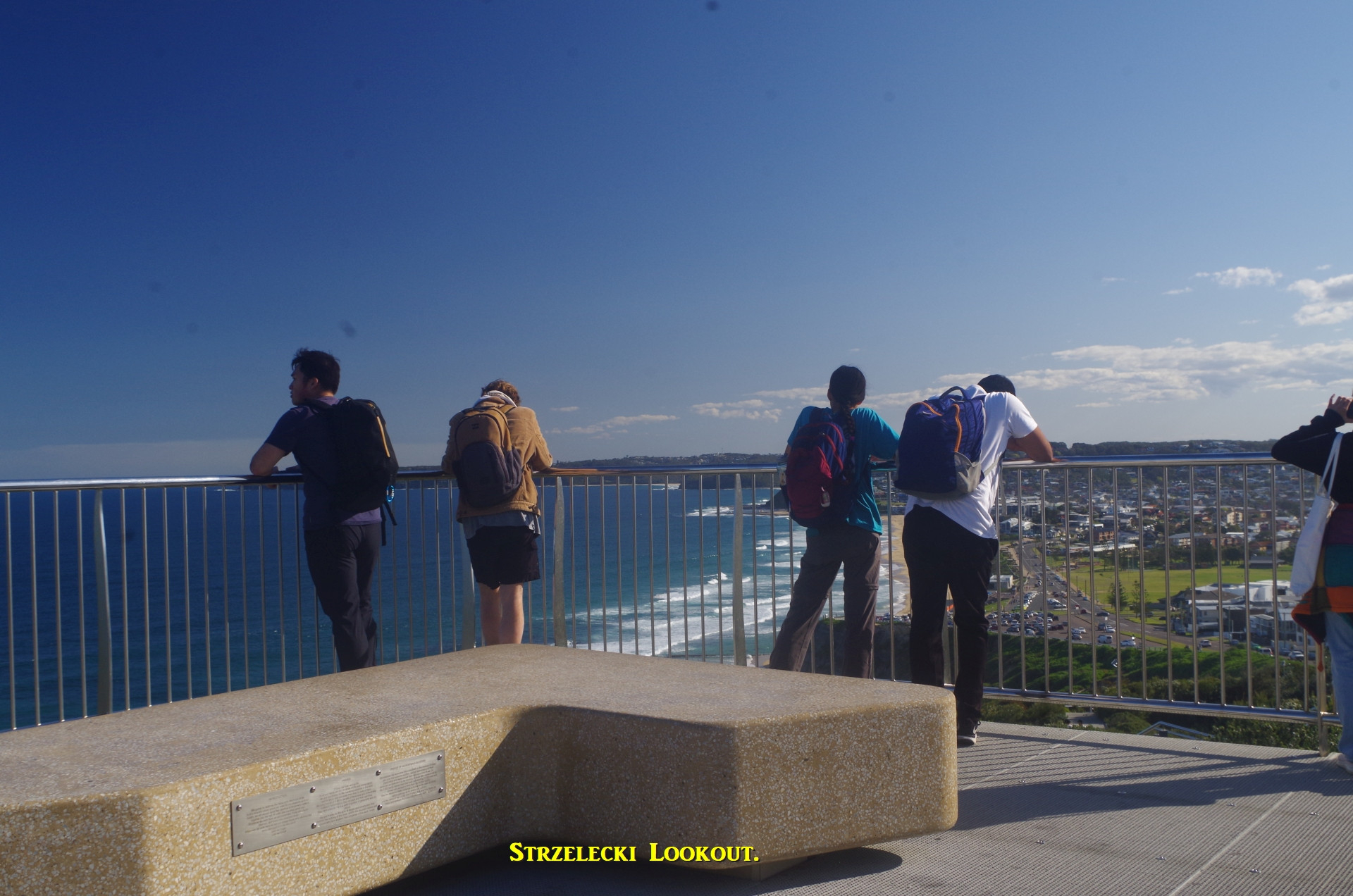
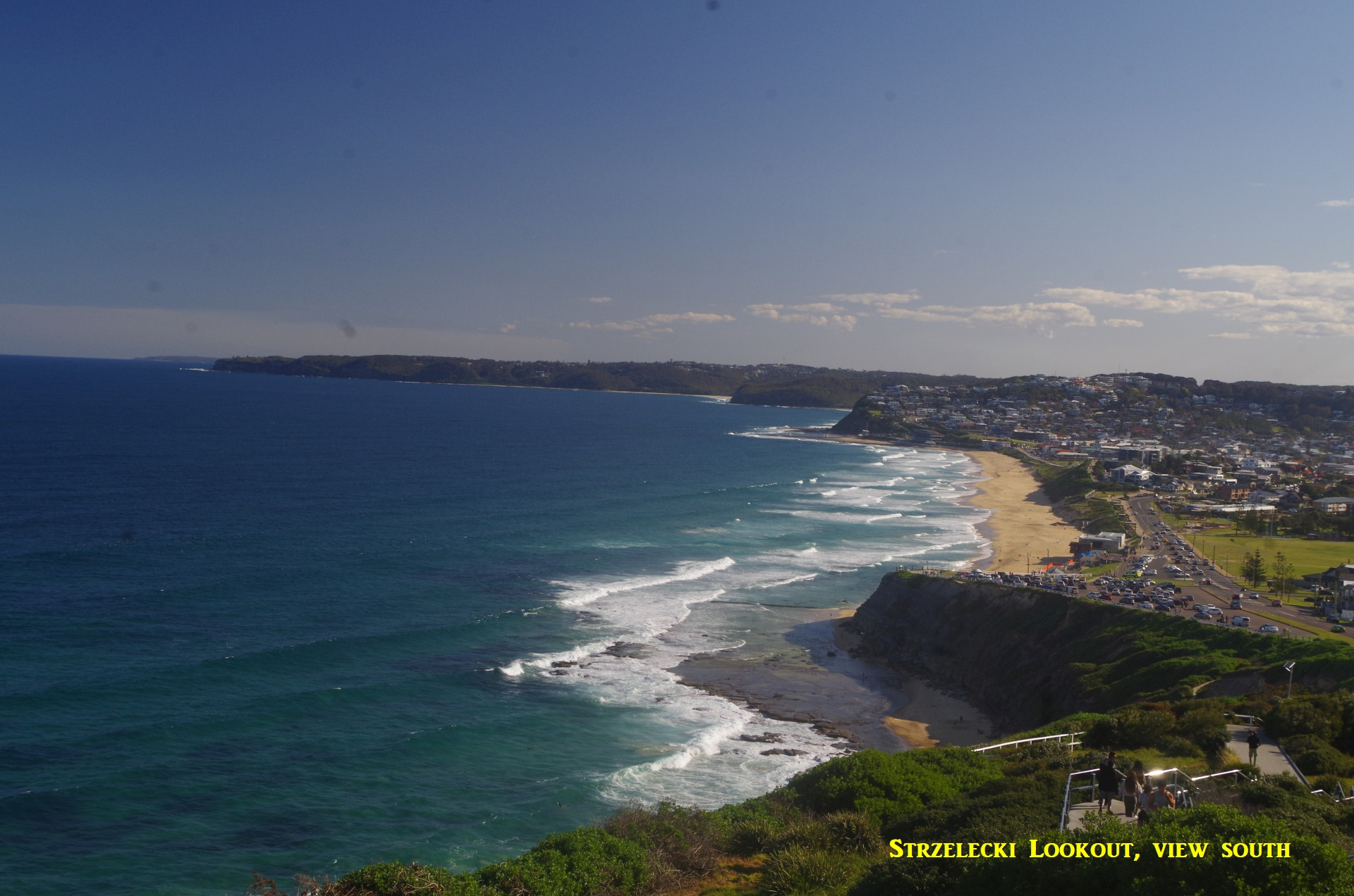
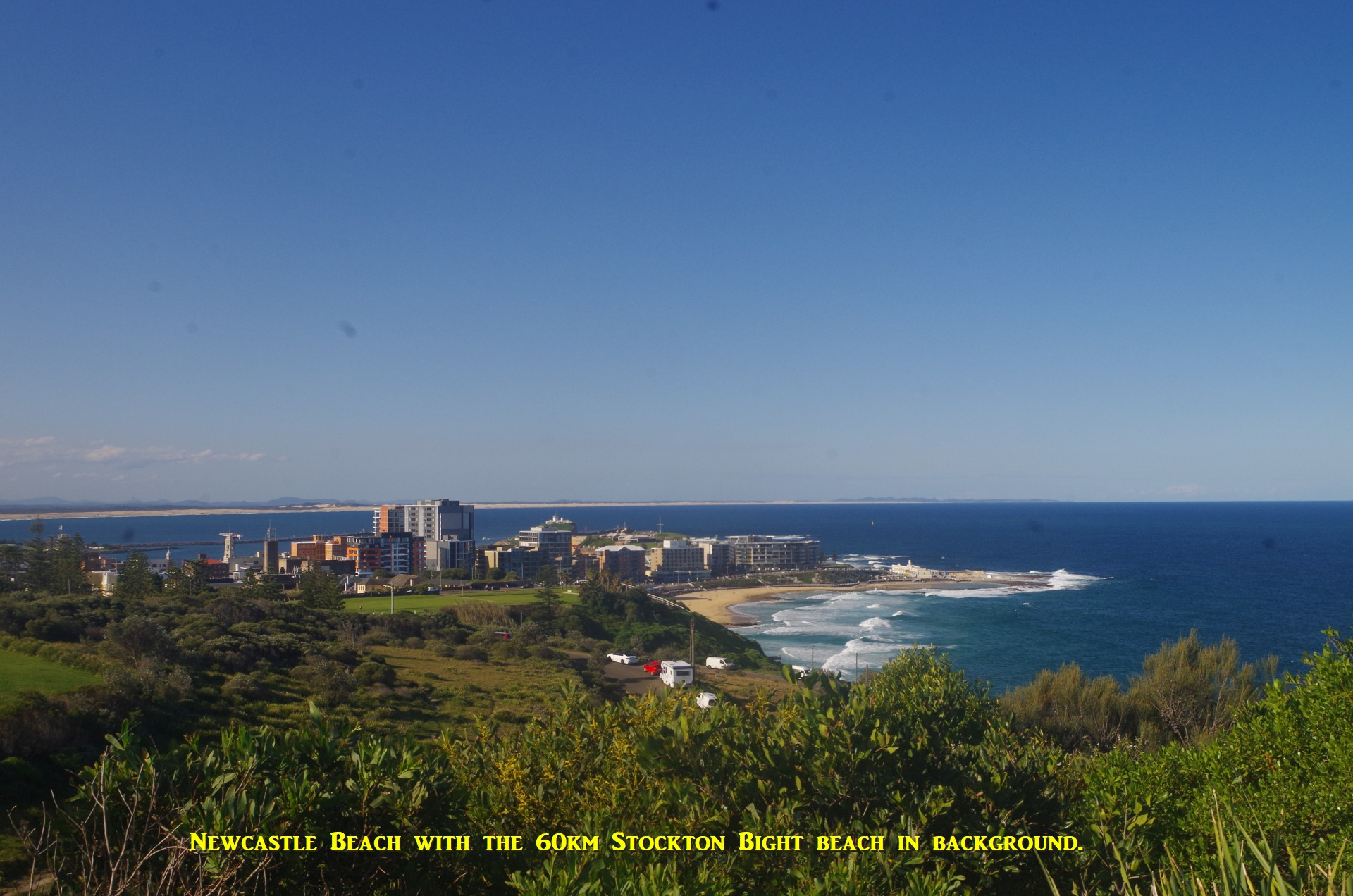
After Bar Beach the steep climb up to Strzelecki Lookout was unavoidable, but the great views there make the climb worthwhile. To the south the view stretches to Swansea, and to the north the view extends the 32km long Stockton Beach (I had earlier told MacKenzie that it was 60km long but I decided to check it later and it is 32km; locals apparently added in two other long beaches to the north which are strictly not part of Stockton Beach).
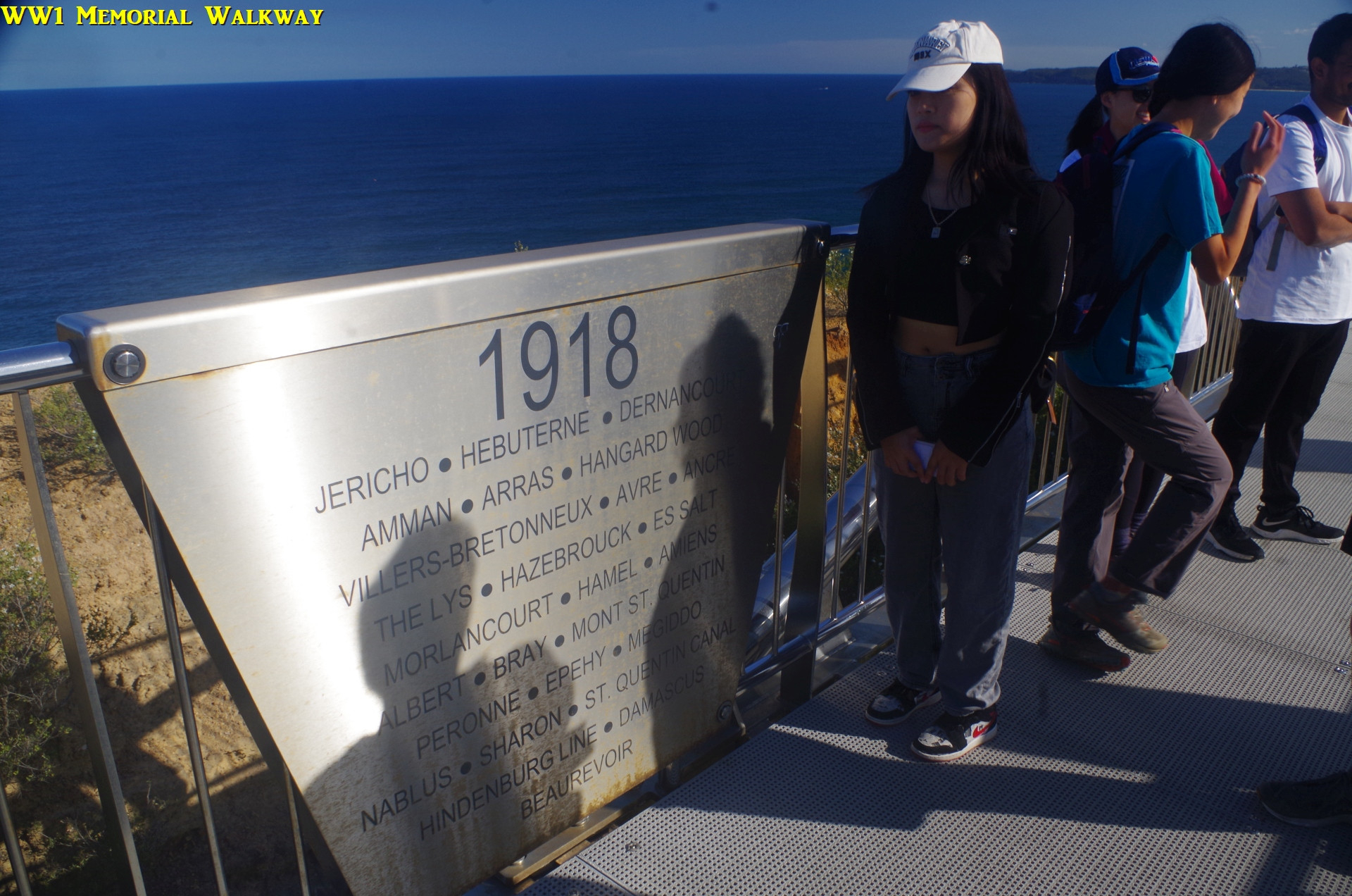
After a break admiring the view we set off along the World War 1 memorial walkway, which is a walkway/bridge spanning the clifftop there, and opened on Anzac Day 25/4/2015. Names of battles are included, including Damascus in 1918, which, despite what the movie “Lawrence of Arabia” states, was libertaed by Australians, not the British. After the walkway we headed off in the direction of Shepherd’s Hill, the site of an old WW2 fort. It was here that we noticed that Doudou was no longer with us. A text came through from her that she had got ahead of us somehow and was going to Newcastle Interchange. It’s not easy to get lost in Newcastle, just go straight down the hill to the tram terminal and go from there, so I decided she would be OK (in fact she ended up on the smae train as the rest of us anyway).
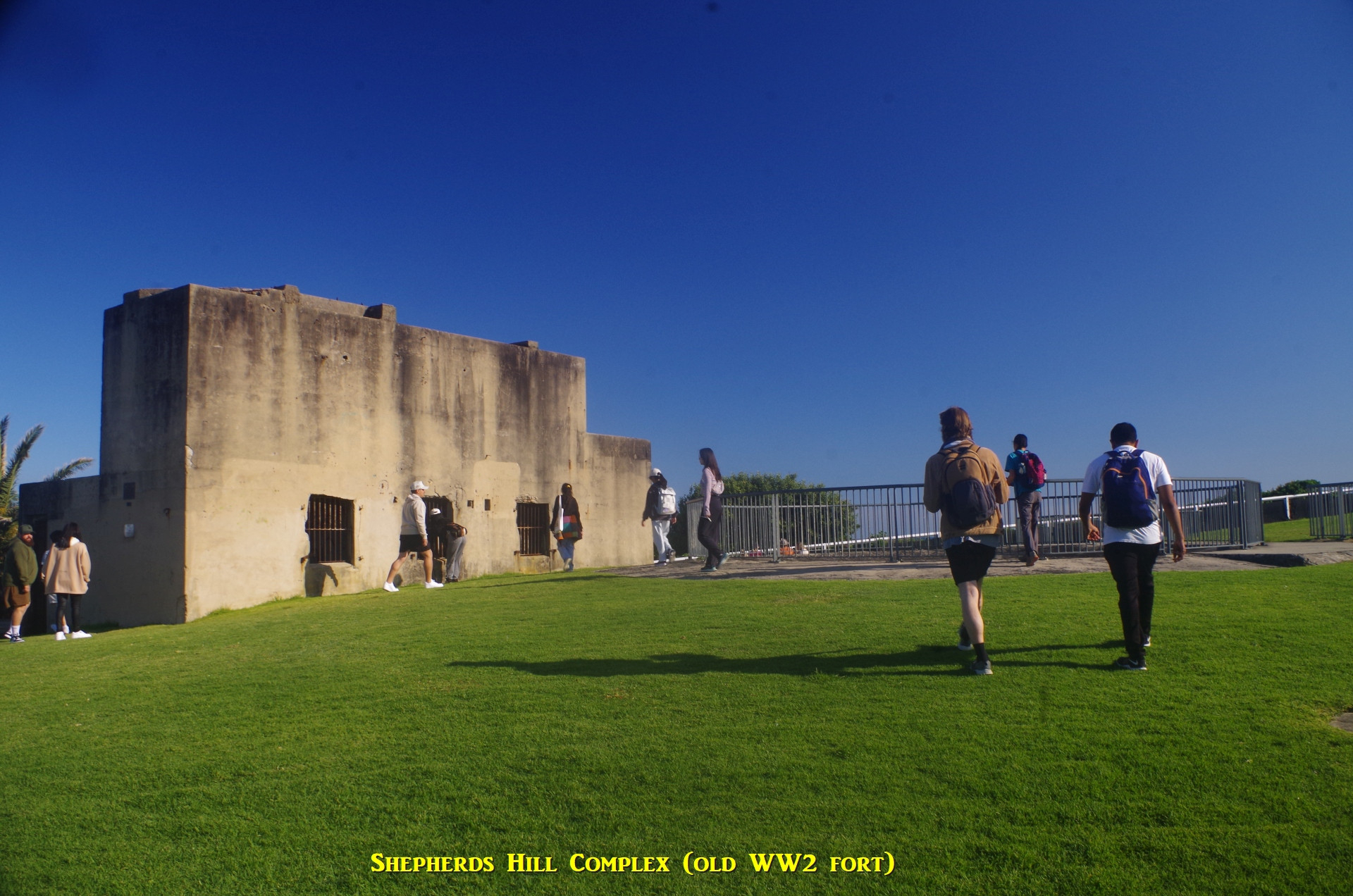
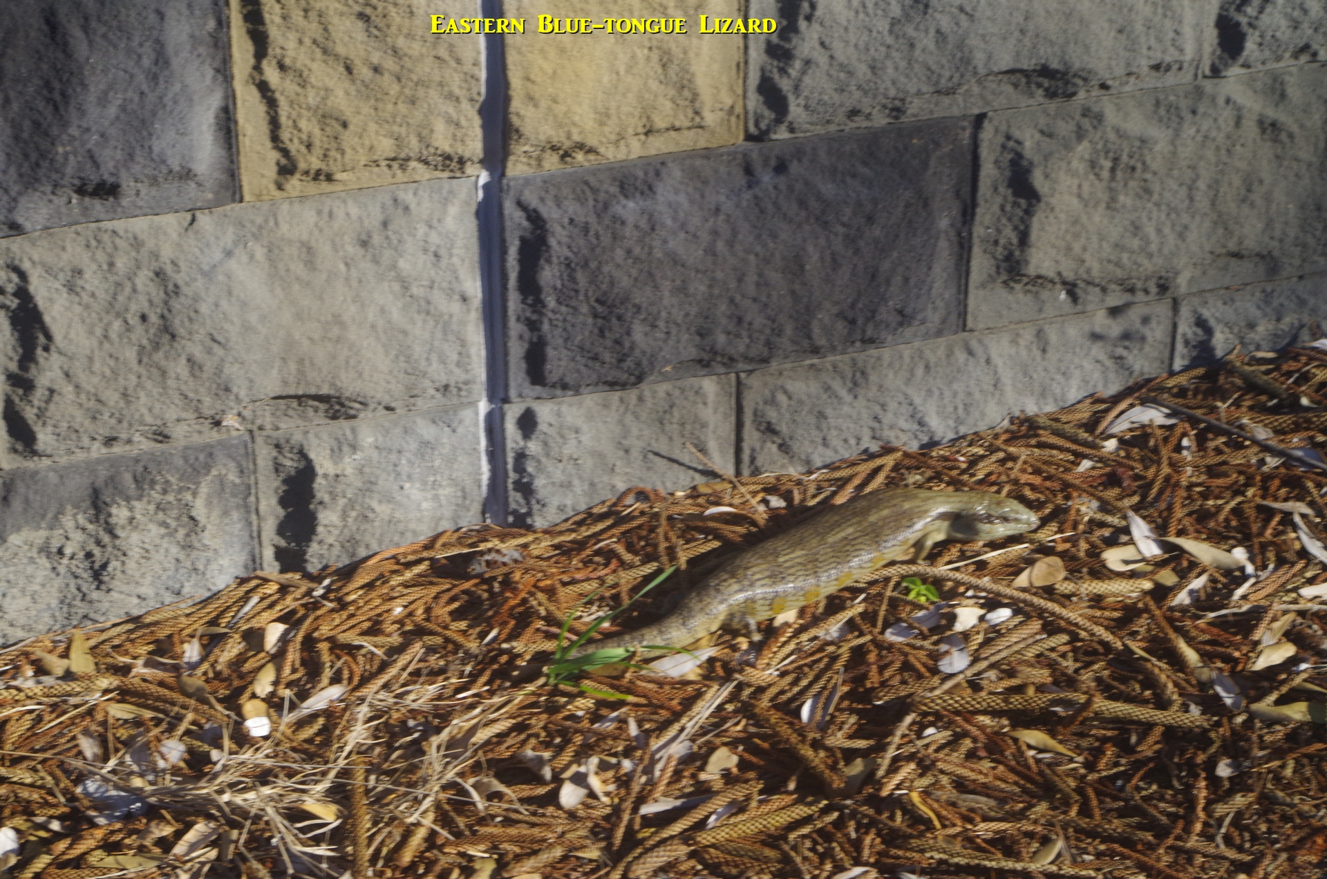
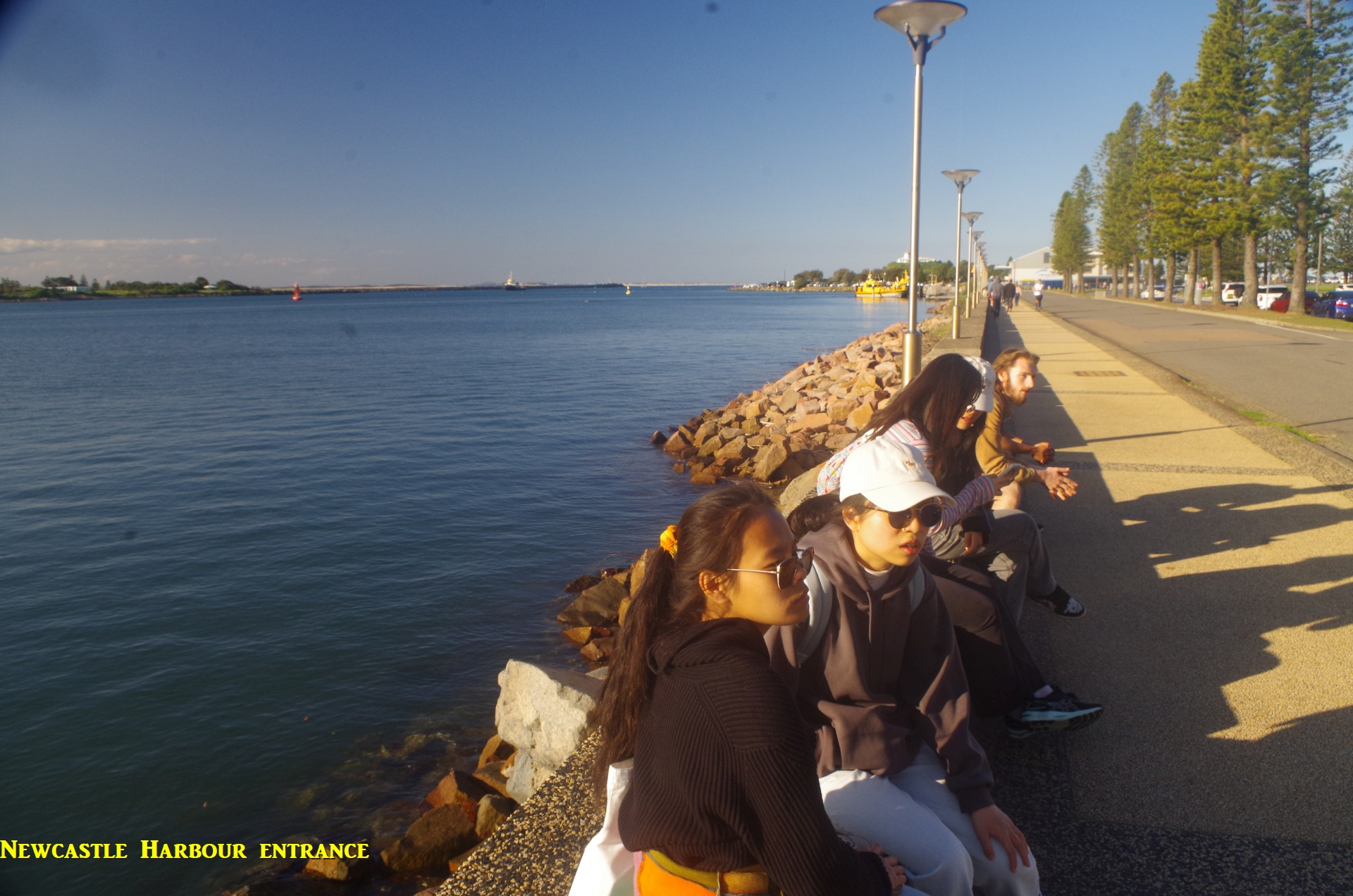
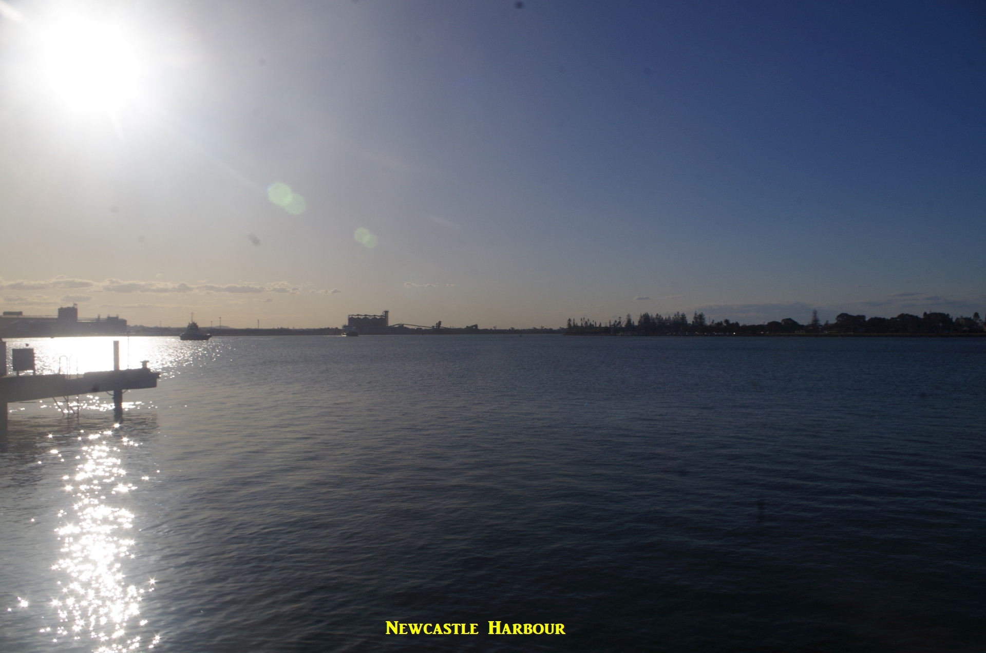
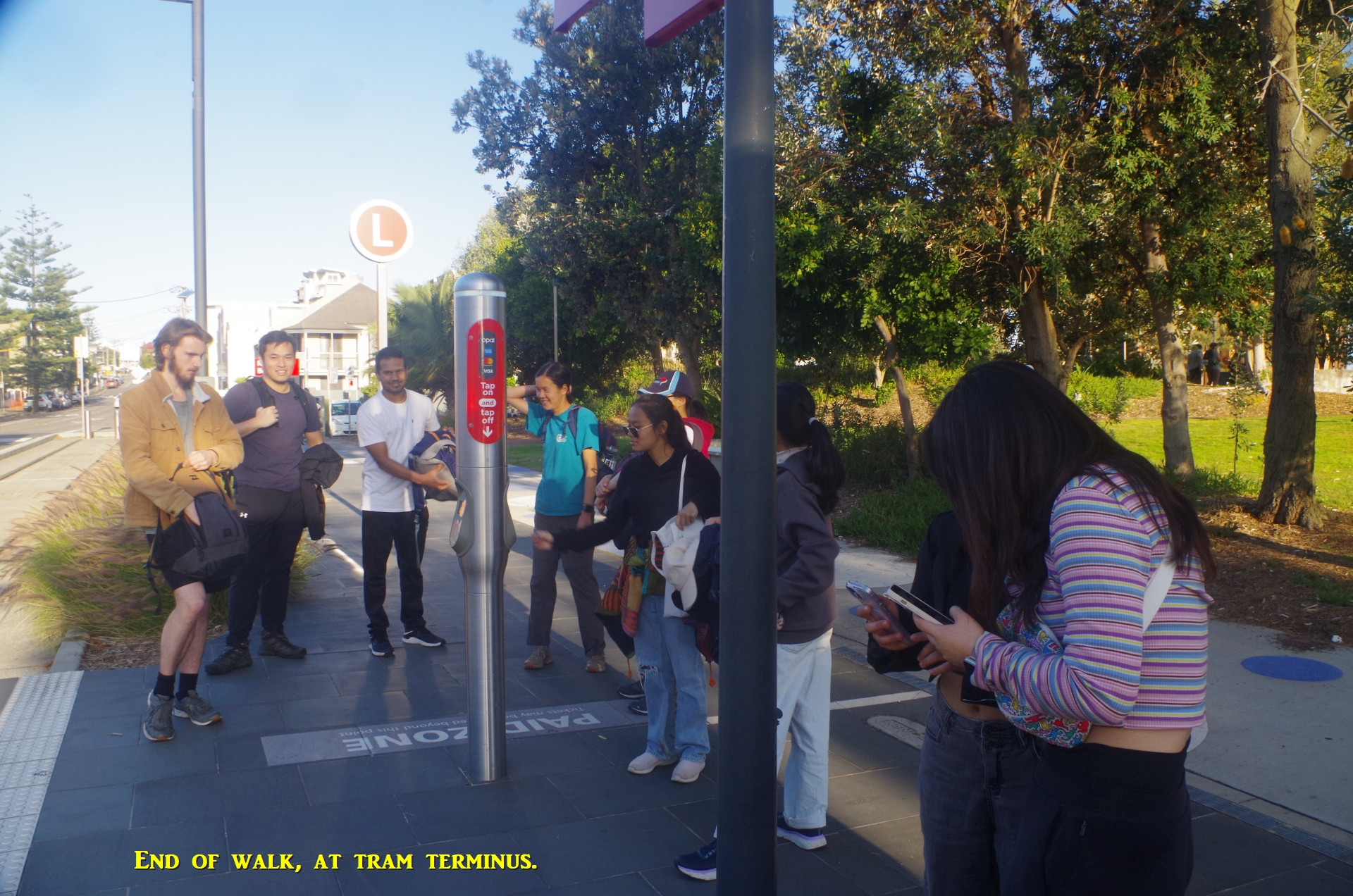
We had a brief look around Shepherd’s Hill and the crumbling fort, which was the only one in Australia in WW2 that fired on an enemy vessel, a Japanese submarine that had fired on Newcastle and on a Russian freighter coming into the Port.From there we went along a meandering path along the cliff line, with an even better view of Stockton Bight, until coming to Shortland Esplanade which, despite almost 4 years of work on its half-kilometre extension to Newcastle Beach, is STILL not open! (Yes, Covid and heavy seas have caused interruptions, but….).Thus a detour around Garside Gardens in King Edward Park is required, but here we saw an Eastern Blue-tongue, a lizard species which are the largest members of the skink family. From King Edward Park we went along Telford Street down to the waterfront of Newcastle Port for a break. A alk along the breakwater at Nobby’s Head could be interesting but we were staring to run out of time, so we then went back down Telford Street to the tram terminus for the next tram to Newcastle Interchange and the train.
Once settled in the train I reminded the group that time was running out to ride in train sets with reversible seats, as the new “modern dynamic, state of the art” intercity sets will not have them. Granted that after the change of government last March, NSW Trains has now conceded that this greatly disliked seating pattern is a bad mistake, but we will be stuck with this for the next 30 years, the usual life-span of train sets.
Anyway, people settled in for the trip back to Sydney, which was faster than the morning trip as it stopped at fewer stations. MacKenzie spotted a Wallaby beside the track at Hawkmount where the Line climbs through Awaba State Forest. I got off the train at Woy Woy while the rest continued back to Sydney destinations. Everyone seemed to enjoy the walk.
We had a good trip with a good group that interacted with each other, and who, I am pleased to note, heeded my warnings about using mobile phones while walking on tracks thus risking not seeing that venomous snake that could bite you. Snake season has now arrived and I can’t emphasise too much that you have to keep a lookout for them on bush tracks. Very few people in Australia get bitten because most people take care when out.
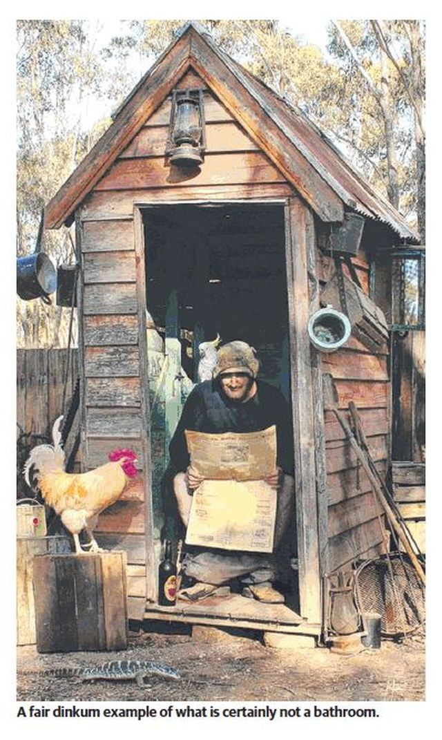
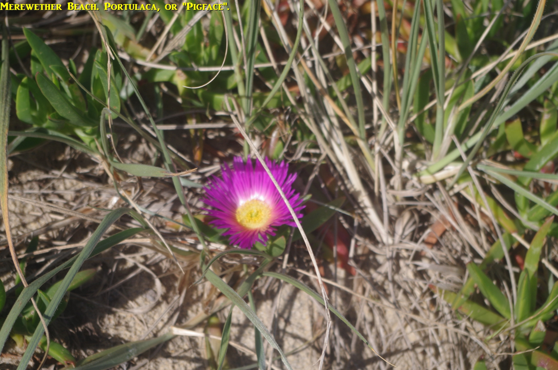
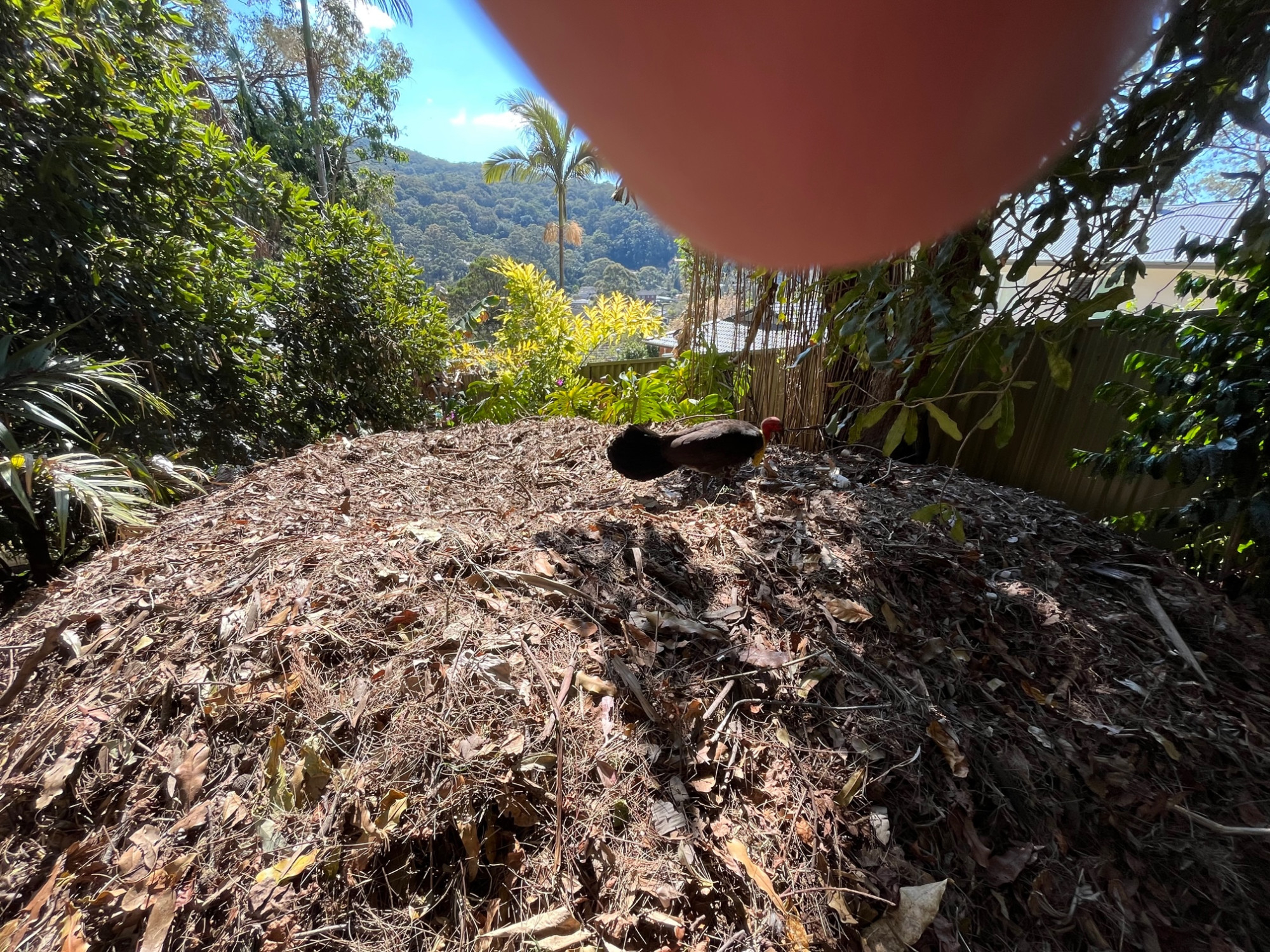
About Bush Turkeys: the purists will insist they are “Brush Turkeys” but people who live with them call them “bush turkeys” or just “turkeys”. “Brush” is a misnomer as they can’t build their large mound nests in thick brush vegetation and prefer more open woodland. The second last photo is of a turkey mound in my yard (with the male turkey owner of the nest). The very last photo is a reminder of what is NOT a “bathroom”!
And no “no shows” either. I thought one person was but she had sent me an email instead of a text and I got it when I arrived home.
Future walks? Maybe one on the monday of the Long Weekend (30/9 to 2/10), and as the weather warms up (but not too hot) some beach walks in October.
Bruce Stafford