Date: 27/7/2023
Trip leader: Bruce Stafford
Party: Alper Tunga, Qi
Sydney introductory walk: Hyde Park, Botanic Gardens, and The Rocks 27/7/2023.
This walk was intended as an introductory walk around certain well known (and less well known) sights around central Sydney for members joining in Semester 2. Although only three people attended, it was still a worthwhile walk (after all, we have done trips with only 3 people before and they have been OK).
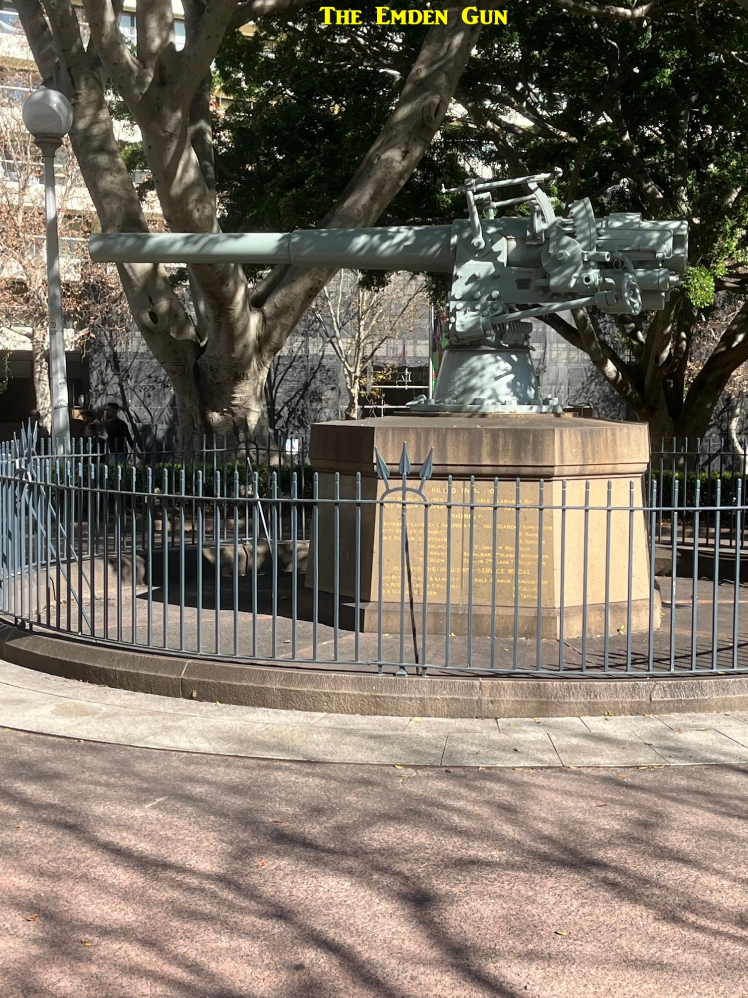
I recall Chloe’s comments about the confusion caused on her trip about meeting at the entrance to Museum Station, as that station has two entrances, one on the edge of Hyde Park, and the other on Castlereagh Street, a block away. Therefore I chose a rather obvious meeting place, the Emden Gun at the extreme lower left corner of Hyde Park, just a short walk from Museum Station. The gun itself is from the SMS Emden, a German warship which in 1914 ran aground on a remote island near Indonesia called Cocos Island (Australian territory) after being attacked by an Australian warship. All its guns were salvaged and two more are in other locations in Sydney and Canberra.
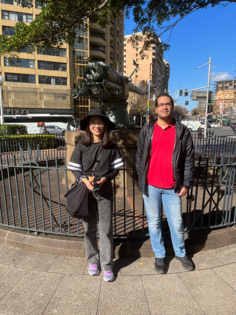
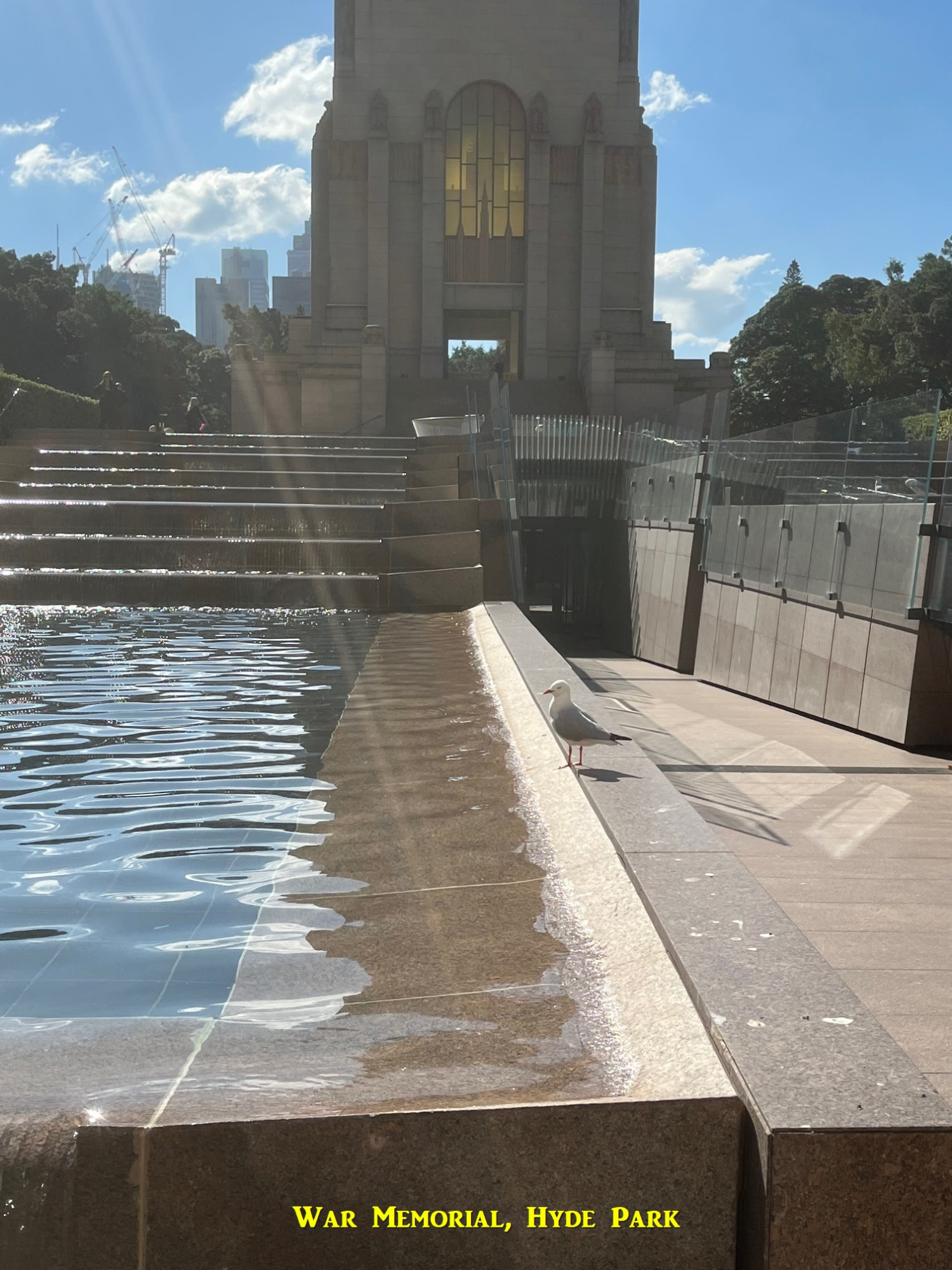
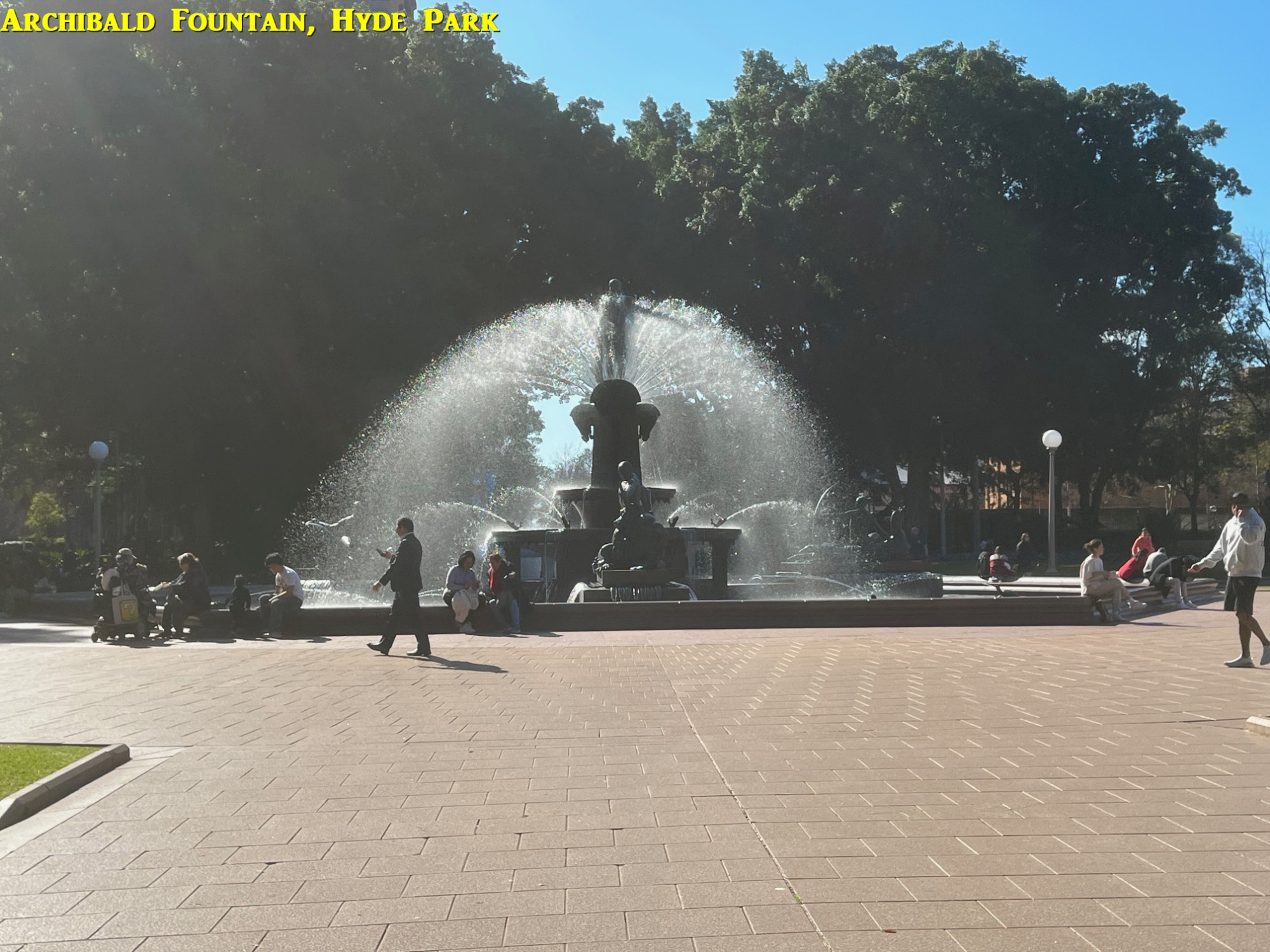
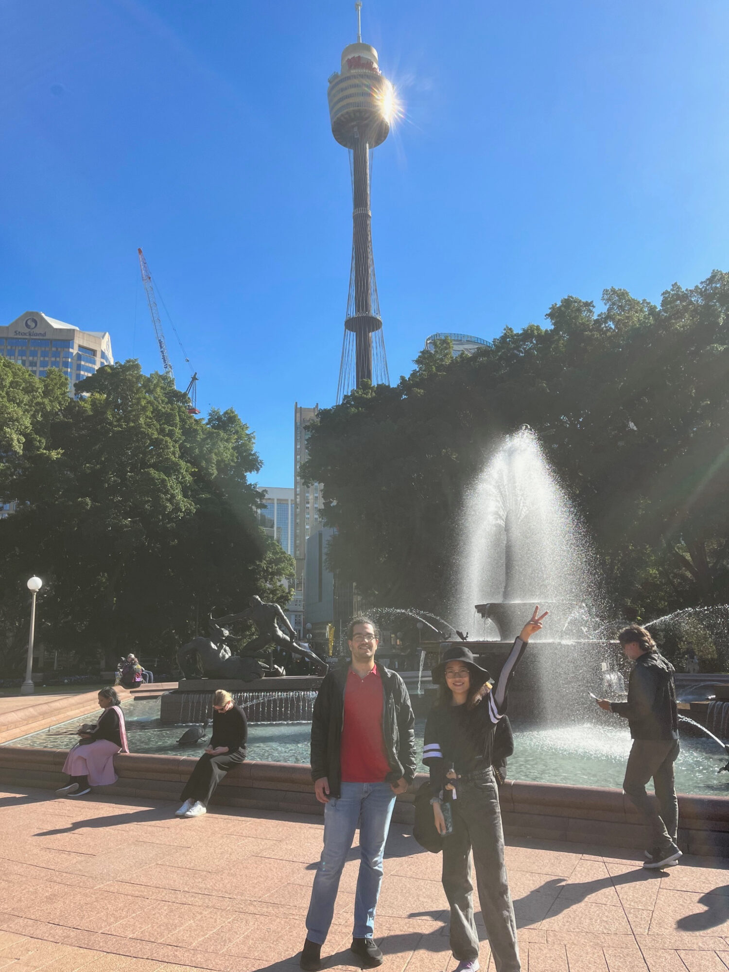
Anyway at 1pm Alper and Qi arrived, and after a photo in front of the Emden Gun, set off to walk the length of Hyde Park. First stop was the War Memorial with place names of battle sites from WW1 (it was built in 1934 prior to WW2). Then it was across Park Street to the northern part of the Park and the Archibald Fountain, named after the art lovinf philantropist who paid for it, as well as funding the annual Archibald Art Prize which continues to this day.

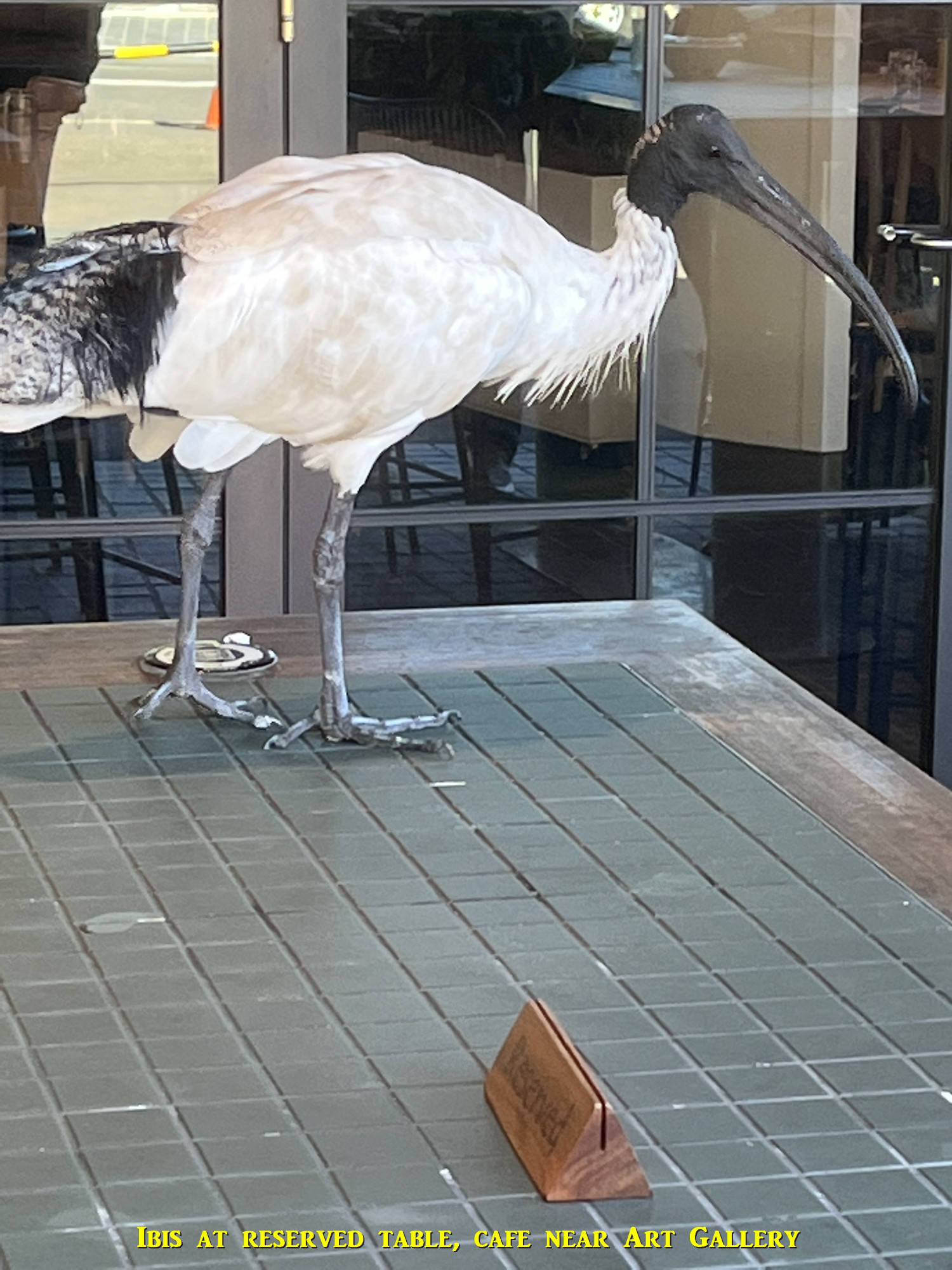
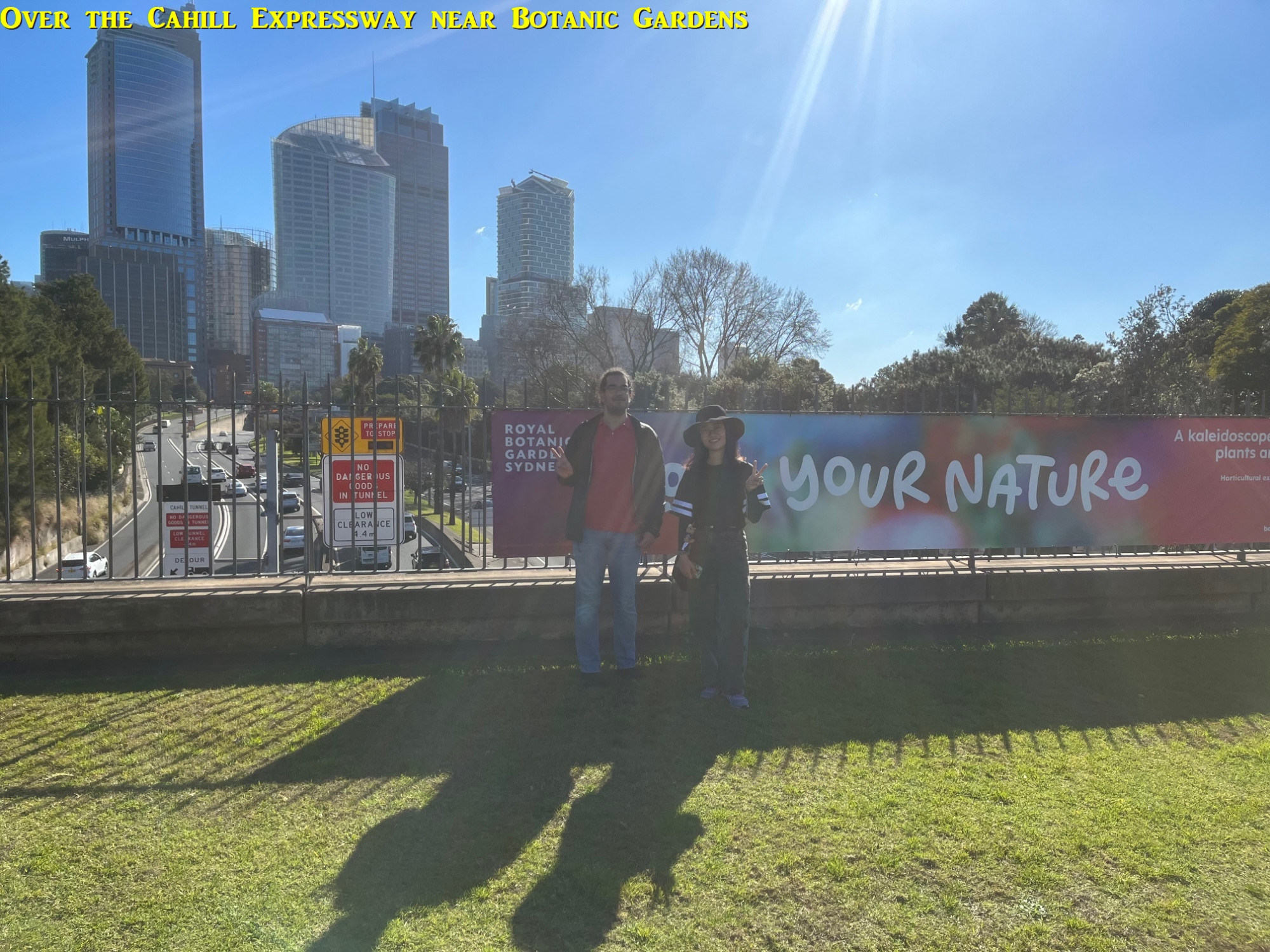
After that, we continued along Macquarie Street to Sydney Hospital, where I showed Alper and Qi the shortcut through it to get to The Domain (the hospital also has a good coffee shop). So we crossed The Domain which, until the 1950s, had an unbroken connection to the Royal Botanic Gardens until the brainless NSW government of the time built the canyon of the obnoxious Cahill Expressway cutting the two in half. The pathway across The Domain comes out opposite the Art Gallery of NSW, but we didn’t go in (you can spend half a day looking around it, and except for special exhibitions like the current Archibald Prize, is free to enter). Opposite the Art Gallery is a cafe with an Ibis standing on a table with a “reserved” sign on it (see photo). Then I asked Alper and Qi to pose in front of a banner on the bridge over the Cahill Expressway canyon which stated “Love Your Nature”. Pity the government didn’t think about loving nature when the Cahill Expressway canyon was built (we will see more of the Cahill Expressway later on).
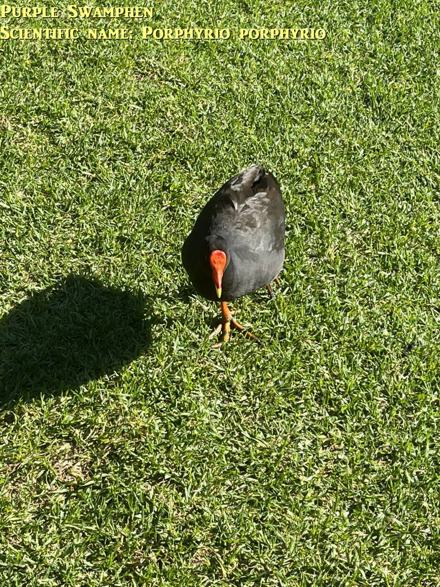
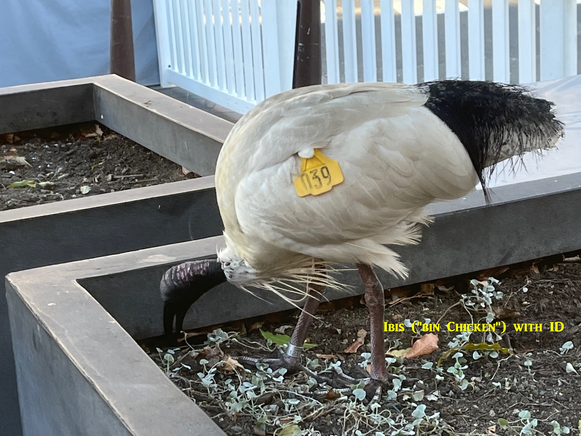
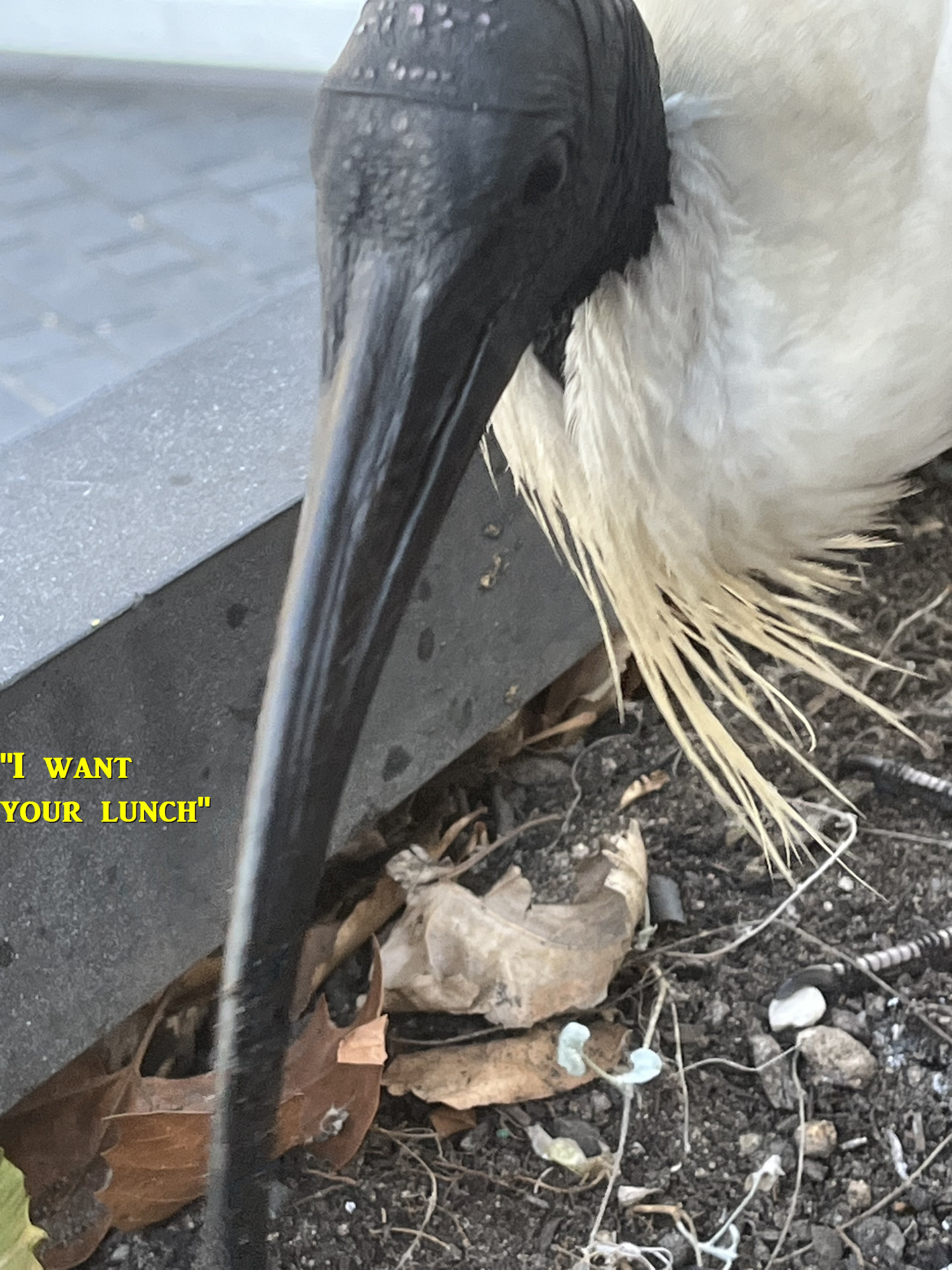
Then into the Botanic Gardens and I showed the others a colony of native stingless bees; they are very tiny so very hard to see. Then meandered around the Gardens until coming to the Pond where we saw several large fish (possibly mullet). As well as the ubiquitous Ibis (“bin chickens”) there were several native Purple Swamphens (Porphyrio porphyrio), which I initially mistook for the very similar Eurasian Coot. One actually approached us looking for food, probably used to getting handouts from tourists. Alas poor bird, none from us! Coots have a white shield on their head, whereas Purple Swamphens have a red shield and are slightly larger birds. Although native to Australia, they have managed to colonise the Bismarck Archipelago to the north, and New Zealand.

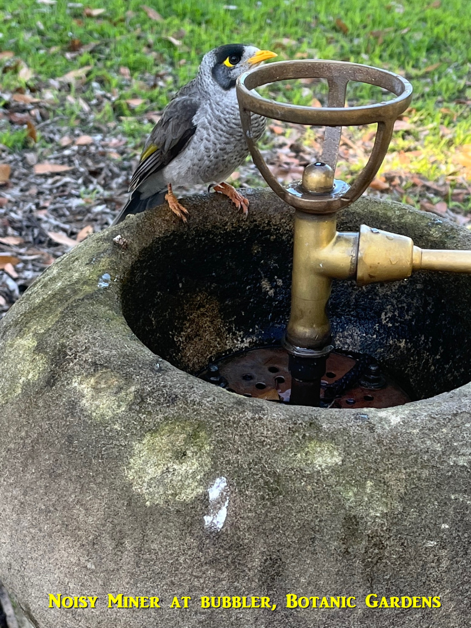
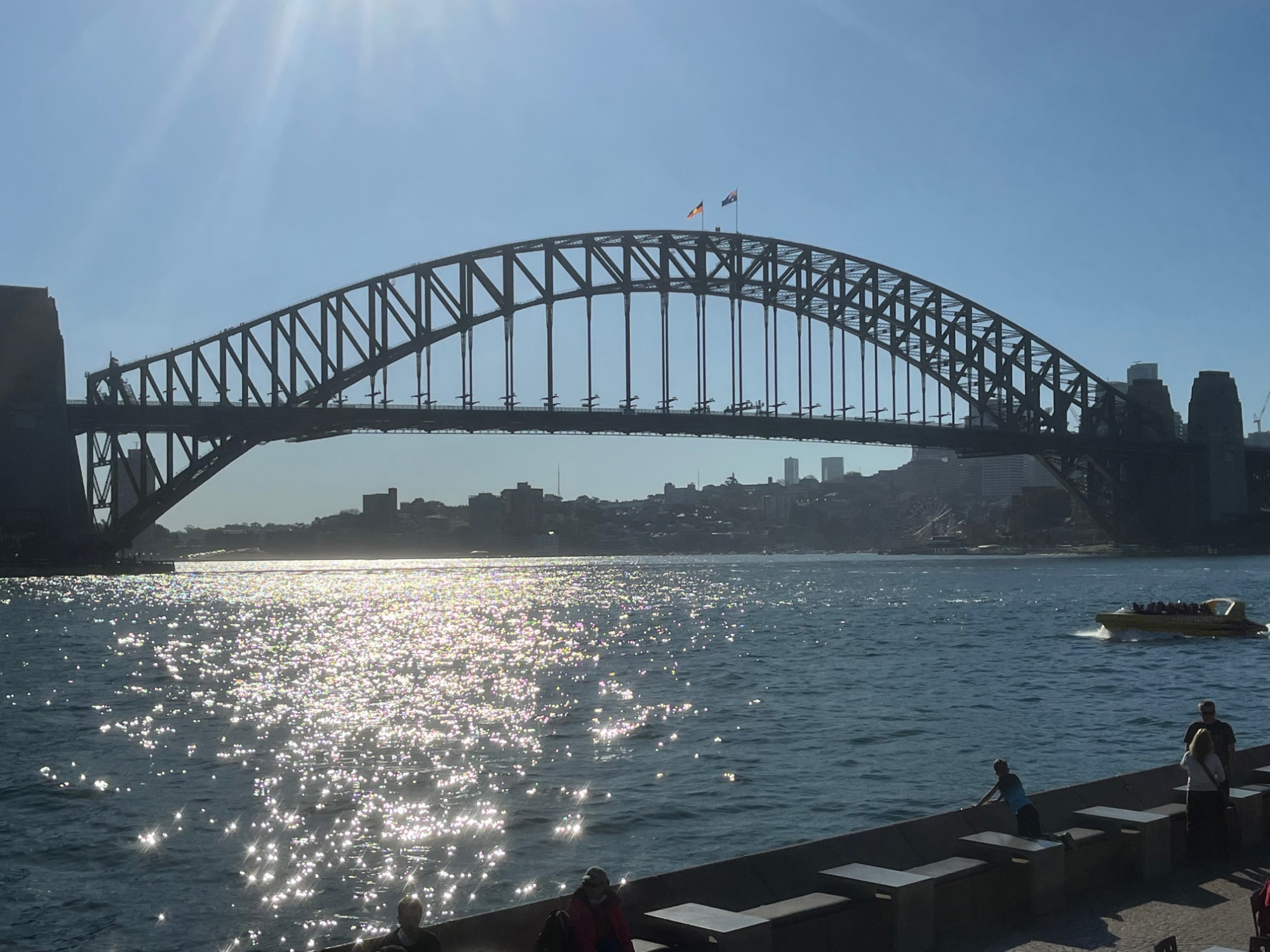
We then looked for a bubbler (U.S. English: faucet, water fountain) to get a drink, and a Gardens enplyee directed us to the Riose Garden above the Pond. We had a drink and so also did a little native Noisy Miner (Manorina melanocephala) which took advantage of the running water (see photo; this bird is not to be confused with the “Common Myna”, an introduced pest https://australian.museum/learn/animals/birds/common-myna/ ). Then around the edge of the Conservatorium of Music (a branch of Sydney University and also has a high school). Then down to the shore of Farm Cove, which we followed round to the Opera House. We went down to the wharf at “Man O’ War Steps” and explained to Alper and Qi how the tides worked, and as it is a pontoon wharf, could show them the marks made on its pylons as the wahrf rose and fell with the tide. I also showed them how to find the tide timetables on the website ( Tide Predictions for Australia, South Pacific and Antarctica (bom.gov.au) ), and then choose your location on the map. The tide variations have often been a source of confusion for some members coming on bushwalks to locations affected by tides, like Figure 8 Pool in the Royal National Park, with some not understanding why it’s not possible to stay there for many hours.
From the Opera House we went up the nearby Tarpeian Stairs to skirt the edge of the Botanic Gardens, with our view of the Harbour unfortunately blocked by the residential buildings at Circular Quay East known derisively as “The Toaster”. There’s no doubt that most Sydneysiders would be happy to see them gone. From Wikipedia:https://en.wikipedia.org/wiki/Bennelong_Apartments
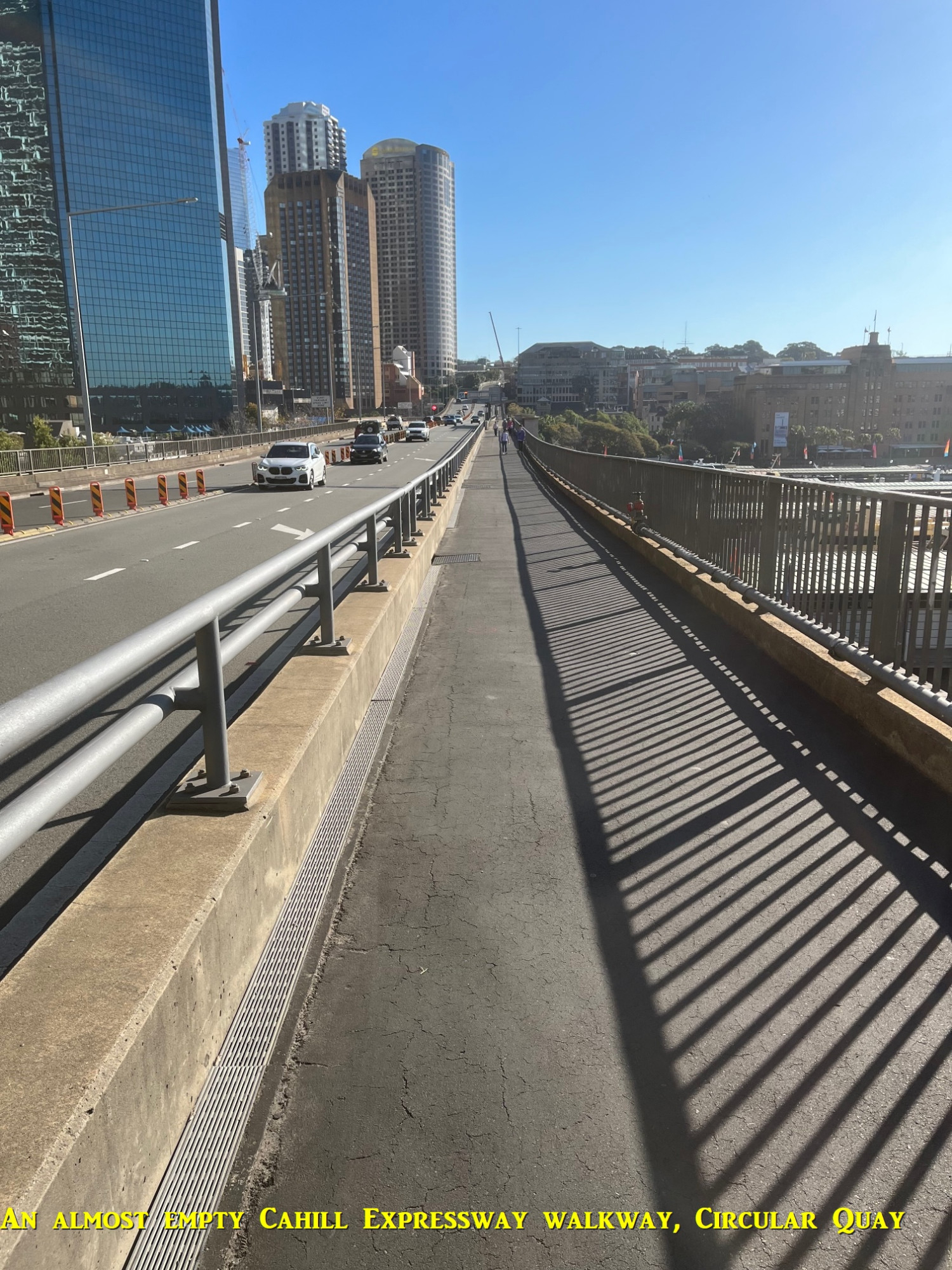
Still, the Tarpeian Way took us to the start of the walkway along the Cahill Expressway where it crosses Circular Quay. I thought it worth a go as it avoids the crowds of tourists at The Quay, provides a view over the ferry waharves, and ends up at our final destination for the day, The Rocks. As you can see from the photos, this walkway was almost empty. Along the way there are several interpretive signs about the development of the Quay. I suspect that the NSW Roads and Traffic Authority (RTA) would like more people to use it, for reasons I will mention shortly. There are new lifts installed in recent years to make easier access to the walkway from The Quay.
I can’t blame people for not using this walkway much because it narrows at The Rocks end, and traffic noise there is quite noticeable.We did however end up in some interesting little lanes in The Rocks which pass by houses from the late 19th Century which could easily be missed if you stick to the main tourist routes there. We came out opposite the start of the walkway across the Harbour Bridge, and I told the others that there was something interesting there from Sydney’s fairly recent history to see. So up the winding stairway we went (good practice for Blue Mountains walks!) and we arrived at the start of the walkway proper.
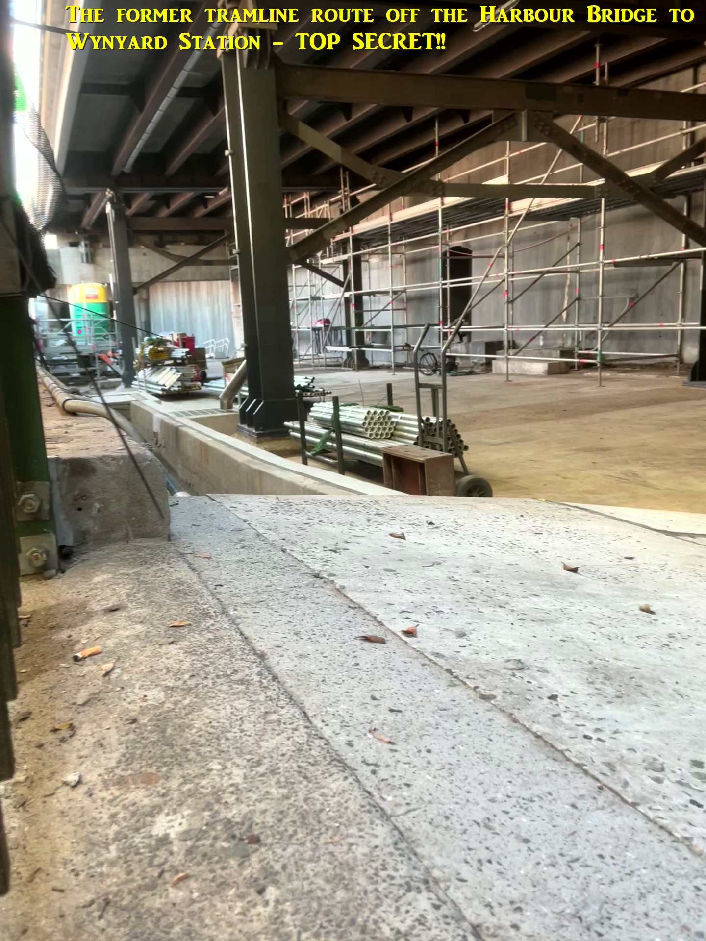
Just beside the walkway there is an area which has a heavy iron grille fence between it and the pathway, and in addition to that, heavy shadecloth lining the inside of that fence to make it difficult to see inside. So what is in there that the abovementioned RTA would obviously not want you to see? All there is inside are spare pipes and rails for Bridge maintenance. I was able to put my phone camera in a small gap under the shadecloth and got a photo of what’s inside. Well, here’s the reason for the secrecy: a photo taken in the 1950s showing what was originally there: https://www.pinterest.co.uk/pin/242631498644647380/ Yes, it was the right-of-way of the former tramline from the North Shore which crossed the Harbour Bridge on its own tracks, and at this location dived beneath Sydney streets to reach Wynyard Station. The line was closed in 1958. There’s no interpretive signs to indicate that this is an important part of Sydney’s transport history, in fact no information at all.
So, why the secrecy? Recall above that I mentioned that the RTA would like more people to use the Cahill Expressway walkway. The reason is that there has been much talk lately of pulling down the Cahill Expressway here (the Harbour Tunnel has made it redundant) as it blocks the vista of Circular Quay from the City. Not only that, but there is talk of reverting the Cahill Expressway on the Harbour Bridge itself back to trains or trams to service the North Shore. The pro-car cardiganmen bureaucrats of the RTA would sooner agree to having all their teeth pulled out than give up The Precious Cahill Expressway, OR have trams return on a large scale! And they definitely don’t want people reminded that trams actually ran there. We met a couple of tourists from England there who were amazed that trams once crossed the Harbour Bridge, and more amazed that they had been removed and replaced by a road.
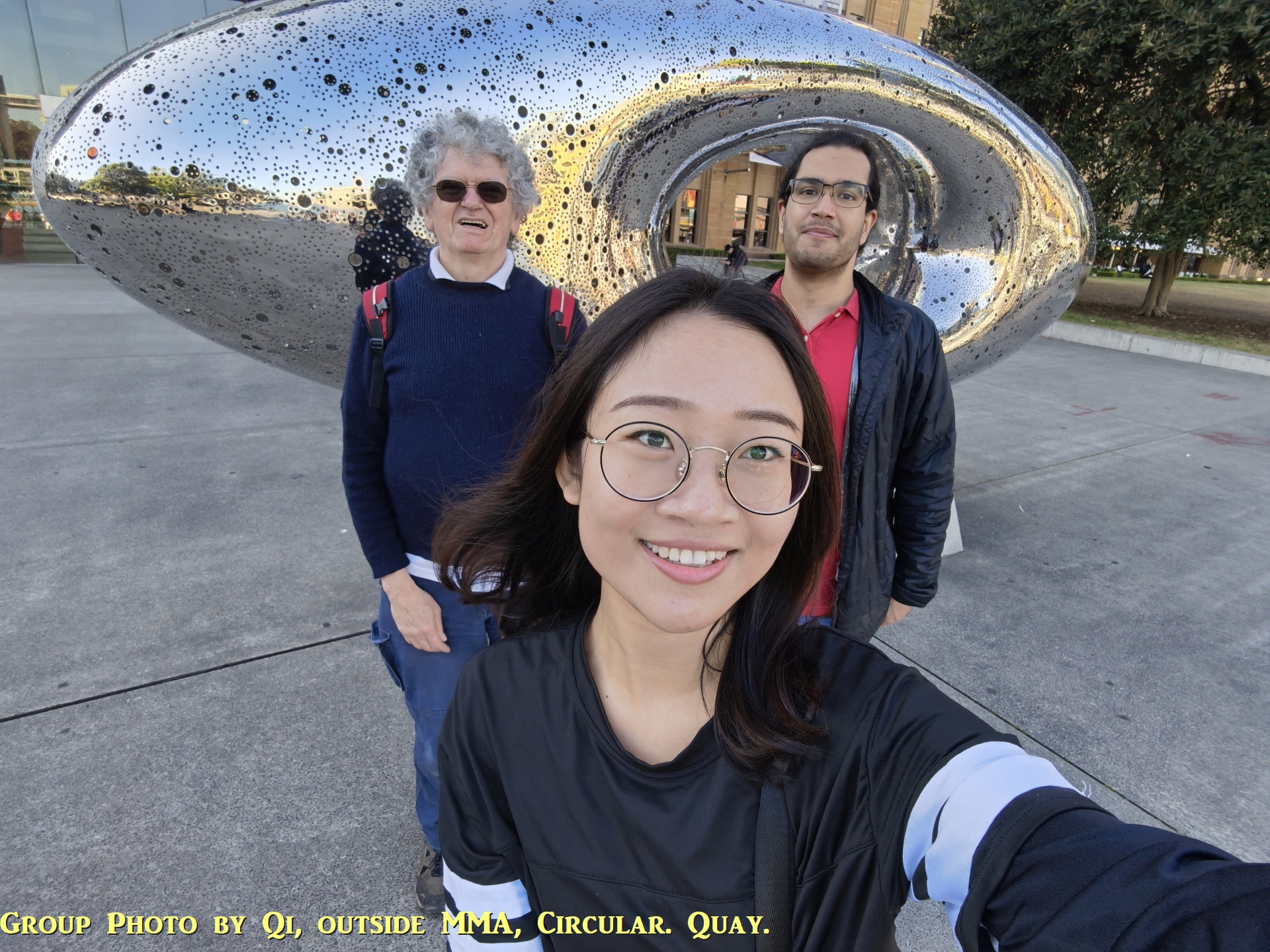
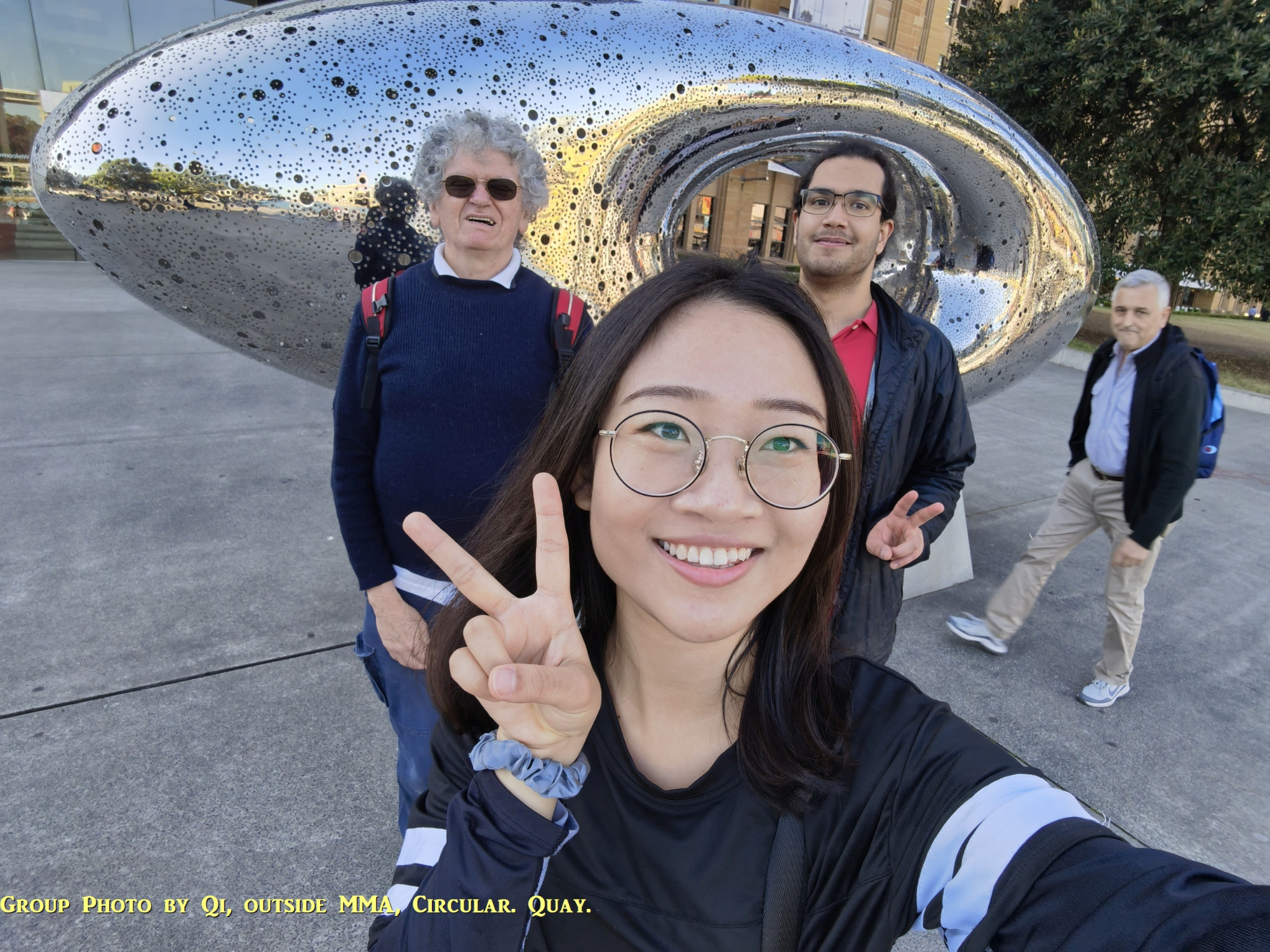
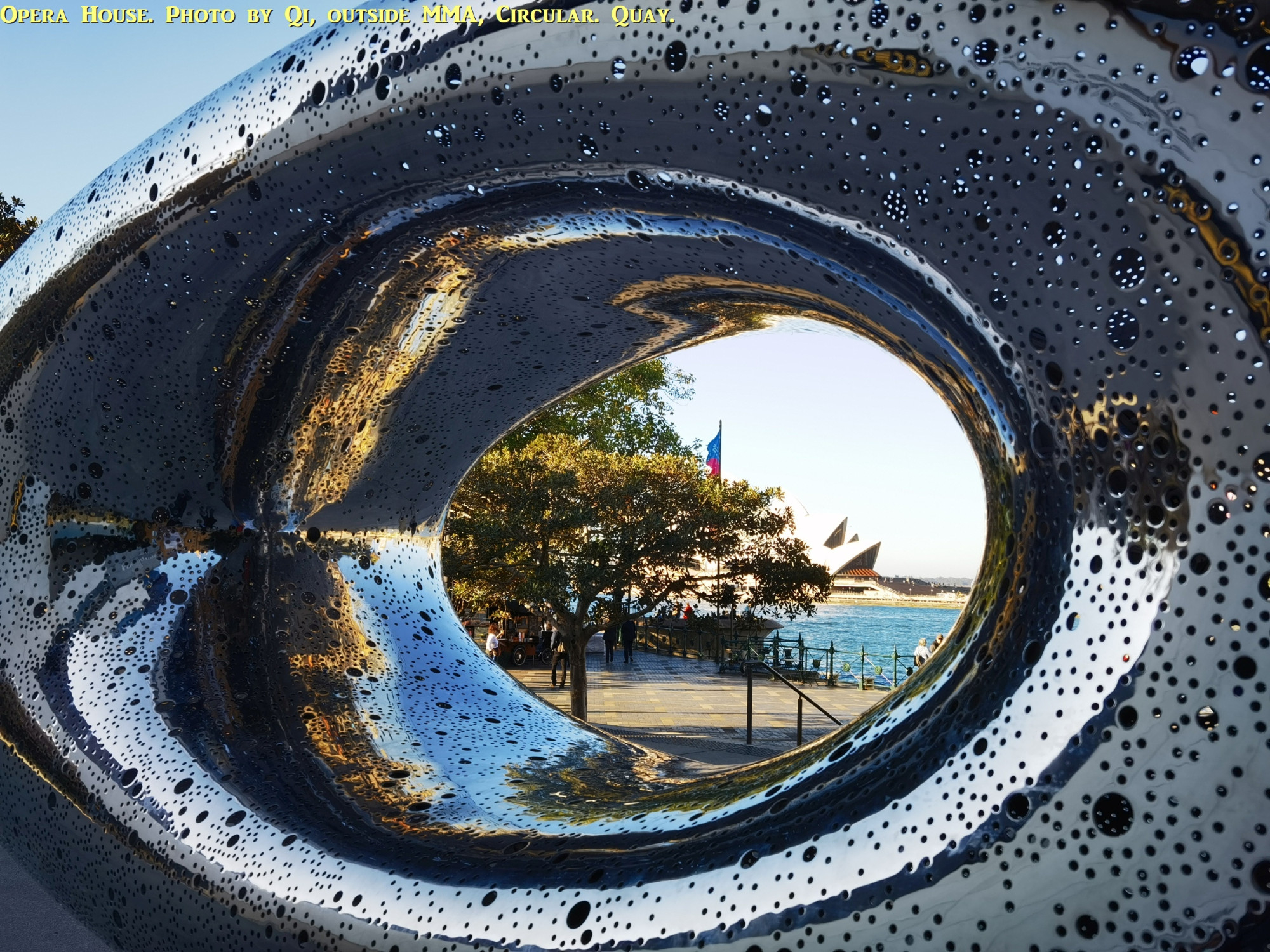
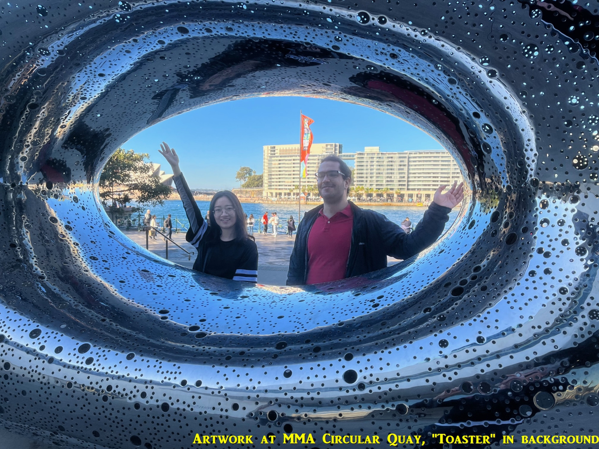
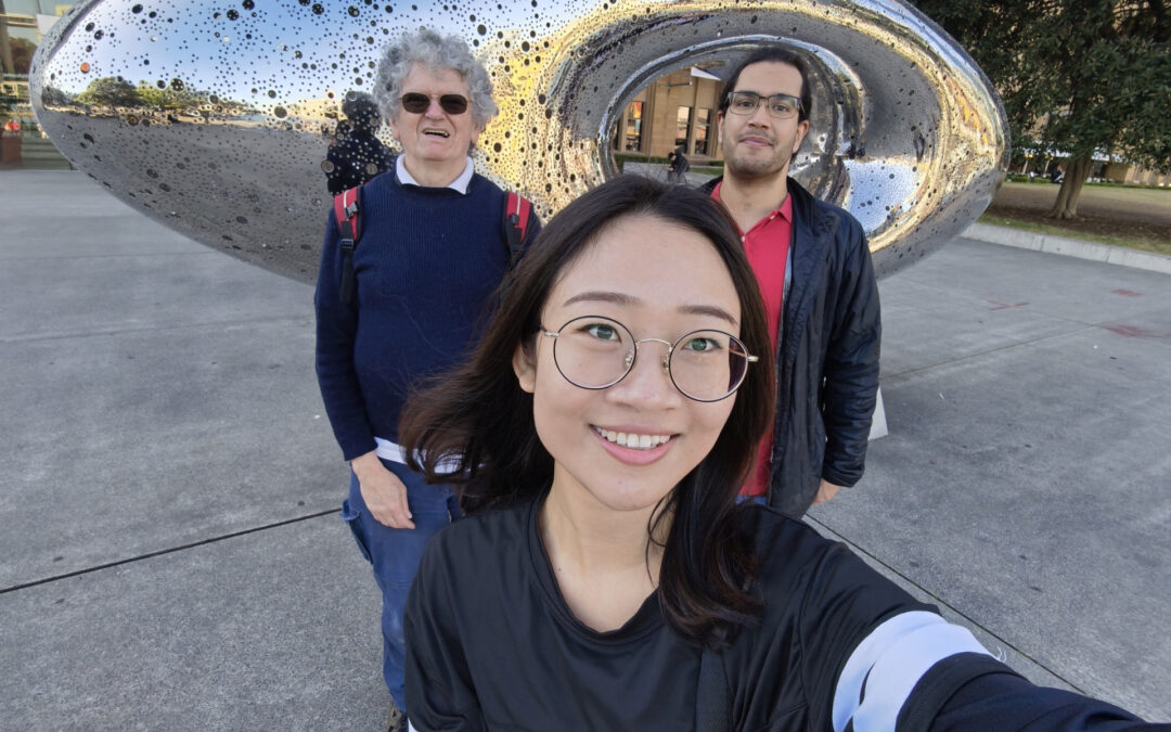
Anyway, enough of stories of the massive blunders of the NSW government of the 1950s. After leaving this site, we returned down to The Rocks at Argyle Cutting (which might be a good abseil site for some people) and down to the west side of Circular Quay. We posed at an artwork outside the Museum of Modern Art, and then finished the walk by going to Circular Quay Station for trains home. The whole walk took two and a half hours and covered a few out of the way places that people on a tour might not encounter. Everyone appeared to enjoy the walk.
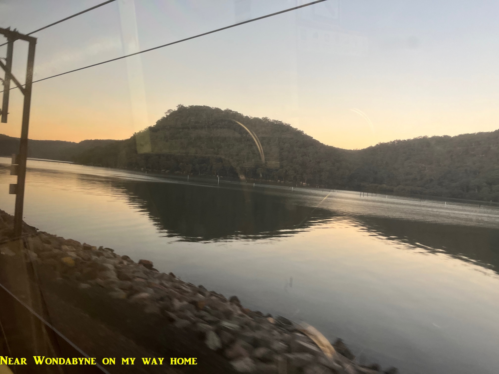
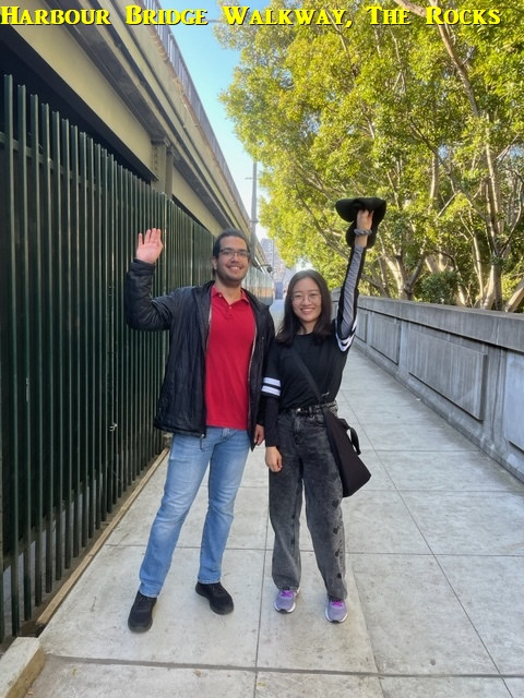
My photos are below, with three near end by Qi (thank you, Qi). The last pic was taken by me on my train home. Also, between Cowan and Brooklyn I saw a wallaby beside the train line (couldn’t get a pic of it unfortunately). Also, I had my hair cut the next day, so I won’t look as woolly now! 🥹
Bruce Stafford.