Date: 28/5/2023
Trip leader: Bruce Stafford
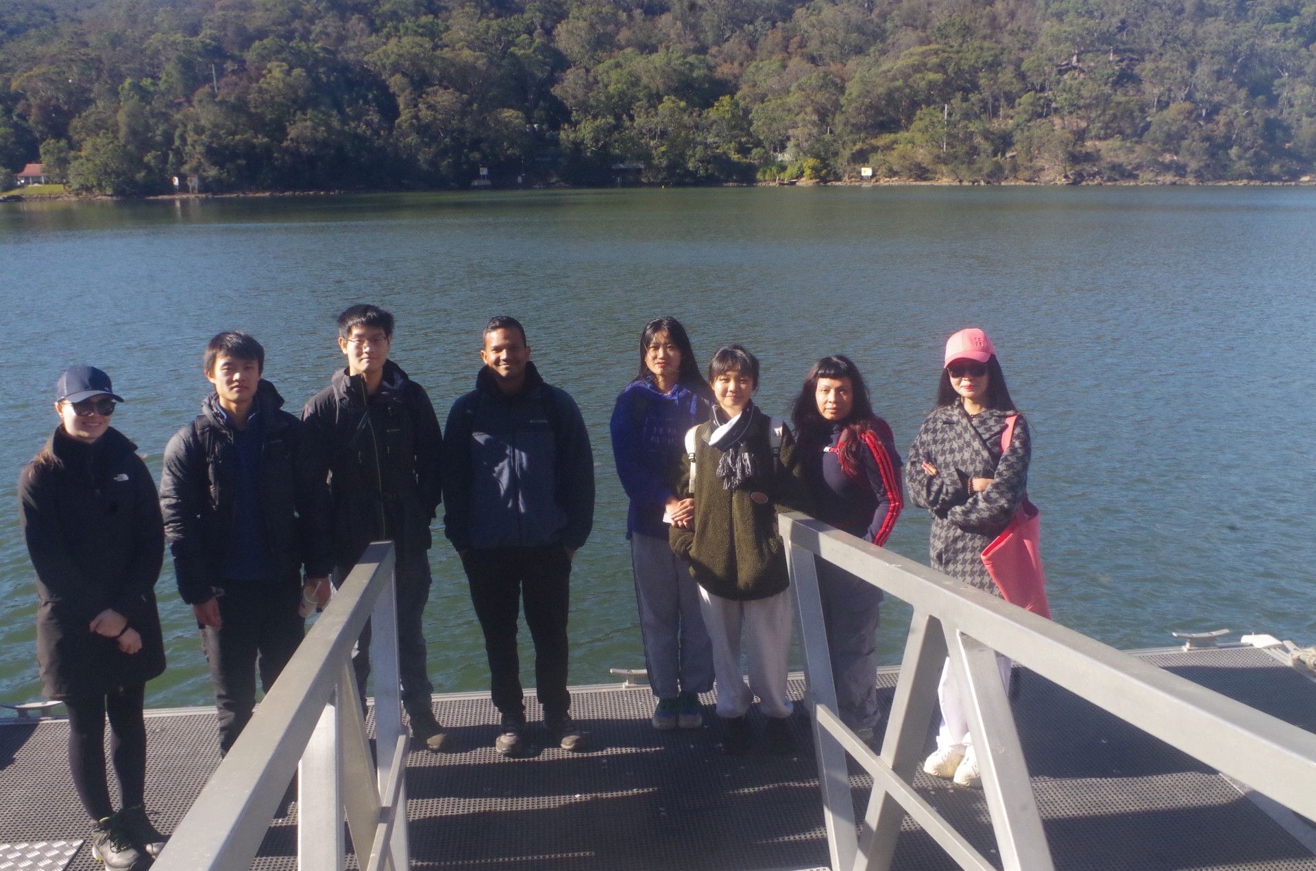
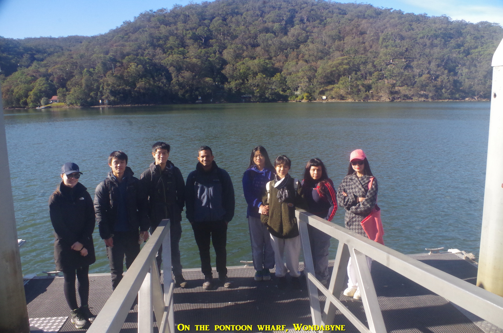
Party: Boren, Chunwei, Devin, Maritza, Trevor, Verity, Yiming, Yuan
Wondabyne to Mt Wondabyne and Woy Woy, Sunday 28th May 2023.
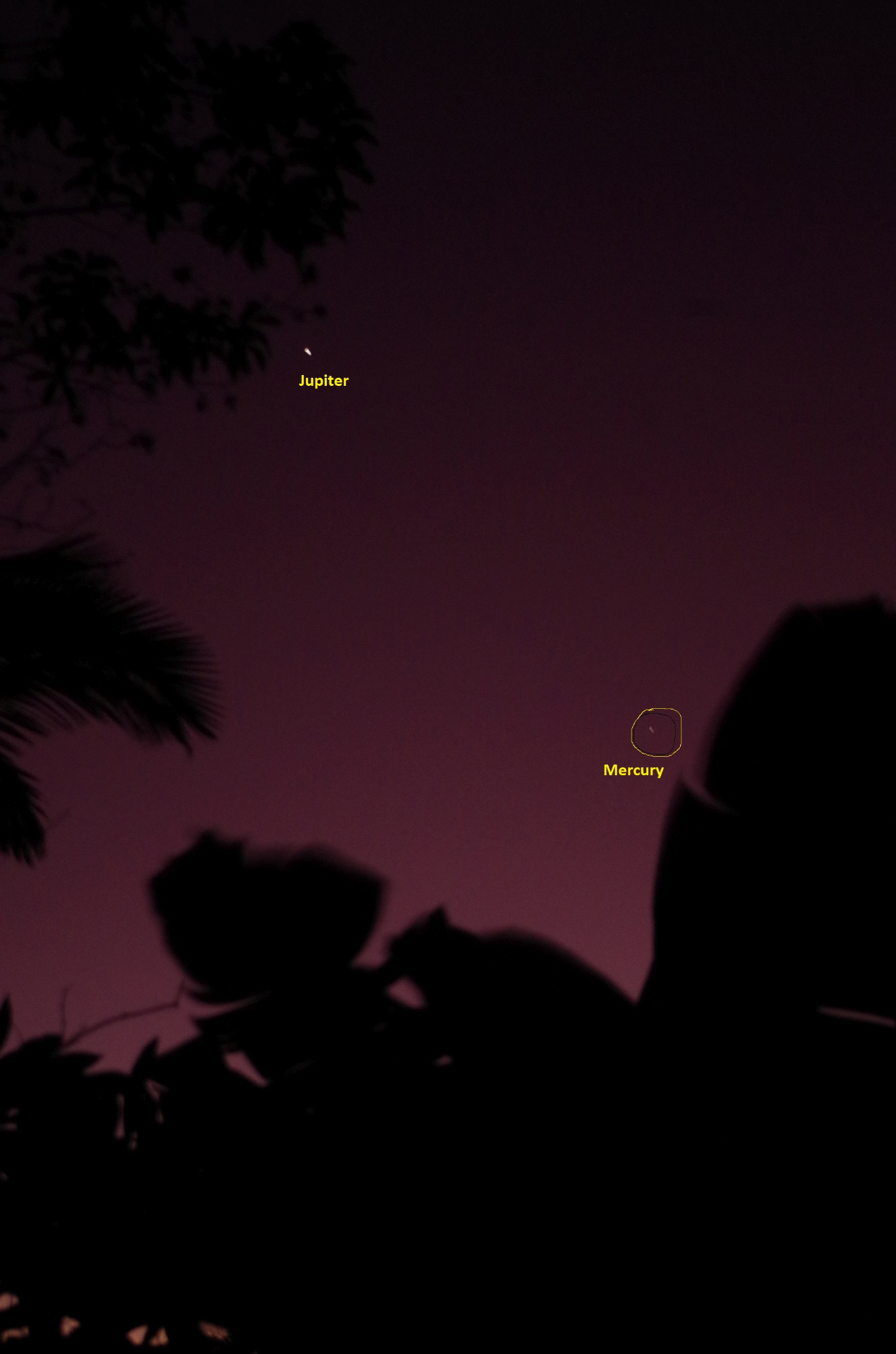
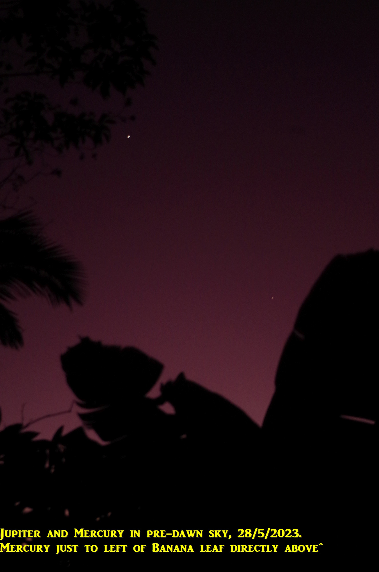
I got up early this morning and I took the opportunity to spot the planets Jupiter and Mercury in the predawn eastern sky, as per the first 2 photos. Before I get into the trip report, I will mention to any students who are from the Northern Hemisphere for this Semester only, to get up early and have a look, as it might be your only chance in your life time to see Mercury. It is very difficult or impossible to see in the more populated areas of the Northern Hemisphere deu to your long twilights and the shallow angle of the Ecliptic (planet’s path). The Ancient Egyptian and Indian astronomers knew about it, being closer to the Equator, but Copernicus, who lived in today’s Poland, did not. So get up around 5.45am and look to the east; it will be seen in much the same position as in my photos, but only until June 12th. After that, you will have to wait until late July and see in in the western sky after sunset with Venus.
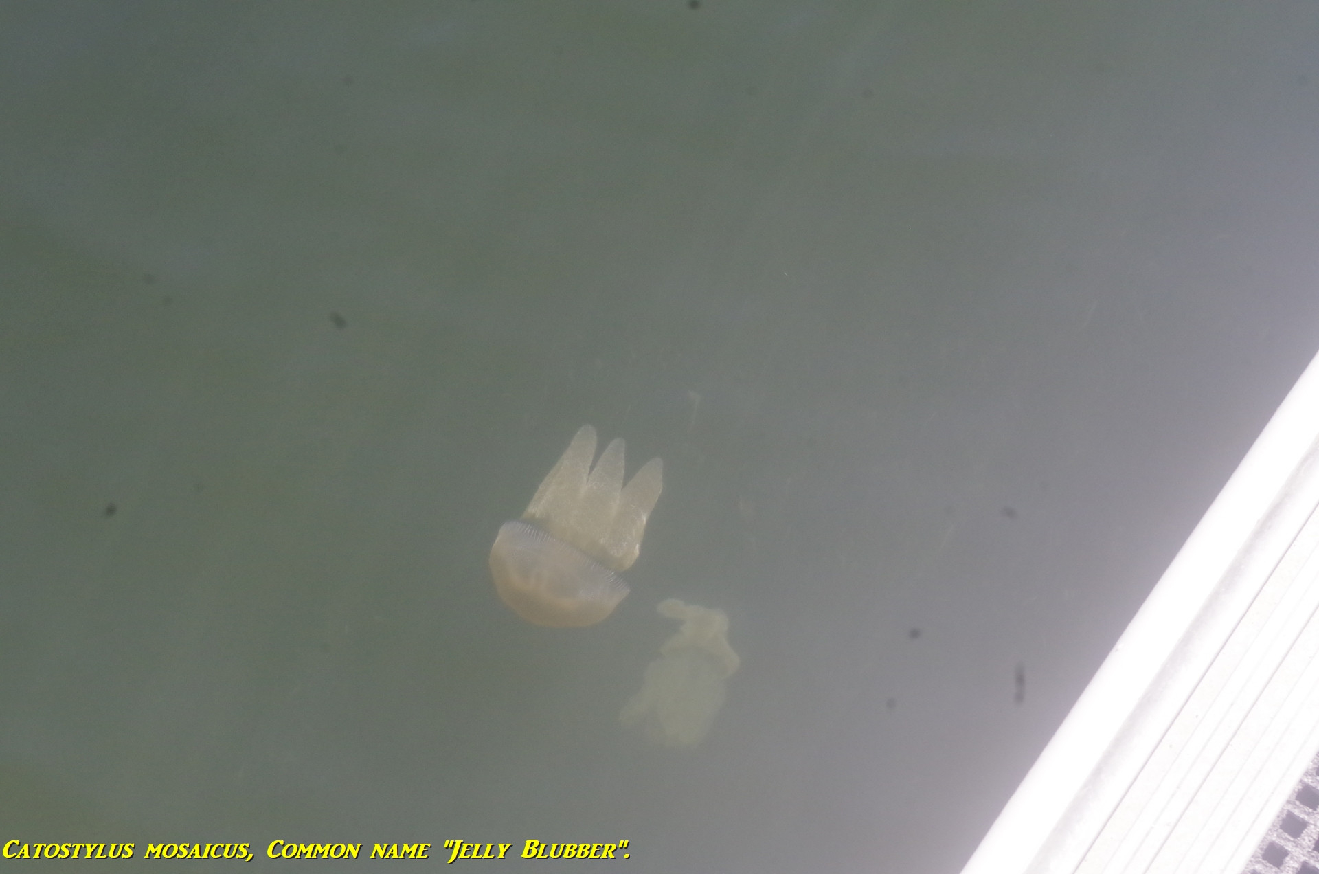
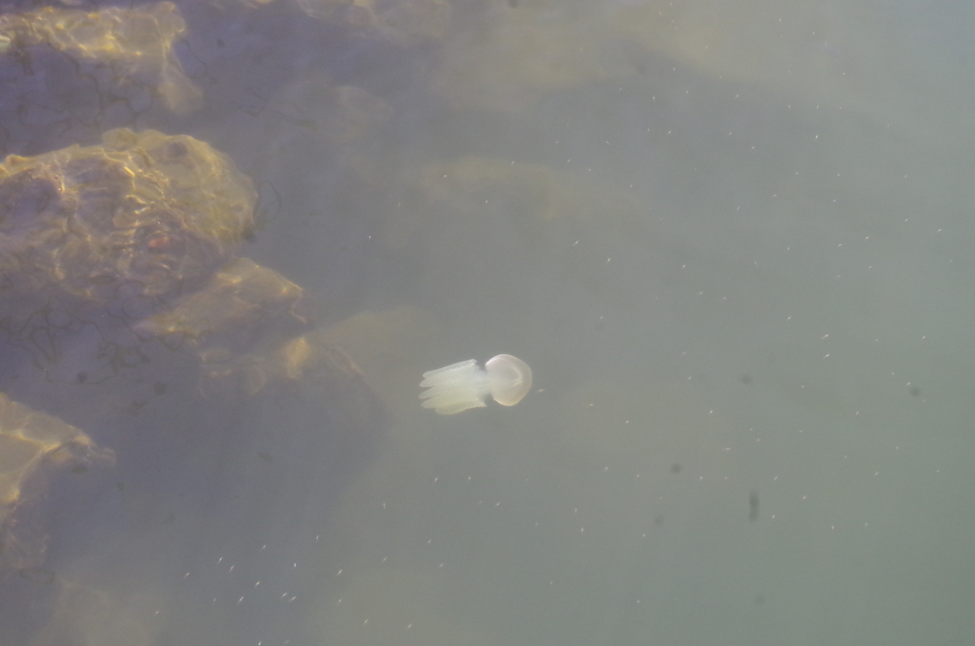
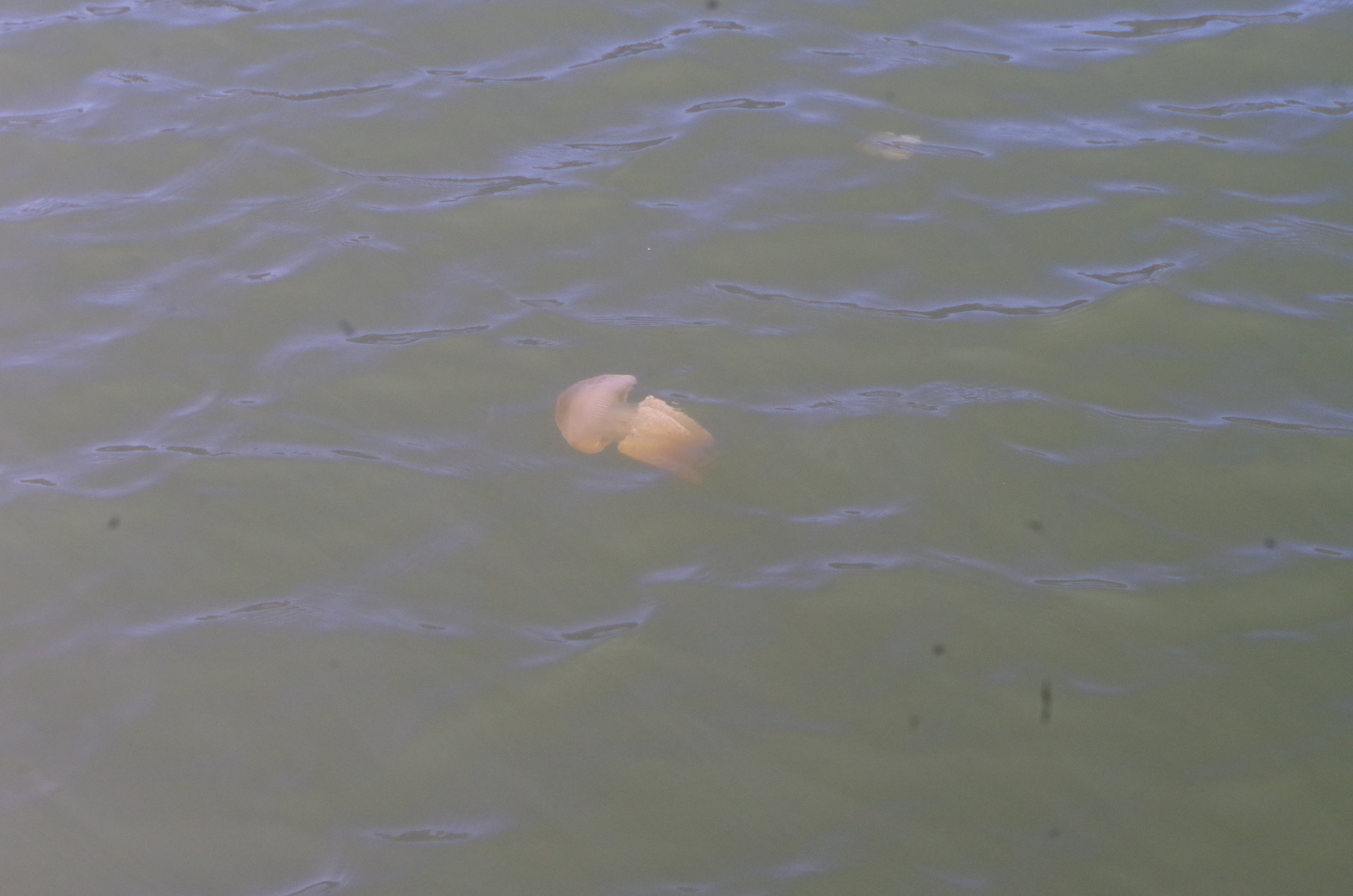
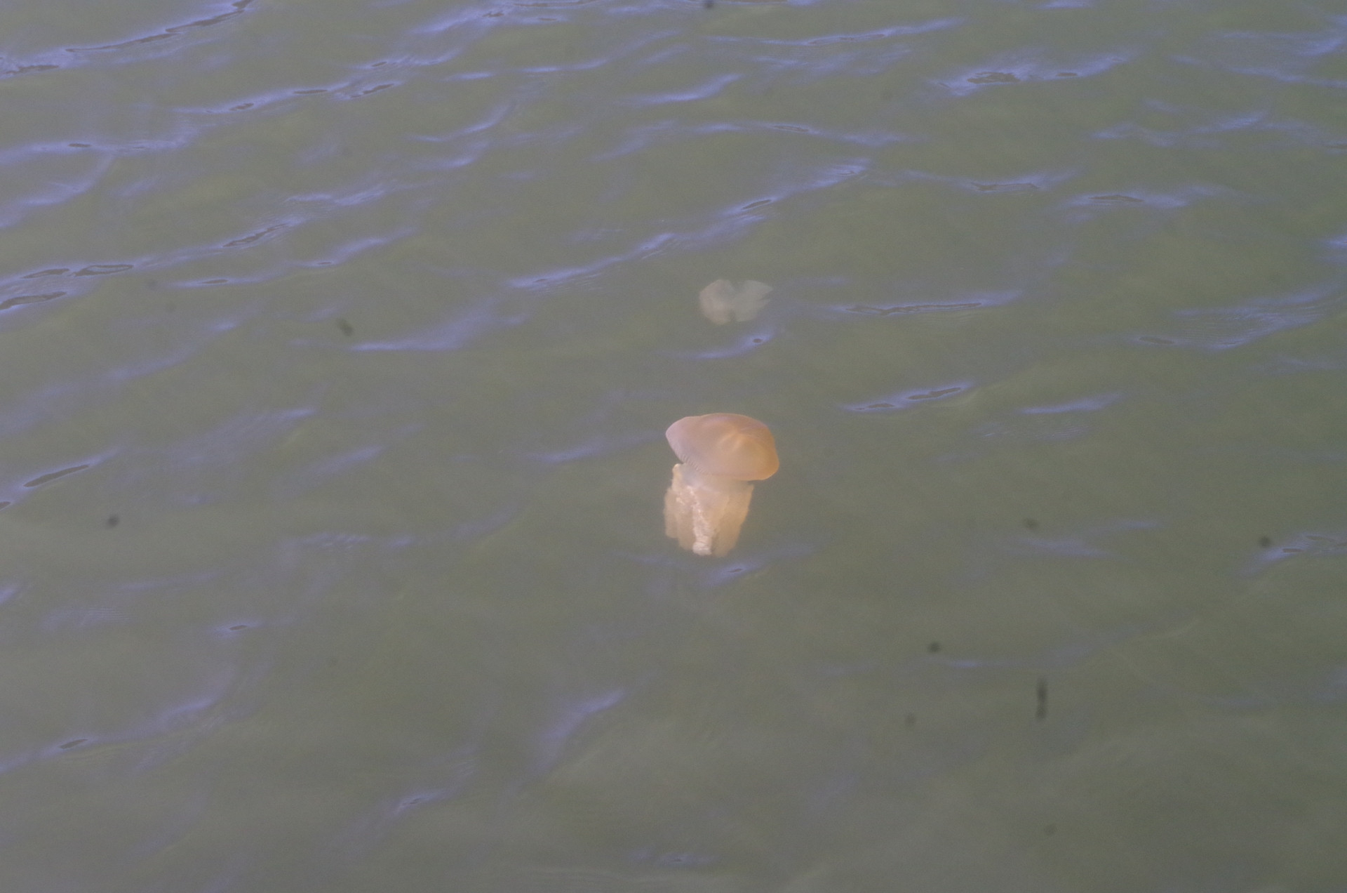
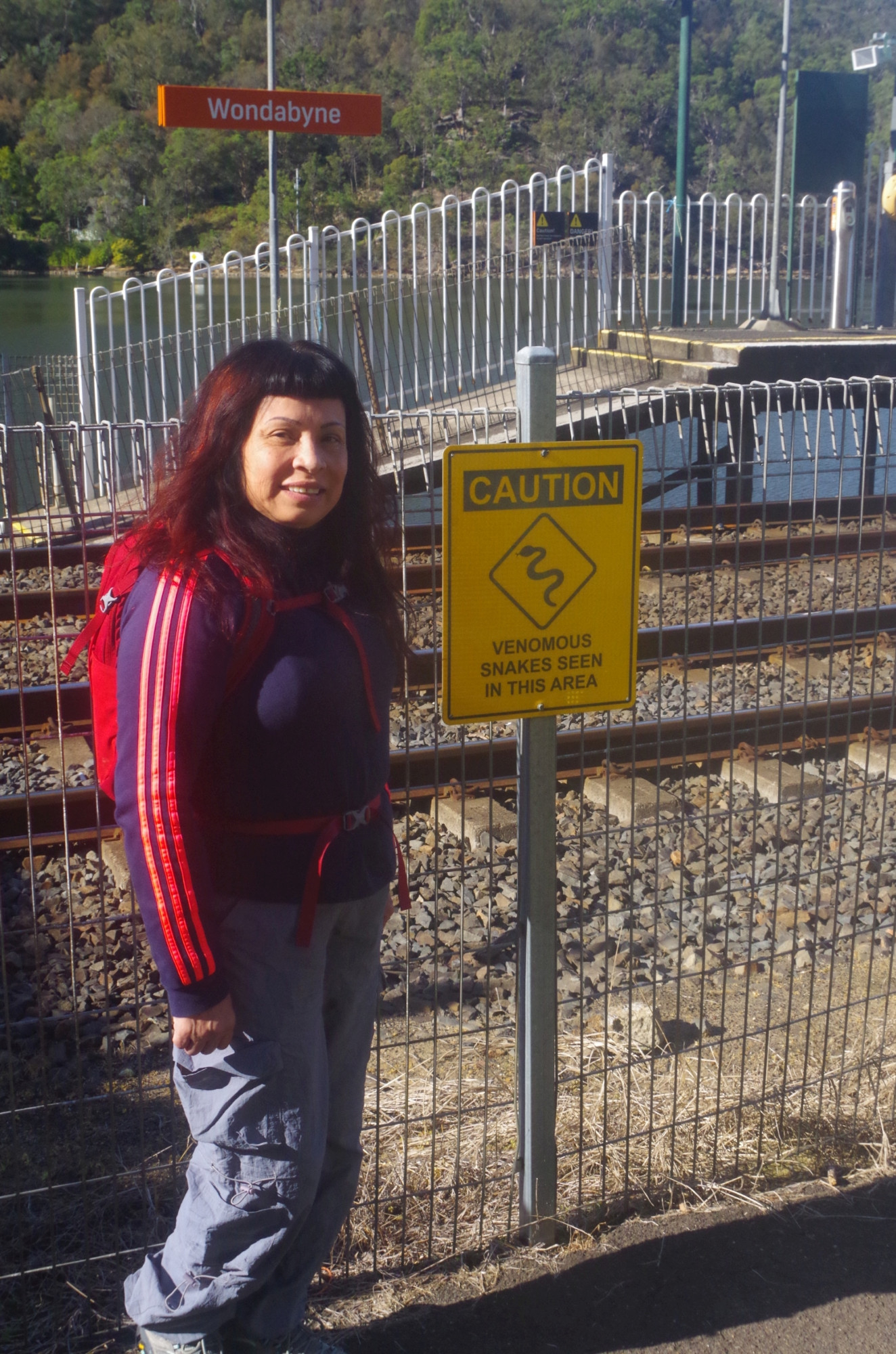
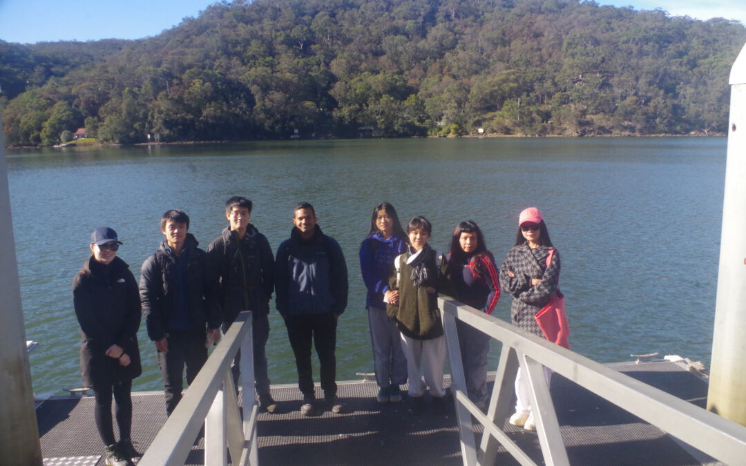
Now the trip report. Nine of us all met up at Wondabyne Station, with a disappointing FOUR “no shows” (and Keyan missing the train thanks to the increasingly unreliable bus service around Camperdown post privatisation). Then we went down to the pontoon wharf while I took a group photo, and we noticed the large numbers of “Jelly Blubber” Jellyfish in the water there (see photos). These jellyfish do have a mild sting, and it would feel like a tingling sensation if touched, but are not dangerous..
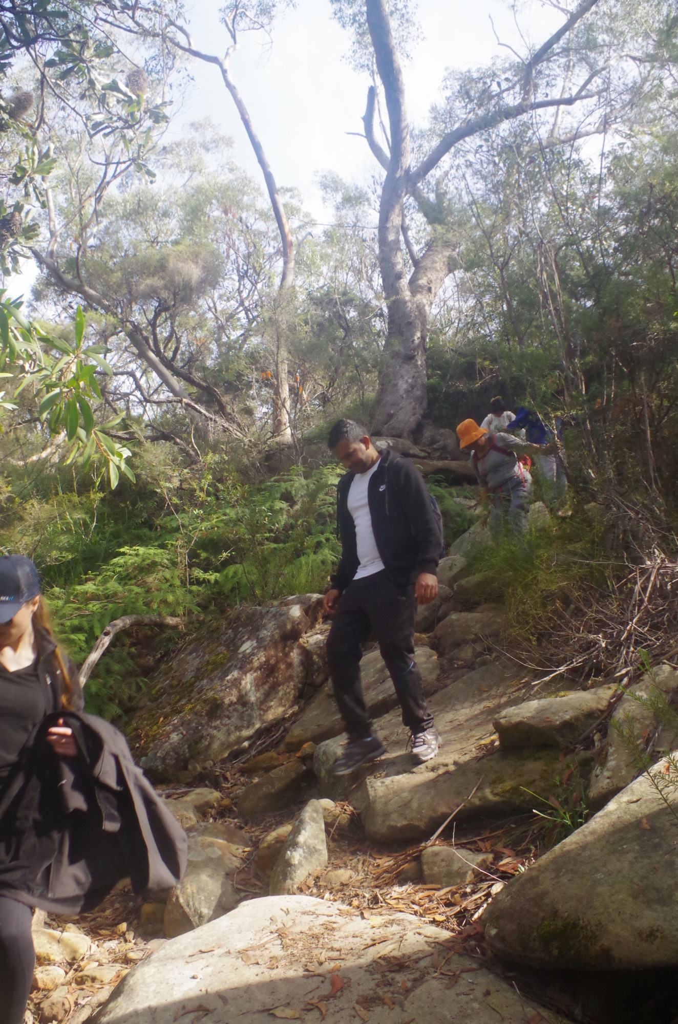
After watching the Jellyfish, we commenced the steep climb to the top of the ridge above Wondabyne, to where the fire trail starts. From there on the trail rises less steeply until reaching the junction with the “Hawkesbury Track’ which eventually leads to Kariong Falls via Myron Brook. This track is much rougher than either the track up from the railway or the fire trail, and crosses over several large rock platforms along the way. It starts dropping down rather steeply to arrive at Myron Brook. This section is probably the roughest section of the whole walk (except for the very short climb up to Mt Wondabyne), and why “Wildwalks” site rates it as a “hard track”. It is not to be taken lightly, as if you read my last trip report here of 18/9/22, an experienced walker in another group (not SUBW) broke her leg on the drop down to Myron Brook.
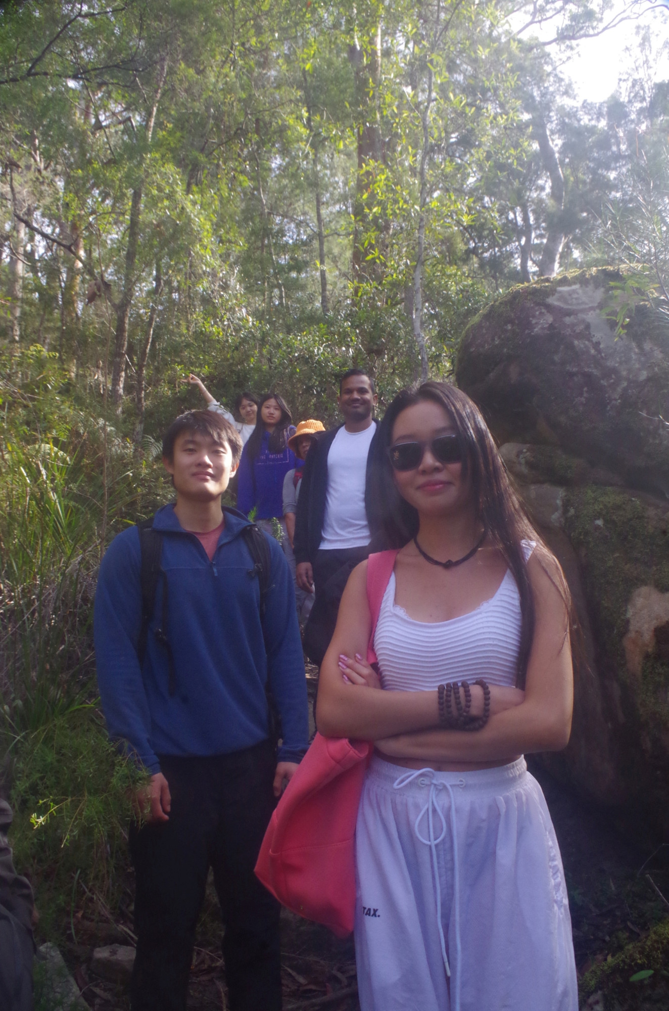
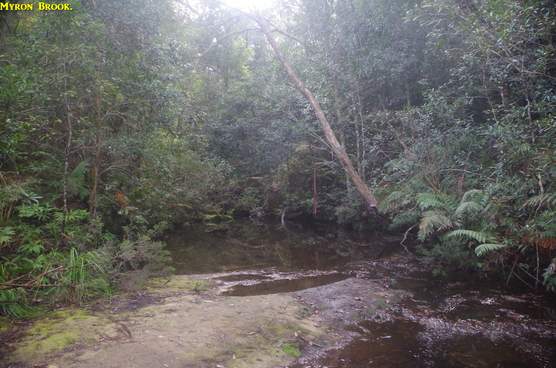
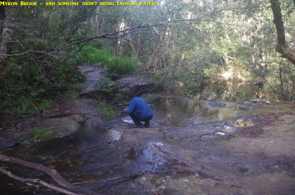
At Myron Brook, one of the group wanted to get some water as he only had less than 500ml in his bottle, and we were only a quarter of the way into this 6 hour walk! Here he is in the photo; he said that the water actually tasted OK. (The catchment of Myron Brook does not appear to include any buildings or farmland, unlike Kariong Falls, the next waterhole).
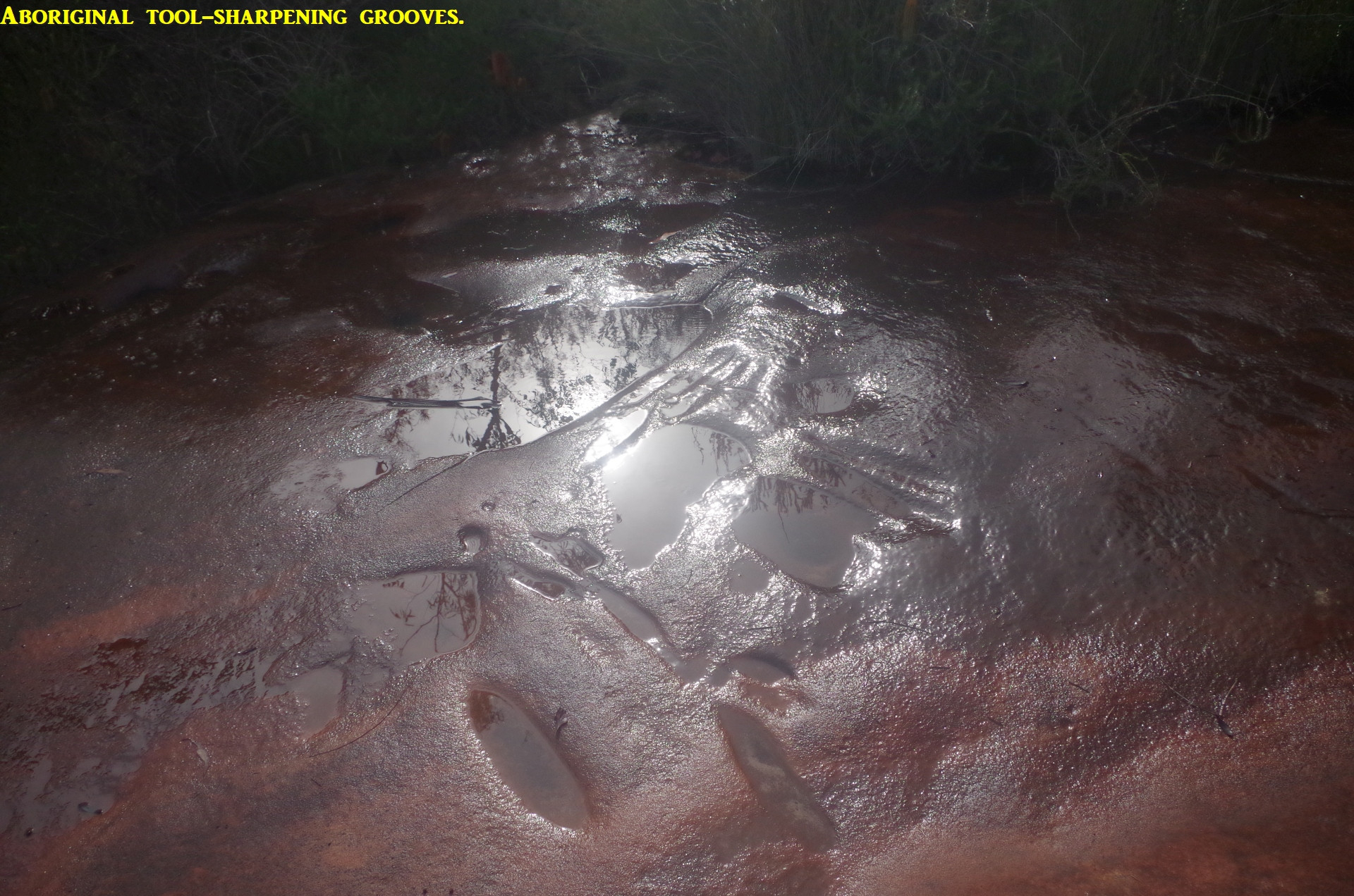
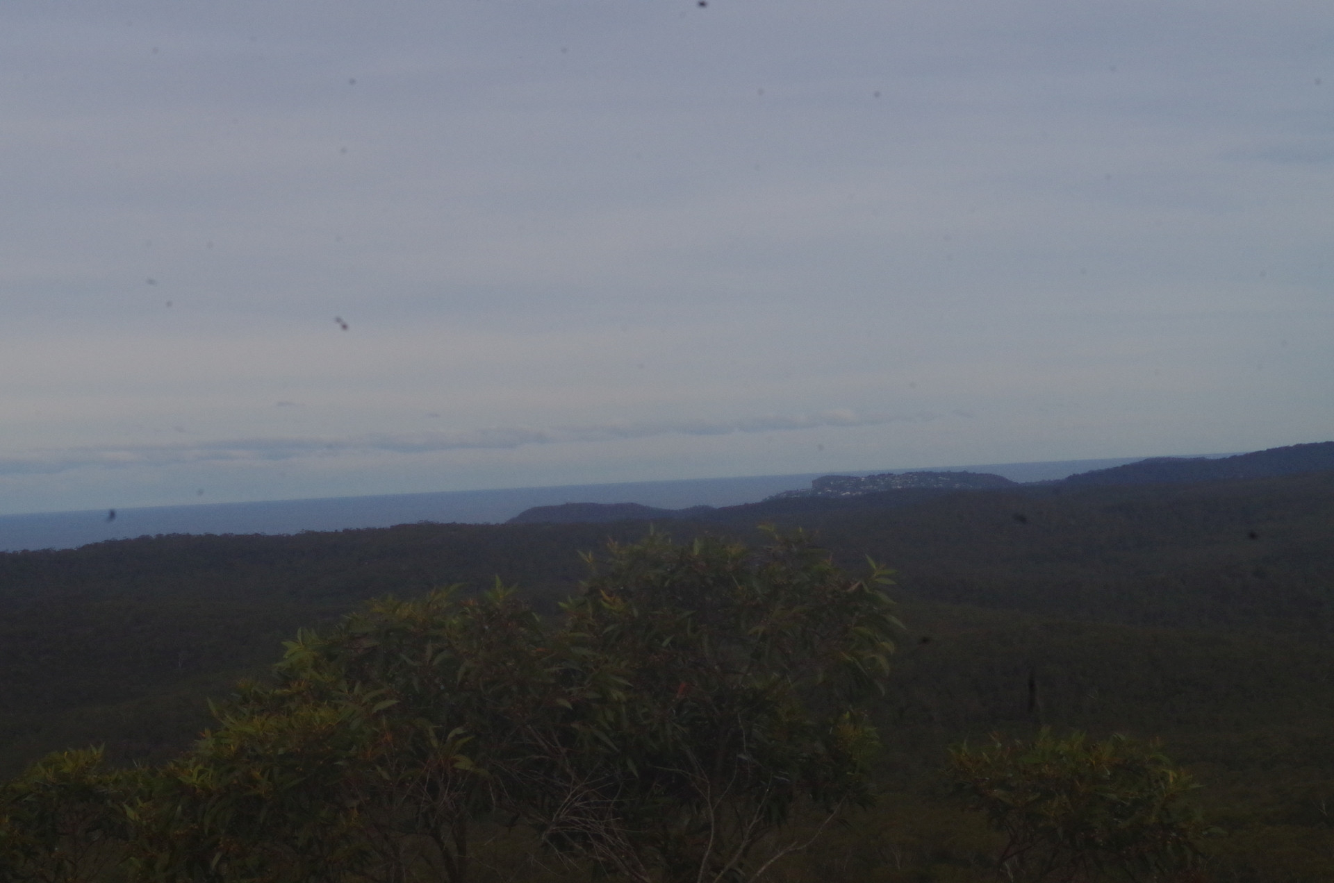
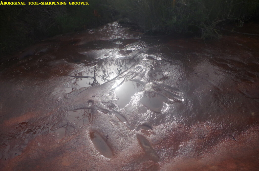
The track out of Myron Brook climbs a rather muddy bank, and then levels out to drop down to Kariong Falls. Here, the NPWS has put up a barrier around the pool and the Falls, as there is at present a risk of rock falls, so we did not stop here. Instead we continued on up the rough track until at 12 noon I found a broad rock shelf on which to have lunch, about 2/3rd of the way along the track. After a 20 minute refreshing break, we continued on until reaching the track’s junction with “Tommo’s Loop” fire trail. This trail continues along for about 2km through pleasant open woodland and heath to come to another junction with a track on the right going through the bush. It crosses a large rock platform with some watercourses crossing it, and where Aboriginal tool sharpening grooves can be seen if you have a keen eye. This is where I pointed out our destination, Mount Wondaybe, in the distance, which caused comments” It looks rather steep”. I predicted we would be there on the top in 45 minutes, which seemed ambitious to some, but it proved to be accurate.
The track continues through the bush, and this time much less muddy than on my walk here last year, despite some recent rain (and too cold for Tiger Snakes). The track crosses a little creek in which there are often tadpoles, but not this time (too late in the season). We came out at yet another fire trail which is also the railway access to Woy Woy Tunnel. We walked only 250 metres along this trail before reaching the Mt Wondabyne track. I mentioned to the group the difference between a “track” and a “trail”. A “track” is usually a single narrow path through the bush, whereas a “trail” is wide enough for vehicles to use if necessary. You “bushwalk” along tracks, and “hike” along trails and roads.
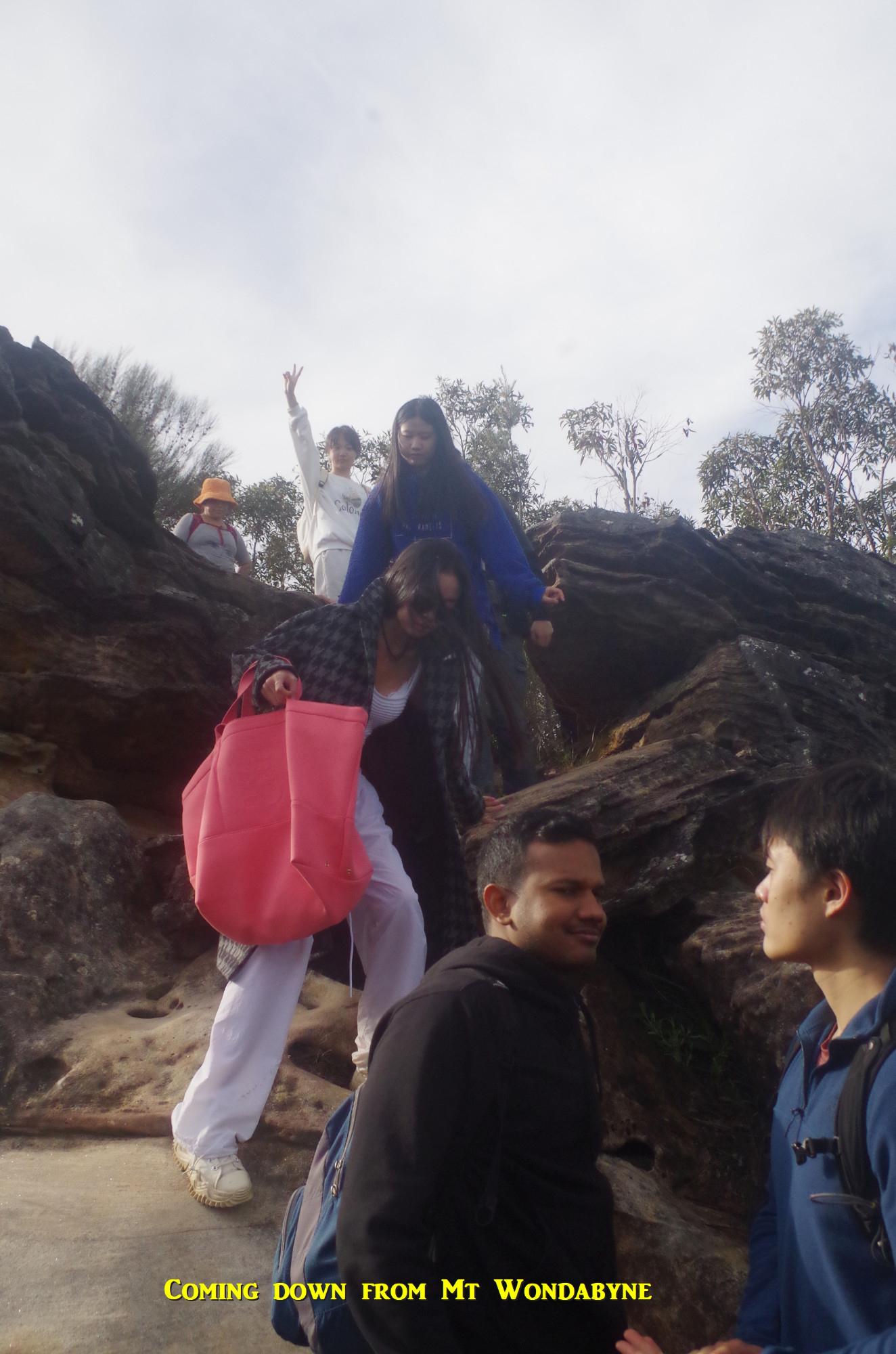
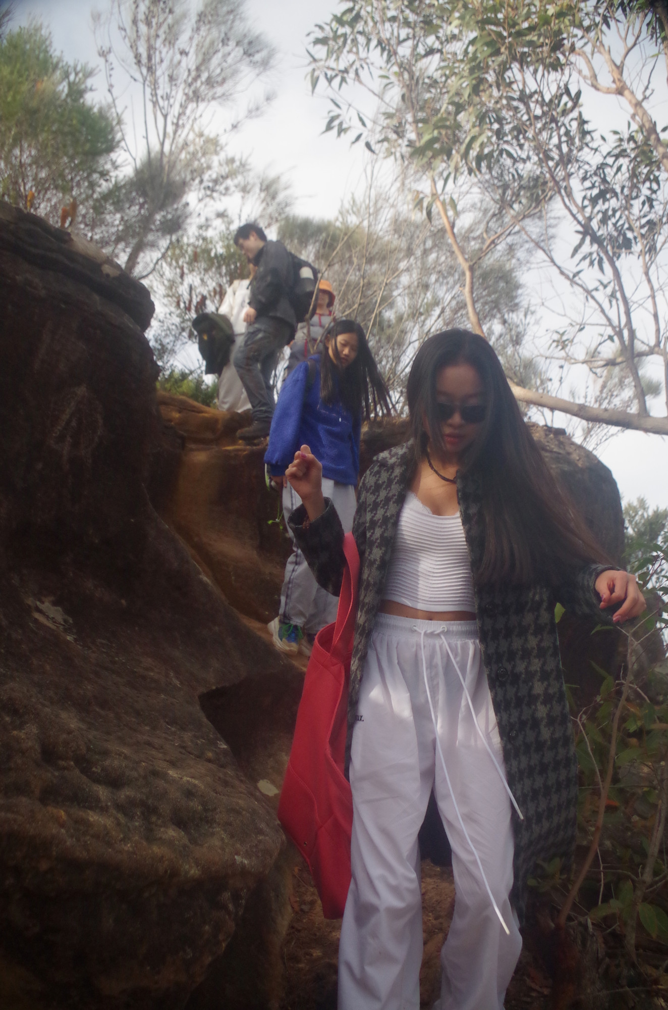
Another track branches off to the left heading for Mount Wondabyne. It is initially level but stony underfoot, then starts to rise more steeply as it nears Mount Wondabyne. In the past there has been a NPWS log book on a post at a large rock platform half way, but it’s been missing for over a year now – I wonder why. Anyway we had a brief water stop on the rock shelf and already a nice view west could be seen. We continued on until reaching the junction with the short (250 metres) track going to the summit of Mount Wondabyne. I advised the group not to stop at the first viewpoint they came to, as it’s not the best one, and it also has an ants nest! The short track is rather tricky to negotiate in a few places, including one spot where you need to climb using all four limbs (one reason why you should not be holding your mobile phone in your hand on bushwalks, as some still do).
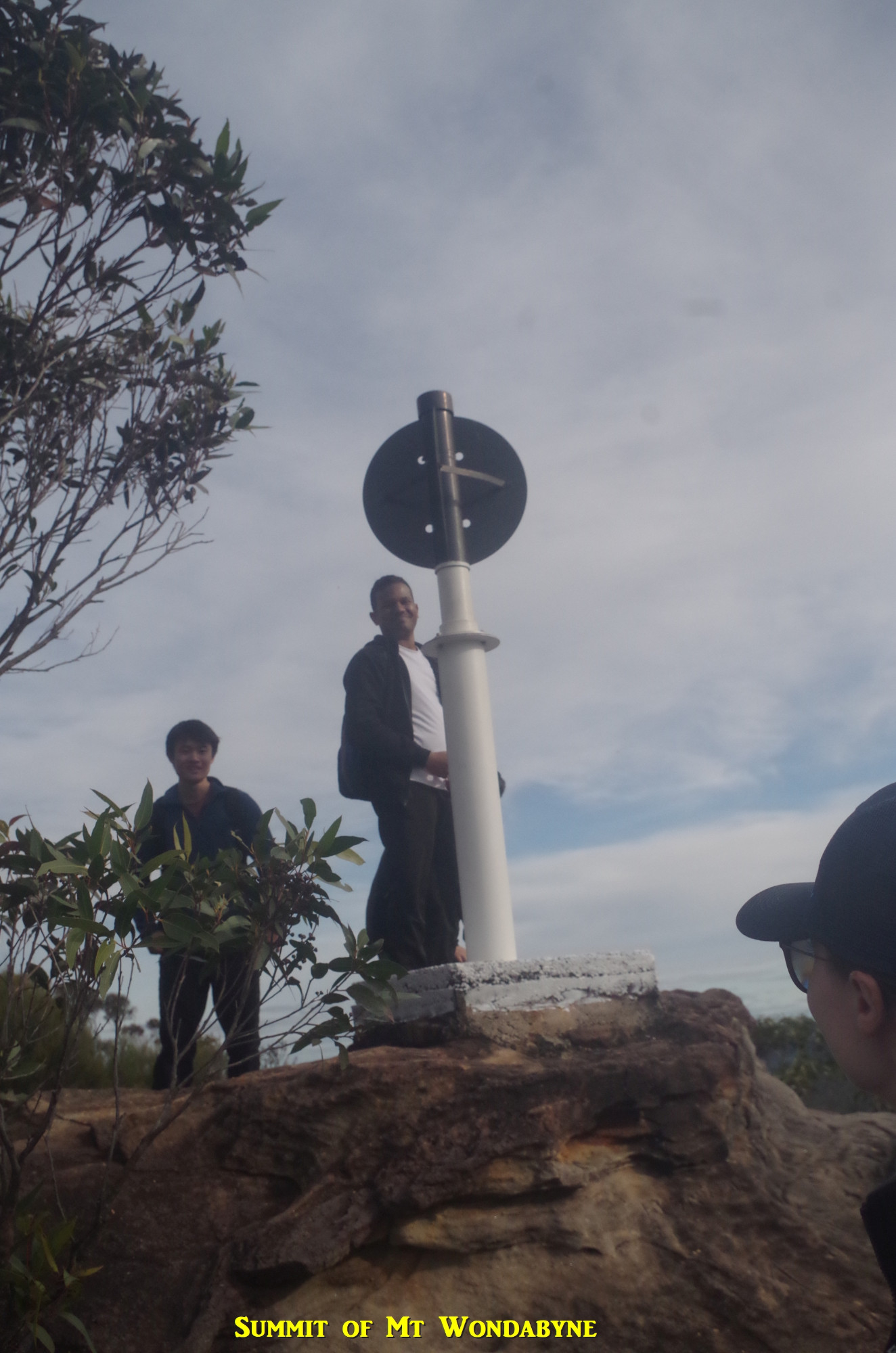
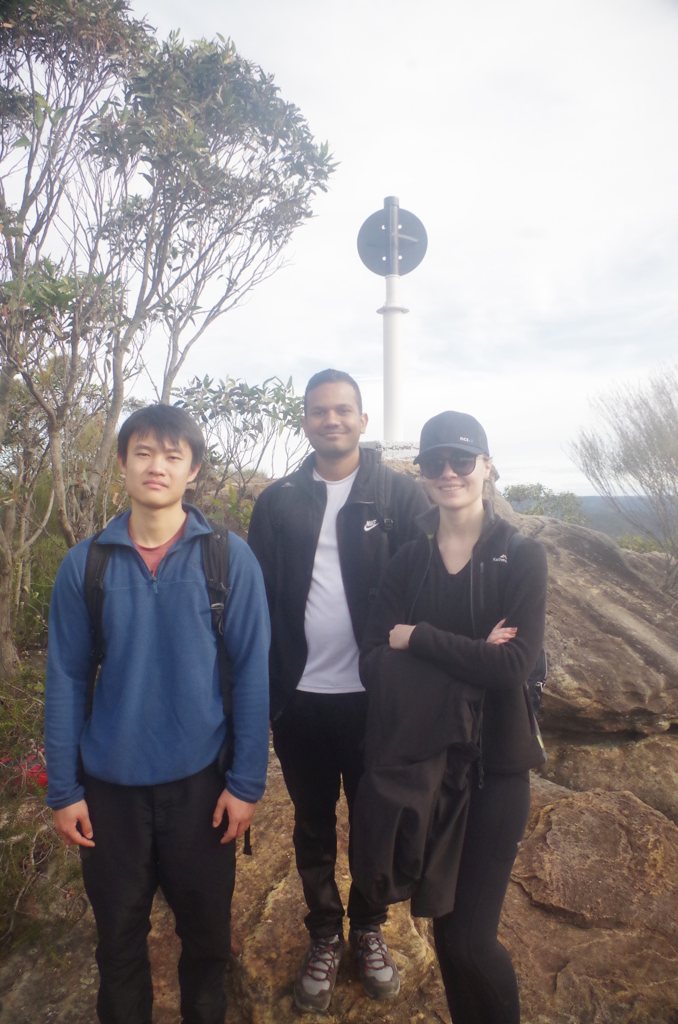
Finally we reached the summit with its trig post, which appears to have had a new coat of paint recently. It is also impervious to attempts to dismantle it, as some walkers have done with obsolete trip stations in the Snowy Mountains. I mentioned this in my Patonga Trip Report of 4/12/2022, and I discussed with Verity how modern surveying methods have made most of them obsolete, and how the early surveyors thought that the highest peak in Oceania, Mt Wilhelm in PNG, was originally thought to be the fourth highest peak in the Bismarck Range instead of the actual highest; they were almost 1000 metres out in their measurements! (Wilhelm was the third child of Chancellor Bismarck). I also mentioned that I couldn’t imagine anyone wanting to name a mountain range after the current German chancellor!
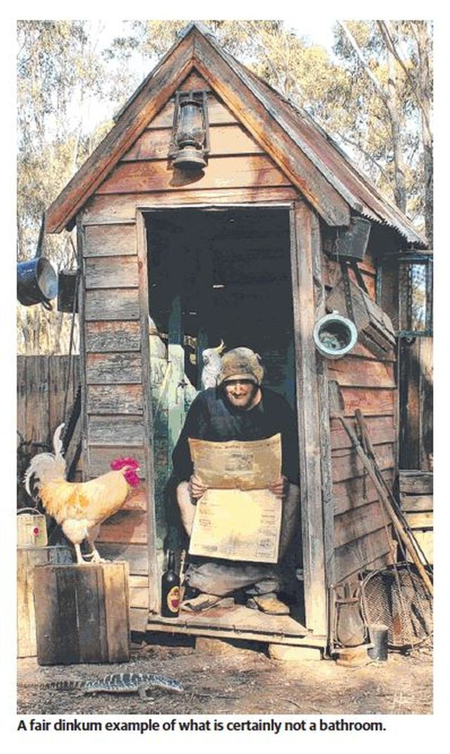
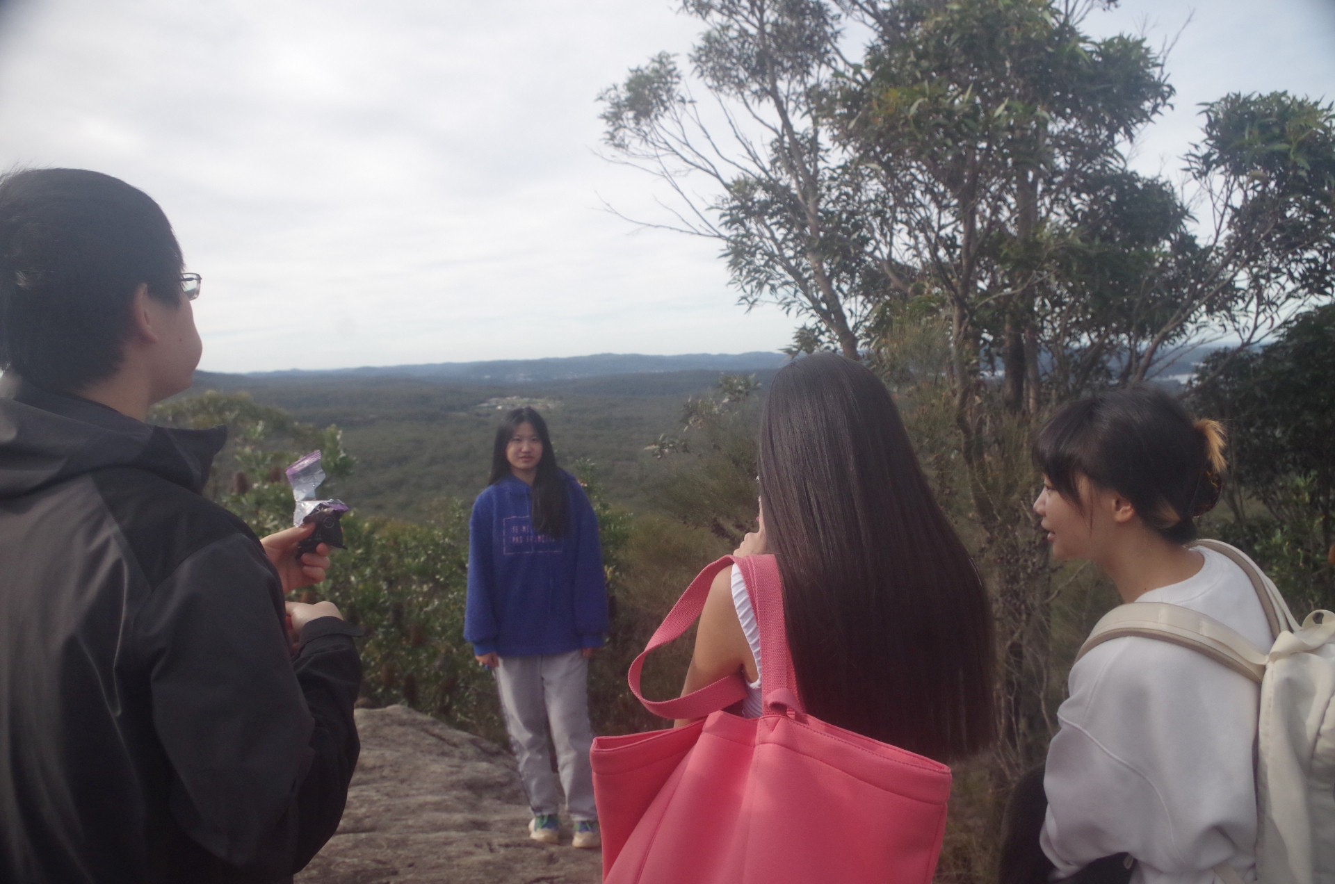
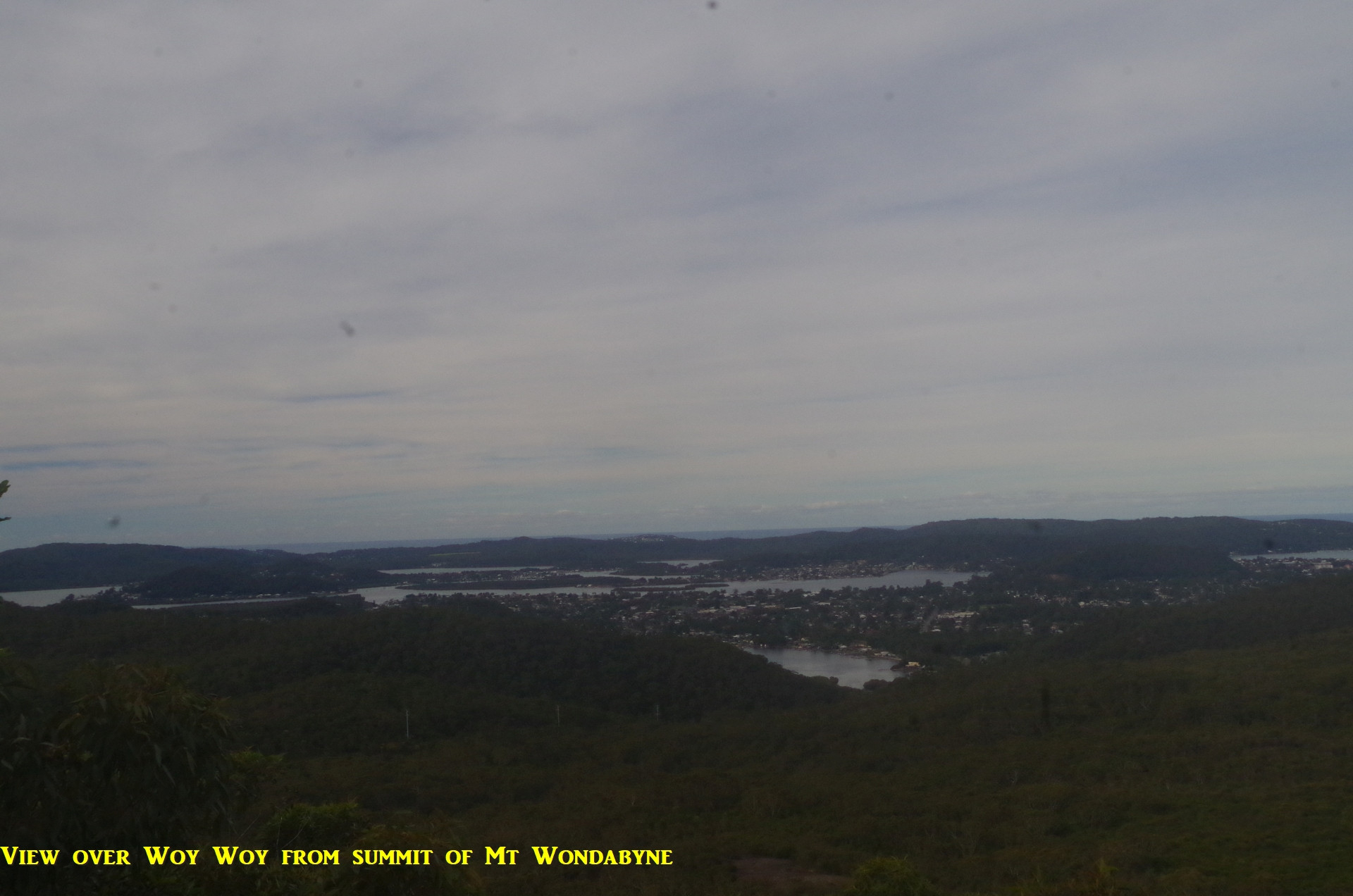
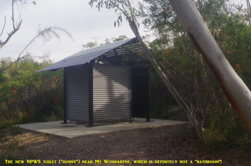
We enjoyed the wide view atop the peak, which extends to the Blue Mountains and east to the ocean, but unfortunately marred by the gash of the Woy Woy Garbage Tip in prominence in the view to the sea. we went back down the steep track back to the main “Hawkesbury Track”, turning left to reach the end of the Mt Wondabyne Trig Fire Trail. Nearby is a new NPWS pit toilet (or “dunny”, definitely not a “bathroom”!). This Fire Trail marks the end of the bushwalking section as the rest of the walk is on fire trails and a short bitumen road to the gates of the Woy Woy “Waste Disposal” facility, 3.5km further on. I noticed that some roadwork has been going on along these fire trails to improve the surface of the dirt road; is the NSW Rural Fire Service expecting a bad fire service next summer?? (This region was not burnt in the bad 2019-20 fire season and hasn’t seen a bushfire for 10 years). I had hoped to find some carnivorous plants along the side of these trails, but it appears that they have died back for the winter.
Maritza observed the sign at the end of the fire trail stating that the distance to Wondabyne Station from there was 7km and it seemed longer than that. In fact, “Wilwalks” site states the distance is 8.32km (you add on another half a km if you do the detour up Mount Wondabyne). Also by the time we reached the garbage tip gates, Maritza was having some problems with her right foot. The rest of the walk was along the level bitumen surface downhill along Nagari Road and Railway Street, but is was still 2.5km to the intended bus stop, so I started considering whether to stop when we reached Shoalhaven Drive 1.5km on, and get her a taxi from there to Woy Woy Station. Then I checked the bus times and found that we might just have enough time, even without rushing, to get an earlier bus from near Shoalhaven Drive, obviating the need to get a taxi or Uber. Indeed we reached the bus stop at Shoalhaven Drive and Nambucca Drive with 4 minutes to spare. What’s more, it would get us to Woy Woy Station 40 minutes earlier than the bus I had originally planned to get. So that was a piece of luck on this walk.
There was 20 minutes to spare before the express (first stop Hornsby) train to Central came, but only 10 minutes to my train (going 2 stops north) came. So I said goodbye to the others and got on my train. Everyone seemed happy with the walk, which took the expected 6 hours to complete, almost exactly.
I have a laugh at the requirements that Yessentay Ismanov put in place for his Heathcote walk the same day: “no whiners, no frequent stopping to take excessive amounts of photos for your social media profile” (etc). I had a walk ruined many years ago by a couple of people doing just that, and also last year I had feedback from someone who said that I must have the “patience of a saint” to put up with some of the trivial things people complain about. Seriously, Yessentay was stating bluntly what many walk leaders think privately. It’s very easy to avoid problems on bushwalks: just think about the needs of others in the group. A major issue is the “no shows”; I had two people on my wait list for this walk, but if the four “no shows” had advised me in advance (i.e. at least a day beforehand) that they couldn’t come, then those two could have been given a place. I suspect the incidence of “no shows”, which seems to be increasing lately, is a factor in deterring some experienced walk laeders from organising trips. I hope to organise a camping trip fairly soon, or at least early next sememster, and camping trips need a higher level of cooperation between participants than some display on day walks. So keep that in mind.
Look, we all want walks to be an enjoyable and fun experience, and they will be if members “do the right thing”. The Australian bush itself imposes some strict rules on us that we must follow if we want to avoid serious problems, and the bush isn’t always very forgiving if you make a mistake. Some people still behave like they are walking along Broadway; Broadway does not have slippery muddy sections, tree roots to trip on, or need your hands to be free to climb a steep section. And I have yet to see a Brown Snake or a Tiger Snake on Broadway! It’s always “safety first, then fun“. And never make assumptions; always ask the walk leader if you need to find out about anything.
Apologies for any spelling errors that might slip through.
Bruce Stafford.