Party: Bruce leading), Ashwin, Cathie, Peter, Phil (Meng), Xiaoxia.
Date: 2/10/17
A good turnout for a walk on the October Long Weekend with relatively short notice. The long spell of dry weather was a chance to walk what are normally rather damp (and leech infested) parts of the Blue Mountains.
I had arrived at Central Station over 30 minutes ahead of train time, and while waiting my mobile iPhone had a message that a software update was available; did I want to download it? With time to spare and thinking it would be a 5 minute job, I allowed the update, causing the phone to shut down for 25 minutes at a time when I was needing to get texts and calls from other walkers! Slowly learning about the less appealing aspects of an iPhone!
With some others unable to contact me they simply just got on the train and eventually we all collected together at Wentworth Falls Station. Peter Stanford had got on at Strathfield and found us on the train, but Zhong was also supposed to get on at Strathfield but his connecting train was cancelled so he missed out.
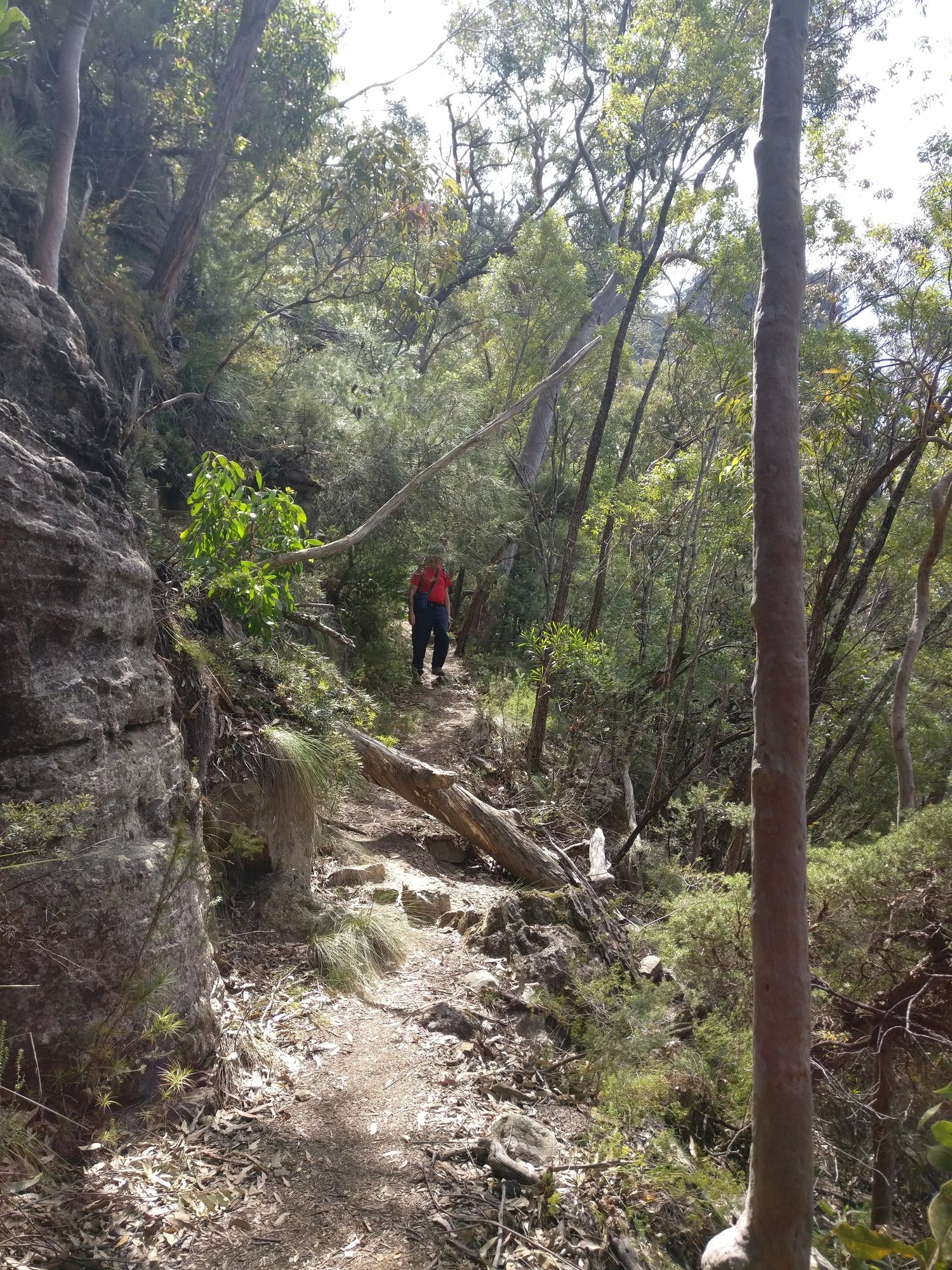
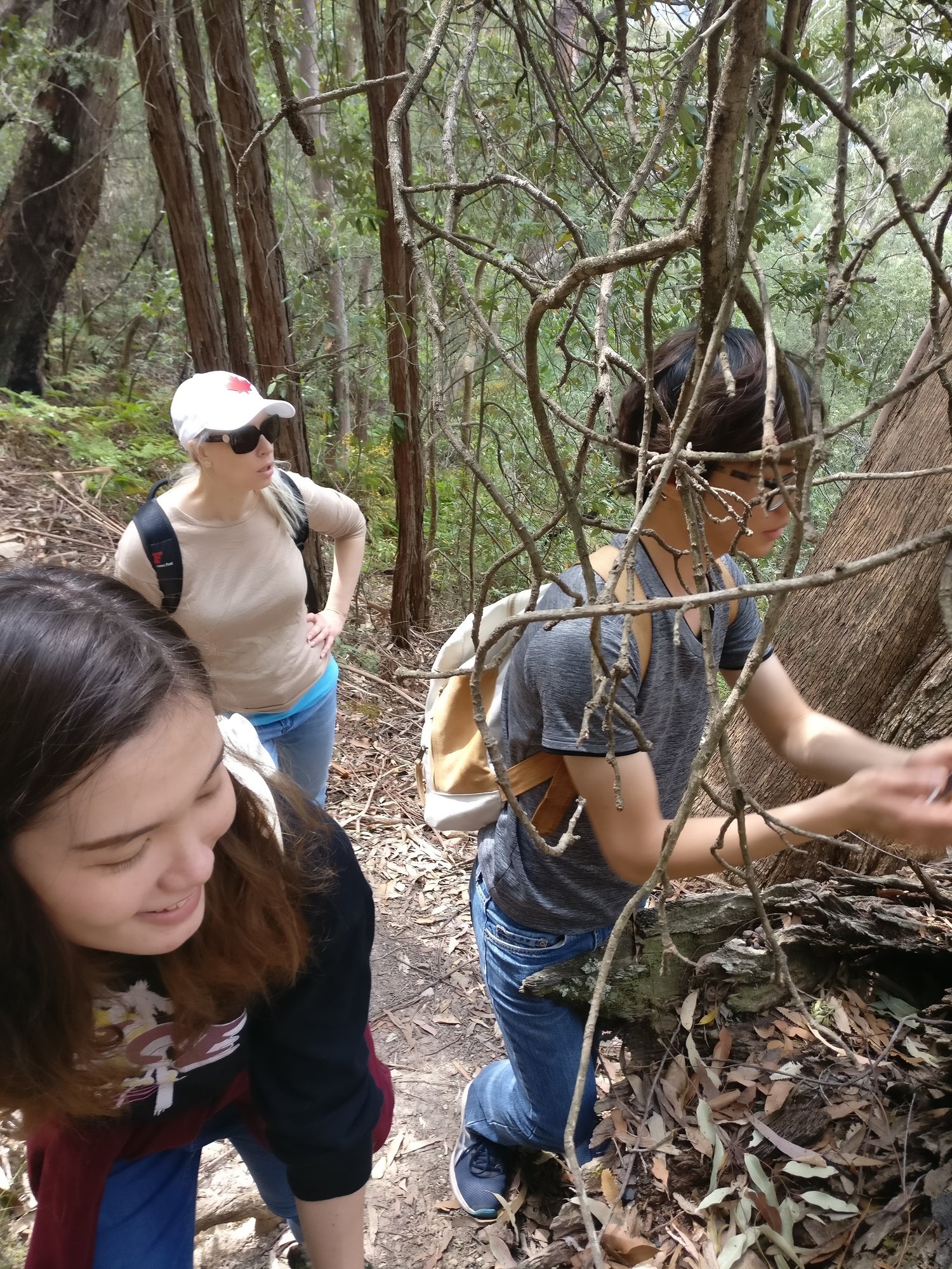
After the compulsory loo stop at Wentworth Falls, we then set off on the road bash to the Conservation Hut above Valley of the Waters. There were heaps of tourists around, but after a brief visit to Queen Victoria Lookout we left them behind as we headed for Lillian’s Bridge (above Empress Canyon). We crossed Lillian’s Bridge then proceeded along the Lillian’s Bridge (Grand Cliff Top) track. Here Peter left us, and the remaining five continued up the track and across a hanging swamp until reaching the edge of the Fairmont Reserve golf course. A soft gentle chattering could be heard in the trees above and a pair of Crimson Rosellas (Platycercus elegans) could be seen. (This demonstrates the value of no loud talking on bushwalks, as if we were, then these birds would not have been heard).
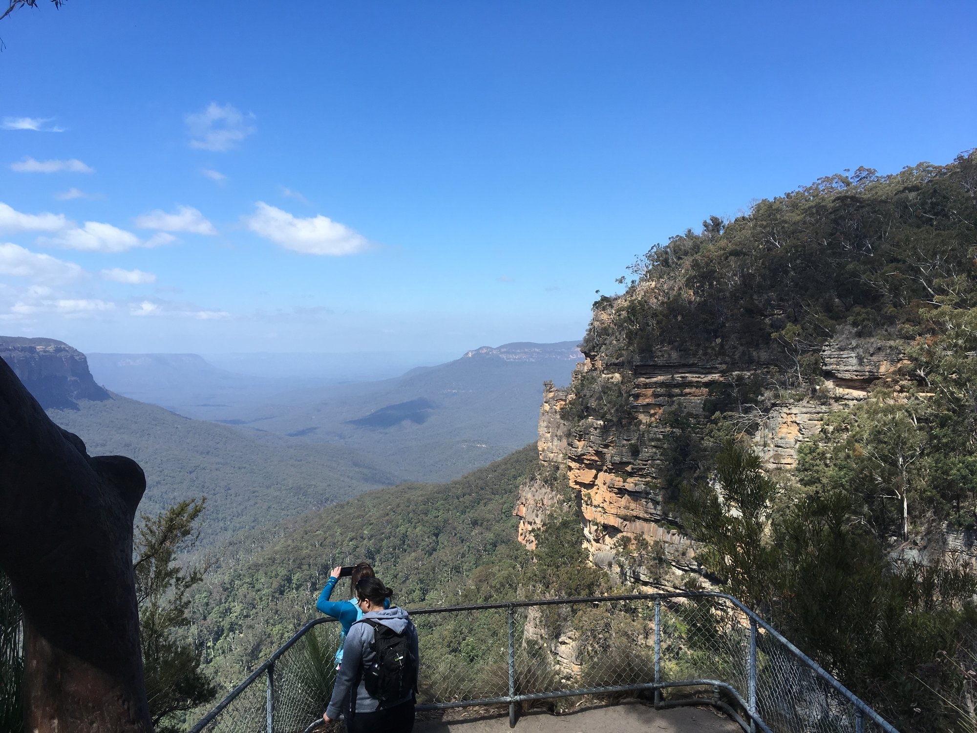
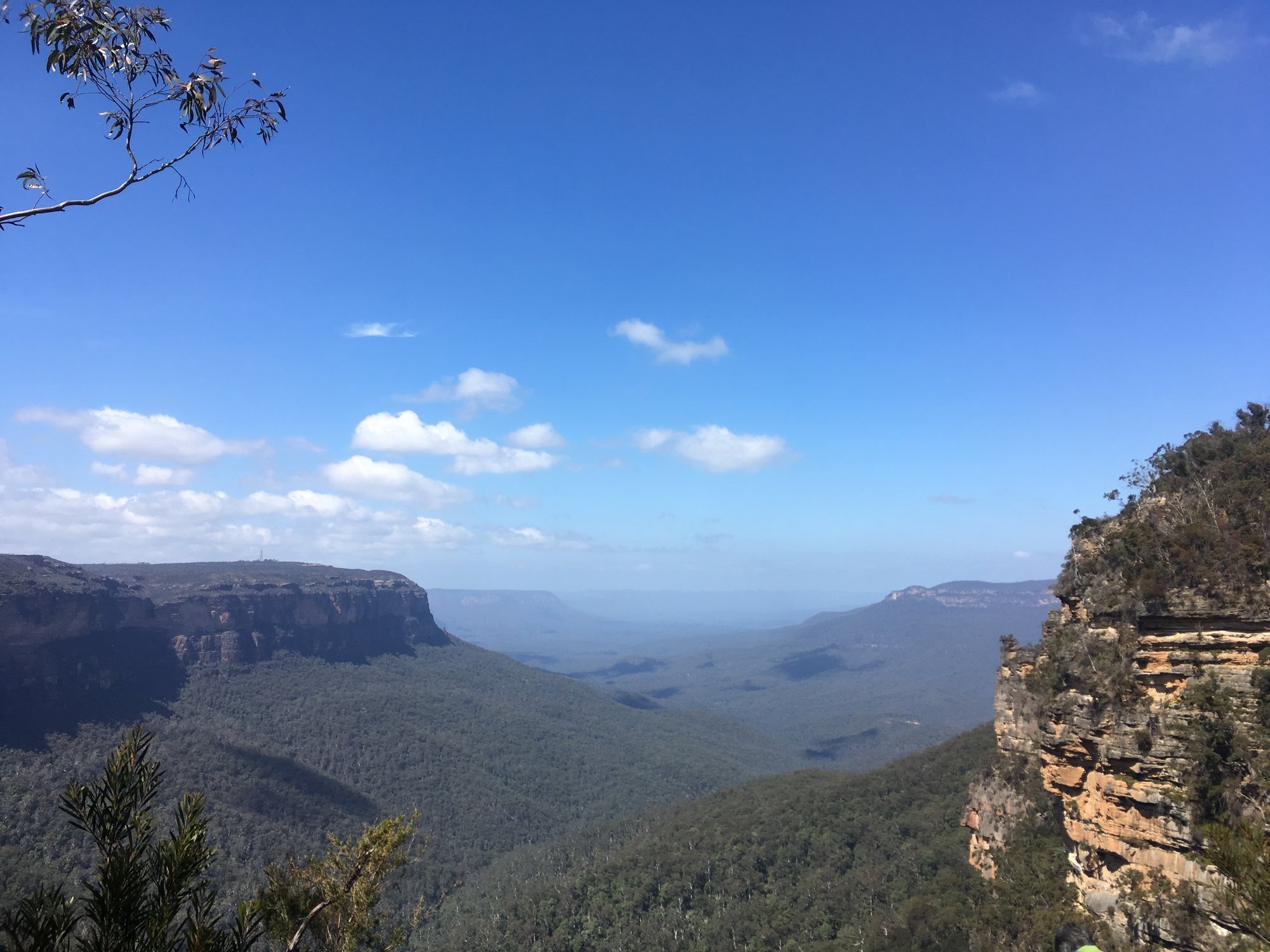
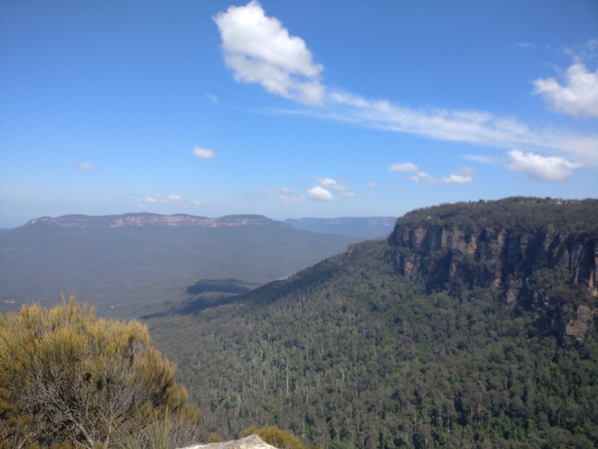
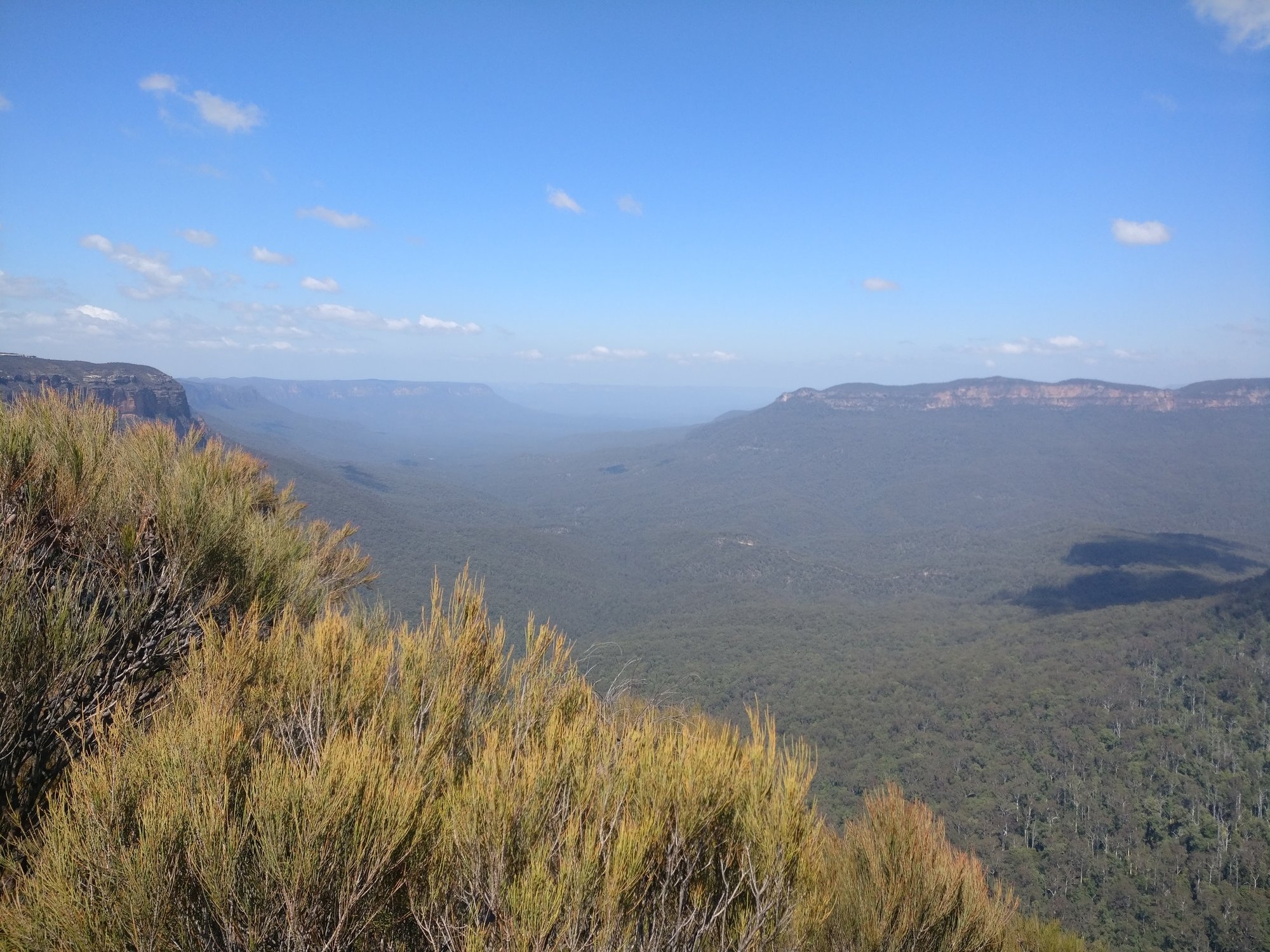
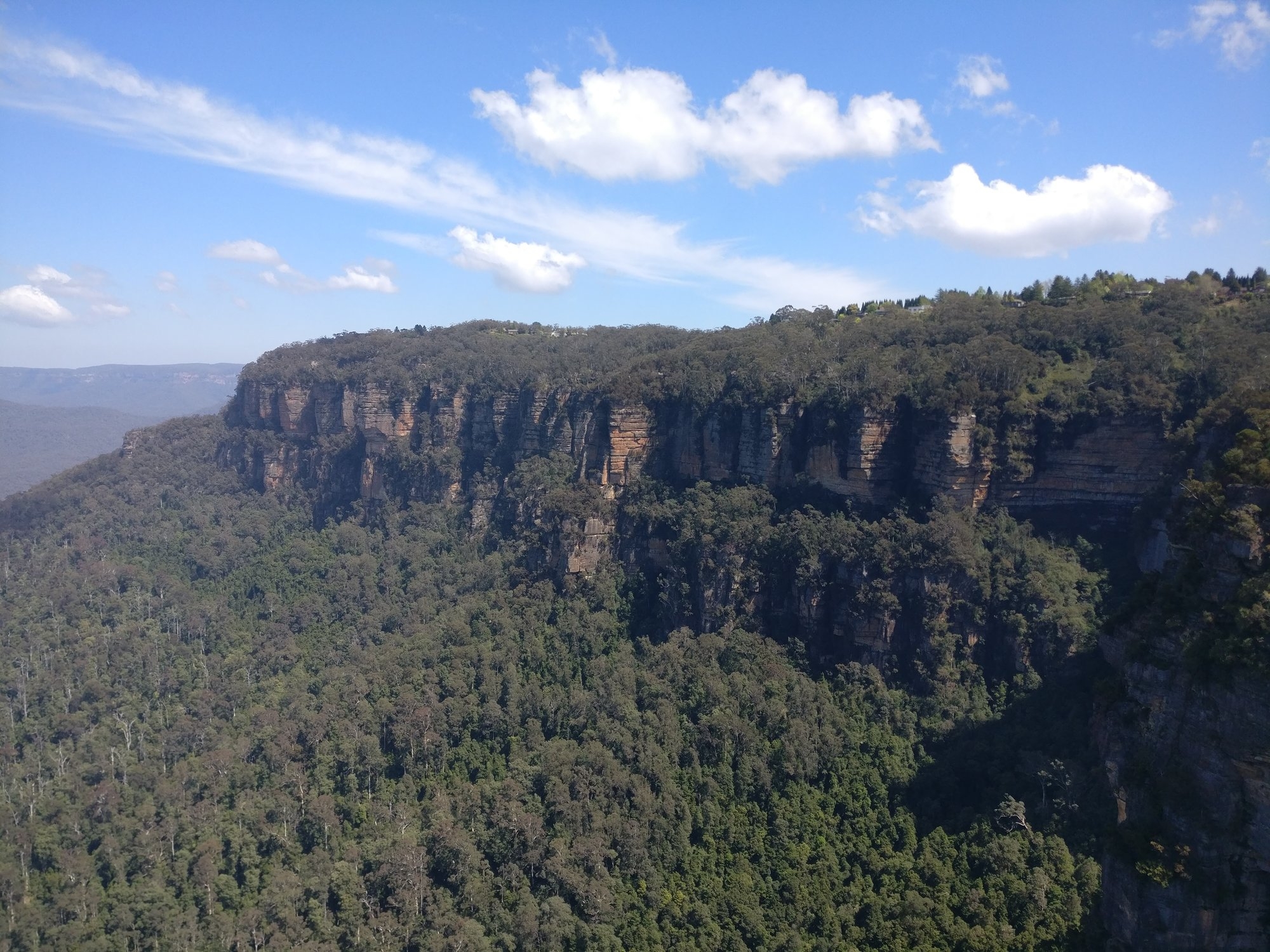
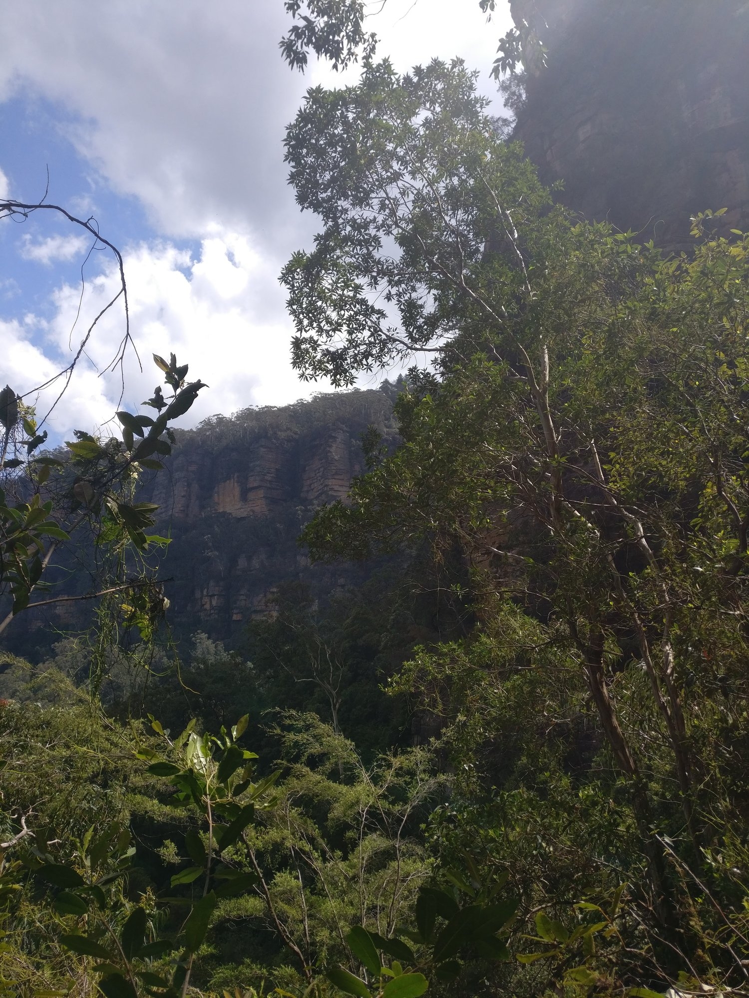
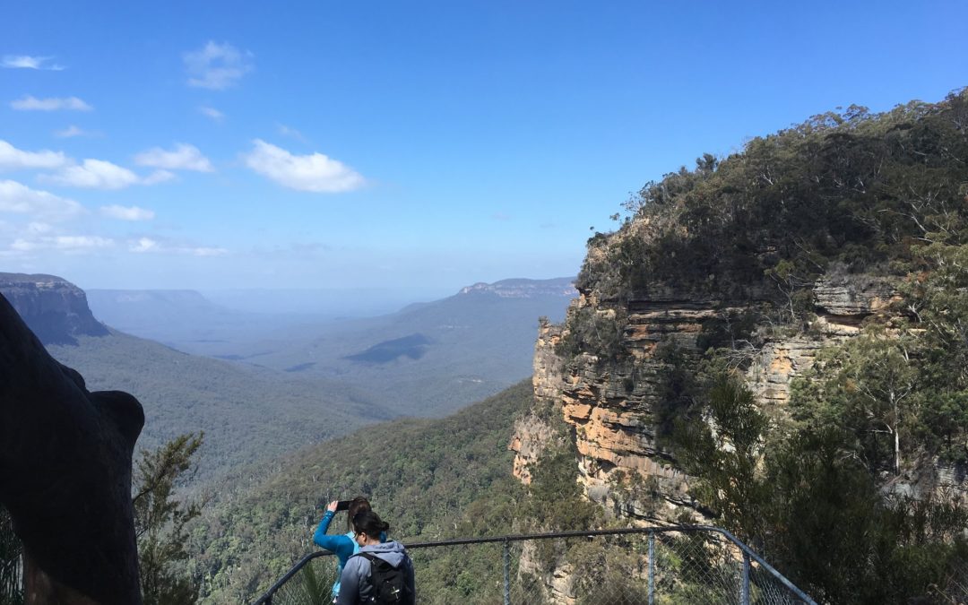
Soon we came to the junction with the track to Inspiration Point, which also continues down through Robert’s Pass. Along this track a Lyrebird was seen. We came to a track which went right to Gladstone Lookout, ans as it was new to me, went along it to see if it was OK. After less than 10 minutes it comes to that Lookout which gives good views over Jamison Valley, and also the gully of Gladstone Pass can be seen.
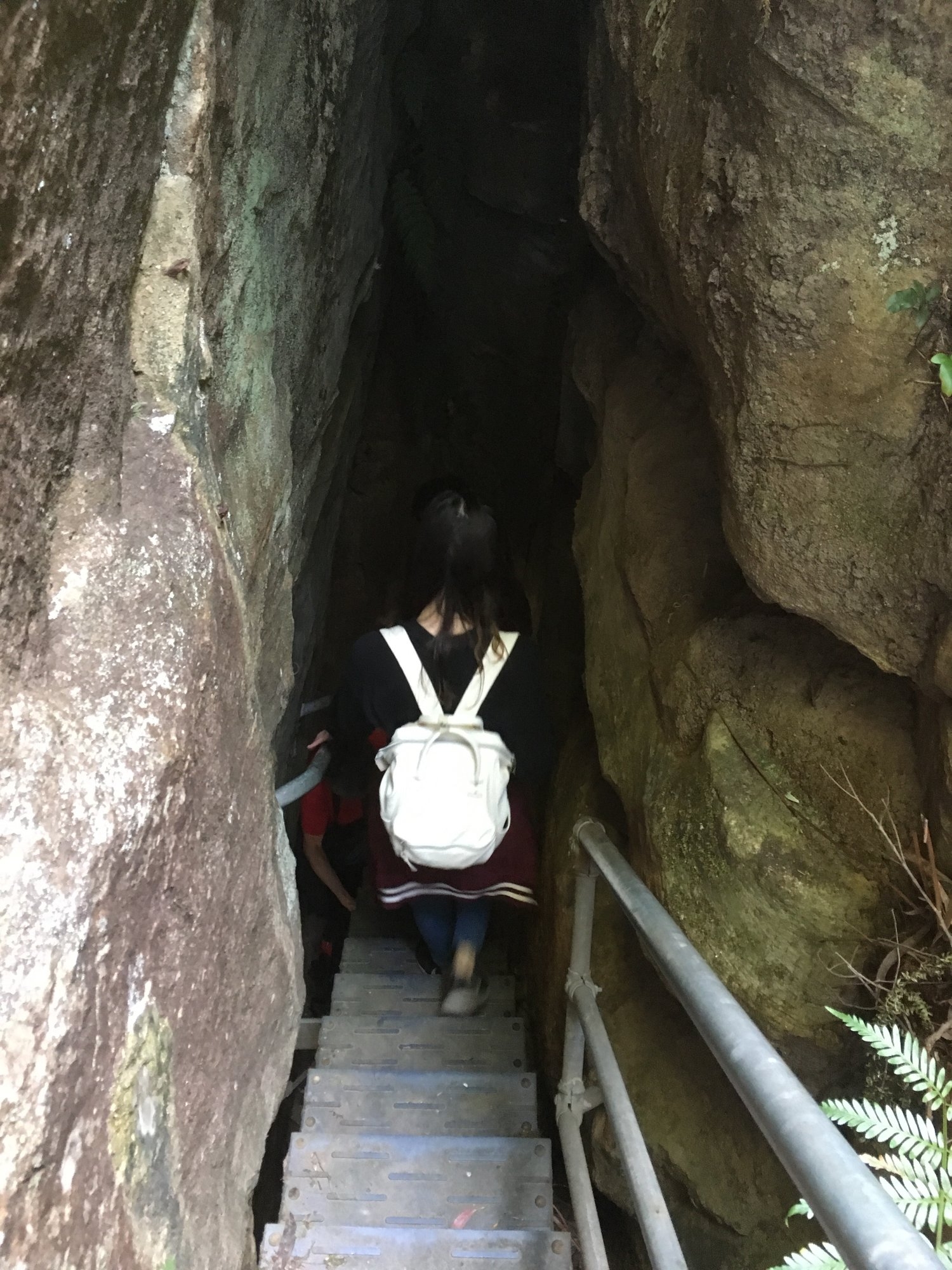
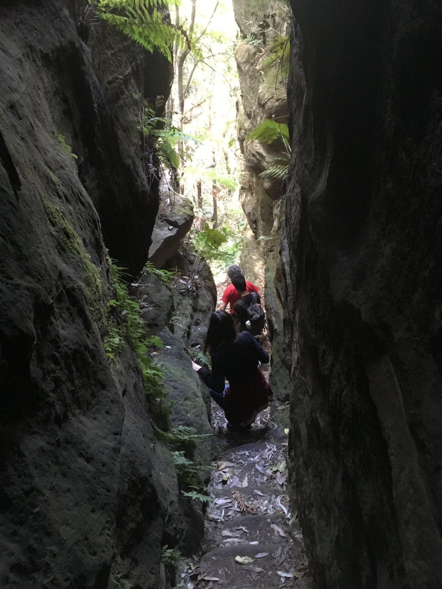
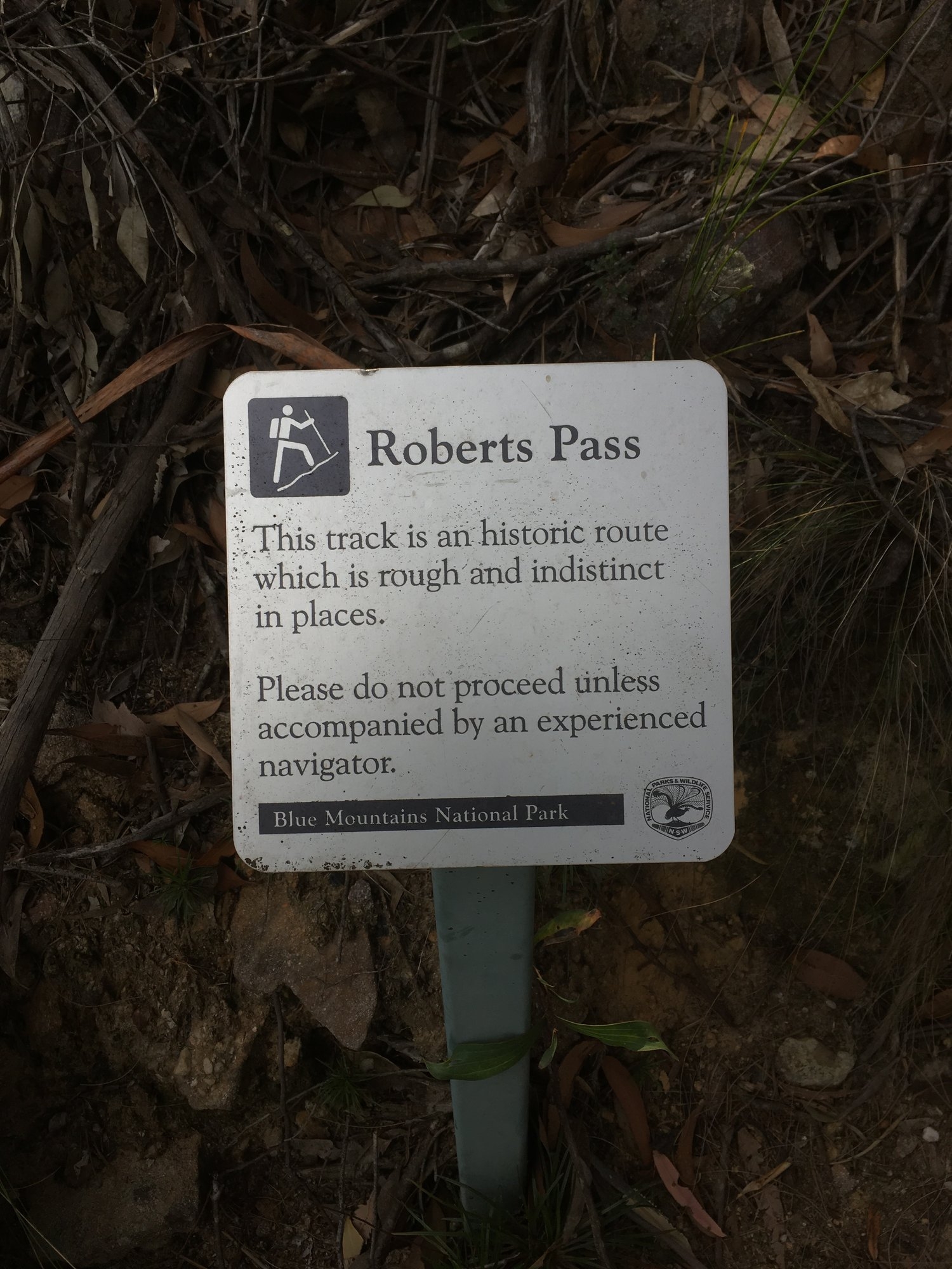
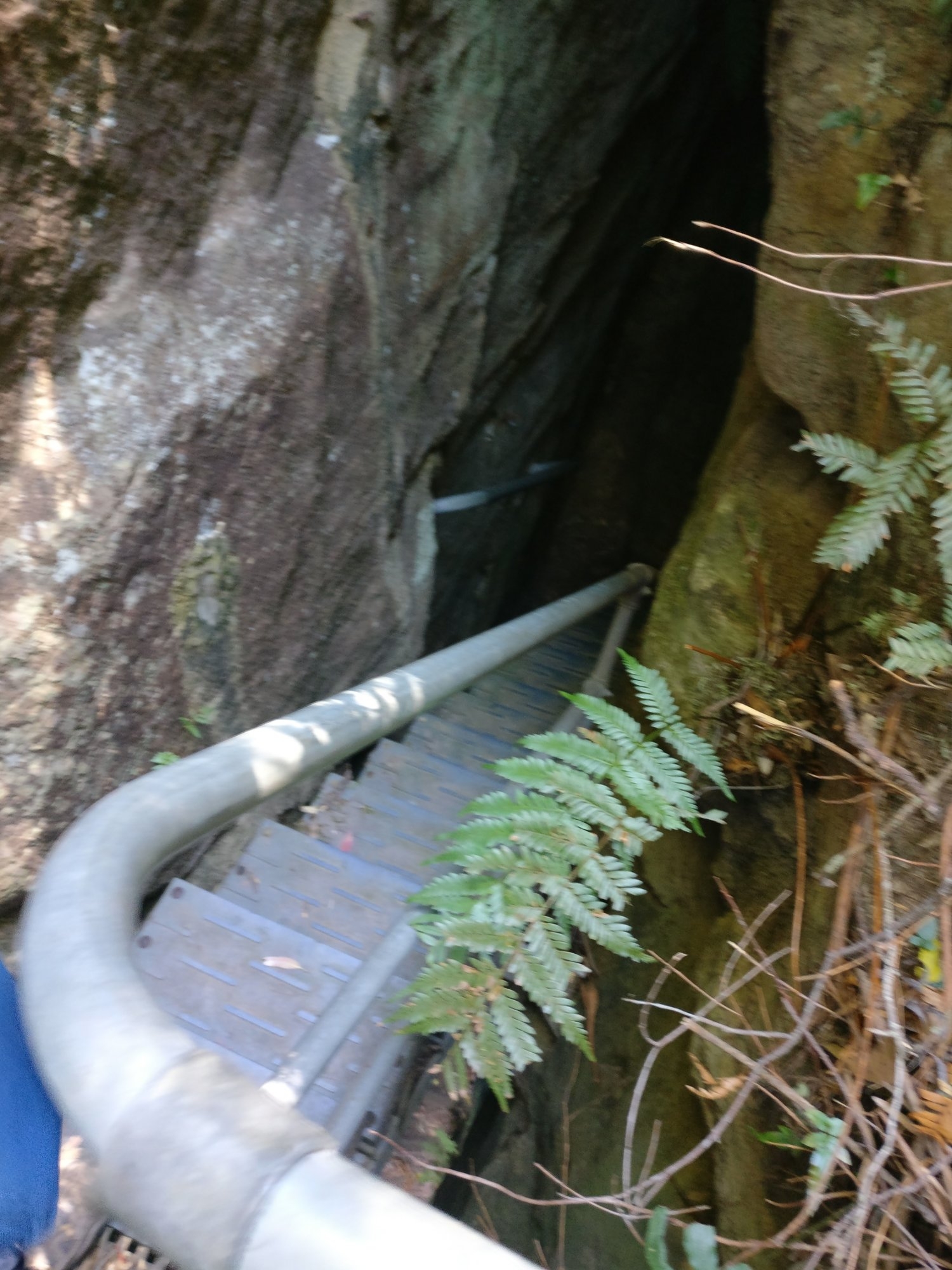
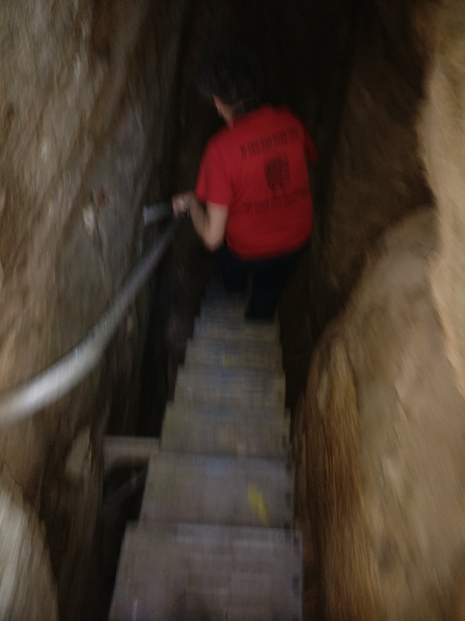
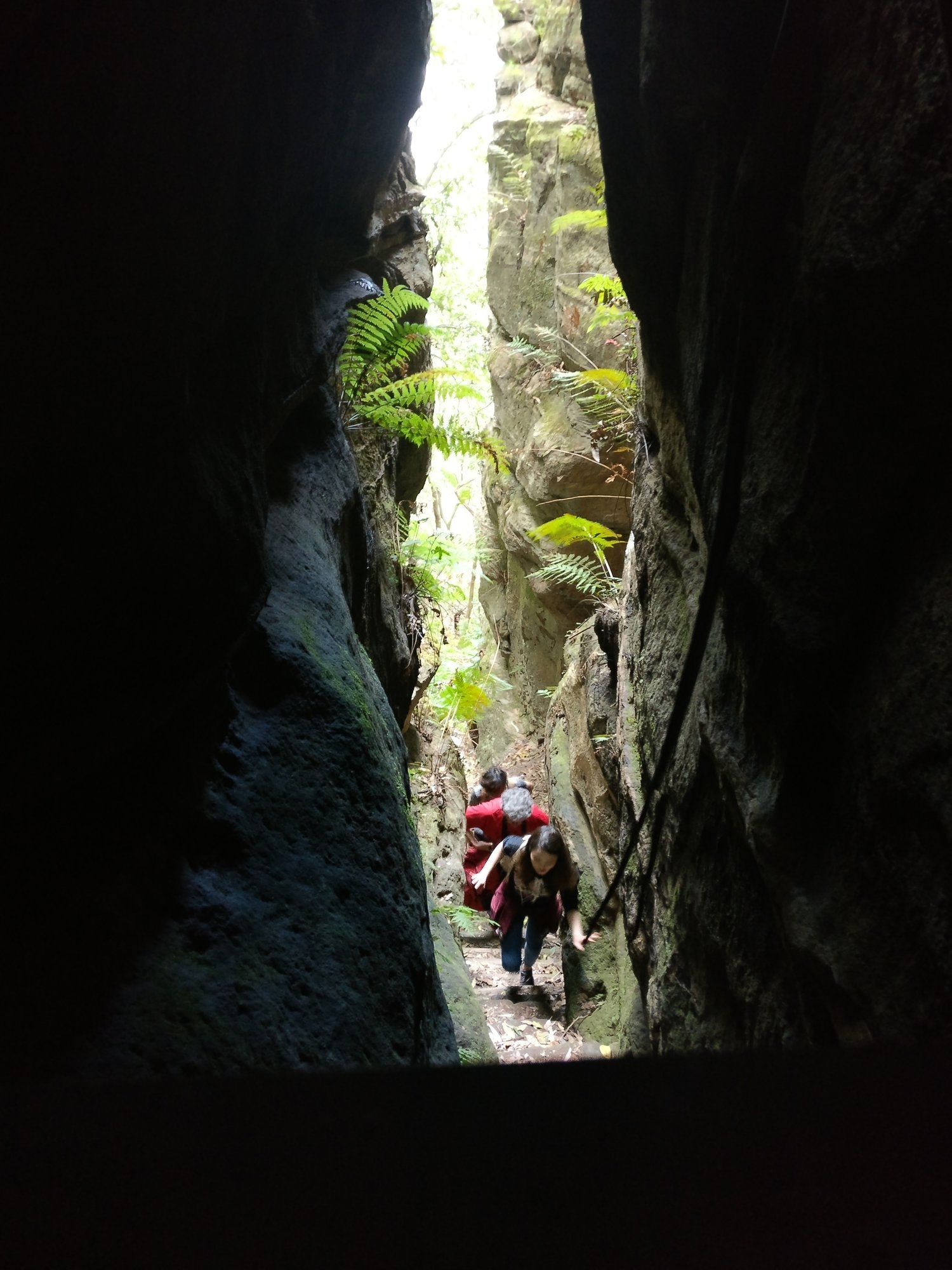
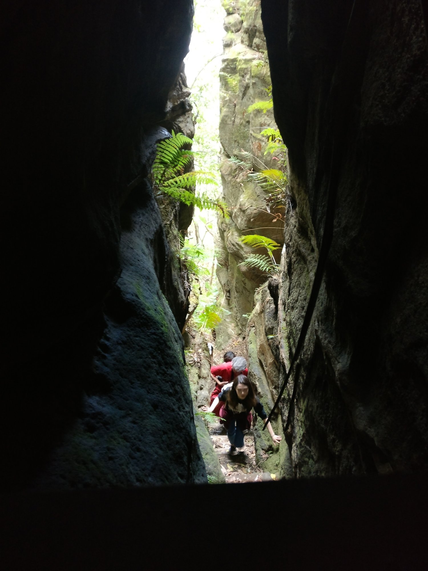
Here we stopped for lunch. Then we retraced our steps to the Inspiration Point track, and went past the sign designed to deter tourists from going down Robert’s Pass (see photo). This pass start going down fairly steeply on a plain track with only a few steps here and there until reaching the narrow slot through which the way down is via a set of metal steps and then a 180 degree turn to continue through the slot via stone steps. That sharp turn is so tight that, unless you and your pack are very small, you must take off your pack to squeeze through.
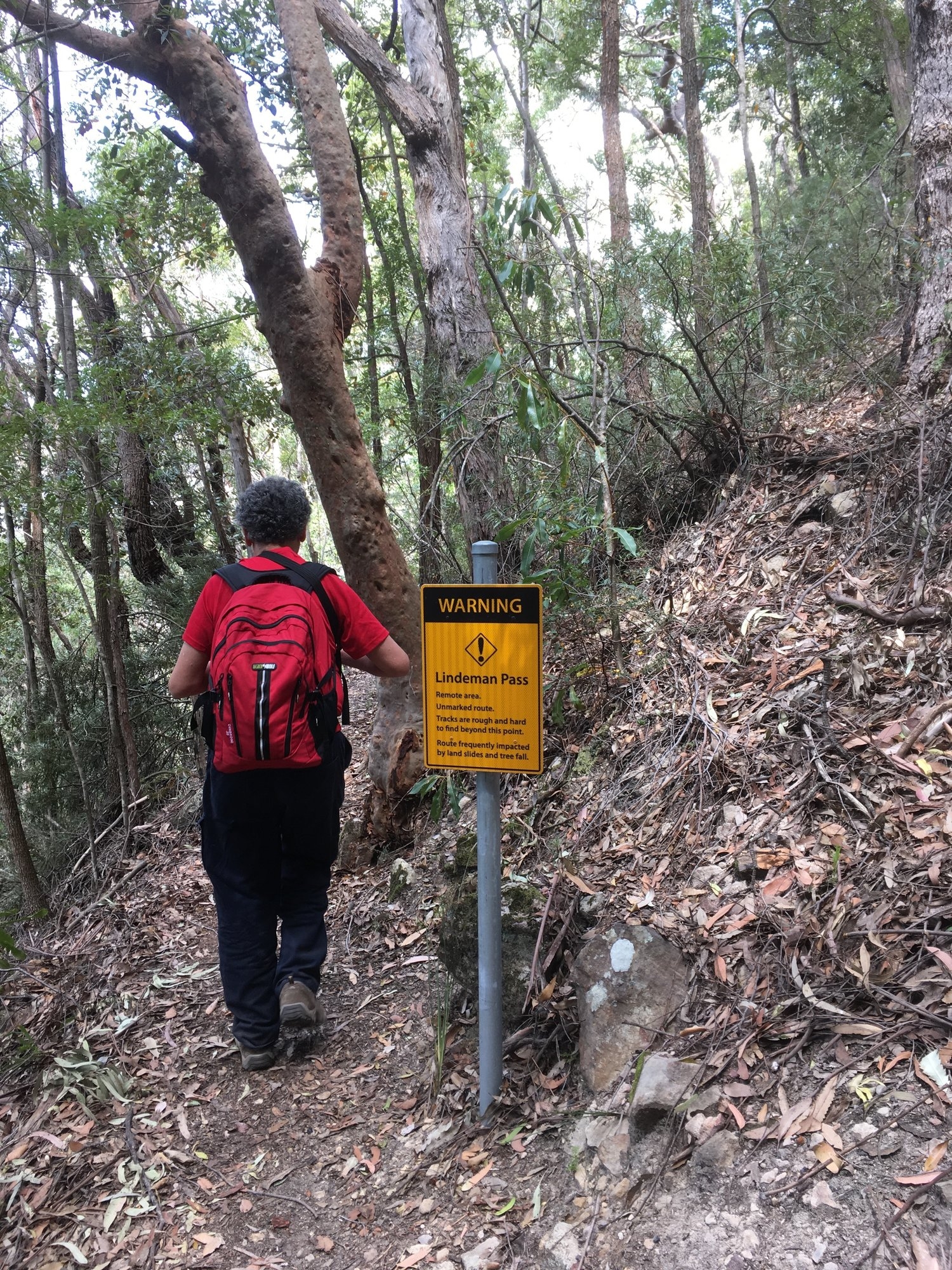
The track continues down the gully until reaching its junction with Lindeman’s Pass. Lindeman’s Pass is not named there (but is at another tourist-deterring sign a bit further on). Turn left here for Valley of The Waters, and right for Lindemans pass proper. We turned right.
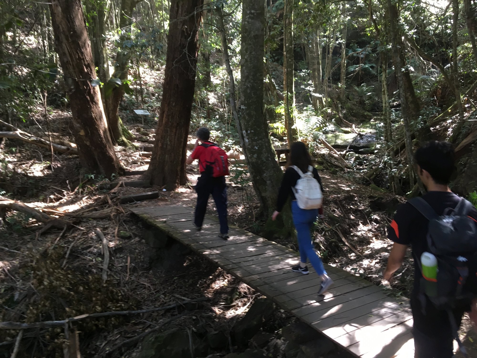
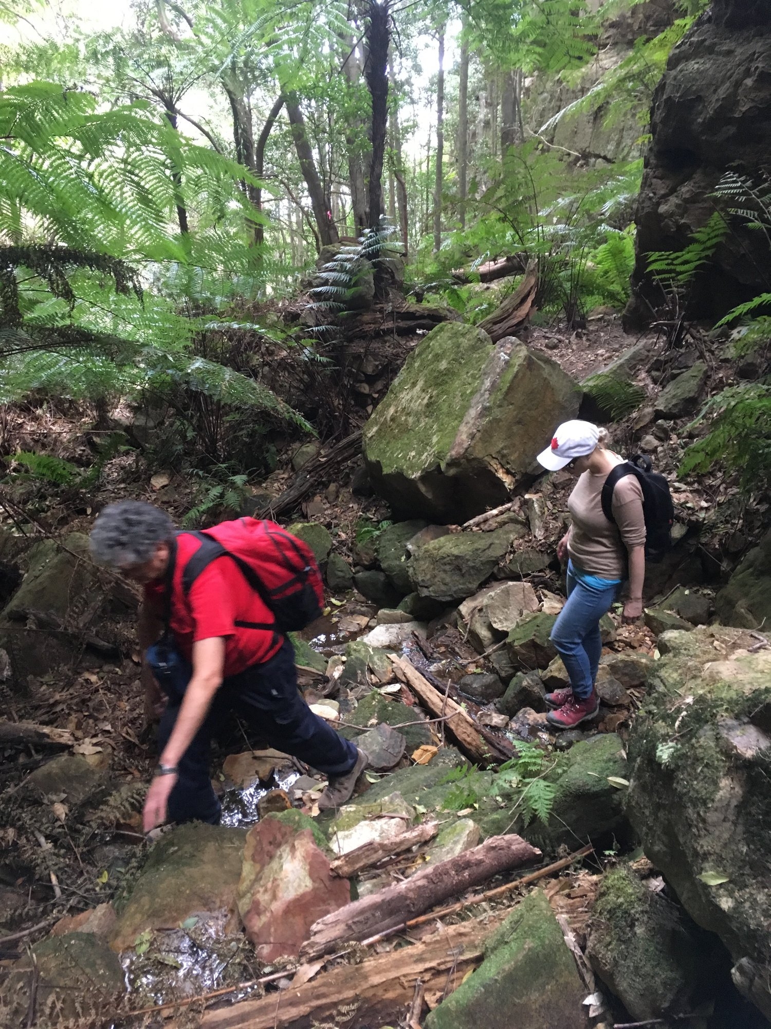
Between Robert’s Pass and Lawton’s Creek, Lindeman’s Pass is quite easy to follow. There are a couple of dodgy sections but no worse than what is seen on the Landslide Section of Federal Pass. So the walk on this section was uneventful.
Then I arrived at what I decided must be the start of Gladstone Pass. Now, I had previously done the walk of Lindeman’s Pass leading a walk from the (now removed) Water Board ladders at Leura as far as Gladstone Pass, but is was in the late 1990’s. The spot looked a bit different than what I recalled, but a lot can change in gullies and canyons over 20 years – changes caused by flash floods and rockfalls. Some reports (as recent as 2015) mention a cairn, but I did not see a cairn there. This does not mean anything as some people are known to remove cairns, the reasoning being that if one is relying on cairns to navigate, then you probably shouldn’t be there in the first place (and I can’t argue with that).
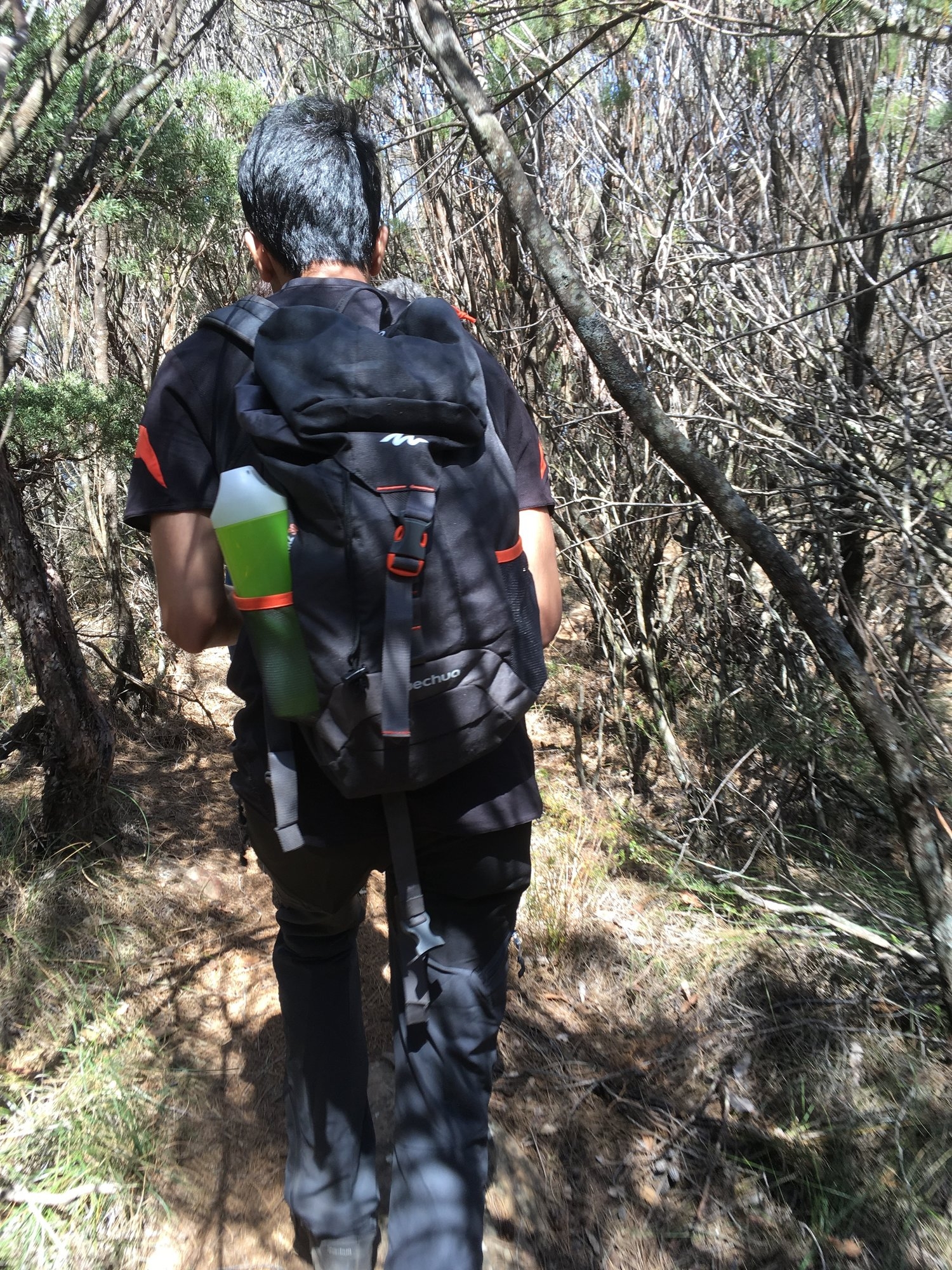
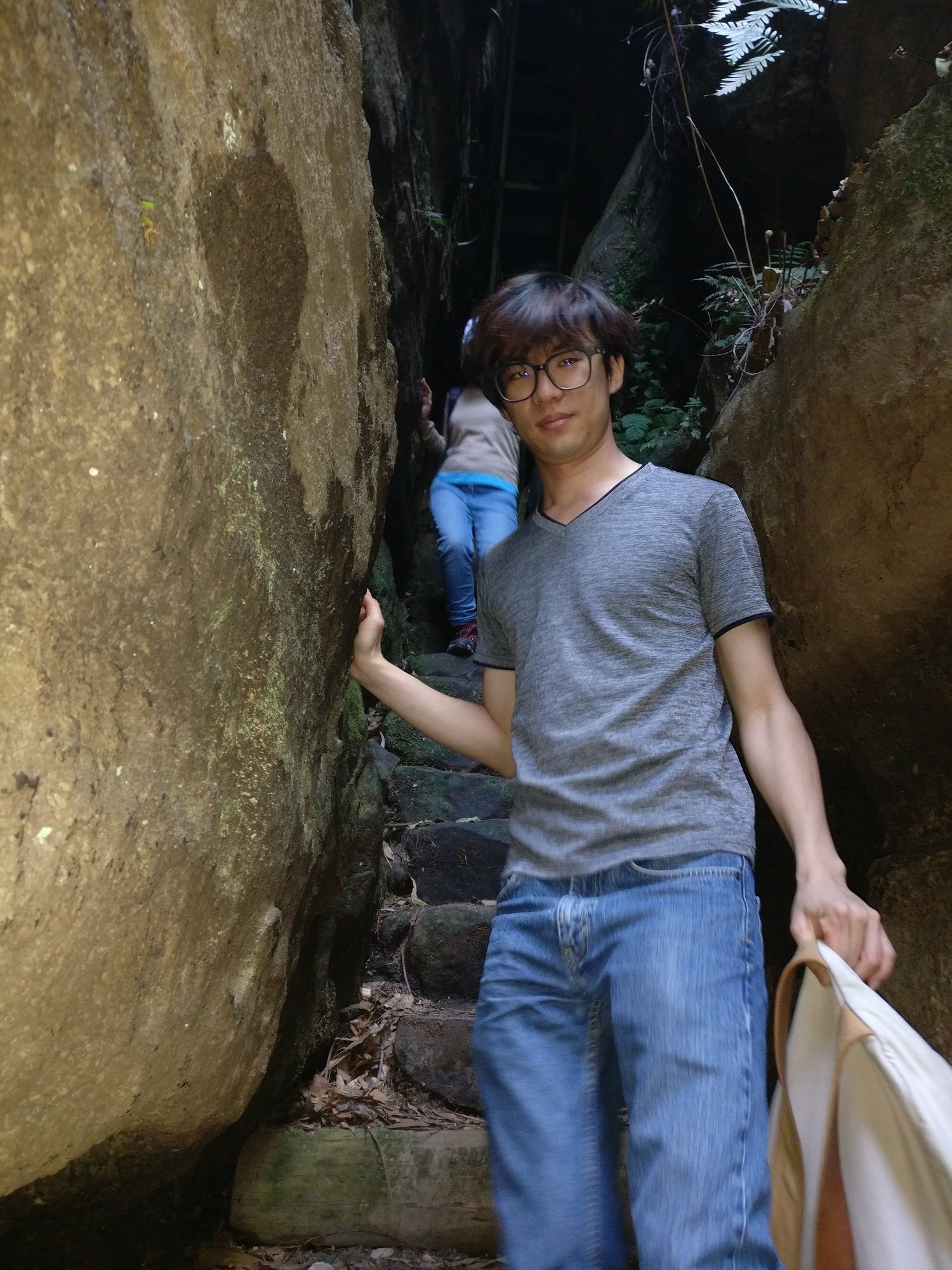
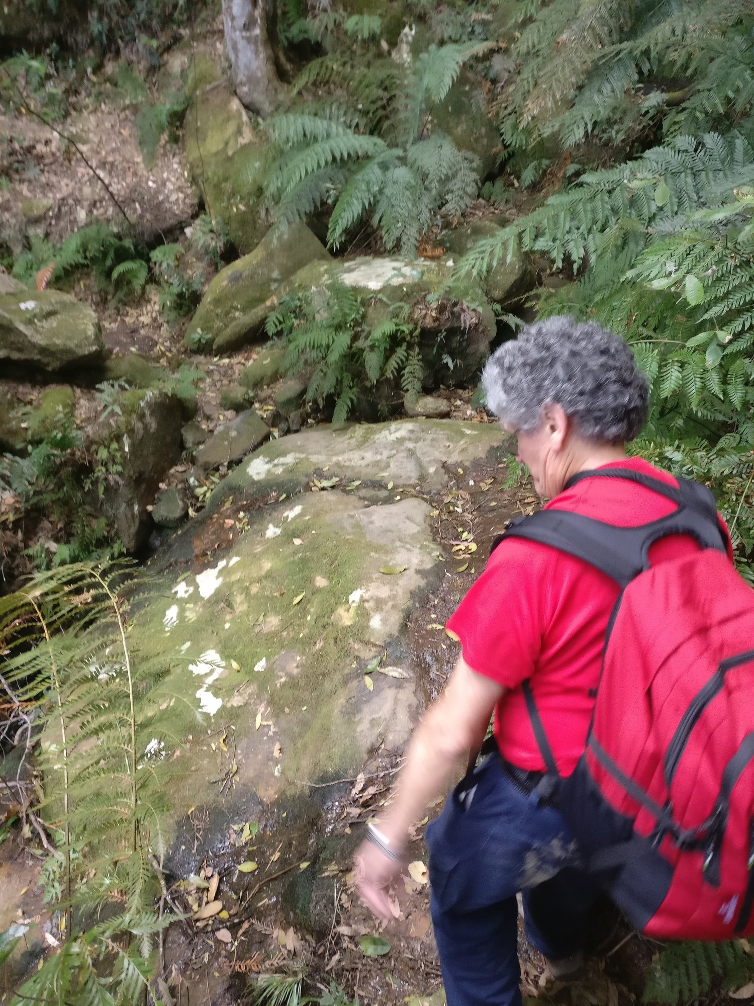
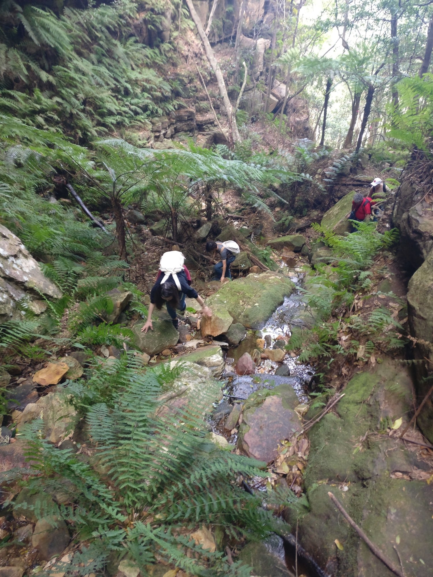
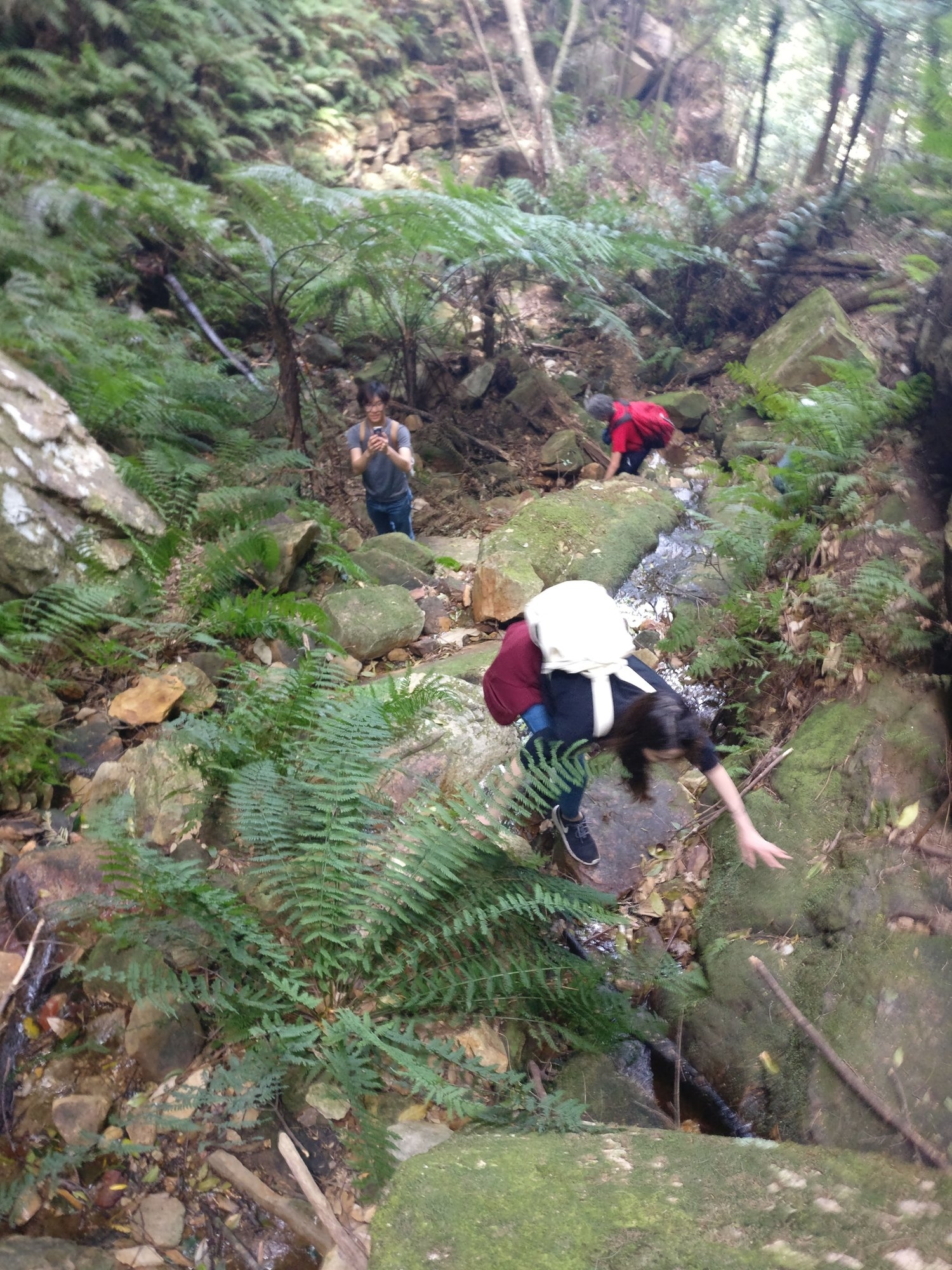
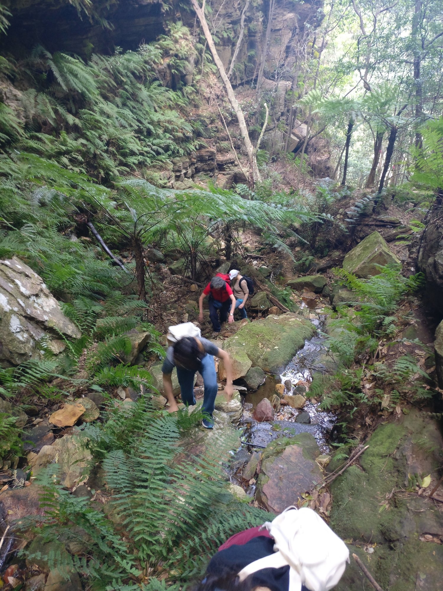
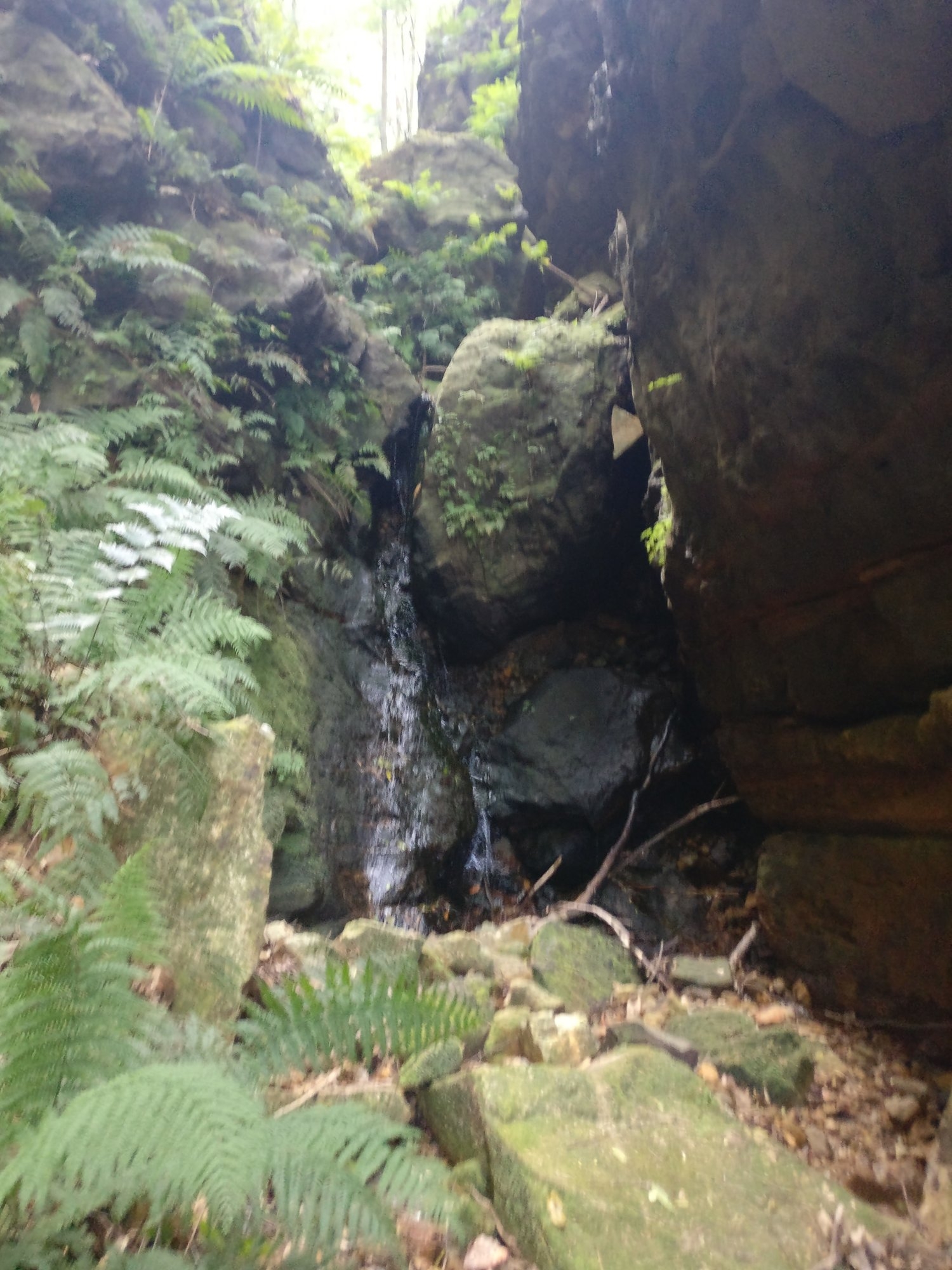
Anyway, we started off with a bit of a steep scramble up and started following a vague track, and the presence on a couple of trees with pink tape seemed to reassure that we were going the right way. Soon we encountered a more obvious track, and followed it upwards (and sometimes downwards) as it followed a steam up the gully which quickly narrowed into a canyon. Every now and then the path (such as it was) crossed the stream. It was a matter of looking out for stepping stones that looked a bit more worn than others. Soon we came to a spot where it was necessary to scale a 3.5 metre high mini-cliff and that’s where we got problems. My guess is that it was about two-thirds of the way up the canyon.
There was only an old log which looked like it was propped up against the obstacle with just a slight wood knot as a foothold (see photo). The rock itself had some hand holds but nothing bit enough to support a walking shoe. The only hand hold at the top was a fern which didn’t appear to be firmly rooted and I wasn’t prepared to use it as a support. Not only that, but other footholds further down were on unstable dirt.
Now, Ashwin, Phil and ZiaoZia had made it up, just, with Ziaozia being given a push up by us below, but the last person up would have no such assistance. Phil offered a helping hand, but Cathie and I realised that if we lost our foothold – a real possibility – then Phil would suddenly be supporting our entire weight with himself standing on unstable dirt, and very likely would pull him down.
Ashwin went ahead a little and said that a vague track could be seen going further up. Nevertheless, with Cathie and I having no safe way of getting past this obstacle, I had to decide that this was going to be as far as we could go, and return back to Lindeman’s Pass.
This made me start doubting that this was in fact Gladstone Pass. On the trip I had led in the 1990’s, we exited up Gladstone Pass and in failing light. Although it was not easy it certainly wasn’t as hard as this, and also not as narrow. Gladstone Pass couldn’t be regarded as a canyon as this was.
we retraced our steps back down, and on encountering the obvious track mentioned earlier followed it rather than the more vague one past the trees with pink tape. This track suddenly ended but Lindeman’s Pass could be seen just below. So it was a matter of doing a scramble down to the Pass.
At this point we were about 100 metres further west of Lawton’s Creek (which was actually what we had entered, I decided later), so it was a matter of just following it back to our starting point, and then continuing back to the junction of Robert’s Pass.
At this point, we could have gone forward to Valley of the Waters, and Lindeman’s Pass is mostly (but not totally) easy to follow there. I preferred to return back up Robert’s Pass so we could end up at our intended destination of Leura. Also, despite what some track walk descriptions say, Robert’s Pass is easier than Valley of the Waters Track, and shorter.
We ended back at the junction of the Lillian’s Bridge track and went left to Leura. The track skirts the south of Fairmont Resort and its golf course and ends at its car park. Along this track is an “adventure tower” with steel and rope walkways (for those who want to pretend they’re commandos!) and there is a track leading off that which I suspect goes to the top of Lawton’s Creek. A bit further along is a track near a steel container which appears to be the start of the track down to Gladstone Pass. Also, more trees with pink ribbons.
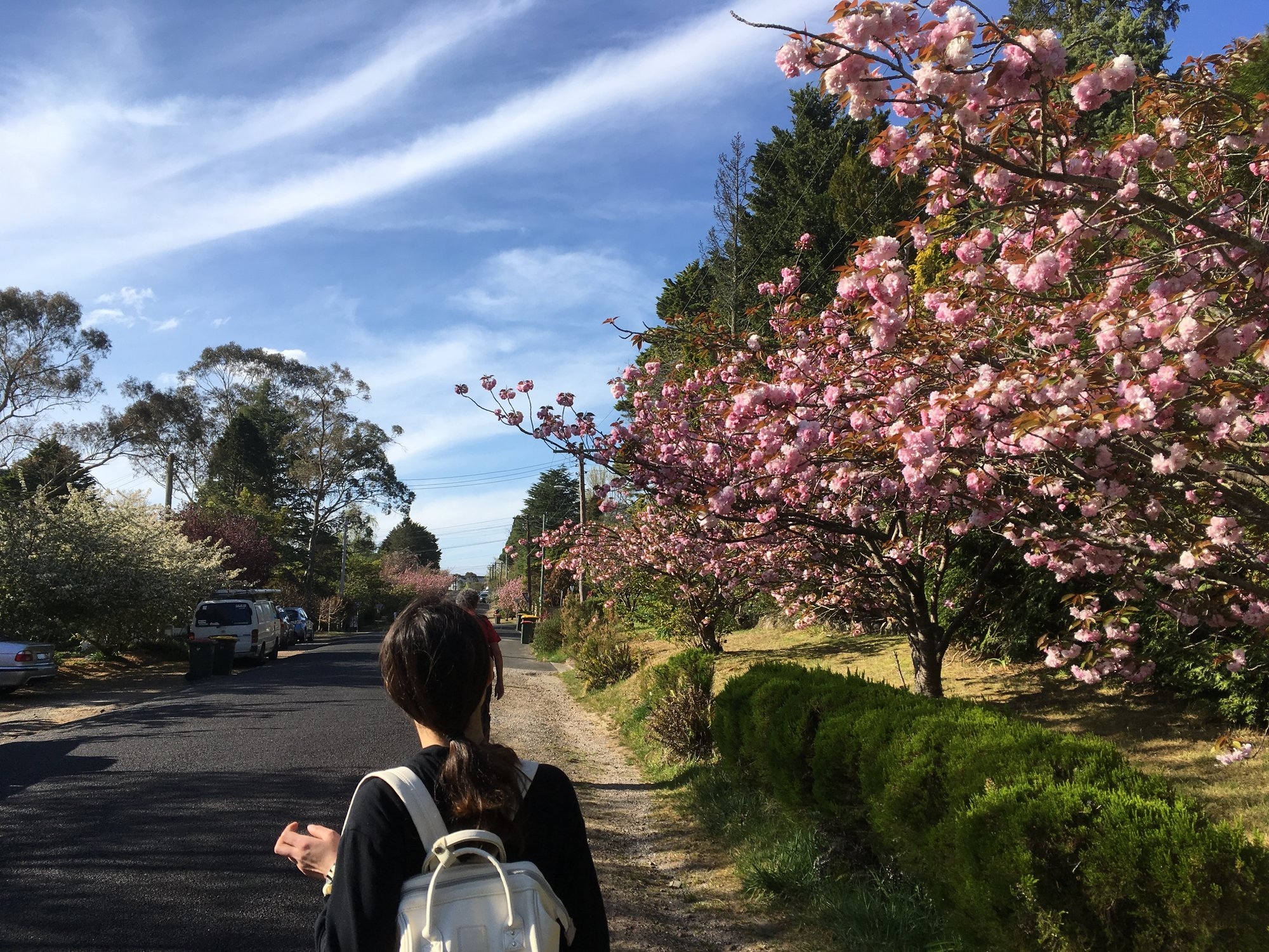
From then on, it was just a road bash to Leura Station. Along the way we went past gardens with flowering Rhododendrons, which grow well in the Blue Mountains around Leura. We also discovered a drawback of Google tracking. Ashwin got Google to mark out the shortest way back to the station, but I noted it took us along streets that went down gullies with a steep climb back out. We did one of these (Craigend Street), but it also suggested Megalong Street which again went down and back out of a steep gully. As I could see the railway straight ahead (we were on Blackheath St), I decided it made no sense to follow Google, and we went up to Railway Parade and from there it follows the Rail Line straight back to Leura Station.
We arrived just 4 minutes before the next train, which we caught. Maybe it would have been nice to have lingered in the coffee shops and cafes at Leura Mall (and had we gone up Gladstone Pass we would have had plenty of time to do so). As it was, it was already 5pm and I didn’t want people getting back to Sydney too late and missing their train and bus connections, so the next train it was. On the way back I saw high Cirrus clouds which are almost always a predictor of rain (usually in 2-3 day’s time). Some rain would be welcome after this 2 month long period without rain.
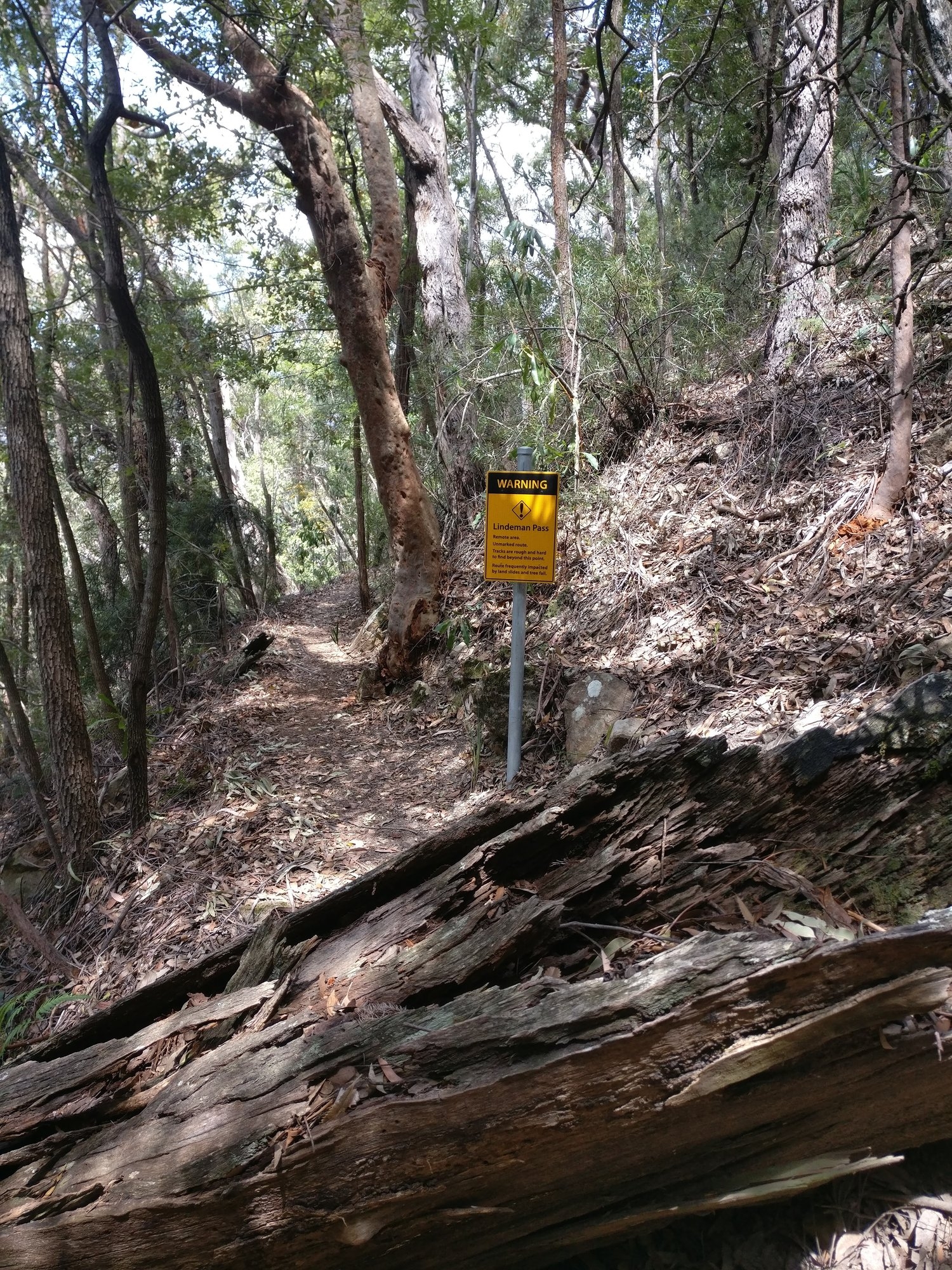
Now, a word to the wise (and no so wise) about Lindeman’s Pass. Although I wrote that the section between Lawton’s Creek and Robert’s Pass, and on to Valley of the Waters is fairly easy to follow, this is the ONLY section which is easy (apart from a short section just west of Sublime Point). The rest of it can be very hard to follow, with instinct or even absent track which can change levels abruptly. There have been metal markers on trees in the 1990’s but can’t guarantee that they will still be there now. There’s a video on Youtube (https://www.youtube.com/watch?v=l_I8qS7Ja_Y) of a walk there by Sydney Bushwalkers in 2014, and the trip leader says it is called the “Bermuda Triangle” by the local Police Rescue Squad. As mentioned above, I led an SUBW walk along it in the 1990’s and found that it is doable with very very careful navigation. (I was also on a walk on it as far east as Sublime Point which I think was led by Dave Noble).
Re Lawton’s Creek: it is apparent from the track there as well as the pink ribbon on the trees that someone is trying to pioneer a track through it. It is a very pretty shaded (and in normal weather quite wet) wide canyon, but rather narrower than Gladstone Pass. My opinion is that it should be left as it is. To get past the difficult section would require a wooden ladder (likely to be washed away in the first flash flood) or a mini Taros Ladder which would despoil the canyon. Jim Smith’s book on Lindeman’s Pass (published in 1990) states that Lawton’s Creek is unpolluted. His book, however, was published before the Fairmont Resort and its golf course were constructed upstream. There are also horse stables there as well. Lawton’s Creek Canyon is not totally pristine though. In it we spotted a relic of the old coal mine further down, a part of a bucket from the old cableway which ran above Lawton’s Creek. There were some lumps of coal as well. About 50m west of Lawton’s Creek on Lindeman’s Pass there is a track of sorts blocked by some tree branches (deliberately placed) which apparently goes down to the old mine (Jim Smith’s book advises against using that track or visiting the mine – old coal mines can still contain dangerous Methane gas).
Anyway, the walk was liked by all despite some of the difficulties encountered, and in good dry mild weather. There are signs that the present run of dry weather will soon end and there will be wetter weekends for walking!
My photo link: https://www.flickr.com/photos/brstafford/albums/72157661098066738
Ashwin’s photos link: https://photos.app.goo.gl/NmRWceoOJN2Vw0HM2