Party: Nat, Tim, Carina
Leader: Nat
Date: 28/05/2017
Photos: https://drive.google.com/drive/folders/0BxIzIR-kWPgkVWdxazJfNDBUdlE?usp=sharing
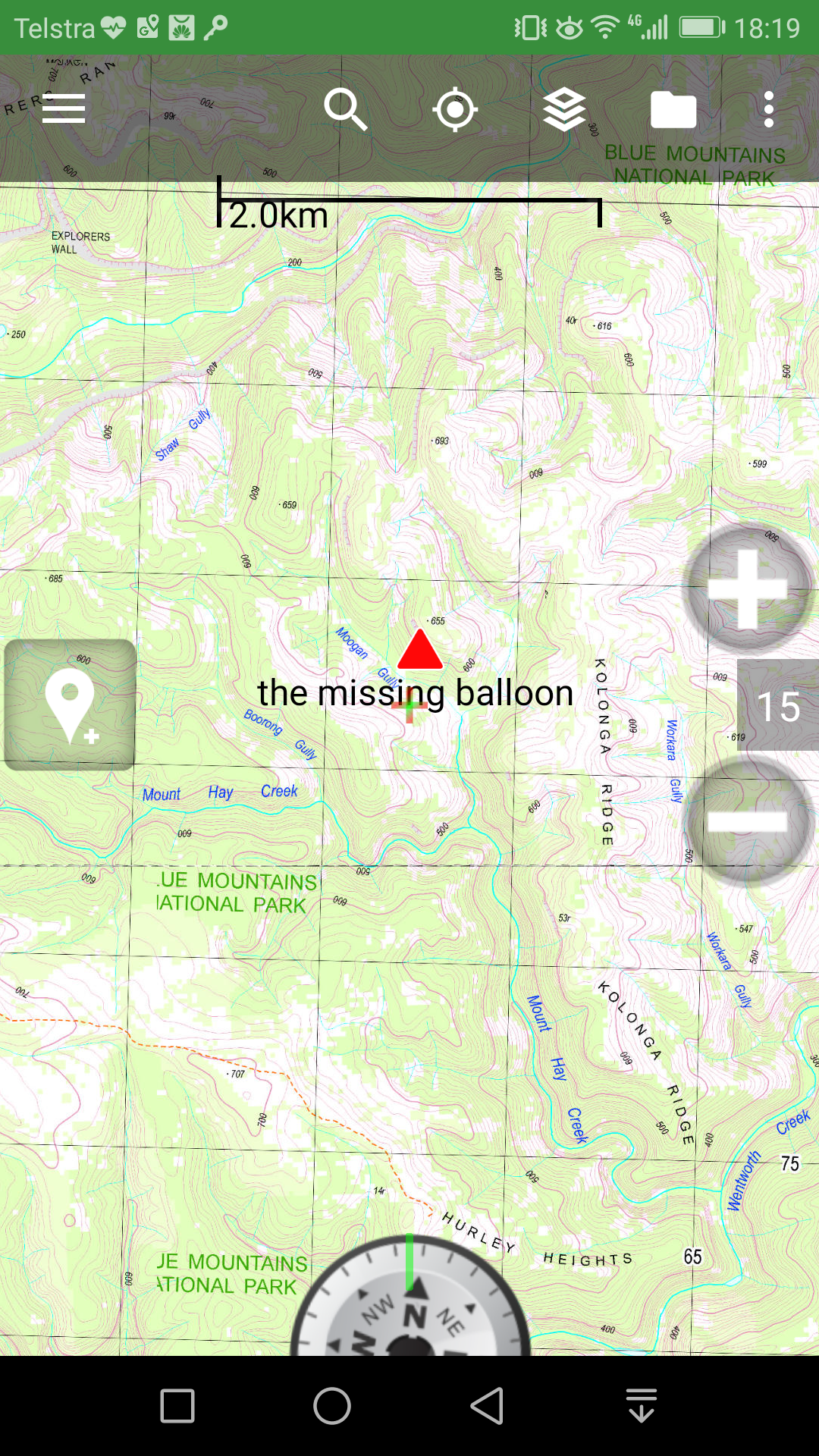
It all began with a random phone call from an engineer friend – a Usyd research team is looking for someone to retrieve a high altitude research balloon that crashed in the Blue mountains. A moment later, a GPS coordinate was sent to my phone. I plotted it in, well, not too bad, just a few kms northeast of Mt Hay.
After studying the topo more closely and consulting with a few other walkers, a possible route is identified, and it is hopeful that the balloon could be retrieved in a day, but where it landed looks very steep on the map, and the satellite map shows there are some cliffs around that area. Anyway, I went to see the research team the next day.
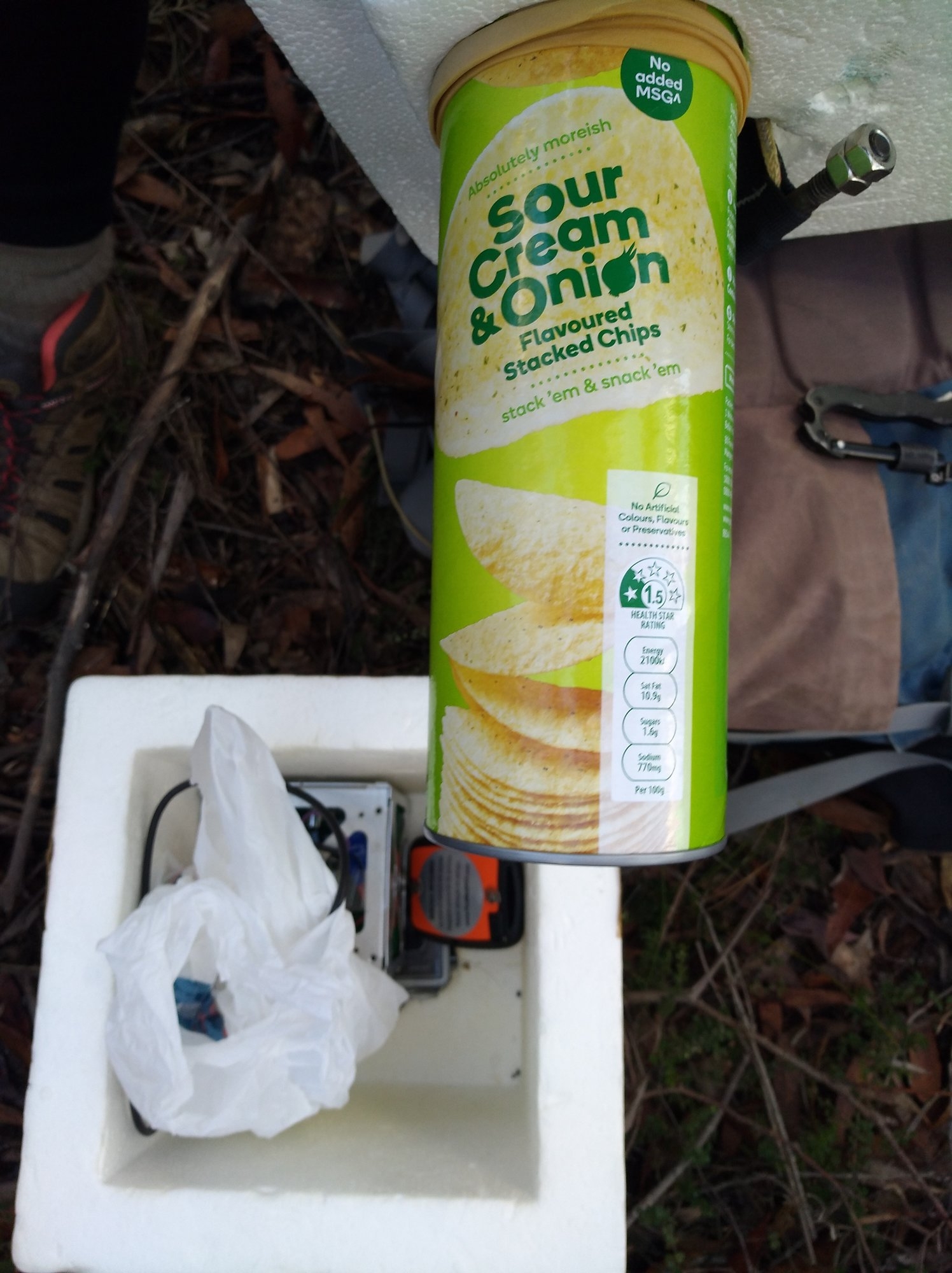
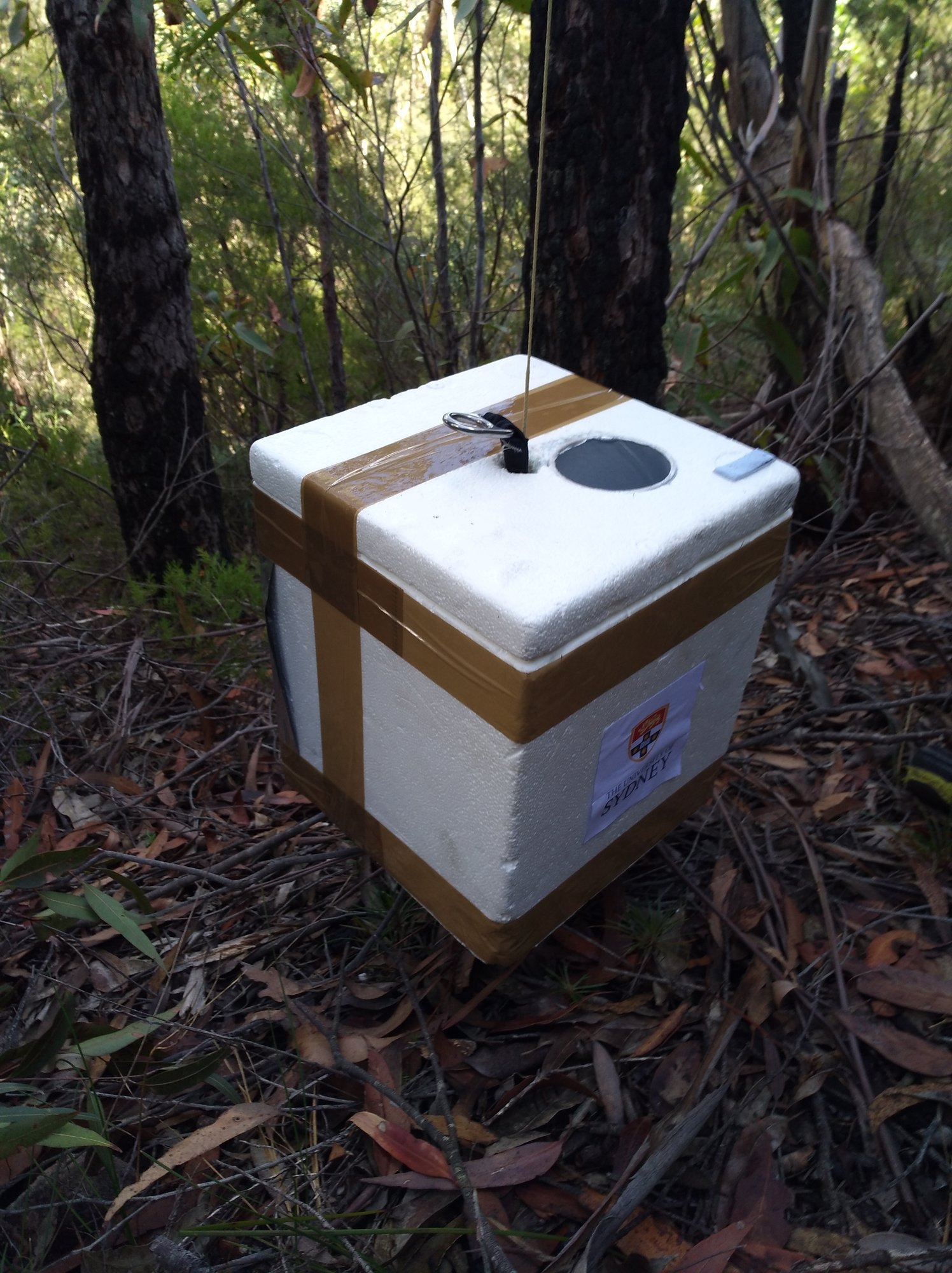
It was quite interesting visiting the space engineering lab, a big warehouse filled with all sorts of aircraft models, engines and special equipments. The team is quite excited to see me, and briefed me with a bit more information on their research project. They launched the balloon to an altitude of 20km to collect some data of the atmosphere. However they must have made a mistake when simulating the wind model so the balloon crashed in the Blue Mountains instead of the planned landing spot at Bathurst. They showed me a similar equipment, which is basically a white foam box. The balloon itself might have already separated from the box before landing but a small parachute should be still attached. They even discussed with me about the possibility of retrieving the balloon using a drone but then realized their drone only has a range of 500m. We had to rely on the human power after all.
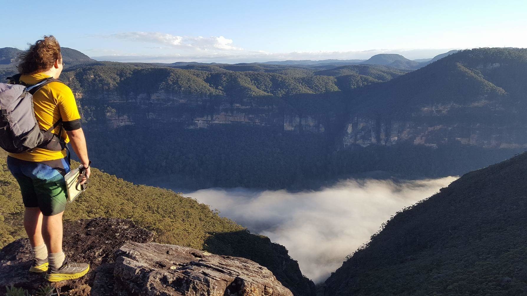
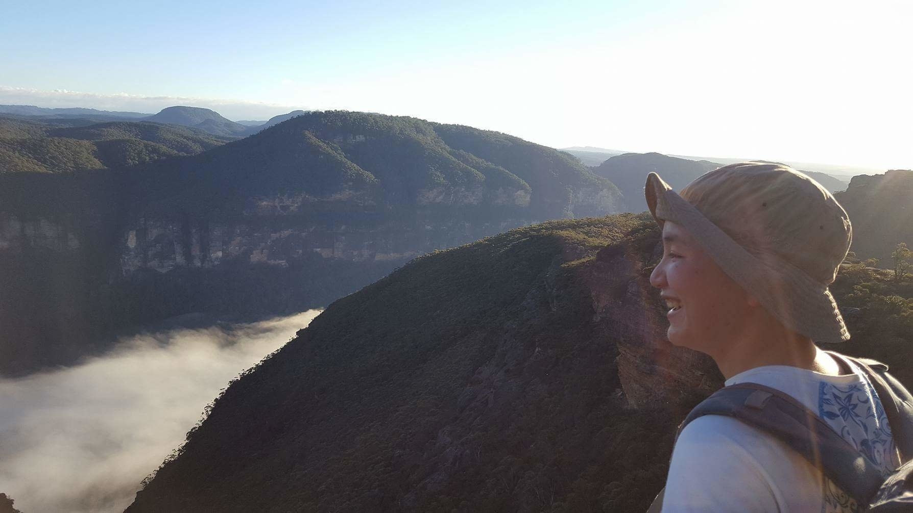
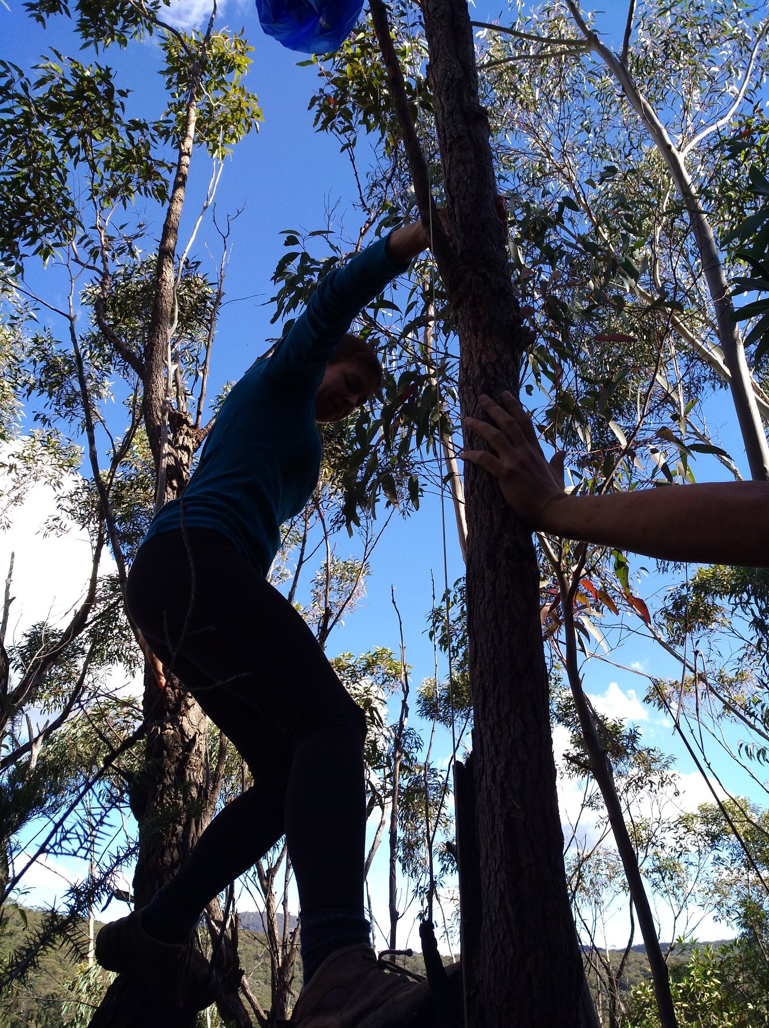
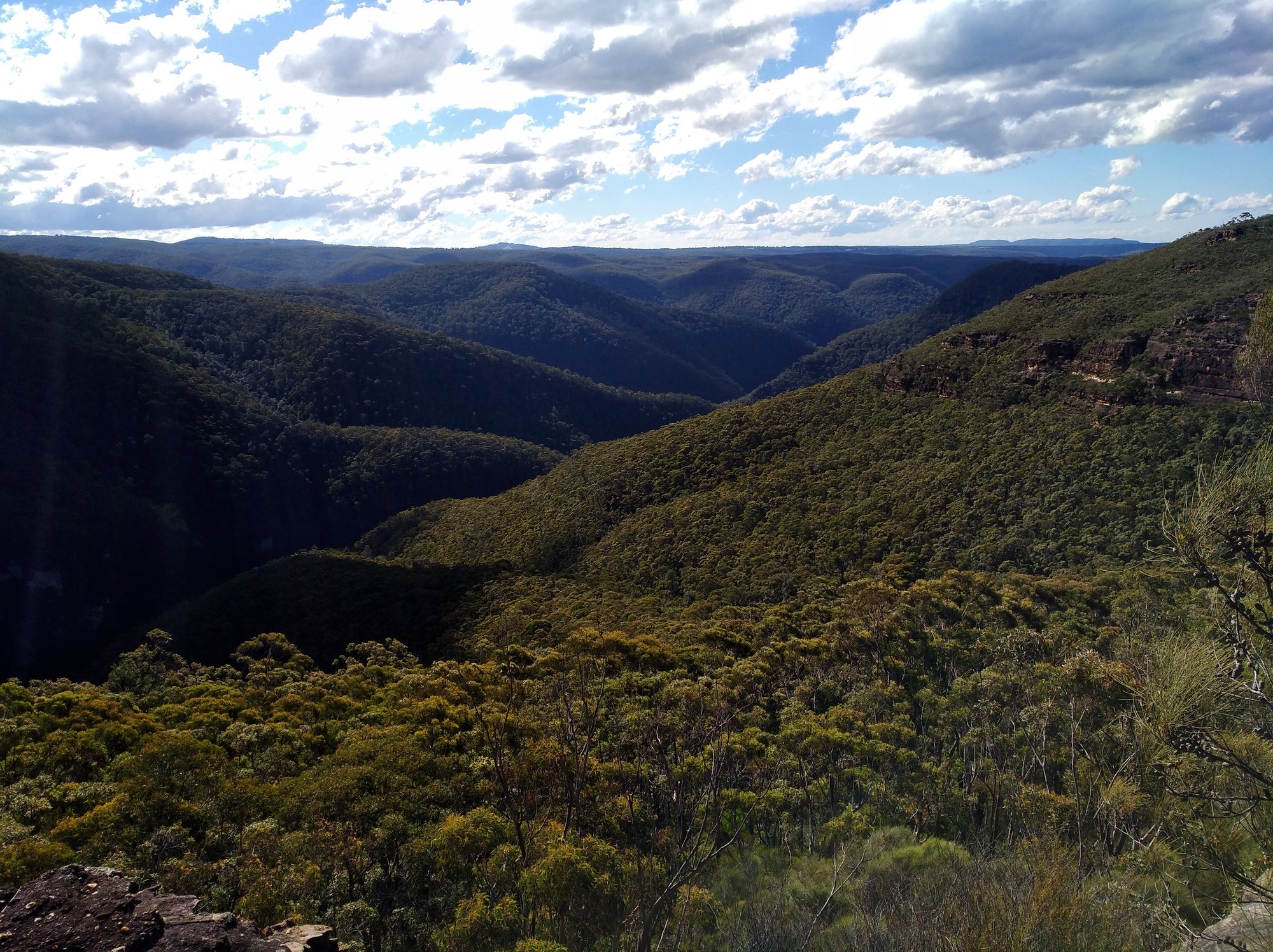
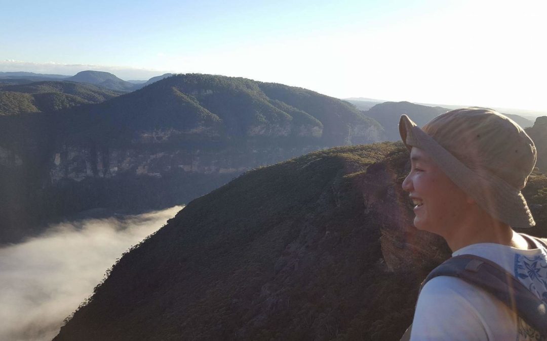
It was still pitch black when Carina and I left Sydney on Sunday morning. We met up with Tim at the start of Mt Hay Rd, and we hopped into his Forester to get to the end of the dirt road. It was just past 7 when we hit the track in the crisp morning air. Soon we are on top of Mt Hay, and from there, a small path continued to the northwest and eventually dropped onto a rocky ridge. We had magnificent views over Grose Valley for the next km or so, then we hit a rock outcrop named as Venus Tor. We found a small rock ledge that traverse across to the other side of the outcrop – a little exposed but very interesting to see how nature can provide its own way. Another a few hundred meters we are on top of Boorong Crags. From there on, we turned towards east and the navigation start to get trickier as the bush gets thicker and the terrain is a bit hard to distinguish. It’s a bit slow going at this point as we had to bash through thick scrubs and even lawyer vines. Nevertheless, with Tim’s superior navigation skill, we managed to find the right spot for the next turn. We saw two cairns on the way which is a bit unusual considering this is a less visited area. Soon we climbed up the next high point. A bit further on, we could see the ridge we are heading to, and it does look quite steep on the sides. The good thing was, the walk gets slightly easier as the vegetation is a little thinner on top of the ridge. At around 11 o’clock, we arrived at a small rock outcrop just above the target area. After a snack break, we headed down to find the balloon. We only walked about 50m when Tim spotted something blue hanging on top of a tree. And the next minute, we are at the spot where the box is. The blue parachute is trapped on the tree while the box is hanging about 1m off the ground, like it has been deliberately placed for someone to spot it. Too easy!
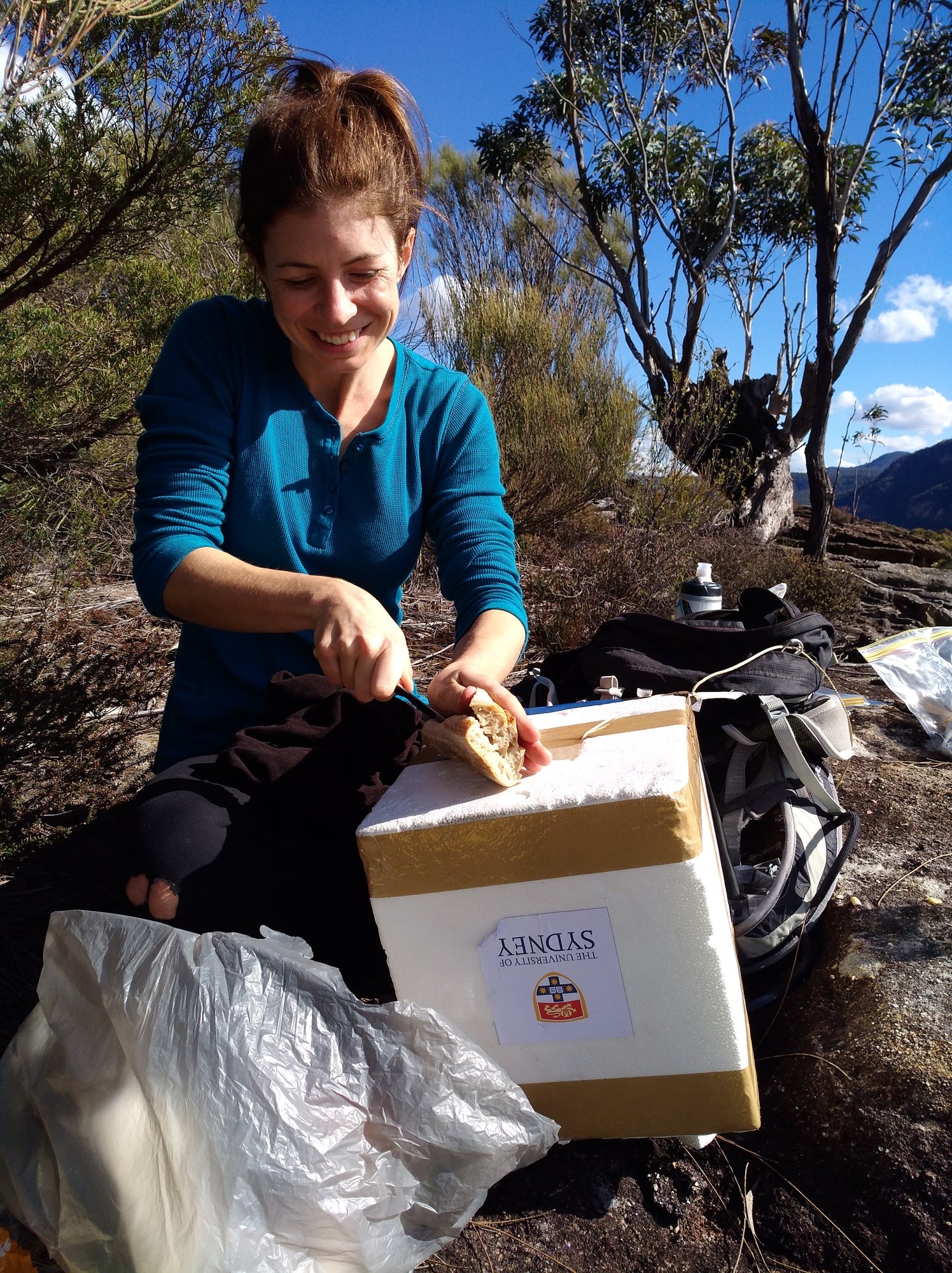
We had to cut the cord to take off the box and parachute but everything seems to be intact. I opened the box and removed the two storage card to a safe place as instructed by the research team. We are impressed how those engineer students could put together such high tech equipment in a relatively cheap way – they even used a sour cream chips container! We bagged the rest of the equipment and strapped the foam box to Carina’s backpack and started to head back.
We stopped for lunch on a rock that has view over both Grose Gully and Kolonga Labyrinth. Very satisfying lunch with great view, perfect weather and mission accomplished! For the rest of the trip Tim handed the maps to me and made me do the hard job. Luckily it’s always easier on the way back so even with my tacky navigation, we still managed to be back on the right track, with even less bush bashing!
By the time we are back near Boorong crags, both me and Tim are running out of water, and one of my knee start to hurt. Never too young to have knee problems! Luckily Carina got a bottle of spare water and saved our life. The last big hill over Mt Hay was a bit of a struggle for me and Tim as we are both tired and a little dehydrated. Again, magically, Carina took out two apples and a mandarin from her bag, and that little piece of fruit got me through the last bit of the walk.
We are back at the car park just before 4:30. A good nine and a half hours of walk. Now it’s time for some beer and pizza! Even better is that all the food and drinks are funded by the engineer students!
Overall speaking, the balloon retrieving mission has provided a rare opportunity for exploring an interesting but less visited area. I would be happy to go back and do more exploration, or just take people out to Venus Tor and Boorong crags for an easy day trip.